Mori Atlas logo
Nearby park discovery

Geographic landscape context for regional protected areas and desert wilderness

Protected Areas and National Parks Near Munga-Thirri–Simpson Desert National Park

Explore the broader regional geography and distribution of protected areas surrounding Munga-Thirri–Simpson Desert National Park. This overview provides a structured map-based look at nearby wilderness landscapes and terrestrial conservation areas across the South Australia region and beyond.

Related tags

Desert LandscapeDune SystemsProtected WildernessIUCN Category IaLargest National Park

Australia's largest protected desert wilderness, spanning ancient dune systems and sacred Indigenous country

Munga-Thirri, Simpson Desert National Park

Munga-Thirri–Simpson Desert National Park is a vast protected area spanning 3.6 million hectares in the far north of South Australia, positioned near the borders with Queensland and the Northern Territory. Established in its current form in November 2021 through the merger of the former Munga-Thirri–Simpson Desert Conservation Park and the Simpson Desert Regional Reserve, it became Australia's largest national park, surpassing even Kakadu in size. The park protects a representative portion of the Simpson Desert, one of the world's great dune deserts, characterized by parallel sand ridges stretching across the horizon, extensive ephemeral playa lakes, and resilient spinifex grasslands. The region holds deep cultural significance as traditional Aboriginal country, with the name Munga-Thirri derived from Indigenous language meaning 'the place of the sand dunes.' As an IUCN Category Ia strict nature reserve, the park prioritizes conservation over recreation, with public access periodically restricted due to extreme environmental conditions.

Location
Australia
Park type
National park
Established
1967
Area
36,000 km²
Munga-Thirri–Simpson Desert National Park Atlas
Regional park map

See the ranked park cluster in its geographic setting

Nearby parks around Munga-Thirri, Simpson Desert National Park

This regional map shows the same 20 nearby parks ranked below around Munga-Thirri, Simpson Desert National Park. Select a ranked marker to highlight that park’s boundary where boundary data is available.
Reference park: Munga-Thirri, Simpson Desert National ParkRanked nearby parkSelected boundary: Munga-Thirri, Simpson Desert National Park20 nearby parks shown
20 nearby parks

Geographic proximity, regional boundaries, and comparative environmental patterns across surrounding landscapes

Ranked Protected Areas and Parks Near Munga-Thirri–Simpson Desert National Park

Examine the ranked collection of nearby protected areas surrounding Munga-Thirri–Simpson Desert National Park based on straight-line geographic separation and regional proximity. Analyze surrounding park characteristics to compare regional conservation contexts, border positions, and diverse protected-landscape patterns across the wider territory.
National parkQueensland
Park boundaries overlap#1 closest

North

Munga-Thirri National Park: Queensland's Premier Desert Dune Protected Landscape

Explore the vast sand ridges and unique arid ecosystems of this national park.

Munga-Thirri National Park is Queensland's largest national park, preserving a spectacular desert landscape dominated by extensive parallel sand dunes. Situated in the remote central west, this protected area offers a unique lens into arid ecosystems, showcasing striking red dunes that define its geographic identity. Discover the mapped features and landscape context of this significant Australian protected land, offering a deep dive into the Simpson Desert's unique terrain and natural heritage.

Area
10,120 km²
Established
1967
IUCN
II
Relief
Lowland
National parkSouth Australia
Park boundaries overlap#2 closest

West

Witjira National Park: Explore its Protected Landscape and South Australian Geography

Mapped terrain and regional park context.

Witjira National Park in South Australia serves as a distinct protected area for detailed geographic exploration. This national park provides essential context for understanding its mapped boundaries and its role within the broader regional landscape of Australia. Discover the park's specific geographic identity and its significance as a protected natural area for atlas-based research and landscape appreciation.

Area
7,726.73 km²
Established
1985
IUCN
VI
Visitors
15K annual
Nature reserveSouth Australia
About 43 km away#3 closest

South

Kalamurina Sanctuary Nature Reserve: Geographic Overview and Protected Landscape Mapping

Arid terrain in the Lake Eyre Basin of South Australia

Covering roughly 6,700 square kilometres, Kalamurina Sanctuary serves as a critical protected node in the Australian interior. The property provides a continuous habitat mosaic of saline lakes, riparian channels, and arid uplands. This reserve bridges the gap between the Simpson Desert and the Lake Eyre landscape, supporting conservation-focused land management and the recovery of threatened arid-zone species.

Area
6,700 km²
Established
2007
Relief
Lowland
Climate
Arid
National parkSouth Australia
About 87 km away#4 closest

South

Kati Thanda-Lake Eyre National Park: National Park in South Australia's Geographic Atlas

Mapped protected area and landscape context.

Kati Thanda-Lake Eyre National Park represents a distinct protected landscape within South Australia, offering a valuable focal point for geographic discovery. As a national park, its mapped boundaries and environmental characteristics are crucial for understanding the regional terrain and the distribution of protected areas. This entry facilitates structured exploration of the park's identity within a broader atlas context, highlighting its significance as a natural landscape.

Area
13,488.4 km²
Established
1985
IUCN
II
Relief
Lowland
Wildlife reserveSouth Australia
111 km away#5 closest

South

Elliot Price Conservation Park: Arid Wildlife Reserve and Lake Eyre Shoreline Geography

Strict protected landscape on the Hunt Peninsula, South Australia.

Elliot Price Conservation Park represents a vital, ungrazed arid-zone benchmark in South Australia. The protected area features prominent limestone cliffs, saltpans, and sand hummocks across the Hunt Peninsula, offering a unique opportunity to study the region's natural ecology and geological character without the influence of pastoral activity.

Area
634.53 km²
Established
1967
IUCN
Ia
Relief
Lowland
Nature reserveNorthern Territory
About 118 km away#6 closest

Northwest

Mac Clark (Acacia peuce) Conservation Reserve: Northern Territory Protected Area

Arid-zone botany and outback landscape exploration.

Situated on the western edge of the Simpson Desert, this reserve preserves a rare population of Acacia peuce trees within a fenced, stony plain. It serves as an essential, protected botanical archive in the Northern Territory, showcasing the resilience of desert-adapted flora in a stark, wind-swept outback landscape of significant scientific and cultural interest.

Area
30.42 km²
Established
1982
IUCN
IV
Relief
Lowland
National parkSouth Australia
148 km away#7 closest

Southeast

Malkumba-Coongie Lakes National Park: A Protected Landscape in South Australia

Explore its mapped geography and regional park context.

Malkumba-Coongie Lakes National Park stands as a protected natural area within South Australia. This national park offers specific insights into the mapped landscape and regional geography of the Australian state. Understanding its boundaries and protected status contributes to a broader atlas view of conservation landscapes. Discover the unique geographic identity of this area for structured exploration and geographic context.

Area
266.69 km²
Established
2005
IUCN
II
Relief
Lowland
Nature reserveQueensland
About 239 km away#8 closest

North

Ethabuka Reserve: Protected Dunefields and Arid Wilderness in Queensland

Nature reserve geography and desert landforms

Ethabuka Reserve serves as a foundational piece of private conservation in the Australian interior. The reserve showcases a vast, ecologically intact landscape featuring linear dune ridges, expansive gibber plains, and gidgee woodlands. These diverse habitats support a rich suite of arid-zone species, forming a crucial block of protected desert territory alongside the neighbouring Pilungah Reserve.

Area
2,155 km²
Established
2004
Relief
Lowland
Scope
Terrestrial
Wildlife reserveSouth Australia
240 km away#9 closest

Southwest

Kanku-Breakaways Conservation Park: Mapping the Arid Mesa Landscapes of South Australia

Indigenous cultural heritage meets striking desert geological formations

Kanku-Breakaways Conservation Park offers a window into the arid geography of northern South Australia. This protected wildlife reserve showcases a distinctive panorama of mesas and low hills that contrast sharply with the surrounding desert plains, providing a profound study of erosion and natural landscape evolution within the outback.

Area
143.23 km²
Established
2013
IUCN
III
Relief
Upland
National parkQueensland
241 km away#10 closest

Northeast

Astrebla Downs National Park: Queensland's Protected Landscape and Geographic Context

Mapping the protected boundaries and regional natural terrain.

Astrebla Downs National Park stands as a distinct national park within Queensland, Australia, contributing to the state's rich tapestry of protected lands. Its landscape offers a unique geographic profile, providing vital context for understanding the mapped terrain and the distribution of natural areas across northeastern Australia. This entry serves as a gateway to exploring the specific geographic features and protected-area significance of Astrebla Downs National Park for atlas-based discovery.

Area
1,740 km²
Established
1996
IUCN
II
Relief
Lowland
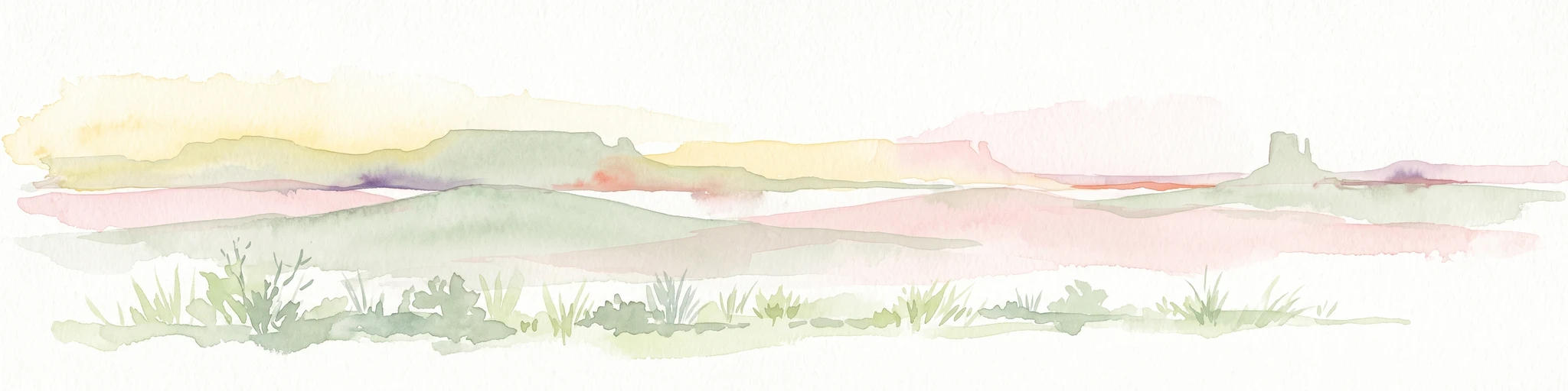
A soft watercolor painting of a desert landscape featuring rolling plains and a prominent, pillar-like rock formation on the horizon under a pale sky.
Natural monumentNorthern Territory
About 268 km away#11 closest

West

Chambers Pillar Historical Reserve: An Atlas of a Significant Northern Territory Sandstone Landmark

Geographic analysis of an iconic Australian outback desert monument

Chambers Pillar is a striking 50-meter sandstone column anchored in the arid plains of central Australia. This historical reserve serves as an essential subject for geological and regional mapping, offering a clear look at how isolated formations define the vast outback horizon. Explore the intersection of 350-million-year-old rock formations and the shifting desert sands that shape this protected cultural and natural site.

Area
3.4 km²
Relief
Lowland
Climate
Arid
Access
Remote access
National parkSouth Australia
285 km away#12 closest

South

Lake Torrens National Park: Explore South Australia's Remarkable Inland Salt Lake Geography

A unique protected landscape of arid plains and expansive salt flats.

Lake Torrens National Park offers an unparalleled exploration of Australia's remote outback, centered around a vast, ancient salt lake basin. This national park in South Australia provides a canvas of stark, minimalist terrain, featuring shimmering saltpans, arid gibber plains, and rocky outcrops. Understand the park's unique geographic identity, its ecological significance as a temporary wetland habitat, and its dramatic visual appeal for landscape photography and geological interest. It is a key protected area showcasing the extreme environment of Australia's interior.

Area
5,676.68 km²
Established
1991
IUCN
VI
Relief
Lowland
National parkQueensland
301 km away#13 closest

Northeast

Diamantina National Park: Queensland National Park Protected Landscape Atlas

Mapped boundaries and regional geography in Queensland.

Diamantina National Park serves as a significant protected area within Queensland's northeastern Australian geography. This detail page offers a focused look at its designation as a national park, providing users with essential information for understanding its mapped landscape and protected boundaries. It is an important entry for anyone exploring the atlas of Australian conservation lands and regional natural terrain.

Area
5,070 km²
Established
1993
IUCN
II
Relief
Lowland
A wide, panoramic watercolor painting showing a soft landscape with rolling hills in the background, green trees and bushes in the midground, and a pinkish path or river in the foreground.
Protected areaNorthern Territory
About 302 km away#14 closest

Northwest

Ruby Gap Nature Park: Geography and Protected Wilderness in the Northern Territory

Gorge-carved arid landscapes and historical mining heritage

Ruby Gap Nature Park stands as a remote protected area in the heart of Australia's Northern Territory. Defined by the Hale River gorge, the terrain showcases dramatic cliff lines, expansive rocky flats, and rich geological sites that reveal a layered story of Indigenous heritage and 19th-century boom-and-bust mining history. Explore the park boundary and the surrounding East MacDonnell Ranges through this focused geographic overview.

Area
92.57 km²
Relief
Upland
Climate
Arid
Access
Remote access
Watercolor painting of a soft, abstract landscape with a line of trees against rolling hills and light, hazy colors.
Nature reserveNorthern Territory
About 314 km away#15 closest

Northwest

Napwerte / Ewaninga Rock Carvings Conservation Reserve: Protected Desert Landscape Map

Cultural heritage and arid basin geography in the Northern Territory

Napwerte / Ewaninga Rock Carvings Conservation Reserve protects a unique desert site defined by its extensive collection of prehistoric Arrernte rock engravings. The landscape encompasses rocky outcrops, red sand dunes, and a seasonal claypan that captures rare rainfall, creating a significant intersection of archaeological history and arid-zone ecology in central Australia.

Area
0.06 km²
Established
1970
IUCN
V
Relief
Lowland
A wide watercolor illustration showing a winding river or creek bed flanked by green trees, with pink and red rocky hills in the background under a pale sky.
Nature reserveNorthern Territory
About 314 km away#16 closest

Northwest

N'Dhala Gorge Nature Park: Mapped Geography and Protected Cultural Heritage

Nature reserve located in the eastern MacDonnell Ranges

This nature reserve protects a vital valley corridor in the Northern Territory where sandstone ridges and sandy terrain meet. The park serves as a repository for approximately 6,000 ancient petroglyphs and sustains specialized arid plant species. Use this resource to understand the park's structural boundaries and its place within the broader geography of Central Australia.

Area
5.01 km²
Established
1962
IUCN
V
Relief
Mountain
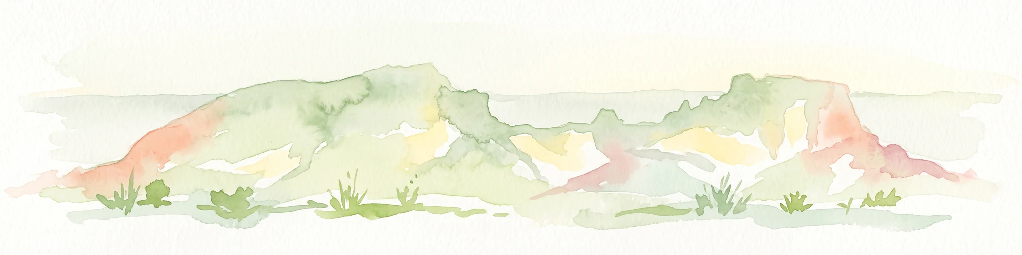
A horizontal watercolor painting showing stylized soft green, orange, and pale yellow hills under a white sky.
Nature reserveNorthern Territory
About 314 km away#17 closest

Northwest

Rainbow Valley Conservation Reserve: Geological Atlas and Protected Landscape Mapping

Examining the arid-zone terrain of Northern Territory, Australia.

The Rainbow Valley Conservation Reserve is a significant protected landscape known for its 350-million-year-old banded sandstone bluffs and diverse arid-zone habitats. This overview provides a focused look at the park's geological structure, claypan terrain, and its status as a vital site for Aboriginal heritage, offering a clear understanding of its place within the broader Northern Territory geographic context.

Area
24.83 km²
Established
1990
IUCN
V
Visitors
6.8K annual
Nature reserveQueensland
About 315 km away#18 closest

North

Pilungah Reserve: Protected Arid Landscapes and Geography in Western Queensland

Exploration of desert dunefields and Mulligan River catchments

Pilungah Reserve protects over 200,000 hectares of diverse desert terrain, from the rugged Toomba Range to the expansive gibber plains of Central West Queensland. This nature reserve serves as an important ecological refuge, preserving rare reptile and bird habitats within the Channel Country and Simpson Strzelecki Dunefields. The area also holds cultural significance to the Wangkamadla people, reflecting a deep connection between traditional heritage and modern conservation.

Area
2,330 km²
Established
2005
Relief
Mixed relief
Climate
Arid
National parkSouth Australia
318 km away#19 closest

South

Vulkathunha-Gammon Ranges National Park: South Australia National Park Atlas Exploration

Mapped boundaries and regional geographic context.

Dive into the specifics of Vulkathunha-Gammon Ranges National Park, a designated national park situated in South Australia. This detailed resource focuses on its role as a protected landscape, providing users with critical geographic information. Understand the park's mapped boundaries and its relation to the broader regional geography, perfect for anyone engaged in atlas-based exploration of Australia's natural areas.

Area
1,257.23 km²
Established
1970
IUCN
II
Relief
Mountain
Protected areaNorthern Territory
About 319 km away#20 closest

Northwest

Arltunga Historical Reserve: A Heritage Protected Area in Northern Territory Australia

Mapping nineteenth century mining ruins and arid terrain

Arltunga Historical Reserve offers a distinct window into the outback mining era through its well-preserved stone structures and desolate desert setting. This protected area within the Northern Territory highlights the intersection of European settlement history and the traditional cultural heritage of the Eastern Arrernte people.

Area
50 km²
Established
1975
Relief
Upland
Climate
Arid
Distance methodology

Geographic measurements, not driving distances

How nearby park distances are calculated

Distances use park boundaries whenever the available geometry allows it. When one or both boundaries are missing, the mapped park locations provide a clearly labelled estimate. Every value represents straight-line geographic separation and does not use roads or routing.

Boundary distance

Calculated between the nearest points of both park boundaries.

Location-to-boundary estimate

Estimated from one mapped park location to the nearest boundary of the other park.

Mapped-location estimate

Estimated between the mapped locations of both parks.

MoriAtlas Explorer

Continue Exploring Munga-Thirri–Simpson Desert National Park's Geographic Context

Dive deeper into the mapped territory and regional geography surrounding Munga-Thirri–Simpson Desert National Park. Understanding its protected landscape and arid terrain provides valuable context for broader Australian geography and atlas exploration. Examine the park's distinct characteristics and its role within the network of protected areas for a richer comprehension of Australia's natural landscapes.