Mori Atlas logo
Wildlife reserveMwabvi Wildlife Reserve

Exploring the diverse woodland, savanna, and sandstone terrain of Malawi's southernmost reserve.

Mwabvi Wildlife Reserve: Protected Landscapes and Geographic Mapping in Southern Malawi

Mwabvi Wildlife Reserve represents a distinct protected landscape within the Nsanje District of southern Malawi, encompassing roughly 135 square kilometers of varied terrain. The area spans from the Shire River lowlands to the rugged Matundwe Range border, featuring a complex mosaic of dry mopane woodlands, dambo wetlands, and dramatic sandstone outcrops. This conservation region serves as a primary reference for the ecological geography and frontier landscape characteristics defining the Lower Shire valley.

wildlife reservedry woodlandmopanesavannasandstone hillsbirdwatching

Mwabvi Wildlife Reserve

Wildlife reserve

Park overview

Structured park overview, official facts, and landscape profile for Mwabvi Wildlife Reserve

Mwabvi Wildlife Reserve park facts, protected area profile, and essential visitor context

Review the core facts for Mwabvi Wildlife Reserve, including designation, size, terrain, visitor scale, habitats, and operating context in one park-focused overview.

About Mwabvi Wildlife Reserve

Mwabvi Wildlife Reserve is a small but ecologically varied protected area in southern Malawi, occupying part of the country's southernmost district close to the Mozambique border. Although it is the smallest of Malawi's wildlife reserves, Mwabvi packs a remarkable range of habitats into its roughly 135 square kilometers, making it a significant site for both savanna and dry woodland biodiversity in the Lower Shire region.

The reserve lies at the meeting point of several distinct ecological zones. The landscape transitions from low-elevation Shire River lowlands into the foothills and ridges of the Matundwe Range, which forms part of the international boundary with Mozambique. Within this relatively confined area the park supports mopane woodland, Combretum bushveld, dry Brachystegia woodland, open savanna, seasonally waterlogged dambo depressions, riverine corridors, and sandstone hills laced with rocky cliffs and outcrops. The diversity of vegetation types gives Mwabvi a layered habitat structure that supports an unusually broad cross-section of species for a reserve of its size.

Historically, the area's ecological richness was even more striking. Mwabvi was once home to all of Africa's Big Five game animals, including elephants, lions, and black rhinoceros. Decades of heavy poaching, particularly during the late twentieth century, progressively stripped the reserve of its large mammals, and today Cape buffalo are the only surviving member of that original group. In their place, Mwabvi continues to harbor smaller antelope such as nyala, sable antelope, greater kudu, impala, suni, and common duiker, along with warthogs, baboons, and vervet monkeys. Predators are scarce, but leopards, spotted hyenas, jackals, and servals are still occasionally recorded. The reserve's birdlife remains one of its strongest assets, with more than 270 documented species in a setting that attracts birdwatchers interested in dry woodland and savanna-associated birds.

Mwabvi is a remote and physically demanding destination. Its inaccessibility is partly responsible for its rugged, untrammeled character, but it also means that visits are typically arranged through park rangers in 4x4 vehicles or on guided walking tours. The reserve's history of external conservation partnerships, including the work of Project African Wilderness before its charity status was removed in 2018, reflects the broader story of community and NGO involvement in Malawi's protected areas, while current management rests once again with the national Department of National Parks and Wildlife.

Quick facts and research context for Mwabvi Wildlife Reserve

Mwabvi Wildlife Reserve is located in Malawi's Nsanje District in the far south of the country, near the Mozambique border. It sits at elevations between roughly 150 and 400 meters above sea level, near Lengwe National Park and Majete Wildlife Reserve. The reserve is classified under IUCN Category IV as a habitat and species management area and is administered by the Department of National Parks and Wildlife. Established in 1953 and expanded in 1975, Mwabvi covers approximately 135 square kilometers and protects a rich mosaic of mopane woodland, Brachystegia dry forest, Combretum woodland, open savanna, sandstone hills, riverine vegetation, and dambo wetlands.

Protection and recognition

Documented terrestrial protection scope, designation history, and management records

Mwabvi Wildlife Reserve Protection Status and International Recognition Data

Mwabvi Wildlife Reserve maintains a documented terrestrial protection scope without imported international recognition sources. Structured records outline the official conservation framework and management designation parameters for this protected area.

Protection details

Protection scope
Terrestrial
Transboundary protection
No
Park context

Deeper park guide and search-rich context for Mwabvi Wildlife Reserve

Mwabvi Wildlife Reserve history, landscape, wildlife, and travel context

Explore Mwabvi Wildlife Reserve through its history, landscape character, ecosystems, wildlife, conservation priorities, cultural context, and seasonal travel timing in a structured park guide built for atlas discovery and search intent.

Why Mwabvi Wildlife Reserve stands out

Mwabvi Wildlife Reserve is most notable for having sheltered the last known population of black rhinoceros in Malawi before poaching drove the species to local extinction. The reserve's compact but unusually varied terrain combines mopane and Brachystegia woodland, open savanna, sandstone ridges, and dambo grasslands within a relatively small area, giving it a high habitat diversity for its size. It is also recognized for the resilience of its birdlife, with over 270 recorded species adapted to southern Africa's dry woodland and savanna conditions, and for its enduring population of Cape buffalo, the only remaining member of the Big Five still present in the reserve.

Mwabvi Wildlife Reserve history and protected-area timeline

The history of Mwabvi Wildlife Reserve stretches back to the early colonial period of wildlife protection in southern Africa. In 1928, the area was set aside as the Thangadzi Game Reserve, marking the first formal recognition of the region's ecological value. The reserve was redesignated as Mwabvi Wildlife Reserve in 1953, and by 1975 the protected area had expanded to its current approximate size of 135 square kilometers.

For much of the twentieth century, Mwabvi was regarded as one of southern Malawi's most important wildlife strongholds, famously sheltering the country's last known population of black rhinoceros. However, decades of heavy poaching steadily reduced the reserve's large mammal populations, with rhinos, elephants, and eventually lions being extirpated from the area.

In 2004, the nonprofit organization Project African Wilderness was founded with the aim of conserving Mwabvi and developing its infrastructure, including game roads and tourist lodges. In February 2007, Project African Wilderness signed a management agreement with Malawi's Department of National Parks and Wildlife to take over conservation and development of the reserve. By 2018, Project African Wilderness had its charity status removed by the Charity Commission for England and Wales, and the reserve reverted to direct management by the Department of National Parks and Wildlife. Today, conservation efforts at Mwabvi continue through cooperation between government agencies and local communities.

Mwabvi Wildlife Reserve landscape and geographic character

Mwabvi Wildlife Reserve occupies a transitional landscape between the Shire River lowlands and the rugged foothills of the Matundwe Range, the latter forming part of the border with Mozambique. Elevations in the reserve range from roughly 150 to 400 meters above sea level, producing a varied topography that rises from gentle lowland flats into rocky ridges and exposed sandstone hills.

The terrain includes a mosaic of open savanna grasslands, dry Brachystegia woodland, mopane-dominated slopes, and Combretum bushveld, interspersed with riverine vegetation along seasonal watercourses and seasonally saturated dambo depressions. Sandstone hills and rocky cliffs break up the woodland canopy across the reserve, creating dramatic outcrops and sheltered valleys that contribute to the park's scenic character. The combination of lowland and hill country, together with its position near the Mozambique border, gives Mwabvi a frontier-like landscape typical of the Lower Shire region of southern Malawi.

Mwabvi Wildlife Reserve ecosystems, habitats, and plant life

Mwabvi Wildlife Reserve is notable for the unusual concentration of habitat types packed into a relatively small protected area. The reserve's vegetation patterns reflect the ecological transition between the hotter Shire Valley lowlands and the slightly higher, rockier terrain of the Matundwe foothills.

Mopane woodland is a defining feature of the reserve, particularly on drier, lower-elevation slopes, while Combretum and dry Brachystegia woodland dominate other areas and contribute to the classic miombo-like character of southern Malawi's dry forests. Open savanna patches interrupt the woodland canopy, and seasonally waterlogged dambo grasslands add a distinctly wetland-influenced layer to the habitat mix. Sandstone hills and rocky cliffs create additional microhabitats, with fringing vegetation adapted to thinner soils and exposed rock.

Riverine areas along watercourses crossing the reserve support denser vegetation and act as biodiversity corridors through the otherwise dry woodland matrix. This combination of mopane, miombo-type woodland, savanna, dambo, and riverine habitats gives Mwabvi a layered ecological profile in which savanna and woodland species, smaller wetland-dependent fauna, and a notably rich bird community can coexist across a relatively compact area.

Mwabvi Wildlife Reserve wildlife and species highlights

Mwabvi Wildlife Reserve has a wildlife story shaped by both historical richness and modern decline. In the mid-twentieth century the park was home to all of Africa's Big Five game species, including elephants, lions, leopards, Cape buffalo, and black rhinoceros. It was particularly significant as the last known refuge of the black rhinoceros in Malawi before poaching eliminated that population from the reserve, and from the country.

Today, Cape buffalo are the only remaining member of the original Big Five present in Mwabvi. Black rhinos, elephants, and resident lions have all been extirpated, although lions from neighboring Mozambique are occasionally seen in the reserve. Despite these losses, the reserve continues to support a noteworthy community of antelope and smaller mammals. Small herds of nyala, sable antelope, greater kudu, impala, suni, and common duiker still inhabit the park, alongside warthogs, baboons, and vervet monkeys.

Larger predators are now infrequent but not entirely absent. Leopards, spotted hyenas, jackals, and servals have been recorded, though typically in very low numbers. Birdlife is among Mwabvi's most intact and valuable wildlife features, with more than 270 documented species occupying habitats that range from dry woodland to open savanna. Notable species include Woodwards' batis and Grey waxbill, among hundreds of others, and birdwatching has become a meaningful source of tourism in the reserve.

Mwabvi Wildlife Reserve conservation status and protection priorities

Mwabvi Wildlife Reserve's conservation significance is twofold: it represents an important surviving refuge for southern Malawi's dry woodland and savanna biodiversity, while also standing as a stark example of the impact of poaching on protected areas in the region. Once a stronghold for all of Africa's Big Five game animals, Mwabvi has lost its black rhinoceros, elephants, and resident lion populations, leaving Cape buffalo as the only remaining member of that original quintet.

The reserve's importance for habitat preservation lies in its unusually varied mosaic of mopane woodland, Combretum bushveld, dry Brachystegia woodland, open savanna, sandstone hills, dambo wetlands, and riverine vegetation within a relatively compact area. Protecting this habitat diversity is critical for sustaining remnant populations of antelope, smaller predators, and a rich bird community of over 270 recorded species.

In 2007, management responsibility was partially transferred to the nonprofit Project African Wilderness under an agreement with Malawi's Department of National Parks and Wildlife, supporting the development of game roads, tourist lodges, and active conservation programs. After Project African Wilderness lost its charity status with the Charity Commission for England and Wales by 2018, control of the reserve reverted to the Department of National Parks and Wildlife. Conservation efforts at Mwabvi are now carried out through cooperation between government bodies and local communities, who play a central role in ongoing stewardship of the reserve.

Mwabvi Wildlife Reserve cultural meaning and human context

The name 'Mwabvi' comes from the Henga language, in which 'Mwabvi' refers to the Ordeal Tree (Erythrophleum suaveolens), a species native to this part of Africa. This linguistic origin ties the reserve to the traditional knowledge and place-naming practices of local communities in the Lower Shire region.

The park's longstanding engagement with external conservation organizations and the fact that current conservation work is described as collaborative between government agencies and local communities reflect a broader pattern of rural Malawian partnerships around protected-area management, even though detailed cultural or ethnographic profiles are not strongly developed in available sources.

Top sights and standout views in Mwabvi Wildlife Reserve

Mwabvi Wildlife Reserve stands out as Malawi's smallest but ecologically varied reserve, where mopane woodland, Brachystegia dry forest, open savanna, sandstone ridges, and dambo wetlands all converge within roughly 135 square kilometers. Its most striking highlight is its historic role as the final sanctuary for Malawi's black rhinoceros before local extinction.

For contemporary visitors, the reserve's strengths lie in its remote, lightly visited atmosphere, its surviving populations of antelope such as nyala and sable antelope, and a bird community of more than 270 species that makes Mwabvi a notable dry-woodland birdwatching destination in southern Malawi.

Best time to visit Mwabvi Wildlife Reserve

Mwabvi lies in a hot lowland region at the southern tip of Malawi, where seasonal rainfall patterns strongly influence both accessibility and wildlife viewing. The dry season, broadly corresponding to the cooler and less humid months outside the main rains, is generally the most favorable period for visiting, as road conditions into this remote reserve improve and animals tend to concentrate around remaining water sources, making wildlife easier to observe.

During the wet season, the reserve's seasonal dambo areas fill with water, transforming the landscape into a greener, more lush environment that can be attractive for birdwatching but may also complicate travel into and around the park, especially given the reserve's reliance on 4x4 access. Visitors interested in birdlife may find the wet-season months particularly rewarding for migrant and water-associated species, though more remote parts of the reserve can become harder to reach.
Monthly climate preview

Long-term monthly temperature and precipitation patterns recorded at representative coordinates

Mwabvi Wildlife Reserve Climate Normals: Annual Temperature and Precipitation Rhythm

Mwabvi Wildlife Reserve records distinct monthly shifts in average temperature and precipitation across the recorded climatology period. Examining the complete twelve-month meteorological profile provides deeper insight into local environmental normals.
Annual mean26 °C
22 °C30 °C
Jan27°
Feb26°
Mar26°
Apr25°
May24°
Jun22°
Jul22°
Aug24°
Sep28°
Oct30°
Nov30°
Dec28°
Warmest month
November

30.4 °C

Coolest month
July

21.8 °C

Wettest month
January

8.3 mm/day

Driest month
August

0.2 mm/day

Park location guide

Geography guide, regional context, and park location map for Mwabvi Wildlife Reserve

Mwabvi Wildlife Reserve park geography, regions, and map view in Malawi

Understand where Mwabvi Wildlife Reserve sits in Malawi through a broader geographic reading of the surrounding landscape, nearby location context, and its mapped position within the national park landscape.

How Mwabvi Wildlife Reserve fits into Malawi

Malawi is a landlocked country in Southeastern Africa. Formerly known as Nyasaland under British colonial rule, it gained independence in 1964 and became a multi-party democracy in 1994. The country is known for Lake Malawi, which comprises about one-fifth of its territory, and is governed as a unitary presidential republic with Lilongwe as its capital.

Wider geography shaping Mwabvi Wildlife Reserve in Malawi

Malawi is located in Southeastern Africa within the Great Rift Valley. It is bordered by Zambia to the west, Tanzania to the north and northeast, and Mozambique to the east, south, and southwest. The country features highlands and plateaus in the northern and central areas, with the Great Rift Valley system running through the territory.

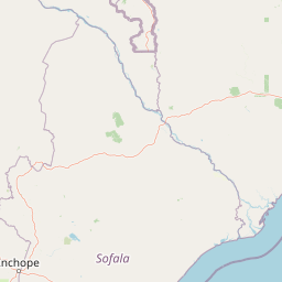
Map view of Mwabvi Wildlife Reserve

Use this park location map to pinpoint Mwabvi Wildlife Reserve in Malawi, understand its exact geographic position, and read its mapped placement within the surrounding landscape more clearly.

Pigeon | © OpenStreetMap contributors

Location context for Mwabvi Wildlife Reserve

Nsanje District
Park atlas

Compare regional conservation landscapes and surrounding dry woodland habitats.

Other Parks and Protected Areas Near Mwabvi Wildlife Reserve

Explore nearby national parks and protected areas to compare regional dry woodland and savanna ecosystems. Analyzing adjacent reserves provides broader context for the wildlife habitats and topography found across southern Malawi.
National parkMalawi
About 52 km away#1 closest

Northwest

Lengwe National Park: Malawi's Protected Landscape Atlas and Geographic Context

Mapped natural terrain and protected area boundaries in Malawi.

Lengwe National Park offers a focused look into Malawi's protected natural areas. As a designated national park, its geographic significance is highlighted through mapped boundaries and an understanding of the surrounding regional terrain. This entry provides essential context for exploring its identity as a protected landscape within southeastern Africa, contributing to a broader atlas of conservation areas.

Area
887 km²
Established
1970
IUCN
II
Climate
Tropical
Wildlife reserveMalawi
About 81 km away#2 closest

North

Majete Wildlife Reserve: Geographic Atlas and Protected Area Map of Southern Malawi

Savanna landscapes and Shire River valley ecology

Majete Wildlife Reserve represents a premier example of habitat restoration in the Shire River valley. Spanning 700 square kilometers of varied terrain, the reserve protects a mosaic of riparian forest and savanna that has been carefully managed to sustain Big Five wildlife. Gain insight into the regional geography, protected landscape boundaries, and conservation history of this essential Malawian wildlife sanctuary.

Area
700 km²
Established
1955
IUCN
IV
Visitors
7K annual
Digital illustration of a large mountain range with jagged peaks, rolling green foothills, a central valley, and a stylized sun in a soft pastel sky.
Nature reserveMalawi
About 103 km away#3 closest

Northeast

Mulanje Mountain Forest Reserve: Protected Afromontane Landscapes in Southern Malawi

Geographic overview of the Mulanje Massif and its high-elevation plateau

This nature reserve covers an isolated mountain block in Malawi, rising sharply to 3,002 meters at Sapitwa Peak. The landscape features rugged granite cliffs, deeply carved valleys, and extensive Afromontane forests that provide sanctuary for numerous endemic species. Use this atlas resource to understand the massif's vertical relief, plateau characteristics, and its central role in the regional geography of southeastern Africa.

Area
563.17 km²
Established
1927
Relief
Mountain
Climate
Tropical
Nature reserveChiradzulu District
About 111 km away#4 closest

North

Chiradzulu Mountain Forest Reserve: Geography and Protected Area Profile

A rugged mountain landmark in the Shire Highlands of southern Malawi

Located in the heart of Chiradzulu District, this nature reserve protects a prominent mountain massif known for its unique silhouette and ecological importance. The site provides a vital reference point for understanding the mountainous terrain, regional reforestation progress, and the broader natural landscapes of the Shire Highlands.

Area
7.74 km²
Established
1924
Relief
Mountain
Scope
Terrestrial
Nature reserveMalawi
About 152 km away#5 closest

North

Zomba Plateau Nature Reserve: Geographic Overview and Mapped Mountain Terrain

Protected montane landscapes in southern Malawi

Zomba Plateau stands as a significant granitic intrusion within the Shire Highlands, featuring high-altitude terrain and diverse forested patches. This record provides essential geographic context on its geological structure, forest reserves, and surrounding vistas across the southern Malawi landscape.

Area
130 km²
Established
1913
Relief
Mountain
Climate
Tropical
A watercolor painting showing a wide, panoramic view of a lake shore with marshy green grasses in the foreground and soft purple hills in the background.
Protected areaZomba District
About 169 km away#6 closest

Northeast

Lake Chilwa Protected Area: Geography, Map, and Seasonal Wetland Landscape Analysis

Understanding the endorheic basin and floodplain dynamics in Malawi.

Lake Chilwa stands as a significant protected area and Ramsar wetland in Zomba District. This detail covers its unique closed-basin geography, the influence of seasonal rainfall on surface extent, and the distinct characteristics of its shallow open water and flooded grasslands. Explore the intersection of river inflows and basin drainage that defines this critical ecosystem.

Established
1996
Relief
Lowland
Scope
Terrestrial
Water
Water-dominated
National parkSouthern Region
About 206 km away#7 closest

North

Liwonde National Park: National Park in Malawi's Southern Region

Mapped Protected Area Boundaries and Geographic Context

Liwonde National Park is a designated national park situated in Malawi's Southern Region. This entry provides detailed geographic information, focusing on the park's mapped boundaries and its role within the broader atlas of protected landscapes. Explore the unique regional geography and conservation context that defines this protected area.

Area
548 km²
Established
1973
Relief
Upland
Climate
Tropical
National parkMozambique
About 209 km away#8 closest

South

Gorongosa National Park: Mozambique National Park with Diverse Rift Valley Ecosystems

Mapped protected area, savanna, and montane rainforest landscapes.

Gorongosa National Park is a premier protected area situated in Mozambique's Great African Rift Valley. This vast national park showcases an extraordinary range of natural landscapes, including extensive floodplains, acacia savannas, and rare montane rainforests within dramatic limestone gorges. Its geographic diversity is matched by its compelling narrative of ecological restoration, making it a significant site for understanding protected land dynamics and regional geography.

Area
3,770 km²
Established
1960
IUCN
II
Relief
Mixed relief

Common questions about visiting, size, designation, and location context for Mwabvi Wildlife Reserve

Mwabvi Wildlife Reserve FAQs for park facts, access, geography, and protected area context

Find quick answers about Mwabvi Wildlife Reserve, including protected-area facts, park geography, trail and visitor context, and how the park fits into its surrounding country and regional landscape.
MoriAtlas Explorer

Continue Your Protected Areas Search Across the Global Atlas

Deepen your exploration by continuing the structured search for national parks and protected areas worldwide. Utilize the comprehensive filtering capabilities to compare different conservation landscapes and refine your understanding of global park geography. Discover more about the distribution and characteristics of protected natural areas.

Global natural geography