Mori Atlas logo
National parkMyall Lakes National Park

Explore the mapped boundaries and regional natural terrain of this key Australian national park.

Myall Lakes National Park: Discover Its Protected Landscape and Geographic Setting in New South Wales

Myall Lakes National Park is a designated national park within New South Wales, Australia, offering a unique opportunity for structured geographic discovery. This page provides detailed insight into its protected area status, mapped boundaries, and surrounding natural landscapes. Understand the park's place in the regional geography through atlas-driven exploration and detailed map context, focusing on its identity as a significant protected landmass.

coastal national parksRamsar wetlandsNew South Waleslittoral rainforestsand dunesisland parks

Myall Lakes National Park

National park

Park overview

Structured park overview, official facts, and landscape profile for Myall Lakes National Park

Myall Lakes National Park park facts, protected area profile, and essential visitor context
Review the core facts for Myall Lakes National Park, including designation, size, terrain, visitor scale, habitats, and operating context in one park-focused overview.

About Myall Lakes National Park

Myall Lakes National Park occupies a distinctive position on the central coast of New South Wales, protecting a sprawling coastal lake system that has shaped the region's ecological and cultural identity for millennia. The park's landscape centres on the Myall Lakes chain, a series of interconnected freshwater and brackish lakes that flow toward the Pacific Ocean through natural channels. This water system, among the largest coastal lake complexes in New South Wales, supports rich aquatic and wetland communities that contrast sharply with the surrounding forested slopes and coastal sand plains. The park extends beyond the lake margins to encompass over 40 kilometres of beaches and the rolling sand dunes that line much of this section of coast. Broughton Island, located offshore, adds another dimension to the park's protected environments, introducing marine ecosystems and island habitats that complement the terrestrial and freshwater communities found on the mainland. The park's accessibility from Sydney, roughly four hours' driving distance, contributes to its status as one of the most frequently visited protected areas in New South Wales, offering visitors a compact experience of coastal diversity without requiring extended travel to more remote destinations.

Quick facts and research context for Myall Lakes National Park

Myall Lakes National Park is located in central coastal New South Wales, Australia, about a four-hour drive north of Sydney. The park protects the Myall Lakes coastal lake system, one of the largest in the state, and includes over 40 kilometres of beaches and rolling sand dunes. Broughton Island, part of the park's territory, adds significant marine and island biodiversity. The park was established in 1972 and is managed by the National Parks and Wildlife Service of New South Wales. It ranks among the most visited parks in the state, drawing visitors to its coastal landscapes, wetland environments, and beach camping opportunities.

Park context

Deeper park guide and search-rich context for Myall Lakes National Park

Myall Lakes National Park history, landscape, wildlife, and travel context
Explore Myall Lakes National Park through its history, landscape character, ecosystems, wildlife, conservation priorities, cultural context, and seasonal travel timing in a structured park guide built for atlas discovery and search intent.

Why Myall Lakes National Park stands out

Myall Lakes is best known for its extensive coastal lake system and the diversity of habitats it encompasses within a single protected area. The combination of freshwater lakes, tidal channels, littoral rainforest, sandy beaches, and offshore islands creates a remarkably varied landscape that supports numerous ecological communities. The Ramsar-listed wetlands represent a key distinguishing feature, marking the park as a site of international conservation significance. The park's littoral rainforest, particularly the dense vegetation fringing the lake margins, stands out as a specialized coastal habitat type increasingly rare along the New South Wales coast.

Myall Lakes National Park history and protected-area timeline

The land now within Myall Lakes National Park has been continuously inhabited by the Worimi Aboriginal people, who have maintained a presence in this resource-rich coastal landscape for thousands of years. The Myall Lakes environment provided the Worimi with abundant natural resources supporting a traditional hunter-gatherer lifestyle, including abundant fish, waterfowl, and plant foods from the lakes and surrounding forests. Several sites within the park hold deep spiritual significance for the Worimi community and remain important markers of cultural identity. Dark Point Aboriginal Place represents one of the most significant heritage locations, serving historically as a gathering place for ceremonies and feasts. Archaeological evidence indicates Dark Point has been a site of ceremonial importance for at least 4000 years, making it one of the oldest documented Aboriginal gathering sites in the coastal region. The park was officially declared in 1972, formalising protection of this coastal landscape and its cultural heritage. The subsequent addition of Ramsar designation in 1999 recognised the international significance of the wetland ecosystems.

Myall Lakes National Park landscape and geographic character

The physical landscape of Myall Lakes National Park presents a layered coastal environment where water, sand, and forest meet in complex patterns. The park's core consists of the Myall Lakes chain, a series of lakes varying in size, salinity, and character, interconnected by natural waterways that maintain hydraulic connection to the sea. The lakes range from fully freshwater bodies in their upper reaches to more tidal, brackish conditions near their outlets. Surrounding the water bodies, extensive sand deposits have built up over geological time, forming both the lake margins and the broad beach systems that front the Pacific. These sand areas support rolling dunes in several locations, creating dynamic topography that shifts gradually under wind action. The coastline within the park stretches for roughly 40 kilometres, offering expansive sandy beaches interrupted occasionally by rocky headlands. Offshore, Broughton Island rises from the ocean as a granite-based island supporting distinct vegetation communities shaped by salt spray and exposure. The littoral rainforest that fringes many lake margins represents a particularly distinctive landscape element, where dense vegetation grows in the humid microclimate created by proximity to water.

Myall Lakes National Park ecosystems, habitats, and plant life

Myall Lakes National Park protects an exceptional diversity of habitats within a relatively compact area, ranging from open water through freshwater wetlands, littoral rainforest, coastal dunes, and island communities. The lake system itself supports complex aquatic vegetation communities adapted to varying depths, light conditions, and salinity levels. The fringing littoral rainforest represents one of the most significant habitat types, forming a dense band of vegetation along many lake margins where moisture-loving species thrive in the humid conditions. These forest patches contain numerous vine species, ferns, and tall trees that create a closed canopy above the water's edge. The coastal sand dune system supports specialized plant communities adapted to sandy, nutrient-poor conditions and periodic salt spray from the ocean. Beach and dune areas host pioneer species capable of stabilizing shifting sand, while more established dune areas support heath and scrub vegetation. The Ramsar designation reflects the international importance of the wetland habitats, particularly for waterfowl and migratory bird species that rely on these coastal wetlands during their annual movements.

Myall Lakes National Park wildlife and species highlights

The wildlife community of Myall Lakes reflects the diversity of habitats within the park, with particular richness in bird life associated with the lake system and surrounding wetlands. The lakes support substantial populations of waterfowl and shorebirds, with species including various ducks, herons, and migratory waders using the wetlands throughout the year. Bowerbirds frequent the forest edges and woodland areas, where their distinctive bowers represent an intriguing behavioral spectacle for observant visitors. The white-bellied sea eagle hunts along the waterways and coastline, its large wingspan and distinctive plumage making it a conspicuous presence over open water. Tawny frogmouths, often mistaken for owls, inhabit the forested areas where they roost during the day and hunt insects at night. The nocturnal long-nosed bandicoot forages through leaf litter in the forest understory, using its pointed snout to locate worms and insects. Striped marsh frogs inhabit pond and swamp margins throughout the park, their distinctive calls providing a persistent backdrop to the wetland environment. The eastern swamp crayfish was first discovered within the park, highlighting the region's significance for aquatic biodiversity.

Myall Lakes National Park conservation status and protection priorities

Myall Lakes National Park holds recognition under the Ramsar Convention since 1999, designating it as a wetland of international importance. This status reflects the park's role in supporting significant populations of migratory birds that traverse the East Asian Australasian flyway, using the wetlands as refuelling and resting sites during their long-distance movements. The protection of the Myall Lakes system also preserves important coastal ecosystem functions, including water filtration, flood regulation, and sediment stabilization provided by the wetland complex. The littoral rainforest communities within the park represent a progressively rare habitat along the New South Wales coast, where development pressure has reduced the extent of this specialized coastal forest type. Managing visitor impacts while maintaining the park's accessibility for recreation represents an ongoing conservation challenge, particularly given the high visitation rates this park experiences relative to other protected areas in the state.

Myall Lakes National Park cultural meaning and human context

The Worimi Aboriginal people hold deep and continuing connection to the Myall Lakes landscape, with archaeological and traditional evidence indicating sustained habitation of this coastal area for thousands of years. The Myall Lakes environment historically provided the Worimi with abundant resources supporting a traditional lifestyle centred on hunting, gathering, and seasonal movement across the landscape. The lake system offered reliable access to fish and waterfowl, while the surrounding forests and beaches provided additional food sources and materials for tools and shelter. Dark Point Aboriginal Place within the park served as a significant ceremonial gathering location, where the Worimi community would come together for rituals, feasts, and cultural exchange. The significance of this site is evidenced by continuous use spanning at least 4000 years, making it one of the oldest documented Aboriginal ceremonial locations in the coastal region. These cultural connections remain vital to the Worimi community today, and the park's management recognises the importance of preserving both the natural and cultural values of this landscape.

Top sights and standout views in Myall Lakes National Park

The Myall Lakes experience centres on the interaction between coastal and freshwater environments that few other protected areas in New South Wales can match within such a compact territory. The lakes themselves offer excellent opportunities for paddling, fishing, and birdwatching, with the calm waters and diverse shoreline providing constantly changing scenery. The beach and dune systems along the Pacific coast present classic Australian coastal scenery, with opportunities for swimming, beach walking, and camping right beside the ocean. Broughton Island, accessible by boat, delivers a more remote island experience with its own distinct wildlife and vegetation communities. The littoral rainforest walks along lake margins provide access to specialised coastal forest environments that feel distinctly different from the surrounding woodlands. The Aboriginal heritage sites, particularly Dark Point, offer insight into the deep human history of this landscape, with interpretation materials explaining the cultural significance of these locations.

Best time to visit Myall Lakes National Park

The park can be visited year-round, though the warmer months from October through April generally offer more comfortable conditions for outdoor activities and camping. Summer temperatures in the region regularly climb into the high twenties and occasionally exceed 40 degrees, making early morning and late afternoon activities more pleasant while midday hours may require seeking shade. Winter brings cooler temperatures ranging from roughly 10 to 19 degrees, creating comfortable conditions for bushwalking though water activities become less appealing for those seeking warmth. The wettest period typically occurs in May, when rainfall can be significant and some low-lying areas may experience temporary flooding, while November generally represents the driest month. The birdlife remains active throughout the year, though migratory species are most abundant during the southern hemisphere spring and summer months from September to March, when numerous waders and waterfowl return to the wetlands.
Park location guide

Geography guide, regional context, and park location map for Myall Lakes National Park

Myall Lakes National Park park geography, regions, and map view in Australia
Understand where Myall Lakes National Park sits in Australia through a broader geographic reading of the surrounding landscape, nearby location context, and its mapped position within the national park landscape.

How Myall Lakes National Park fits into Australia

Australia is a constitutional monarchy and federal parliamentary democracy comprising six states and ten territories. With a population of nearly 28 million, it is one of the world's most urbanised countries, with most people concentrated on the eastern seaboard. The country has a high Human Development Index and is known for its cultural diversity, ancient Aboriginal heritage, and unique wildlife.

Wider geography shaping Myall Lakes National Park in Australia

Australia occupies the entire Australian continent, the island of Tasmania, and numerous smaller islands. It is the world's flattest and driest inhabited continent, featuring vast deserts in the interior (the Outback), tropical rainforests along the eastern coast, and a coastline bordering the Indian and Pacific Oceans.

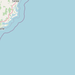
Map view of Myall Lakes National Park

Use this park location map to pinpoint Myall Lakes National Park in Australia, understand its exact geographic position, and read its mapped placement within the surrounding landscape more clearly.

Pigeon | © OpenStreetMap contributors

Location context for Myall Lakes National Park

New South Wales
Park atlas

Map and compare coastal national parks, Ramsar wetlands, and surrounding protected areas in the New South Wales region

Discover Nearby National Parks and Protected Areas around Myall Lakes National Park
After exploring Myall Lakes National Park, browse other significant coastal national parks and protected areas across New South Wales, including extensive Ramsar wetlands and diverse littoral rainforests. Compare adjacent protected landscapes, trace the spread of conservation efforts, and understand the regional geographic context of these vital Australian ecosystems.
National parkNew South Wales

Wallingat National Park: Explore Protected Landscape and Regional Geography in New South Wales

Discover mapped park boundaries and terrain context.

Wallingat National Park in New South Wales is a protected landscape crucial for understanding Australia's natural geography. This canonical page detail provides essential information for atlas exploration, focusing on the park's protected status, mapped contours, and its place within the regional context. Discover the unique geographic features that distinguish this national park from others in the atlas.

Area
65.57 km²
Established
1999
IUCN
II
Relief
Lowland
National parkNew South Wales

Booti Booti National Park: New South Wales National Park Protected Landscape Atlas

Mapped boundaries and regional geography for this Australian national park.

Delve into the specifics of Booti Booti National Park, a designated national park within New South Wales, Australia. This resource facilitates a detailed understanding of its protected area status, landscape characteristics, and precise geographic placement. Explore its mapped features and regional context to enrich your atlas-based discovery of Australia's protected lands.

Area
15.67 km²
Established
1992
IUCN
II
Relief
Highland
National parkNew South Wales

Tomaree National Park: New South Wales National Park with Defined Protected Boundaries

Explore its mapped geography and regional landscape context.

Tomaree National Park represents a significant protected landscape within New South Wales, Australia. This national park entry focuses on its distinct geographic features and mapped boundaries, offering a clear point of reference for atlas-based exploration. Understand its place in the regional geography of New South Wales and its identity as a conserved natural area. The detailed mapping and contextual data provide a solid foundation for appreciating this protected landscape.

Area
23.18 km²
Established
1984
IUCN
II
Relief
Lowland
National parkNew South Wales

Crowdy Bay National Park: New South Wales Protected Coastal Landscape and Terrain Map

Explore mapped boundaries and diverse natural geography within this national park.

Crowdy Bay National Park offers a compelling example of coastal protected landscape in New South Wales, Australia. This page facilitates a detailed atlas exploration of its natural geography, focusing on the interaction between ocean beaches, headlands, and inland forested terrain. Understand the park's specific location and its characteristic ecosystems, providing a structured view of this significant national park for geographic discovery.

Area
102 km²
Established
1972
IUCN
II
Relief
Lowland
National parkNew South Wales

Coorabakh National Park: A Protected Volcanic Landscape in New South Wales

Discover unique terrain, mapped protected boundaries, and regional geography.

Coorabakh National Park in New South Wales, Australia, is characterized by its striking volcanic trio: Big Nellie, Flat Nellie, and Little Nellie. These peaks dominate the rugged escarpment terrain, offering a unique geographic vista. The park protects a rich mosaic of tall eucalypt forests and sheltered subtropical rainforest gullies, highlighting its ecological diversity. For those interested in atlas-style exploration, Coorabakh National Park provides a clear example of a protected landscape with significant geological and ecological features within the broader regional context of New South Wales.

Area
18 km²
Established
1999
IUCN
II
Relief
Highland
Watercolor illustration of a river flowing through hills with distant mountains and pink trees
National parkNew South Wales

Barrington Tops National Park: A Protected National Park in New South Wales

Explore ancient Gondwana rainforests and dramatic volcanic terrain.

Barrington Tops National Park represents a significant protected landscape in New South Wales, Australia, offering a deep dive into diverse ecosystems. Its unique altitudinal vegetation gradient supports the southernmost subtropical rainforests in Australia and showcases geological formations dating back millions of years. This park is crucial for understanding Australia's natural heritage, providing a rich context for landscape exploration and the study of ancient flora within a mapped geographic setting.

Area
765.12 km²
Established
1969
IUCN
Ib
Relief
Mountain
National parkMid North Coast

Tapin Tops National Park: Protected Landscape in Mid North Coast, Australia

Mapped geographic context and natural terrain discovery.

Tapin Tops National Park is a designated national park offering rich opportunities for geographic and landscape exploration. This detail page provides a structured look at its protected area status and its location within the Mid North Coast region of Australia. Delve into the mapped boundaries and understand the park's specific natural terrain for comprehensive atlas-based discovery.

Area
110 km²
Established
1999
IUCN
II
Relief
Mountain
National parkNew South Wales

Middle Brother National Park: New South Wales Protected Area and Geographic Exploration

Mapped boundaries and regional landscape context for this national park.

Middle Brother National Park represents a distinct protected landscape within the state of New South Wales, Australia. This entry offers detailed geographic context, focusing on the park's mapped boundaries and its significance as a national park. Users can explore its place within the regional geography of New South Wales, gaining a structured understanding of this protected area through an atlas-focused perspective.

Area
18.3 km²
Established
1999
IUCN
II
Relief
Mountain

Common questions about visiting, size, designation, and location context for Myall Lakes National Park

Myall Lakes National Park FAQs for park facts, access, geography, and protected area context
Find quick answers about Myall Lakes National Park, including protected-area facts, park geography, trail and visitor context, and how the park fits into its surrounding country and regional landscape.
MoriAtlas Explorer

Continue Your Protected Areas Search Across the Global Atlas

Deepen your exploration by continuing the structured search for national parks and protected areas worldwide. Utilize the comprehensive filtering capabilities to compare different conservation landscapes and refine your understanding of global park geography. Discover more about the distribution and characteristics of protected natural areas.

Global natural geography