
Mori Atlas logo
Nature reserveMývatn

Mapping the concentration of pseudocraters, lava pillars, and breeding bird habitats in the Mývatn basin.

Mývatn Nature Reserve: An Atlas of Volcanic Terrain and Wetland Ecosystems in Northern Iceland

Mývatn serves as a primary example of active volcanic landscape evolution in northern Iceland, where a lake basin was formed by prehistoric basaltic lava flows. This protected nature reserve features an intricate geography of explosion craters, rootless cones, and lava pillars like Dimmuborgir that border shallow, nutrient-rich waters. The site supports significant wetland biodiversity as a Ramsar-recognised habitat, acting as a crucial breeding ground for diverse duck species within an accessible, compact volcanic region.

volcanic lakepseudocraterslava formationswaterbird habitatduck breeding siteramsar wetland
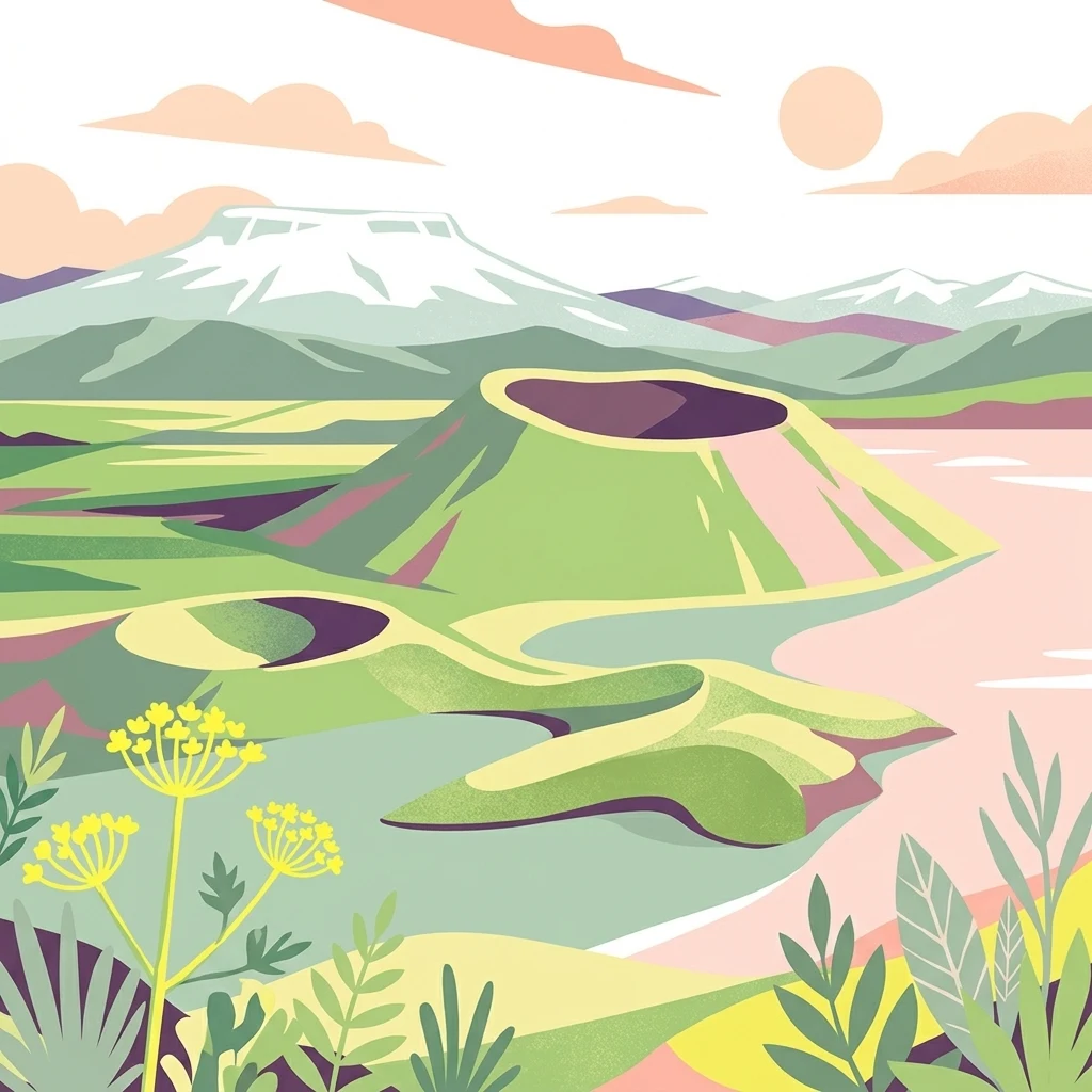
A stylized digital illustration of a volcanic landscape with a large central cinder cone crater, rolling green terrain, and snow-capped mountains in the background under a soft sunset sky.

Mývatn

Nature reserve

Park overview

Structured park overview, official facts, and landscape profile for Mývatn

Mývatn park facts, protected area profile, and essential visitor context

Review the core facts for Mývatn, including designation, size, terrain, visitor scale, habitats, and operating context in one park-focused overview.

About Mývatn

Mývatn occupies a striking position in the volcanic geography of northeastern Iceland. The lake and its immediate surrounds sit on the western edge of the north-south volcanic zone that crosses the region as an above-ground continuation of the Mid-Atlantic Ridge. The bedrock west of the lake is built from interglacial lava flows, while most surrounding mountains were shaped by eruptions beneath the Pleistocene ice sheet, producing both flat-topped table mountains and jagged hyaloclastite ridges.

The lake itself is relatively young in geological terms. About 2,300 years ago, a major basaltic fissure eruption along what is now called the Þrengslaborgir crater row sent a vast lava flow, the Younger Laxá Lava, down the Laxárdalur valley toward the lowland plain of Aðaldalur and on to the Arctic coast. Where this lava encountered the precursor lake, trapped water flashed to steam and produced extensive fields of rootless cones, now preserved as the pseudocrater groups that punctuate the shoreline and form many of the lake's small islands. The same eruption left behind dramatic lava formations such as Dimmuborgir, a forest of rock pillars, and the standing pillars at Höfði that rise directly from the lake water.

The region's volcanic history did not end there. A second cycle about 2,500 years ago produced the huge explosion crater Hverfjall and additional lava flows. A third, historically documented cycle began with the Mývatnseldar eruptions of 1724 to 1729, which began with the explosive creation of the crater lake Víti and then sent lava from Leirhnjúkur toward the north shore of Mývatn. The 1975 to 1984 Krafla fires repeated this pattern, with periods of slow uplift, subsidence, fissure eruptions, and earthquakes, providing one of the most accessible examples anywhere of continental rifting in action.

Because volcanic activity has repeatedly dammed and reshaped the lake basin, Mývatn today is shallow and richly nourished. Nutrient-laden springwater feeds the lake from its eastern and southern sides, generating huge populations of chironomid midges and water fleas. This biological productivity underpins the area's international importance for waterbirds and gives the region its evocative name. The outflowing Laxá river, rich in brown trout and Atlantic salmon, completes the system now protected as the Mývatn-Laxá Nature Conservation Area and listed as a Ramsar Wetland since 1977.

Quick facts and research context for Mývatn

Mývatn covers roughly 37 square kilometres and sits at about 288 metres elevation in northern Iceland, with an average depth of only 2.5 metres, making it one of the country's larger yet shallowest natural lakes. It lies near the Krafla volcanic system, which forms part of the expression of the Mid-Atlantic Ridge on land.

The lake's catchment and the outflowing Laxá river together form a protected nature reserve and a designated Ramsar site. The area combines active geothermal features, basaltic lava fields, pseudocraters, and one of the highest concentrations of breeding duck species found anywhere in the world.

Protection and recognition

Terrestrial protection scope and historical designation records

Mývatn Protection Status and Designated Conservation History

Documented protection records for Mývatn outline a terrestrial conservation framework established in 1977. Verified administrative details and designation history provide structured insight into the management scope of this protected landscape.

Protection details

Protection scope
Terrestrial
Designated year
1977
Transboundary protection
No
Park context

Deeper park guide and search-rich context for Mývatn

Mývatn history, landscape, wildlife, and travel context

Explore Mývatn through its history, landscape character, ecosystems, wildlife, conservation priorities, cultural context, and seasonal travel timing in a structured park guide built for atlas discovery and search intent.

Why Mývatn stands out

Mývatn is best known internationally for its waterbird richness, hosting fifteen breeding duck species, the largest such concentration in Europe, with a notable blend of European, North American, boreal, and arctic species. The most abundant duck, the tufted duck, has roughly 6,000 breeding pairs around the lake, and the population of the nearctic Barrow's goldeneye depends almost entirely on the lake and river system. Equally distinctive is the volcanic scenery framing the lake. Pseudocraters (rootless cones) at Skútustaðir, the towering tephra ring of Hverfjall, the lava pillar labyrinth of Dimmuborgir, and the ever-present backdrop of the Krafla volcanic system make Mývatn a showcase of how recent basaltic volcanism can sculpt an entire landscape within just a few thousand years.
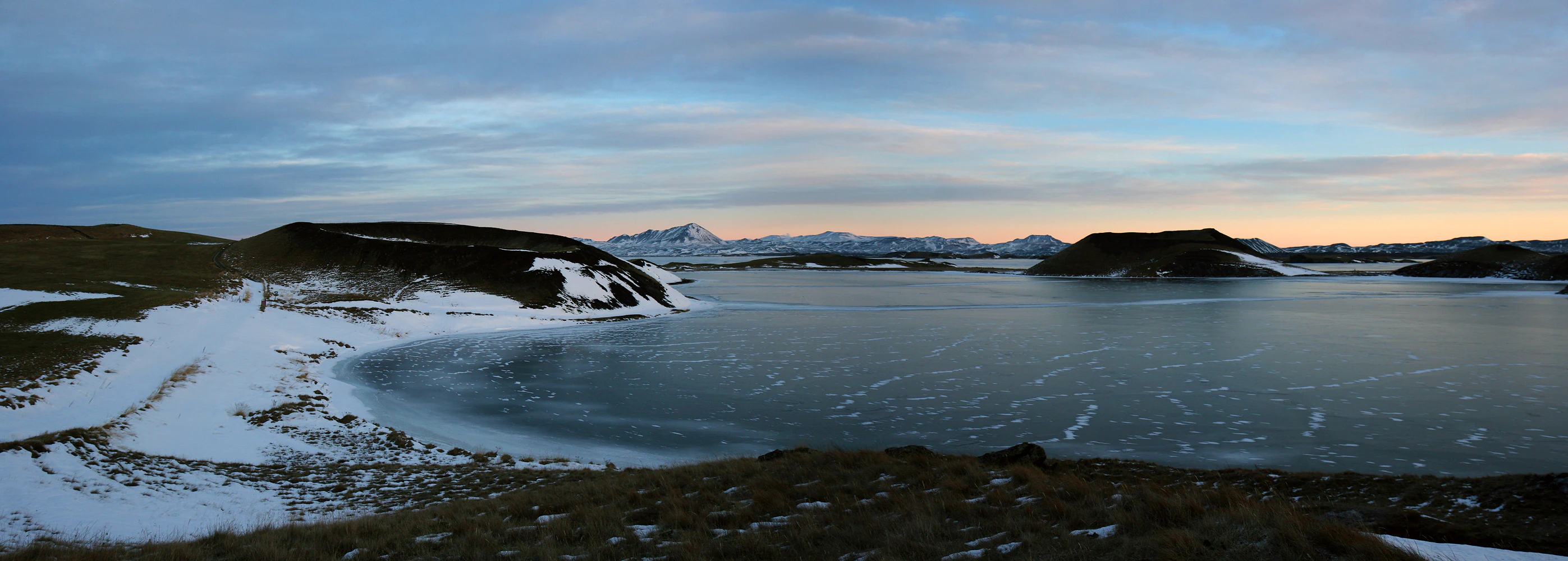
A panoramic view of Mývatn lake in winter, with snow-covered volcanic pseudocraters on the shoreline and distant snow-capped mountains under a soft twilight sky.
Winter view of the pseudocraters along the shore of Lake Mývatn.

Mývatn history and protected-area timeline

Mývatn's history is, in geological terms, extremely short and intensely active. The basin itself began taking shape at the close of the last Ice Age, when retreating glaciers left large end moraines at the north end of the present lake and a glacial lake pooled in the depression until the ice withdrew from the course of the Laxá river. Three distinct post-glacial volcanic cycles have since shaped the landscape: an early Lúdent cycle shortly after deglaciation, a Hverfjall cycle beginning about 2,500 years ago, and a later Mývatnseldar cycle starting in 1724.

The eruption that created the modern lake around 2,300 years ago flowed down the Laxárdalur valley, reached the sea near Aðaldalur, and produced the pseudocraters that now define the shoreline. Following the formation of the Hverfjall tephra ring, lava flows from a later cycle filled the basin and shaped Höfði and Dimmuborgir. The 1724 to 1729 Mývatnseldar eruptions opened with the explosive creation of the Víti crater and later sent lava from Leirhnjúkur down to the north end of the lake, destroying two farms in the process. The more recent Krafla fires of 1975 to 1984 revived the same volcanic system, producing nine separate eruptions and a textbook example of land rifting.

The human and ecological protection history is more recent. Local farms have long traditions of collecting duck eggs under strict customary rules that protect nesting success, and bird populations have been systematically monitored at the Mývatn Research Station since 1975. The lake, the Laxá river, and the surrounding wetlands were brought together under formal protection as the Mývatn-Laxá Nature Conservation Area covering 4,400 square kilometres, with international recognition as a Ramsar Wetland following designation in 1977. A diatomite mining operation that once drew on the lake's unique sediments was closed in 2004, ending an industrial chapter in the lake's recent history.

Mývatn landscape and geographic character

The Mývatn landscape is a compact, walkable composition of young volcanic terrain. The lake itself, dotted with around forty small islands, is shallow and reflective rather than deep, and its shores rise gently into lavafields that look far fresher than their age suggests. The pseudocraters at Skútustaðir form one of the most accessible groups of rootless cones in the world, protected as a natural monument and admired from the village of the same name on the southern shore.

A short distance east of the lake rises the Hverfjall tephra ring, a near-perfect explosion crater of considerable size, while to the north the lava pillars of Dimmuborgir create a labyrinth of arches, caves, and standing stones. At Höfði, similar pillars rise directly from the lake water, framed by views toward Krafla and the surrounding peaks. The plateau encircling the lake includes table mountains such as Bláfjall and Búrfell, hyaloclastite ridges like Vindbelgjarfjall and Námafjall, and the volcanic peaks of Gæsafjöll. The Krafla central volcano dominates the skyline to the north, with its rhyolite outliers and the steaming Víti crater bringing the active rift zone right to the edge of the basin.
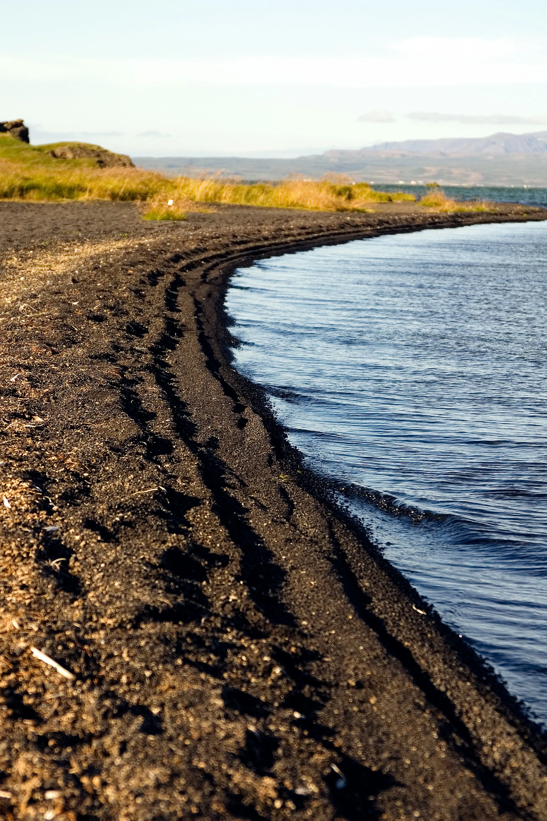
A wide angle view of a black sand beach curving along the water edge of Lake Myvatn with grassy mounds and distant mountains in the background.
The volcanic black sand shoreline of Lake Mývatn in northern Iceland.

Mývatn ecosystems, habitats, and plant life

Mývatn's ecological identity is shaped by extraordinary fertility rather than by harsh conditions. The lake is fed by nutrient-rich springs along its eastern and southern shore, producing one of the densest populations of chironomid midges and cladoceran water fleas found in any temperate lake. This biological productivity is the engine behind the area's global importance for waterbirds and gives the lake its characteristically fertile, eutrophic ecology.

The surrounding wetlands, shallow bays, and small islands host thick stands of aquatic vegetation and emergent marsh plants, providing nesting cover and feeding habitat for ducks and other waterbirds. Wet moorlands and lava fields around the lake support low arctic vegetation, including mosses, lichens, and dwarf shrubs typical of Icelandic tundra environments. As one of the very few places in the world where marimo, the spherical filamentous green alga also known as Cladophora ball, grows naturally, the lake holds an unusual ecological curiosity whose population has been the focus of long-running research and conservation attention.
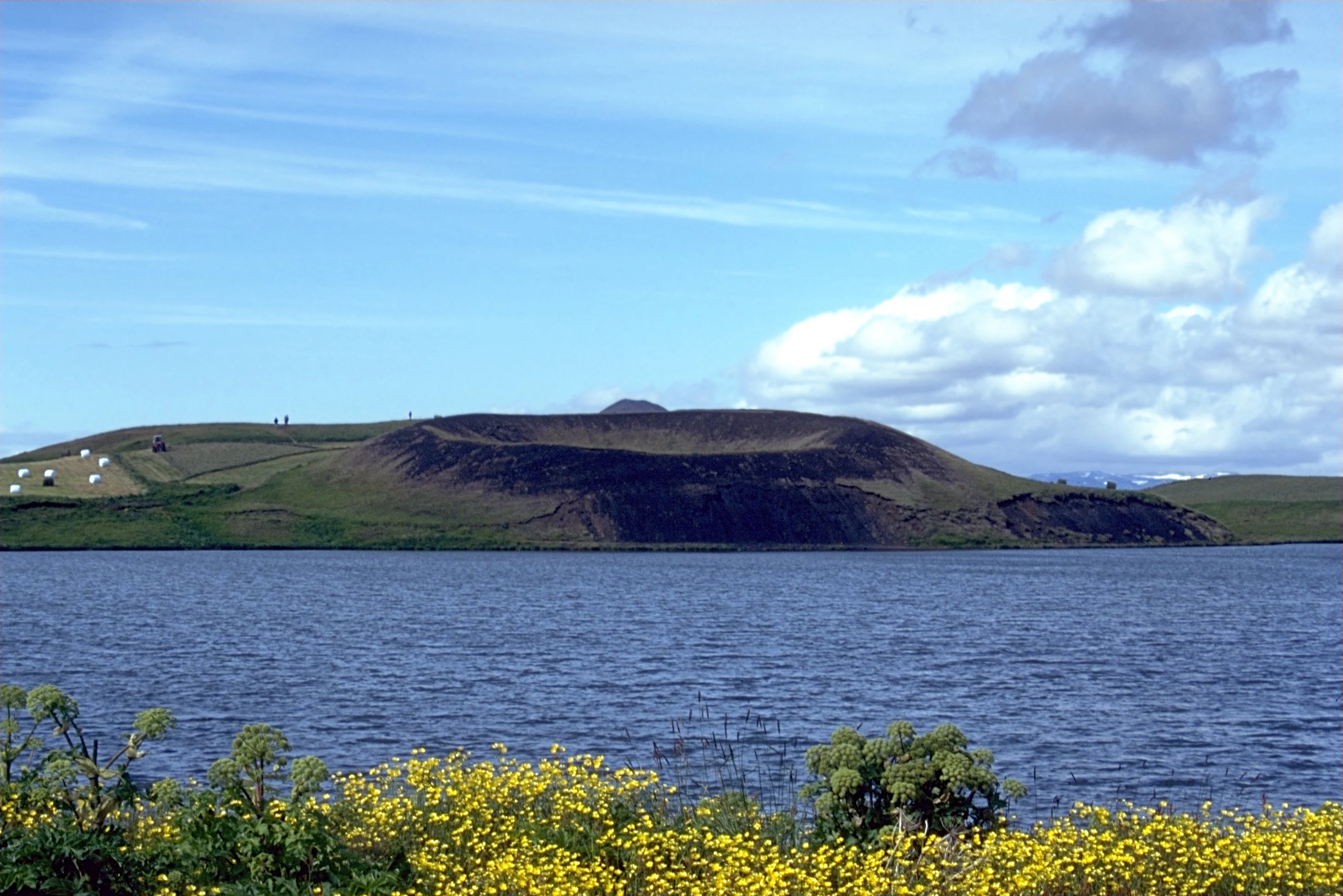
A wide view of a dark, grass-covered volcanic pseudocrater rising from the edge of a deep blue lake, with yellow wildflowers in the foreground.
The distinctive Skútustaðagígar pseudocraters along the shores of Lake Mývatn, Iceland.

Mývatn wildlife and species highlights

Wildlife at Mývatn is dominated by birds, and especially by ducks. Fifteen duck species breed around the lake, the largest concentration of breeding duck species in Europe. The community blends European and North American elements, mixing boreal and arctic species, and includes notable numbers of tufted ducks, greater scaup, Barrow's goldeneye, red-breasted mergansers, Eurasian wigeon, gadwall, mallard, common scoter, long-tailed ducks, Eurasian teal, northern shoveler, and northern pintail. The outflowing Laxá river adds harlequin ducks to the regional list, while a large eider colony exists near the river mouth.

The Barrow's goldeneye is a particular point of conservation importance: nearly all of Iceland's population, roughly 2,000 individuals, depends on the Mývatn-Laxá system. The birds use ice-free areas kept open by emerging springwater and the river's current, and at Mývatn they nest in cavities in the lava fields, replacing the tree-holes typical of the species in North America. Other characteristic waterbirds include Slavonian grebe, red-necked phalarope, great northern diver, red-throated diver, and whooper swan, with the lake formally recognised as part of an Important Bird Area.

Surrounding moorlands and lava fields are home to rock ptarmigan, the iconic Icelandic highland bird, while gyr falcons occasionally hunt in the area. The lake's enormous summer swarms of midges, vast though they are, underpin the entire waterbird community and have given the lake its name. Beneath the surface, the marimo algae add a quieter but distinctive biological signature to the lake's wildlife profile.

A wide panoramic view of a snow covered volcanic landscape in Iceland under a soft sunrise sky, with several distinct mountains and a wooden guardrail in the foreground.
A winter sunrise panoramic view of the volcanic landscape surrounding Lake Mývatn.

Mývatn conservation status and protection priorities

Mývatn is internationally recognised as a conservation priority because of the unusually high concentration of breeding duck species supported by a single lake and river system. The lake, the Laxá river, and the surrounding wetlands together form the Mývatn-Laxá Nature Conservation Area, a 4,400 square kilometre protected region. The same system was designated as a Ramsar Wetland in December 1977, reflecting its global significance for waterbirds and wetland ecology.

The area also matters for its geological heritage. The pseudocraters at Skútustaðir are protected as a natural monument, while sites such as Dimmuborgir and Hverfjall are recognised as nationally important volcanic features. Monitoring at the Mývatn Research Station, in operation since 1975, has provided one of the longest continuous datasets on duck populations anywhere in the world, guiding conservation decisions in the face of eutrophication, climate variability, and past industrial pressure. Local traditions of regulated duck-egg harvesting, governed by long-standing rules that protect nesting success, also form a living part of the area's conservation culture. The closure of diatomite mining in 2004 marked another shift toward a more preservation-oriented management of the lake.

Mývatn cultural meaning and human context

The cultural footprint around Mývatn is closely tied to the lake's fertile waters and seasonal rhythms. Local farming communities have long traditions of harvesting duck eggs under customary rules that balance subsistence with ecological sustainability, particularly important in sustaining the breeding populations of species like the tufted duck and greater scaup. Since 2000, a summer marathon around the lake has become a recurring event, drawing runners into the surrounding landscape and embedding the lake more visibly into regional life.

The lake also has a place in Icelandic folklore. A story recorded in Jón Árnason's collection of folk legends describes the lake as the product of a mischievous act of the devil, who, angered by the beauty of the new world, attempted to extinguish the sun; instead, his act gave rise to Mývatn, with its dense midge swarms portrayed as a continuing nuisance. While a myth rather than an environmental treatise, the story captures the long-standing awareness among local people of the lake's defining quirks, especially the swarms that give it its name.
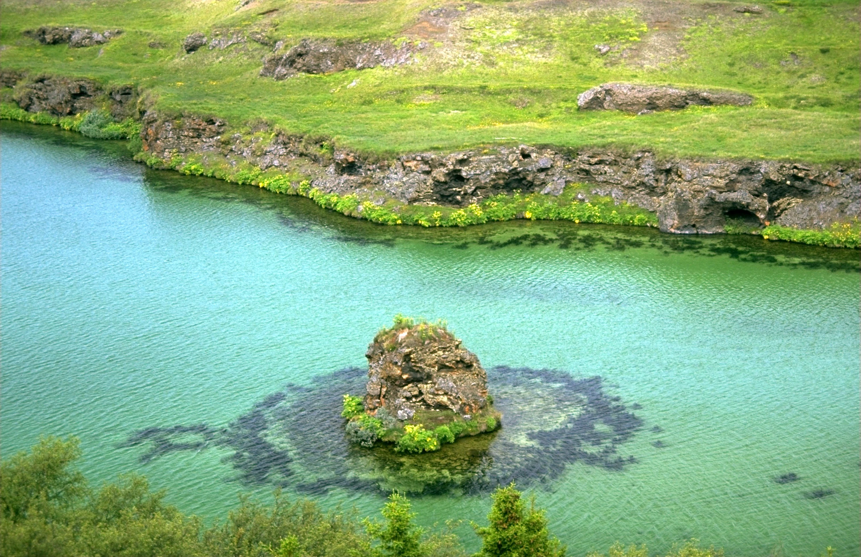
An elevated view of a small, rocky volcanic island surrounded by clear turquoise water, with a grassy, rocky shoreline in the background.
A small lava island rising from the turquoise waters of Lake Mývatn.

Top sights and standout views in Mývatn

Mývatn's highlights cluster around three intertwined themes: volcanic scenery, exceptional birdlife, and intimate scale. The pseudocrater fields at Skútustaðir, the Hverfjall explosion crater, the lava pillar maze of Dimmuborgir, and the lake-facing pillars at Höfði together form one of the most concentrated volcanic landscapes in Iceland.

At the same time, the lake is one of the world's premier freshwater bird destinations, supporting more breeding duck species than any comparable site in Europe and acting as the stronghold for Iceland's Barrow's goldeneye population. Despite this richness, the area remains approachable: a shallow, walkable lake surrounded by an inhabited rural district, with a Ramsar-recognised conservation framework ensuring that the place remains ecologically significant for the long term.
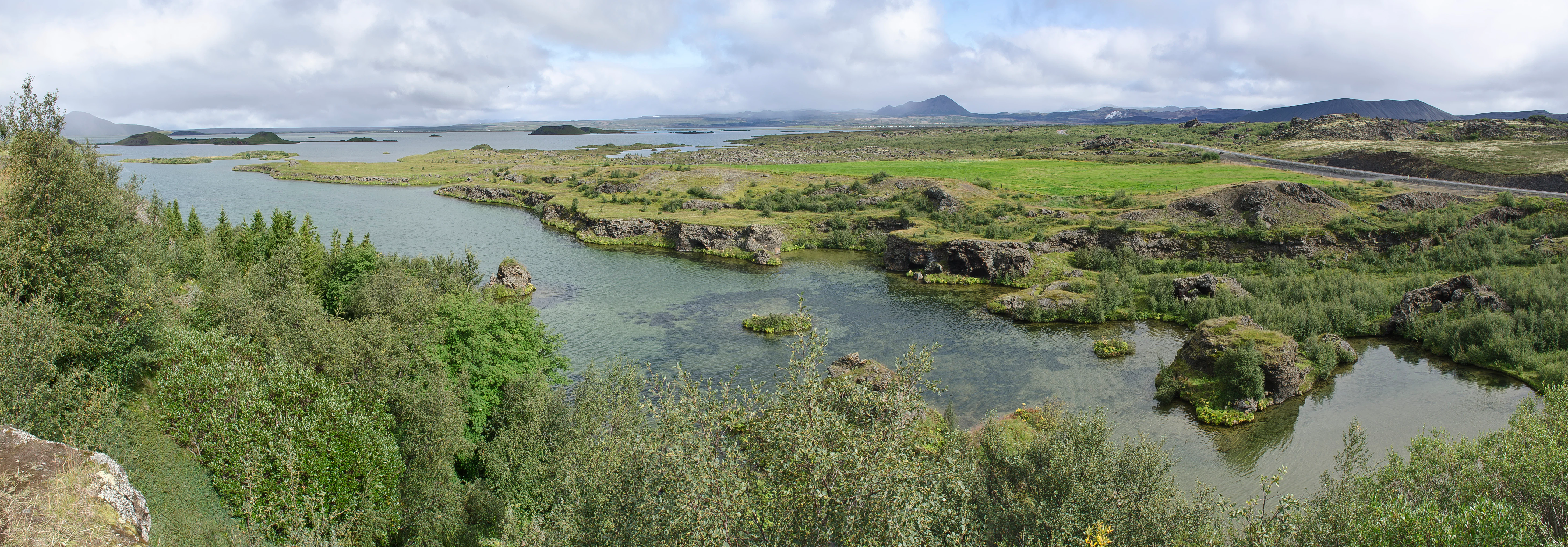
Panoramic landscape shot of Mývatn lake in Iceland, featuring green vegetation, rocky volcanic outcrops, small islets, and a distant horizon under a cloudy sky.
A wide panoramic view of the Mývatn lake landscape, showcasing the volcanic terrain and wetlands.

Best time to visit Mývatn

Late spring through early autumn is the natural window for experiencing the full character of Mývatn. Ducks begin arriving from late April into May, building toward peak breeding numbers through the summer months, when the lake's productivity, vegetation, and wildlife viewing opportunities are at their highest. The long daylight hours typical of northern Iceland in June and July, combined with relatively mild conditions and the chance to see nesting birds, make this period especially rewarding for naturalists.

Late summer also brings atmospheric conditions that suit the volcanic scenery: lower sun angles enhance the textures of lava pillars and pseudocraters, and the cooler air often carries visible steam from the active geothermal areas around Krafla and Námafjall. Winters at Mývatn are long, cold, and snowy, with the lake region under snow cover for extended periods; this season is much less suited to wildlife-based visits but can appeal to visitors drawn to the stark winter volcanic landscape.
Monthly climate preview

Long-term representative records trace monthly temperature ranges and precipitation flows across the Mývatn terrain

Mývatn Climate Normals, Annual Temperature and Precipitation Patterns

Historical monitoring data records measured temperature extremes and precipitation rates across a representative coordinate in Mývatn from 1991 to 2020. Examining the complete monthly climate normals reveals full year-round patterns and detailed weather variations for the protected landscape.
Annual mean-1 °C
-6 °C6 °C
Jan-6°
Feb-6°
Mar-5°
Apr-3°
May
Jun
Jul
Aug
Sep
Oct-1°
Nov-5°
Dec-6°
Warmest month
July

6.2 °C

Coolest month
December

-6.1 °C

Wettest month
October

3.6 mm/day

Driest month
June

2 mm/day

Park location guide

Geography guide, regional context, and park location map for Mývatn

Mývatn park geography, regions, and map view in Iceland

Understand where Mývatn sits in Iceland through a broader geographic reading of the surrounding landscape, nearby location context, and its mapped position within the national park landscape.

How Mývatn fits into Iceland

Iceland is a Nordic island nation located between Europe and North America on the Mid-Atlantic Ridge. With a population of approximately 394,000 and an area of 103,125 km², it is one of the world's most sparsely populated countries. The country features dramatic volcanic terrain, extensive glaciers, geysers, and geothermal activity, all while maintaining a temperate climate warmed by the Gulf Stream.

Wider geography shaping Mývatn in Iceland

Iceland is an island nation located in the North Atlantic Ocean between the Arctic Ocean and the Atlantic Ocean, situated on the Mid-Atlantic Ridge between Europe and North America. The interior consists of volcanic plateaus with sand and lava fields, while mountains and glaciers dominate the terrain. Numerous glacial rivers flow from the highlands through lowlands to the sea. The country sits at a latitude just south of the Arctic Circle.

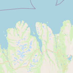
Map view of Mývatn

Use this park location map to pinpoint Mývatn in Iceland, understand its exact geographic position, and read its mapped placement within the surrounding landscape more clearly.

Pigeon | © OpenStreetMap contributors

Explore protected area views, unique volcanic formations, and rich wetland habitats across northern Iceland.

Mývatn Landscape and Scenery Photography: Visualizing Volcanic Terrain

Visual records reveal the striking interaction between active volcanic terrain and diverse waterbird habitats within the northern Ramsar wetland reserve. Examining these protected area views helps naturalists and geologists understand the compact geological forces shaping the regional ecosystem.

A panoramic view of Mývatn lake in winter, with snow-covered volcanic pseudocraters on the shoreline and distant snow-capped mountains under a soft twilight sky.

An aerial perspective of Mývatn showing a large lake with small, grassy volcanic pseudo craters on the shore and a snow-capped mountain in the distant background.

A wide angle view of a black sand beach curving along the water edge of Lake Myvatn with grassy mounds and distant mountains in the background.

A wide view of a dark, grass-covered volcanic pseudocrater rising from the edge of a deep blue lake, with yellow wildflowers in the foreground.

A wide panoramic view of a snow covered volcanic landscape in Iceland under a soft sunrise sky, with several distinct mountains and a wooden guardrail in the foreground.

A vast, rough field of dark, mossy lava rocks stretching toward a large, symmetrical volcanic crater under a light sky.

An elevated view of a small, rocky volcanic island surrounded by clear turquoise water, with a grassy, rocky shoreline in the background.

Panoramic landscape shot of Mývatn lake in Iceland, featuring green vegetation, rocky volcanic outcrops, small islets, and a distant horizon under a cloudy sky.

Park atlas

Compare nearby volcanic terrain, wetland reserves, and regional protected areas.

Explore Parks Near Mývatn and Surrounding Protected Landscapes in Northern Iceland

Browse protected areas near Mývatn to examine similar volcanic terrain and wetland reserves across northern Iceland. Continued comparison of regional park geography reveals broader conservation patterns within active volcanic zones.
Watercolor illustration showing a landscape with green fields, a winding path, pink flowers, and mountains in the background
National parkIceland
About 26 km away#1 closest

South

Vatnajökull National Park: Iceland's Expansive Protected Glacier and Volcanic Terrain

Mapped boundaries of a UNESCO World Heritage site dynamic with fire and ice.

Vatnajökull National Park offers a profound exploration of one of Earth's most dynamic natural environments. This Icelandic national park protects the vast Vatnajökull ice cap, a landscape shaped by active volcanoes and powerful glacial forces, creating a region of extraordinary geographic diversity. Discover the mapped terrain, from subglacial mountain ranges to dramatic caldera systems, and understand the unique protected area context of this significant European natural heritage.

Area
14,967 km²
Established
2008
IUCN
II
Relief
Mountain
Watercolor illustration showing a river valley with hills and tents.
National parkIceland
About 42 km away#2 closest

Northeast

Jökulsárgljúfur National Park: Explore Iceland's Volcanic Canyon and Glacial River Protected Landscape

Mapped geography and terrain of a key northern Iceland protected area.

Jökulsárgljúfur National Park, located in northern Iceland, is celebrated for its striking volcanic canyon landscape carved by the powerful Jökulsá á Fjöllum glacial river. This protected area showcases a terrain shaped by ancient glacial outburst floods and volcanic forces, featuring notable geological formations like the Hljóðaklettar echo rocks and iron-colored hills. Understanding Jökulsárgljúfur National Park provides crucial insight into the unique regional geography and the atlas-driven exploration of Iceland's preserved natural heritage.

IUCN
II
Relief
Mountain
Access
Remote access
Scope
Terrestrial
A watercolor painting showing a wide view of a geothermal area with green hills, steam plumes rising from hot springs, and yellow-toned ground patches.
Natural monumentIceland
About 145 km away#3 closest

Southwest

Hveravellir Natural Monument: Geothermal Plateau Geography and Highland Protected Areas

Central Iceland geothermal field and volcanic plateau

Located on the Kjölur route, Hveravellir serves as a protected natural monument characterized by high-temperature geothermal activity. The area features a concentration of fumaroles, geysers, and mineral-rich springs set upon a stark volcanic plateau. This site offers significant insights into the geological processes shaping the central highlands of Iceland, blending ancient lava fields with active thermal surface transformations.

Area
2.5 km²
Relief
Highland
Climate
Subpolar
Access
Moderate access
Watercolor illustration showing a mountain landscape with green valleys, pink mountains, and a winding river
National parkIceland
About 177 km away#4 closest

South

Skaftafell National Park: Iceland's Accessible Protected Landscape with Glacial Terrain and Basalt Columns

Discover glacial landscapes and volcanic geology.

Skaftafell National Park is a vital protected area in Southeast Iceland, offering a unique atlas-level view of dramatic glacial landscapes. Located at the base of Vatnajökull, Europe's largest glacier, the park features accessible hiking trails that traverse outwash plains, birch woodlands, and glacial tongues like Skaftafellsjökull. Explore the iconic Svartifoss waterfall, framed by striking basalt columns, and understand the park's dynamic terrain shaped by volcanic activity and glacial processes, providing rich geographic context for protected landscape discovery.

Established
1967
IUCN
II
Scope
Terrestrial
Watercolor painting depicting a landscape with cliffs, a body of water, and distant hills under a light sky
National parkSouthern Region
About 232 km away#5 closest

Southwest

Þingvellir National Park: Witness Tectonic Plates and Ancient Icelandic Governance

Explore the rift valley and historic parliament site in Iceland's Southern Region.

Þingvellir National Park offers a singular opportunity for geographic discovery, situated in Iceland's Southern Region. This protected national park is globally recognized for its visible expression of the Mid-Atlantic Ridge, where the North American and Eurasian tectonic plates actively diverge, creating a dramatic rift valley. Moreover, Þingvellir served as the site of the Althing, Iceland's ancient parliament, making it a crucial historical landmark. Explore this landscape to understand both powerful geological processes and the foundations of Icelandic democratic history through its mapped terrain.

Area
92.7 km²
Established
1930
IUCN
II
Relief
Lowland
Nature reserveIceland
About 309 km away#6 closest

Southwest

Surtsey Nature Reserve: Mapping Volcanic Landscapes and Ecological Succession in Iceland

A pristine laboratory of North Atlantic volcanic terrain.

Surtsey represents a rare geological event, a volcanic island created by sustained eruptions and now protected as a strict nature reserve. The island acts as a primary research site for observing how life colonizes barren volcanic substrates, from mosses and insects to seabird colonies. Its mapped boundaries encompass dramatic basaltic lava flows and tephra deposits, providing a vital window into the formative processes of oceanic islands.

Area
1.4 km²
Established
1963
Relief
Upland
Climate
Subpolar
A horizontal watercolor illustration depicting a soft, pink-hued coastal landscape with rolling hills, rocky outcrops, and a quiet bay.
National parkIceland
About 329 km away#7 closest

West

Snæfellsjökull National Park: Volcanic Stratovolcano and Coastal Protected Area in Iceland

Mapped geologic features, glacier terrain, and coastal volcanic landmarks.

Snæfellsjökull National Park features a unique assembly of volcanic landforms, including the iconic glacier-capped stratovolcano, the towering Lóndrangar basalt pinnacles, and symmetrical craters like Saxhóll. This protected area offers deep insights into the glacial and submarine origins of western Iceland through its diverse palagonite ridges and extensive lava plains.

Area
170 km²
Established
2001
Relief
Mountain
Scope
Terrestrial
Watercolor illustration of a mountain landscape with a glacier-capped peak and surrounding green fields
National parkIceland
About 330 km away#8 closest

West

Snæfellsjökull National Park: Geography and Protected Landscapes of Western Iceland

Glacial volcanoes, lava fields, and coastal topography.

Snæfellsjökull National Park sits at the western tip of the Snæfellsnes peninsula, creating a unique intersection of glacial, volcanic, and maritime environments. This database provides structured insights into the park's rugged terrain, including its moss-covered lava fields, sea-carved cliffs, and the namesake glacier that dominates the local landscape.

Established
2001
IUCN
II

Common questions about visiting, size, designation, and location context for Mývatn

Mývatn FAQs for park facts, access, geography, and protected area context

Find quick answers about Mývatn, including protected-area facts, park geography, trail and visitor context, and how the park fits into its surrounding country and regional landscape.
MoriAtlas Explorer

Continue Your Protected Areas Search Across the Global Atlas

Deepen your exploration by continuing the structured search for national parks and protected areas worldwide. Utilize the comprehensive filtering capabilities to compare different conservation landscapes and refine your understanding of global park geography. Discover more about the distribution and characteristics of protected natural areas.

Global natural geography