Mori Atlas logo
National parkNaciones Unidas National Park

Mapping the geography and protected boundaries of a key Guatemalan natural area.

Naciones Unidas National Park: Guatemala's Protected National Park Landscape

Naciones Unidas National Park stands as a significant protected area within Guatemala's diverse geography. This page offers an atlas-driven view, detailing the park's mapped boundaries and its role as a national park. Understand its place within the regional landscape, providing context for geographic exploration and the study of protected lands.

National ParkForest ReserveMountain LandscapeVolcanic TerrainBirdwatchingHighland Ecosystem

Naciones Unidas National Park

National park

Park overview

Structured park overview, official facts, and landscape profile for Naciones Unidas National Park

Naciones Unidas National Park park facts, protected area profile, and essential visitor context

Review the core facts for Naciones Unidas National Park, including designation, size, terrain, visitor scale, habitats, and operating context in one park-focused overview.

About Naciones Unidas National Park

Naciones Unidas National Park occupies a distinctive position in Guatemala's protected area system as one of the few remaining forested tracts within the densely populated Guatemala City Metropolitan Area. The park's location on the volcanic slopes north of Lake Amatitlán creates a heterogeneous landscape of ridges, ravines, and mature forest that provides habitat for numerous species adapted to subtropical highland conditions. Beyond its ecological significance, the park serves as an important recreational resource for the capital region's residents, offering accessible nature-based activities within a short drive of urban centers. The combination of biodiversity conservation, watershed protection for Lake Amatitlán, and public recreation makes this park a multifaceted protected area serving both environmental and social functions.

Quick facts and research context for Naciones Unidas National Park

Naciones Unidas National Park covers 4.91 square kilometers of mountainous terrain in the Guatemala department, positioned between Guatemala City and Lake Amatitlán in the Villa Nueva municipality. The park was officially declared a national park in 1955 through Presidential Agreement, making it one of the earliest protected areas established in modern Guatemala. It is administered by Fundación Defensores de la Naturaleza under a management agreement originally granted in 1997. The protected area serves dual purposes as both a biodiversity refuge and a recreational destination for metropolitan residents, offering trails, picnic facilities, and panoramic views of the surrounding volcanic landscape including the active Pacaya Volcano.

Protection and recognition

Documenting the terrestrial boundaries and official designation history of the reserve.

Naciones Unidas National Park Protection Status and Conservation Designation

Map-based analysis of Naciones Unidas National Park outlines the documented terrestrial boundaries and official conservation status established for the area. Verifying official records provides essential geographic context for understanding regional conservation frameworks and management history within the global dataset.

Protection details

Protection scope
Terrestrial
Transboundary protection
No
Park context

Deeper park guide and search-rich context for Naciones Unidas National Park

Naciones Unidas National Park history, landscape, wildlife, and travel context

Explore Naciones Unidas National Park through its history, landscape character, ecosystems, wildlife, conservation priorities, cultural context, and seasonal travel timing in a structured park guide built for atlas discovery and search intent.

Why Naciones Unidas National Park stands out

Naciones Unidas National Park is best known as a rare pocket of intact forest surviving within the Guatemala City metropolitan region, providing critical habitat for highland biodiversity in an otherwise heavily developed area. The park is celebrated for its accessibility to city residents seeking natural recreation, featuring trails that wind through mature forest and ascend to viewpoints overlooking Lake Amatitlán and the Pacaya Volcano. Its cultural attractions include replicas of ancient Maya structures reminiscent of Tikal and architectural features modeled after the colonial center of Antigua Guatemala, giving visitors both natural and cultural experiences within a single protected area.

Naciones Unidas National Park history and protected-area timeline

Naciones Unidas National Park was established through Presidential Agreement on May 26, 1955, making it one of the oldest national parks in Guatemala and part of the country's early wave of protected area designation during the mid-twentieth century. The park remained under various administrative arrangements until 1997, when the Guatemalan government granted Fundación Defensores de la Naturaleza a 25-year usufruct agreement to manage the protected area. This management arrangement was subsequently modified through governmental agreements in 2007, expanding the organization's administrative scope to encompass nearly 2.5 million square meters of protected territory. The founding of the park reflected mid-century recognition of the need to preserve natural areas near Guatemala City's expanding metropolitan zone.

Naciones Unidas National Park landscape and geographic character

The park occupies mountainous terrain formed by volcanic activity associated with the Guatemala highlands, with elevation around 1,450 meters above sea level. The landscape features undulating ridges and valleys that descend from the higher slopes toward the basin containing Lake Amatitlán, a volcanic crater lake of significant ecological and cultural importance to the region. Forest cover dominates the park's interior, with mixed coniferous and broadleaf species creating a layered canopy structure. The terrain provides opportunities for hiking along trails that traverse different elevation zones and offer expansive views of the surrounding volcanic landscape, including the prominent Pacaya Volcano which remains an active geological feature visible from many points within the park.

Naciones Unidas National Park ecosystems, habitats, and plant life

The ecological character of Naciones Unidas National Park reflects its position in the subtropical highland zone of Guatemala's volcanic highlands. The park supports diverse forest communities dominated by coniferous species including cypress (Cupressus lucitanica) and pine (Pinus oocarpa), alongside deciduous and semi-deciduous broadleaf trees. Native tree species such as cedar (Cedrella tonduzi) contribute to the forest's ecological complexity, while introduced species including loquat, avocado, and guava have become established in certain areas. The combination of mature forest, varied topography, and proximity to Lake Amatitlán creates habitat conditions supporting considerable biodiversity within a metropolitan context where natural areas are increasingly scarce.

Naciones Unidas National Park wildlife and species highlights

Biological surveys conducted within Naciones Unidas National Park have documented remarkable biodiversity for such a relatively small protected area situated within a metropolitan region. At least 111 species of birds have been recorded within the park, representing both resident species and seasonal migrants using the area as habitat or passage corridor. The mammal fauna includes 11 species, while reptiles are represented by 36 documented species and amphibians by 5 species. This vertebrate diversity, combined with the park's forest structure and connectivity to broader ecological corridors, makes the area particularly valuable as a biodiversity refuge within the heavily modified Guatemala City metropolitan landscape.

Naciones Unidas National Park conservation status and protection priorities

Naciones Unidas National Park serves critical conservation functions as one of the last remaining forest fragments in the Guatemala City Metropolitan Area, representing a vanishing habitat type in one of Central America's most urbanized regions. The park contributes to watershed protection for Lake Amatitlán, helping maintain water quality and reduce sedimentation in this important volcanic crater lake. Its long history as a protected area since 1955 demonstrates sustained institutional commitment to preserving this highland forest ecosystem. The presence of biodiversity monitoring programs tracking species populations indicates active management focused on maintaining ecological integrity despite the pressures associated with surrounding urban development.

Naciones Unidas National Park cultural meaning and human context

The park's cultural offerings reflect Guatemala's rich heritage, featuring replicas of Maya temple structures inspired by the ancient city of Tikal, one of the most significant archaeological sites in Mesoamerica. Architectural reproductions of Antigua Guatemala's colonial central park provide visitors with familiar symbols of Guatemalan cultural identity. These cultural installations complement the natural attractions and create a composite visitor experience that combines environmental appreciation with cultural education. The park's accessibility from Guatemala City makes it an important site for environmental education and nature-based recreation for metropolitan residents, particularly families seeking accessible outdoor experiences.

Top sights and standout views in Naciones Unidas National Park

Naciones Unidas National Park offers a rare combination of accessible forest recreation, biodiversity observation, and cultural exhibits within the Guatemala City metropolitan region. The panoramic views of Lake Amatitlán and Pacaya Volcano from the park's elevated trails provide distinctive visual experiences not available in many urban-proximate protected areas. The park's trail network and picnic facilities make it particularly suitable for family outings and educational visits, while its documented bird, mammal, reptile, and amphibian populations support wildlife observation activities. The presence of mature coniferous and broadleaf forest in a metropolitan context gives the park particular value as an educational resource and ecological reference area.

Best time to visit Naciones Unidas National Park

The park can be visited year-round given its proximity to Guatemala City and consistent subtropical highland climate. The dry season from November through April typically offers more reliable trail conditions and clearer visibility for viewing the surrounding volcanic landscape, though morning fog may occasionally reduce visibility in the higher elevations. The wet season from May through October brings lush forest conditions and increased bird activity, though trails may become muddy and some areas less accessible. Given the park's popularity as a recreational destination for metropolitan residents, weekend visits may be busier than weekday visits.
Monthly climate preview

Long-term representative monthly averages for temperature and precipitation

Naciones Unidas National Park Climate Normals and Annual Weather Patterns

Naciones Unidas National Park records long-term baseline temperatures ranging from 18.86 degrees Celsius to 23.34 degrees Celsius alongside varying monthly precipitation rates from 0.22 to 7.76 millimeters per day. Examining the complete twelve-month climate profile reveals the full scope of temperature shifts and precipitation distribution across the protected area coordinate.
Annual mean21 °C
19 °C23 °C
Jan19°
Feb21°
Mar22°
Apr23°
May23°
Jun22°
Jul21°
Aug21°
Sep21°
Oct20°
Nov19°
Dec19°
Warmest month
April

23.3 °C

Coolest month
December

18.9 °C

Wettest month
September

7.8 mm/day

Driest month
February

0.2 mm/day

Park location guide

Geography guide, regional context, and park location map for Naciones Unidas National Park

Naciones Unidas National Park park geography, regions, and map view in Guatemala

Understand where Naciones Unidas National Park sits in Guatemala through a broader geographic reading of the surrounding landscape, nearby location context, and its mapped position within the national park landscape.

How Naciones Unidas National Park fits into Guatemala

Guatemala is a presidential republic in Central America with a population of approximately 18.6 million, making it the most populous country in the region. The country was the heartland of the Maya civilization and gained independence from Spain in 1821. Guatemala has a diverse population including Maya, Ladino, Xinca, and Afro-Guatemalan communities, with Spanish as the official language.

Wider geography shaping Naciones Unidas National Park in Guatemala

Guatemala is located in northern Central America, bordered by Mexico to the north and west, Belize to the northeast, Honduras to the east, El Salvador to the southeast, and the Pacific Ocean to the south. The terrain is predominantly mountainous with highlands, volcanic ranges, and coastal lowlands. The country includes the Petén region, a large lowland jungle area in the north.

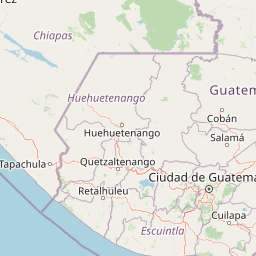
Map view of Naciones Unidas National Park

Use this park location map to pinpoint Naciones Unidas National Park in Guatemala, understand its exact geographic position, and read its mapped placement within the surrounding landscape more clearly.

Pigeon | © OpenStreetMap contributors

Location context for Naciones Unidas National Park

Guatemala
Park atlas

Compare other protected areas and national parks sharing the highland geography and volcanic terrain near Naciones Unidas National Park.

Explore Nearby National Parks and Protected Areas Beyond Naciones Unidas National Park

After exploring Naciones Unidas National Park, continue your geographic discovery by browsing other national parks and protected areas across Guatemala's volcanic highlands. Compare these distinct conservation landscapes to understand the regional spread of forest reserves and unique metropolitan green spaces.
National parkEscuintla
About 82 km away#1 closest

Southwest

Sipacate-Naranjo National Park: Exploring Its Protected Landscape and Regional Geography

Understand mapped boundaries within Escuintla's natural context.

Delve into the protected landscape of Sipacate-Naranjo National Park, a key national park situated in Guatemala's Escuintla region. This content focuses on its mapped geographic boundaries and its contribution to the regional atlas of protected lands. Gain structured insights into the park's identity and its surrounding natural terrain, crucial for understanding its protected area significance and geographic placement.

Area
20 km²
Established
1969
IUCN
IV
Relief
Lowland
Stylized illustration of a mountain valley with waterfall, dense forest, and trees
National parkAhuachapán Department
About 101 km away#2 closest

Southeast

El Imposible National Park: National Park Protected Landscape and Regional Geography Exploration

Atlas context and mapped boundaries for El Imposible National Park.

Delve into the protected landscape of El Imposible National Park, a key national park located within Ahuachapán Department, El Salvador. This resource provides detailed information on its geographic setting, mapped park boundaries, and its role within the regional natural context. Understand the essence of this protected natural area through structured atlas data, offering a unique lens for exploring its conservation significance and landscape features.

Area
38.2 km²
Established
1989
IUCN
II
Relief
Mountain
National parkEl Salvador
About 130 km away#3 closest

Southeast

Los Volcanes National Park: Exploring El Salvador's Volcanic Terrain and National Park Boundaries

Mapped protected lands and regional geography.

Los Volcanes National Park is a protected natural area situated within El Salvador's geographically rich landscape, known for its volcanic terrain. This page provides an atlas-focused view of the park, highlighting its mapped boundaries and its context within the Central American region. Engage with structured geographic data to understand the protected land and its surrounding terrain.

IUCN
II
Relief
Mountain
Scope
Terrestrial
Water
Minor water
National parkHonduras
About 135 km away#4 closest

East

Montecristo Trifinio National Park: Honduras National Park and Protected Landscape Atlas

Explore its mapped boundaries and regional geographic context.

Delve into the protected landscape of Montecristo Trifinio National Park, a designated national park within Honduras. This resource provides critical atlas-level information, detailing the park's geographic scope, mapped boundaries, and its significance as a protected natural area. Understand the terrain and landscape context to appreciate its unique role in the region's conservation framework and its place within the structured exploration of national parks.

Area
54 km²
Established
1987
IUCN
II
Relief
Mountain
Biosphere reserveChiquimula Department
About 135 km away#5 closest

East

Trifinio Biosphere Reserve: A Transboundary Protected Landscape in Chiquimula Department

Highland cloud forests and tri-national mountain terrain exploration

Trifinio Biosphere Reserve represents a significant protected area within Chiquimula Department, featuring the mist-cloaked Montecristo massif. As a foundational transboundary landscape, it preserves critical highland oak and laurel forests that span the borderlands of Guatemala, Honduras, and El Salvador. Access detailed geographic context and map-based insights into this essential Central American mountain refuge.

Area
221.79 km²
Established
1987
IUCN
VI
Relief
Mountain
National parkEl Salvador
About 138 km away#6 closest

East

Montecristo National Park: El Salvador's Protected Landscape and Geographic Identity

Explore its mapped boundaries and regional terrain.

Montecristo National Park is a vital protected area that anchors a specific geographic identity within El Salvador. This MoriAtlas entry provides an atlas-driven view of the park, highlighting its mapped boundaries and the characteristics of its natural terrain. Understanding Montecristo National Park's protected status offers insight into the region's geography and its place within Central America's broader landscape.

Area
19.73 km²
Established
2008
IUCN
II
Relief
Mixed relief
National parkEl Salvador
About 166 km away#7 closest

Southeast

El Boquerón National Park: National Park Atlas, Mapped Boundaries, and Regional Geography

Explore El Salvador's protected volcanic terrain and landscape.

Delve into the protected landscape of El Boquerón National Park, a significant national park in El Salvador. This resource provides detailed map context, focusing on the park's geographic boundaries and its position within the country's volcanic region. Understand the atlas-driven discovery value and unique regional setting of this protected area.

Area
2.05 km²
Established
2008
IUCN
II
Relief
Mountain
Natural monumentChiapas
About 176 km away#8 closest

Northwest

Volcán Tacaná Natural Monument: Stratovolcano Geography and Protected Landscape Context

A massive volcanic landmark spanning the Mexico and Guatemala frontier

Volcán Tacaná functions as an essential natural monument and active stratovolcano rising above the Chiapas region. Its geography includes dense cloud forests, high-altitude alpine zones, and geothermal activity, making it a pivotal feature of the Sierra Madre de Chiapas mountain range and a protected transboundary area.

Relief
Mountain
Climate
Tropical
Access
Moderate access
Scope
Terrestrial

Common questions about visiting, size, designation, and location context for Naciones Unidas National Park

Naciones Unidas National Park FAQs for park facts, access, geography, and protected area context

Find quick answers about Naciones Unidas National Park, including protected-area facts, park geography, trail and visitor context, and how the park fits into its surrounding country and regional landscape.
MoriAtlas Explorer

Continue Your Protected Areas Search Across the Global Atlas

Deepen your exploration by continuing the structured search for national parks and protected areas worldwide. Utilize the comprehensive filtering capabilities to compare different conservation landscapes and refine your understanding of global park geography. Discover more about the distribution and characteristics of protected natural areas.

Global natural geography