Mori Atlas logo
National parkNini-Suhien National Park

Analyzing the physical boundaries and regional topography of this vital West African protected area.

Nini-Suhien National Park: Comprehensive Geographic Atlas and Protected Area Landscape Mapping

Nini-Suhien National Park represents a significant protected area within the diverse landscapes of Ghana. This detailed geographic profile provides essential data on its territorial extent and spatial characteristics. Examine how the park is situated within the broader West African region through mapped terrain analysis and structured environmental context designed for deep landscape discovery.

national parkprotected areaEastern EuropeCaucasus

Nini-Suhien National Park

National park

Park overview

Structured park overview, official facts, and landscape profile for Nini-Suhien National Park

Nini-Suhien National Park park facts, protected area profile, and essential visitor context

Review the core facts for Nini-Suhien National Park, including designation, size, terrain, visitor scale, habitats, and operating context in one park-focused overview.
Monthly climate preview

Long-term representative point measurements tracking monthly temperature ranges and rainfall cycles

Nini-Suhien National Park Climate Normals, Annual Temperature and Precipitation Rhythm

Representative coordinates record measured annual temperature variation and monthly precipitation shifts from historical climatology data. Examining the full twelve-month profile provides detailed meteorological context for this protected geography.
Annual mean26 °C
24 °C28 °C
Jan27°
Feb28°
Mar27°
Apr27°
May26°
Jun25°
Jul24°
Aug24°
Sep25°
Oct25°
Nov26°
Dec27°
Warmest month
February

27.9 °C

Coolest month
July

24 °C

Wettest month
June

8.9 mm/day

Driest month
January

1 mm/day

Park location guide

Geography guide, regional context, and park location map for Nini-Suhien National Park

Nini-Suhien National Park park geography, regions, and map view in Ghana

Understand where Nini-Suhien National Park sits in Ghana through a broader geographic reading of the surrounding landscape, nearby location context, and its mapped position within the national park landscape.

How Nini-Suhien National Park fits into Ghana

Ghana, officially the Republic of Ghana, is a West African nation spanning approximately 240,000 km² along the Gulf of Guinea. It achieved independence from Britain in 1957, becoming the first Sub-Saharan colony to do so, and transitioned to a republic in 1960. The country has a population of over 35 million, with Accra as its capital and largest city. Ghana features diverse ecosystems from coastal savannas to tropical rainforests and is linguistically and ethnically rich, with English as the official language.

Wider geography shaping Nini-Suhien National Park in Ghana

Ghana is located in West Africa along the Gulf of Guinea and Atlantic Ocean to its south. It borders Côte d'Ivoire to the west, Burkina Faso to the north, and Togo to the east. The country spans diverse ecologies including coastal savannas and tropical rainforests.

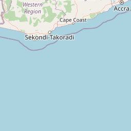
Map view of Nini-Suhien National Park

Use this park location map to pinpoint Nini-Suhien National Park in Ghana, understand its exact geographic position, and read its mapped placement within the surrounding landscape more clearly.

Pigeon | © OpenStreetMap contributors
Park atlas

Compare surrounding regional geography and connected conservation landscapes

Parks Near Nini-Suhien National Park and Related Protected Areas

Browsing other parks near Nini-Suhien National Park helps place individual protected areas within a wider regional geography. Continuing past single conservation sites provides broader context for comparing mapped terrain across neighboring protected landscapes.
National parkGhana
Mapped park locations coincide#1 closest

Nini-Suhien National Park: Protected Coastal Forest Geography and Mapping in Ghana

Regional forest landscapes and conservation boundaries

Nini-Suhien National Park serves as a vital anchor for coastal forest conservation in southwestern Ghana. This profile provides an atlas-level understanding of the park's location, its physical landscape features, and its role within the larger Ankasa Conservation Area for researchers and geography enthusiasts.

Area
160 km²
Established
1976
IUCN
II
Relief
Lowland
Nature reserveWestern North Region
About 28 km away#2 closest

North

Boin Tano Forest Reserve: Mapping Ghana's Protected Tropical Nature Reserve Landscapes

Regional geography and habitat analysis in Western North Region

Boin Tano Forest Reserve stands as a vital protected area in Ghana, recognized for its complex mosaic of equatorial forest, grassland, and shrubland. This 129 square kilometre reserve serves as a sanctuary for diverse primate, antelope, and bird populations, reflecting the rich biodiversity of the Upper Guinean forest ecosystem within the Western North Region.

Area
129 km²
Established
1968
IUCN
V
Relief
Lowland
Protected landscapeWestern Region
About 48 km away#3 closest

Northeast

Mamiri Forest Reserve: Mapped Geography and Protected Landscape Identity in Western Ghana

Ecological transition zone of the Upper Guinea forest block

Spanning roughly 45 square kilometers, Mamiri Forest Reserve is defined by its unusual, elongated geometry and dissected hill-and-valley topography. This protected landscape serves as a vital transition zone between wet and moist evergreen forest types, supporting a complex array of seasonal wetland patches and upland forest ridges. Recognized for its significance as an Important Bird Area, it remains a critical remnant of the original high forest system found in this part of Ghana.

Area
45 km²
Established
1949
IUCN
V
Relief
Upland
National parkComoé District
About 74 km away#4 closest

West

Parc national des îles Ehotilé: Geography and Protected Landscapes of the Aby Lagoon Archipelago

Coastal national park featuring unique estuarine terrain and mangrove ecosystems.

Parc national des îles Ehotilé preserves a rare six-island archipelago within the Aby lagoon. The area showcases diverse aquatic environments, including salt-tolerant mangrove forests and dense woodland habitats that support large fruit bat colonies and West African manatee populations. This protected landscape represents a critical estuarine intersection in southeastern Cote d'Ivoire, offering deep insight into the region's complex hydrological and botanical geography.

Area
105 km²
Established
1974
IUCN
II
National parkIvory Coast
About 74 km away#5 closest

West

Îles Ehotilé National Park: A Protected Island Ecosystem within Ivory Coast's National Park Network

Explore its island terrain and mapped coastal geography.

Îles Ehotilé National Park stands as a protected island ecosystem within the national park system of Ivory Coast. This area is distinguished by its island landscapes, coastal zones, and the surrounding marine environments characteristic of the Gulf of Guinea. As a designated national park, it plays a crucial role in preserving unique West African island biodiversity and providing a mapped protected area for ecological study and appreciation. The park's conservation focus highlights the importance of safeguarding coastal habitats within the region.

Area
105 km²
Established
1974
IUCN
II
Relief
Lowland
National parkGhana
About 107 km away#6 closest

East

Kakum National Park: Ghana's Landmark Protected Rainforest and Canopy Walkway

Mapped tropical forest landscape and unique elevated park exploration.

Kakum National Park represents a significant protected area within Ghana, characterized by its 375 square kilometers of moist evergreen tropical rainforest. The park's identity is strongly linked to its iconic canopy walkway, an engineering feat offering elevated views into the forest structure. As a national park, Kakum provides crucial mapped context for understanding West African biodiversity and regional geography, including notable primate populations and the densest concentration of forest elephants in Ghana. Its community-driven establishment also marks it as a key site for participatory conservation examples.

Area
375 km²
Established
1992
IUCN
II
Visitors
135.9K annual
National parkWestern North Region
About 108 km away#7 closest

Northwest

Bia National Park: Ghana's Vital Protected Forest Landscape with West Africa's Tallest Trees

Explore the unique mapped geography and biodiversity of this key conservation area.

Bia National Park serves as a crucial protected landscape in Ghana's Western North Region, celebrated for harboring some of West Africa's tallest trees and a rich diversity of wildlife. This detailed entry provides context on its mapped boundaries and ecological significance as one of the last relatively untouched forest remnants in the region. Understand the park's place within Ghana's geography and its value for conservation research, showcasing its unique transitional forest ecosystem and the documented species it protects.

Area
563 km²
Established
1974
IUCN
II
Climate
Tropical
National parkAbidjan
About 162 km away#8 closest

West

Banco National Park National Park: Primary Forest Landscape and Abidjan Geography

Explore mapped boundaries and urban conservation.

Banco National Park is a globally significant protected area, uniquely preserving dense primary tropical forest within the urban sprawl of Abidjan, Ivory Coast. This national park offers critical insights into urban conservation, featuring rare tree species and providing essential ecosystem services like water supply and carbon sequestration for the surrounding region. Its landscape, characterized by the Gbangbo River and rare mahogany and avodire trees, forms a vital geographic element within the metropolitan atlas.

Area
30 km²
Established
1953
IUCN
II
Relief
Lowland

Common questions about visiting, size, designation, and location context for Nini-Suhien National Park

Nini-Suhien National Park FAQs for park facts, access, geography, and protected area context

Find quick answers about Nini-Suhien National Park, including protected-area facts, park geography, trail and visitor context, and how the park fits into its surrounding country and regional landscape.
MoriAtlas Explorer

Continue Your Protected Areas Search Across the Global Atlas

Deepen your exploration by continuing the structured search for national parks and protected areas worldwide. Utilize the comprehensive filtering capabilities to compare different conservation landscapes and refine your understanding of global park geography. Discover more about the distribution and characteristics of protected natural areas.

Global natural geography