Mori Atlas logo
National parkNiokolo-Koba National Park

Discover the mapped boundaries and natural terrain context of this national park.

Niokolo-Koba National Park: A Protected Landscape in Senegal's Geography

(Parc National du Niokolo Koba)

Niokolo-Koba National Park stands as a significant protected area within the diverse geography of Senegal. As a national park, it offers a critical lens through which to explore the nation's natural landscapes and regional context. This page provides detailed information on its mapped boundaries and the surrounding natural terrain, facilitating a deeper understanding of its place within West Africa's broader geographic framework.

World Heritage SiteBiosphere ReserveSavanna EcosystemGallery ForestLion ConservationLarge Mammals

Niokolo-Koba National Park

National park

Park overview

Structured park overview, official facts, and landscape profile for Niokolo-Koba National Park

Niokolo-Koba National Park park facts, protected area profile, and essential visitor context
Review the core facts for Niokolo-Koba National Park, including designation, size, terrain, visitor scale, habitats, and operating context in one park-focused overview.

About Niokolo-Koba National Park

Niokolo-Koba National Park represents one of West Africa's most important protected areas and serves as the cornerstone of Senegal's nature conservation efforts. The park's vast 9,130-square-kilometer expanse encompasses a remarkable diversity of habitats, from riverine forests and seasonal wetlands to woodland savannah and semi-arid forest zones. The Gambia River, flowing through the park's center towards the Guinea border, is the lifeblood of the ecosystem, supporting the gallery forests that are a defining feature of the landscape. These ribbon-like forests along watercourses contain the majority of Senegal's gallery forest habitat and provide critical refuge for many species during the dry season. The park's location in southeastern Senegal places it at the crossroads of Guinean and Sudanese ecological influences, resulting in a unique blend of species from different regional faunal and floral communities. Beyond its ecological significance, the park provides essential ecosystem services including watershed protection, soil conservation, and climate regulation for the surrounding region. The protected area also supports local communities whose traditional land use practices have shaped the landscape over generations, creating a cultural landscape that complements the natural values.

Quick facts and research context for Niokolo-Koba National Park

Niokolo-Koba National Park covers approximately 9,130 square kilometers in southeastern Senegal, spanning from Upper Casamance and the Kolda Region near the Guinea-Bissau border into the Tambacounda Region. The park's terrain ranges from 16 meters elevation in river valleys to 311 meters on upland ridges. The Gambia River flows through the park's heart, supporting extensive gallery forests and wetlands. The park was designated a UNESCO World Heritage Site in 1981 and was on the List of Endangered World Heritage Sites from 2007 until 2024, when it was removed following improvements in conservation status. It serves as a Lion Conservation Unit and contains over 1,500 plant species, making it a biodiversity stronghold in West Africa.

Park context

Deeper park guide and search-rich context for Niokolo-Koba National Park

Niokolo-Koba National Park history, landscape, wildlife, and travel context
Explore Niokolo-Koba National Park through its history, landscape character, ecosystems, wildlife, conservation priorities, cultural context, and seasonal travel timing in a structured park guide built for atlas discovery and search intent.

Why Niokolo-Koba National Park stands out

Niokolo-Koba is best known for its remarkable large mammal populations, particularly the western giant eland, which represents one of the most significant remaining populations of this endangered antelope species in West Africa. The park also maintains viable populations of African elephants, lions, and western chimpanzees, all of which face significant conservation pressure throughout their ranges. Its status as a UNESCO World Heritage Site and Biosphere Reserve underscores its global significance, while the presence of approximately 80 mammal species, 330 bird species, and over 1,500 plant species within its boundaries makes it a biodiversity hotspot for the region. The park's extensive gallery forests, which represent 78% of Senegal's total gallery forest coverage, are particularly notable as they provide critical habitat and migration corridors through the predominantly savannah landscape.

Niokolo-Koba National Park history and protected-area timeline

Niokolo-Koba's path to protection began in 1925 when the area was first designated as a reserve, recognizing even then its exceptional natural value. On January 1, 1954, the reserve was elevated to national park status, establishing it as one of Senegal's premier protected areas. The park underwent significant expansion in 1969, increasing its territory to encompass the full extent of the ecosystems it protects. In 1981, the international community recognized the park's universal value when it was inscribed as a UNESCO World Heritage Site, becoming part of a select group of natural sites of outstanding global significance. That same year, the park was also designated as a UNESCO-MAB Biosphere Reserve, acknowledging its role in both conservation and sustainable development. The park faced a period of concern when it was added to the UNESCO List of Endangered World Heritage Sites in 2007 due to threats including poaching, habitat degradation, and insufficient management resources. Following sustained conservation efforts and improved management, the park was removed from the endangered list in 2024, marking a significant achievement in international conservation. Since 2005, the park has been recognized as a Lion Conservation Unit, highlighting its importance for the survival of the critically endangered West African lion population.

Niokolo-Koba National Park landscape and geographic character

The landscape of Niokolo-Koba National Park is defined by the interplay between the Gambia River and the surrounding savannah uplands. The park occupies an arc-shaped territory stretching from the Guinea-Bissau border in the southwest through the Kolda Region into the Tambacounda Region in the northeast, extending to within approximately 100 kilometers of the Guinea border. The terrain is characterized by gently undulating plains and low ridges, with elevations ranging from 16 meters in the river valleys to 311 meters on the highest points. The Gambia River and its tributaries have carved fertile valleys that support the park's distinctive gallery forests, which appear as green ribbons threading through the golden savannah. Seasonal wetlands and ponds dot the landscape, filling during the rainy season and providing crucial water sources for wildlife. The vegetation transitions from more lush, Guinean-influenced forests in the south to drier Sudanese-zone savannah in the north, creating a mosaic of habitats across the park's extensive area. The suspension bridge crossing the Gambia River serves as a notable human-made feature within this wild landscape.

Niokolo-Koba National Park ecosystems, habitats, and plant life

The ecological character of Niokolo-Koba reflects its position at the intersection of Guinean and Sudanese biomes, creating a rich tapestry of habitats that support exceptional biodiversity. The park's vegetation is predominantly woodland savannah and semi-arid forest, interspersed with extensive wooded and seasonal wetlands. The gallery forests along watercourses represent the most biologically productive habitats, containing over 78% of all gallery forest in Senegal and providing critical refuge for forest-dependent species. These riverine forests support lush vegetation with abundant lianas and tropical woody plants, contrasting sharply with the surrounding savanna. The wetlands and floodplains support semiaquatic species and change dramatically with the seasonal water levels, while the drier uplands feature characteristic savanna grasses including Vetiveria species and overgrown grasslands of Paspalum and Echinochloa. Bamboo occurs in certain valley areas, adding to the habitat diversity. The park's over 1,500 documented plant species include numerous endemic and regionally significant taxa, making it a center of botanical diversity for West Africa.

Niokolo-Koba National Park wildlife and species highlights

Niokolo-Koba National Park supports an impressive array of wildlife, with approximately 80 mammal species, 330 bird species, 60 fish species, 38 reptile species, and 20 amphibian species documented within its boundaries. The park is particularly significant for its large mammal populations, including an estimated 11,000 African buffalo, 6,000 hippopotamuses, 400 western giant eland, 50 African elephants, 120 lions, and 150 western chimpanzees. The western giant eland population is especially important, as this represents one of the last substantial populations of this magnificent antelope in West Africa. Other notable antelopes include 3,000 waterbuck and roan antelope. The primate community includes western red colobus, Guinea baboon, green monkey, and patas monkey. Predators include African leopards and the rare West African wild dog, the latter having been nearly eliminated from other parts of Senegal. The bird community features remarkable species including the Arabian bustard, black crowned crane, Abyssinian ground hornbill, martial eagle, and bateleur. Reptiles include three crocodile species and four tortoise species, while hippos and crocodiles inhabit the river systems.

Niokolo-Koba National Park conservation status and protection priorities

Niokolo-Koba's designation as a UNESCO World Heritage Site and Biosphere Reserve reflects its exceptional international conservation significance. The park serves as a Lion Conservation Unit, recognizing its critical role in protecting the last remaining populations of West African lions, a region-specific subspecies that is highly threatened across its range. The western giant eland population represents a conservation priority, as this antelope has suffered dramatic declines throughout West Africa. The gallery forest protection is particularly significant, as these habitats contain 78% of Senegal's gallery forest and provide ecosystem services far beyond the park's boundaries. The park's inclusion on the UNESCO List of Endangered World Heritage Sites from 2007 to 2024 focused international attention and resources on addressing threats including poaching, illegal logging, and habitat degradation. The successful improvement in the park's conservation status, resulting in its removal from the endangered list, demonstrates what can be achieved through sustained management effort and international collaboration. The park functions as a living laboratory for understanding savanna ecosystem dynamics and serves as a model for protected area management in West Africa.

Niokolo-Koba National Park cultural meaning and human context

The landscape of Niokolo-Koba has been shaped by human presence over generations, with local communities maintaining traditional relationships with the land that predate formal protection. The park's location in southeastern Senegal places it within the territory of various communities whose land use practices have influenced the vegetation patterns visible today. While the source material provides limited specific detail on cultural aspects, the presence of the Niokolo-Koba Airport, an unpaved airstrip, indicates ongoing human activity and access to the protected area. The park's role as a Biosphere Reserve explicitly acknowledges the need to balance conservation with sustainable use by local communities, reflecting an integrated approach to landscape management that recognizes both natural and cultural values.

Top sights and standout views in Niokolo-Koba National Park

Niokolo-Koba National Park stands as one of West Africa's last great wilderness areas, offering visitors the opportunity to experience a functioning savanna ecosystem with substantial populations of large mammals. The western giant eland, one of Africa's most impressive antelopes, remains here in significant numbers, while the lion population represents the last viable group in Senegal. The gallery forests along the Gambia River provide a striking contrast to the surrounding savanna, with their dense, verdant vegetation supporting species found nowhere else in the country. The park's designation as both a World Heritage Site and Biosphere Reserve reflects its dual importance for both biodiversity conservation and sustainable development. The removal from UNESCO's endangered list in 2024 marks a conservation success story and demonstrates that sustained protection efforts can yield meaningful results for threatened ecosystems.

Best time to visit Niokolo-Koba National Park

The best time to visit Niokolo-Koba National Park coincides with the dry season, which typically runs from November to May, when wildlife is more easily spotted as animals concentrate around remaining water sources. The cooler months from November to February offer the most comfortable conditions for game viewing, with daytime temperatures remaining moderate. The landscape during this period is characterized by golden savanna grasses and clear skies, providing excellent visibility for wildlife observation. The wet season from June to October transforms the park, with the landscape turning lush and green and many animals giving birth to offspring. However, heavy rains can make some roads impassable and reduce visibility for wildlife viewing. The transition periods just before and after the rainy season often offer a good balance between accessibility and landscape beauty. Visitors interested in birdwatching may find the wet season particularly rewarding as migratory birds arrive and resident species become more active.

Park location guide

Geography guide, regional context, and park location map for Niokolo-Koba National Park

Niokolo-Koba National Park park geography, regions, and map view in Senegal
Understand where Niokolo-Koba National Park sits in Senegal through a broader geographic reading of the surrounding landscape, nearby location context, and its mapped position within the national park landscape.

How Niokolo-Koba National Park fits into Senegal

Senegal is a West African country along the Atlantic coast, bordered by Mauritania, Mali, Guinea, and Guinea-Bissau. It nearly surrounds The Gambia and shares a maritime border with Cape Verde. The capital is Dakar.

Wider geography shaping Niokolo-Koba National Park in Senegal

Senegal is situated in West Africa along the Atlantic Ocean coast. It borders Mauritania to the north, Mali to the east, Guinea to the southeast, and Guinea-Bissau to the southwest. The country nearly surrounds The Gambia, a narrow strip along the Gambia River that separates the Casamance region from the rest of Senegal.

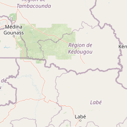
Map view of Niokolo-Koba National Park

Use this park location map to pinpoint Niokolo-Koba National Park in Senegal, understand its exact geographic position, and read its mapped placement within the surrounding landscape more clearly.

Pigeon | © OpenStreetMap contributors

Location context for Niokolo-Koba National Park

Kolda RegionTambacounda Region
Park atlas

Map Regional Protected Landscapes and Compare Conservation Areas Across Senegal and West Africa

Explore Other National Parks and Protected Areas Near Niokolo-Koba National Park, West Africa
After exploring Niokolo-Koba National Park, browse other national parks and protected areas located throughout Senegal and the wider West African region. Compare diverse savanna ecosystems, gallery forests, and critical wildlife habitats to understand the broader conservation landscape of Western Africa.
National parkGuinea

Badiar National Park: Guinea's Protected Landscape for Atlas Exploration

Explore its mapped geographic boundaries and regional terrain.

Badiar National Park is a key protected area situated in Guinea, contributing significantly to the country's conservation landscape. This page offers detailed geographic context, highlighting the park's mapped boundaries and its place within the regional atlas of West Africa. Discover the natural terrain and protected-area identity that define Badiar National Park, facilitating a comprehensive understanding for any geographic exploration.

Area
1,228 km²
Established
1985
IUCN
II
Climate
Tropical
National parkMali

Bafing National Park: Mali National Park Atlas and Protected Woodland Landscape

Explore the unique chimpanzee habitat and bird conservation within this West African savanna.

Bafing National Park is a cornerstone of conservation in Mali, recognized for its exclusive role in protecting chimpanzee populations within the Manding Plateau region. This extensive national park features a predominant woodland ecosystem interspersed with savanna areas, providing critical habitat for numerous bird species as designated by BirdLife International. Understanding Bafing National Park's mapped geography and protected landscape offers insight into vital primate and avian conservation efforts in West Africa.

Area
5,000 km²
Established
2000
IUCN
II
Relief
Upland
National parkMali

Kouroufing National Park: Mali's National Park with Defined Protected Landscape Boundaries

Explore the mapped geography and protected land context of Kouroufing National Park.

Kouroufing National Park is a significant protected area recognized as a national park within Mali. This entry focuses on its distinct geographic identity and mapped boundaries, essential for understanding its role in the regional atlas. Examine the park's protected landscape context and how it contributes to the natural geography of West Africa. This resource is tailored for users seeking detailed information on specific protected areas rather than broad travel advice.

Area
557 km²
Established
2002
Scope
Terrestrial
Water
No major water
Watercolor illustration of a river flowing through a landscape with trees, grassy areas, and distant hills under a soft sky
National parkCentral River Division

River Gambia National Park: National Park Geography and Protected Landscape Atlas

Discover mapped boundaries within Central River Division.

River Gambia National Park represents a key protected area within the Central River Division, offering specific geographic insights for atlas exploration. This page details the park's mapped boundaries and its role as a national park, providing a factual basis for understanding its landscape context and regional importance. Explore the geographic features that define this protected natural area.

Area
5.85 km²
Established
1978
IUCN
II
Relief
Lowland
Wildlife reserveGambia

Bao Bolong Wetland Reserve: West African Wildlife Reserve with Extensive Mangrove Ecosystems

Explore mapped terrain and crucial protected wetland boundaries.

Bao Bolong Wetland Reserve in Gambia is a significant protected area renowned for its ecological importance as a Ramsar wetland and Important Bird Area. This wildlife reserve features the tallest mangrove trees in the Senegambia region, transitioning through salt marshes to savanna, all centered around the Bao Bolong tributary's estuary. Its complex hydrological network and diverse habitats support 268 bird species and are crucial for the endangered West African manatee, offering a rich landscape for geographic and protected-area discovery.

Area
220 km²
Established
1996
IUCN
VI
Relief
Lowland
National parkGambia

Kiang West National Park: National Park Detail and Protected Landscape Geography

Explore mapped boundaries and regional context in The Gambia.

Kiang West National Park serves as a crucial point for understanding protected natural areas within The Gambia, West Africa. This national park's identity is rooted in its geographic setting along the Gambia River, offering a distinct landscape context and mapped territory. Users can explore its boundaries and place within the nation's conservation network, contributing to a structured understanding of regional geography and protected lands.

Area
115 km²
Established
1987
IUCN
II
Relief
Lowland
National parkKarene District

Outamba-Kilimi National Park: Sierra Leone National Park and Protected Landscape Atlas

Mapped natural terrain within Karene District.

Investigate Outamba-Kilimi National Park as a protected area, examining its geographic footprint and significance within Sierra Leone's natural landscapes. This detailed entry provides context on the park's mapped boundaries and its contribution to regional geography, serving as a key point for atlas-based exploration of conservation lands in the Karene District.

Area
1,109 km²
Established
1986
IUCN
II
Relief
Lowland
National parkFaranah Region

National Park of Upper Niger: Protected Landscape and Geographic Context in Faranah Region

Explore mapped boundaries and regional natural terrain.

National Park of Upper Niger is a key protected area within the Faranah Region of Guinea, providing a focal point for understanding regional geography and conservation landscapes. Its designation as a national park highlights its importance in the mapped atlas of protected territories. This page offers detailed insights into the park's geographic setting and its specific natural terrain, aiding exploration of Guinea's protected lands.

Area
6,000 km²
Established
1997
IUCN
II
Relief
Mixed relief

Common questions about visiting, size, designation, and location context for Niokolo-Koba National Park

Niokolo-Koba National Park FAQs for park facts, access, geography, and protected area context
Find quick answers about Niokolo-Koba National Park, including protected-area facts, park geography, trail and visitor context, and how the park fits into its surrounding country and regional landscape.
MoriAtlas Explorer

Continue Your Protected Areas Search Across the Global Atlas

Deepen your exploration by continuing the structured search for national parks and protected areas worldwide. Utilize the comprehensive filtering capabilities to compare different conservation landscapes and refine your understanding of global park geography. Discover more about the distribution and characteristics of protected natural areas.

Global natural geography