

Mori Atlas logo
Nature reserveNorthern Jaguar Reserve

Understanding the landscape mosaic and wild habitat corridors of this essential Mexican nature reserve.

Northern Jaguar Reserve: Mapping the Protected Foothills of the Sierra Madre Occidental in Sonora

Northern Jaguar Reserve serves as a vital protected landscape in the eastern foothills of the Sierra Madre Occidental, where the terrain shifts between rugged canyons and productive river valleys. Spanning the Aros and Bavispe drainage systems, this nature reserve maintains an intact bushland habitat that functions as a critical stronghold for wild cat populations. The geography provides an essential connection between mountain slopes and arid tropical forest, supporting a unique convergence of neotropical and North American wildlife species.

jaguar conservationwild catsdry tropical bushlandSierra Madre foothillsSonorabirdwatching

Northern Jaguar Reserve

Nature reserve

Park overview

Structured park overview, official facts, and landscape profile for Northern Jaguar Reserve

Northern Jaguar Reserve park facts, protected area profile, and essential visitor context

Review the core facts for Northern Jaguar Reserve, including designation, size, terrain, visitor scale, habitats, and operating context in one park-focused overview.

About Northern Jaguar Reserve

The Northern Jaguar Reserve is a privately managed protected area in northern Mexico, established to maintain a viable habitat for wild jaguars in a landscape where the species has been almost everywhere eliminated. The reserve occupies a remote, sparsely populated section of the Sonoran foothills of the Sierra Madre Occidental, between the Aros and Bavispe river systems, and functions as one of the most northerly refuges for the species anywhere in its historical range.

The reserve's identity is rooted in its role as a landscape-scale refuge rather than a small fenced enclosure. Covering roughly 222 square kilometers of connected bushland habitat, it offers jaguars the kind of room they need to roam, hunt, and reproduce. Large predators require extensive home ranges, and one of the reserve's most important contributions to jaguar recovery in the region is providing a continuous block of habitat without major roads, settlements, or agricultural barriers inside it.

Access remains deliberately difficult. The only road into the area is a rough dirt track that terminates within the reserve, which limits incidental human presence, poaching risk, and habitat disturbance. Combined with the very low local human population, this isolation factor is part of why the site was selected and why it remains ecologically functional as a wildlife sanctuary.

The vegetation of the reserve is dominated by bushland typical of the transition between the Sinaloan dry forests to the south and the more arid Sonoran uplands to the north, with vegetation patterns shaped by elevation, slope, and proximity to the two river drainages. The resulting mosaic creates dense cover for prey species, sheltered canyons, and travel corridors valued by jaguars.

Ecologically, the reserve sits within a broader region that has historically supported jaguars but has been heavily impacted by ranching, hunting pressure, and habitat conversion. By concentrating protection in a strategic foothill area between two major rivers, the reserve serves as both a local recovery site and a reference point for understanding how jaguar habitat in northern Mexico can persist in the modern era.

Quick facts and research context for Northern Jaguar Reserve

The Northern Jaguar Reserve is located in the Mexican state of Sonora, in the foothills of the Sierra Madre Occidental between the Aros and Bavispe river valleys. It is classified as a private nature reserve rather than a federal or state park, and its central management purpose is the protection of the northernmost wild jaguar population in the Americas.

The protected area covers approximately 222 square kilometers of bushland habitat on slopes and valley bottoms. Human presence within the reserve is extremely limited, and the site is reached only by a single unpaved track, factors that are central to its conservation value as a secure refuge for wide-ranging predators.

Protection and recognition

Examining terrestrial protected area designation and international records

Northern Jaguar Reserve Protection Status and Management Scope Facts

Northern Jaguar Reserve holds a documented terrestrial protection status within its regional conservation landscape. Structured facts outline available designation records and management scope details for geographic analysis.

Protection details

Protection scope
Terrestrial
Park context

Deeper park guide and search-rich context for Northern Jaguar Reserve

Northern Jaguar Reserve history, landscape, wildlife, and travel context

Explore Northern Jaguar Reserve through its history, landscape character, ecosystems, wildlife, conservation priorities, cultural context, and seasonal travel timing in a structured park guide built for atlas discovery and search intent.

Why Northern Jaguar Reserve stands out

The Northern Jaguar Reserve is best known as a stronghold for the northernmost surviving population of wild jaguars, a subspecies-level population that lives far north of the species' typical tropical range. It is one of the very few places in Sonora, and indeed in the entire borderlands region between Mexico and the United States, where breeding jaguars are still documented. The reserve is also distinguished by the unusual coexistence of four wild cat species, including jaguar, puma, bobcat, and ocelot, supported by healthy populations of prey such as white-tailed deer and javelina. Its birdlife adds another layer of identity, blending neotropical species like the military macaw with North American species such as the bald eagle, which reaches the southern limit of its range in this part of the Sierra Madre.

Northern Jaguar Reserve landscape and geographic character

The Northern Jaguar Reserve occupies a transitional landscape between mountains and arid valleys in the eastern foothills of the Sierra Madre Occidental. The reserve sits between the Aros River and the Bavispe River, two drainage systems that shape the topography, vegetation distribution, and movement corridors for wildlife within the protected area.

The terrain is a mix of slopes, canyons, and valley bottoms, with vegetation dominated by bushland that ties together the rocky uplands and the richer riparian influence closer to the river systems. Elevation changes across the reserve produce subtle shifts in plant communities, giving the landscape a mosaic quality rather than a uniform cover type. The combination of rugged topography, low human density, and intact vegetation produces conditions favorable for species that depend on cover and on relatively undisturbed travel routes.

Because the reserve lies just south of the region where the more arid Sonoran Desert intensifies to the north, the bushland habitat here represents one of the more productive foothill expressions of the dry tropical forest systems that extend southward into Sinaloa. The landscape therefore reads as a green-and-gold forested slope interrupted by river-cut valleys, rather than as the open desert that dominates much of northern Sonora.

Northern Jaguar Reserve ecosystems, habitats, and plant life

The vegetation of the reserve is broadly classified as bushland, a category encompassing low forest, scrub, and shrubs that fill the slopes and valleys between the two bounding river systems. This bushland functions as the structural backbone of the ecosystem, providing food for herbivores, shelter for predators, and nesting habitat for the many bird species recorded on site.

A defining ecological feature of the reserve is the way its location between two river drainages produces a gradient of moisture and vegetation density. Canyons and valley bottoms closer to the Aros and Bavispe rivers support denser growth, while the intervening slopes carry more open bushland consistent with the regional dry tropics. The result is an interconnected habitat mosaic in which wildlife can move between denser vegetation for resting and feeding and more open terrain for travel.

The combination of low human pressure, intact bushland, and continuity with surrounding landscapes makes the reserve unusually valuable as a dryland habitat block. It is not a single specialized ecosystem but rather a working example of the foothills ecosystem that historically extended across much of the Sierra Madre borderlands.

Northern Jaguar Reserve wildlife and species highlights

The Northern Jaguar Reserve is most notable for its population of jaguars, the species for which the reserve was established and around which its management is centered. The reserve is considered one of the most important sites in Mexico for the survival of northern jaguars, a population that lives far north of the species' typical tropical range.

In addition to jaguars, the reserve hosts three other wild cat species: puma, bobcat, and ocelot. This coexistence of four felids in a single protected area in the northern dry tropics is itself a measure of how intact the food web remains. The presence of these predators is supported by healthy populations of ungulate and peccary prey, particularly white-tailed deer and javelina, which form the main prey base for the larger cats.

The reserve is also recognized for its rich birdlife, with 215 recorded species reflecting the area's position at the transition between major biogeographic regions. Neotropical species reach their northern range edges here, exemplified by the military macaw, while North American species such as the bald eagle find the southern limit of their range in these same foothills. This overlap gives the reserve an unusually distinctive bird community that combines tropical and temperate elements.

Northern Jaguar Reserve conservation status and protection priorities

The Northern Jaguar Reserve exists primarily to protect the northernmost population of wild jaguars, a conservation goal of regional and continental significance because jaguars have largely disappeared from the northernmost portions of their historical range, including most of the southwestern United States and large parts of northern Mexico. Maintaining a breeding population in Sonora is therefore considered a key element of any long-term strategy for jaguar recovery further north.

The 222 square kilometer reserve provides jaguars with the kind of broad habitat block these wide-ranging predators need for territory establishment, hunting, and reproduction. By securing a continuous area between the Aros and Bavispe rivers, the reserve reduces the fragmentation that has affected predator habitat elsewhere in the region and offers a refuge where large cats can coexist with healthy prey populations.

Beyond its flagship focus on jaguars, the reserve contributes to broader arid-tropics conservation by maintaining populations of three additional cat species and a rich neotropical-North American bird community overlap. The extremely low human density, the absence of major roads, and the dead-end nature of the access track all serve to limit direct human pressures on wildlife, allowing the reserve to function as a relatively undisturbed habitat island in an otherwise heavily used region.

Top sights and standout views in Northern Jaguar Reserve

Four wild cat species in a single protected area: jaguar, puma, bobcat, and ocelot, all supported by healthy populations of white-tailed deer and javelina.

A clearly defined habitat block for northern jaguars, located between the Aros and Bavispe river valleys in the eastern foothills of the Sierra Madre Occidental, in one of the most remote parts of Sonora.

A 215-species bird community that bridges two biogeographic worlds, with neotropical species like the military macaw sharing habitat with North American species such as the bald eagle at the southern edge of its range.
Monthly climate preview

Long-term representative monthly temperature and precipitation data for Sonora

Northern Jaguar Reserve Climate Normals and Annual Weather Patterns

Representative coordinate measurements record annual temperature swings alongside distinct monthly precipitation variations across Northern Jaguar Reserve. Detailed weather by month profiles and extended climate metrics provide complete analytical depth for conservation research.
Annual mean22 °C
13 °C30 °C
Jan13°
Feb15°
Mar18°
Apr21°
May25°
Jun30°
Jul28°
Aug27°
Sep27°
Oct23°
Nov18°
Dec13°
Warmest month
June

30 °C

Coolest month
December

13.3 °C

Wettest month
July

4.7 mm/day

Driest month
April

0.1 mm/day

Park location guide

Geography guide, regional context, and park location map for Northern Jaguar Reserve

Northern Jaguar Reserve park geography, regions, and map view in Mexico

Understand where Northern Jaguar Reserve sits in Mexico through a broader geographic reading of the surrounding landscape, nearby location context, and its mapped position within the national park landscape.

How Northern Jaguar Reserve fits into Mexico

Mexico, officially the United Mexican States, is a country in North America spanning the Sierra Madre mountain ranges, coastal plains, and tropical regions. It borders the United States to the north, Guatemala and Belize to the southeast, and has coastlines along the Pacific Ocean, Gulf of Mexico, and Caribbean Sea. With a population exceeding 130 million, Mexico is home to one of the world's most significant concentrations of Indigenous languages alongside Spanish.

Wider geography shaping Northern Jaguar Reserve in Mexico

Mexico occupies a land area of 1,972,550 km2, making it the thirteenth-largest country in the world. The terrain is highly diverse, featuring the Sierra Madre Occidental and Sierra Madre Oriental mountain ranges, the Mexican Plateau, coastal lowlands along the Pacific and Gulf/Caribbean margins, and the Yucatan Peninsula. The country spans multiple climate zones from desert in the north to tropical rainforest in the south.

Map view of Northern Jaguar Reserve

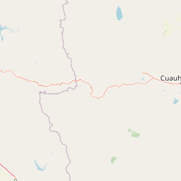
Use this park location map to pinpoint Northern Jaguar Reserve in Mexico, understand its exact geographic position, and read its mapped placement within the surrounding landscape more clearly.

Pigeon | © OpenStreetMap contributors

Location context for Northern Jaguar Reserve

Sonora
Park atlas

Compare regional park geography, connected wildlife corridors, and neighboring protected landscapes.

Explore Parks Near Northern Jaguar Reserve and Surrounding Protected Areas

Browsing other protected areas near Northern Jaguar Reserve reveals the broader ecological continuity of the Sierra Madre foothills and arid river valleys. Comparing these regional wildlands helps place individual conservation strongholds into a wider geographical context.
Wildlife reserveChihuahua
About 77 km away#1 closest

Northeast

Campo Verde Flora and Fauna Protection Area: Atlas and Landscape Discovery in Chihuahua

A significant wildlife reserve in the Sierra Madre Occidental

Spanning the transition from high montane forests to semi arid desert, Campo Verde Flora and Fauna Protection Area represents a core component of Mexico's northern conservation network. Documented for its endemic flora and fauna, this wildlife reserve provides a rare look at the ecological mosaic of the Sierra Madre Occidental region.

Area
1,080.67 km²
Established
1938
IUCN
VI
Relief
Mountain
Wildlife reserveSonora
About 135 km away#2 closest

Northwest

Bavispe Flora and Fauna Protection Area: Sierra Madre Occidental Mountain Geography

Mapped protected forest tracts across Sonora ranges

Spanning five distinct mountain tracts in Sonora, this wildlife reserve preserves rare pine-oak forest communities within the Sierra Madre Occidental. Learn how these ridges and basins act as a vital hydrological anchor for the Yaqui River and provide critical corridors for wildlife through the diverse, transition-heavy terrain of northern Mexico.

Area
2,009 km²
Established
1936
IUCN
VI
Relief
Mountain
Wildlife reserveChihuahua
About 141 km away#3 closest

Southeast

Tutuaca Flora and Fauna Protection Area: Sierra Madre Occidental Mountain Conservation Reserve

Expansive pine-oak forest habitat in Chihuahua, Mexico

Covering over 4,000 square kilometers, the Tutuaca Flora and Fauna Protection Area acts as a critical link in the Sierra Madre Occidental mountain spine. This wildlife reserve preserves dense pine-oak woodlands, rugged canyons, and high-elevation watersheds that characterize the biodiversity of northwestern Mexico. The area plays a vital role in sustainable resource management and habitat connectivity between Chihuahua and neighboring regions.

Area
4,369.86 km²
Established
2001
IUCN
VI
Relief
Mountain
National parkOcampo Municipality
About 173 km away#4 closest

Southeast

Basaseachic Falls National Park: National Park Geography and Mapped Boundaries

Explore protected lands within Ocampo Municipality.

Basaseachic Falls National Park serves as a key protected area within Ocampo Municipality, Mexico. This page provides detailed geographic information and mapped boundaries, essential for understanding its landscape context and its significance as a national park. Dive into the atlas-style data to appreciate the park's protected terrain and its contribution to the regional geography, offering a factual discovery experience.

Area
58.03 km²
Established
1981
IUCN
II
Relief
Mountain
Wildlife reserveChihuahua
About 192 km away#5 closest

Southeast

Papigochic Flora and Fauna Protection Area: Sierra Madre Occidental Forest Geography

An expansive mountain wildlife reserve in Chihuahua, Mexico.

Spanning over 2,200 square kilometers, this reserve preserves vital pine and oak forest ecosystems in the Sierra Tarahumara. The area is defined by its deep canyons, high-elevation forested ridgelines, and important role in safeguarding temperate montane habitats within northwestern Mexico.

Area
2,227.64 km²
Established
2003
IUCN
VI
Relief
Mountain
National parkChihuahua
About 271 km away#6 closest

East

Cumbres de Majalca National Park: National Park Discovery and Geographic Context in Chihuahua

Mapped protected landscape exploration in Chihuahua.

Delve into the protected landscape of Cumbres de Majalca National Park, a national park situated in the Chihuahua region of Mexico. This entry provides essential geographic context and details on its mapped boundaries, serving as a key point for atlas-based exploration of Mexico's protected areas. Understand its specific contribution to the regional geography and conservation landscape.

Area
47.72 km²
Established
1939
IUCN
II
Relief
Mountain
Protected areaSonora
About 282 km away#7 closest

South

Área de protección de flora y fauna Sierra de Álamos-Río Cuchujaqui: Geography and Park Boundaries

Detailed atlas view of the Sonora biodiversity enclave and canyon systems.

Spanning over 92,000 hectares in Sonora, this protected area is defined by its dramatic transition from coastal plains to the Sierra Madre range. The geography centers on the deep, moisture-trapping barrancas of the Cuchujaqui River, which sustain a rare mixture of Neotropical and temperate species. Examine the structural complexity of these forested slopes and river-carved valleys that function as a essential habitat for large predators and diverse flora alike.

Area
928.9 km²
Established
1996
A minimalist watercolor painting showing rolling green and yellow hills against a soft, light-colored background.
Wildlife reserveChihuahua
About 286 km away#8 closest

Northeast

Médanos de Samalayuca: Protected Silica Sand Dune Landscapes in Northern Chihuahua

A dynamic desert wildlife reserve and arid natural ecosystem

Located in northern Chihuahua, Médanos de Samalayuca is a protected wildlife reserve centered on a massive, shifting field of fine white silica sand. This desert landscape offers a stark contrast to the surrounding scrublands, providing an essential look at the geological forces and climatic extremes that shape the arid environments of the Chihuahuan Desert.

Area
631.82 km²
Established
2009
Relief
Lowland
Climate
Arid

Common questions about visiting, size, designation, and location context for Northern Jaguar Reserve

Northern Jaguar Reserve FAQs for park facts, access, geography, and protected area context

Find quick answers about Northern Jaguar Reserve, including protected-area facts, park geography, trail and visitor context, and how the park fits into its surrounding country and regional landscape.
MoriAtlas Explorer

Continue Your Protected Areas Search Across the Global Atlas

Deepen your exploration by continuing the structured search for national parks and protected areas worldwide. Utilize the comprehensive filtering capabilities to compare different conservation landscapes and refine your understanding of global park geography. Discover more about the distribution and characteristics of protected natural areas.

Global natural geography