Mori Atlas logo
State or regional parkNwanedi Provincial Park

Mapping the riverine landscapes and valley terrain of this South African protected area

Nwanedi Provincial Park: Geographic Atlas of Protected Woodlands and Mountain Foothills in Limpopo

Nwanedi Provincial Park stands as a protected sanctuary within the wooded foothills of the Soutpansberg range in northern Limpopo. This reserve encompasses a distinctive lowveld landscape defined by the confluence of the Nwanedi and Luphephe Rivers, where twin dams create essential water habitats amidst rocky ridges and dense forest. The terrain transitions from high-elevation summits to riparian bushveld, providing a complex ecological structure for regional wildlife and bird populations.

lowveldsoutpansbergriverine foresttwins damswildlife reservewhite rhino

Nwanedi Provincial Park

State or regional park

Park overview

Structured park overview, official facts, and landscape profile for Nwanedi Provincial Park

Nwanedi Provincial Park park facts, protected area profile, and essential visitor context

Review the core facts for Nwanedi Provincial Park, including designation, size, terrain, visitor scale, habitats, and operating context in one park-focused overview.

About Nwanedi Provincial Park

Nwanedi Provincial Park occupies a privileged position in northern Limpopo, tucked between the Soutpansberg and the broader lowveld plains that stretch toward Kruger National Park. Although it is smaller than its famous neighbor to the east, it has a more varied physical setting, with mountain foothills, valleys, rivers, and dams all packed into a compact reserve. The result is a landscape where cliffs, forests, and water meet, providing a range of habitats uncommon in any single protected area of comparable size.

At the heart of the park is the confluence of the Nwanedi and Luphephe Rivers. The two dams built along these rivers, the Nwanedi Dam and the Luphephe Dam, shape the reserve's visual character and act as central focal points for both wildlife and visitors. The valleys upstream of the dams are framed by wooded ridges, while the lower elevations open into bushveld plains typical of the Limpopo lowveld. Hidden within the reserve is the Tshihovhohovho Falls, a waterfall that has long been regarded as one of the park's lesser-known natural attractions.

The reserve falls within the broader cultural and ecological context of the Soutpansberg. To the north, the Soutpansberg is traditionally the territory of the Venda people, whose presence enriches the regional identity of the park. Ecologically, the Soutpansberg is a recognized center of plant diversity, and the park shares in this richness. Together, these qualities make Nwanedi a reserve where mountain scenery, wooded valleys, water, wildlife, and cultural geography intersect in a relatively small footprint.

Quick facts and research context for Nwanedi Provincial Park

Nwanedi Provincial Park lies in Limpopo, South Africa's northernmost province, about 20 kilometers east of Tshipise and 35 kilometers north of Thohoyandou. It sits to the west of Kruger National Park, in the wooded foothills of the Soutpansberg Range, sometimes called the mountain of salt in local tradition. The reserve covers approximately 11,170 hectares, built around the confluence of the Nwanedi River and the Luphephe River, where the twin Nwanedi and Luphephe Dams form a central hub. The park is managed by the Limpopo Tourism and Parks Board and serves as both a nature reserve and a regional recreation destination, with the Nwanedi Luphephe resort located within its boundaries.

Protection and recognition

Documented terrestrial protection scope and recognized management framework

Nwanedi Provincial Park Protection Status and Conservation Records

Nwanedi Provincial Park maintains a documented terrestrial protection scope within its regional landscape. Recorded administrative facts outline the established conservation framework without international designations.

Protection details

Protection scope
Terrestrial
Transboundary protection
No
Park context

Deeper park guide and search-rich context for Nwanedi Provincial Park

Nwanedi Provincial Park history, landscape, wildlife, and travel context

Explore Nwanedi Provincial Park through its history, landscape character, ecosystems, wildlife, conservation priorities, cultural context, and seasonal travel timing in a structured park guide built for atlas discovery and search intent.

Why Nwanedi Provincial Park stands out

Nwanedi Provincial Park is best known for its confluence setting at the meeting of the Nwanedi and Luphephe Rivers, the pair of dams that fill this valley, and the surrounding lowveld stretches that support white rhino. It is also recognized for the dramatic Tshihovhohovho Falls and for the mixture of Soutpansberg foothills, riverine woodland, and open lowveld that produces a notably varied wildlife habitat. Birdwatching along the rocky ridgelines and the presence of rare plant species, including twelve types of acacia and ancient tree ferns, add to the reserve's distinct profile.
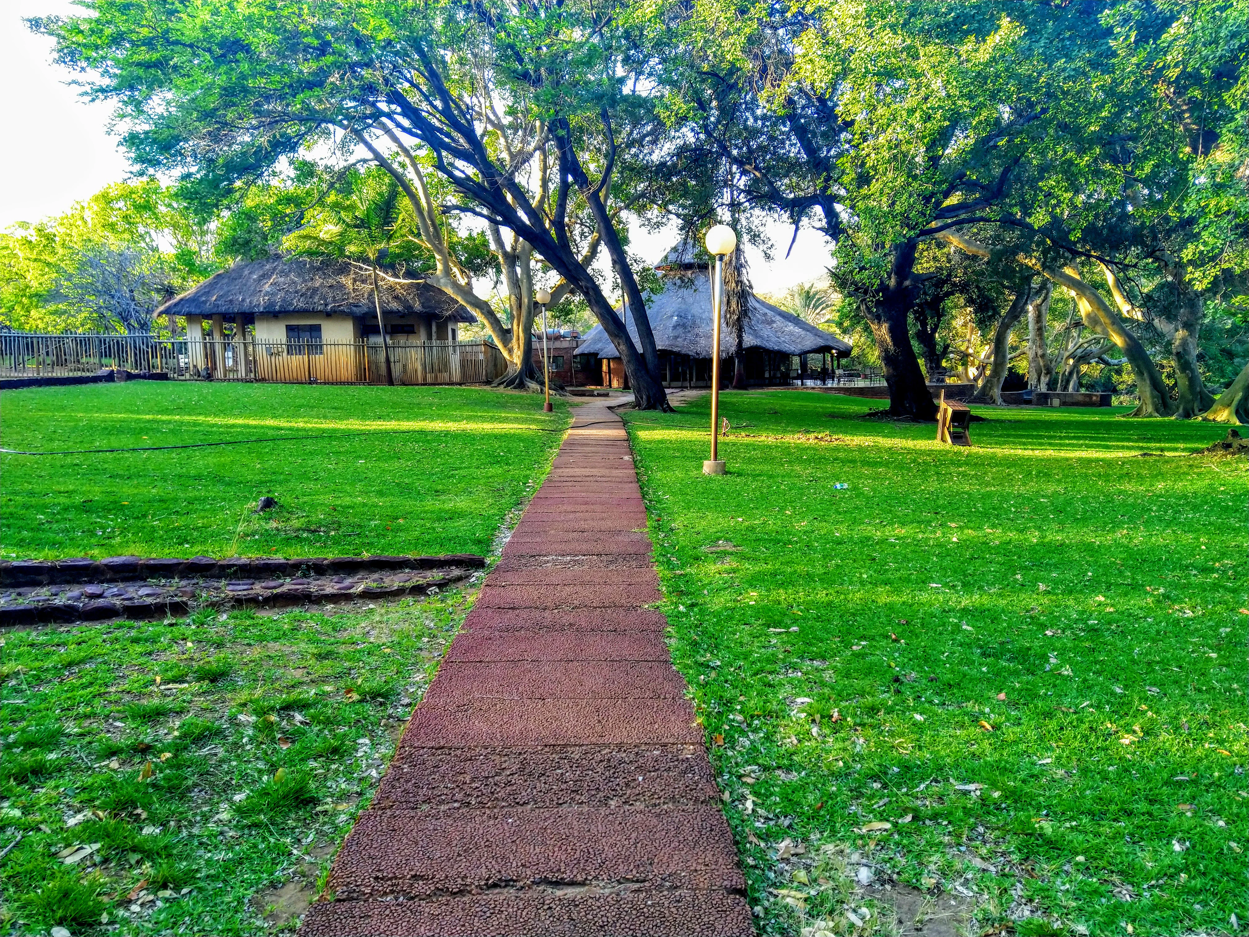
A paved walkway extends through a green lawn shaded by large trees, leading to thatched-roof resort buildings.
A paved pathway leads through a grassy, tree-shaded area toward thatched-roof resort buildings at Nwanedi and Luphephe.

Nwanedi Provincial Park landscape and geographic character

The defining landscape feature of Nwanedi Provincial Park is its location in the wooded foothills of the Soutpansberg, a range whose name reflects the historic importance of salt in the region. The terrain rises from lowveld plains along the rivers into broken ridges and rocky summits, producing a layered scenery where forested slopes give way to cliff faces and then to gentler bushveld downstream.

Water shapes much of the park's geography. The Nwanedi River and its tributary, the Luphephe River, meet within the reserve, and their waters are held back by the twin Nwanedi and Luphephe Dams. These dams create broad reflective surfaces framed by hills and woodland, forming the visual and ecological core of the protected area. Above the dams, the Tshihovhohovho Falls add a vertical element to the scenery, while below, the river systems continue to carve paths through the foothills.

Nwanedi Provincial Park ecosystems, habitats, and plant life

The park's natural character is defined by the meeting of two major habitats: Soutpansberg mountain woodland and Limpopo lowveld bushveld. This combination supports a wide variety of plant communities, from riverine forest along the dams to more open, drier vegetation in the lowveld zone. The Soutpansberg as a whole is renowned for its plant richness, and Nwanedi benefits from this diversity within its own borders.

Vegetation includes yellowwood trees, twelve species of acacia, including the conspicuous fever trees, alongside giant cabbage trees, proteas, and ancient tree ferns that lend the forested sections a primeval quality. The rocky summits and cliffs harbor specialized plant communities and provide sheltered niches for birds and small wildlife. Together, these features give the reserve an ecological profile that is unusually compact but botanically distinctive.

Nwanedi Provincial Park wildlife and species highlights

Nwanedi Provincial Park is well stocked with game, and its lowveld zone is home to a notable population of white rhino, one of the reserve's headline wildlife attractions. This rhino population gives the park real conservation weight, placing it among the smaller protected areas in northern South Africa that still retain megafauna.

Beyond rhino, the park supports a broader community of lowveld mammals typical of the Limpopo region, with the wooded ridges and dams providing varied habitat for browsing and grazing species. The reserve is also a productive birding area. The rocky summits of the Soutpansberg foothills act as a refuge for birds of prey, while the dams, riverine forest, and mixed woodland host a wide range of other birdlife, making the park appealing to visitors interested in both large mammal and bird sightings.

Nwanedi Provincial Park conservation status and protection priorities

As a protected area within Limpopo, Nwanedi Provincial Park contributes to the patchwork of state-managed reserves that conserve northern South Africa's lowveld and mountain foothill ecosystems. Its value lies largely in its position at a transitional zone between the Soutpansberg and the broader lowveld, a setting that helps maintain ecological connectivity with the larger Kruger National Park complex to the east.

The presence of a viable white rhino population in the lowveld zone is one of the reserve's most significant conservation contributions, particularly given the ongoing pressures on rhino populations elsewhere in southern Africa. Protection of the Nwanedi and Luphephe river systems and their associated dams also safeguards aquatic and riparian habitats that support a wide range of dependent species. Managed by the Limpopo Tourism and Parks Board, the reserve plays a regional role in maintaining habitat, wildlife populations, and ecological corridors in this northern corner of South Africa.

Nwanedi Provincial Park cultural meaning and human context

The park lies at the edge of the Soutpansberg, known in local tradition as Tha vhani ya muno, or mountain of salt, a name that reflects both the geology and the long-standing cultural importance of the range. This traditional name, rooted in the Venda language, signals the area's deep indigenous heritage. The Soutpansberg has historically been the traditional home of the Venda people, and their cultural presence continues to shape the identity of the region around the park.

The Venda heritage is visible in place names, oral traditions, and the wider cultural landscape of northern Limpopo, of which Nwanedi forms a part. While the park itself is a natural reserve, its mountain setting and proximity to longstanding Venda communities give it an additional layer of cultural significance that connects ecological value with regional identity.

Top sights and standout views in Nwanedi Provincial Park

The twin Nwanedi and Luphephe Dams at the confluence of two rivers form the scenic and ecological centerpiece of the reserve. The wooded foothills of the Soutpansberg give the park a dramatic mountain backdrop rarely found in lowveld reserves of its size. The Tshihovhohovho Falls offer one of the park's less widely known but distinctive natural features.

Best time to visit Nwanedi Provincial Park

The park's setting straddles both lowveld and foothill environments, meaning seasonal conditions can shift the atmosphere considerably. The cooler, dry months of the southern African winter generally bring clearer skies, easier wildlife viewing along the dams and open areas, and more comfortable conditions for walking the surrounding terrain. By contrast, the warmer and wetter summer months bring lusher vegetation and active birdlife, with the dams and riverine zones becoming especially appealing for waterbirds and forest species.

Monthly climate preview

Long-term monthly averages for temperature and precipitation patterns

Nwanedi Provincial Park Climate Normals and Annual Temperature Rhythm

Representative coordinate records show measured variations in monthly temperature and precipitation normals across the year at Nwanedi Provincial Park. Reviewing the complete twelve-month dataset provides a detailed baseline for analyzing regional weather patterns and seasonal shifts.
Annual mean23 °C
18 °C27 °C
Jan27°
Feb26°
Mar25°
Apr23°
May21°
Jun18°
Jul18°
Aug20°
Sep23°
Oct25°
Nov26°
Dec27°
Warmest month
December

26.9 °C

Coolest month
July

17.5 °C

Wettest month
January

3.3 mm/day

Driest month
August

0.2 mm/day

Park location guide

Geography guide, regional context, and park location map for Nwanedi Provincial Park

Nwanedi Provincial Park park geography, regions, and map view in South Africa

Understand where Nwanedi Provincial Park sits in South Africa through a broader geographic reading of the surrounding landscape, nearby location context, and its mapped position within the national park landscape.

How Nwanedi Provincial Park fits into South Africa

South Africa is the southernmost country in Africa, spanning 1.22 million km² with a population of over 63 million. The country operates with three capital cities, Pretoria (executive), Cape Town (legislative), and Bloemfontein (judicial), and is renowned for its biodiversity, national parks, and multicultural society.

Wider geography shaping Nwanedi Provincial Park in South Africa

South Africa occupies the southernmost region of Africa, with coastline along both the Atlantic Ocean to the west and the Indian Ocean to the east. The interior features elevated plateaus including the Highveld, with the Drakensberg escarpment marking the eastern highlands. The country shares borders with Namibia, Botswana, Zimbabwe, Mozambique, Eswatini, and Lesotho.

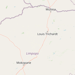
Map view of Nwanedi Provincial Park

Use this park location map to pinpoint Nwanedi Provincial Park in South Africa, understand its exact geographic position, and read its mapped placement within the surrounding landscape more clearly.

Pigeon | © OpenStreetMap contributors

Location context for Nwanedi Provincial Park

Limpopo

Visualizing the terrain, river confluences, and protected habitats of the Soutpansberg foothills

Nwanedi Provincial Park Landscape and Scenery Photography

Visual records capture the distinctive lowveld terrain, wooded ridges, and river confluences that define Nwanedi Provincial Park. Photographic collections reveal the protected landscapes, wetland habitats, and mountain backdrops characteristic of the Limpopo reserve.

A paved walkway extends through a green lawn shaded by large trees, leading to thatched-roof resort buildings.

Park atlas

Compare adjacent lowveld reserves and mountain foothill sanctuaries across the region

Parks Near Nwanedi Provincial Park and Surrounding Regional Protected Areas

Browse other parks near Nwanedi Provincial Park to examine similar lowveld terrain, river confluences, and protected mountain habitats. Expanding the geographic comparison reveals broader ecological patterns across the surrounding regional protected areas.
National parkSouth Africa
About 51 km away#1 closest

Southeast

Kruger National Park: South Africa's Iconic National Park for Geographic Discovery

Explore savanna landscapes and mapped protected area boundaries.

Kruger National Park serves as a paramount example of a protected landscape, offering a rich tapestry of savanna ecosystems and varied terrain across South Africa's Lowveld. This canonical entry details its vast geographic scope, approximately 19,623 square kilometres, and its status as the nation's first national park. Understand the park's environmental context, from the Lebombo Mountains to the Limpopo River, and its integral role within larger transfrontier conservation initiatives, providing critical insight for atlas-based geographic exploration.

Area
19,623 km²
Established
1926
IUCN
II
Visitors
1.7M annual
National parkMozambique
About 96 km away#2 closest

Southeast

Limpopo National Park: Mozambique's Savanna Ecosystem and Protected Landscape

Explore its mapped boundaries and transfrontier park significance.

Limpopo National Park is a protected national park in Mozambique, distinguished by its savanna ecosystem and its critical role as the eastern segment of the Great Limpopo Transfrontier Park. This page offers an atlas-driven exploration of its geographic scope, mapped protected area boundaries, and its function as a key wildlife migration corridor, providing essential context for understanding this significant conservation landscape.

Area
10,000 km²
Established
2002
IUCN
II
Relief
Lowland
Watercolor illustration of a savanna landscape with scattered trees and rock formations
National parkLimpopo
About 100 km away#3 closest

West

Mapungubwe National Park: National Park with Rich Iron Age Archaeology and Savanna Landscapes

Explore Limpopo's unique protected area at the three-nation border.

Mapungubwe National Park is a vital protected area in South Africa's Limpopo region, renowned for its dual significance as a major archaeological site and a diverse natural landscape. This national park protects a significant portion of savanna ecosystems, including unique riparian forests and mopane woodlands, surrounding the historic Mapungubwe Hill. As part of the Greater Mapungubwe Transfrontier Conservation Area, it plays a crucial role in regional conservation, offering a distinct geographic perspective at the confluence of South Africa, Botswana, and Zimbabwe, and serving as a focal point for atlas-based discovery of protected lands.

Area
280 km²
Established
1998
IUCN
II
Relief
Lowland
Wildlife reserveLimpopo
About 131 km away#4 closest

West

Mapesu Private Game Reserve: Atlas of Protected Landscapes and Savannah Geography

Limpopo Province, South Africa Wildlife Reserve

Mapesu Private Game Reserve serves as a significant conservation entity in South Africa, defined by undulating mopane plains and rocky outcrops. The reserve functions as an ecological extension of the neighbouring Mapungubwe World Heritage Site, safeguarding a mosaic of thirteen distinct plant communities and supporting a rich variety of mammal and avian populations in a remote, protected bushveld setting.

Area
125 km²
Established
2014
Relief
Upland
Climate
Subtropical
Protected areaSouth Africa
About 136 km away#5 closest

Northwest

Greater Mapungubwe Transfrontier Conservation Area: A Transboundary Protected Landscape in South Africa

Mapped savanna ecosystems and rich cultural heritage at the Limpopo River confluence.

The Greater Mapungubwe Transfrontier Conservation Area, situated in South Africa, stands as a remarkable example of collaborative conservation across national borders. This protected area protects diverse savanna landscapes, particularly around the confluence of the Shashe and Limpopo Rivers, and holds immense cultural value as home to the Mapungubwe Cultural Landscape, a UNESCO World Heritage Site. By examining its mapped geography and protected area status, users gain insight into the ecological corridors vital for wildlife and the ancient archaeological heritage preserved within this significant transfrontier initiative.

Area
4,872 km²
Established
2009
IUCN
VI
Relief
Upland
Nature reserveLimpopo Province
About 140 km away#6 closest

West

Blouberg Nature Reserve: Geographic Map and Protected Landscape Overview in Limpopo, South Africa

Tracing the savanna and mountain transition zones of a northern protected area

Blouberg Nature Reserve offers a distinctive look at the Limpopo landscape, encompassing steep sandstone cliffs, old-growth mountain forest patches, and open baobab-studded plains. This protected area stands as a focal point for understanding the ecological transition between the Soutpansberg range and the Limpopo lowveld. Use this atlas resource to understand the park's internal topography, its specific habitat boundaries, and its regional position as a significant node for raptor conservation in southern Africa.

Area
93.6 km²
Established
1990
Relief
Mountain
Climate
Subtropical
Protected areaLimpopo
About 160 km away#7 closest

South

Wolkberg Wilderness Area: Protected Mountain Geography and Quartzite Ridge Landscapes

Mapping the diverse Afromontane ecosystems of the Limpopo escarpment

Wolkberg Wilderness Area protects a high-altitude transition zone in South Africa, where quartzite massifs rise sharply above the surrounding plains. This reserve features a rugged, low-infrastructure environment defined by mist-influenced forests, clean mountain rivers, and steep boulder slopes. Analyze the geographic boundaries and terrain features that make this reserve a critical sanctuary for regional bird species and forest-loving plant communities.

Area
220 km²
Established
1977
Relief
Mountain
Climate
Subtropical
National parkMasvingo Province
About 169 km away#8 closest

Northeast

Gonarezhou National Park: National Park Protected Landscape in Masvingo Province

Explore mapped boundaries and regional geography

Gonarezhou National Park represents a significant protected area within the geography of Masvingo Province, Zimbabwe. This page details its specific mapped boundaries and landscape context, offering a focused view for atlas-based exploration. Understand the park's natural terrain and its positioning within the regional protected lands for comprehensive geographic discovery.

Area
5,053 km²
Established
1975
IUCN
II
Relief
Mixed relief

Common questions about visiting, size, designation, and location context for Nwanedi Provincial Park

Nwanedi Provincial Park FAQs for park facts, access, geography, and protected area context

Find quick answers about Nwanedi Provincial Park, including protected-area facts, park geography, trail and visitor context, and how the park fits into its surrounding country and regional landscape.
MoriAtlas Explorer

Continue Your Protected Areas Search Across the Global Atlas

Deepen your exploration by continuing the structured search for national parks and protected areas worldwide. Utilize the comprehensive filtering capabilities to compare different conservation landscapes and refine your understanding of global park geography. Discover more about the distribution and characteristics of protected natural areas.

Global natural geography