Mori Atlas logo
National parkNyika National Park

Discover the geographic context and mapped boundaries of this key protected area in Malawi.

Nyika National Park: Malawi's Protected Landscape and National Park Atlas Entry

Nyika National Park stands as a significant protected area within Malawi, offering a unique focal point for geographic exploration and atlas-based discovery. This page details the park's identity as a national park, providing a contextual understanding of its mapped landscape and protected land status within southeastern Africa. Engage with the geographic features that define this natural entity and its place in the broader conservation atlas.

afromontane grasslandmontane wildlifeorchid floraleopard habitathighland plateauMiombo woodland

Nyika National Park

National park

Park overview

Structured park overview, official facts, and landscape profile for Nyika National Park

Nyika National Park park facts, protected area profile, and essential visitor context

Review the core facts for Nyika National Park, including designation, size, terrain, visitor scale, habitats, and operating context in one park-focused overview.

About Nyika National Park

Nyika National Park represents Malawi's flagship protected area and one of the most extensive high-altitude conservation spaces in southeastern Africa. The park encompasses virtually the entire Nyika Plateau, a vast upland area that rises dramatically above the surrounding lowland landscapes of northern Malawi. The plateau's elevation creates a distinct ecological character, generating higher rainfall than the surrounding regions and supporting ecosystems more typical of East African highlands than of the Miombo woodlands that dominate lower elevations in the region. The park's isolation has been both a challenge and a blessing: access is limited to a single winding dirt road that climbs the southwestern escarpment, but this relative inaccessibility has helped preserve the area's wilderness character. The park headquarters at Chelinda sits near the center of the plateau, serving as the main hub for visitors exploring this remote destination. The park shares an international boundary with Zambia, where a smaller 80-square-kilometer portion of the Nyika continues across the border. Management of the Malawian side has improved in recent years with upgraded facilities including the refurbishment of Chelinda Camp and construction of new lodge accommodations, while an airstrip enables fly-in safari access for those unwilling to undertake the lengthy overland journey.

Quick facts and research context for Nyika National Park

Nyika National Park occupies virtually the entire Nyika Plateau in northern Malawi, making it the country's largest protected area at roughly 3,200 square kilometers. The park was formally established in 1966 with a significant extension added in 1978. The plateau sits at high elevation and frequently experiences cloud cover and dense morning fogs known as Chiperoni, particularly during the cold dry season. The park contains over 200 orchid species and supports more than 400 recorded bird species. Notable wildlife includes elephants, leopards (reportedly at high density for Central Africa), eland, roan antelope, zebra, and recently reintroduced lion populations. The park features dramatic scenery including the Chisanga Falls, miombo woodland on lower slopes, and extensive montane grassland ecosystems.

Protection and recognition

Exploring the terrestrial boundaries and international conservation framework of the reserve

Nyika National Park Protection Status and Protected Area Designation

Established in 1966 as a terrestrial protected area, Nyika National Park spans a unique transboundary highland landscape requiring coordinated cross-border oversight. Structured atlas records compile documented protection statuses and international designations to map the formal conservation footprint of the regional highland ecosystem.

Protection details

Protection scope
Terrestrial
Designated year
1966
Transboundary protection
Yes
Park context

Deeper park guide and search-rich context for Nyika National Park

Nyika National Park history, landscape, wildlife, and travel context

Explore Nyika National Park through its history, landscape character, ecosystems, wildlife, conservation priorities, cultural context, and seasonal travel timing in a structured park guide built for atlas discovery and search intent.

Why Nyika National Park stands out

Nyika National Park is best known for its spectacular afromontane grassland ecosystem, which supports what is reputed to be one of Central Africa's highest leopard densities, though this claim remains unsupported by recent scientific survey. The plateau's orchids are legendary among botanists, with over 200 species recorded and flowering occurring throughout the year, particularly abundant from January to April during the rainy season. The park's high-altitude landscape of rolling grasslands, often shrouded in morning mist, creates an almost ethereal wilderness atmosphere unlike typical African savanna parks. The juxtaposition of montane grassland with lower-elevation miombo woodland and Protea scrub on the escarpments provides remarkable ecological diversity within a single protected area.

Nyika National Park history and protected-area timeline

Nyika National Park was established in 1966 as Malawi's first large-scale protected area in the northern highlands, representing a significant commitment to conservation in a region previously lacking formal wildlife protection. The park boundaries were substantially expanded in 1978, increasing the protected area to encompass nearly the entire Nyika Plateau. This extension reflected growing recognition of the plateau's ecological significance and the need to protect its watersheds, wildlife populations, and unique montane ecosystems. Throughout the latter decades of the twentieth century, the park remained relatively underdeveloped in terms of tourism infrastructure compared to Malawi's other protected areas, largely due to its remote location and challenging access. The establishment of Chelinda Camp and basic visitor facilities marked the beginning of organized tourism, though visitor numbers remained low. More recently, the park has benefited from infrastructure improvements including accommodation upgrades and airstrip development, though it remains one of Africa's lesser-visited major national parks. The park was added to UNESCO's World Heritage Tentative List in 2000 under the Mixed category, recognizing both natural and cultural values, though full inscription has not yet been achieved.

Nyika National Park landscape and geographic character

The Nyika Plateau presents a distinctive landscape of rolling afromontane grassland stretching to the horizon, punctuated by rocky outcrops, quartz deposits, and seasonal streams. The plateau surface sits at elevations between 1,800 and 2,400 meters above sea level, creating a cool, often misty environment distinctly different from the tropical lowlands below. The southwestern scarp descends sharply through a series of dramatic bends, transitioning from the high grasslands to lower-altitude zones of Brachystegia woodland and Protea scrub that characterize the interzone between grassland and woodland ecosystems. The northern areas of the park descend similarly, while the plateau surface itself remains predominantly open grassland with scattered rocky exposures. Water features include Lake Kaulime, a significant body of water within the plateau interior, and the Chisanga Falls where the North Rukuru river cascades off the plateau edge into the Thalire District below. The landscape supports a patchwork of vegetation types that shift with aspect, altitude, and soil conditions, creating visual variety across the park's extensive area.

Nyika National Park ecosystems, habitats, and plant life

The ecological character of Nyika National Park is defined by its afromontane grassland ecosystems, which represent a distinct vegetation type within the African highlands. The plateau's high elevation and persistent moisture support extraordinary botanical diversity, most famously expressed in the park's orchid flora with over 200 species recorded. Wildflowers bloom throughout the year but reach peak abundance during the rainy season from January to April, when the grasslands become carpeted with color. The park straddles a critical ecological transition zone, with montane grassland dominating the high plateau while Brachystegia woodland and Protea scrub occupy the lower-elevation escarpments and northern hill areas. This diversity of habitats within a single protected area contributes significantly to the park's conservation value. The miombo woodlands found in the lower zones represent a major African forest type, and their inclusion within the park boundary ensures protection for a complete ecological gradient from high-altitude grassland to mid-altitude woodland.

Nyika National Park wildlife and species highlights

Nyika National Park supports diverse wildlife populations characteristic of Central African highland ecosystems. Large mammals include elephants, which are commonly encountered across the plateau, along with several antelope species ranging from the diminutive common duiker to the impressive common eland and roan antelope. Zebra are particularly common near Chelinda and the higher portions of the plateau. The park has a longstanding reputation for leopard populations, reportedly one of the highest densities in Central Africa, though this claim lacks recent scientific verification. Lions and elephants have recently been recorded on the high plateau, suggesting possible population recovery or expansion. Buffalo are now rare or possibly extinct, with any hoof prints likely representing wandering domestic cattle. Smaller mammals include warthogs, bushpigs, various small cats, and porcupine. The bird fauna is exceptionally rich with over 400 species recorded, including notable species such as Denham's bustard, wattled crane, and red-winged francolin. This diversity makes Nyika particularly significant for ornithological conservation in the region.

Nyika National Park conservation status and protection priorities

Nyika National Park represents a critical conservation area within Malawi and the broader Central African region, protecting one of the last extensive tracts of afromontane grassland and the headwaters of multiple river systems. The park's inclusion on UNESCO's World Heritage Tentative List since 2000 acknowledges both natural and cultural values, though full inscription remains pending. The protection of the Nyika Plateau safeguards important watershed functions, with the plateau's elevation making it a crucial source of water for surrounding lowland areas. The diverse habitats from grassland through miombo woodland to escarpment scrub support ecological processes that would be severely impacted by habitat loss or degradation. Conservation challenges include the need for improved wildlife monitoring, particularly given the age of population assessments for species like leopards, and management of human-wildlife interaction at park boundaries where local communities maintain pastoral activities.

Nyika National Park cultural meaning and human context

The Nyika Plateau holds significance beyond its ecological value as a landscape shaped by human activity over centuries. The name Nyika itself reflects cultural understanding of the landscape, derived from local languages and meaning either 'where the water comes from' or alternatively 'wilderness' or 'short grassland,' each interpretation capturing different aspects of the plateau's character. Archaeological evidence of human presence includes neolithic rock shelters within the park, indicating that the area has supported human communities for thousands of years. The landscape has historically supported pastoralist communities, and evidence of traditional land use practices remains visible in certain areas. The park shares a border with Zambia, and the historical arrangement whereby visitors could access the Zambian portion via Malawi without formal border crossing procedures reflects the integrated nature of the plateau landscape across national boundaries. The Chelinda area serves as a modest settlement hub within this vast remote wilderness.

Top sights and standout views in Nyika National Park

Nyika National Park offers a distinctive African safari experience centered on high-altitude wilderness rather than the typical savanna landscapes found in most other major parks. The plateau's expansive grasslands, often shrouded in morning mist and cloud, create an atmospheric setting unlike anywhere else in Malawi or much of southern Africa. Wildlife viewing centers on the chance to encounter leopards in their montane habitat, while elephant encounters on the open grasslands provide memorable experiences. The orchid season from January to April transforms the landscape with wildflower displays across the plateau. Trekking and mountain biking offer active ways to explore the terrain beyond the roads, while the spectacular Chisanga Falls provide a dramatic natural attraction. The recent improvements to accommodation at Chelinda have made the park more accessible without sacrificing its remote, off-the-beaten-path character.

Best time to visit Nyika National Park

The best time to visit Nyika National Park depends on what visitors hope to experience. The dry season from May through October offers easier access on less muddy roads and generally clearer visibility for wildlife viewing, though morning fog (Chiperoni) can persist well into the day during the cold dry season months of June through August. The wet season from November through April brings the orchid and wildflower displays that make Nyika botanically famous, with January to April representing the peak flowering period. The rains can make some roads impassable and access more challenging, but the landscape transforms with fresh green growth and the grassland生态系统 becomes vibrant with blooming flowers. Birdwatching is rewarding throughout the year, but the wet season sees more active bird activity. The park's high elevation means temperatures can be cool, particularly at night and during the dry season, so warm clothing is advisable for visitors.

Monthly climate preview

Mapping temperature averages and precipitation cycles across thirty years of climatology data

Annual Climate Normals and Weather by Month in Nyika National Park

Climatology data from 1991 through 2020 at 1490 meters elevation reveal a distinct annual cycle of warmer, wet intervals and cooler, dry months in Nyika National Park. Exploring the complete dataset provides a detailed twelve-month breakdown of average temperatures and daily precipitation levels for deeper ecological comparison.
Annual mean19 °C
14 °C22 °C
Jan20°
Feb20°
Mar20°
Apr19°
May17°
Jun15°
Jul14°
Aug16°
Sep19°
Oct22°
Nov22°
Dec21°
Warmest month
November

22.3 °C

Coolest month
July

14.4 °C

Wettest month
January

8.9 mm/day

Driest month
September

0.1 mm/day

Park location guide

Geography guide, regional context, and park location map for Nyika National Park

Nyika National Park park geography, regions, and map view in Malawi

Understand where Nyika National Park sits in Malawi through a broader geographic reading of the surrounding landscape, nearby location context, and its mapped position within the national park landscape.

How Nyika National Park fits into Malawi

Malawi is a landlocked country in Southeastern Africa. Formerly known as Nyasaland under British colonial rule, it gained independence in 1964 and became a multi-party democracy in 1994. The country is known for Lake Malawi, which comprises about one-fifth of its territory, and is governed as a unitary presidential republic with Lilongwe as its capital.

Wider geography shaping Nyika National Park in Malawi

Malawi is located in Southeastern Africa within the Great Rift Valley. It is bordered by Zambia to the west, Tanzania to the north and northeast, and Mozambique to the east, south, and southwest. The country features highlands and plateaus in the northern and central areas, with the Great Rift Valley system running through the territory.

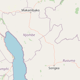
Map view of Nyika National Park

Use this park location map to pinpoint Nyika National Park in Malawi, understand its exact geographic position, and read its mapped placement within the surrounding landscape more clearly.

Pigeon | © OpenStreetMap contributors
Recorded earthquake history

Explore Historical Earthquake Records Associated with Nyika National Park

Investigate the regional earthquake history of Nyika National Park through a curated, location-indexed catalogue of recorded seismic events. MoriAtlas presents these records to assist with geographic understanding of the plateau, providing access to historical data including event magnitude, focal depth, and proximity to the protected landscape.

Nyika National Park Earthquake History

Catalogued events

51 events

Strongest magnitude

Magnitude 6

Most recent event

May 4, 2024

This history includes earthquakes recorded inside the park or within 50 km of its borders

Park atlas

Trace the geographic spread of protected areas and compare park features within the highland plateau region surrounding Nyika National Park.

Explore Nearby National Parks and Protected Areas Surrounding Nyika National Park's Afromontane Landscapes

Users can browse a curated selection of national parks and protected areas geographically related to Nyika National Park, offering a comparative overview of nearby conservation landscapes. Continue your atlas exploration from Nyika's afromontane grasslands, discovering montane wildlife habitats, varied woodland ecosystems, and distinct highland plateaus in the surrounding region.
National parkZambia
Mapped location lies within the park boundary#1 closest

West

Nyika National Park: A Zambian National Park for Mapped Landscape Discovery

Explore its protected area boundaries and regional geographic context.

Nyika National Park in Zambia is a critical protected landscape offering valuable insights for geographic exploration. As a national park, its mapped terrain and regional context provide a distinct point of study within the country's atlas. Users can investigate the park's specific geographic features and its contribution to Zambia's conservation landscapes, enriching their understanding of protected areas.

Relief
Highland
Climate
Subtropical
Access
Moderate access
Scope
Terrestrial
Wildlife reserveMalawi
About 12 km away#2 closest

South

Vwaza Marsh Wildlife Reserve: Geographic Atlas and Protected Landscape Overview

A lowland wilderness reserve in northern Malawi

Spanning roughly 1,000 square kilometers, Vwaza Marsh Wildlife Reserve provides a unique contrast to the surrounding highlands through its flat topography, seasonal wetlands, and dense mopane forests. This destination serves as a vital corridor for large mammals moving across the border, offering a window into the complex interplay of water-focused ecology and savanna-woodland habitats in Southeastern Africa.

Area
1,000 km²
IUCN
IV
Wildlife reserveNorthern Region
About 97 km away#3 closest

South

Chikangawa Forest Reserve: Mapping Malawi's Viphya Mountains Protected Wildlife Landscape

Explore montane forest ecosystems and exotic pine plantations

Chikangawa Forest Reserve stands as a major protected block within Malawi's Northern Region. The area covers extensive mountain ridges where native montane vegetation interweaves with significant man-made pine plantations. This geographic atlas entry provides insight into the reserve's role as a watershed protector and its unique position across the Viphya Plateau.

Area
1,147.8 km²
Established
1948
Relief
Mountain
Climate
Tropical
Wildlife reserveMalawi
About 118 km away#4 closest

South

Nkhotakota Wildlife Reserve: Protected Geography and Rift Valley Landscapes

A vast, recovering miombo woodland sanctuary in central Malawi.

Nkhotakota Wildlife Reserve represents a massive conservation effort within the Great Rift Valley, protecting 1,800 square kilometres of steep ridges, riverine gorges, and dense woodland patches. This atlas entry details the reserve's unique topography, ranging from high-altitude escarpments down toward Lake Malawi, and its role as a pivotal site for large mammal restoration and bird diversity in Southeastern Africa.

Area
1,800 km²
IUCN
IV
Relief
Mixed relief
Climate
Tropical
National parkNjombe Region
About 120 km away#5 closest

North

Kitulo National Park: National Park within Njombe Region's Geographic Atlas

Mapped protected area boundaries and regional landscape context.

Kitulo National Park represents a distinct national park within the geographic atlas of Tanzania's Njombe Region. This page offers a focused exploration of its protected landscape identity, highlighting its mapped boundaries and contributing to a broader understanding of regional geography. It is designed for users seeking detailed, atlas-centric information about Kitulo National Park's specific natural landscape and its position within the surrounding terrain.

Area
413 km²
Established
2005
IUCN
II
Visitors
409 annual
National parkMuchinga Province
142 km away#6 closest

Southwest

North Luangwa National Park: National Park Protected Landscape and Regional Geography

Mapped boundaries and geographic context within Muchinga Province.

North Luangwa National Park is a designated national park offering critical insights into Zambia's protected landscapes. This page provides an atlas-driven view of its geographic scope, emphasizing its mapped boundaries and its position within Muchinga Province. Explore the fundamental geography and protected area context that defines North Luangwa National Park for structured landscape discovery.

Area
4,636 km²
Established
1972
IUCN
II
Relief
Mixed relief
National parkTanzania
165 km away#7 closest

North

Ruaha National Park: Tanzania National Park, Protected Landscape and Geographic Atlas

Mapped boundaries and regional landscape context for Ruaha National Park.

Explore the protected landscape of Ruaha National Park in Tanzania. This page provides detailed mapping of its boundaries and offers insights into its geographic setting. Understand its significance as a national park within the atlas of protected areas, focusing on its natural terrain and regional context without travel logistics.

Area
20,226 km²
Established
1964
IUCN
II
Visitors
21.3K annual
National parkZambia
204 km away#8 closest

Southwest

Lukusuzi National Park: Zambia's Protected National Park Geographic Context

Mapped protected area and regional landscape identity for Lukusuzi.

Gain detailed insights into Lukusuzi National Park, a key protected area in Zambia, through its geographic setting and mapped boundaries. This page provides essential context for understanding the park's landscape character and its significance within the national park atlas. Explore the fundamental protected-area geography of this distinct Zambian natural landscape.

IUCN
II
Access
Access unknown
Scope
Terrestrial

Common questions about visiting, size, designation, and location context for Nyika National Park

Nyika National Park FAQs for park facts, access, geography, and protected area context

Find quick answers about Nyika National Park, including protected-area facts, park geography, trail and visitor context, and how the park fits into its surrounding country and regional landscape.
MoriAtlas Explorer

Continue Your Protected Areas Search Across the Global Atlas

Deepen your exploration by continuing the structured search for national parks and protected areas worldwide. Utilize the comprehensive filtering capabilities to compare different conservation landscapes and refine your understanding of global park geography. Discover more about the distribution and characteristics of protected natural areas.

Global natural geography