
Mori Atlas logo
Protected landscapeOlympic National Forest

Mapping the temperate rainforests, glacial rivers, and wilderness ridges of the Olympic Peninsula

Olympic National Forest: A Comprehensive Geography and Protected Landscape Map of Washington

Olympic National Forest serves as a sprawling protected landscape on the Olympic Peninsula, covering roughly 628,000 acres of diverse terrain that buffers the interior mountains. From the moss-drenched temperate rainforests of the western river valleys to the saltwater shoreline of the Hood Canal, this region offers a complex study in Pacific Northwest geography. Our map-based atlas traces the forest boundaries, wilderness areas, and critical river drainages that characterize this significant ecological zone in Washington.

temperate rainforestold-growth forestPacific NorthwestOlympic Peninsulamountain forestswilderness areas
A digital illustration of a waterfall cascading down a rocky cliff into a river, framed by tall pine trees and foreground wildflowers under a light-colored sky.

Olympic National Forest

Protected landscape

Park overview

Structured park overview, official facts, and landscape profile for Olympic National Forest

Olympic National Forest park facts, protected area profile, and essential visitor context

Review the core facts for Olympic National Forest, including designation, size, terrain, visitor scale, habitats, and operating context in one park-focused overview.

About Olympic National Forest

Olympic National Forest occupies a defining position on the Olympic Peninsula in western Washington, encircling the core of the Olympic Mountains and acting as a forested buffer around Olympic National Park. Although the national park protects the most famous inner core of the range, the surrounding national forest ties the region together ecologically and geographically, connecting the wet coastal valleys, the Hood Canal shoreline, and the lower mountain flanks into a single managed landscape. Its territory reaches across four counties: Clallam, Grays Harbor, Jefferson, and Mason, and the forest influences everything from local watersheds to regional salmon habitat.

The defining character of the forest is the contrast between its two sides. The Pacific side faces the storms rolling in off the Pacific Ocean and receives some of the highest rainfall totals in the continental United States, with annual precipitation averaging around 220 inches. This moisture feeds dense temperate rainforests, swelling rivers such as the Humptulips, Quinault, Hoh, and Elwha, and sustaining the moss-draped, old-growth forests that the region is internationally known for. The eastern Hood Canal side is drier and more varied, falling towards the saltwater fjord of Hood Canal, with different forest types, drier ridges, and views across Puget Sound.

Administratively, the forest is split into the Pacific Ranger District on the west and the Hood Canal Ranger District on the east, with district offices in Forks, Quinault, and Quilcene and a headquarters in Olympia. The forest contains five congressionally designated wilderness areas: The Brothers, Buckhorn, Colonel Bob, Mt. Skokomish, and Wonder Mountain. Major landmarks within its boundaries include Lake Cushman, Lake Crescent, Lake Quinault, the Quinault Rain Forest, Wynoochee Dam, and Mount Lincoln, as well as iconic viewpoints such as Mount Walker, which looks north toward Puget Sound. Together these features make the forest one of the most ecologically varied units in the U.S. Forest Service system.

Quick facts and research context for Olympic National Forest

Olympic National Forest is a federally protected U.S. National Forest on Washington's Olympic Peninsula, established in 1897 originally as the Olympic Forest Reserve. At roughly 628,000 acres, it nearly encircles Olympic National Park and the Olympic Mountain range. Annual precipitation averages about 220 inches, making it one of the wettest national forests in the lower 48 states. It is administered across two ranger districts (Pacific and Hood Canal) and contains multiple congressionally designated wilderness areas and notable lakes such as Lake Crescent, Lake Cushman, and Lake Quinault.

Protection and recognition

Explore documented conservation scope and international recognition records

Olympic National Forest Protection Status and Terrestrial Designation Data

Terrestrial protection status and management scope parameters for Olympic National Forest are detailed through verified administrative records. Conservation data highlights official boundaries without relying on unverified international recognition sources.

Protection details

Protection scope
Terrestrial
Transboundary protection
No
Park context

Deeper park guide and search-rich context for Olympic National Forest

Olympic National Forest history, landscape, wildlife, and travel context

Explore Olympic National Forest through its history, landscape character, ecosystems, wildlife, conservation priorities, cultural context, and seasonal travel timing in a structured park guide built for atlas discovery and search intent.

Why Olympic National Forest stands out

Olympic National Forest is best known for its temperate rainforests, extreme precipitation, and the protected ring of old-growth and mountainous terrain that surrounds Olympic National Park. The forest preserves large stands of old-growth forest, glacier and snowmelt-fed rivers such as the Humptulips, Hoh, Elwha, Quinault, and Hamma Hamma, and a striking diversity of landscapes that shift from mossy coastal rainforest valleys to alpine peaks and the brackish shoreline of Hood Canal. It is also known as the central landscape in the 'Wild Olympics' debate, a long-running campaign to expand wilderness and Wild and Scenic River designations across a large portion of the Olympic Peninsula.

Wide panoramic mountain landscape featuring golden grassy slopes in the foreground, alpine ridges in the midground, and prominent rocky mountain peaks under a clear blue sky.
Panoramic view of Buckhorn Mountain and the surrounding terrain from Marmot Pass in the Olympic National Forest.

Olympic National Forest history and protected-area timeline

Olympic National Forest was originally established on February 22, 1897, as the Olympic Forest Reserve, one of the early federal forest reserves carved out of the public domain to protect timber, watersheds, and mountainous terrain in the Pacific Northwest. In 1907 the reserve was redesignated as Olympic National Forest, reflecting the shift in federal policy that reorganized forest reserves into the National Forest system administered by the newly created U.S. Forest Service.

A pivotal early event came in 1909, when President William Howard Taft designated a portion of the forest as the Mount Olympus National Monument. Mount Olympus and its surrounding interior were later elevated in status when, in 1938, Olympic National Park was established to protect the mountain's glaciated core. As a result, Olympic National Forest lost its central mountain heart but retained the surrounding forested ring that continues to define its present-day shape.

Throughout the twentieth century, the forest was significant both for timber management and for the protection of large tracts of old-growth forest downstream of the park. A 1993 Forest Service study estimated roughly 266,800 acres of old-growth remained within the forest, underscoring its importance as a refuge for ancient trees and the wildlife that depends on them. The forest's administrative footprint has also shifted over time, including the closure of the former Hoodsport ranger office in 2005.

In the early 2010s, the forest became the focus of the 'Wild Olympics' campaign, a citizen and legislative effort that proposed new wilderness designations covering roughly 126,000 additional acres and Wild and Scenic River protections for nineteen rivers on the peninsula, including the Quinault, Hoh, Elwha, Hamma Hamma, and Satsop. The proposal revived debates reminiscent of the earlier Northern Spotted Owl controversy, pitting conservation and hunting and fishing groups against local communities concerned about economic impacts, and was reintroduced in Congress in 2019 as H.R. 2642.

Olympic National Forest landscape and geographic character

The landscape of Olympic National Forest is defined by its dramatic variation across relatively short distances. On the western side of the Olympic Mountains, the forest drops into deep, moss-filled river valleys lined with enormous conifers, where the Hoh, Quinault, and Humptulips rivers carve through ancient forest. These western drainages are among the rainiest places in North America, sustaining the lush, fern-rich temperate rainforests that visually define the region. Lake Quinault, the Quinault Rain Forest, and Lake Cushman sit within or along these valleys, anchoring the western landscape with glacially carved basins and reservoirs.

The central and upper portions of the forest are shaped by the Olympic Mountains themselves. Although the highest peaks and glaciers now lie within Olympic National Park, the surrounding national forest climbs into rugged subalpine and alpine terrain, including recognizable summits such as Mount Washington, Mount Lincoln, and the ridges of the Buckhorn and Iron Mountains. Wilderness-designated ridges and passes, including Marmot Pass, offer panoramic views back into the wet western valleys and out toward the east.

On the eastern side, the forest slopes down toward Hood Canal, a long saltwater fjord that separates the Olympic Peninsula from the Kitsap Peninsula. Here the terrain is drier and more open, with views across the canal toward Puget Sound and, from places like Mount Walker, sweeping vistas north toward the Sound. The combination of fjord shoreline, forested ridges, snowmelt rivers, and Olympic Mountain foothills makes the forest a landscape of striking local transitions rather than uniform terrain.
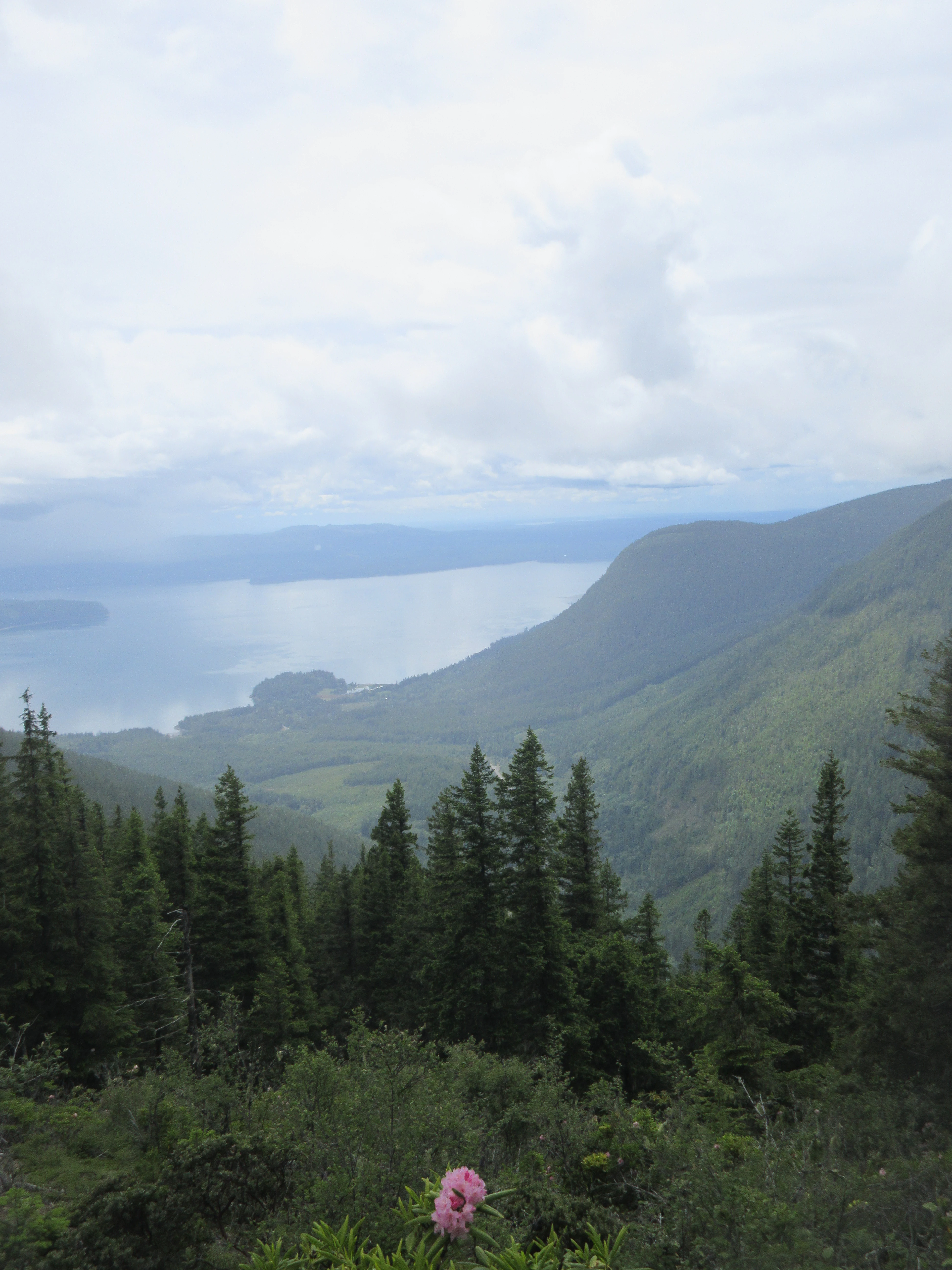
A high-angle view looking down from a mountain peak over a dense evergreen forest with a large body of water in the distance under an overcast sky, with a pink rhododendron flower in the foreground.
A scenic overlook from the slopes of Mount Walker, looking out over the forested landscape and water below.

Olympic National Forest ecosystems, habitats, and plant life

Olympic National Forest protects an unusually rich gradient of Pacific Northwest ecosystems, owing to the steep environmental differences between its wet western flanks and its drier eastern reaches. The defining ecosystem of the western forest is temperate rainforest, dominated by old-growth stands of Sitka spruce, western hemlock, and Douglas-fir draped in mosses and lichens. These forests are anchored on deep, moisture-retentive soils and feed a network of cold, sediment-rich rivers that are crucial for anadromous fish, particularly salmon and steelhead.

Above the rainforests, the forest climbs through montane and subalpine vegetation zones, where shorter, hardier conifers give way to alpine meadows and rocky ridgelines shaped by the Olympic Mountains' heavy snowfall. Lower montane areas across the peninsula support complex mixed-conifer stands and provide habitat for elk and other ungulates, while riparian corridors along rivers such as the Satsop, Wynoochee, and Hamma Hamma link aquatic and terrestrial ecosystems across the forest.

The eastern side, bordering Hood Canal, supports drier forest types and transitional plant communities more typical of the broader Puget Sound region. Old-growth inventories within the national forest are substantial: a 1993 Forest Service study estimated more than 266,000 acres of old growth remained in the forest, a figure that gives the landscape significant conservation value for species that depend on large, contiguous tracts of ancient forest.

Olympic National Forest wildlife and species highlights

Wildlife across Olympic National Forest reflects the same west-to-east ecological gradient visible in its vegetation. The wet, old-growth forests of the western drainages are important habitat for Roosevelt elk, black bear, and a dense community of smaller mammals, amphibians, and invertebrates adapted to hyper-wet conditions. These forests also shelter nesting and foraging habitat for a wide range of Pacific Northwest bird species, with stream corridors providing cover for salmon, steelhead, and trout.

The rivers running through and originating in the forest are central to the region's wildlife story. The Quinault, Hoh, Elwha, Hamma Hamma, and Humptulips rivers, along with tributaries like the middle fork of the Satsop, support salmon runs that link marine and forest ecosystems and have figured prominently in regional conservation debates, including the Wild Olympics effort.

On the eastern slopes and around Hood Canal, drier forests and edge habitats host deer, smaller carnivores, raptors, and migratory bird species, while viewpoints such as Mount Walker offer raptor and seabird viewing opportunities over Puget Sound. The mosaic of habitats means the forest supports both the classic interior Olympic Mountain fauna and the more coastal, fjord-edge species communities typical of the peninsula's eastern reach.

Olympic National Forest conservation status and protection priorities

Olympic National Forest carries significant conservation value beyond its status as a multiple-use national forest. It surrounds most of Olympic National Park, creating a large forested buffer that helps maintain water quality, wildlife movement, and ecological connectivity on the Olympic Peninsula. Large blocks of old-growth forest within its boundaries, estimated at roughly 266,000 acres in 1993, contribute to habitat for salmon-dependent species, northern spotted owls, marbled murrelets, and other old-growth associates, giving the forest an outsized importance for the regional conservation network.

Five congressionally designated wilderness areas within the forest, including The Brothers, Buckhorn, Colonel Bob, Mt. Skokomish, and Wonder Mountain, provide higher levels of protection within an otherwise managed landscape. The forest also sits at the center of the Wild Olympics campaign, which has proposed additional wilderness designations covering a substantial percentage of its acreage and Wild and Scenic River protections for nineteen rivers, recognizing the system's importance for clean drinking water, salmon habitat, and Puget Sound water quality.

The forest's conservation profile is shaped by ongoing tension between timber production, recreation, hunting and fishing traditions, and ecological protection. The Wild Olympics debate, which has drawn support from major hunting and fishing organizations along with environmental groups and opposition from residents concerned about local economic impacts, illustrates how the forest continues to function as a contested but extremely important conservation landscape in the Pacific Northwest.

Olympic National Forest cultural meaning and human context

Olympic National Forest is deeply embedded in the identity of the Olympic Peninsula, where logging, fishing, hunting, and outdoor recreation have long shaped local economies and community life. Federal forest management has influenced small towns such as Forks, Quinault, Hoodsport, Amanda Park, and Port Angeles for over a century, and the forest's management decisions, particularly around timber harvest, have been a defining local political issue.

The 'Stop Wild Olympics' signs visible in communities like Aberdeen, and organized groups such as Working Wild Olympics, reflect a strong tradition of local skepticism toward additional federal land restrictions, while the Wild Olympics campaign itself shows the equally strong tradition of community-led conservation advocacy on the peninsula. The forest has also been a cultural subject beyond the region, featured in episodes of PBS's This American Land, helping to carry its identity into broader national conversations about public lands in the Pacific Northwest.

Top sights and standout views in Olympic National Forest

Olympic National Forest stands out for combining some of the rainiest temperate rainforests in North America with rugged Olympic Mountain foothills, deep glacial lakes, and a saltwater fjord shoreline. Its old-growth forests, large connected wilderness areas, and salmon-bearing rivers give it exceptional biodiversity value, while its tight administrative partnership with Olympic National Park makes the combined protected landscape of the Olympic Peninsula unusually cohesive.

Equally distinctive is the forest's role as the stage for one of the most high-profile contemporary land-protection debates in the Pacific Northwest, the Wild Olympics campaign, which has elevated the forest to a national symbol of how communities negotiate wilderness, river protection, and working landscapes on the Olympic Peninsula.

Best time to visit Olympic National Forest

The experience of Olympic National Forest shifts strongly with the seasons, and the best time to visit depends on what kind of landscape a visitor wants to see. Late spring through early summer brings lush green conditions, swelling rivers, high waterfall flow, and accessible snowmelt in the valleys, with cooler temperatures in the higher elevations making hiking comfortable. Summer is the most accessible period overall, especially for reaching alpine viewpoints such as Mount Walker and passes like Marmot Pass once snow has melted, though western valleys remain cool and misty under typical ocean-influenced weather.

Autumn brings clearer skies, early fall color in the understory, and active salmon runs in rivers such as the Quinault, Hoh, and Elwha, making it a particularly rewarding season for wildlife and river-oriented visits. Winter is the wettest period on the western side, with heavy rainfall saturating the rainforests and snow accumulating at higher elevations, turning the forest into a quiet, deeply atmospheric destination that rewards visitors prepared for very wet conditions. Throughout the year, visitors should generally expect rapidly shifting weather, especially on the western side of the peninsula.
Monthly climate preview

Trace long-term representative temperature ranges and precipitation patterns across twelve months.

Olympic National Forest Climate Normals and Measured Annual Weather by Month

Olympic National Forest records documented average temperatures and precipitation volumes that shift gradually across the twelve-month climatology period. Evaluating the full monthly breakdown provides deeper clarity into long-term environmental patterns at this representative coordinate.
Annual mean9 °C
2 °C16 °C
Jan
Feb
Mar
Apr
May11°
Jun13°
Jul16°
Aug16°
Sep14°
Oct
Nov
Dec
Warmest month
August

16.4 °C

Coolest month
December

2.2 °C

Wettest month
November

6.7 mm/day

Driest month
July

0.8 mm/day

Park location guide

Geography guide, regional context, and park location map for Olympic National Forest

Olympic National Forest park geography, regions, and map view in United States of America

Understand where Olympic National Forest sits in United States of America through a broader geographic reading of the surrounding landscape, nearby location context, and its mapped position within the national park landscape.

How Olympic National Forest fits into United States of America

The United States of America is a federal presidential republic and one of the world's largest countries by area and population. It consists of 50 states across a vast territory spanning multiple time zones, with its capital in Washington, D.C. and largest city in New York City. The nation has a diverse economy, influential political system, and significant cultural and military presence globally.

Wider geography shaping Olympic National Forest in United States of America

The United States occupies a vast territory in North America, bordered by Canada to the north and Mexico to the south. The 48 contiguous states stretch from the Atlantic to the Pacific Ocean, while Alaska occupies the northwestern region and Hawaii is an archipelago in the Pacific. The country encompasses diverse terrain including the Rocky Mountains, Appalachian Mountains, Great Plains, and extensive river systems.

Map view of Olympic National Forest

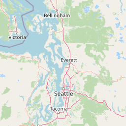
Use this park location map to pinpoint Olympic National Forest in United States of America, understand its exact geographic position, and read its mapped placement within the surrounding landscape more clearly.

Pigeon | © OpenStreetMap contributors

Location context for Olympic National Forest

Washington
Natural feature types

Explore the Geographic Features and Landforms of Olympic National Forest

Browse the extensive list of natural landmarks that define Olympic National Forest. Using the MoriAtlas geographic database, you can trace river systems, identify mountain ridges, and better understand the protected landscape transitions across the Olympic Peninsula.
Recorded earthquake history

Review Historical Seismic Activity Near Olympic National Forest

Browse the documented collection of historical earthquakes associated with the Olympic National Forest landscape. This MoriAtlas catalogue provides structured access to epicentre data and magnitude records, allowing for an informed perspective on the seismic history of the region.

Olympic National Forest Earthquake History

Catalogued events

199 events

Strongest magnitude

Magnitude 6.8

Most recent event

Jul 2, 2026

This history includes earthquakes recorded inside the park or within 50 km of its borders

Visualizing temperate rainforests, alpine ridges, and fjord terrain across the Pacific Northwest

Olympic National Forest Photos: Scenery and Protected Landscapes

Explore curated Olympic National Forest photos that reveal the complex geography of ancient river valleys and steep mountain terrain. Visual archives provide direct insight into diverse protected habitats, from moss-draped old growth to open saltwater shorelines.

Wide panoramic mountain landscape featuring golden grassy slopes in the foreground, alpine ridges in the midground, and prominent rocky mountain peaks under a clear blue sky.

Panoramic landscape view from a rocky outcrop overlooking a dense coniferous forest valley under a cloudy sky.

A high-angle view looking down from a mountain peak over a dense evergreen forest with a large body of water in the distance under an overcast sky, with a pink rhododendron flower in the foreground.

Park atlas

Compare regional park geography and adjacent Pacific Northwest wilderness areas.

Parks Near Olympic National Forest and Surrounding Protected Landscapes

Browse other national parks and protected areas sharing the rugged mountainous terrain and temperate rainforest geography of the Olympic Peninsula. Regional comparison reveals broader ecological patterns across adjacent river valleys, alpine ridges, and coastal reserves.
Wildlife reserveWashington
Park boundaries overlap#1 closest

Southwest

Mount Skokomish Wilderness: Ridge Systems and Alpine Geography in Washington State

Exploration of a protected Olympic Peninsula mountain landscape.

Mount Skokomish Wilderness protects a dramatic stretch of the eastern Olympic Mountains defined by steep ridges and glacial basins. The area serves as a critical headwaters region and offers a dense display of peaks and old-growth forest transitions across its varied elevation profile, providing essential landscape context for the region.

Area
53.79 km²
Established
1984
IUCN
Ib
Relief
Mountain
National parkWashington
Park boundaries overlap#2 closest

Northwest

Olympic National Park National Park: Geographic Atlas and Protected Landscape Discovery

Explore its unique Washington landscape and mapped protected areas.

Olympic National Park serves as a key protected area within Washington, offering rich opportunities for geographic exploration. This detail page provides essential context on its designation as a national park, its mapped boundaries, and its contribution to the regional geography. Understand the park's specific landscape character and its role within the atlas of protected lands, facilitating a structured approach to discovering its natural terrain and geographic significance.

Area
3,733.8 km²
Established
1938
IUCN
II
Visitors
3.7M annual
A horizontal watercolor painting showing a panoramic view of a coastal landscape with green, tree-covered headlands, rocky sea stacks, and distant mountains under a pale sky.
Marine protected areaWashington
11 km away#3 closest

West

Olympic Coast National Marine Sanctuary: Mapping the Washington Outer Coast Marine Protected Area

Pacific Ocean canyons, shelf ecosystems, and coastal wilderness

Defined by its proximity to the Olympic Peninsula, this marine protected area spans a rugged stretch of the Pacific Ocean. The sanctuary encompasses significant seafloor features including the Nitinat and Quinault canyons, alongside dynamic upwelling zones that support diverse marine life and complex tidal habitats.

Area
8,260 km²
Established
1994
IUCN
IV
Climate
Temperate
Nature reserveBritish Columbia
About 26 km away#4 closest

Northwest

Race Rocks Ecological Reserve: Protected Marine Landscape and Island Geography

Nature reserve in the Strait of Juan de Fuca, British Columbia

Race Rocks Ecological Reserve is a geographically distinct protected area consisting of low-lying rocky islets and surrounding high-current marine waters. Located in the Strait of Juan de Fuca, the reserve is recognized for its intense tidal mixing, which supports productive food webs and diverse marine mammals. This site provides a vital window into the ecological dynamics of the Pacific coast through its role as a dedicated research and conservation zone.

Area
2.27 km²
Established
1980
IUCN
Ia
Relief
Lowland
National parkBritish Columbia
43 km away#5 closest

Northwest

Pacific Rim National Park Reserve: National Park Protected Landscape & Map Atlas

Mapped boundaries and regional geographic context in British Columbia.

Pacific Rim National Park Reserve stands as a distinct protected natural landscape, serving as a critical component of Canada's national park inventory. This page facilitates an atlas-style exploration of its mapped boundaries and its position within the broader geography of British Columbia. Understanding the park's protected status and its integration with the surrounding natural terrain offers valuable insight into conservation landscapes.

Area
511 km²
Established
1970
IUCN
VI
Visitors
1.2M annual
National parkBritish Columbia
58 km away#6 closest

North

Gulf Islands National Park Reserve: British Columbia National Park Protected Area

Mapped boundaries and regional geographic context.

Delve into the protected landscape of Gulf Islands National Park Reserve, a significant national park located in British Columbia. This entry provides detailed insights into its mapped boundaries, regional geographic setting, and its identity as a protected area. Understand the park's place within the natural terrain and atlas of Canada, offering a clear geographic overview for focused discovery and landscape context.

Area
36 km²
Established
2003
IUCN
VI
Visitors
28.4K annual
A horizontal watercolor painting depicting a calm coastal inlet, surrounded by green hills, coniferous trees, and distant soft mountain silhouettes.
Marine protected areaUnited States of America
About 66 km away#7 closest

Northeast

Padilla Bay National Estuarine Research Reserve: Coastal Protected Area Geography

A significant tidal estuary and marine protected landscape in Washington

This marine protected area encompasses large, shallow tidal mudflats and salt marshes within the Salish Sea. It serves as a essential hub for ecological research and conservation, framing a hybrid environment where historical diked farmlands meet protected coastal terrain. The reserve offers deep insight into the regional geography of Washington, detailing how tidal processes and human history have shaped this productive Pacific Northwest estuarine landscape.

Area
32 km²
Established
1980
Relief
Lowland
Access
Easy access
A watercolor painting showing a panoramic view of mountain peaks in the distance above green foothills and plains.
Protected landscapeWashington
80 km away#8 closest

East

Mount Baker, Snoqualmie National Forest: Mapped Geography and Protected Landscape Analysis

Exploratory atlas of Washington's primary Cascade Range wilderness

Delve into the structural geography of Mount Baker, Snoqualmie National Forest. This protected area corridor serves as a major ecological transition zone between the Puget Sound lowlands and the interior Cascades, characterized by extensive glaciers, wild river systems, and iconic stratovolcanoes that define the regional landscape of Washington state.

Area
6,978 km²
Established
1974
Relief
Mountain
Climate
Alpine

Common questions about visiting, size, designation, and location context for Olympic National Forest

Olympic National Forest FAQs for park facts, access, geography, and protected area context

Find quick answers about Olympic National Forest, including protected-area facts, park geography, trail and visitor context, and how the park fits into its surrounding country and regional landscape.
MoriAtlas Explorer

Continue Your Protected Areas Search Across the Global Atlas

Deepen your exploration by continuing the structured search for national parks and protected areas worldwide. Utilize the comprehensive filtering capabilities to compare different conservation landscapes and refine your understanding of global park geography. Discover more about the distribution and characteristics of protected natural areas.

Global natural geography