
Streams
Park geography
A detailed analysis of protected land boundaries, elevation range, and regional geography
Olympic National Park: Geographic Profile, Boundary Dimensions, and Natural Terrain Features
This geographic profile details the physical scope of Olympic National Park, which covers a recorded area of 3733.8 square kilometers in Washington. The terrain spans from sea level to 2428 meters at its highest point, encompassing a diverse array of mountains, coastal cliffs, forests, and glacial features.
Related tags
Temperate RainforestGlacial MountainsPacific CoastlineOld-Growth ForestWilderness Area
A Pacific Northwest wilderness preserving glaciers, temperate rainforests, and rugged coastline on Washington's Olympic Peninsula
Olympic National Park
Olympic National Park is a vast wilderness preserve spanning over 922,000 acres on Washington's Olympic Peninsula, a mountainous landmass jutting into the Pacific Ocean. The park encompasses an extraordinary diversity of ecosystems within a relatively compact area, ranging from Pacific coastline beaches and sea stacks to glaciers capping mountain peaks, from world-renowned temperate rainforests to drier east-side forests. This ecological variety, combined with the park's relative isolation from other mountain ranges, has fostered significant endemism, with species like the Olympic marmot found nowhere else on Earth. Established as Mount Olympus National Monument in 1909 and redesignated as a national park in 1938, Olympic National Park received UNESCO World Heritage recognition in 1981 and maintains its status as an International Biosphere Reserve.
- Location
- United States of America
- Park type
- National park
- Established
- 1938
- Area
- 3,733.8 km²
- Highest point
- 2,428 m
Location overview
Regional administrative details and marine park status in Washington
Geographic Location and Regional Setting of Olympic National Park
Olympic National Park belongs to the regional jurisdiction of Washington within the United States of America. As a protected landscape, the park possesses officially designated coastal and marine status.
- Countries
- United States of America
- Regions
- Washington
- Primary location
- Washington
- Geographic setting
- Coastal · Marine
Boundary and coordinates
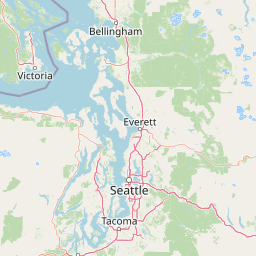
Olympic National Park’s mapped boundary spans 3,733.8 km²
Olympic National Park mapped boundary and 3,733.8 km² area
Olympic National Park has an atlas footprint spanning its documented 3,733.8 km² extent. The geometry communicates the protected landscape’s breadth, while the record provides no land–marine split or perimeter.
- Boundary area
- 3,697.6 km²
- Boundary perimeter
- 736.4 km
- Northernmost point
- 48.2753° N
- Southernmost point
- 47.4698° N
- Easternmost point
- 123.124° W
- Westernmost point
- 124.7426° W
- Geographic centre
- 47.8031° N, 123.666° W
- North–south span
- 89.6 km
- East–west span
- 121.1 km
Elevation and terrain
Vertical range profiles and recorded natural physical features
Olympic National Park Elevation Summary and Terrain Geography
This elevation summary outlines the vertical relief spanning from sea level up to two thousand four hundred twenty-eight meters. Recorded natural feature cards detail specific peaks and formations situated within the protected landscape.
- Minimum elevation
- 0 m
- Maximum elevation
- 2,428 m
- Highest point
- 2,428 m
Selected named natural features
Streams
Scott Creek
Peaks
Mount Hoquiam
1,485 m
Mountain saddles
Saint Peter's Gate
Streams
Royal Creek
Capes
Devil Point
178 m
Environmental setting
Temperate climate zones, dominant forest cover, and diverse mountain relief
Olympic National Park Environmental Classifications and Physical Setting
Recorded landscape features and habitat types categorize the physical setting across mountain relief, temperate climate zones, and dominant forest cover. Connected atlas destinations link each classification to related protected areas and regional geography.
- Relief
- Mountain
- Climate
- Temperate
- Water
- Major water bodies
- Forest cover
- Dense forest cover
- Seasonality
- Strongly seasonal
Landscape features
Mountains · Valleys · Cliffs · Forest · Wetland · Lakes · Rivers · Waterfalls · Coast · Beach · Glacier · Tundra
Habitat types
Montane forest · Alpine meadow · Temperate coniferous forest · Coastal habitat · Marine habitat · Wetland · Glacial habitat · Tundra habitat · Riverine habitat · Lacustrine habitat
Park atlas
Trace the regional geography, comparing diverse protected landscapes across the Pacific Northwest.
Explore Nearby National Parks and Protected Areas Around Olympic National Park
Discover additional national parks and protected areas geographically connected to Olympic National Park across the broader Pacific Northwest region. Compare diverse ecosystems, mapped terrain, and conservation landscapes, tracing how protected areas like Olympic fit into the wider regional context.
Wildlife reserveWashington
Park boundaries overlap#1 closest
South

Mount Skokomish Wilderness: Ridge Systems and Alpine Geography in Washington State
Exploration of a protected Olympic Peninsula mountain landscape.
Mount Skokomish Wilderness protects a dramatic stretch of the eastern Olympic Mountains defined by steep ridges and glacial basins. The area serves as a critical headwaters region and offers a dense display of peaks and old-growth forest transitions across its varied elevation profile, providing essential landscape context for the region.
- Area
- 53.79 km²
- Established
- 1984
- IUCN
- Ib
- Relief
- Mountain
Marine protected areaWashington
Park boundaries overlap#2 closest
West
Olympic Coast National Marine Sanctuary: Mapping the Washington Outer Coast Marine Protected Area
Pacific Ocean canyons, shelf ecosystems, and coastal wilderness
Defined by its proximity to the Olympic Peninsula, this marine protected area spans a rugged stretch of the Pacific Ocean. The sanctuary encompasses significant seafloor features including the Nitinat and Quinault canyons, alongside dynamic upwelling zones that support diverse marine life and complex tidal habitats.
- Area
- 8,260 km²
- Established
- 1994
- IUCN
- IV
- Climate
- Temperate
Protected landscapeWashington
Park boundaries overlap#3 closest
Southeast
Olympic National Forest: Atlas and Geographic Overview of Washington Protected Lands
Temperate rainforests, alpine ridges, and fjord shorelines
Olympic National Forest defines the outer reaches of the Olympic Mountains, featuring a massive expanse of old-growth conifers and high-precipitation temperate rainforests. This protected area connects diverse ecosystems ranging from the brackish waters of Hood Canal to rugged, snow-dusted subalpine ridges. Our detailed geographic mapping highlights the forest's role as a vital buffer and wilderness corridor within the broader Pacific Northwest landscape.
- Area
- 2,541.89 km²
- Established
- 1897
- Relief
- Mountain
- Climate
- Temperate
Nature reserveBritish Columbia
About 23 km away#4 closest
North

Race Rocks Ecological Reserve: Protected Marine Landscape and Island Geography
Nature reserve in the Strait of Juan de Fuca, British Columbia
Race Rocks Ecological Reserve is a geographically distinct protected area consisting of low-lying rocky islets and surrounding high-current marine waters. Located in the Strait of Juan de Fuca, the reserve is recognized for its intense tidal mixing, which supports productive food webs and diverse marine mammals. This site provides a vital window into the ecological dynamics of the Pacific coast through its role as a dedicated research and conservation zone.
- Area
- 2.27 km²
- Established
- 1980
- IUCN
- Ia
- Relief
- Lowland
National parkBritish Columbia
32 km away#5 closest
Northwest
Pacific Rim National Park Reserve: National Park Protected Landscape & Map Atlas
Mapped boundaries and regional geographic context in British Columbia.
Pacific Rim National Park Reserve stands as a distinct protected natural landscape, serving as a critical component of Canada's national park inventory. This page facilitates an atlas-style exploration of its mapped boundaries and its position within the broader geography of British Columbia. Understanding the park's protected status and its integration with the surrounding natural terrain offers valuable insight into conservation landscapes.
- Area
- 511 km²
- Established
- 1970
- IUCN
- VI
- Visitors
- 1.2M annual
National parkBritish Columbia
52 km away#6 closest
North
Gulf Islands National Park Reserve: British Columbia National Park Protected Area
Mapped boundaries and regional geographic context.
Delve into the protected landscape of Gulf Islands National Park Reserve, a significant national park located in British Columbia. This entry provides detailed insights into its mapped boundaries, regional geographic setting, and its identity as a protected area. Understand the park's place within the natural terrain and atlas of Canada, offering a clear geographic overview for focused discovery and landscape context.
- Area
- 36 km²
- Established
- 2003
- IUCN
- VI
- Visitors
- 28.4K annual
Marine protected areaUnited States of America
About 78 km away#7 closest
Northeast
Padilla Bay National Estuarine Research Reserve: Coastal Protected Area Geography
A significant tidal estuary and marine protected landscape in Washington
This marine protected area encompasses large, shallow tidal mudflats and salt marshes within the Salish Sea. It serves as a essential hub for ecological research and conservation, framing a hybrid environment where historical diked farmlands meet protected coastal terrain. The reserve offers deep insight into the regional geography of Washington, detailing how tidal processes and human history have shaped this productive Pacific Northwest estuarine landscape.
- Area
- 32 km²
- Established
- 1980
- Relief
- Lowland
- Access
- Easy access
Protected landscapeWashington
99 km away#8 closest
East
Mount Baker, Snoqualmie National Forest: Mapped Geography and Protected Landscape Analysis
Exploratory atlas of Washington's primary Cascade Range wilderness
Delve into the structural geography of Mount Baker, Snoqualmie National Forest. This protected area corridor serves as a major ecological transition zone between the Puget Sound lowlands and the interior Cascades, characterized by extensive glaciers, wild river systems, and iconic stratovolcanoes that define the regional landscape of Washington state.
- Area
- 6,978 km²
- Established
- 1974
- Relief
- Mountain
- Climate
- Alpine
MoriAtlas Explorer
Continue Exploring Olympic National Park's Geography and Protected Landscape
Dive deeper into the specific geographic identity of Olympic National Park, a national park in Washington. Understand its mapped boundaries and regional setting to build a comprehensive picture of its protected landscape within the broader atlas. This focused exploration helps solidify your understanding of its unique terrain and its place in the United States' conservation geography, offering a clear pathway to detailed geographic discovery.
Browse next
Global natural geography
Explore related park routes
Explore MoriAtlas Global ParksBrowse All MoriAtlas ParksGlobal Park Map DiscoveryMoriAtlas: Browse All CountriesBrowse All MoriAtlas ContinentsNational Park Environment AtlasGrand Canyon National Park AtlasYellowstone National Park AtlasYosemite National Park Atlas and GeographySerengeti National Park AtlasGalápagos National Park Protected LandscapeBanff National Park Geography and AtlasKruger National Park Atlas EntryUluṟu-Kata Tjuṯa National Park AtlasExplore Uluru-Kata Tjuta National Park GeographyPlitvice Lakes National Park AtlasFiordland National Park Protected LandscapeGreat Smoky Mountains National Park AtlasAfghanistan National Parks and Protected AreasAlbania National Parks and Protected AreasAlgeria National Parks and Protected AreasAmerican Samoa National Parks and Protected AreasAndorra National Parks and Protected AreasAngola National Parks and Protected AreasAntarctica National Parks and Protected AreasAntigua and Barbuda Park List