
Mori Atlas logo
National parkOlympus National Park

Tracing the mapped boundaries, altitudinal forest zones, and rugged gorges of this protected terrain

Olympus National Park: A Comprehensive Geographic Atlas of Greece's Iconic Mountain Massif

(Εθνικός Δρυμός Ολύμπου)

Olympus National Park stands as the primary protected landscape in Greece, centered on the towering massif of Mount Olympus. This atlas entry details the dramatic vertical relief, ranging from Mediterranean shrublands to alpine grasslands, and explains the ecological gradient that characterizes the park's terrain. The area serves as a significant intersection of limestone geology, deep ravines, and historic mythological significance within the broader geography of Thessaly.

national parkhigh mountainsalpine landscapeevergreen forestsbeech forestsBosnian pine forests
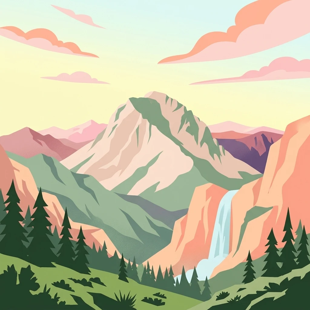
A flat-style digital illustration of a prominent, rugged mountain peak rising above a pine forest and a vertical waterfall on the right.

Olympus National Park

National park

Park overview

Structured park overview, official facts, and landscape profile for Olympus National Park

Olympus National Park park facts, protected area profile, and essential visitor context

Review the core facts for Olympus National Park, including designation, size, terrain, visitor scale, habitats, and operating context in one park-focused overview.

About Olympus National Park

Olympus National Park is a landmark protected area in northern Greece that centers on Mount Olympus, the most famous mountain in Greek mythology and the highest peak in the country. The park sits where the Thessalian and Macedonian landscapes meet, and its core zone extends across the high elevations and northern flanks of the massif. In scale, the park is relatively compact, yet in ecological terms it is one of the most diverse protected mountain environments in the country because every increase in altitude brings a dramatic shift in vegetation, climate, and animal life.

The park's significance goes well beyond protection of scenic mountain landscapes. It safeguards a complex geological substrate that includes Triassic dolomitic limestones, Paleocene and Cretaceous formations, Jurassic rocks near the summit complex, and patches of Eocene flysch and gneiss. These varied substrates shape the soils, the drainage patterns, and in turn the distribution of forest communities. The dominance of limestone in particular influences local microclimate by accelerating temperature change and altering how moisture is absorbed and released, creating the conditions that allow specialized flora to thrive.

Culturally, Olympus carries extraordinary weight. In classical Greek tradition, the mountain was believed to house the palaces of the twelve Olympian gods, with the summit of Mytikas serving as a meeting place and the supposed throne of Zeus. This mythological identity has been sustained for centuries and adds an unmatched cultural dimension to what is otherwise a striking natural park. Recognition of this combination of nature and legend was formalized in 2026, when the wider Mount Olympus area was inscribed on the UNESCO World Heritage List as a mixed site, while the park itself has carried UNESCO Biosphere Reserve status since 1981.

Today, Olympus National Park stands as both a functioning conservation area and a destination of national pride, offering one of the most concentrated experiences of Greek mountain wilderness.

Quick facts and research context for Olympus National Park

Olympus National Park is located in northern Greece across the Thessaly and Central Macedonia regions and is administered cooperatively by the Pieria Forestry Service and the Management Agency of Olympus National Park. It is the country's oldest national park, established on 9 June 1938, and the protected core covers roughly 40 square kilometers of the Mount Olympus massif, the highest mountain in Greece. The park contains Europe's highest tree line at about 2,500 meters elevation and is internationally protected in multiple layers, including a UNESCO Biosphere Reserve designation from 1981 and a UNESCO World Heritage inscription in 2026 recognizing both natural and cultural value.

Protection and recognition

Documented terrestrial protection scope, designation history, and UNESCO records

Olympus National Park Protection Status And International Recognition

Olympus National Park maintains a documented terrestrial protection status with established designation records and management scopes. Official international recognition data includes UNESCO World Heritage context for the wider mountain region.

International recognition

Protection details

Protection scope
Terrestrial
Designated year
2026
Transboundary protection
No
Park context

Deeper park guide and search-rich context for Olympus National Park

Olympus National Park history, landscape, wildlife, and travel context

Explore Olympus National Park through its history, landscape character, ecosystems, wildlife, conservation priorities, cultural context, and seasonal travel timing in a structured park guide built for atlas discovery and search intent.

Why Olympus National Park stands out

Olympus National Park is best known for protecting the forests, gorges, and peaks of Mount Olympus, the highest mountain in Greece and the mythological home of the twelve Olympian gods. Its distinct identity lies in the convergence of dramatic high-mountain scenery, layered forest ecosystems, the highest tree line in Europe, and an incomparable classical heritage tied to ancient Greek religion. The park is also recognized internationally as a UNESCO Biosphere Reserve and later as a mixed UNESCO World Heritage Site, combining natural and cultural importance in a single protected landscape.
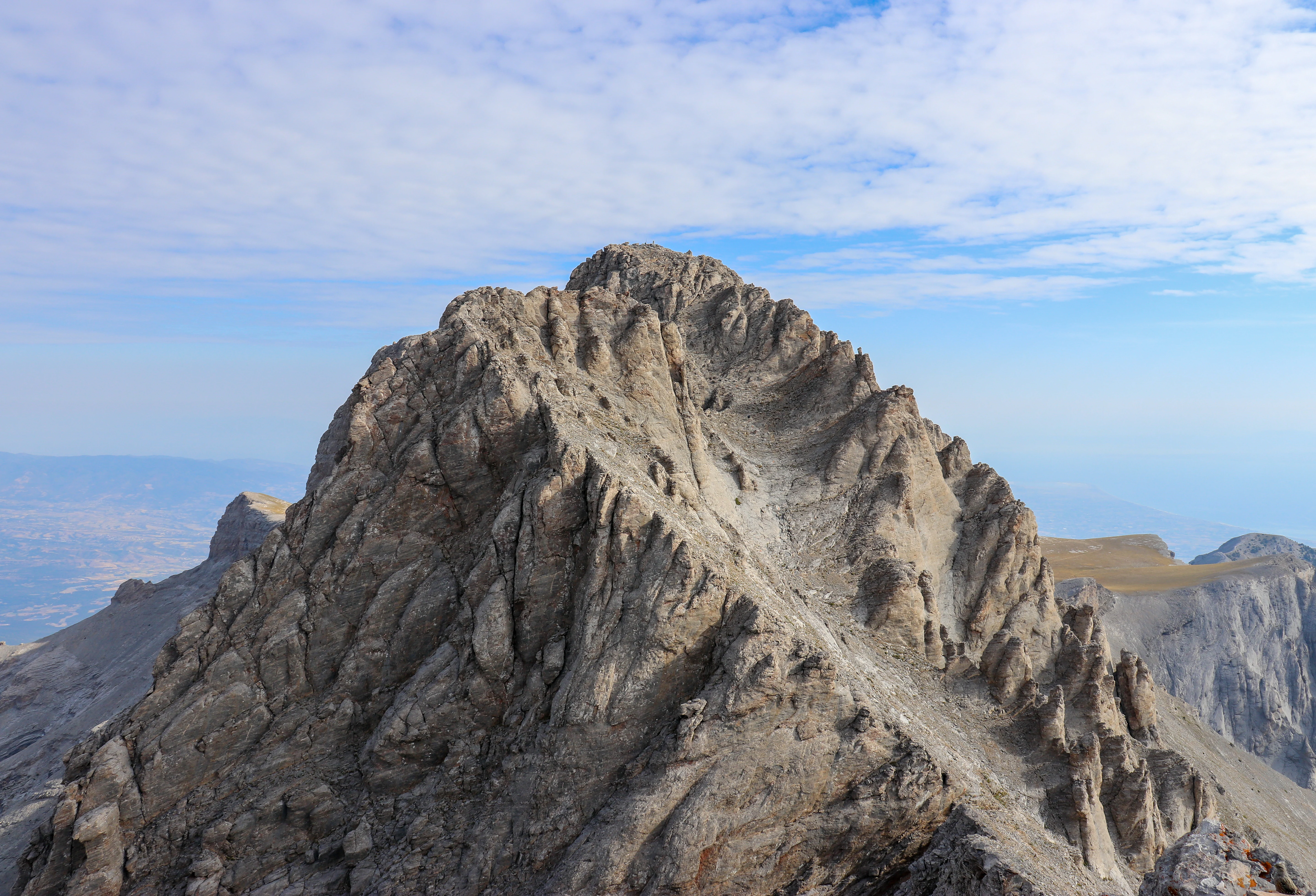
A high-angle view of the sharp, rocky summit of Mytikas peak on Mount Olympus, showing textured stone faces and distant hazy mountain ranges under a partly cloudy sky.
The rugged Mytikas peak, the highest point of Mount Olympus.

Olympus National Park history and protected-area timeline

Olympus National Park has a history that bridges modern Greek conservation with some of the country's deepest cultural roots. The park was formally established on 9 June 1938, making it the first national park of Greece and an early statement of intent in the protection of the country's iconic landscapes.

For more than forty years after its founding, the park functioned primarily as a national-level protected area focused on the conservation of Mount Olympus's natural values. Its status was raised internationally in 1981, when the area was added to UNESCO's Man and the Biosphere Programme as a biosphere reserve, recognizing its environmental importance far beyond Greek borders. In July 2026, the wider area of Mount Olympus was inscribed on the UNESCO World Heritage List as a mixed site, formally acknowledging that the mountain's significance is both natural and cultural, rooted in both its ecosystems and its role as the mythological home of the gods.

Olympus National Park landscape and geographic character

The landscape of Olympus National Park is defined by the towering massif of Mount Olympus, whose summit at Mytikas reaches 2,918 meters, making it the highest peak in Greece and one of the most prominent in the Balkan Peninsula. Within the park, the terrain moves rapidly from forested gorges and river valleys to alpine plateaus, stony ridges, and exposed rocky summits. Deep canyons and steep ravines cut across the northern flanks, while the broader mountain mass forms a strong visual and climatic boundary between Thessaly and Macedonia.

Geologically, the park is unusually varied. Eastern slopes feature dolomitic limestones dating to the Upper Triassic, while the western and southern slopes are shaped by Cretaceous and Paleocene formations. The summit complex around Mytikas is built on Jurassic rock, and smaller zones of Eocene flysch and gneiss appear on the western and northwestern flanks. The dominance of limestone influences both landform and climate, contributing to drier, warmer conditions on the lower slopes and shaping the drainage networks that feed streams flowing down through the park.
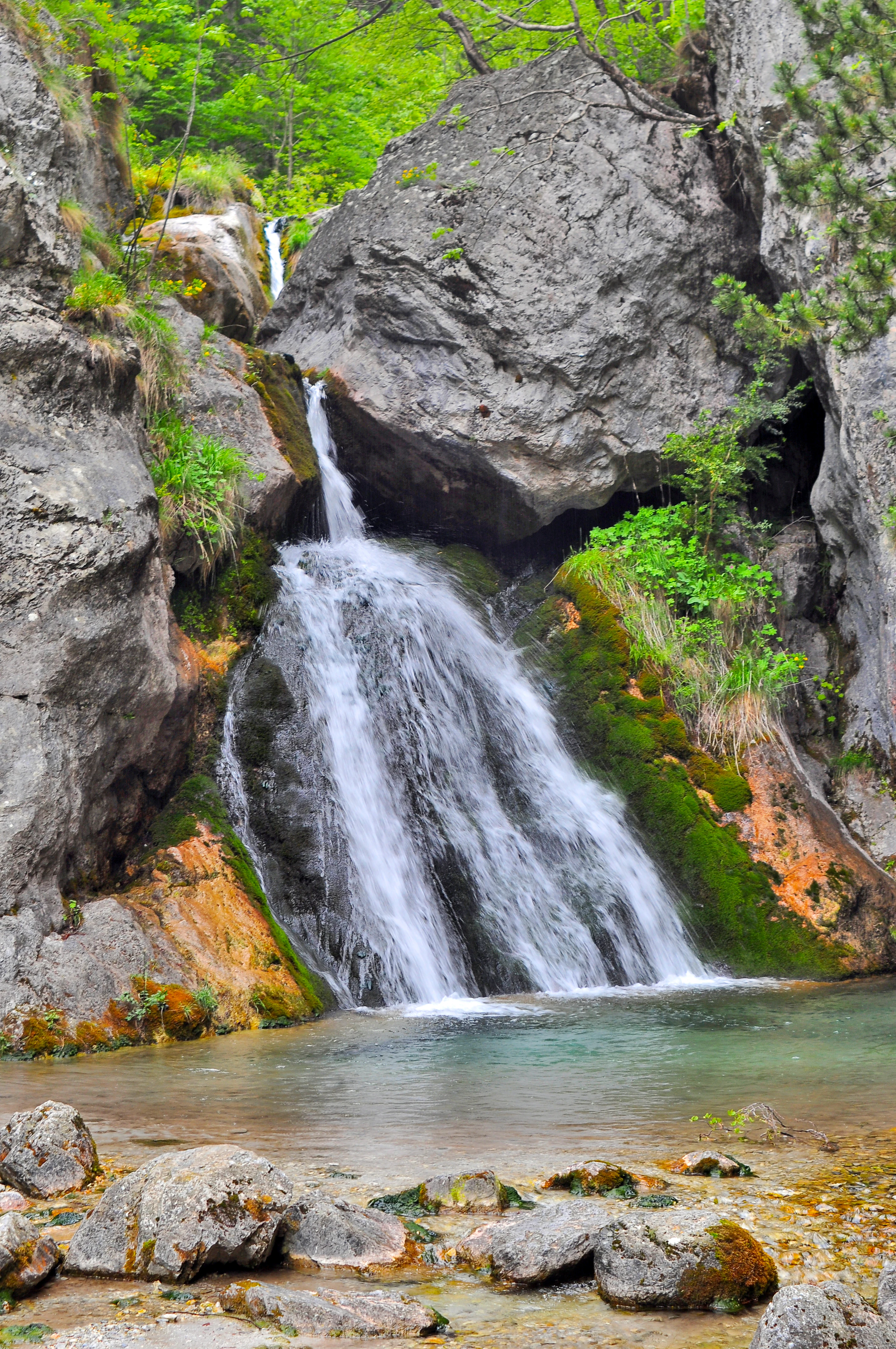
A small waterfall flows down a rocky cliff into a clear mountain pool, with green moss and vegetation covering the surrounding stone.
A small, secluded waterfall cascading over mossy rocks in Olympus National Park.

Olympus National Park ecosystems, habitats, and plant life

The natural character of Olympus National Park is shaped by one of the most striking altitudinal gradients in Greece. As elevation rises, vegetation shifts from Mediterranean to montane to subalpine communities in a relatively compressed space. Between roughly 300 and 500 meters, evergreen Mediterranean shrubland dominates, with holm oak, Greek strawberry trees, and kermes oak forming characteristic low-stature forests.

From about 600 to 1,400 meters, beech and silver fir communities take over, often mixed with Bulgarian fir, oriental hornbeam, and black pine in places where conditions allow. Higher still, between roughly 1,400 and 2,500 meters, vast stands of Bosnian pine create one of the park's most distinctive forests, extending toward the tree line that crowns Mount Olympus at around 2,500 meters, recognized as the highest tree line in Europe. Above this, alpine grasslands, rocky peaks, and deep gorges form the upper tier of the park's ecology.

The combination of Mediterranean, montane, and alpine conditions in a single massif has made Olympus one of the richest botanical areas in Greece, with numerous endemic species found alongside relict Alpine and Balkan elements. Rivers and streams fed by snowmelt and springs sustain riparian plant communities such as plane trees, willows, and alders along the park's waterways.
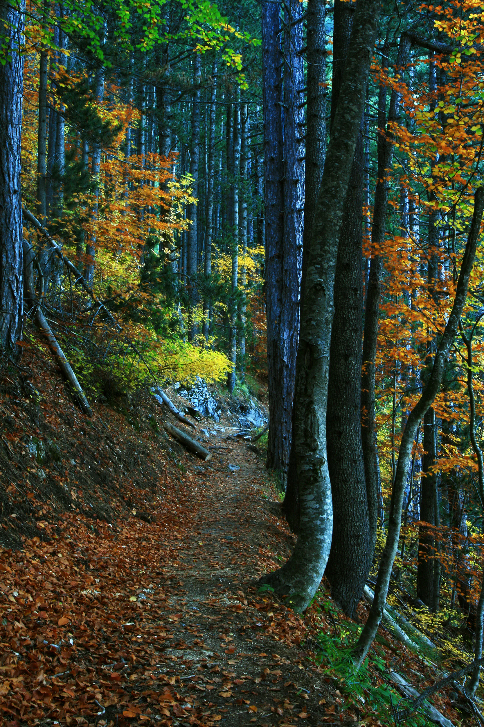
A narrow hiking trail leads through a dense, sun-dappled forest with tall pine and deciduous trees displaying autumn foliage in shades of orange, yellow, and deep green.
A woodland trail in Mount Olympus National Park during autumn, showing a path covered in fallen leaves surrounded by tall trees.

Olympus National Park wildlife and species highlights

The wildlife of Olympus National Park reflects the same altitudinal diversity that defines its plant life, with different animal communities occupying elevation zones from forested valleys to alpine cliffs. The park has been recorded as hosting about 32 mammal species, including the Balkan chamois, which is one of its most important conservation subjects and a rare presence in Greece, estimated at only a small number of individuals in recent counts.

Larger mammals in the park include wolves and golden jackals, while smaller predators and omnivores include European wildcats, beech martens, and edible dormice. Wild boar are also resident in the forested zones. In addition, several bat species inhabit the mountain, including the greater horseshoe bat and Geoffroy's bat, which find refuge in the park's caves, rock crevices, and forest habitats.

Avifauna is equally significant, with about 108 bird species recorded in and around the park. Raptors such as the golden eagle and the Egyptian vulture soar above the cliffs and gorges, while high-elevation rocky habitats support specialist cliff-dwelling birds like the wallcreeper, alongside breeding species such as the Alpine swift, the Eurasian three-toed woodpecker, the ortolan bunting, and Cretzschmar's bunting. Together, the mammal and bird communities give the park a strong conservation profile that complements its botanical importance.
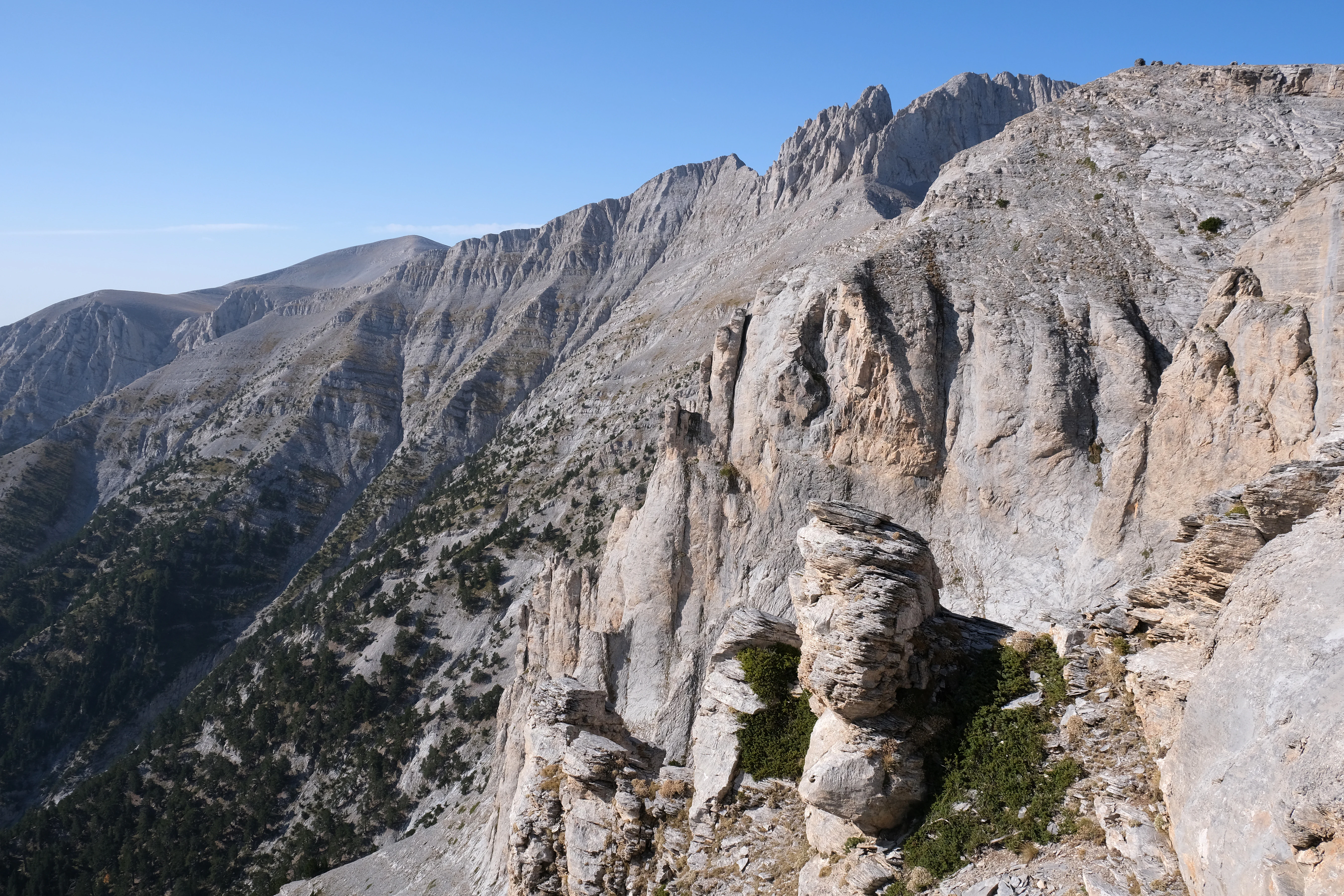
A wide angle view of rocky, light colored mountain peaks and steep cliffs under a clear blue sky in Olympus National Park.
The rugged limestone peaks of Mount Olympus as seen from the trail within Olympus National Park.

Olympus National Park conservation status and protection priorities

Conservation is the defining purpose of Olympus National Park, which has carried protected status longer than any other national park in Greece. Established in 1938, the park was created specifically to safeguard the natural values of Mount Olympus, and over the decades its protection has been reinforced through multiple layers of recognition.

The elevation gradient of the massif creates rare ecological transitions within a compact area, including Europe's highest tree line near 2,500 meters. This makes the park important not just for its scenic value but for the conservation of montane and subalpine forest communities, such as the extensive Bosnian pine woodlands, and for the persistence of species like the Balkan chamois at the very edge of their range in Greece. Endemic and relict plant species add to the conservation significance.

Since 1981, the area has been designated as a UNESCO Biosphere Reserve under the Man and the Biosphere Programme, marking its international recognition. In July 2026, the wider Mount Olympus region was inscribed as a mixed UNESCO World Heritage Site, formally acknowledging both the natural and the cultural importance of the landscape. Today the park is managed by the Pieria Forestry Service together with the Management Agency of Olympus National Park, continuing the long-standing Greek commitment to balancing preservation with public access.

Olympus National Park cultural meaning and human context

The cultural importance of Olympus National Park is inseparable from the mountain it protects. Mount Olympus occupies a unique place in Greek mythology as the dwelling of the twelve Olympian gods, with the summit at Mytikas believed to be the meeting place of the gods and the location of the throne of Zeus. This identity has shaped Greek imagination for millennia and gives the park a symbolic resonance that goes well beyond its ecological value.

Across centuries, the mountain remained a powerful reference in Greek religious thought, literature, and identity, and modern visitors still arrive at the park with an awareness of the mountain's mythological role almost as much as its natural one. The 2026 UNESCO World Heritage inscription of the wider Mount Olympus area reflects this duality, formally recognizing the natural and cultural meanings of the landscape together rather than treating them separately.
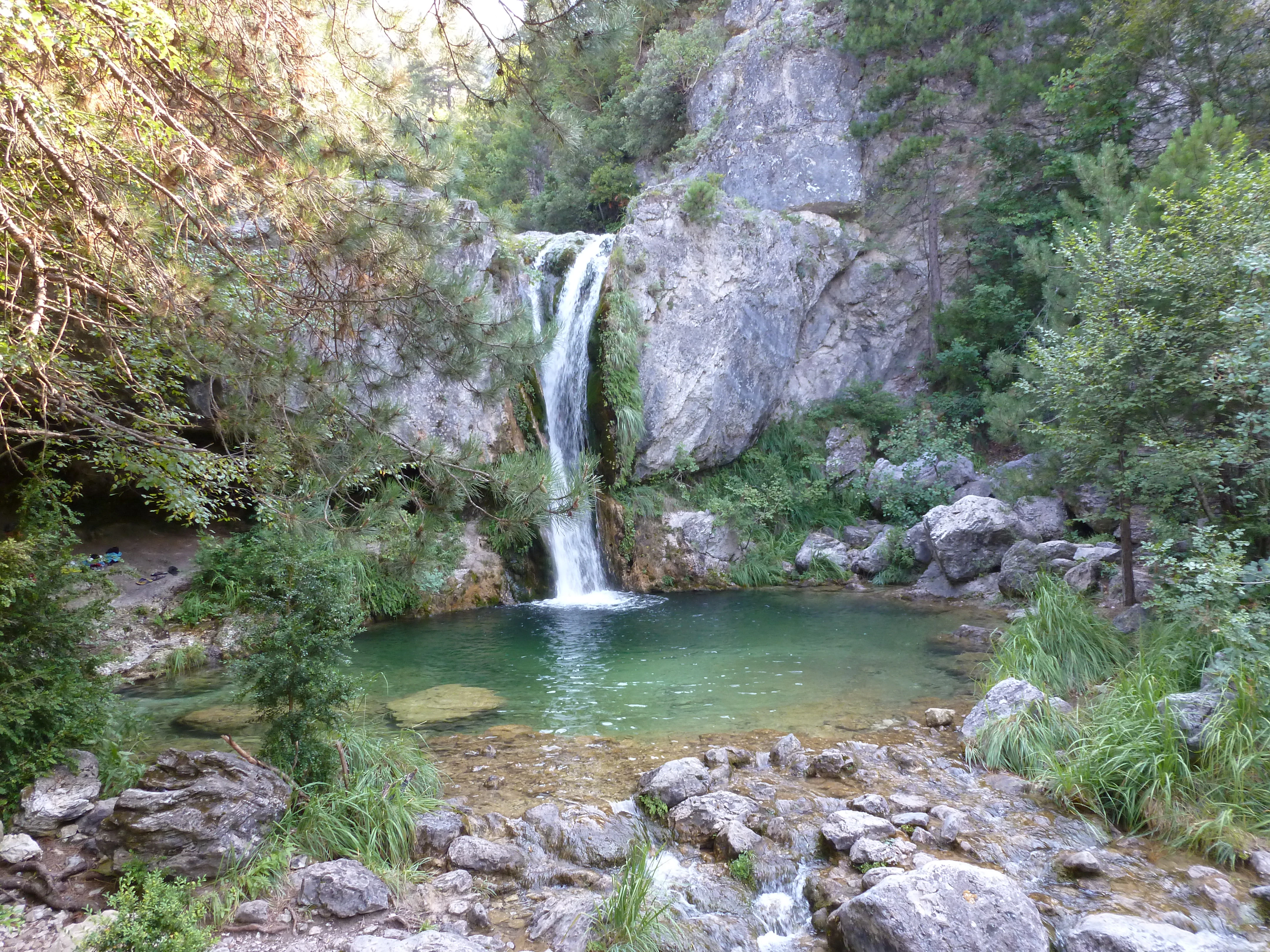
A waterfall cascades down a rocky cliff into a turquoise pool, surrounded by dense forest and stone boulders.
The Orlia Stream forms a scenic waterfall and pool within the protected landscape of Mount Olympus.

Top sights and standout views in Olympus National Park

The defining highlights of Olympus National Park revolve around the extreme vertical drama of Mount Olympus, the rich layering of vegetation from Mediterranean shrubland to subalpine forest, and Europe's highest tree line crowning the massif at around 2,500 meters. Among its most distinctive features are the extensive beech and silver fir forests of the middle slopes, the great Bosnian pine woodlands higher up, and the alpine grasslands and gorges above the tree line.

Wildlife highlights include the presence of the Balkan chamois in its rocky refuges and the regular use of the cliffs and skies by golden eagles, while the mythological dimension of the landscape, anchored by the summit of Mytikas, sets the park apart from purely natural sites. Layered protections, including national park status since 1938, UNESCO Biosphere Reserve status since 1981, and UNESCO World Heritage inscription in 2026, mark the park as one of Greece's most formally recognized conservation landscapes.
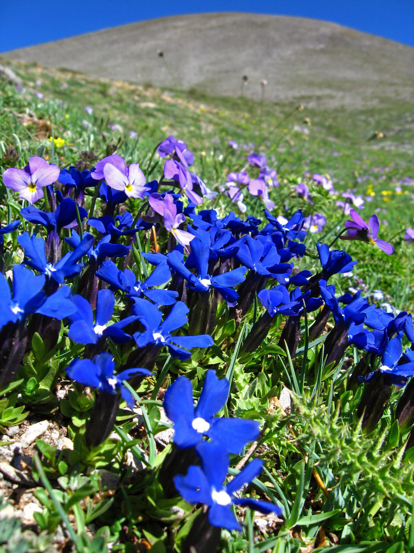
A close-up view of bright blue Gentiana flowers and smaller purple flowers growing in a grassy alpine meadow with a blurred mountain slope in the background.
A patch of vibrant blue Gentiana flowers blooming on the slopes of Mount Olympus.

Best time to visit Olympus National Park

The character of a visit to Olympus National Park shifts strongly with season and altitude. The lower Mediterranean slopes remain mild through much of the year, but the higher elevations of Mount Olympus introduce sharp seasonal contrasts, with snowy winters, refreshing springs, and relatively short, changeable summers above 2,000 meters.

For exploring the lower forests, Mediterranean flora, and streams, late spring is widely considered favorable, while early to mid summer is often the best window for experiencing the alpine and subalpine zones, where flowers bloom in alpine meadows beyond the highest tree line. Autumn is also commonly valued for its own atmospheric conditions, with clearer days and vivid seasonal coloration in the forests. Winter brings heavy snow to the upper mountain and effectively closes the higher mountaineering routes, shaping the park into a quieter, more limited-access landscape.
Monthly climate preview

Trace monthly average temperatures and precipitation normals across representative terrain elevations

Olympus National Park Climate Normals and Annual Weather Patterns

Representative coordinates document twelve-month temperature oscillations alongside measured precipitation rates for Olympus National Park. Detailed monthly climate records expand on these foundational averages to clarify long-term atmospheric patterns.
Annual mean14 °C
4 °C25 °C
Jan
Feb
Mar
Apr12°
May17°
Jun22°
Jul25°
Aug25°
Sep20°
Oct15°
Nov10°
Dec
Warmest month
July

24.7 °C

Coolest month
January

4.1 °C

Wettest month
December

1.7 mm/day

Driest month
August

0.7 mm/day

Park location guide

Geography guide, regional context, and park location map for Olympus National Park

Olympus National Park park geography, regions, and map view in Greece

Understand where Olympus National Park sits in Greece through a broader geographic reading of the surrounding landscape, nearby location context, and its mapped position within the national park landscape.

How Olympus National Park fits into Greece

Greece, officially the Hellenic Republic, is a country in Southeast Europe occupying the southern Balkans. It borders Albania, North Macedonia, Bulgaria, and Turkey, with coastlines on the Aegean, Ionian, and Mediterranean seas. The country has over 10 million people and is renowned for its ancient Greek heritage, philosophy, democracy, and the Olympic Games.

Wider geography shaping Olympus National Park in Greece

Greece occupies the southern tip of the Balkan peninsula in Southeast Europe. It shares land borders with Albania to the northwest, North Macedonia and Bulgaria to the north, and Turkey to the east. The Aegean Sea lies to the east of the mainland, the Ionian Sea to the west, and the Sea of Crete and Mediterranean Sea to the south. The country spans thousands of islands across nine traditional geographic regions and has the longest coastline in the Mediterranean basin.

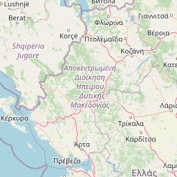
Map view of Olympus National Park

Use this park location map to pinpoint Olympus National Park in Greece, understand its exact geographic position, and read its mapped placement within the surrounding landscape more clearly.

Pigeon | © OpenStreetMap contributors

Location context for Olympus National Park

Central MacedoniaThessaly

Visualizing high mountain terrain, ancient forests, and alpine habitats

Olympus National Park Photos and Scenic Landscape Exploration

Examine detailed photography of Olympus National Park to understand the steep limestone gorges, dense beech forests, and towering peaks that define the protected landscape. Visual reference materials reveal the distinct altitudinal zones and rugged topography shaping Europe's most famous mythological mountain environment.

A high-angle view of the sharp, rocky summit of Mytikas peak on Mount Olympus, showing textured stone faces and distant hazy mountain ranges under a partly cloudy sky.

Dramatic sunset over silhouetted mountain ridges with purple and orange clouds filling the sky.

A small waterfall flows down a rocky cliff into a clear mountain pool, with green moss and vegetation covering the surrounding stone.

A narrow hiking trail leads through a dense, sun-dappled forest with tall pine and deciduous trees displaying autumn foliage in shades of orange, yellow, and deep green.

A wide angle view of rocky, light colored mountain peaks and steep cliffs under a clear blue sky in Olympus National Park.

A wide scenic view showing the rugged, snow-dusted rocky peaks of Mount Olympus rising behind a Mediterranean town nestled in the foothills.

A waterfall cascades down a rocky cliff into a turquoise pool, surrounded by dense forest and stone boulders.

A close-up view of bright blue Gentiana flowers and smaller purple flowers growing in a grassy alpine meadow with a blurred mountain slope in the background.

A wide view of Mount Olympus with snow-covered peaks under a partly cloudy blue sky, framed by forested slopes in the foreground.

A sunrise view over a mountainous landscape with pine branches in the foreground.

An aerial satellite photograph showing the mountainous terrain of Mount Olympus and its proximity to the Thermaic Gulf and surrounding Greek cities, with geographic labels overlaid in Greek.

A group of three hikers walking along a narrow, rocky mountain trail with a steep drop-off on the left and a dramatic mountainous landscape in the background.

A wide view of steep, rocky mountainsides densely covered in pine forests under a bright sky.

Three Balkan chamois standing on a steep, rocky, sparsely vegetated mountain slope under a clear blue sky.

Dense forest trees with tall, slender trunks on a sloped hillside, obscured by thick white fog.

Park atlas

Compare adjacent mountain landscapes and regional protected areas across northern Greece

Explore Parks Near Olympus National Park and Surrounding Regional Protected Areas

Continue geographic discovery by comparing protected areas and national parks situated near Olympus National Park. Regional terrain analysis helps connect high mountain massifs with broader conservation zones across the surrounding landscape.
Watercolor depiction of a river delta with green fields, a winding river, wildflowers, and distant hills
National parkCentral Macedonia
About 54 km away#1 closest

Northeast

Axios Delta National Park: Central Macedonia's Premier Protected Wetlands and Bird Sanctuary

Mapping the unique geography of this vital European bird migration corridor.

Axios Delta National Park is a significant protected wetland located in Central Macedonia, Greece, renowned for its role as a critical stopover and breeding ground for countless bird species along the East Atlantic Flyway. The park's landscape is shaped by the Axios, Haliacmon, Loudias, and Gallikos river deltas, creating a dynamic mosaic of lagoons, reedbeds, and coastal dunes. As a Ramsar site and Natura 2000 network area, it highlights the importance of understanding mapped protected landscapes and their regional geographic context for conservation efforts. Explore the distinct natural features and ecological significance of this unique delta.

Area
338 km²
Established
2009
IUCN
VI
Relief
Lowland
A soft watercolor illustration featuring a winding river flowing through green wetlands towards gentle rolling hills under a pale pink and light orange sky.
National parkGreece
About 105 km away#2 closest

Northeast

Parc national des lacs Korónia, Vólvi et du Témpi macédonien: Landscape and Map Atlas

Protected wetland basins and river gorge terrain in northern Greece

Spanning 159 square kilometers, this national park protects essential Mediterranean wetland habitats. Examine the unique intersection of Lake Korónia, the expansive Lake Vólvi, and the Richios River gorge that shapes the ecological character of this prominent Macedonian protected area.

Area
159.28 km²
Established
2004
IUCN
VI
Relief
Lowland
Watercolor illustration of a mountainous landscape with a river, forests, and distant hills
National parkGreece
About 108 km away#3 closest

West

Pindus National Park: A Protected Greek Mountain Wilderness with Ancient Forests

Explore its rugged terrain, biodiversity, and alpine landscape.

MoriAtlas presents Pindus National Park, a significant protected area in Greece known for its dramatic mountainous terrain, deep valleys, and ancient old-growth forests. This page details its geographic context, featuring rugged highland landscapes, serpentine soils, and vital habitats for species like the Eurasian brown bear. Understand its place within the Pindus mountain range and its importance as a mapped wilderness area for conservation.

Area
69.27 km²
Established
1966
IUCN
II
Relief
Mountain
National parkGreece
About 115 km away#4 closest

Southwest

Parc national de Tzoumérka-Achelóos-Ágrafa-Météores National Park: Geography and Landscape Atlas

Central Greece Pindus mountain protected wilderness zone

An extensive protected landscape bridging Thessaly and Epirus, this national park showcases the ecological and geological diversity of the central Pindus Mountains. Analyze the geographic layout of the Athamanian ranges, the Acheloos river corridor, and the unique conglomerate formations at Meteora through a detailed protected-area lens.

Area
3,379.94 km²
Established
2009
IUCN
VI
Relief
Mountain
A watercolor illustration of a landscape with soft green hills and a pinkish water area, set against a plain white background.
National parkWestern Macedonia
About 124 km away#5 closest

Northwest

Prespa National Park: Mapping the Biodiversity and Lake Landscapes of Western Macedonia

A Ramsar wetland reserve and transboundary protected area

Prespa National Park encompasses 32,700 hectares of diverse habitats, from the shallow waters of Small Prespa Lake to the surrounding forested uplands. This protected area acts as a vital sanctuary for migratory bird species and endemic plants, offering a rich look at the ecological interplay between water, floodplains, and mountain terrain in northern Greece.

Area
327 km²
Established
2009
IUCN
VI
Relief
Mixed relief
Watercolor painting of a landscape with green trees, rolling hills, and distant mountains under a light sky
National parkMunicipality of Bitola
About 124 km away#6 closest

Northwest

Pelister National Park: North Macedonia's Oldest National Park and Alpine Protected Landscape

Explore unique glacial features and endemic forests within Municipality of Bitola.

Pelister National Park, a pioneering protected area in North Macedonia, offers a rich tapestry of alpine geography and unique geological formations. This page provides detailed information on the park's landscape, including its dramatic mountain massif within Municipality of Bitola, the rare Macedonian pine forests, the striking 'stone rivers' formed by ancient glacial processes, and the serene Pelister Eyes glacial lakes. Discover the park's mapped boundaries and its significance as a conservation heritage site within the Balkan Peninsula.

Area
171.5 km²
Established
1948
IUCN
II
Visitors
30K annual
Watercolor painting of a river flowing through a valley with mountains and greenery
National parkKorçë County
About 128 km away#7 closest

Northwest

Prespa National Park: Protected Landscape and High-Altitude Lakes in Korçë County, Albania

Explore the geography and mapped boundaries of this vital national park.

Prespa National Park, located in Korçë County, Albania, is a protected area characterized by its significant high-altitude tectonic lakes, dramatic mountain landscapes, and vital wetland habitats. This entry provides a structured atlas-style overview of the park's geographic identity, its protected landscape features, and its ecological importance, serving as a key point of reference for understanding this unique Balkan region.

Area
276.131 km²
Established
1999
IUCN
II
Relief
Mountain
A watercolor painting showing a river winding through a mountainous gorge with a stone arch bridge on the right bank.
National parkEpirus
About 139 km away#8 closest

West

Northern Pindus National Park: A Geographic Survey of Mountain Landscapes in Epirus Greece

Mapped terrain, karst river gorges, and alpine forest ecosystems.

Northern Pindus National Park preserves an extensive mountain environment characterized by steep limestone ridges, the profound Vikos Gorge, and glacial lake basins. Located in the Pindus range of Epirus, this area offers deep insight into the intersection of geological processes, rare wildlife habitats, and traditional human settlements integrated into the mountainous terrain.

Area
157.4 km²
Established
2005
IUCN
II
Relief
Mountain

Common questions about visiting, size, designation, and location context for Olympus National Park

Olympus National Park FAQs for park facts, access, geography, and protected area context

Find quick answers about Olympus National Park, including protected-area facts, park geography, trail and visitor context, and how the park fits into its surrounding country and regional landscape.
MoriAtlas Explorer

Continue Your Protected Areas Search Across the Global Atlas

Deepen your exploration by continuing the structured search for national parks and protected areas worldwide. Utilize the comprehensive filtering capabilities to compare different conservation landscapes and refine your understanding of global park geography. Discover more about the distribution and characteristics of protected natural areas.

Global natural geography