
Mori Atlas logo
National parkNorthern Pindus National Park

Discover the geologic heritage, alpine peaks, and river gorge systems within this major Greek protected area.

Northern Pindus National Park: A Comprehensive Atlas of Protected Mountainous Landscapes in Epirus

(Εθνικός Δρυμός Βόρειου Πίνδου (Ethnikós Drymós Voreiou Pindou))

Northern Pindus National Park stands as a significant protected wilderness area in the Pindus Mountains of Epirus, Greece. This expansive territory encompasses the dramatic Vikos and Aoos river gorges, high-altitude alpine lakes, and rugged limestone massifs that define the regional geography. Through this atlas, identify the complex terrain, karst formations, and mountain ecosystems that form the core of one of the most vital conservation landscapes in the Balkan region.

mountain parknational parkgorgeslimestone landscapealpine lakesdense forests
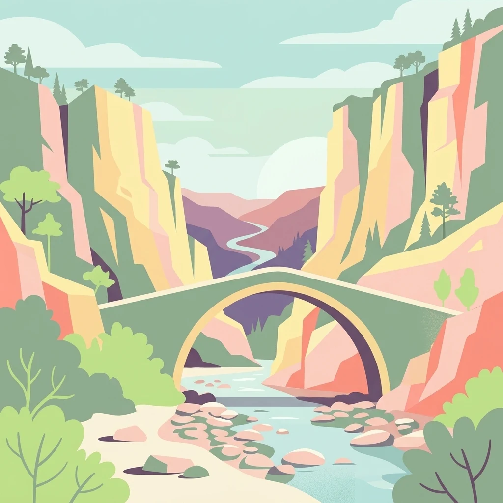
A flat-style digital illustration showing a classic stone arch bridge spanning a river between steep, layered rocky cliffs and forested slopes.

Northern Pindus National Park

National park

Park overview

Structured park overview, official facts, and landscape profile for Northern Pindus National Park

Northern Pindus National Park park facts, protected area profile, and essential visitor context

Review the core facts for Northern Pindus National Park, including designation, size, terrain, visitor scale, habitats, and operating context in one park-focused overview.

About Northern Pindus National Park

Northern Pindus National Park is a major protected area in the Pindus Mountains of the Epirus region in northwestern Greece. It protects a remarkable sequence of mountain landscapes, from the deep limestone gorges of the Vikos and Aoos rivers to the high alpine zones of the Tymfi massif and the lower forested valleys around the traditional villages of Zagori. Together these landscapes create one of the most ecologically rich and visually dramatic protected areas in Greece, and one of the country's ten national parks.

The park was formally created in 2005 by merging two earlier national parks that together represented different facets of the Pindus range. The Pindus-Valea Calda park, established in 1966, focused on the Pindus range around the Valia Calda valley, an area long valued for its forests and wildlife. The Vikos-Aoos park, established in 1973, focused on the spectacular Vikos Gorge and the Aoos river gorge, including the core of the Tymfi massif. Their union under the Northern Pindus name created a single large protected area that spans both the deep gorge country and the broader alpine Pindus.

Ecologically, the park is defined by its combination of Mediterranean and continental influences. Lower elevations are dominated by dense mixed forests of beech, oak, plane trees, willows, and poplars along the river valleys, while higher elevations transition to oak-dominated woodlands and, above the treeline, alpine grasslands and rock. This gradient supports a wide variety of flora and fauna and contributes to the park's ecological importance within Greece and the wider Balkans.

Culturally, the park overlays the Zagori region, an area known for its network of historic stone villages, centuries-old arched stone bridges, and monastic sites. Many of these settlements are protected as traditional villages, and their relationship with the surrounding landscape, including traditional forestry, livestock keeping, and the legacy of the so-called Vikos doctors who used local herbs, is an integral part of how the park is understood today.

Quick facts and research context for Northern Pindus National Park

Northern Pindus National Park lies in the Pindus range of Epirus in northwestern Greece, north of the city of Ioannina and around the traditional Zagori villages. It was created in 2005 through the merger of two earlier national parks, the Pindus-Valea Calda park (established in 1966) and the Vikos-Aoos park (established in 1973), and today covers roughly 157 square kilometers of core protected mountain terrain. The park includes the Vikos and Aoos river gorges, the Tymfi massif with peaks rising above 2,400 meters, and the Drakolimni alpine lake. It is classified as an IUCN Category II protected area, is part of the Natura 2000 network as a Special Area of Conservation, and was recognized as a UNESCO Global Geopark in the mid-2010s.

Protection and recognition

Documented protection history and official designation metrics

Northern Pindus National Park Protection Status and Management Scope

Northern Pindus National Park maintains recorded terrestrial protection status established in 2010. Structured conservation records provide verifiable administrative details regarding the protected area designation.

Protection details

Protection scope
Terrestrial
Designated year
2010
Transboundary protection
No
WDPA ID
124201
Park context

Deeper park guide and search-rich context for Northern Pindus National Park

Northern Pindus National Park history, landscape, wildlife, and travel context

Explore Northern Pindus National Park through its history, landscape character, ecosystems, wildlife, conservation priorities, cultural context, and seasonal travel timing in a structured park guide built for atlas discovery and search intent.

Why Northern Pindus National Park stands out

Northern Pindus National Park is best known for the Vikos Gorge, a limestone canyon often cited among the deepest in the world relative to its narrow width, and for the broader rugged scenery of the Tymfi massif. The park is also recognized for its diverse mountain wildlife, including brown bears, wolves, jackals, chamois, and golden eagles, as well as for the traditional stone villages of Zagori scattered throughout its valleys. The combination of deep gorges, alpine lakes such as Drakolimni, dense beech and oak forests, and centuries-old cultural heritage makes it one of the defining mountain landscapes of Greece.
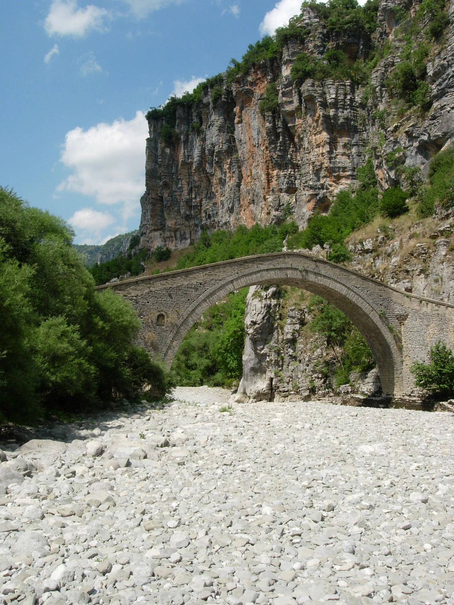
A historic arched stone bridge stands in a rocky, dry river channel at the base of a towering, craggy limestone cliff.
An Ottoman stone bridge spanning a dry, rocky riverbed within Vikos Gorge.

Northern Pindus National Park history and protected-area timeline

Northern Pindus National Park has its roots in two separate Greek national parks, each established to protect a different part of the Pindus range in Epirus. The older of the two, the Pindus-Valia Calda National Park, was created in 1966 to protect the forest and mountain habitats around the Valia Calda valley, a name that means 'warm valley' in the local Aromanian language. The second, the Vikos-Aoos National Park, was established in 1973 to safeguard the dramatic Vikos and Aoos gorges along with the surrounding mountain terrain, including the Tymfi massif.

In 2005 these two parks were merged into a single protected area under the name Northern Pindus National Park, formalizing what had been overlapping conservation work in the region. This consolidation effectively created one of the largest and most significant mountain national parks in Greece, combining the deep gorges and traditional villages of the Vikos-Aoos area with the broader Pindus forests of the Valia Calda area. The merged park was subsequently recognized as a Global Geopark and later received UNESCO Global Geopark status in the mid-2010s, recognizing the importance of its geological heritage in addition to its ecological value.

The Zagori villages within and around the park have a much longer human history. Stone arched bridges, monasteries such as the Monastery of Agios Ioannis Roggovou near Tsepelovo and the historic Spiliotissa Monastery, and traditional settlements all reflect centuries of human habitation and land use within what is now a strict conservation area. The park administration has sought to balance the protection of fragile ecosystems with preservation of the cultural identity of these mountain communities.

Northern Pindus National Park landscape and geographic character

The landscape of Northern Pindus National Park is dominated by the rugged terrain of the Pindus range, where steep limestone ridges, deep river gorges, forested valleys, and high alpine plateaus combine to create one of the most striking mountain environments in Greece. The Vikos Gorge is the park's signature landform: a long, narrow canyon carved by the Voidomatis River, flanked by cliffs and dense forest, widely recognized for its exceptional depth relative to its width. Parallel to it, the Aoos Gorge is another dramatic canyon system formed by the Aoos River, with its own distinct combination of vertical cliffs and forested slopes.

Beyond the gorges, the Tymfi massif rises above the park's valleys, with peaks including Astraka and the locally known Gamila, the highest summit in the area. The massif hosts the Drakolimni, a small glacial lake in a high alpine basin, and a network of caves and sinkholes formed by erosion of the limestone bedrock, including the deep Provatina abyss. Stone formations near Monodendri, sometimes referred to as a 'stone forest', produce an unusual layered rock landscape above the gorge.

At lower elevations, the park's valleys host the traditional villages of Zagori, with their stone houses, slate roofs, and arched bridges across rivers such as the Voidomatis, Aoos, Vardas, and Zagoritikos. Together these elements, gorges, peaks, alpine lakes, forested slopes, and stone villages, form a single tightly connected mountain landscape in which geological processes and human history are visibly intertwined.
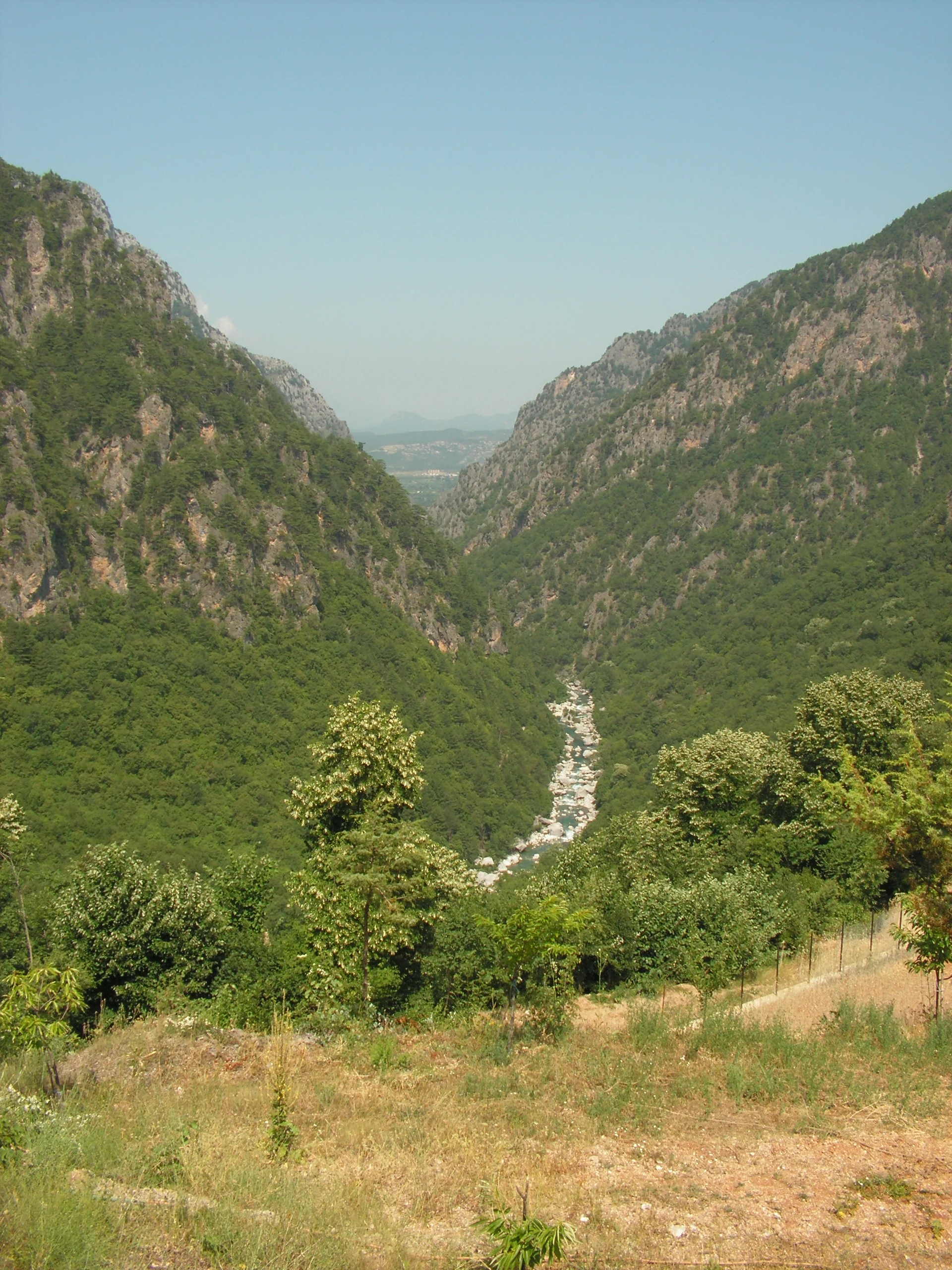
A wide, high-angle view looking down into a deep, steep-walled canyon covered in dense green forest, with a rocky riverbed visible at the bottom.
A view looking down into the deep Vikos Gorge in Northern Pindus National Park.

Northern Pindus National Park ecosystems, habitats, and plant life

The ecology of Northern Pindus National Park reflects its position at the transition between Mediterranean and continental mountain climates, producing an unusually broad range of habitats within a relatively compact area. In the lower valleys and along the rivers, dense forests of plane trees, willows, poplars, and beech line the waterways, while oaks and related deciduous species dominate the mid-elevation slopes. Above the treeline, the landscape opens into alpine meadows, exposed limestone, and rocky terrain shaped by glacial and karst processes.

The park has recorded a large number of plant species and subspecies, with notable concentrations of endemic and rare Balkan taxa growing on its cliffs, meadows, and woodland edges. The combination of deeply shaded gorges, sun-exposed slopes, and high-altitude sites supports an exceptionally varied flora, and the region has long been studied for its medicinal plants, especially in and around the Vikos Gorge.

Freshwater ecosystems are equally important. The Voidomatis and Aoos rivers and their tributaries are renowned for the clarity of their waters and for the biodiversity they support, including fish, amphibians, crustaceans, and river birds. Springs along the Voidomatis are a notable hydrological feature, and the broader catchment plays a central role in shaping the downstream ecology of Epirus. Together, these terrestrial and aquatic systems give the park a layered ecological identity, from gorge and forest to alpine plateau and lake.
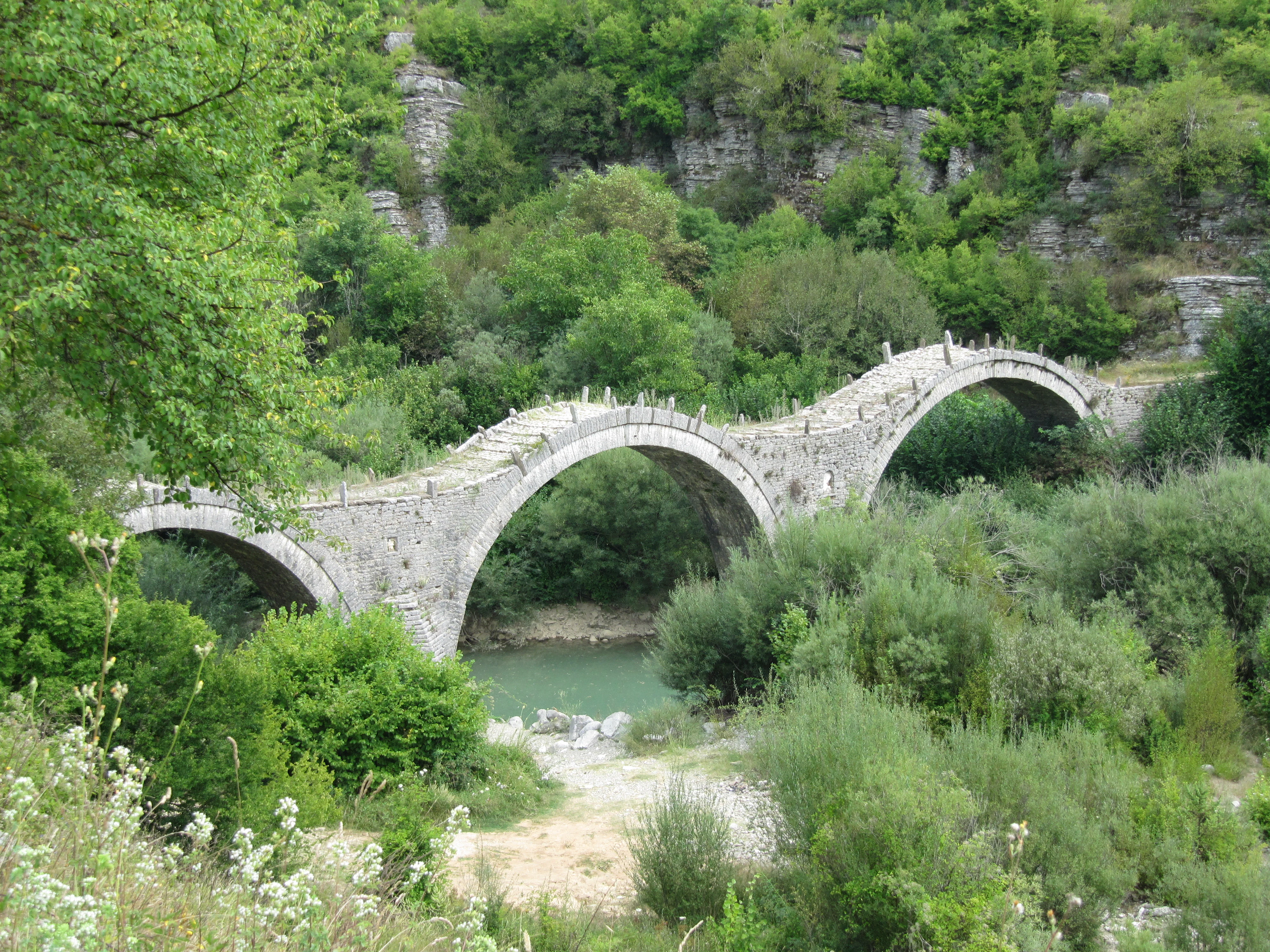
A multi-arched stone bridge spanning a river, surrounded by dense green forest and rocky terrain.
The historic Plakida stone arch bridge, a prominent architectural feature nestled within the lush valley of Northern Pindus National Park.

Northern Pindus National Park wildlife and species highlights

Wildlife is one of the defining features of Northern Pindus National Park. The area is home to a strong community of large mammals, including brown bears and gray wolves, both of which use the park's extensive forests and remote valleys as core habitat. Roe deer and wild boar roam the wooded slopes, while chamois and wild goats cling to the steeper cliff faces and rocky ridges above. Smaller carnivores such as the European wildcat, the Eurasian lynx, stone martens, and the golden jackal, which has one of its few remaining strongholds in Greece and the Balkans here, are also present.

The park's rivers support a distinct freshwater fauna species including the European otter, along with amphibians, reptiles, insects, and fish adapted to cold, clean mountain waters. Birdlife is exceptionally rich, with raptors such as the golden eagle and the rare Egyptian vulture nesting on the cliffs, alongside a wide variety of woodland and alpine species, including several woodpeckers and high-elevation songbirds.

A particularly unusual wildlife feature is the alpine newt, which in Greece occurs only in high-elevation habitats such as those around Drakolimni on the Tymfi massif. The combination of large carnivores, cliff-nesting raptors, freshwater specialists, and high-altitude amphibians makes the park a key refuge for some of the rarest and most emblematic species of the Balkans.
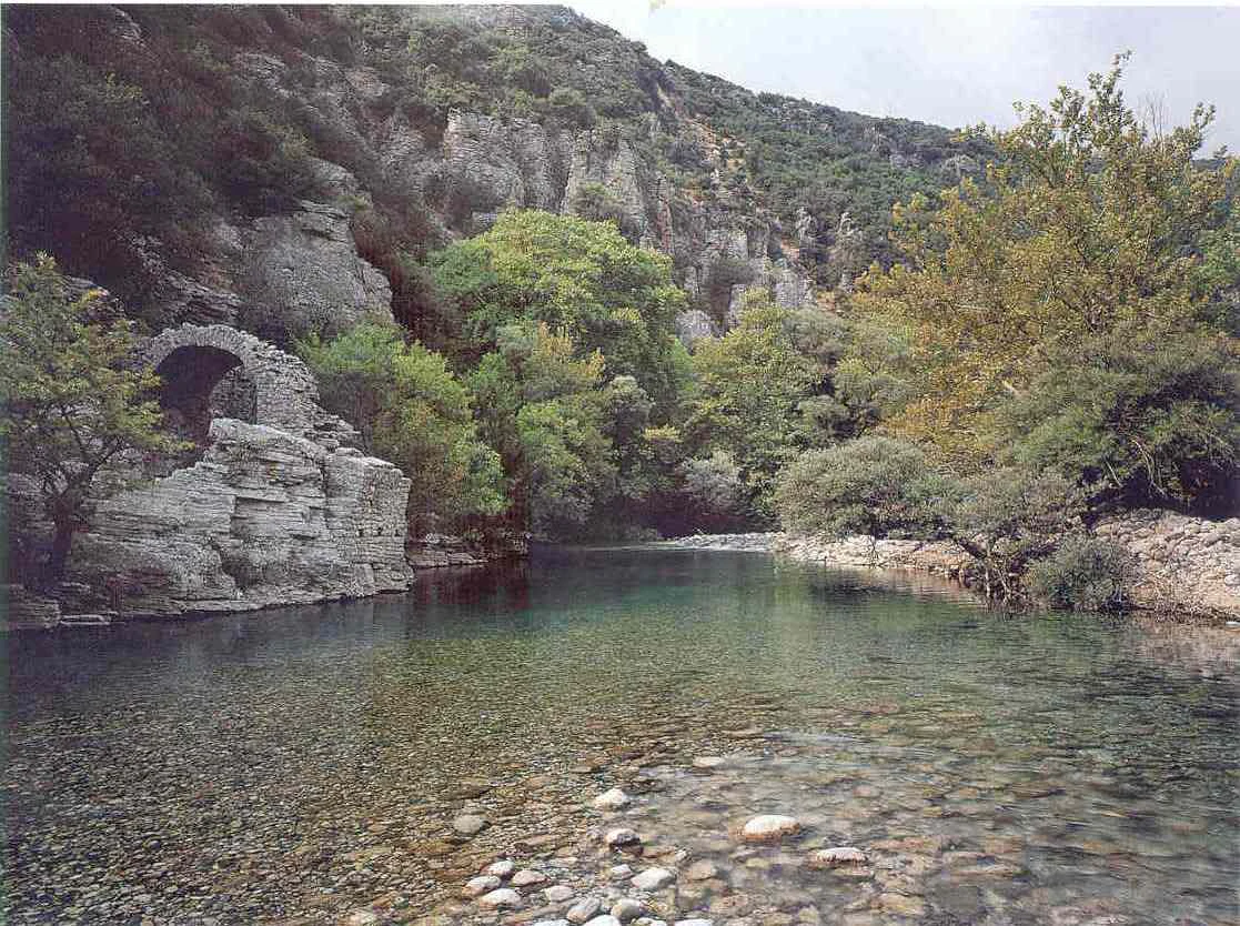
A clear, shallow river flows over a pebble-strewn bed, flanked by lush green trees and a rock formation featuring a small stone archway.
The clear waters of the Voidomatis River flowing through Northern Pindus National Park.

Northern Pindus National Park conservation status and protection priorities

Northern Pindus National Park holds an especially important place in Greek and European conservation. It is classified as an IUCN Category II national park, includes a UNESCO-recognized Global Geopark, and forms part of the Natura 2000 network as a Special Area of Conservation, reflecting its combined ecological and geological significance. The park's deep gorges, extensive beech and oak forests, and high-altitude habitats support populations of brown bears, wolves, and other large mammals that depend on connected, low-disturbance landscapes, making it a critical refuge in a region where such habitats have otherwise become fragmented.

Beyond its role for wildlife, the park protects a striking karst landscape with numerous caves, sinkholes, and glacial landforms. The Drakolimni alpine lake and deep abysses such as Provatina represent rare geological and hydrological features that are central to the park's identity as a Global Geopark. Strict regulations limiting activities like grazing and logging inside the core zone aim to maintain the integrity of these systems.

Although economic pressures, including historical logging, road development, and changing land use in surrounding villages, have at times affected the broader area, the park's protected status and its integration into European conservation networks have helped anchor long-term efforts to preserve both its biodiversity and its geological heritage.

Northern Pindus National Park cultural meaning and human context

Northern Pindus National Park overlays the heart of the Zagori region, one of the most culturally distinctive mountain areas of Greece. The area is home to a network of traditional stone villages, known collectively as Zagorochoria, whose houses, churches, and stone-paved paths are built entirely from local stone and slate. These villages have been formally recognized for their architectural value and continue to shape the cultural identity of the park.

The villages are also connected by a remarkable system of arched stone bridges built across the rivers and gorges, financed in many cases by wealthy emigrant Zagorisians from the 17th century onward. Famous examples include the Kokkorou Bridge and the triple-arched Plakidas Bridge, which remains a defining image of the park. Scattered monasteries, water mills, and chapels, including the Monastery of Agios Ioannis Roggovou near Tsepelovo and the Spiliotissa Monastery overlooking the Vikos Gorge, reflect the long religious and community history of the region.

Traditional livelihoods in Zagori centered on forestry, livestock keeping, and trade, and local knowledge of wild plants was historically significant; so-called Vikos doctors used herbs from the gorge for healing into the 20th century. Today, this heritage is preserved as an integral cultural layer of the park, alongside the natural environment it has long been intertwined with.
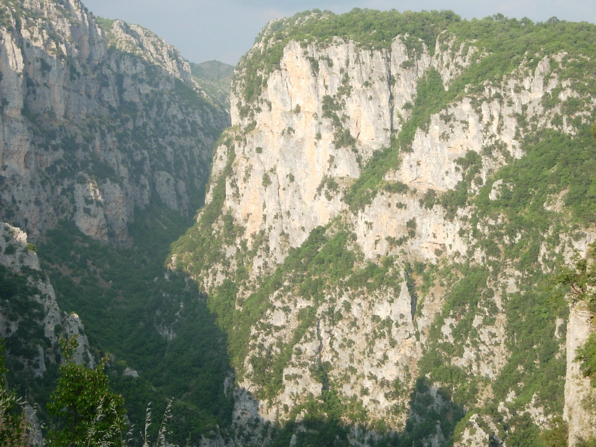
A wide, vertical shot of the Vikos Gorge in Greece, showcasing deep limestone cliffs covered in green vegetation.
The deep, limestone walls of the Vikos Gorge, a major landmark within Northern Pindus National Park.

Top sights and standout views in Northern Pindus National Park

Among the park's most distinctive features are the Vikos Gorge, often recognized as one of the deepest canyons in the world relative to its narrow opening, and the adjacent Aoos Gorge, with the Aoos River cutting its own dramatic corridor through the limestone terrain. The high peaks of the Tymfi massif, including the locally named Gamila, host the glacial Drakolimni lake and a network of deep karst features such as the Provatina abyss.

The protected area also contains some of the most important wildlife habitat in the Balkans for brown bears and wolves, alongside breeding populations of golden eagles and rare Egyptian vultures. The traditional stone villages of Zagori and their historic bridges and monasteries add a cultural dimension that is inseparable from the natural landscape. Together these elements, gorges, peaks, alpine lakes, forests, wildlife, and stone villages, define the park's distinctive identity as a mountain protected area.

Best time to visit Northern Pindus National Park

Northern Pindus National Park is a high-mountain protected area where seasonal conditions strongly affect both access and atmosphere. Spring and early summer are typically the most attractive periods: the alpine meadows above the treeline come into bloom, the rivers run full from snowmelt, and the villages and gorges are at their most photogenic. Summer remains pleasantly cool in the higher elevations compared to much of Greece, and is well suited to hiking, gorge trekking, and rafting on the Voidomatis and Aoos.

Autumn brings strong color to the beech and oak forests and a quieter atmosphere, though rainfall increases. Winter brings heavy snow to the higher elevations, with snow cover lasting for many months at altitude, which can limit access to some alpine trails and mountain refuges. Visitors interested primarily in the gorges, villages, and lower forest zones will generally find the warmer months easiest, while those drawn to snow scenery and alpine landscapes must expect more challenging conditions.
Monthly climate preview

Long-term temperature and precipitation averages across representative coordinates

Northern Pindus National Park Climate Normals and Monthly Weather Records

Northern Pindus National Park records documented monthly temperature variations alongside shifting precipitation rates from long-term climatology data. Reviewing the complete twelve-month profile provides deeper analytical insight into baseline environmental patterns across the protected terrain.
Annual mean11 °C
1 °C23 °C
Jan
Feb
Mar
Apr
May14°
Jun19°
Jul23°
Aug23°
Sep17°
Oct12°
Nov
Dec
Warmest month
August

23 °C

Coolest month
January

1.4 °C

Wettest month
November

4.5 mm/day

Driest month
July

0.6 mm/day

Park location guide

Geography guide, regional context, and park location map for Northern Pindus National Park

Northern Pindus National Park park geography, regions, and map view in Greece

Understand where Northern Pindus National Park sits in Greece through a broader geographic reading of the surrounding landscape, nearby location context, and its mapped position within the national park landscape.

How Northern Pindus National Park fits into Greece

Greece, officially the Hellenic Republic, is a country in Southeast Europe occupying the southern Balkans. It borders Albania, North Macedonia, Bulgaria, and Turkey, with coastlines on the Aegean, Ionian, and Mediterranean seas. The country has over 10 million people and is renowned for its ancient Greek heritage, philosophy, democracy, and the Olympic Games.

Wider geography shaping Northern Pindus National Park in Greece

Greece occupies the southern tip of the Balkan peninsula in Southeast Europe. It shares land borders with Albania to the northwest, North Macedonia and Bulgaria to the north, and Turkey to the east. The Aegean Sea lies to the east of the mainland, the Ionian Sea to the west, and the Sea of Crete and Mediterranean Sea to the south. The country spans thousands of islands across nine traditional geographic regions and has the longest coastline in the Mediterranean basin.

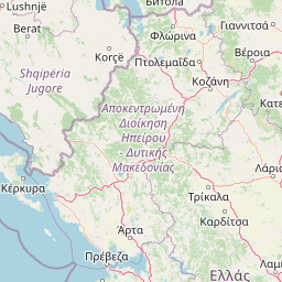
Map view of Northern Pindus National Park

Use this park location map to pinpoint Northern Pindus National Park in Greece, understand its exact geographic position, and read its mapped placement within the surrounding landscape more clearly.

Pigeon | © OpenStreetMap contributors

Location context for Northern Pindus National Park

Epirus

Visual reference of limestone cliffs, alpine peaks, and mountain habitats across Epirus

Northern Pindus National Park Photos: Exploring Landscapes, Gorges, and Protected Scenery

Visual documentation captures the rugged terrain, deep river canyons, and dense mountain forests defining Northern Pindus National Park. Photographic collections illustrate the scale of limestone formations and protected wildlife habitats across the wider Greek landscape.

A historic arched stone bridge stands in a rocky, dry river channel at the base of a towering, craggy limestone cliff.

Several vibrant orange Lilium chalcedonicum flowers with recurved petals in the foreground of a forested mountain slope.

A wide, high-angle view looking down into a deep, steep-walled canyon covered in dense green forest, with a rocky riverbed visible at the bottom.

A multi-arched stone bridge spanning a river, surrounded by dense green forest and rocky terrain.

A clear, shallow river flows over a pebble-strewn bed, flanked by lush green trees and a rock formation featuring a small stone archway.

A multi-story stone and plaster monastery building built into a rocky cliff face, featuring traditional masonry and an exterior fresco on the wall.

A wide, vertical shot of the Vikos Gorge in Greece, showcasing deep limestone cliffs covered in green vegetation.

Park atlas

Compare nearby mountain landscapes and connected regional reserves

Other Parks Near Northern Pindus National Park And Protected Areas In The Region

Browse protected areas and rugged mountain terrain adjacent to Northern Pindus National Park for broader regional comparison. Examining surrounding reserves reveals shared geological features and connected wildlife habitats across the wider terrain.
National parkGreece
About 0.4 km away#1 closest

Southwest

Vikos-Aoös National Park: Deepest Gorge and Protected Mountain Landscape Atlas

Discover protected area boundaries and regional geography in Epirus.

Vikos-Aoös National Park in Greece's Pindus mountains is a premier destination for exploring dramatic natural geography. Best known for the Vikos Gorge, considered the world's deepest canyon relative to its width, the park also features towering alpine peaks like Mount Tymphe, glacial lakes such as Drakolimni, and rich botanical diversity. As a UNESCO Geopark and part of the Natura 2000 network, it safeguards critical habitats, including significant brown bear populations. This park offers a profound look into protected landscapes, offering detailed geographic context and mapped terrain for atlas-based discovery.

Area
126 km²
Established
1973
IUCN
II
Visitors
100K annual
Watercolor illustration of a mountainous landscape with a river, forests, and distant hills
National parkGreece
About 34 km away#2 closest

East

Pindus National Park: A Protected Greek Mountain Wilderness with Ancient Forests

Explore its rugged terrain, biodiversity, and alpine landscape.

MoriAtlas presents Pindus National Park, a significant protected area in Greece known for its dramatic mountainous terrain, deep valleys, and ancient old-growth forests. This page details its geographic context, featuring rugged highland landscapes, serpentine soils, and vital habitats for species like the Eurasian brown bear. Understand its place within the Pindus mountain range and its importance as a mapped wilderness area for conservation.

Area
69.27 km²
Established
1966
IUCN
II
Relief
Mountain
Watercolor painting of a landscape with green fields, scattered trees, and rolling hills under a light sky
National parkGjirokastër County
About 46 km away#3 closest

Northwest

Fir of Hotovë-Dangëlli National Park: Ancient Forests & Mountain Wilderness Atlas

Explore a premier protected landscape in Gjirokastër County, Albania.

Fir of Hotovë-Dangëlli National Park stands as a monumental protected area, celebrated for its exceptional old-growth Hotova Fir forests, which are a rare Mediterranean plant relic. This national park in Gjirokastër County offers a detailed look at a vast mountainous terrain, featuring dramatic canyons like Lengarica Canyon, and serving as a critical habitat for diverse wildlife. MoriAtlas provides structured geographic context for this significant landscape, highlighting its mapped boundaries and role as a key component of regional protected area networks.

Area
360.038 km²
Established
2008
IUCN
II
Relief
Mountain
A soft, horizontal watercolor painting showing a serene landscape with a body of water in the foreground, surrounded by grasses and bushes, with rolling hills in the background.
Natural monumentVlorë County
About 46 km away#4 closest

West

Blue Eye Natural Monument: Protected Karst Geography in Vlore County

A study of Albania's most prominent karst spring and woodland ecosystem.

The Blue Eye is a protected natural monument in southern Albania featuring a powerful, deep karst vent and vivid blue basin. This site acts as the headwater for the Bistrice River and supports a diverse forest ecosystem of oak and sycamore. The surrounding karst terrain and hydrology offer a focused look at the environmental geography of the Ionian watershed.

Area
1.8 km²
Established
1996
IUCN
III
Relief
Upland
Watercolor landscape painting showing a lake, distant mountains, and vegetation
National parkVlorë County
About 58 km away#5 closest

West

Butrint National Park: Archaeological Heritage and Mediterranean Wetland Landscape

Explore its unique geography and protected park boundaries.

Butrint National Park presents a singular opportunity for geographic and protected-area discovery, showcasing an unparalleled fusion of ancient history and ecological richness. Located in Albania's Vlorë County, this national park encompasses Lake Butrint, coastal lagoons, and vital wetland habitats, recognized internationally for their biodiversity. Through MoriAtlas, users can explore the mapped extent of this unique landscape, understand its role within regional geography, and uncover the interplay between its preserved archaeological sites and the surrounding Mediterranean environment.

Area
94.244 km²
Established
2000
IUCN
II
Relief
Lowland
National parkGreece
About 61 km away#6 closest

Southeast

Parc national de Tzoumérka-Achelóos-Ágrafa-Météores National Park: Geography and Landscape Atlas

Central Greece Pindus mountain protected wilderness zone

An extensive protected landscape bridging Thessaly and Epirus, this national park showcases the ecological and geological diversity of the central Pindus Mountains. Analyze the geographic layout of the Athamanian ranges, the Acheloos river corridor, and the unique conglomerate formations at Meteora through a detailed protected-area lens.

Area
3,379.94 km²
Established
2009
IUCN
VI
Relief
Mountain
Watercolor painting showing a river valley with mountain ranges in the background and green fields
National parkGjirokastër County
About 63 km away#7 closest

Northwest

Vjosa Wild River National Park: Europe's Pioneer Free-Flowing River Protected Area

Mapping dynamic canyons and vital river ecosystems in Gjirokastër County.

Vjosa Wild River National Park is recognized as Europe's first Wild River National Park, a groundbreaking designation protecting an entire river system from source to sea. This protected area in Gjirokastër County preserves remarkable topography, including dramatic canyons, natural rapids, and meandering islands, all shaped by the free flow of the Vjosa River and its tributaries. Explore the mapped boundaries and unique landscape context of this significant biodiversity hotspot, offering a crucial case study for river conservation and atlas discovery.

Area
127.27 km²
Established
2023
IUCN
II
Relief
Mixed relief
Protected landscapeKorçë County
About 67 km away#8 closest

North

Fir of Drenovë-Sinicë Protected Landscape: Forest and Geological Map of Korçë County

Mapping Albania's protected Silver fir woodland ecosystems

Explore the structured geography of the Fir of Drenovë-Sinicë Protected Landscape, a diverse expanse in Korçë County defined by its ancient Silver fir stands and karst cave systems. This area showcases a varied landscape of rocky monoliths, mountain lakes, and tectonic valleys that serve as a vital ecological record for the southeastern Albanian mountains.

Area
10.3 km²
Established
1966
IUCN
V
Relief
Mountain

Common questions about visiting, size, designation, and location context for Northern Pindus National Park

Northern Pindus National Park FAQs for park facts, access, geography, and protected area context

Find quick answers about Northern Pindus National Park, including protected-area facts, park geography, trail and visitor context, and how the park fits into its surrounding country and regional landscape.
MoriAtlas Explorer

Continue Your Protected Areas Search Across the Global Atlas

Deepen your exploration by continuing the structured search for national parks and protected areas worldwide. Utilize the comprehensive filtering capabilities to compare different conservation landscapes and refine your understanding of global park geography. Discover more about the distribution and characteristics of protected natural areas.

Global natural geography