Mori Atlas logo
National parkButrint National Park

Discover the mapped boundaries and ecological landscape of this UNESCO World Heritage protected area in Vlorë County.

Butrint National Park: Ancient Ruins, Mediterranean Wetlands, and Coastal Geography

(Parku Kombëtar i Butrintit)

Butrint National Park stands as a remarkable protected area in Albania, seamlessly integrating a significant archaeological site with vital Mediterranean wetland ecosystems. Situated in Vlorë County, its landscape is defined by Lake Butrint, coastal lagoons, and channels connecting to the Ionian Sea, creating a unique geographic setting. This national park offers a profound opportunity for atlas-based discovery, allowing exploration of its rich history and the complex natural terrain that supports diverse species and habitats.

UNESCO World Heritage SiteRamsar WetlandArchaeological SiteMediterranean WetlandsCoastal LagoonsIsland Ecosystems
Illustration showing a mountainous landscape with waterfall, lake, pine forests, and ancient stone structures

Butrint National Park

National park

Park overview

Structured park overview, official facts, and landscape profile for Butrint National Park

Butrint National Park park facts, protected area profile, and essential visitor context
Review the core facts for Butrint National Park, including designation, size, terrain, visitor scale, habitats, and operating context in one park-focused overview.

About Butrint National Park

Butrint National Park represents one of the Mediterranean region's most compelling examples of how cultural and natural heritage can be integrated within a single protected landscape. The park sprawls across a peninsula in extreme southern Albania, where the waters of Lake Butrint meet the Ionian Sea through the natural conduit of the Vivari Channel. This geography creates a complex hydrographical network of lakes, lagoons, rivers, and coastal zones that support exceptional biodiversity while containing the ruins of a city that served as an important settlement from ancient Greek times through the Roman and Byzantine periods. The archaeological remains are situated within a natural woodland setting, their preservation intimately connected to the surrounding ecosystems—ruins have survived partly because the marshy environment limited later development. The park's management approach reflects this dual character, balancing archaeological conservation with wetland protection and sustainable visitor access. In 2005, after intensive restoration work supported by the Butrint Foundation, World Bank, and UNESCO, the site was removed from the UNESCO World Heritage in Danger list, demonstrating successful integrated management. The Ksamil Islands, a group of four rocky islands in the western part of the park, add a distinctive coastal dimension accessible only by boat.

Quick facts and research context for Butrint National Park

Butrint National Park occupies a peninsula bordered by Lake Butrint and the Vivari Channel in Albania's southern Ionian coast region. The park was established in 2000 and covers approximately 8,600 hectares of coastal and wetland terrain. It holds dual international protection status as a UNESCO World Heritage Site and a Ramsar Wetland of International Importance. The park's ecosystem supports over 400 animal species including dolphins, Mediterranean monk seals, sea turtles, and more than 240 bird species. The climate is Mediterranean with mild, wet winters and warm, dry summers.

Park context

Deeper park guide and search-rich context for Butrint National Park

Butrint National Park history, landscape, wildlife, and travel context
Explore Butrint National Park through its history, landscape character, ecosystems, wildlife, conservation priorities, cultural context, and seasonal travel timing in a structured park guide built for atlas discovery and search intent.

Why Butrint National Park stands out

Butrint National Park is best known for its extraordinary combination of archaeological and natural heritage. The ancient city of Butrint contains one of Albania's most significant archaeological sites, featuring a remarkably preserved Roman theatre built in the 3rd century BC, a late antique baptistery with elaborate mosaic floors, a great Byzantine basilica, city walls dating to various periods, and the famous Lion Gate, a 4th century BC entrance featuring a sculptural group of a lion attacking a bull. The park's natural landscapes are equally distinguished, centred on Lake Butrint, a large coastal lagoon connected to the Ionian Sea via the narrow Vivari Channel, surrounded by wetlands, reed beds, and the Ksamil Islands. The marine environment supports populations of common bottlenose dolphins, and the park provides critical habitat for the endangered Mediterranean monk seal.

A turtle with a patterned shell resting on a rock with its mouth open
Hellenic pond turtle resting on a rock at Butrint National Park

Butrint National Park history and protected-area timeline

Butrint National Park was formally established through Albanian government ordinance number 82 on 2 March 2000, with the explicit purpose of preserving both the natural ecosystems and landscapes along with their plant and animal communities, and the significant cultural heritage contained within the area. The park's territory was expanded several times following its initial designation, reaching its current extent in 2005. The archaeological site of Butrint itself had earlier protected status—it was first declared a Cultural Monument in 1948 through Albania's first cultural heritage protection legislation, and the surrounding forested area received similar protection in 1981 to safeguard both archaeological and environmental values. The ancient city's international recognition came in 1992 when it was inscribed on the UNESCO World Heritage List as a site of outstanding universal cultural significance. The lagoon system's wetland values were recognized under the Ramsar Convention in 2003. The park is managed by a directorate under the Albanian Ministry of Environment, with the Butrint Foundation playing a key coordinating role in conservation and training activities. In 2010, authorities demolished over 200 illegal structures in Ksamil that had violated the master plan and threatened park integrity.

Butrint National Park landscape and geographic character

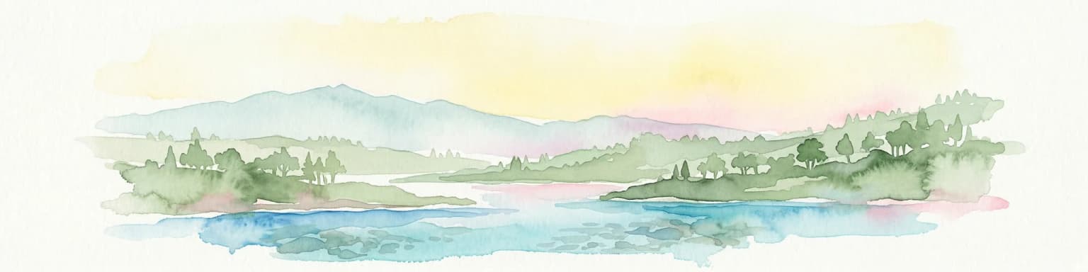
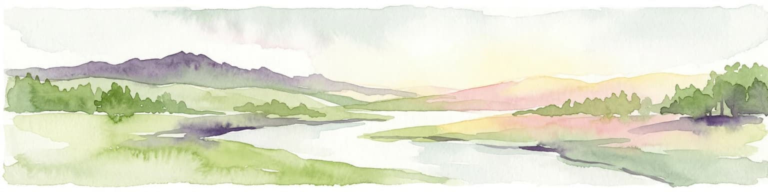
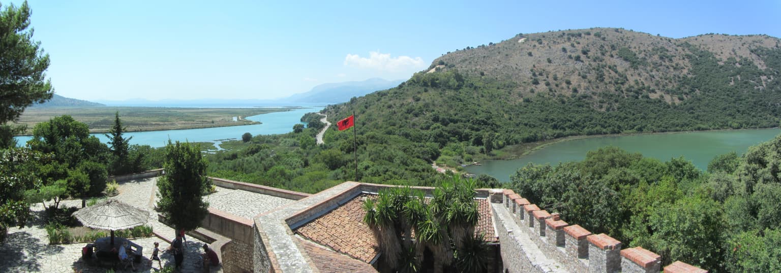
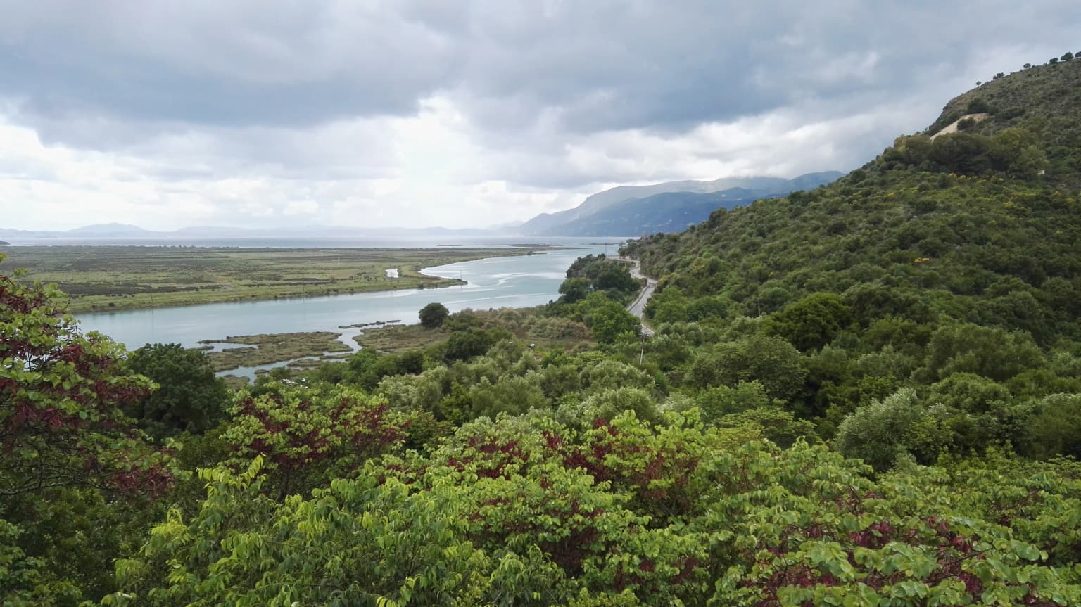
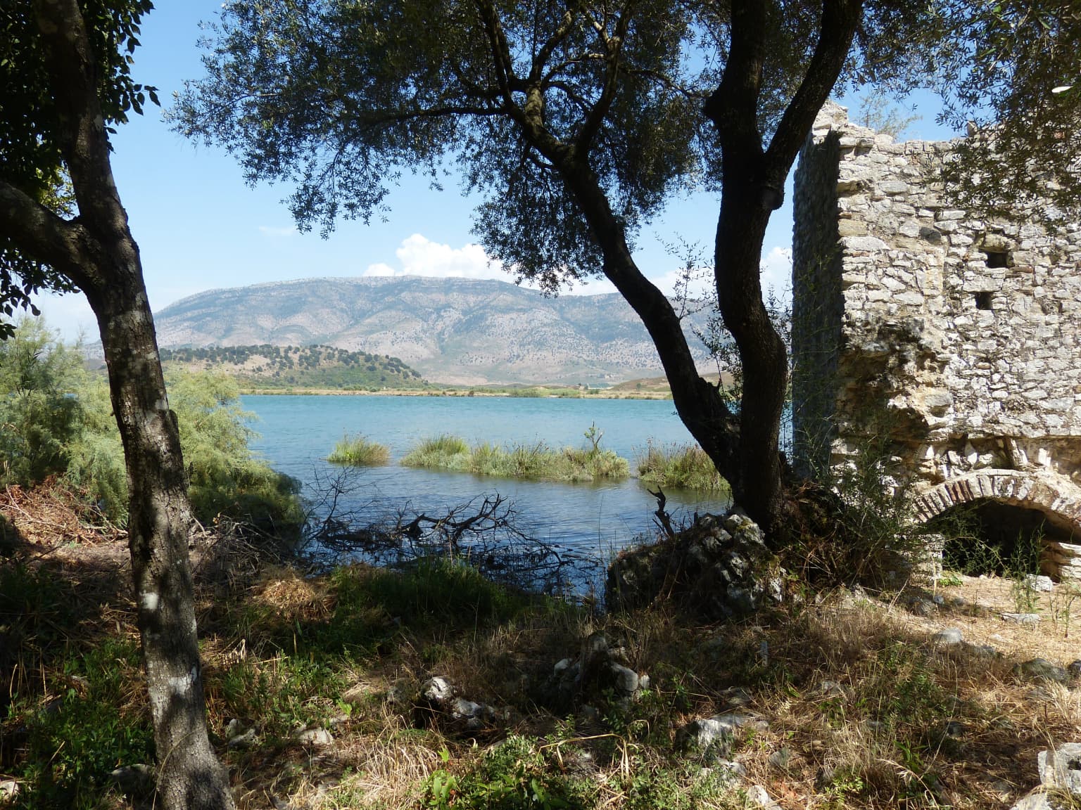
The physical landscape of Butrint National Park is defined by the interplay between freshwater and marine environments along Albania's Ionian coast. At its heart lies Lake Butrint, a coastal lagoon with a surface area of approximately 16.3 square kilometres, measuring 7.1 kilometres in length and 3.3 kilometres in width. The lake's water regime is characteristic of coastal lagoons, with mesotrophic waters showing eutrophic tendencies, and its limnology divided into two distinct layers. The Vivari Channel, a natural watercourse connecting the lake to the Ionian Sea, forms a critical ecological corridor and represents the lake's only connection to the open sea. Smaller water bodies include Lake Bufi in the southeast, covering 83 hectares. The terrain surrounding the wetlands consists of hilly country, with Mile Mountain in the west and the slopes of Sotira rising to the south and east. The Ksamil Islands—four rocky islets in the western coastal area—are accessible only by boat, two of them connected by a narrow sandbar. The park experiences a Mediterranean climate with annual precipitation of approximately 1,500 millimetres, characterised by rainy winters and dry, warm to hot summers.

Panoramic view of Butrint National Park with stone ruins, trees, a lake, hills, and a red flag
Panoramic view of Butrint National Park featuring ancient stone structures, Lake Butrint, and surrounding hills

Butrint National Park ecosystems, habitats, and plant life

The ecological character of Butrint National Park is defined by the convergence of Mediterranean forest, wetland, and coastal marine ecosystems within a relatively compact area. The park falls phytogeographically within the Illyrian deciduous forests ecoregion of the Palearctic Mediterranean forests, woodlands, and scrub. The diverse geological and hydrological conditions, combined with the mosaic distribution of habitats ranging from shallow coastal lagoons to evergreen forests, create conditions for exceptional biodiversity—the park's vertebrate flora alone comprises 800 to 900 species, representing approximately 27% of Albania's total species count. Vegetation is vertically divided into distinct zones, with holly oak and bay laurel dominating the upper tree layer, while the scrub layer features species such as elmleaf blackberry, common hawthorn, and common ivy. The shallow coastal lagoons support extensive beds of phragmites and typha latifolia, while underwater meadows of zostera noltei and ruppia cirrhosa occur in subtidal areas. Along the littoral sea bottom, posidonia oceanica meadows dominate from the Stillo Cap to Cuka Channel. The Vivari Channel and river mouths support different seagrass communities including cymodocea nodosa.

Wide landscape view of the Vivari Channel surrounded by dense green vegetation and rolling hills under an overcast sky
Vivari Channel flowing through Butrint National Park, Albania, with lush green hills in the background

Butrint National Park wildlife and species highlights

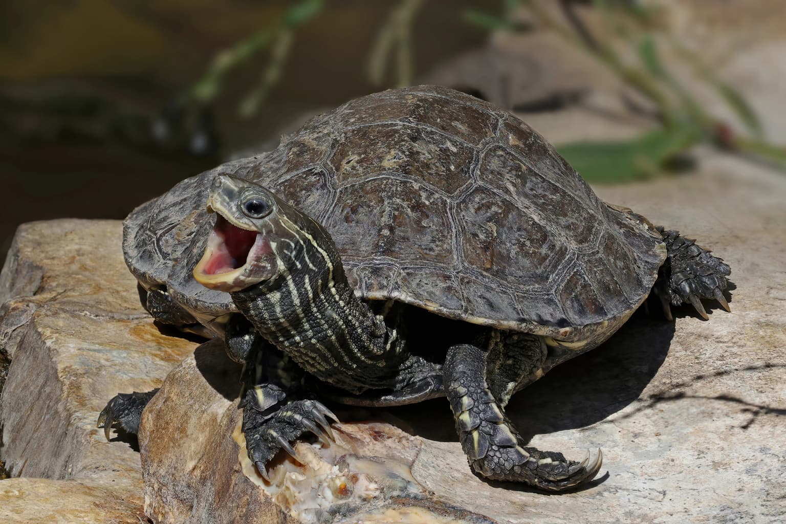
Butrint National Park supports an extraordinary diversity of wildlife across its terrestrial, wetland, and marine habitats. The park records over 400 animal species distributed across distinct ecosystems: 39 mammal species, 246 bird species, 25 reptile species, 10 amphibian species, and 105 fish species. The coastal marine environment is particularly notable, frequented by common bottlenose dolphins, short-beaked common dolphins, and occasionally striped dolphins. The park provides one of the last remaining nesting habitats for the endangered Mediterranean monk seal, which inhabits the rocky caverns along the coast. Sea turtles, including loggerhead and leatherback turtles, occur in the shallow coastal waters. The wetland habitats support exceptional bird life, with the marshes and reed beds serving as critical feeding and resting areas along the Adriatic flyway for migratory species including common pochard, great cormorant, great crested grebe, and various ducks and waders. The forests and shrublands provide refuge for mammals including beech marten, golden jackal, red fox, and occasionally grey wolf. The Eurasian otter inhabits the streams and lakes. Reptile diversity is notably high, with 25 species recorded including balkan green lizard and aesculapian snake.

Stone ruin structure by a lake with trees, vegetation, and mountains in the background
Stone ruins beside Lake Butrint in Butrint National Park, Albania

Butrint National Park conservation status and protection priorities

Butrint National Park holds multiple layers of international protection reflecting its outstanding universal value. The archaeological site has been a UNESCO World Heritage Site since 1992, recognised under cultural criteria for its remarkable preservation of monuments from the Iron Age through the medieval period. The wetland components—Lake Butrint and its associated lagoon systems—were designated as a Ramsar Wetland of International Importance in 2003, recognising the site's significance for waterbird conservation and sustainable use. The park is also recognized as an Important Bird Area and Important Plant Area by BirdLife International and PlantLife International respectively. The International Union for Conservation of Nature lists the park under Category II, reflecting its national park designation. Following inscription, the site was placed on the World Heritage in Danger list due to management challenges and illegal construction, but was removed in 2005 after significant restoration work, demonstrating that integrated conservation approaches can achieve tangible results.

Butrint National Park cultural meaning and human context

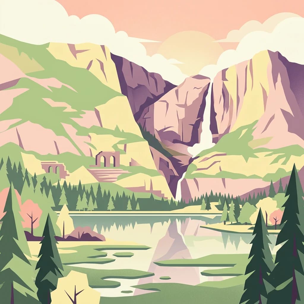
The cultural heritage of Butrint spans multiple millennia and reflects the site's strategic position at the crossroads of Mediterranean civilisations. The ancient city was an important Greek colony in antiquity, later becoming a Roman municipal centre and subsequently a significant Byzantine ecclesiastical location. The archaeological complex includes the city walls, a Roman theatre, a late antique baptistery with well-preserved mosaic floors, a great basilica, a nymphaeum, thermae, a gymnasium, forum, aqueduct, and temples dedicated to Minerva and Asclepius. The Lion Gate, one of the city's six 4th century BC entrances, features a distinctive sculptural relief depicting a lion attacking a bull, thought to symbolise the city's strength against its enemies. The Castle of Ali Pasha Tepelena, a small rectangular fortification on an island at the mouth of the Vivari Channel, dates from the early 19th century and is named after the Albanian ruler Ali Pasha of Ioannina. The park's cultural narrative reflects a long history of human settlement and land use that is inseparable from the natural landscape.

Top sights and standout views in Butrint National Park

The highlights of Butrint National Park centre on its unique integration of archaeological grandeur and natural diversity. The Roman theatre, among the best-preserved structures in the ancient city, sits below the Acropolis facing the Vivari Channel and retains its original seating and stage architecture. The Byzantine baptistery, with its elaborate floor mosaics, represents one of the most important early Christian monuments in the Balkans. Lake Butrint and its network of channels and wetlands create a landscape of exceptional ecological richness, home to dolphins, sea turtles, and globally significant populations of waterbirds. The Ksamil Islands offer a remote island experience accessible only by boat, with their rocky shores and surrounding waters providing wildlife viewing opportunities. The Vivari Channel, with the Ali Pasha Castle on its island at the sea mouth, connects the inland lake system to the Ionian Sea.

Best time to visit Butrint National Park

The best time to visit Butrint National Park depends on what visitors wish to experience. The Mediterranean climate makes spring and autumn particularly appealing for combining archaeological exploration with nature observation—April through May and September through October offer comfortable temperatures for walking the site while migratory birds pass through the wetlands. Summer brings hot, dry conditions but also allows for swimming at coastal areas and the Ksamil Islands, though this is the peak tourist season. Winter brings milder temperatures and fewer visitors, though some facilities may have reduced hours, and the wetlands attract wintering waterbirds in significant numbers. The archaeological site can be visited year-round, but early morning visits in summer help avoid the midday heat. Those interested in marine wildlife such as dolphins are more likely to encounter them in the calmer summer and early autumn seas.

Park location guide

Geography guide, regional context, and park location map for Butrint National Park

Butrint National Park park geography, regions, and map view in Albania
Understand where Butrint National Park sits in Albania through a broader geographic reading of the surrounding landscape, nearby location context, and its mapped position within the national park landscape.

How Butrint National Park fits into Albania

Albania is a unitary parliamentary republic in Southeast Europe, situated on the Balkan Peninsula along the Adriatic and Ionian coastal regions. With a population of approximately 2.4 million people, it borders Montenegro, Kosovo, North Macedonia, and Greece. The country features varied landscapes ranging from the Albanian Alps to fertile coastal plains, with Tirana as its capital and largest city.

Wider geography shaping Butrint National Park in Albania

Albania occupies the western part of the Balkan Peninsula in Southeast Europe. The country features a varied terrain with rugged mountain ranges including the Albanian Alps (Accursed Mountains), Korab, Skanderbeg Mountains, Pindus, and Ceraunian Mountains. Fertile lowland plains extend along the Adriatic and Ionian coastal regions. The country borders Montenegro to the northwest, Kosovo to the northeast, North Macedonia to the east, and Greece to the south.

Map view of Butrint National Park

Use this park location map to pinpoint Butrint National Park in Albania, understand its exact geographic position, and read its mapped placement within the surrounding landscape more clearly.

Pigeon | © OpenStreetMap contributors

Location context for Butrint National Park

Vlorë County

Trace the ancient ruins, coastal lagoons, and Mediterranean wetland habitats of this protected landscape through detailed visual reference.

Visual Exploration of Butrint National Park: Essential Photography for Understanding Park Landscapes
Browse an essential visual atlas of Butrint National Park, revealing its unique combination of ancient archaeological sites, coastal lagoons, and Mediterranean wetland ecosystems. These images offer critical insight into the park's diverse terrain, cultural heritage, and ecological richness, facilitating a deeper understanding of its protected landscape.

A turtle with a patterned shell resting on a rock with its mouth open

Stone amphitheater with tiered seating, surrounded by ruins of ancient structures and visitors, under a clear sky.

Panoramic view of Butrint National Park with stone ruins, trees, a lake, hills, and a red flag

Wide landscape view of the Vivari Channel surrounded by dense green vegetation and rolling hills under an overcast sky

Stone ruin structure by a lake with trees, vegetation, and mountains in the background

Panoramic view of Lake Butrint with a causeway structure on the water, surrounded by hills and greenery

Park atlas

Explore the regional spread of protected landscapes and coastal ecosystems beyond Butrint National Park.

Discover Other National Parks Near Butrint National Park and Vlorë County, Albania
Explore additional national parks and protected areas across Albania, especially those within Vlorë County, to trace diverse coastal and mountainous terrain. Compare geographic features and conservation landscapes surrounding Butrint National Park for a richer understanding of the region's natural and cultural heritage.
National parkVlorë County

Llogara National Park: Vlorë County's Dramatic Ceraunian Mountain Protected Landscape

Explore Albania's rugged national park geography and mapped terrain.

Llogara National Park stands as a vital protected area within Vlorë County, Albania, renowned for its spectacular Ceraunian Mountain topography. This page provides access to detailed geographic information, highlighting the park's unique landscape characteristics, from alpine peaks to coastal vistas. Discover the mapped extent of this national park and its significance within the regional geography, perfect for structured atlas exploration.

Area
17.69 km²
Established
1966
IUCN
II
Relief
Mountain
National park

Vikos-Aoös National Park: Deepest Gorge and Protected Mountain Landscape Atlas

Discover protected area boundaries and regional geography in Epirus.

Vikos-Aoös National Park in Greece's Pindus mountains is a premier destination for exploring dramatic natural geography. Best known for the Vikos Gorge, considered the world's deepest canyon relative to its width, the park also features towering alpine peaks like Mount Tymphe, glacial lakes such as Drakolimni, and rich botanical diversity. As a UNESCO Geopark and part of the Natura 2000 network, it safeguards critical habitats, including significant brown bear populations. This park offers a profound look into protected landscapes, offering detailed geographic context and mapped terrain for atlas-based discovery.

Area
126 km²
Established
1973
IUCN
II
Visitors
100K annual
Watercolor painting of a landscape with green fields, scattered trees, and rolling hills under a light sky
National parkGjirokastër County

Fir of Hotovë-Dangëlli National Park: Ancient Forests & Mountain Wilderness Atlas

Explore a premier protected landscape in Gjirokastër County, Albania.

Fir of Hotovë-Dangëlli National Park stands as a monumental protected area, celebrated for its exceptional old-growth Hotova Fir forests, which are a rare Mediterranean plant relic. This national park in Gjirokastër County offers a detailed look at a vast mountainous terrain, featuring dramatic canyons like Lengarica Canyon, and serving as a critical habitat for diverse wildlife. MoriAtlas provides structured geographic context for this significant landscape, highlighting its mapped boundaries and role as a key component of regional protected area networks.

Area
360.038 km²
Established
2008
IUCN
II
Relief
Mountain
Watercolor scene featuring a blue lake, green trees, and mountains under a yellow-pink sky
National park

Karaburun-Sazan Marine Park: A National Park with Dramatic Limestone Cliffs and Island Ecosystems

Explore Albania's protected coastline and marine geography.

Karaburun-Sazan Marine Park, Albania's sole national park, offers a profound exploration of a unique protected landscape. This marine protected area combines the rugged Karaburun Peninsula, characterized by high limestone cliffs, with Sazan Island, Albania's largest island, known for its distinct geology and subtropical climate. The park's waters are critical habitats for endangered species, making it a significant site for marine biodiversity and regional geographic study. Discover the mapped boundaries and ecological context of this vital protected area.

Area
124.377 km²
Established
2010
IUCN
II
Relief
Mixed relief
Watercolor illustration of a mountainous landscape with a river, forests, and distant hills
National park

Pindus National Park: A Protected Greek Mountain Wilderness with Ancient Forests

Explore its rugged terrain, biodiversity, and alpine landscape.

MoriAtlas presents Pindus National Park, a significant protected area in Greece known for its dramatic mountainous terrain, deep valleys, and ancient old-growth forests. This page details its geographic context, featuring rugged highland landscapes, serpentine soils, and vital habitats for species like the Eurasian brown bear. Understand its place within the Pindus mountain range and its importance as a mapped wilderness area for conservation.

Area
69.27 km²
Established
1966
Relief
Mountain
Climate
Temperate
Watercolor painting showing mountains, a river, and vegetation
National park

Tomorr Mountain National Park: Sacred Peak & Karst Protected Landscape in Albania

Explore Albania's dramatic mountain geography and protected areas.

Tomorr Mountain National Park offers a unique exploration of southern Albania's dramatic limestone anticline. Dominated by the sacred Mount Tomorr and featuring the spectacular Osum Canyon, this national park provides insight into karst terrain, old-growth forests, and significant biodiversity. Discover its mapped boundaries and regional geographic context within the Pindus Mountains for structured atlas exploration.

Area
271.855 km²
Established
1956
IUCN
II
Relief
Mountain
Watercolor painting of a river flowing through a valley with mountains and greenery
National parkKorçë County

Prespa National Park: Protected Landscape and High-Altitude Lakes in Korçë County, Albania

Explore the geography and mapped boundaries of this vital national park.

Prespa National Park, located in Korçë County, Albania, is a protected area characterized by its significant high-altitude tectonic lakes, dramatic mountain landscapes, and vital wetland habitats. This entry provides a structured atlas-style overview of the park's geographic identity, its protected landscape features, and its ecological importance, serving as a key point of reference for understanding this unique Balkan region.

Area
276.13 km²
Established
1999
IUCN
II
Watercolor painting showing hills, green fields, a body of water, and vegetation under a soft sky
National park

Divjakë-Karavasta National Park: Albania's Expansive Coastal Wetland and Pelican Breeding Site

Mapping Albania's largest Mediterranean lagoon and its vital bird sanctuaries.

Divjakë-Karavasta National Park is a key protected coastal wetland in western Albania, centered around Karavasta Lagoon, one of the largest in the Mediterranean. This Ramsar site provides critical habitats for numerous bird species, including a globally significant population of the endangered Dalmatian pelican, making it a premier destination for understanding regional wetland geography and protected area dynamics.

Area
222.3 km²
Established
2007
IUCN
II
Relief
Lowland

Common questions about visiting, size, designation, and location context for Butrint National Park

Butrint National Park FAQs for park facts, access, geography, and protected area context
Find quick answers about Butrint National Park, including protected-area facts, park geography, trail and visitor context, and how the park fits into its surrounding country and regional landscape.
MoriAtlas Explorer

Continue Your Protected Areas Search Across the Global Atlas

Deepen your exploration by continuing the structured search for national parks and protected areas worldwide. Utilize the comprehensive filtering capabilities to compare different conservation landscapes and refine your understanding of global park geography. Discover more about the distribution and characteristics of protected natural areas.

Global natural geography