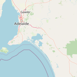
Why Onkaparinga River National Park stands out
Onkaparinga River National Park is best known for its striking river gorge landscape, where the Onkaparinga River has carved a deep channel through the foothills of the Mount Lofty Ranges. The park preserves remnant patches of native eucalypt forest and woodland, with the Hardy's Scrub section representing the most intact vegetation community. The gorge offers dramatic views from various lookouts, particularly Sundews Lookout, and provides habitat for kangaroos, diverse birdlife, and twenty-seven recorded orchid species. The contrast between the steep rocky gorge walls and the river valley below defines the park's distinctive character.
Onkaparinga River National Park history and protected-area timeline
The land that now comprises Onkaparinga River National Park was acquired by the South Australian State Planning Authority between 1973 and 1977. The acquisition program had three explicit purposes: to provide open space for recreational use, to preserve the natural character of the landscape including native flora and fauna, and to function as a buffer between urban and rural land uses along the full length of the Onkaparinga River. In 1982, the majority of the acquired land was transferred to the then Department for Environment and Heritage, which subsequently established the Onkaparinga River Recreation Park in 1985. The recreation park initially encompassed both the gorge and floodplain areas. In 1993, the land east of Main South Road, comprising the gorge section, was separated from the recreation park and formally constituted as the Onkaparinga River National Park. The area has a longer human history, with the lower reaches of the river having been inhabited by the Kaurna Aboriginal people prior to European settlement, which began around 1840 and led to the rapid displacement of the original inhabitants.
Onkaparinga River National Park landscape and geographic character
The landscape of Onkaparinga River National Park is defined by the dramatic gorge cut by the Onkaparinga River through the foothills of the Mount Lofty Ranges. The river has incised a deep valley with steep rocky walls, creating a distinctive landscape of cliffs, ridgelines, and the watercourse below. The floodplain areas surrounding the river support more gentle terrain, while the surrounding hills rise to form the park's boundaries. Rocky outcrops punctuate the landscape, particularly visible from Sundews Lookout which provides panoramic views across the meandering river and the gorge's convoluted terrain. The park's elevation changes create varied microclimates and aspect, influencing vegetation patterns and contributing to the diversity of habitats within this relatively compact protected area.
Onkaparinga River National Park ecosystems, habitats, and plant life
The vegetation of Onkaparinga River National Park reflects a landscape that has experienced significant historical disturbance, yet retains important remnants of the original Mount Lofty Ranges woodland communities. Despite 160 years of livestock grazing, timber harvesting, and cropping that cleared much of the native understorey, patches of remnant eucalypts persist throughout the reserve. The Hardy's Scrub section represents the most intact area of native vegetation, serving as a crucial refuge for native species. Eucalypt species present include grey box, pink gum, mallee box, red gum, and blue gum, each occupying different niches within the terrain. The understorey has been invaded by invasive grasses in many areas, while the European olive has established as a problematic weed. Over the past two decades, systematic revegetation efforts have been undertaken, using both tubestock planting and direct seeding methods to restore native vegetation communities along the gorge slopes.
Onkaparinga River National Park wildlife and species highlights
Wildlife in the park is adapted to the woodland and gorge environments of the Mount Lofty Ranges. Kangaroos are commonly observed among the open hillsides where grass is abundant, often spotted resting in the shade of remnant trees during warmer parts of the day. The park supports diverse birdlife, with walking trails providing opportunities to observe numerous species in their natural habitat. Reptiles including lizards are occasionally encountered along the tracks. The park has recorded twenty-seven native orchid species, reflecting the diversity of groundcover and sheltered microhabitats present in the remnant vegetation areas. Insect activity includes butterflies and dragonflies, particularly along the river corridor and in areas with more established understorey. The river itself provides aquatic habitat, though the park's wildlife focus is primarily on the terrestrial environments of the gorge and surrounding woodland.
Onkaparinga River National Park conservation status and protection priorities
Onkaparinga River National Park represents an important conservation asset in the heavily cleared Mount Lofty Ranges region of South Australia. The park protects what remains of the original river valley ecosystem, preserving connectivity along the riparian corridor and providing refuge for species in remnant vegetation patches. Hardy's Scrub is recognised as a very important conservation area despite its history of disturbance from timber cutting, quarrying, and grazing. The ongoing management challenge involves controlling invasive species, particularly the European olive which continues to spread through the reserve. Revegetation programs have been implemented over the past twenty years to restore native vegetation communities, with direct seeding now the preferred method for establishing diverse native species. The park's location adjacent to the Adelaide metropolitan area creates both pressures and opportunities, serving as a natural education resource while requiring active management of visitor impacts.
Onkaparinga River National Park cultural meaning and human context
The Onkaparinga River holds deep significance for the Kaurna Aboriginal people, the traditional owners of the land in the Adelaide region. The river's name derives from the Kaurna language and is understood to mean chief, reflecting the waterway's importance in Aboriginal culture and economy. The lower reaches of the river supported Kaurna communities prior to European settlement, with the area serving as a source of food, water, and spiritual connection to Country. European settlement of the district began around 1840, leading to rapid displacement of Aboriginal inhabitants and the establishment of farming enterprises. The town of Noarlunga served as the service centre for the agricultural district, with produce transported downriver to Port Noarlunga. Kaurna people maintain strong cultural ties to the area today through ongoing cultural practices and religious beliefs, and the park provides a venue for connections between contemporary Aboriginal communities and their traditional lands.
Top sights and standout views in Onkaparinga River National Park
The Onkaparinga River National Park offers several standout features that distinguish it within the Adelaide region. The Sundews Lookout provides sweeping views across the rocky gorge and meandering river below, making it a highlight for visitors. The network of walking trails, ranging from easy loops to challenging descents into the gorge, allows exploration of different aspects of the park's landscape and vegetation. The Hardy's Scrub area, despite its history of human disturbance, represents a significant conservation area with some of the best remnant vegetation in the reserve. The Echidna Trail winds through heritage sites including 1880s-era huts and houses, adding historical dimension to the walking experience. The diversity of orchid species, with twenty-seven native species recorded, highlights the ecological complexity hidden within the park's varied habitats.
Best time to visit Onkaparinga River National Park
The park can be visited throughout the year, though different seasons offer distinct experiences. Autumn and spring typically provide comfortable temperatures for hiking and opportunity to observe flowering plants, including orchids in spring. Summer months can be hot, making early morning or late afternoon visits more comfortable, though the gorge offers some shade relief. Winter often brings cooler conditions and may include periods of rain that affect trail conditions and river levels, though the landscape can appear particularly green and vibrant after rainfall. The park's proximity to Adelaide makes it accessible year-round for day visits, though those planning extended hikes should check current conditions and trail status before traveling.