

Mori Atlas logo
Wildlife reservePantabangan–Carranglan Watershed Forest Reserve

Understanding the geography, watershed hydrology, and mountain terrain of this unique Philippine reserve.

Pantabangan–Carranglan Watershed Forest Reserve: A Vital Protected Landscape in Nueva Ecija

The Pantabangan–Carranglan Watershed Forest Reserve spans the northern reaches of Nueva Ecija, serving as a critical environmental link between the Sierra Madre and Caraballo mountain ranges. This protected landscape contains the extensive Pantabangan Lake reservoir, acting as an essential hydrological system that supports irrigation and hydropower across Central Luzon. The area features a complex terrain of forested slopes, river valleys, and rare botanical habitats that define its ecological and functional importance.

watershed forest reserveupland foresttropical reservoirSierra MadreCaraballo Mountainsriver basin
A flat vector-style illustration showing a landscape with a foreground of desert-like ground and grass, a midground of green rolling hills and trees, and a background of purple mountains with a waterfall cascading from a peak under a pale sun.

Pantabangan–Carranglan Watershed Forest Reserve

Wildlife reserve

Park overview

Structured park overview, official facts, and landscape profile for Pantabangan, Carranglan Watershed Forest Reserve

Pantabangan, Carranglan Watershed Forest Reserve park facts, protected area profile, and essential visitor context

Review the core facts for Pantabangan, Carranglan Watershed Forest Reserve, including designation, size, terrain, visitor scale, habitats, and operating context in one park-focused overview.

About Pantabangan, Carranglan Watershed Forest Reserve

Pantabangan–Carranglan Watershed Forest Reserve is a major upland conservation area on the island of Luzon, enclosing the forested ridges and valleys that feed the Pampanga River system. The landscape spans flat valley floors, rolling terrain, and rugged, steep mountains belonging to the Sierra Madre range on the east and the Caraballo Mountains on the north. These mountains are dissected by narrow, flat-bottomed valleys drained by the Pantabangan and Carranglan rivers, the two principal headwaters of the Pampanga.

The reserve covers 36 barangays spread across five municipalities: Carranglan and Pantabangan in Nueva Ecija, Alfonso Castañeda and Dupax del Sur in Nueva Vizcaya, and Maria Aurora in Aurora. It lies roughly 176 kilometres north of Manila, and is bordered by the Casecnan Protected Landscape to the north, the Aurora Memorial National Park to the east and south, and the Talavera Watershed Forest Reserve to the west, placing it within a network of large protected uplands in Central and Cagayan Valley Luzon.

At the reserve's centre, the upper Pampanga River is impounded by the Pantabangan Dam, producing the 4,023-hectare Pantabangan Lake. This reservoir serves multiple roles: a domestic water source for Central Luzon, the irrigation backbone for 24 municipalities across Nueva Ecija, Bulacan, and Pampanga, and a hydropower resource contributing 112 megawatts to the Luzon grid through the Pantabangan and Masiway dams. Additional inflow arrives from the Casecnan Dam via a transbasin tunnel completed in 2001.

Mountains command much of the reserve's vertical character. Mount Susong Dalaga rises to 1,650 metres near Alfonso Castañeda, while Mount Nedumular reaches 1,410 metres near Maria Aurora. Beyond its water resources and terrain, the reserve also carries recreational significance: Binbin Falls and Pajanutic Falls near Carranglan, lake-based activities around Pantabangan Lake, and the annual Pandawan Festival celebrating the lake's fishing heritage.

Quick facts and research context for Pantabangan, Carranglan Watershed Forest Reserve

Pantabangan–Carranglan is a watershed-class conservation reserve in Central and Cagayan Valley Luzon, administered under IUCN Category VI as a protected area with sustainable use of natural resources. It covers roughly 84,500 hectares across Nueva Ecija, Aurora, and Nueva Vizcaya, encompassing the drainage basin of the upper Pampanga River.

Its establishment, in 1969, was closely tied to the development of the Pantabangan Dam and the broader Upper Pampanga River Project. Today the reserve is governed jointly by agencies including the Department of Environment and Natural Resources, the National Irrigation Administration, the Metropolitan Waterworks and Sewerage System, and First Gen Hydro Power Corporation. It functions as both a working forest and a critical source of water, irrigation, and hydroelectric energy for the region.

Protection and recognition

Documented terrestrial protection scope and international recognition data

Pantabangan–Carranglan Watershed Forest Reserve Protection Status

Pantabangan–Carranglan Watershed Forest Reserve maintains a documented terrestrial protection scope within the global protected area network. Official records outline its conservation designation history and management framework without external international recognition sources.

Protection details

Protection scope
Terrestrial
Transboundary protection
No
Park context

Deeper park guide and search-rich context for Pantabangan, Carranglan Watershed Forest Reserve

Pantabangan, Carranglan Watershed Forest Reserve history, landscape, wildlife, and travel context

Explore Pantabangan, Carranglan Watershed Forest Reserve through its history, landscape character, ecosystems, wildlife, conservation priorities, cultural context, and seasonal travel timing in a structured park guide built for atlas discovery and search intent.

Why Pantabangan, Carranglan Watershed Forest Reserve stands out

Pantabangan, Carranglan is best known for being the forested catchment surrounding Pantabangan Lake, one of the largest reservoirs in Southeast Asia and one of the cleanest in the Philippines. The reserve anchors the Upper Pampanga River Project, providing irrigation water for the agricultural heartland of Central Luzon and hydroelectric generation for the Luzon grid. It is also recognised as the type locality of Rafflesia consueloae, the smallest known species of the parasitic Rafflesia plant, discovered on its slopes in 2014. This combination of a giant engineered reservoir, an intact upper watershed, and a globally unique botanical species gives the reserve a distinctive profile among Philippine protected areas.
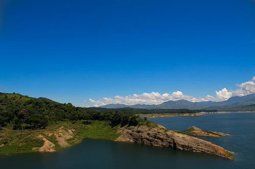
A wide, elevated view of a large reservoir with calm blue water, rocky shoreline, and distant mountains under a clear blue sky.
The Pantabangan Reservoir, a key feature of the Pantabangan-Carranglan Watershed Forest Reserve.

Pantabangan, Carranglan Watershed Forest Reserve history and protected-area timeline

The Pantabangan–Carranglan Watershed Forest Reserve was formally established on May 21, 1969 through Presidential Proclamation No. 561, which set aside the upper Pampanga basin for watershed protection. Initial stewardship was distributed across several agencies, including the Bureau of Forestry under the Department of Environment and Natural Resources, the Reforestation Administration, NAWASA (predecessor to today's MWSS), the National Irrigation Administration, the Bureau of Public Works, the Bureau of Public Soils, and the National Power Corporation.

Only a month after the reserve's creation, President Marcos authorised the construction of the Upper Pampanga River Project, with the Pantabangan Dam as its centrepiece. Construction began in March 1971 and required the relocation of residents from the dam site to the upper portion of Pantabangan municipality, a process coordinated by the Department of Agrarian Reform and the National Irrigation Administration. When the dam was completed in August 1974, its reservoir inundated eight former barangays, including the old Pantabangan poblacion and the communities of Conversión, Villarica, San Juan, Cadaclan, Napon-Napon, Liberty, and Marikit.

The reserve's history therefore reflects a dual story: a watershed protected by presidential declaration, and a working landscape reshaped by a major mid-century infrastructure project. Over time, its management framework evolved to include energy and water utilities alongside forestry and environment agencies, reflecting its multi-purpose role today.

In more recent history, the reserve gained scientific prominence in February 2014 with the discovery on Mount Pantaburon and Mount Balukbok of Rafflesia consueloae, the smallest known species of the parasitic Rafflesia genus, found worldwide only within this reserve.

Pantabangan, Carranglan Watershed Forest Reserve landscape and geographic character

The landscape of Pantabangan–Carranglan is shaped by its position between two significant mountain chains: the Caraballo Mountains to the north and the Sierra Madre to the east. Within their foothills and main ranges, the terrain transitions from flat land near the lake to rolling countryside and finally to rugged, steep slopes carved by narrow valleys. The Carranglan and Pantabangan rivers cut through this terrain, gathering water that eventually pools in the Pantabangan Lake basin.

The lake itself dominates the geography visually and functionally, expanding for 21 kilometres along the former Carranglan channel toward its northern source and 18 kilometres up the former Pantabangan channel toward its eastern source in the Sierra Madre. The surrounding ranges rise sharply from its edges, with Mount Susong Dalaga at 1,650 metres and Mount Nedumular at 1,410 metres forming the highest visible summits.

Water movement defines the reserve's character. Beyond natural drainage, engineered infrastructure has reshaped the system: the Pantabangan Dam at the meeting of the two headwaters, the Masiway Dam downstream, and a 25-kilometre transbasin tunnel from the Casecnan–Taan river system in Nueva Vizcaya that augments the lake's inflow. Together, these features turn the reserve into a layered landscape where natural mountain hydrology and large-scale water management coexist.
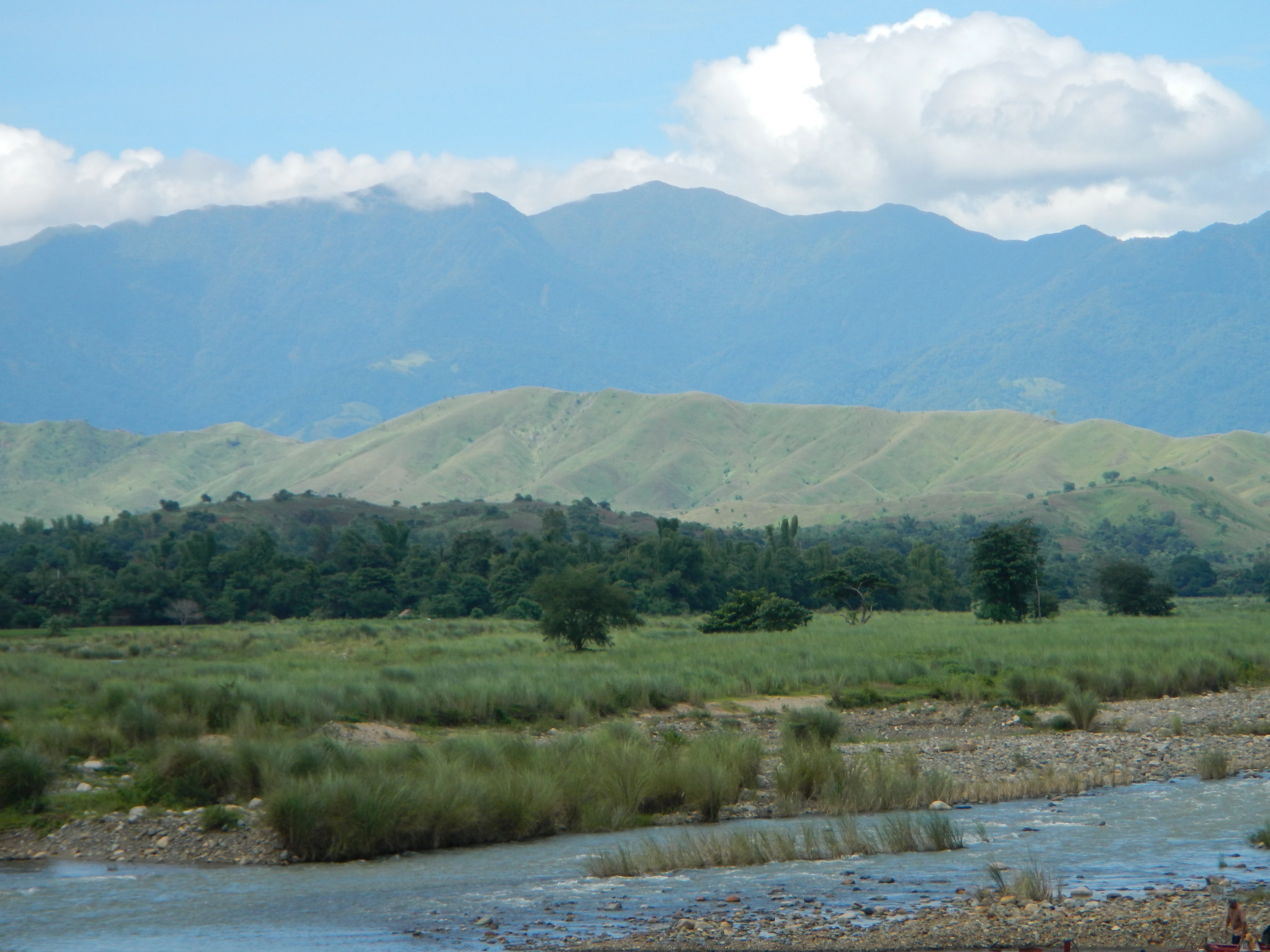
A wide landscape view of a shallow river flowing through a grassy valley with forested hills and a range of mountains in the background under a blue sky with white clouds.
The rolling hills and river landscape of the Carranglan area within the watershed reserve.

Pantabangan, Carranglan Watershed Forest Reserve ecosystems, habitats, and plant life

Ecologically, the reserve presents a mosaic typical of mid-elevation Luzon. Its forest cover, roughly 36,915 hectares, consists largely of secondary growth stands dominated by earleaf acacia, eucalyptus, yemane, ipil-ipil, mahogany, and narra, reflecting decades of reforestation alongside the area's protection history. Open grasslands cover a similar expanse, around 35,665 hectares, and are dominated by cogon grass, samon, and talahib in the flatter areas near the lake, with croplands and village lands filling out the rest of the reserve's area.

Higher in the watershed, above roughly 700 metres, the vegetation shifts to Benguet pine forests interspersed with montane dipterocarp trees, marking a distinctive upland pine zone within the broader tropical landscape. Alibangbang trees grow abundantly across the reserve, contributing to the mosaic of lowland and mid-elevation habitats.

The reserve's most celebrated biological feature is its role as the sole habitat of Rafflesia consueloae, discovered in 2014 on the slopes of Mount Pantaburon and Mount Balukbok near the hydroelectric dams. As the smallest known Rafflesia species, its presence places the reserve on the global map of plant biodiversity and underscores the scientific value of protecting the reserve's forests in their full elevational range.

Pantabangan, Carranglan Watershed Forest Reserve wildlife and species highlights

The reserve provides refuge for a mix of lowland and upland species typical of Luzon's remaining forested watersheds. Native mammals such as the Philippine deer and crab-eating macaque roam its forested tracts, while the Asian water monitor and the impressive reticulated python inhabit its riverine and lakeside zones.

Birds also feature prominently. Species recorded in or associated with its grasslands and wetlands include the Philippine duck, the Eastern grass owl, and the red junglefowl, the wild ancestor of the domestic chicken. The mix of open grassland, lakeside habitat, and forested ridges creates varied niches that support both resident species and those that depend on wetland edges.

Although the reserve has not been promoted primarily as a wildlife-viewing destination, its ecological integrity and habitat diversity make it ecologically significant for the Central Luzon region, particularly as surrounding lowlands have been heavily converted for agriculture.

Pantabangan, Carranglan Watershed Forest Reserve conservation status and protection priorities

Pantabangan–Carranglan's conservation value lies primarily in its role as a critical watershed. As IUCN Category VI protected area, it is managed for sustainable use of natural resources while serving core environmental functions; its forests regulate water flow, reduce sediment into Pantabangan Lake, and sustain the quality of one of the country's cleanest inland reservoirs.

The reserve's protection directly underpins multi-sector benefits: it secures drinking water supplies for parts of Central Luzon, maintains irrigation flows for 24 agricultural municipalities, and supports hydroelectric generation feeding the Luzon grid. Without the reserve's forested cover, the lake's water quality and the dams' long-term viability would be at heightened risk.

The reserve is also a redoubt for biodiversity that has been lost elsewhere in Central Luzon. Its secondary and upper-elevation forests, grasslands, and river systems sustain native deer, primates, waterbirds, and reptiles, while its mountains harbour the globally rare Rafflesia consueloae. Managing the reserve today involves balancing the interests of forestry, irrigation, hydropower, and water supply agencies with the need to preserve ecological function and habitat integrity.

Pantabangan, Carranglan Watershed Forest Reserve cultural meaning and human context

Although the reserve is primarily valued for environmental and infrastructural reasons, it carries a layered human history. The construction of the Pantabangan Dam in the early 1970s submerged eight barangays, including the original Pantabangan poblacion, displacing communities that were resettled in upper townships by the Department of Agrarian Reform and the National Irrigation Administration. This basin is therefore not only a natural landscape but also a place shaped by significant mid-twentieth-century resettlement.

Today, the lake and its surrounding communities sustain a fishing economy and recreation tradition. The annual Pandawan Festival celebrates the lake's role in local livelihoods, particularly its fishers. Visitors and regional residents engage with the lake through boating, jet-skiing, swimming, and seasonal sports fishing competitions, embedding the reserve into the cultural and recreational life of Nueva Ecija and its neighbouring provinces.

Top sights and standout views in Pantabangan, Carranglan Watershed Forest Reserve

Pantabangan Lake itself is the reserve's signature feature, a 4,023-hectare reservoir framed by the Sierra Madre and Caraballo mountains and recognised as one of the cleanest inland waters in the Philippines.

The reserve is the only known home of Rafflesia consueloae, the world's smallest Rafflesia species, lending it global botanical significance alongside its broader watershed role.

It functions as a multi-purpose resource: a domestic water source for Central Luzon, an irrigation lifeline for 24 municipalities, and a hydropower contributor generating 112 megawatts for the Luzon grid.

Best time to visit Pantabangan, Carranglan Watershed Forest Reserve

The reserve's tropical climate gives it warm conditions year-round, but the dry season generally offers the most rewarding conditions for lake activities and visits to waterfalls such as Binbin and Pajanutic Falls, when water levels are calmer and outdoor recreation around Pantabangan Lake is more comfortable. Cooler months over the higher elevations of the Caraballo and Sierra Madre bring crisper air on the forested ridges, suitable for appreciating the secondary forests and pine belts above 700 metres.

Wet-season months bring heavier rains that fill rivers and falls, but also reduce visibility on the lake and complicate travel through mountainous roads. Visitors interested in the reserve's waterfalls and forest scenery may find shoulder periods attractive for lush vegetation, while those drawn to lake-based recreation typically prefer the calmer dry months. Timing for the Pandawan Festival, which celebrates the lake's fishing heritage, can also add cultural context to a visit when scheduled around lake-side activities.

Monthly climate preview

Long-term representative monthly temperature and precipitation patterns across the reserve

Pantabangan–Carranglan Watershed Forest Reserve Annual Climate and Temperature Normals

Representative coordinates record measured monthly temperature swings from 20.31 to 24.58 degrees Celsius alongside shifting daily precipitation averages from 3.78 to 10.64 millimeters. Examining the complete twelve-month climatology profile reveals deeper shifts in long-term temperature ranges and precipitation rhythms across the protected landscape.
Annual mean23 °C
20 °C25 °C
Jan20°
Feb21°
Mar22°
Apr24°
May25°
Jun24°
Jul24°
Aug24°
Sep24°
Oct23°
Nov22°
Dec21°
Warmest month
May

24.6 °C

Coolest month
January

20.3 °C

Wettest month
October

10.6 mm/day

Driest month
February

3.8 mm/day

Park location guide

Geography guide, regional context, and park location map for Pantabangan, Carranglan Watershed Forest Reserve

Pantabangan, Carranglan Watershed Forest Reserve park geography, regions, and map view in Philippines

Understand where Pantabangan, Carranglan Watershed Forest Reserve sits in Philippines through a broader geographic reading of the surrounding landscape, nearby location context, and its mapped position within the national park landscape.

How Pantabangan, Carranglan Watershed Forest Reserve fits into Philippines

The Philippines, officially the Republic of the Philippines, is an archipelagic nation in Southeast Asia comprising approximately 7,641 islands categorized into three main geographical divisions: Luzon, Visayas, and Mindanao. Located in the western Pacific Ocean, it shares maritime borders with Taiwan, Japan, Palau, Indonesia, Malaysia, Vietnam, and China. Manila serves as the capital city, while Quezon City is the most populated city, both within Metro Manila.

Wider geography shaping Pantabangan, Carranglan Watershed Forest Reserve in Philippines

The Philippines is an archipelagic nation in Southeast Asia, positioned in the western Pacific Ocean. Its islands are bounded by the South China Sea to the west, Philippine Sea to the east, and Celebes Sea to the south. The country shares maritime borders with Taiwan to the north, Japan to the northeast, Palau to the east and southeast, Indonesia to the south, Malaysia to the southwest, Vietnam to the west, and China to the northwest.

Map view of Pantabangan, Carranglan Watershed Forest Reserve

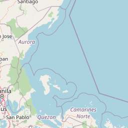
Use this park location map to pinpoint Pantabangan, Carranglan Watershed Forest Reserve in Philippines, understand its exact geographic position, and read its mapped placement within the surrounding landscape more clearly.

Pigeon | © OpenStreetMap contributors

Location context for Pantabangan, Carranglan Watershed Forest Reserve

Nueva Ecija

Visual exploration of mountain terrain, reservoir basins, and protected forest habitats

Pantabangan–Carranglan Watershed Forest Reserve Photos and Landscape Scenery

Visual documentation captures the rugged mountain terrain, forested slopes, and expansive reservoir waters defining the protected reserve. Examining these landscape photographs provides deeper insight into the ecological character and hydrological features spanning the region.

A wide, elevated view of a large reservoir with calm blue water, rocky shoreline, and distant mountains under a clear blue sky.

A close up of a small, open red Rafflesia consueloae flower resting on the ground, with a ruler visible for scale in the background.

A wide landscape view of a shallow river flowing through a grassy valley with forested hills and a range of mountains in the background under a blue sky with white clouds.

Park atlas

Compare adjacent mountain reserves and regional watershed landscapes across Luzon

Parks Near Pantabangan–Carranglan Watershed Forest Reserve and Surrounding Protected Areas

Browse protected areas and connected mountain habitats located near Pantabangan–Carranglan Watershed Forest Reserve. This regional park comparison helps trace broader ecological patterns across the Caraballo and Sierra Madre ranges.
National parkPhilippines
About 50 km away#1 closest

Southeast

Aurora Memorial National Park: A Protected Landscape in the Philippines' Sierra Madre

Explore mapped boundaries and endemic avian habitat.

Aurora Memorial National Park represents a critical conservation area situated within the Philippines' Sierra Madre mountain range. Spanning a significant stretch along the eastern mountain slopes, this national park is characterized by its lowland dipterocarp forest ecosystem, recognized for supporting diverse flora and fauna. It is particularly noted as an Important Bird Area, crucial for endemic species like the Philippine eagle and various other avian populations, highlighting its ecological significance within the archipelago's geography.

Area
56.76 km²
Established
1937
IUCN
V
Relief
Mountain
Illustration of a river with bamboo boats, people rowing, limestone cliffs, and trees
National parkNueva Ecija
About 61 km away#2 closest

South

Minalungao National Park: Protected Landscape and Geographic Context in Nueva Ecija

Explore the mapped boundaries of this Philippines national park.

Delve into the specifics of Minalungao National Park, a protected natural area identified as a national park in the Philippines. This exploration focuses on its distinct geographic identity within Nueva Ecija, highlighting the importance of its mapped boundaries and regional landscape. Understand the park's role as a protected land entity for atlas-based discovery.

Area
20.18 km²
Established
1967
IUCN
V
Relief
Upland
A soft, artistic watercolor illustration of a river winding through green rolling hills and mountain terrain.
Protected landscapePhilippines
About 65 km away#3 closest

Northwest

Lower Agno Watershed Forest Reserve: Watershed Geography and Mountain Terrain in the Philippines

A vital river corridor and pine forest protected landscape

Explore the structured geography of the Lower Agno Watershed Forest Reserve, defined by its 34.59 kilometer river corridor and dense network of tributaries. From the Benguet pine forests of the Cordillera Central to the industrial landscape surrounding the San Roque Dam, this reserve serves as a complex model of water management, rugged mountain topography, and long term mining heritage in the Philippine highlands.

Area
393.04 km²
Established
1983
IUCN
V
Relief
Mountain
National parkNueva Vizcaya
About 65 km away#4 closest

North

Bangan Hill National Park: A Protected Landscape within Nueva Vizcaya's Geography

Explore its mapped terrain and cultural significance.

Bangan Hill National Park is a crucial protected area nestled in Nueva Vizcaya, Philippines. This page details its specific geography, including its role as a distinct hill within the broader Cagayan Valley landscape. Users can explore the park's mapped boundaries, understand its role as a national park, and discover the surrounding mountain context of the Caraballo and Cordillera Central ranges. It offers a unique perspective on the region's natural and historical significance, serving as a focal point for protected landscape exploration.

Area
0.139 km²
Established
1995
IUCN
II
Relief
Mixed relief
National parkBulacan
About 74 km away#5 closest

South

Biak-na-Bato National Park: National Park Atlas and Geographic Context in Bulacan

Explore protected landscapes and mapped terrain.

Biak-na-Bato National Park is a key protected area in Bulacan, Philippines, identified for its national park designation. This entry provides specific details on its geographic positioning and mapped features, essential for atlas-based research and understanding the distribution of protected lands within the region. Dive into the landscape context and mapped boundaries that define this significant natural entity.

Area
21.17 km²
Established
1937
IUCN
V
Relief
Mountain
Protected landscapeBenguet
About 82 km away#6 closest

Northwest

Upper Agno River Basin Resource Reserve: Mapping the Benguet Watershed Protected Landscape

High-elevation forest, river catchment, and Cordillera peaks

Spanning from the Mount Data area to the Binga Dam, this reserve serves as a pivotal hydropower catchment and mountain sanctuary. Explore the geographic extent of these pine-clad slopes, mossy dwarf forests, and high-altitude grasslands that define the southern Cordillera landscape.

Area
775.61 km²
Established
1966
IUCN
VI
Relief
Mountain
Protected landscapeAurora
About 83 km away#7 closest

East

Simbahan-Talagas Protected Landscape: Geographic Profile and Sierra Madre Forest Mapping

An essential watershed and dipterocarp habitat in Aurora province.

Analyze the protected boundaries and hydrological features of the Simbahan-Talagas Protected Landscape. This region features a dense network of river systems and continuous dipterocarp forest cover that extends across the eastern foothills of the Sierra Madre mountain range in Luzon.

Area
22.66 km²
Established
2000
IUCN
V
Relief
Mountain
National parkPhilippines
About 85 km away#8 closest

Southwest

Mount Arayat National Park: Philippines National Park and Protected Landscape Atlas Entry

Mapped geography and protected natural landscape context.

Mount Arayat National Park represents a distinct protected area within the Philippines, serving as a focal point for geographic and landscape exploration. This detailed entry offers insight into its mapped boundaries and its significance as a national park within the archipelago's rich natural tapestry. Users can leverage this information for structured discovery of the park's terrain and its place in the regional geography of the Philippines.

Relief
Mountain
Climate
Tropical
Scope
Terrestrial

Common questions about visiting, size, designation, and location context for Pantabangan, Carranglan Watershed Forest Reserve

Pantabangan, Carranglan Watershed Forest Reserve FAQs for park facts, access, geography, and protected area context

Find quick answers about Pantabangan, Carranglan Watershed Forest Reserve, including protected-area facts, park geography, trail and visitor context, and how the park fits into its surrounding country and regional landscape.
MoriAtlas Explorer

Continue Your Protected Areas Search Across the Global Atlas

Deepen your exploration by continuing the structured search for national parks and protected areas worldwide. Utilize the comprehensive filtering capabilities to compare different conservation landscapes and refine your understanding of global park geography. Discover more about the distribution and characteristics of protected natural areas.

Global natural geography