
Rivers
Park geography
A comprehensive analysis of the park area, mountain relief, and karst cave systems.
Paparoa National Park Geographic Profile: Mapped Boundaries, Terrain, and Natural Features
Examine the detailed geographic structure of Paparoa National Park in the West Coast Region of New Zealand. This profile presents the recorded 429.7 square kilometer land area, elevation peaks reaching 1447 meters, and a wide array of physical landscape features including coastal cliffs, karst caves, and dense temperate forests.
Related tags
Karst LandscapeCoastal National ParkLimestone FormationsCave SystemsWest Coast New Zealand
Coastal national park protecting dramatic limestone karst, caves, and the famous Pancake Rocks on New Zealand's West Coast
Paparoa National Park
Paparoa National Park is a protected area on the west coast of New Zealand's South Island, established in 1987 and encompassing approximately 430 square kilometers of diverse terrain. The park stretches from the Tasman Sea coastline across the Paparoa Range to the interior, featuring an unusual combination of coastal cliffs, mountain peaks, deep valleys, and an extensive limestone karst system. This geology creates a landscape of subterranean rivers, caves, and dramatic surface formations that distinguish Paparoa from most other New Zealand national parks. The park lies between the Buller River to the north and the Grey River to the south, with the small settlement of Punakaiki providing visitor access to one of the park's most famous attractions, the Pancake Rocks and Blowholes. The park protects significant ecological areas including the Pororari Ecological Area and hosts several notable bird and marine species, while also serving as a location for the Paparoa Track, one of New Zealand's Great Walks.
- Location
- New Zealand
- Park type
- National park
- Established
- 1987
- Area
- 429.7 km²
- Highest point
- 1,447 m
Location overview
Administrative placement and coastal status in the West Coast Region
Geographic Setting of Paparoa National Park, New Zealand
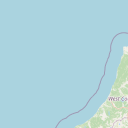
Paparoa National Park is situated within the West Coast Region of New Zealand. Selected regional records map its designated boundaries as a coastal protected area contained entirely within a single country.
- Countries
- New Zealand
- Regions
- West Coast Region
- Primary location
- West Coast Region
- Geographic setting
- Coastal
Boundary and coordinates
Paparoa National Park’s stored outline frames 429.7 km²
Paparoa National Park mapped boundary and 429.7 km² area
Paparoa National Park has atlas geometry for a recorded protected extent of 429.7 km². Its outline helps readers understand the park’s geographic reach without asserting official survey precision.
- Boundary area
- 435.2 km²
- Boundary perimeter
- 332.9 km
- Northernmost point
- 41.8507° S
- Southernmost point
- 42.2513° S
- Easternmost point
- 171.9254° E
- Westernmost point
- 171.3256° E
- Geographic centre
- 42.0985° S, 171.5031° E
- North–south span
- 44.5 km
- East–west span
- 49.7 km
Elevation and terrain
Recorded vertical relief data and physical landform features within protected boundaries
Paparoa National Park Elevation Range and Mountain Terrain Geography
Examine the recorded elevation summary and mountain relief statistics for Paparoa National Park. Review structured cards detailing individual natural features, types, and spatial relationships.
- Maximum elevation
- 1,447 m
- Highest point
- 1,447 m
Selected named natural features
Rivers
Mawheraiti / Little Grey River
Cave entrances
Ballroom Overhang
Rivers
Four Mile River
Wetlands
Bessons Dam
Viewpoints
Putai Blowhole seat
Environmental setting
Analysis of recorded forest cover, relief types, and regional water networks
Paparoa National Park Environmental Setting and Classification Profile
Recorded landscape features and habitat types frame the physical setting across mountain relief and coastal terrain. Connected atlas categories link these classifications directly to broader regional geography.
- Relief
- Mountain
- Water
- Major water bodies
- Forest cover
- Mostly forested
- Seasonality
- Year-round
Landscape features
Mountains · Valleys · Cliffs · Forest · Rivers · Coast · Beach · Cave · Karst
Habitat types
Temperate broadleaf forest · Riverine habitat · Wetland
Park atlas
Trace connected protected landscapes across New Zealand's South Island, comparing geographic features and conservation zones adjacent to Paparoa National Park.
Discover Nearby National Parks and Protected Areas Beyond Paparoa National Park, New Zealand
Continue browsing national parks and protected areas near Paparoa National Park, examining diverse conservation landscapes found along New Zealand's dramatic West Coast. This geographic overview helps compare unique karst formations, expansive mountain ranges, and distinctive coastal environments, deepening understanding of regional protected area distribution.
Marine protected areaWest Coast
About 0.2 km away#1 closest
West

Punakaiki Marine Reserve: Mapped Protected Waters and West Coast Geographic Context
Exploring marine habitats and coastal land-sea corridors
Punakaiki Marine Reserve provides a critical look at marine conservation geography in New Zealand. Located along the West Coast, the reserve encompasses a variety of seafloor substrates and coastal formations that define the boundary between the Tasman Sea and the rugged limestone landscapes of the region. This atlas entry provides essential context for understanding the reserve's role in linking terrestrial and marine ecosystems.
- Area
- 35.2 km²
- Established
- 2014
- Relief
- Lowland
- Climate
- Temperate
Protected landscapeSouth Island
About 11 km away#2 closest
East
Victoria Forest Park: A Deep Dive Into New Zealand's Largest Protected Forest Landscape
Inland West Coast mountain ranges and beech forest ecosystems
Spanning over 200,000 hectares, Victoria Forest Park stands as a defining geographic feature of the South Island. It acts as a critical refuge for endemic species and preserves all five native beech tree types within a massive, continuous protected area. The landscape integrates rugged mountain ranges with deep river valleys and historical industrial artifacts, providing a comprehensive look at the intersection of conservation and regional history.
- Area
- 2,069 km²
- Established
- 1981
- Relief
- Mountain
- Climate
- Temperate
National parkWest Coast Region
23 km away#3 closest
Northeast
Kahurangi National Park: A National Park of Ancient Geology and Diverse Protected Landscapes in New Zealand
Explore the mapped natural terrain and regional geographic context.
Kahurangi National Park is distinguished by its extraordinary geological diversity, representing New Zealand's finest Paleozoic rock sequence and expansive karst features. Covering a vast area in the West Coast Region, it protects a remarkable array of natural landscapes, from coastal cliffs and nikau palm forests to alpine tussock basins and deep gorges. This national park is crucial for understanding New Zealand's natural heritage, offering a rich tapestry of mapped terrain and protected biodiversity for dedicated geographic exploration.
- Area
- 5,193 km²
- Established
- 1996
- IUCN
- II
- Relief
- Mixed relief
National parkNew Zealand
42 km away#4 closest
East
Nelson Lakes National Park: Alpine Geography and Glacial Lakes Atlas
Explore New Zealand's protected mountain terrain and natural landscapes.
Nelson Lakes National Park provides a deep dive into a dramatic alpine environment situated at the northern edge of New Zealand's Southern Alps. This national park is characterized by its striking glacial lakes, Rotoiti and Rotoroa, and the extensive mountain ranges that surround them, offering a rich context for understanding protected land distribution. Explore the park's mapped geography, its distinct beech forest ecosystems, and the rugged natural terrain that makes it a significant feature within the broader South Island landscape.
- Area
- 1,018.8 km²
- Established
- 1956
- IUCN
- II
- Relief
- Mountain
National parkNew Zealand
57 km away#5 closest
South
Arthur's Pass National Park: Dramatic Alpine Protected Landscape in the Southern Alps
Explore the unique geography and mapped boundaries of this South Island national park.
Arthur's Pass National Park, a substantial protected area within New Zealand's Southern Alps, presents a compelling focus for geographic and atlas exploration. Characterized by dramatic alpine terrain shaped by ancient glacial forces, the park exhibits a striking ecological contrast between its drier eastern beech forests and wetter western rainforests. Users can delve into the mapped park boundaries and understand the regional landscape context of this unique protected area, making it a key destination for understanding New Zealand's natural geography.
- Area
- 1,184.7 km²
- Established
- 1929
- IUCN
- II
- Relief
- Mountain
Protected landscapeCanterbury
About 64 km away#6 closest
Southeast
Lake Sumner Forest Park: Geography and Protected Landscape Atlas for Canterbury
Mountainous river valleys and remote beech forests
Spanning over 100,000 hectares of the Canterbury high country, Lake Sumner Forest Park stands as a prime example of New Zealand's protected backcountry. This mapping resource details the park's river-carved terrain, subalpine fringes, and its role as a connective wilderness area between major South Island mountain ranges.
- Area
- 1,051 km²
- Relief
- Mountain
- Climate
- Temperate
- Access
- Moderate access
Protected landscapeMarlborough Region
81 km away#7 closest
Northeast
Mount Richmond Forest Park: Geography and Protected Landscapes in the Marlborough Region
Expansive native bush and mountain peak terrain
Mount Richmond Forest Park stands as one of the largest protected forest areas on the South Island of New Zealand. Dominated by dense native bush and rugged subalpine ridges, the park offers a complex topography of river valleys and high-altitude peaks, including its namesake Mount Richmond. It serves as a vital conservation landscape and a core segment of the regional geography between Nelson and the Marlborough district.
- Area
- 1,659 km²
- Established
- 1977
- Relief
- Mountain
- Scope
- Terrestrial
Marine protected areaWest Coast Region
89 km away#8 closest
North
Kahurangi Marine Reserve: Protected Marine Landscapes and West Coast Geography
Mapped coastal reefs, nīkau forest margins, and subtidal habitats
Located in New Zealand's West Coast Region, Kahurangi Marine Reserve protects 16 kilometres of coastline and extends five kilometres offshore. The reserve is defined by its layered marine profile, ranging from boulder-strewn beaches to complex rocky reefs and expansive mud and sand seabeds. It serves as a vital protected counterpart to Kahurangi National Park, fostering habitats for Hector's dolphins and diverse reef communities within its remote and rugged geography.
- Area
- 84.19 km²
- Established
- 2014
- Relief
- Lowland
- Climate
- Temperate
MoriAtlas Explorer
Continue Exploring Paparoa National Park's Distinct Karst Geography and Mapped Landscape
Deepen your understanding of Paparoa National Park by tracing its protected boundaries and examining its unique karst landscape. This national park, situated in the West Coast Region, provides an exceptional case study for geographic discovery, showcasing subterranean wonders and coastal geological formations that distinguish it within New Zealand's atlas of protected areas. Continue your exploration to appreciate the mapped terrain and ecological context of this extraordinary natural region.
Browse next
Global natural geography
Explore related park routes
Explore MoriAtlas Global ParksBrowse All MoriAtlas ParksGlobal Park Map DiscoveryMoriAtlas: Browse All CountriesBrowse All MoriAtlas ContinentsNational Park Environment AtlasGrand Canyon National Park AtlasYellowstone National Park AtlasYosemite National Park Atlas and GeographySerengeti National Park AtlasGalápagos National Park Protected LandscapeBanff National Park Geography and AtlasKruger National Park Atlas EntryUluṟu-Kata Tjuṯa National Park AtlasExplore Uluru-Kata Tjuta National Park GeographyPlitvice Lakes National Park AtlasFiordland National Park Protected LandscapeGreat Smoky Mountains National Park AtlasAfghanistan National Parks and Protected AreasAlbania National Parks and Protected AreasAlgeria National Parks and Protected AreasAmerican Samoa National Parks and Protected AreasAndorra National Parks and Protected AreasAngola National Parks and Protected AreasAntarctica National Parks and Protected AreasAntigua and Barbuda Park List