
Mori Atlas logo
National parkParc national du Haut-Niger

Mapping the Dry Tropical Forests and Savanna Landscapes along the Upper Niger River

Parc national du Haut-Niger: An Essential Protected Area in the Kankan Region of Guinea

Parc national du Haut-Niger encompasses a vast protected landscape within the Kankan Region of Guinea. As a critical biosphere reserve, it preserves a rare mosaic of dry tropical forest and Sudano-Guinean savanna centered on the historic Mafou forest. The geography is shaped by the upper Niger River and its tributaries, which create a vital corridor for large mammals and maintain diverse riverine habitats across the interior landscape.

national parkbiosphere reservedry tropical forestsavannaupper niger riverwildlife refuge
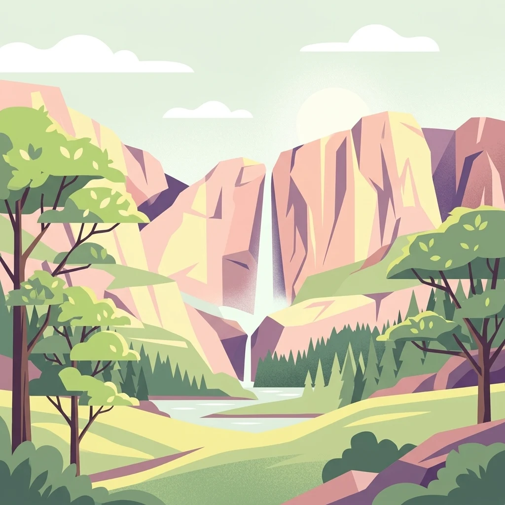
A flat vector-style illustration of a valley between steep cliffs with a central waterfall flowing into a river, framed by stylized trees in the foreground.

Parc national du Haut-Niger

National park

Park overview

Structured park overview, official facts, and landscape profile for Parc national du Haut-Niger

Parc national du Haut-Niger park facts, protected area profile, and essential visitor context

Review the core facts for Parc national du Haut-Niger, including designation, size, terrain, visitor scale, habitats, and operating context in one park-focused overview.

About Parc national du Haut-Niger

Parc national du Haut-Niger is the largest protected area in Guinea and a cornerstone of West African conservation. Located in the upper basin of the Niger River in the Kankan Region, the park covers a landscape where the Niger and two of its tributaries, the Mafou and the Kofing rivers, weave through a continuous stretch of dry forest and savanna.

At its heart is the Mafou core area, historically protected as a classified forest and now the strict central zone of the biosphere reserve. Around it, the park is structured into three concentric zones: a total no-hunting area of roughly 24,500 hectares in the north, a managed hunting zone for organized sporting activities benefiting local communities, and an agroforestry zone where traditional livelihoods continue under controlled and supported conditions. The Amana classified forest (about 19,800 hectares) and the Tamba classified forest (about 16,000 hectares) act as additional contiguous buffer areas.

The park's mosaic of dry tropical forest and savanna is exceptionally rare in West Africa, where such relatively undisturbed habitats have largely disappeared under centuries of agricultural pressure. UNESCO recognized this landscape's importance by including the park in its World Network of Biosphere Reserves in 2002. The designation reflects both the ecological value of the site and the intention to link conservation with sustainable development for the surrounding population.

For visitors, the park offers an experience of the upper Niger corridor in a setting that remains largely undeveloped for tourism. Water and forests guides can take visitors into the park in search of guinea fowl, monkeys, and hippos, though facilities are limited. The site also carries historical resonance: the village of Sékou Touré, the first president of the Republic of Guinea, lies only a short distance away, while the broader region was shaped by the late nineteenth-century resistance of Samory Touré.

Quick facts and research context for Parc national du Haut-Niger

Parc national du Haut-Niger was formally established in January 1997 and inscribed on UNESCO's World Network of Biosphere Reserves on 16 December 2002. Its IUCN management category is II, the standard classification for national parks.

The park lies in the Kankan Region of Guinea and extends across parts of the prefectures of Faranah, Dabola, Kouroussa, Kankan, and Kissidougou. It is centered on the former Mafou classified forest and organized around a strict core area and surrounding buffer zones, including the Amana and Tamba classified forests. Since 2005 it has been recognized as a lion conservation unit.

Protection and recognition

Documented terrestrial protection scope, designation year, and management framework

Parc national du Haut-Niger Protection Status and Designation History

Parc national du Haut-Niger maintains a documented terrestrial protection status established in two thousand and two within the global database. Comprehensive administrative records outline the official designation history and territorial management scope for conservation analysis.

Protection details

Protection scope
Terrestrial
Designated year
2002
Transboundary protection
No
WDPA ID
29069
Core area
550 km²
Park context

Deeper park guide and search-rich context for Parc national du Haut-Niger

Parc national du Haut-Niger history, landscape, wildlife, and travel context

Explore Parc national du Haut-Niger through its history, landscape character, ecosystems, wildlife, conservation priorities, cultural context, and seasonal travel timing in a structured park guide built for atlas discovery and search intent.

Why Parc national du Haut-Niger stands out

The park is best known for protecting one of the last remaining stands of dry tropical forest in West Africa, the Mafou forest, alongside extensive Sudano-Guinean savanna along the upper Niger River. It is also recognized for its role as a biosphere reserve with a strict protection core surrounded by managed buffer zones that allow sustainable use by surrounding communities. Its position in a cross-border large mammal migration corridor gives it regional importance far beyond its national borders.
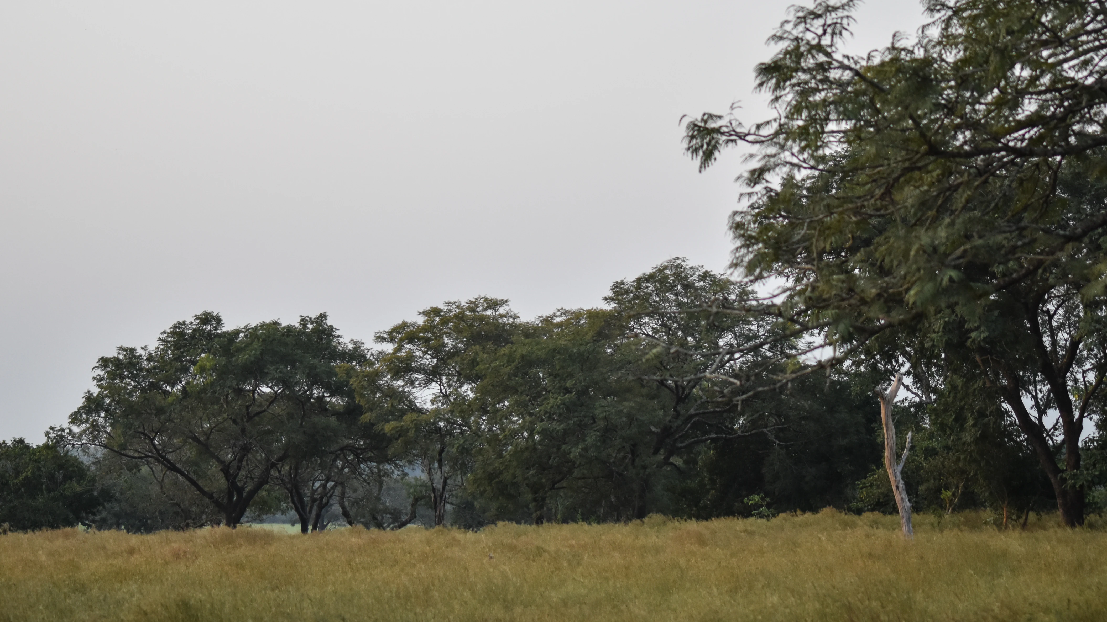
A wide view of savanna woodland under an overcast, grey sky featuring scattered trees and golden grasses.
Savanna woodland within the Parc national du Haut-Niger.

Parc national du Haut-Niger history and protected-area timeline

The landscape protected by Parc national du Haut-Niger has long been unusual within Guinea. The Mafou forest is one of the last remaining dry tropical forests in the country and one of very few that still stand in West Africa. It survived in a relatively undisturbed state in part because historical circumstances kept human pressure unusually low: widespread river blindness limited settlement, and the violent campaigns of the West African leader Samory Touré in the late nineteenth century devastated local communities across the region.

For roughly fifty years preceding the park's creation, this corner of Guinea saw little large-scale disturbance, allowing its forest and savanna mosaic to remain ecologically intact. Building on this foundation, the Guinean state formally classified the area as a national park in January 1997, centered on the former Mafou classified forest.

The park's profile rose further on 16 December 2002, when UNESCO's Man and the Biosphere Programme added it to the World Network of Biosphere Reserves, affirming its importance as a regional conservation priority. In 2005 the area was formally recognized as a lion conservation unit, marking its place within continental efforts to maintain viable populations of large carnivores. The park thus represents a layered conservation history: long-term protection of dry forest in the Mafou area, formal national-level protection in 1997, international biosphere recognition in 2002, and ongoing wildlife-focused conservation in the years since.

Parc national du Haut-Niger landscape and geographic character

The landscape of Parc national du Haut-Niger is shaped by the upper Niger River and its tributaries, which carve broad corridors through a plateau of dry tropical forest and Sudano-Guinean savanna. The Niger itself defines the northwest boundary of the central Mafou core area, while the Mafou River marks the eastern edge and the Kofing River, a Niger tributary, forms part of the southern boundary.

Inside the strict core, the terrain is dominated by remnant dry forest rooted in the historic Mafou classified forest, one of the few such stands still in existence in West Africa. Surrounding the core, the land transitions outward into more open savanna formations, with vegetation patterns that reflect the interplay of riverine forest, dry woodland, and grassy expanses typical of the Sudano-Guinean ecological zone.

The park's hydrological network is central to its scenic and ecological character. The Niger and its tributary system create permanent water sources, gallery forest ribbons, and seasonal floodplain habitats that punctuate an otherwise dry forest landscape. The contour of the protected area follows these waterways closely, producing an elongated reserve that mirrors the river's path through the Faranah, Dabola, Kouroussa, Kankan, and Kissidougou prefectures.

Parc national du Haut-Niger ecosystems, habitats, and plant life

The ecological character of Parc national du Haut-Niger is defined by the meeting of dry tropical forest with Sudano-Guinean savanna along the upper Niger River. The park represents one of the very last examples of this forest-savanna mosaic remaining in West Africa, a region where such habitats have largely been converted to agriculture over the course of centuries.

Vegetation in the central Mafou core retains elements of dry deciduous forest typical of the Sudano-Guinean transition zone, while the surrounding buffer and transition zones host more open savanna formations, gallery forests along the rivers, and areas where controlled agroforestry and traditional land use are integrated into the management framework. The two additional classified forest blocks, Amana and Tamba, extend this pattern outward and reinforce the continuity of forest cover in the landscape.

The hydrology of the Niger, Mafou, and Kofing rivers supports a range of wetland and riverine habitats that complement the drier forest and savanna. Together, these habitats sustain the rich fauna of the West African interior and provide ecological connectivity across a broad regional landscape.

Parc national du Haut-Niger wildlife and species highlights

The park supports the full suite of large mammal species typical of the West African savanna biome, drawn together by the protected setting of the Mafou forest and its surrounding savanna. Among the species documented in the area are lions, leopards, chimpanzees, hippopotamuses, African buffalo, pangolins, and aardvarks.

Chimpanzees in particular benefit from active protection by the Chimpanzee Conservation Center, an NGO operating in and around the park. The park's formal recognition as a lion conservation unit since 2005 reflects the importance of the site for sustaining viable populations of large carnivores, while its position in a regional migration corridor for large mammals means that wildlife in the park is linked to broader transboundary movements between Guinea and neighboring countries.

Birdlife is also a feature of the park, with guinea fowl and other savanna bird species regularly encountered. Although the source material does not document species lists in detail, the park's combination of dry forest, open savanna, and riverine habitats gives it strong potential for both resident and migratory bird communities as well as the larger mammals for which it is best known.

Parc national du Haut-Niger conservation status and protection priorities

Parc national du Haut-Niger carries significant conservation weight at both national and regional levels. At 554 square kilometers of the formally gazetted park, and with a broader reserve system including the Amana and Tamba classified forests, it represents one of the few remaining refuges of relatively undisturbed dry tropical forest in Guinea and West Africa as a whole. Conservation planners have long identified the Mafou forest as a priority site for West African biodiversity protection.

The park's 2002 inscription in UNESCO's World Network of Biosphere Reserves gives it international recognition, while its IUCN Category II status places it among formally protected national parks. Its 2005 designation as a lion conservation unit underlines its importance for maintaining populations of wide-ranging carnivores and linking them to neighboring countries through migration corridors.

At the management level, the park combines a strict core zone with a layered buffer system, including a total no-hunting area, a managed hunting zone for community-based sporting activities, and an agroforestry zone where local livelihoods continue under controlled sustainable use. This zoning approach reflects a conservation model that links ecological protection with the social and economic realities of the surrounding rural population.

Parc national du Haut-Niger cultural meaning and human context

The region around Parc national du Haut-Niger carries a layered cultural and historical memory. The relative ecological integrity of the Mafou forest area has been shaped by tragic historical circumstances, including widespread river blindness, which limited settlement, and the late nineteenth-century campaigns of Samory Touré, which devastated communities across the area.

The park is also associated with modern Guinean history through its proximity to the village of Sékou Touré, the first president of the Republic of Guinea, located near the site. The surrounding communities remain closely tied to the land, with continuing agricultural and forestry activities accommodated within the park's agroforestry and managed hunting zones.

Top sights and standout views in Parc national du Haut-Niger

Parc national du Haut-Niger stands out for the exceptional rarity of its habitat type in West Africa, protecting the last major stand of dry tropical forest in Guinea along the upper Niger. Its structuring as a UNESCO Biosphere Reserve since 2002 gives it both international recognition and a layered management framework that supports both strict protection and community engagement.

Its role as a lion conservation unit and its position within a regional large-mammal migration corridor lift it beyond purely national significance. The combination of intact dry forest, savanna, riverine habitat along the Niger and its tributaries, and adjacent classified forest buffer zones produces a landscape of unusually high conservation value in a region where such landscapes have almost entirely disappeared.

Best time to visit Parc national du Haut-Niger

Seasonal timing in the upper Niger basin follows the West African pattern of a distinct dry season and a wet season. The dry season, roughly corresponding to the northern hemisphere winter through early spring, brings lower water levels in the Niger and its tributaries, more open savanna landscapes, and generally easier access along rural tracks, including the piste rurale connecting the Faranah side of the park to Sidakoro in the commune of Beindou.

The wet season transforms the landscape with greener vegetation, fuller rivers, and more challenging rural roads, but may also bring richer bird activity and a more lush forest atmosphere. Visitors interested in large mammals and broad savanna scenery will often favor the dry season, while those drawn to greener forest conditions and birdlife may find the wet season rewarding. Because tourism infrastructure is limited and guided visits depend on the availability of water and forests guides, prospective visitors should plan around broad seasonal conditions rather than fixed operational schedules.
Monthly climate preview

Long-term temperature ranges and precipitation rhythms across the protected area

Parc national du Haut-Niger Climate Normals and Monthly Weather Patterns

Representative coordinate records show monthly mean temperatures shifting between twenty-three and thirty degrees Celsius alongside distinct precipitation variations across the year. Detailed twelve-month climate normals provide a complete statistical profile of temperature extremes and rainfall distribution across the reserve.
Annual mean26 °C
23 °C30 °C
Jan24°
Feb27°
Mar29°
Apr30°
May28°
Jun27°
Jul25°
Aug24°
Sep24°
Oct25°
Nov24°
Dec23°
Warmest month
April

30 °C

Coolest month
December

23.4 °C

Wettest month
August

11.8 mm/day

Driest month
December

0.1 mm/day

Park location guide

Geography guide, regional context, and park location map for Parc national du Haut-Niger

Parc national du Haut-Niger park geography, regions, and map view in Guinea

Understand where Parc national du Haut-Niger sits in Guinea through a broader geographic reading of the surrounding landscape, nearby location context, and its mapped position within the national park landscape.

How Parc national du Haut-Niger fits into Guinea

Guinea is a West African country with a population of approximately 14 million people. The country achieved independence from France in 1958 and is known for its diverse geography ranging from coastal lowlands to highland plateaus. Conakry serves as both the capital and largest city. Guinea is a member of the United Nations, ECOWAS, the African Union, and La Francophonie.

Wider geography shaping Parc national du Haut-Niger in Guinea

Guinea is located on the West African Atlantic coast, bordered by Guinea-Bissau to the northwest, Senegal to the north, Mali to the northeast, Ivory Coast to the southeast, and Sierra Leone and Liberia to the south. The country is divided into four geographic regions: Maritime Guinea along the Atlantic coast, the Fouta Djallon highlands in Middle Guinea, the Upper Guinea savanna in the northeast, and the forested Guinea region in the southeast.

Map view of Parc national du Haut-Niger

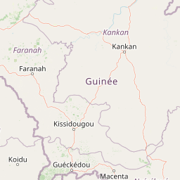
Use this park location map to pinpoint Parc national du Haut-Niger in Guinea, understand its exact geographic position, and read its mapped placement within the surrounding landscape more clearly.

Pigeon | © OpenStreetMap contributors

Location context for Parc national du Haut-Niger

Kankan Region

Visual reference collection showcasing dry tropical forests, riverine habitats, and protected savanna terrain.

Parc national du Haut-Niger Photos and Mapped Landscape Scenery

Visual documentation captures the rare dry tropical forest and Sudano-Guinean savanna ecosystems defining Guinea's upper Niger River corridor. Photographic records reveal the complex terrain, riverine habitats, and conservation boundaries shaping this protected West African landscape.

A wide view of savanna woodland under an overcast, grey sky featuring scattered trees and golden grasses.

Park atlas

Compare regional habitats, dry tropical forests, and connected wildlife migration corridors

Parks Near Parc National Du Haut Niger And Surrounding Protected Landscapes

Browse other national parks and protected areas situated within the broader West African savanna and riverine ecosystems surrounding Parc national du Haut-Niger. Comparing adjacent conservation zones provides valuable context for understanding regional biodiversity patterns and landscape-scale habitats.
National parkFaranah Region
About 5.5 km away#1 closest

Northeast

National Park of Upper Niger: Mapped Savanna and Forest Protected Area in Faranah Region

A key West African conservation site with critical riparian corridors.

Spanning 6,000 square kilometers, the National Park of Upper Niger serves as a primary reservoir for biodiversity in Guinea. The park features a distinct transition between open woodland savanna and forested river corridors along the Niger and Mafou Rivers. It remains a significant model for community-led conservation and habitat preservation in West Africa, representing one of the region's few areas with relatively low human impact.

Area
6,000 km²
Established
1997
IUCN
II
Relief
Mixed relief
National parkGuinea
About 5.5 km away#2 closest

Northeast

National Park of Upper Niger: A Geographic Overview of Guinea Protected Lands

Savanna woodland and riparian forest conservation in West Africa

Located in eastern Guinea, the National Park of Upper Niger serves as a significant conservation stronghold for the region. Its diverse terrain includes vast savanna woodlands, essential riparian forest corridors along the Niger River, and the rare Mafou dry forest. This protected area provides a critical refuge for numerous mammal species and represents a key segment of the West African savanna-forest ecosystem.

Area
6,000 km²
Established
1997
Relief
Upland
Climate
Tropical
Watercolor painting of a soft, layered landscape featuring green trees and gentle hills against a pale, warm sky.
Nature reserveIvory Coast
About 161 km away#3 closest

West

Forêt classée de Pinselly: Protected Area Geography and Landscape Mapping

Nature reserve analysis and regional atlas context

Examine the formal boundaries and landscape character of Forêt classée de Pinselly. This atlas entry focuses on the geographic structure and environmental positioning of this nature reserve in Ivory Coast, offering a clear view of its role as a protected landscape.

Established
1945
Relief
Mountain
Climate
Tropical
Access
Moderate access
A wide watercolor illustration showing green hills and trees along a pale river valley with a soft sky.
Protected areaMamou Region
About 185 km away#4 closest

West

Bafing-Source Protected Area: A Highland Wetland Landscape in the Mamou Region

Tracing the headwaters and plateau geography of the Bafing River basin

The Bafing-Source protected area serves as a significant hydrological anchor within the Fouta Djallon highlands of Guinea. This expansive site protects critical wetland catchments and plateau terrain that feed into the broader Senegal River system, demonstrating the vital link between highland ecosystems and downstream water security.

Area
3,172 km²
Established
2007
Relief
Highland
Climate
Tropical
National parkKarene District
About 211 km away#5 closest

West

Outamba-Kilimi National Park: Sierra Leone National Park and Protected Landscape Atlas

Mapped natural terrain within Karene District.

Investigate Outamba-Kilimi National Park as a protected area, examining its geographic footprint and significance within Sierra Leone's natural landscapes. This detailed entry provides context on the park's mapped boundaries and its contribution to regional geography, serving as a key point for atlas-based exploration of conservation lands in the Karene District.

Area
1,109 km²
Established
1986
IUCN
II
Relief
Lowland
Watercolor painting of a green forested mountain landscape under a soft pastel sky.
Biosphere reserveNzerekore Region
About 259 km away#6 closest

South

Massif de Ziama Biosphere Reserve: Geographic Overview and Protected Forest Boundaries

A montane forest complex in the Nzerekore Region of Guinea.

Massif de Ziama functions as a significant forested mountain chain and protected biosphere reserve in the Nzerekore Region. This geographic profile details the massif's high-elevation terrain, its connectivity with the Kpo Range in Liberia, and its foundational importance as a remnant of the Upper Guinean forest formation.

Established
1980
National parkMali
About 263 km away#7 closest

North

Kouroufing National Park: Mali's National Park with Defined Protected Landscape Boundaries

Explore the mapped geography and protected land context of Kouroufing National Park.

Kouroufing National Park is a significant protected area recognized as a national park within Mali. This entry focuses on its distinct geographic identity and mapped boundaries, essential for understanding its role in the regional atlas. Examine the park's protected landscape context and how it contributes to the natural geography of West Africa. This resource is tailored for users seeking detailed information on specific protected areas rather than broad travel advice.

Area
557 km²
Established
2002
Scope
Terrestrial
Water
No major water
Protected areaGuinea
About 270 km away#8 closest

Northeast

Sankarani River Protected Area: Guinea Highland Watershed and River Basin Geography

Mapping riparian corridors and Ramsar wetland ecosystems

The Sankarani River represents a vital hydrologic system originating in the Guinea Highlands. As a designated Ramsar site, this protected area features a unique 170-kilometre floodplain, gallery forest ribbons, and iron-bearing terrain. Map the riverine path and understand the environmental significance of this major tributary within the upper Niger Basin and the Fouta Djallon landscape.

Established
2002
Relief
Mixed relief
Scope
Terrestrial
Water
Major water bodies

Common questions about visiting, size, designation, and location context for Parc national du Haut-Niger

Parc national du Haut-Niger FAQs for park facts, access, geography, and protected area context

Find quick answers about Parc national du Haut-Niger, including protected-area facts, park geography, trail and visitor context, and how the park fits into its surrounding country and regional landscape.
MoriAtlas Explorer

Continue Your Protected Areas Search Across the Global Atlas

Deepen your exploration by continuing the structured search for national parks and protected areas worldwide. Utilize the comprehensive filtering capabilities to compare different conservation landscapes and refine your understanding of global park geography. Discover more about the distribution and characteristics of protected natural areas.

Global natural geography