
Mori Atlas logo
National parkParque nacional Archipiélago de Los Roques

Mapping the coral reef barriers, turquoise lagoons, and maritime geography of this Caribbean protected area

Parque nacional Archipiélago de Los Roques: A Vast Marine National Park and Coral Atoll Landscape

Parque nacional Archipiélago de Los Roques stands as the largest marine national park in the Caribbean, spanning over 200,000 hectares of submerged reef platforms, sandy cays, and sea-level islands. Located in the Dependencias Federales, the protected area showcases a unique atoll formation created without volcanic activity, relying instead on the accumulation of calcareous material. This landscape is defined by its deep southern drop-off, shallow northern lagoons, and expansive seagrass meadows that shelter nesting sea turtles and diverse marine life.

marine national parkcoral atollcaribbean islandscoral reefseagrass meadowssea turtle nesting
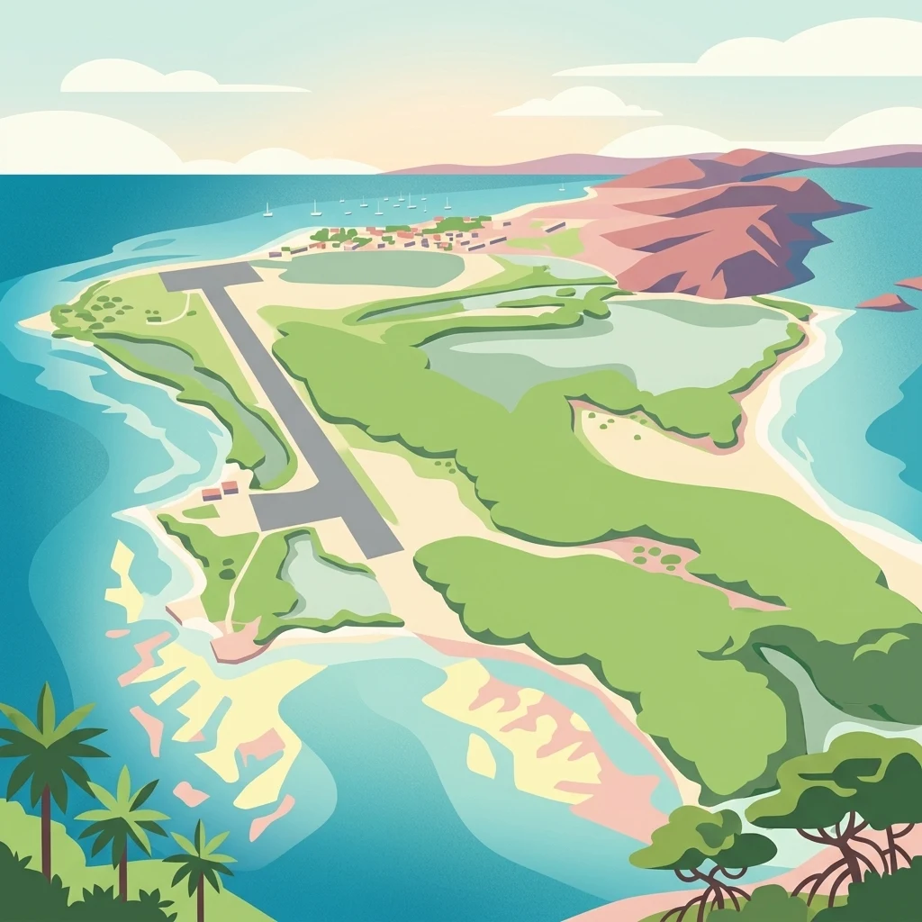
Colorful stylized illustration showing an aerial view of a tropical island with a long airstrip, green vegetation, sandy beaches, and surrounding blue water with coral reefs.

Parque nacional Archipiélago de Los Roques

National park

Park overview

Structured park overview, official facts, and landscape profile for Los Roques Archipelago National Park

Los Roques Archipelago National Park park facts, protected area profile, and essential visitor context

Review the core facts for Los Roques Archipelago National Park, including designation, size, terrain, visitor scale, habitats, and operating context in one park-focused overview.

About Los Roques Archipelago National Park

Los Roques Archipelago National Park protects an entire Caribbean atoll system located roughly 130 kilometers due north of the Venezuelan mainland. The protected area spans about 221,120 hectares, of which more than 80 percent is submerged, making it the largest marine national park in the Caribbean Sea. Established in 1972, the park covers approximately 50 islands and around 292 cays, keys, and banks, oriented along a reef platform that stretches roughly 36 kilometers east to west and about 24.6 kilometers north to south.

The setting is distinctly oceanic. The southern edge of the atoll drops into waters as deep as 1,700 meters, while the northern lagoon remains shallow, averaging under 15 meters in depth. The terrain itself is uniformly low, with the highest elevation reaching only about 130 meters above sea level, reinforcing the sense that Los Roques is fundamentally a marine landscape punctuated by small sand and coral islands. The climate is warm and dry, with average annual temperatures close to 28°C and low annual rainfall, conditions that contribute both to the clarity of the surrounding waters and to the limited terrestrial vegetation on the islands.

Gran Roque is the only island with a permanent population, accommodating roughly 1,200 residents in a small settlement whose economy long revolved around fishing before shifting decisively toward tourism from the 1990s onward. The rest of the archipelago is essentially uninhabited, including important destination cays such as Francisquí, Crasquí, Madrisquí, Pirata, Fernando, Noronquí, and Dos Mosquises. There are no rivers or permanent freshwater sources anywhere in the park, a defining constraint that shapes both the ecology and the visitor experience, and there is no nightlife or commercial development on Gran Roque, where dining remains simple and informal.

The park's identity is overwhelmingly defined by its marine ecosystems. Its reefs are considered among the most diverse and best conserved of the entire Caribbean, supporting rich communities of fish, crustaceans, mollusks, corals, sponges, and echinoderms. Surrounding the reef platform are extensive seagrass meadows, notably turtle grass meadows, which serve as feeding habitat for green sea turtles and other marine species. Together, these habitats form an unusually complete Caribbean atoll ecosystem, protected within a single national park.

Quick facts and research context for Los Roques Archipelago National Park

Los Roques Archipelago National Park protects an entire coral atoll in the southern Caribbean, about 130 kilometers north of the Venezuelan coast. Created on August 8, 1972, during the presidency of Rafael Caldera, the park encompasses approximately 221,120 hectares of marine and terrestrial surface, of which over 80 percent is submerged water. Geologically, the atoll rests on Cretaceous-era rock some 40 million years old, although the reef formations and islands themselves emerged roughly 10,000 to 15,000 years ago following post-glacial sea-level rise.

Administratively, the park belongs to Venezuela's Federal Dependencies and is managed by INPARQUES. Gran Roque is the only inhabited island, hosting a small fishing community. The climate is consistently warm, with average annual temperatures near 28°C and limited rainfall, which helps preserve the dry, low-lying character of the islands. The highest point in the park reaches only about 130 meters above sea level, underscoring its predominantly marine identity.

Protection and recognition

Examine the documented marine protection status and official conservation framework for this protected area.

Parque nacional Archipiélago de Los Roques Protection Status and Marine Reserve Designations

Marine protection status and management records provide a structured framework for evaluating Parque nacional Archipiélago de Los Roques. Official designations outline the geographic scope governing this protected marine ecosystem and its conservation boundaries.

Protection details

Protection scope
Marine
Park context

Deeper park guide and search-rich context for Los Roques Archipelago National Park

Los Roques Archipelago National Park history, landscape, wildlife, and travel context

Explore Los Roques Archipelago National Park through its history, landscape character, ecosystems, wildlife, conservation priorities, cultural context, and seasonal travel timing in a structured park guide built for atlas discovery and search intent.

Why Los Roques Archipelago National Park stands out

Los Roques is best known for being one of the most pristine and ecologically rich coral atolls in the Caribbean, with exceptionally well-preserved reefs that host hundreds of species of fish, crustaceans, mollusks, corals, sponges, and echinoderms. The archipelago is also recognized for its brilliant white sand beaches and shallow lagoon, which create striking contrasts between turquoise shallows and deeper blue waters where dolphins, manta rays, and migratory seabirds are frequently seen. The park stands out as the largest marine national park in the Caribbean and as a globally important nesting ground for several threatened sea turtle species. It is also closely identified with the Caribbean spiny lobster fishery that once dominated its economy, and with the unique Dutch-Caribbean linguistic legacy found in many of its island names ending in the syllable qui.
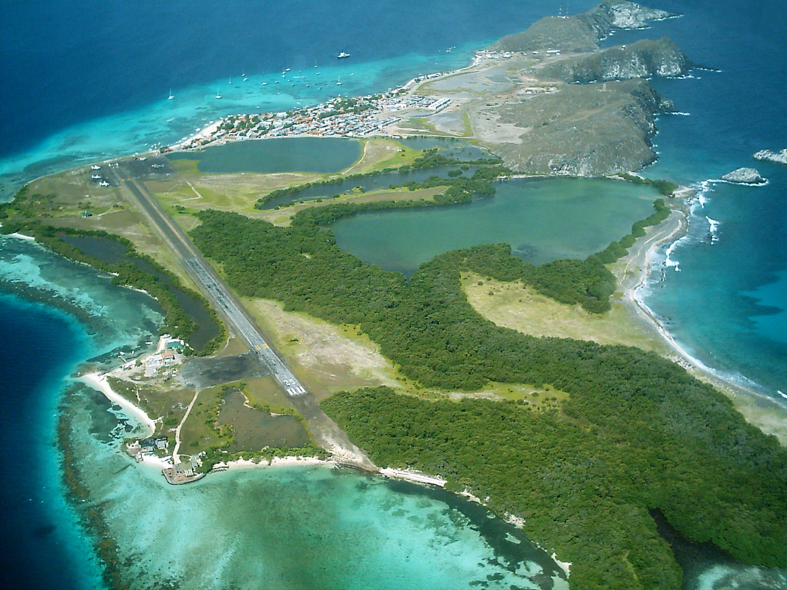
An aerial photograph of a tropical island featuring a long airstrip, green vegetation, several inland lagoons, and turquoise shallow waters surrounding the coastline.
Aerial view of Gran Roque island showing the airstrip, lagoons, and surrounding coral reefs in Los Roques National Park, Venezuela.

Los Roques Archipelago National Park history and protected-area timeline

Human presence in the Los Roques archipelago reaches back to the closing centuries of the first millennium. Archaeological evidence suggests that indigenous seafarers from the Lake Valencia basin and the central Venezuelan coast made frequent visits to the islands for ritual gatherings, the collection of botutos (queen conchs), fishing, turtle hunting, and salt extraction. During the colonial period, the islands attracted additional visitors drawn by pearls, salt, and mangrove timber, while their convoluted coasts also made them natural shelters for smugglers and pirates operating in the southern Caribbean.

In the second half of the nineteenth century, the Venezuelan government signed an agreement with a Dutch entrepreneur for the extraction of guano. This activity was carried out principally by workers from Aruba, Bonaire, and Curaçao, and it is from this chapter of the archipelago's history that many of the islands acquired their distinctive names ending in the syllable qui, a local adaptation of the English word key meaning small island. By the mid-twentieth century, permanent Venezuelan fishermen, many of them from Margarita Island, had begun settling on eight of the islands. When the national park was created on August 8, 1972 under President Rafael Caldera, settlement was effectively restricted to Gran Roque, which remains the only inhabited island today.

Over the following decades, Los Roques gradually shifted from a fishing-based economy toward a tourism-based economy, becoming a major Caribbean destination for Venezuelan and international visitors. The lobster fishery, however, never disappeared entirely; Los Roques continues to provide the great majority of the spiny lobsters consumed in Venezuela, and the islands still host an annual lobster festival each November to mark the opening of the fishing season.

Los Roques Archipelago National Park landscape and geographic character

The landscape of Los Roques is overwhelmingly defined by water, light, and the geometry of coral growth. The atoll is structured around two clearly defined reef barriers, one to the north and one to the south, which together enclose a broad central lagoon. These barriers protect a scatter of low sandy islands, cays, and banks, none rising more than about 130 meters above sea level. The result is a horizon-dominant seascape in which narrow strips of white sand and low vegetation sit between bands of shallow turquoise water and deeper blue channels.

To the south, the seafloor plunges dramatically, with depths reaching about 1,700 meters close to the atoll, while the northern lagoon is comparatively shallow, with average depths of around 15 meters. This contrast produces the alternating palette of bright lagoon and deep oceanic blue that defines the visual identity of the park. Submerged features are equally important to the landscape: the reef structures themselves, the expansive seagrass meadows that fan out across the lagoon floor, and the channels between cays all contribute to the park's character as a living coral system.

Geologically, the substrate underlying the atoll originates from the Late Cretaceous, roughly 40 million years ago, but the present-day configuration of reefs and islands is far younger. The reef architecture expanded markedly during the sea-level rise that followed the last glaciation, allowing coral growth to build up the barriers that now shape and shelter the islands. Los Roques is notable for being one of the world's few coral atolls formed without any volcanic activity, relying instead on the slow accumulation of calcareous material from snails, corals, and other marine organisms.
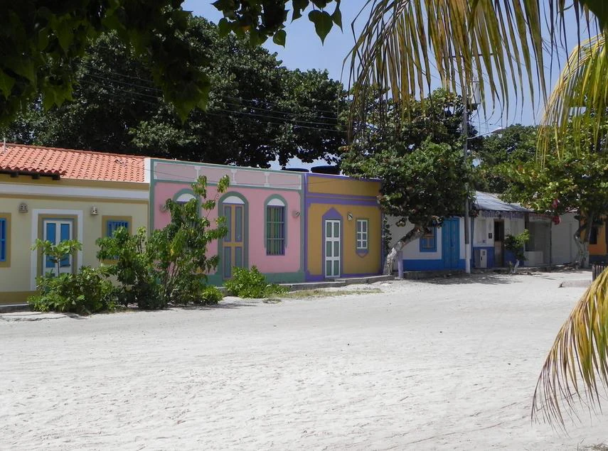
A wide white sandy street lined with colorful single-story buildings painted in yellow, pink, blue, and orange, framed by palm fronds and tropical trees under a clear blue sky.
Colorful colonial-style buildings line a white sandy street in the Los Roques archipelago, Venezuela.

Los Roques Archipelago National Park ecosystems, habitats, and plant life

The natural character of Los Roques is shaped by its aridity, its isolation, and the absence of permanent freshwater sources. Land vegetation is limited to halophytic and salt-tolerant plants adapted to dry, sun-exposed conditions. Mangroves occupy portions of the shoreline, contributing red mangrove, black mangrove, white mangrove, and buttonwood to the limited plant communities, while coastal herbaceous plants such as sea purslane anchor the dune fringes. Cacti, including the Caribbean prickly pear and the locally known buche or melon cactus, contribute the most conspicuous terrestrial structure on the driest islands.

Despite the terrestrial scarcity, the marine habitats of the park are exceptionally rich. The reefs support an extensive diversity of hard corals, alongside sponges, mollusks, crustaceans, echinoderms, and seagrass meadows dominated by turtle grass, which serves as a key feeding ground for green sea turtles. Beneath the lagoon floor and the reef framework lies a biological inheritance built up over the last 10,000 to 15,000 years, and the park functions as a continuous refuge for species that have declined elsewhere in the Caribbean.

The combination of dry climate, low elevation, and isolation produces an environment in which ecological patterns are unusually legible. Birds concentrate on the cays, marine life clusters around the reef walls and seagrass beds, and the relatively small landmass ensures that nutrient, energy, and water cycles are tightly linked to the surrounding sea. This is, in essence, a marine ecosystem with a small terrestrial frame.
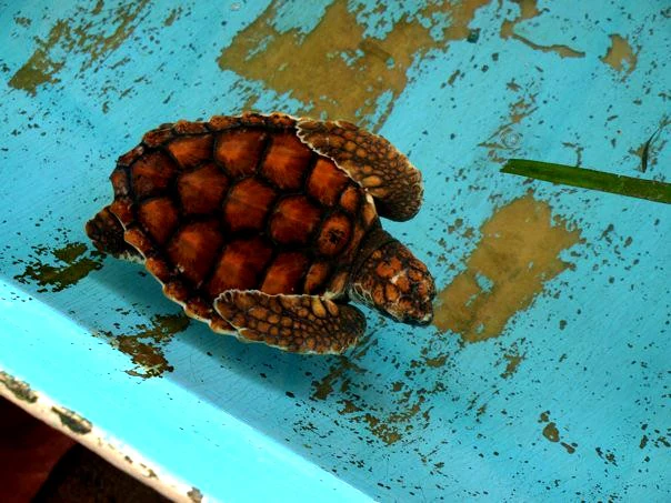
A small green sea turtle with a brown patterned shell resting in a shallow blue container with some algae.
A juvenile green sea turtle resting in a blue container at Los Roques National Park.

Los Roques Archipelago National Park wildlife and species highlights

Wildlife on land is sparse and adapted to extreme conditions. The only native terrestrial mammal is the greater bulldog bat, also known as the fishing bat, which hunts over the lagoon at night. Reptiles include several species of iguanas and lizards, while spiders and insects make up the remainder of the conspicuous terrestrial fauna.

The marine realm is where biodiversity becomes striking. The waters of Los Roques host hundreds of fish species, alongside dozens of coral species, sponges, echinoderms, mollusks, and crustaceans. Dolphins and whales are regularly observed in surrounding waters, manta rays glide through the deeper channels, and four species of sea turtle nest on the islands: the green sea turtle, the loggerhead, the leatherback, and the hawksbill. All four nesting species are listed globally as threatened.

Birdlife is among the park's most accessible wildlife experiences. Roughly 92 bird species have been recorded, and around 50 migratory species from North America use the archipelago as a regular stopover or wintering ground. The brown pelican is one of the most frequently observed species, sharing the skies with red-footed and brown boobies, laughing gulls, and greater flamingos in suitable habitats. The spiny lobster, the queen conch, and the green sea turtle together form the trio of species most closely associated with the ecological identity of Los Roques.

Los Roques Archipelago National Park conservation status and protection priorities

Los Roques Archipelago National Park holds a prominent place in Caribbean conservation. It is recognized for harboring one of the most diverse coral reef systems in the entire Caribbean Sea and one of the best preserved, a status that has made it an important regional reference point for reef protection. The IUCN lists it as a Category II protected area, classifying it among the formally recognized national parks of the world.

The park's protected status imposes strict controls on commercial activity, a key reason that its reefs, seagrass meadows, and wildlife continue to function as productive natural systems rather than degraded ones. The nesting beaches for four globally threatened sea turtle species are among the most important conservation assets within the park's boundaries, while the reef barriers themselves provide nursery, feeding, and breeding habitat for countless reef-associated species.

At the same time, the park sits within a living economic landscape. The lobster fishery that once sustained the local population has gradually been overtaken by tourism, a transition that has brought both conservation challenges and new pressures related to visitor numbers, infrastructure on Gran Roque, and access patterns. The role of INPARQUES as managing authority is therefore central to maintaining the balance between protection, traditional fishing, and the tourism economy that now defines daily life on the islands.

Los Roques Archipelago National Park cultural meaning and human context

Although Los Roques is far from mainland Venezuela, its cultural footprint reflects centuries of layered contact with the Caribbean basin. The islands preserve an archaeological heritage linked to indigenous seafarers from the central Venezuelan coast and the Lake Valencia region, who visited the atoll for rituals, fishing, turtle hunting, and the gathering of queen conchs and salt. This pre-Columbian layer remains visible in shell middens, pottery fragments, and place names that hint at indigenous roots.

The colonial and post-colonial periods introduced other cultural currents. Dutch-language influences survive in many island names, a direct legacy of the late nineteenth-century guano extraction carried out by workers from Aruba, Bonaire, and Curaçao. Later, fishing families from Margarita Island established the only permanent settlement, on Gran Roque, and shaped the fisherfolk identity that still defines the local community.

Cultural expression today is modest and intimately tied to the sea. Each September, the community celebrates the festivities of the Virgen del Valle; each November, the Lobster Festival marks the opening of the fishing season and reinforces the central place of the spiny lobster in local identity. Together, these practices connect the archipelago's marine environment to the rhythms of everyday community life on Gran Roque.

Top sights and standout views in Los Roques Archipelago National Park

The single most defining feature of Los Roques is its scale as a marine protected area: more than 221,000 hectares, with over 80 percent submerged, anchoring the largest marine national park in the Caribbean. Its two reef barriers, deep southern drop-off, and shallow northern lagoon combine to form a textbook example of a coral atoll that, unusually, formed without any volcanic activity.

Equally distinctive is the park's biological inheritance, from the diversity of the reef itself to the nesting beaches used by four threatened sea turtle species. The contrast between the dry, sparsely vegetated islands and the rich marine life beneath their surrounding waters is one of the park's most persistent signatures, paired with a cultural current in which lobster fishing, Dutch-influenced place names, and a small permanent settlement on Gran Roque coexist with one of the region's most important reef systems.

Best time to visit Los Roques Archipelago National Park

Los Roques has a warm, dry climate year-round, with average annual temperatures around 28°C and limited rainfall, so the defining seasonal difference lies less in temperature than in water conditions, sea state, and the rhythm of local culture. The dry season generally offers the clearest skies, calmest seas, and best underwater visibility, which favor snorkeling, diving, and sailing across the lagoon.

The November lobster festival marks both the cultural peak of the year and the opening of the lobster fishing season, drawing visitors interested in combining marine experiences with the archipelago's traditional fishing culture. The September festivities dedicated to the Virgen del Valle offer a different cultural overlay. Because the park lies in a consistently warm belt, planning is less about avoiding bad weather than about choosing between the calmer, clearer months and the busier cultural seasons of late summer and autumn.
Monthly climate preview

Trace long-term monthly temperature and precipitation rhythm across representative coordinates

Parque nacional Archipiélago de Los Roques Climate Normals and Temperature Patterns

Representative coordinate measurements reveal sustained warmth and measured precipitation variations across twelve months at Parque nacional Archipiélago de Los Roques. Analyzing the complete monthly climate profile provides deeper context into long-term temperature ranges and precipitation normals.
Annual mean27 °C
26 °C28 °C
Jan26°
Feb26°
Mar26°
Apr26°
May27°
Jun27°
Jul27°
Aug28°
Sep28°
Oct28°
Nov28°
Dec27°
Warmest month
September

28.3 °C

Coolest month
February

26 °C

Wettest month
August

3.7 mm/day

Driest month
March

0.4 mm/day

Park location guide

Geography guide, regional context, and park location map for Los Roques Archipelago National Park

Los Roques Archipelago National Park park geography, regions, and map view in Venezuela

Understand where Los Roques Archipelago National Park sits in Venezuela through a broader geographic reading of the surrounding landscape, nearby location context, and its mapped position within the national park landscape.

How Los Roques Archipelago National Park fits into Venezuela

Venezuela is a country in northern South America with coastline along the Caribbean Sea and Atlantic Ocean. It borders Colombia, Brazil, Guyana, and Trinidad and Tobago. The country has an area of approximately 916,445 km² and a population of about 31.8 million. Caracas is the capital and largest city. Venezuela consists of 23 states and the Capital District.

Wider geography shaping Los Roques Archipelago National Park in Venezuela

Venezuela is located on the northern coast of South America. The continental territory is bordered by the Caribbean Sea and Atlantic Ocean to the north, Colombia to the west, Brazil to the south, and Guyana to the east. Trinidad and Tobago lies to the northeast. The country includes various islands and islets in the Caribbean Sea known as the Federal Dependencies.

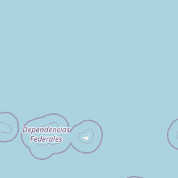
Map view of Los Roques Archipelago National Park

Use this park location map to pinpoint Los Roques Archipelago National Park in Venezuela, understand its exact geographic position, and read its mapped placement within the surrounding landscape more clearly.

Pigeon | © OpenStreetMap contributors

Location context for Los Roques Archipelago National Park

Dependencias Federales

Visualizing the coral atoll terrain, turquoise lagoons, and protected marine habitats

Parque nacional Archipiélago de Los Roques Photos, Landscapes, and Marine Scenery

Photographic records reveal the distinct atoll architecture, barrier reefs, and shallow marine environments defining Parque nacional Archipiélago de Los Roques. Visual exploration provides concrete insight into the protected island geography, seagrass meadows, and marine ecosystems characterizing the region.

An aerial photograph of a tropical island featuring a long airstrip, green vegetation, several inland lagoons, and turquoise shallow waters surrounding the coastline.

Several brown pelicans standing on white concrete pilings rising from clear turquoise Caribbean water under a blue sky

A wide white sandy street lined with colorful single-story buildings painted in yellow, pink, blue, and orange, framed by palm fronds and tropical trees under a clear blue sky.

A small green sea turtle with a brown patterned shell resting in a shallow blue container with some algae.

Park atlas

Discover adjacent marine reserves and protected landscapes across the surrounding region

Explore Other Parks Near Parque nacional Archipiélago de Los Roques for Regional Comparison

Users browsing Parque nacional Archipiélago de Los Roques can examine neighboring marine reserves and protected coastal landscapes. Comparing adjacent protected areas reveals broader geographic patterns and regional biodiversity context.
National parkVenezuela
Mapped location lies within the park boundary#1 closest

East

Archipiélago Los Roques National Park: Venezuela's Caribbean Marine Protected Landscape Explorer

Mapped coral reefs, protected islands, and Caribbean geography.

Archipiélago Los Roques National Park is a critical national park in Venezuela, safeguarding a remarkable archipelago in the Caribbean Sea. The park's landscape is defined by its vibrant coral reef systems, pristine white-sand beaches, and diverse marine habitats. Users can explore the geographic extent of this protected marine area, understanding its importance for conservation and its unique position within the southern Caribbean's natural geography.

IUCN
II
Climate
Tropical
Scope
Marine
Water
Water-dominated
Watercolor painting showing a winding river flowing through a landscape with rolling hills in the background
National parkVenezuela
About 138 km away#2 closest

South

El Ávila National Park: Venezuela's Premier Coastal Mountain National Park Exploration

Discover diverse terrain, mapped boundaries, and unique geographic context.

El Ávila National Park offers an exceptional gateway into Venezuela's mountainous protected landscapes. This national park features a dramatic rise from the Caribbean coast into varied terrain, including unique cloud forest and alpine zones. Its mapped geography showcases steep slopes, deep ravines, and remarkable elevation changes, providing a significant atlas-style study of coastal mountain environments. Exploring El Ávila National Park reveals a vital natural barrier and a rich ecosystem supporting diverse flora and fauna, making it a key destination for understanding regional protected areas.

Area
819 km²
Established
1958
IUCN
II
Relief
Mountain
National parkVenezuela
About 157 km away#3 closest

South

Macarao National Park: Venezuela's National Park with Mapped Boundaries and Regional Atlas Context

Explore its protected landscape and geographic setting within South America.

Delve into Macarao National Park, a significant national park situated in Venezuela. This page offers an atlas-centric view of the park, detailing its mapped boundaries and highlighting its importance within the regional geography of northern South America. Understand how Macarao National Park contributes to the country's network of protected landscapes and provides foundational geographic context for explorers and researchers.

Area
150 km²
Established
1973
IUCN
II
Relief
Mountain
Natural monumentMiranda
About 163 km away#4 closest

South

Monumento natural Cueva Alfredo Jahn: Exploring Protected Limestone Caves in Miranda

Geology, karst topography, and cave system mapping

Monumento natural Cueva Alfredo Jahn serves as a primary geological research site and protected natural area in the Serranía Litoral. The cave system, shaped by perennial waterways, features significant calcite formations and mineral rarity. Examine the mapped extent, elevations, and landscape context of this central Venezuelan cave complex.

Area
0.58 km²
Established
1978
IUCN
III
Visitors
3.5K annual
Watercolor painting depicting mountains, a lake, and green vegetation
National parkVenezuela
About 165 km away#5 closest

Southwest

Henri Pittier National Park: Venezuela's Oldest National Park, Coastal Range Geography

Explore protected landscapes, cloud forests, and birdwatching geography.

Henri Pittier National Park is Venezuela's foundational protected area, established in 1937 and spanning over 107,800 hectares within the Venezuelan Coastal Range. This national park is renowned for its exceptional biodiversity, particularly its over 500 bird species and its distinctive cloud forest ecosystems, which include the iconic Gyranthera caribensis tree. The park's geography extends from rugged mountain terrain to coastal bays and beaches, with the Paso de Portachuelo serving as a significant migratory bird corridor. Its mapped boundaries enclose a rich mosaic of natural landscapes vital for understanding regional conservation and protected area geography in northern South America.

Area
1,078 km²
Established
1937
IUCN
II
Relief
Mountain
Natural monumentAragua
About 171 km away#6 closest

South

Monumento Natural Pico Codazzi: Karst Landscapes and Mountain Corridors in Aragua

Exploring protected summit terrain and regional mountain connectivity

Spanning over 11,850 hectares, Monumento Natural Pico Codazzi preserves a complex mountain landscape defined by limestone massifs, vertical cliffs, and subterranean cave systems. Located in Aragua, this protected area functions as a biological bridge between major national parks, safeguarding a critical environment for migratory bird transit and high-altitude cloud forest stability across the Coastal Range.

Area
118.5 km²
Established
1991
Relief
Mountain
Climate
Tropical
National parkBonaire
About 175 km away#7 closest

West

Washington-Slagbaai National Park: Mapping the Protected Terrain of Northern Bonaire

Saline wetlands, volcanic peaks, and coastal ecology

Washington-Slagbaai National Park represents a cornerstone of Bonaire's conservation identity. The protected area features a striking blend of salt-tolerant mangrove systems, expansive salinas, and the rising slopes of Brandaris. This geographic overview highlights the physical characteristics and ecological distribution within one of the oldest national parks in the Dutch Caribbean, mapping the convergence of arid scrubland and marine environments.

Area
56.43 km²
Established
1969
Relief
Upland
Water
Major water bodies
National parkVenezuela
About 186 km away#8 closest

Southwest

Morrocoy National Park: Venezuela's Coastal National Park with Distinct Protected Geography

Explore the mapped protected landscape and regional context.

Morrocoy National Park stands as a key protected area within Venezuela, offering a distinct focus for geographic exploration. As a national park, its mapped boundaries delineate a significant natural landscape critical for understanding regional conservation and the country's broader atlas of protected lands. Discover the unique geographic characteristics and the atlas-driven context of this important Venezuelan protected area.

Area
320.9 km²
Established
1974
IUCN
II
Relief
Mixed relief

Common questions about visiting, size, designation, and location context for Los Roques Archipelago National Park

Los Roques Archipelago National Park FAQs for park facts, access, geography, and protected area context

Find quick answers about Los Roques Archipelago National Park, including protected-area facts, park geography, trail and visitor context, and how the park fits into its surrounding country and regional landscape.
MoriAtlas Explorer

Continue Your Protected Areas Search Across the Global Atlas

Deepen your exploration by continuing the structured search for national parks and protected areas worldwide. Utilize the comprehensive filtering capabilities to compare different conservation landscapes and refine your understanding of global park geography. Discover more about the distribution and characteristics of protected natural areas.

Global natural geography