

Mori Atlas logo
National parkParque nacional Juan Crisóstomo Falcón

Mapping the limestone sinkholes, subterranean lakes, and cloud forests of this Venezuelan region.

Parque nacional Juan Crisóstomo Falcón: A Protected Karst Landscape in Sierra de Falcón

(Parque Nacional Juan Crisóstomo Falcón)

Parque nacional Juan Crisóstomo Falcón protects a complex mountainous terrain on the eastern flank of the Sierra de Falcón range. This region features a unique geology shaped by ancient water erosion, resulting in dramatic sinkholes, extensive cave networks, and the prominent Fosa de San Luis underground lake. The park acts as a vital hydrologic source for the surrounding Falcón state, bridging diverse ecosystems from humid cloud forests to xerophytic woodlands within its rugged limestone boundaries.

karst landscapecloud forestxerophytic forestnational parkmountain rangecave systems
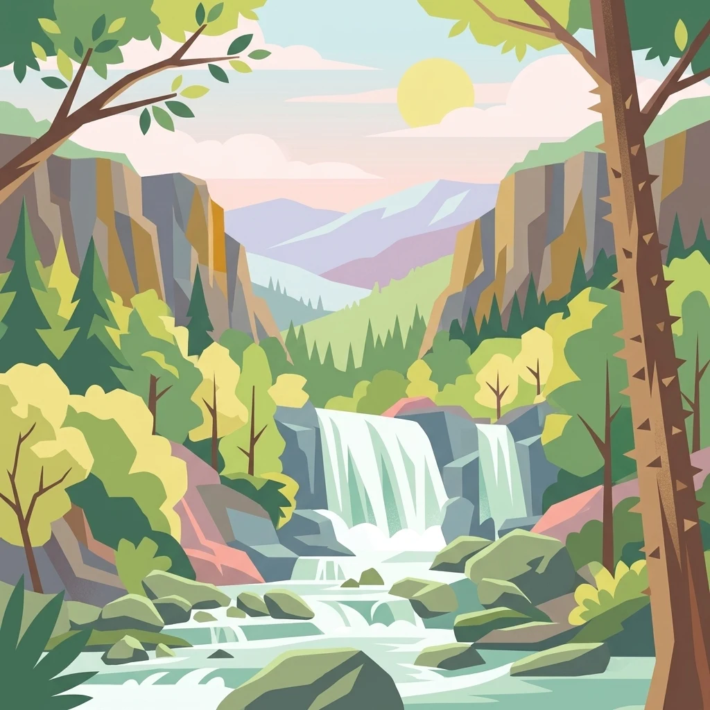
A stylized vector illustration showing a double waterfall cascading over rocky ledges into a stream, framed by pine and deciduous trees in a mountainous valley under a pale sun.

Parque nacional Juan Crisóstomo Falcón

National park

Park overview

Structured park overview, official facts, and landscape profile for Juan Crisóstomo Falcón National Park

Juan Crisóstomo Falcón National Park park facts, protected area profile, and essential visitor context

Review the core facts for Juan Crisóstomo Falcón National Park, including designation, size, terrain, visitor scale, habitats, and operating context in one park-focused overview.

About Juan Crisóstomo Falcón National Park

Juan Crisóstomo Falcón National Park protects a striking fragment of the Sierra de Falcón in northwestern Venezuela, straddling the transition between the arid coastal plains around Coro and the higher, wetter mountains of the interior. Established in 1987 and administered by INPARQUES, the park encompasses roughly 20,000 hectares of mid- and low-elevation mountains that culminate in Cerro Galicia, the highest peak in the protected area. Its setting, just a short drive from the historic city of Santa Ana de Coro, makes it accessible while still preserving a relatively untouched mountain environment.

The park is fundamentally a landscape shaped by water acting on limestone. Long-term infiltration of water through soluble rock has carved out the signature features of the area: towering masses of limestone laced with embedded quartz, river-cut ravines, and especially the deep vertical sinkholes known locally as haitones. The most famous geological feature is the Fosa de San Luis, a vast subterranean lake developed within the cave network, regarded as the largest underground lake in Venezuela. In addition to these karst formations, the park contains extensive cave galleries, river channels, and erosion-sculpted hillsides.

Ecologically, the park is notable for the sharp contrast between vegetation zones found within a relatively small area. At lower elevations, xerophytic forests host drought-adapted species, while higher, moister slopes support cloud forest and humid woodland, sometimes within sight of one another. The protected area preserves endemic species such as the Urupagua fruit and the campanero herrero bird, and harbors a diverse community of mammals, reptiles, invertebrates, and especially birds, including several macaw species and the oilbird.

Beyond its scenic and ecological value, Juan Crisóstomo Falcón National Park plays a vital hydrological role for Falcón State. The watersheds of the Mitare, Acarigua, Ricoa, and Hueque rivers all begin within the park, supplying water to Coro, Punto Fijo, and surrounding communities. This combination of karst geology, biodiversity, endemism, and regional water provisioning makes the park a defining natural landmark of the Falcón region.

Quick facts and research context for Juan Crisóstomo Falcón National Park

Juan Crisóstomo Falcón National Park was established on May 6, 1987 and is administered by Venezuela's national park authority, INPARQUES. It is classified as a UICN Category II protected area and covers roughly 200 square kilometers across part of the Sierra de Falcón range near Santa Ana de Coro.

The park's highest point is Cerro Galicia at around 1,600 meters above sea level, and its limestone geology has produced caves, sinkholes, and the large Fosa de San Luis underground lake. The watersheds of the Mitare, Acarigua, Ricoa, and Hueque rivers all originate within the park, making it a critical water resource for Falcón State.

Protection and recognition

Documented terrestrial protection scope and official designation details

Parque nacional Juan Crisóstomo Falcón Protection Status and Recognition

Parque nacional Juan Crisóstomo Falcón maintains a documented terrestrial protection scope within the national conservation network. Recorded administrative facts outline the official protection status and management scope established for the protected landscape.

Protection details

Protection scope
Terrestrial
Transboundary protection
No
Park context

Deeper park guide and search-rich context for Juan Crisóstomo Falcón National Park

Juan Crisóstomo Falcón National Park history, landscape, wildlife, and travel context

Explore Juan Crisóstomo Falcón National Park through its history, landscape character, ecosystems, wildlife, conservation priorities, cultural context, and seasonal travel timing in a structured park guide built for atlas discovery and search intent.

Why Juan Crisóstomo Falcón National Park stands out

Juan Crisóstomo Falcón National Park is best known for its karst landscape of deep sinkholes and caves carved into limestone, particularly the haitones and the Fosa de San Luis, one of Venezuela's largest subterranean lakes. The park is also recognized for its combination of humid cloud forest and drier xerophytic woodland within a single protected area, set against the backdrop of the Sierra de Falcón mountains. Its significance extends beyond scenery: the park shelters an unusual collection of endemic species, including the Urupagua fruit and the campanero herrero bird, and serves as a key water source for the region through the Mitare, Acarigua, Ricoa, and Hueque river basins.
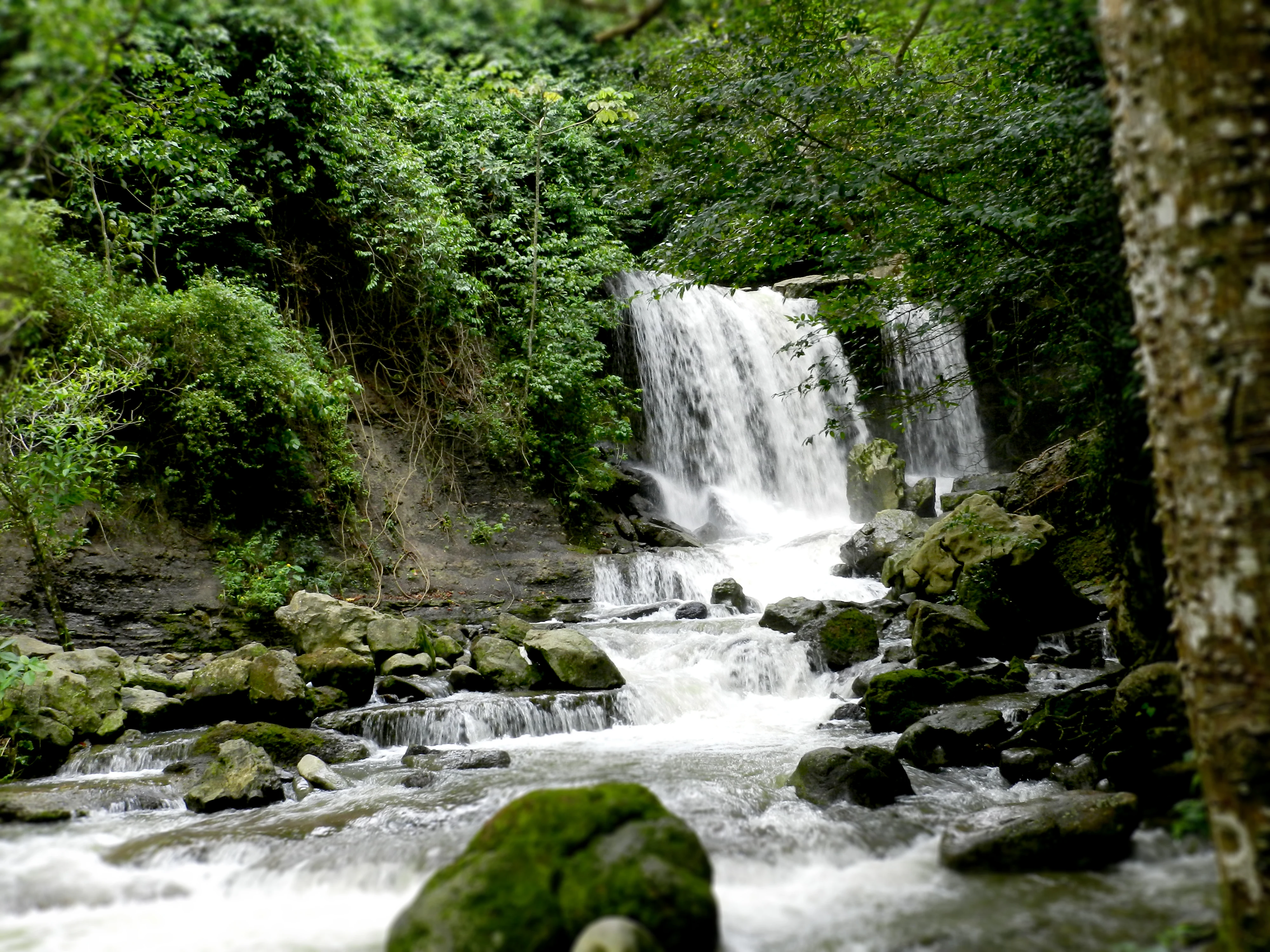
A multi-tiered waterfall cascades over mossy rocks into a stream within a dense green forest.
The Hueque Waterfall flows through the lush cloud forest of the Sierra de San Luis in Juan Crisóstomo Falcón National Park.

Juan Crisóstomo Falcón National Park history and protected-area timeline

Juan Crisóstomo Falcón National Park was officially created on May 6, 1987, becoming one of the formal national protected areas of Venezuela under the administration of INPARQUES, the national park service. The park was established to safeguard a representative portion of the eastern slopes of the Sierra de Falcón, an area that had long been recognized locally for its unusual karst formations, caves, and water resources.

The park takes its name from Juan Crisóstomo Falcón, a prominent 19th-century Venezuelan political figure associated with the Falcón region. Over time, conservation efforts have focused on protecting not only the surface landscapes but also the underground systems of caves, sinkholes, and the Fosa de San Luis, recognizing their geological, hydrological, and scientific significance. The park also functions as a regulated zone for scientific research and nature observation, activities explicitly permitted within its management framework.

Juan Crisóstomo Falcón National Park landscape and geographic character

The landscape of Juan Crisóstomo Falcón National Park is defined by the rugged terrain of the eastern Sierra de Falcón, where medium- and low-elevation mountains rise to a high point at Cerro Galicia, around 1,600 meters above sea level. The underlying geology is predominantly limestone, often laced with veins of quartz, and has been continuously reshaped by water over thousands of years, producing some of the most distinctive karst scenery in Venezuela.

The most visually arresting features are the deep sinkholes, locally called haitones, which drop dramatically through the forest canopy and expose the bare rock beneath. These vertical openings, along with vast systems of caves and galleries, have been gradually hollowed out by water infiltration. Among them lies the Fosa de San Luis, an expansive subterranean lake recognized as the largest underground lake in Venezuela.

Rivers such as the Mitare, Acarigua, Ricoa, and Hueque carve erosion-shaped valleys and ravines through the park, while dense cloud forest clings to the moist upper slopes and xerophytic woodland covers the drier lower elevations. The combination of rugged mountain ridges, forested slopes, limestone outcrops, sinkholes, caves, and waterfall sites like the Cataratas del Hueque gives the park a notably varied terrain within a compact area.

Juan Crisóstomo Falcón National Park ecosystems, habitats, and plant life

The vegetation of Juan Crisóstomo Falcón National Park reflects the interplay of geology, elevation, and moisture. On the lower, drier slopes, xerophytic forests are dominated by species such as tiamo, guamo, crucete, pringamosa, and ajito, all adapted to periodic drought conditions. These drier forests transition abruptly into humid and cloud-forest environments on the higher slopes, where moisture from fog and rainfall supports a very different plant community.

In the cloud-forest zone, characteristic species include tacamahaco, tapataparo, quina, and lechocillo, along with carnivorous bladder plants, a wide variety of bromeliads and orchids, and numerous climbing vines. The park also contains palm-rich areas, where shade palm, caña molinillo, and palma prapa grow. Multiple soil types and humidity levels combine to produce a layered mosaic of vegetation that changes significantly over short distances, producing one of the park's defining ecological traits: the juxtaposition of dry forest and humid forest within the same protected landscape.

Juan Crisóstomo Falcón National Park wildlife and species highlights

Wildlife in Juan Crisóstomo Falcón National Park is shaped by the same altitudinal and humidity gradients that define its vegetation. The park hosts an outstanding diversity of birds, including several macaw species such as the red macaw, the bandera macaw, the green macaw, and the Maracaná macaw, alongside the perico cara sucia, the blue-headed parakeet, the loro real, the loro guaro, woodpeckers, and the nocturnal oilbird, or guácharo.

Reptiles are well represented by iguanas, lizards, spectacled caiman, coastal caiman, cofre turtles, and a range of snakes including rainbow boas, tigras, mapanares, cuaimas, tragavenado, and vejucas. Mammals recorded in the park include armadillos, foxes, weasels, cuchi cuchis, opossums, picures, jaguarundis, pumas, oncillas, jaguars, and tapirs. The park also hosts a notable endemic invertebrate, the Tityus falconensis scorpion, often called the Escorpión de Hueque, along with giant centipedes, dung beetles, and fishing spiders of the Pisauridae family.

Juan Crisóstomo Falcón National Park conservation status and protection priorities

Juan Crisóstomo Falcón National Park is significant for conservation largely because it protects a complex karst hydrological system that underpins water supply across Falcón State. The rivers Mitare, Acarigua, Ricoa, and Hueque, whose waters ultimately serve the cities of Coro and Punto Fijo, all rise within the park. By safeguarding these headwaters and the underground conduits that feed them, the park plays a direct role in regional water security.

Beyond its hydrological value, the park conserves an unusually high concentration of endemic and narrowly distributed species, from plants such as Urupagua to animals like the campanero herrero bird and the Tityus falconensis scorpion. The presence of marine fossils of corals and echinoderms at elevations above 1,500 meters offers scientific insight into the geological history of the region. The protected area also preserves threatened habitats, including cloud forests and xerophytic forests, as well as fragile cave and sinkhole ecosystems that cannot easily be restored once damaged.

Juan Crisóstomo Falcón National Park cultural meaning and human context

The area encompassing Juan Crisóstomo Falcón National Park is deeply tied to the identity of Falcón State and the nearby colonial city of Santa Ana de Coro, a historic capital of Venezuela. The park is named after Juan Crisóstomo Falcón, a 19th-century political and military figure closely associated with the region's history. Local communities have long recognized the significance of the area's caves, sinkholes, and river sources, which have shaped settlement patterns, water use, and regional folklore across the Sierra de Falcón.

Top sights and standout views in Juan Crisóstomo Falcón National Park

Among the standout features of Juan Crisóstomo Falcón National Park are the Fosa de San Luis, an immense subterranean lake carved into the park's limestone bedrock, and the dramatic haitones, deep vertical sinkholes that pierce the forest canopy. The park's combination of cloud forest and xerophytic woodland within a single protected area creates unusual ecological transitions, while the quartz-veined limestone formations and the Cataratas del Hueque provide striking visual landmarks.

The park is also distinguished by its role as the source of four major river basins that supply much of Falcón State, by its concentration of endemic species, and by the presence of globally unusual marine fossils exposed at high elevations, making it a destination where geology, hydrology, and biodiversity intersect within a relatively compact mountain range.

Best time to visit Juan Crisóstomo Falcón National Park

The climate of the Sierra de Falcón is generally warm and dry on the lower slopes, with cooler, moister conditions in the cloud-forest zones higher up. Periods outside the peak dry season tend to be more rewarding for visiting the park, as the cloud-forest zones and waterfalls like the Cataratas del Hueque depend on sufficient rainfall to be at their most impressive. Cooler higher elevations and the presence of humidity-loving vegetation mean the upper park retains a misty, green character even while the lowlands may be arid.

Visitors interested in birdwatching, photography of the dense forest and limestone scenery, or exploring the caves and sinkholes will find that conditions vary considerably with elevation; planning around the regional rainy patterns can enhance both visibility and landscape character, since the same weather that greens the forest above can dry out the lower trails below.
Monthly climate preview

Long-term temperature and precipitation averages across the representative coordinate

Parque nacional Juan Crisóstomo Falcón Climate Normals and Monthly Weather Records

Historical data records monthly temperature ranges and precipitation levels sampled across a representative coordinate within Parque nacional Juan Crisóstomo Falcón. Exploring the complete twelve-month profile provides detailed weather patterns for the protected area.
Annual mean27 °C
26 °C28 °C
Jan26°
Feb26°
Mar27°
Apr28°
May28°
Jun28°
Jul28°
Aug28°
Sep28°
Oct27°
Nov26°
Dec26°
Warmest month
August

28 °C

Coolest month
December

25.5 °C

Wettest month
October

3.6 mm/day

Driest month
February

0.5 mm/day

Park location guide

Geography guide, regional context, and park location map for Juan Crisóstomo Falcón National Park

Juan Crisóstomo Falcón National Park park geography, regions, and map view in Venezuela

Understand where Juan Crisóstomo Falcón National Park sits in Venezuela through a broader geographic reading of the surrounding landscape, nearby location context, and its mapped position within the national park landscape.

How Juan Crisóstomo Falcón National Park fits into Venezuela

Venezuela is a country in northern South America with coastline along the Caribbean Sea and Atlantic Ocean. It borders Colombia, Brazil, Guyana, and Trinidad and Tobago. The country has an area of approximately 916,445 km² and a population of about 31.8 million. Caracas is the capital and largest city. Venezuela consists of 23 states and the Capital District.

Wider geography shaping Juan Crisóstomo Falcón National Park in Venezuela

Venezuela is located on the northern coast of South America. The continental territory is bordered by the Caribbean Sea and Atlantic Ocean to the north, Colombia to the west, Brazil to the south, and Guyana to the east. Trinidad and Tobago lies to the northeast. The country includes various islands and islets in the Caribbean Sea known as the Federal Dependencies.

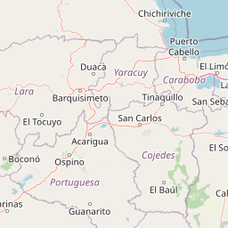
Map view of Juan Crisóstomo Falcón National Park

Use this park location map to pinpoint Juan Crisóstomo Falcón National Park in Venezuela, understand its exact geographic position, and read its mapped placement within the surrounding landscape more clearly.

Pigeon | © OpenStreetMap contributors

Location context for Juan Crisóstomo Falcón National Park

Falcón

Visual exploration of limestone karst formations, cloud forests, and subterranean waters

Parque nacional Juan Crisóstomo Falcón Photos and Mapped Scenery

Protected area photography reveals the rugged mountain terrain, deep sinkholes, and contrasting forest zones of Parque nacional Juan Crisóstomo Falcón. Visual records provide essential context for understanding the geology, habitats, and hydrological networks shaping this Venezuelan mountain range.

A multi-tiered waterfall cascades over mossy rocks into a stream within a dense green forest.

Park atlas

Compare adjacent mountain terrain and connected limestone landscapes

Other parks near Parque nacional Juan Crisóstomo Falcón and regional protected areas

Browse nearby national parks and protected areas sharing the regional geography of the Sierra de Falcón mountain range. Comparing adjacent conservation landscapes provides deeper context into regional karst geology, river basins, and cloud forest ecosystems.
National parkVenezuela
About 0 km away#1 closest

Southeast

Juan Crisóstomo Falcón National Park: Venezuela's Protected Area and Landscape Geography

Mapped boundaries and regional context for this Venezuelan national park.

Juan Crisóstomo Falcón National Park represents a distinct protected area within Venezuela, offering specific insights into its geographic identity and mapped landscape. This entry facilitates a deeper understanding of the park's protected boundaries and its place within the national and regional atlas of South America. Explore the terrain and natural context that define this significant Venezuelan national park for structured geographic discovery.

National parkFalcón State
About 26 km away#2 closest

North

Médanos de Coro National Park: Venezuela's Unique Arid Landscape and Protected Dune System

Explore the mapped geography of this coastal desert in Falcón State.

Médanos de Coro National Park represents a remarkable protected area within Venezuela's Falcón State, renowned for its spectacular and active sand dune systems. This national park encompasses approximately 91 square kilometers of unique terrain, including large sand formations, salt marshes, and mangrove swamps, contributing to its designation as a key conservation site for arid coastal ecosystems. Users can explore the park's distinctive landscape, understand its geographic context, and discover the patterns of wind-sculpted dunes that define this Venezuelan national park.

Area
91 km²
Established
1974
IUCN
II
Relief
Lowland
National parkVenezuela
About 82 km away#3 closest

Southeast

Cueva de la Quebrada del Toro National Park: Venezuelan National Park Protected Landscape

Explore its mapped boundaries and regional geographic context.

This page details Cueva de la Quebrada del Toro National Park, highlighting its status as a national park within Venezuela. Understand the park's geographic setting, its role as a protected landscape, and its mapped presence within the country's natural reserves. It provides essential context for exploring its protected boundaries and regional significance for atlas-based discovery.

Area
48.85 km²
Established
1961
IUCN
II
Relief
Upland
National parkLara State
About 107 km away#4 closest

South

Cerro Saroche National Park: A National Park within Lara State's Geography

Explore the protected landscape and mapped boundaries.

Cerro Saroche National Park in Lara State, Venezuela, is a distinct protected area offering a valuable perspective for geographic and atlas exploration. This page provides essential details about its identity as a national park, highlighting its place within the regional landscape. Understanding Cerro Saroche National Park helps in appreciating the distribution of protected lands and their geographical significance across Venezuela.

Area
322.94 km²
Established
1989
IUCN
II
Relief
Mountain
National parkVenezuela
About 137 km away#5 closest

Southeast

Yurubí National Park: A National Park in Venezuela for Protected Landscape Exploration

Explore mapped boundaries and regional geography.

Yurubí National Park represents a distinct protected area within Venezuela, offering valuable data for geographic exploration and atlas-based understanding. This national park's identity is defined by its mapped boundaries and its role in the regional landscape context of northern South America. Delve into its protected territory to gain insights into Venezuela's natural geography and conservation landscapes.

Area
236.7 km²
Established
1960
IUCN
II
Relief
Mountain
Watercolor painting of a landscape featuring green trees, hills, and cacti under a light blue sky
National parkCuracao
About 145 km away#6 closest

Northeast

Christoffelpark National Park: Curacao's Volcanic Terrain and Protected Landscape Atlas

Explore mapped boundaries and unique dry forest ecosystems.

Christoffelpark represents Curacao's most vital protected natural area, offering a deep dive into its unique geography and landscape. This national park preserves the island's highest peak, Christoffelberg, alongside distinctive dry forest ecosystems, endemic species, and the remnants of colonial plantations. Explore the mapped terrain, understand the regional context, and appreciate the rich natural and cultural heritage that defines this important protected landscape on Curacao.

Area
10.4 km²
Established
1978
IUCN
II
Relief
Mixed relief
National parkVenezuela
About 145 km away#7 closest

East

Morrocoy National Park: Venezuela's Coastal National Park with Distinct Protected Geography

Explore the mapped protected landscape and regional context.

Morrocoy National Park stands as a key protected area within Venezuela, offering a distinct focus for geographic exploration. As a national park, its mapped boundaries delineate a significant natural landscape critical for understanding regional conservation and the country's broader atlas of protected lands. Discover the unique geographic characteristics and the atlas-driven context of this important Venezuelan protected area.

Area
320.9 km²
Established
1974
IUCN
II
Relief
Mixed relief
National parkVenezuela
About 149 km away#8 closest

South

Terepaima National Park: Venezuela's National Park Protected Landscape

Mapped Boundaries and Regional Geography

Terepaima National Park is a designated national park within Venezuela, offering a clear focus for atlas-driven exploration of protected natural areas. This entry highlights the park's significance as a mapped protected landscape, providing essential geographic context and detail for understanding its boundaries and regional setting. It is an integral component for any structured discovery of Venezuela's conservation network.

Area
186.5 km²
Established
1976
IUCN
II
Relief
Mountain

Common questions about visiting, size, designation, and location context for Juan Crisóstomo Falcón National Park

Juan Crisóstomo Falcón National Park FAQs for park facts, access, geography, and protected area context

Find quick answers about Juan Crisóstomo Falcón National Park, including protected-area facts, park geography, trail and visitor context, and how the park fits into its surrounding country and regional landscape.
MoriAtlas Explorer

Continue Your Protected Areas Search Across the Global Atlas

Deepen your exploration by continuing the structured search for national parks and protected areas worldwide. Utilize the comprehensive filtering capabilities to compare different conservation landscapes and refine your understanding of global park geography. Discover more about the distribution and characteristics of protected natural areas.

Global natural geography
