Mori Atlas logo
National parkPatuca National Park

Understand the geographic context and protected area boundaries of this Honduran natural landscape.

Patuca National Park: A National Park of Honduras and its Mapped Protected Landscape

Patuca National Park represents a significant protected landscape within Honduras, offering a vital focal point for understanding regional geography and conservation efforts. This national park serves as a key entity in the Central American atlas, providing mapped outlines and a distinct geographic identity for exploration. Users can delve into the park's specific setting, examining its protected area context and the natural terrain it encompasses, contributing to a comprehensive view of Honduras's natural heritage.

national parkprotected areatropical forestCentral AmericaHondurasMosquitia

Patuca National Park

National park

Park overview

Structured park overview, official facts, and landscape profile for Patuca National Park

Patuca National Park park facts, protected area profile, and essential visitor context
Review the core facts for Patuca National Park, including designation, size, terrain, visitor scale, habitats, and operating context in one park-focused overview.

About Patuca National Park

Patuca National Park represents a major conservation initiative by the government of Honduras, established in 1999 to protect a substantial tract of the country's eastern forestlands. The park occupies a significant area in the Mosquitia region, a remote and ecologically important zone that spans portions of eastern Honduras and extends into neighboring countries. This protected area was created with the dual goals of preserving ecological integrity and maintaining the natural processes that sustain biodiversity in tropical forest ecosystems. The national park designation reflects Honduras's recognition that these lands require formal protection to ensure their long-term conservation value. The park's establishment represents part of a broader movement in Central America during the late 1990s to expand and strengthen national protected area systems, with Patuca becoming a cornerstone of Honduras's conservation portfolio.

Quick facts and research context for Patuca National Park

Patuca National Park is situated in eastern Honduras within the Mosquitia region. The park was officially established on January 1, 1999, covering roughly 3,756 square kilometers of terrain. It is classified as an IUCN Category II protected area, the national park designation reserved for areas of significant ecological value requiring formal protection. The park's coordinates are approximately 14.43°N latitude and 85.45°W longitude. This vast protected area encompasses tropical forest ecosystems and represents one of Honduras's largest conservation spaces.

Park context

Deeper park guide and search-rich context for Patuca National Park

Patuca National Park history, landscape, wildlife, and travel context
Explore Patuca National Park through its history, landscape character, ecosystems, wildlife, conservation priorities, cultural context, and seasonal travel timing in a structured park guide built for atlas discovery and search intent.

Why Patuca National Park stands out

Patuca National Park is known primarily for its extensive tropical forest coverage and its role in protecting a significant portion of Honduras's interior wilderness. The park encompasses portions of the Mosquitia region, an area recognized for its ecological diversity and relatively intact natural landscapes. As one of the larger protected areas in Honduras, Patuca serves as a reservoir of biodiversity and a representative sample of the country's tropical forest ecosystems.

Patuca National Park history and protected-area timeline

Patuca National Park was established on January 1, 1999, as part of Honduras's efforts to expand its protected areas network during the late twentieth century. The creation of the park reflected growing recognition of the ecological importance of the Mosquitia region and the need to provide formal protection to its forest ecosystems. The establishment date places Patuca within a period when many Central American countries were strengthening their environmental protection frameworks, responding to both domestic conservation priorities and international environmental agreements. The park's designation as a national park rather than another category of protected area indicates its significance as a representative natural landscape requiring comprehensive protection.

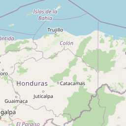
Patuca National Park landscape and geographic character

Patuca National Park encompasses a landscape typical of the Mosquitia region in eastern Honduras, characterized by extensive tropical moist forests, rolling terrain, and a network of waterways that drain toward the Caribbean coast. The terrain within the park includes lowland forest areas and transitional zones that connect to higher elevation systems further inland. The region's landscape has remained relatively undeveloped compared to other parts of Honduras, which has allowed the natural vegetation and terrain features to persist in a less disturbed state. Rivers originating in the park's interior flow outward through the landscape, connecting the protected area to the broader watershed systems of eastern Honduras.

Patuca National Park ecosystems, habitats, and plant life

The ecosystems within Patuca National Park represent the tropical moist forest formations that characterize the Mosquitia region of Central America. These forests support a complex array of plant and animal species adapted to the warm, humid conditions of lowland tropical environments. The park protects forest habitats that would otherwise face pressures from agricultural expansion, logging, and other land-use changes that have affected much of Honduras's original forest cover. The ecological character of the area reflects its position within the broader Mesoamerican biodiversity hotspot, a region recognized internationally for its high species richness and endemism. The protected status helps maintain ecological processes and habitat connectivity across this portion of eastern Honduras.

Patuca National Park wildlife and species highlights

The wildlife within Patuca National Park includes species typical of Central American tropical forests, though detailed species inventories specific to the park are limited in the available source material. The Mosquitia region as a whole is known to support populations of neotropical mammals, bird species, and reptiles that inhabit the forest canopy and understory. The extensive forest cover provides habitat for species that require large, contiguous tracts of natural habitat, making the protected status of the park particularly valuable for conservation. The park's role in maintaining connectivity between forest areas contributes to the survival of wildlife populations that depend on landscape-scale habitat continuity.

Patuca National Park conservation status and protection priorities

Patuca National Park serves as a conservation anchor for the Mosquitia region, protecting a substantial area of Honduras's remaining forest ecosystems. As an IUCN Category II protected area, the park is managed with the primary objectives of protecting natural ecosystems and enabling public enjoyment of the environment. The establishment of Patuca in 1999 added a significant conservation area to Honduras's protected areas network at a time when the country was working to expand coverage of its biodiversity-rich landscapes. The park contributes to national and regional conservation goals by preserving forest habitat that supports ecosystem services, watershed protection, and biodiversity maintenance.

Patuca National Park cultural meaning and human context

The Mosquitia region in which Patuca National Park is located has historical connections to indigenous peoples, including groups that have traditionally inhabited and used the forestlands of eastern Honduras. The broader Mosquitia area extends across the border into Nicaragua and has been home to Miskito and other indigenous communities whose relationship with the landscape predates the establishment of formal protected areas. The creation of the national park occurs within this cultural context, where conservation objectives intersect with the ancestral lands and livelihoods of local communities. The region has historically been one of the more remote and less densely populated areas of Honduras, which has influenced both the ecological character of the landscape and the human dimensions of conservation planning.

Top sights and standout views in Patuca National Park

Patuca National Park stands out as one of Honduras's largest and most significant protected areas, representing a major investment in conservation for the country's eastern forestlands. The park protects extensive tropical forest ecosystems in the Mosquitia region, an area that remains relatively undeveloped compared to other parts of Honduras. Its establishment in 1999 reflects a commitment to preserving biodiversity and maintaining natural landscapes that are essential to the country's ecological heritage. The park provides protection for forest habitats that would otherwise face significant conversion pressures, ensuring that these ecosystems remain intact for future generations.

Best time to visit Patuca National Park

The climate of eastern Honduras features a tropical pattern with distinct wet and dry seasons that influence visiting conditions for Patuca National Park. The wet season typically extends from May through November, bringing higher rainfall and making some areas less accessible. The dry season from December through April generally offers more stable conditions for exploration, though the tropical climate means that rainfall can occur at any time. Visitors interested in experiencing the park should consider how seasonal patterns affect both accessibility and the character of the landscape, with the wet season bringing lusher vegetation and the dry season offering more consistent conditions for outdoor activities.

Park location guide

Geography guide, regional context, and park location map for Patuca National Park

Patuca National Park park geography, regions, and map view in Honduras
Understand where Patuca National Park sits in Honduras through a broader geographic reading of the surrounding landscape, nearby location context, and its mapped position within the national park landscape.

How Patuca National Park fits into Honduras

Honduras, officially the Republic of Honduras, is a Central American nation with a predominantly Mestizo population. It gained independence in 1821 and operates as a unitary presidential republic. The country faces significant economic challenges, with over 70% of its population living in poverty, though it possesses valuable natural resources including minerals, coffee, and tropical fruits.

Wider geography shaping Patuca National Park in Honduras

Honduras is located in Central America, bordering Guatemala to the west, El Salvador to the southwest, Nicaragua to the southeast, the Pacific Ocean to the south at the Gulf of Fonseca, and the Caribbean Sea to the north at the Gulf of Honduras. The terrain includes mountainous regions and coastal lowlands.

Map view of Patuca National Park

Use this park location map to pinpoint Patuca National Park in Honduras, understand its exact geographic position, and read its mapped placement within the surrounding landscape more clearly.

Pigeon | © OpenStreetMap contributors
Park atlas

Trace the regional park geography and compare other protected areas within the wider Honduran Mosquitia region.

Discover Related National Parks and Protected Areas Near Patuca National Park
Browse other national parks and protected areas in the region surrounding Patuca National Park, extending your geographic discovery across Central America. This focused view allows for comparing diverse park types and understanding the broader protected-area network across the Honduran Mosquitia region.
National parkHonduras

Sierra de Agalta National Park: National Park within Honduras's Protected Landscape Atlas

Explore mapped boundaries and natural terrain details.

Sierra de Agalta National Park is a protected national park in Honduras, offering valuable insight into the country's natural geography and conservation efforts. As a key entity within the broader atlas of protected lands, this park's mapped boundaries and surrounding terrain provide a foundation for understanding its ecological significance and regional context. Discover the geographic identity of Sierra de Agalta National Park and its contribution to Honduras's protected areas.

Area
207.85 km²
Established
1987
IUCN
II
Relief
Mountain
National parkLa Unión

La Muralla National Park: Honduras National Park Geography and Mapped Boundaries

Explore the protected landscape and regional context.

La Muralla National Park represents a significant protected landscape within Honduras, offering valuable geographic data for atlas exploration. As a national park, its mapped boundaries and regional setting are key to understanding its conservation significance. This entry provides structured insight into the park's physical characteristics and its place within the broader Honduran geography, ideal for detailed landscape analysis.

Area
210.35 km²
Established
1993
IUCN
II
Scope
Terrestrial
National parkColón Department

Capiro Calentura National Park: Honduran National Park Atlas and Protected Landscape

Discover mapped geography and protected area context in Colón Department.

Access detailed geographic information and mapped boundaries for Capiro Calentura National Park, a key protected area within Honduras' Colón Department. This entry offers an atlas-style perspective on the park's landscape and its regional setting, supporting structured discovery of national parks and conservation lands.

Area
80.82 km²
Established
1992
IUCN
II
Climate
Tropical
National parkHonduras

Montaña de Yoro National Park: Honduran National Park Atlas and Protected Landscape Exploration

Understanding its mapped boundaries and regional geography.

This card details Montaña de Yoro National Park, a designated national park in Honduras, offering a focused look at its protected landscape. It provides essential geographic context, helping users to understand the park's mapped boundaries and its significance within the broader atlas of Honduran protected areas. Explore the specific terrain and regional setting that define Montaña de Yoro National Park.

Area
154.8 km²
Established
1987
IUCN
II
Relief
Mountain
National parkHonduras

Montaña de Comayagua National Park: Honduras National Park and Protected Area Geography

Explore mapped boundaries and natural terrain within Central America.

Montaña de Comayagua National Park stands as a vital protected area, contributing significantly to the geographic tapestry of Honduras. This national park offers a focused perspective for atlas exploration, allowing users to trace its mapped boundaries and comprehend its role within the regional landscape. Delve into the park's protected identity and its unique position in the mapped geography of Central America.

Area
184.8 km²
Established
1987
IUCN
II
Relief
Mountain
National parkRoatán

Port Royal National Park National Park: Mapped Protected Landscape on Roatán

Explore its geographic context and park boundaries.

Port Royal National Park, situated on Roatán, Honduras, offers a distinct protected landscape for geographic exploration. As a National Park, its mapped boundaries define a significant area for understanding regional geography and conservation landscapes. Discover the park's identity through its position within Roatán and its contribution to a structured atlas of protected natural areas.

Area
5 km²
Established
2010
IUCN
II
Climate
Tropical
National parkHonduras

Pico Pijol National Park: National Park within the Honduran Geographic Atlas

Explore its mapped boundaries and protected landscape context.

Pico Pijol National Park stands as a protected area within Honduras, offering critical insight into the nation's natural landscapes. This detail page provides essential context for understanding its geographic positioning and mapped boundaries, serving as a foundational element for broader atlas-based exploration of protected regions in Central America. Discover the park's unique identity as a national park and its contribution to regional geographic understanding.

Area
122.1 km²
Established
1987
IUCN
II
Relief
Mountain
National parkHonduras

Jeannette Kawas National Park: A Protected Landscape within Honduran Geography

Explore the mapped boundaries and regional setting of this national park.

Jeannette Kawas National Park is a vital protected area whose geographic identity is central to understanding the natural landscape of Honduras. This page serves as a detailed exploration point, focusing on the park's mapped boundaries and its role within the country's protected lands atlas. Discover the unique aspects of this national park's terrain and its contribution to regional geographic context, providing a factual basis for atlas-driven learning.

Area
781.62 km²
Established
1994
IUCN
II
Relief
Highland

Common questions about visiting, size, designation, and location context for Patuca National Park

Patuca National Park FAQs for park facts, access, geography, and protected area context
Find quick answers about Patuca National Park, including protected-area facts, park geography, trail and visitor context, and how the park fits into its surrounding country and regional landscape.
MoriAtlas Explorer

Continue Your Protected Areas Search Across the Global Atlas

Deepen your exploration by continuing the structured search for national parks and protected areas worldwide. Utilize the comprehensive filtering capabilities to compare different conservation landscapes and refine your understanding of global park geography. Discover more about the distribution and characteristics of protected natural areas.

Global natural geography