Why Península de Paria National Park stands out
Península de Paria National Park is best known for protecting a distinctive coastal peninsula environment where the Venezuelan Coastal Range meets the Caribbean Sea. The park preserves unique biodiversity characteristic of the Venezuelan Guiana, a region typically found much further east in Venezuela. Its dramatic landscape features the highest elevations on the Paria Peninsula, with peaks like Cerro Humo providing panoramic views across both the Caribbean Sea and Gulf of Paria. The park offers hiking opportunities through both coastal and mountainous terrain, with trails ascending to the peninsula's highest points. The combination of Caribbean coastline, steep mountainous interior, and ecological isolation has created conditions for distinctive plant and animal communities.
Península de Paria National Park history and protected-area timeline
Península de Paria National Park was established on December 12, 1978, as part of Venezuela's expanding protected area network during the late 1970s. The park's creation reflected growing recognition of the ecological significance of the Venezuelan Coastal Range and the need to protect unique biodiversity pockets along the country's Caribbean margin. The formal declaration was published in Official Gazette No. 2417 on March 7, 1979, completing the legal process that brought the peninsula under national protection. The establishment of the park came during a period when Venezuela was developing its national park system to preserve representative examples of the country's diverse ecosystems. The decision to protect this particular peninsula was influenced by scientific studies documenting the presence of flora and fauna with strong affinities to the Venezuelan Guiana, a major ecoregion typically associated with eastern Venezuela's interior highlands and plateaus.
Península de Paria National Park landscape and geographic character
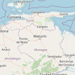
The landscape of Península de Paria National Park is defined by the dramatic intersection of the Venezuelan Coastal Range with the Caribbean Sea. The peninsula forms a land protrusion extending into the Caribbean, creating a distinctive geographical feature on Venezuela's eastern coast. The park encompasses steep mountain slopes that rise abruptly from the sea, with the highest peaks concentrated in the central spine of the peninsula. Cerro Humo, reaching 1,371 meters above sea level, and Cerro El Patao at 1,070 meters represent the highest points on the peninsula and provide sweeping views in all directions. The terrain transitions from rugged coastal cliffs and beaches along the Caribbean-facing shores to more sheltered coves and coastal plains facing the Gulf of Paria. The mountain streams and rivers that originate in the highland areas have carved valleys through the peninsula, creating diverse micro-landscapes from steep ravines to more gently sloped drainages. The combination of high relief, coastal exposure, and the peninsula's isolation has produced a landscape of considerable visual and ecological diversity.
Península de Paria National Park ecosystems, habitats, and plant life
The natural environment of Península de Paria National Park is characterized by tropical forest ecosystems that display strong ecological connections to the Venezuelan Guiana, despite the peninsula's location in the Coastal Range. This makes the park botanically significant, as it contains species assemblages more typical of regions hundreds of kilometers to the east. The park's elevation gradient, from sea level to nearly 1,400 meters, creates multiple habitat zones including coastal vegetation, lowland tropical forest, and montane forest communities. The rivers flowing from the mountains to the Gulf of Paria create additional ecological diversity and provide important habitats for aquatic species. The park's position on the Caribbean coast places it within a region influenced by moist tropical conditions, supporting dense vegetation cover across the peninsula's slopes. The combination of coastal exposure, high rainfall, and diverse topography has produced a complex mosaic of habitats supporting considerable biodiversity.
Península de Paria National Park wildlife and species highlights
While the Wikipedia source provides limited specific detail on wildlife, the park's ecological significance suggests diverse fauna associated with both coastal and forest environments. The Venezuelan Guiana affiliations of the peninsula's flora indicate that wildlife communities may include species with distributions extending from the interior Guiana region. The park's rivers provide freshwater habitat, while its forests shelter birdlife and arboreal species. The coastal positions attracts marine and coastal bird species, and the elevation gradient supports altitudinal zonation in species distribution. The protected status of the area since 1978 has allowed wildlife communities to persist in relatively undisturbed conditions, maintaining ecological connections between the peninsula's diverse habitats.
Península de Paria National Park conservation status and protection priorities
Península de Paria National Park represents an important conservation priority within Venezuela's protected area system due to its unique ecological character. The park protects a peninsula where flora and fauna display Guiana affinities despite being geographically separated from the main Guiana region by the Coastal Range and lowerlands. This makes the area a critical site for preserving ecological patterns that illustrate the complex distribution of Venezuela's biodiversity. As a Category II protected area under IUCN classification, the park is managed primarily for ecosystem conservation while allowing sustainable recreation use. The protection of the peninsula's watersheds is particularly important, as the rivers originating in the park provide fresh water to communities and ecosystems along the Gulf of Paria. The establishment of the park in 1978 secured this distinctive coastal mountain environment against development pressures that might otherwise have transformed the peninsula's natural landscape.
Península de Paria National Park cultural meaning and human context
The park occupies territory within the districts of Arismendi, Mariño, and Valdez in Sucre state. These districts contain coastal communities whose histories are intertwined with the peninsula's geography. The Paria Peninsula has historically served as a zone of cultural exchange along Venezuela's Caribbean coast, and local communities maintain connections to the land and resources that the park now protects. The region has been associated with agricultural activities, particularly cacao production, which has shaped the cultural landscape of the peninsula. While the park itself focuses on natural protection, the surrounding areas contain human communities whose relationship with the peninsula's environment predates formal protection.
Top sights and standout views in Península de Paria National Park
Peninsula de Paria National Park offers visitors the opportunity to experience one of Venezuela's most geographically distinctive protected areas, where Caribbean coastal scenery meets mountainous terrain rising sharply from the sea. The park contains the highest points on the Paria Peninsula, with hiking trails ascending to Cerro El Patao and Cerro Humo for panoramic views spanning both the Caribbean Sea and Gulf of Paria. The park protects unique ecological communities with Guiana-region affinities, making it botanically significant beyond its relatively compact size. Coastal beaches, dramatic cliffs, and the transition from sea-level to near-1,400-meter elevations create remarkable diversity within a single protected area. The park's rivers flowing south to the Gulf of Paria add further ecological and landscape variety to the visitor experience.
Best time to visit Península de Paria National Park
The park can be visited year-round, though the dry season typically from December through April generally offers more comfortable conditions for hiking and outdoor activities. The period from December to April corresponds with reduced rainfall and more stable weather patterns, making it favorable for exploring the park's mountain trails and coastal areas. The wet season from May through November brings increased precipitation, particularly to the mountain areas, which can make trails slippery and views less clear. However, the wet season also brings lusher vegetation and fuller water flows in the park's streams. Visitors interested in wildlife observation may find different advantages in each season, with wet-season bird activity often being more pronounced.