

Mori Atlas logo
Nature reservePeradayan Forest Reserve

Explore the protected geography and natural terrain of this Brunei nature reserve.

Peradayan Forest Reserve Nature Reserve: Mapped Boundaries and Protected Landscape in Temburong District

Peradayan Forest Reserve is a designated nature reserve located within the Temburong District of Brunei, an area renowned for its extensive tropical rainforests. As a key protected landscape, its boundaries and natural terrain offer valuable insight into the region's geography. This page serves as a starting point for understanding the park's identity, its ecological context within Temburong District, and its significance for structured geographic discovery through detailed mapping and atlas exploration.

forest reservetropical foresthikingwildlife viewingBorneohills

Peradayan Forest Reserve

Nature reserve

Park overview

Structured park overview, official facts, and landscape profile for Peradayan Forest Reserve

Peradayan Forest Reserve park facts, protected area profile, and essential visitor context
Review the core facts for Peradayan Forest Reserve, including designation, size, terrain, visitor scale, habitats, and operating context in one park-focused overview.

About Peradayan Forest Reserve

Peradayan Forest Reserve represents one of Brunei's designated nature reserves in the less-accessible eastern portion of the country, where the Temburong District is separated from the main population centers by Malaysian territory. The reserve's location in the hill country of Borneo provides a distinct landscape character compared to the coastal and lowland areas that dominate much of Brunei. Visitors approach the reserve from Bangar, the small district capital, traveling along the road toward Labu village. The forest recreation area offers a more accessible introduction to Brunei's tropical forest environments, with established trails that allow visitors to explore the terrain without extensive preparation. The twin hills that anchor the reserve, Bukit Perdayan and Bukit Patoi, provide both recreational challenge and scenic reward for those who complete the walking paths to their summits.

Quick facts and research context for Peradayan Forest Reserve

Peradayan Forest Reserve covers 2,650 hectares in eastern Brunei's Temburong District, within Mukim Batu Apoi near the town of Bangar. The reserve features two prominent hills, Bukit Perdayan at 410 meters and Bukit Patoi at 310 meters elevation. A popular 1.6-kilometer walking trail winds through the forest to Bukit Patoi's summit, where a flat stone area serves as a helipad. The recreation zone within the reserve spans roughly 1,070 hectares and is known for accessible wildlife viewing, particularly of the native kijang deer. The reserve is administered by the Temburong District Office.

Park context

Deeper park guide and search-rich context for Peradayan Forest Reserve

Peradayan Forest Reserve history, landscape, wildlife, and travel context
Explore Peradayan Forest Reserve through its history, landscape character, ecosystems, wildlife, conservation priorities, cultural context, and seasonal travel timing in a structured park guide built for atlas discovery and search intent.

Why Peradayan Forest Reserve stands out

Peradayan Forest Reserve is best known for its accessible tropical forest recreation experience in eastern Brunei, where visitors can walk through well-maintained trails to reach panoramic viewpoints on Bukit Patoi. The reserve is notable for the ease of spotting wildlife, particularly the native kijang (deer) that inhabit the forest. The twin-peak silhouette of Bukit Perdayan and Bukit Patoi forms a recognizable landscape feature within Brunei's Temburong District, making the reserve a popular destination for both nature observation and hill climbing within this relatively remote region of the country.

Peradayan Forest Reserve history and protected-area timeline

Peradayan Forest Reserve was established as a protected nature reserve under the administration of the Temburong District Office. The designation reflects Brunei's approach to maintaining forest coverage across the country, with the reserve serving both conservation and recreation functions. The development of the forest recreation park component, with its walking trails and visitor facilities, represents an effort to provide public access to natural areas while maintaining protection of the forest ecosystem. The use of Bukit Patoi's summit as a helipad suggests the reserve has been accessible by air for administrative and potentially emergency purposes.

Peradayan Forest Reserve landscape and geographic character

The landscape of Peradayan Forest Reserve centers on two forested hills that rise from the surrounding terrain, creating a distinctive twin-peak profile visible from the surrounding area. Bukit Perdayan reaches 410 meters above sea level while Bukit Patoi stands at 310 meters, both covered in tropical forest vegetation. The terrain is typical of Borneo's hill country, with slopes covered in dense vegetation and the valleys between the hills providing lower-lying forest areas. The summit of Bukit Patoi features a flat stone area cleared for helicopter access, providing an unusual open viewpoint within the forest environment. The walking trail to the summit involves negotiating a winding 1.6-kilometer path through the forest.

Peradayan Forest Reserve ecosystems, habitats, and plant life

The reserve protects tropical forest ecosystems characteristic of Borneo's interior hill regions. The forest covers the hillsides and valleys, providing a relatively intact habitat area within the broader landscape. The recreation park zone allows visitor access while maintaining the forest environment, creating a space where people can experience the tropical forest without significant impact. The forest likely contains diverse plant species typical of Borneo, though the source material does not detail specific vegetation types or forest composition.

Peradayan Forest Reserve wildlife and species highlights

The Peradayan Forest Reserve is noted for accessible wildlife viewing, with the native kijang (deer) being particularly readily seen by visitors. The kijang is a native Borneo species that inhabits the forest areas within the reserve. Beyond the deer, the tropical forest environment would support various bird species, insects, and other fauna typical of Bornean forests, though the available source material does not provide detailed wildlife lists. The relative ease of spotting wildlife in the recreation park area makes this a key attraction for visitors.

Peradayan Forest Reserve conservation status and protection priorities

Peradayan Forest Reserve functions as a protected area within Brunei's nature reserve system, preserving forest habitat in the Temburong District. The dual-purpose designation allowing both conservation and limited recreation reflects a management approach that provides public access to natural areas while maintaining protection of the forest ecosystem. The reserve contributes to Brunei's overall forest conservation estate, particularly in the eastern region where forest cover remains extensive.

Peradayan Forest Reserve cultural meaning and human context

The reserve is situated within the traditional territory of the Temburong District, an area with indigenous Malay communities whose ancestors have inhabited the Bornean interior. The place name Perdayan derives from local usage, referring to the hills that shape the reserve. The road to Labu that passes the reserve connects traditional villages in this eastern district of Brunei.

Top sights and standout views in Peradayan Forest Reserve

The twin hills of Bukit Perdayan and Bukit Patoi form the visual centerpiece of the reserve, offering hiking opportunities to their summits. The accessible wildlife viewing, particularly of the native kijang deer, distinguishes this reserve for visitors. The 1.6-kilometer trail to Bukit Patoi's summit provides a achievable challenge for day visitors, with the helipad at the top serving as a distinctive destination. The proximity to Bangar town and the road to Labu make this one of the more accessible forest areas in eastern Brunei.

Best time to visit Peradayan Forest Reserve

The reserve can be visited year-round given Brunei's tropical climate, though the drier months typically offer more comfortable conditions for hiking. The hot and humid tropical environment means visitors should prepare for warm conditions regardless of season. The forest environment provides shade along the walking trails, making early morning visits practical for those seeking to avoid peak daytime temperatures.

Park location guide

Geography guide, regional context, and park location map for Peradayan Forest Reserve

Peradayan Forest Reserve park geography, regions, and map view in Brunei
Understand where Peradayan Forest Reserve sits in Brunei through a broader geographic reading of the surrounding landscape, nearby location context, and its mapped position within the national park landscape.

How Peradayan Forest Reserve fits into Brunei

Brunei is a sovereign nation on the northern coast of Borneo island in Southeast Asia. It is the only country entirely on Borneo and is completely surrounded by Malaysia's Sarawak state. The country operates as an Islamic absolute monarchy ruled by the Sultan, with Malay as the official language.

Wider geography shaping Peradayan Forest Reserve in Brunei

Brunei is located on the northern coast of Borneo island in Southeast Asia, with coastline along the South China Sea. The country is completely surrounded by the Malaysian state of Sarawak, and its territory is bifurcated by the Sarawak district of Limbang. Total area is 5,765 km².

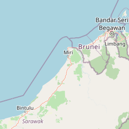
Map view of Peradayan Forest Reserve

Use this park location map to pinpoint Peradayan Forest Reserve in Brunei, understand its exact geographic position, and read its mapped placement within the surrounding landscape more clearly.

Pigeon | © OpenStreetMap contributors

Location context for Peradayan Forest Reserve

Temburong District
Park atlas

Explore tropical forest reserves and conservation landscapes across Brunei's Temburong District and the wider Borneo region.

Discover Other Protected Areas and Nearby National Parks Around Peradayan Forest Reserve in Brunei
Continue your park discovery beyond Peradayan Forest Reserve by mapping other protected areas and tropical forest landscapes in Brunei and the surrounding Borneo region. Compare geographic features, conservation statuses, and regional park distribution to enhance your understanding of local protected ecosystems.
National parkBrunei

Ulu Temburong National Park: Brunei's Protected Rainforest Landscape and Geographic Context

Mapped natural terrain and conservation significance.

Ulu Temburong National Park represents Brunei's commitment to preserving its most ecologically significant tropical rainforests, covering approximately 550 square kilometers. This protected area is characterized by its remote location in the Temburong District and its diverse topography, ranging from lowland areas to mountainous ridges, all within a largely undisturbed natural setting. The park's mapped boundaries encompass a vital transboundary conservation landscape, making it a key site for understanding Borneo's unique ecosystems and forest protection policies through an atlas-driven exploration approach.

Area
488.59 km²
Established
1991
IUCN
II
Relief
Mixed relief
Protected areaBrunei-Muara District

Bukit Shahbandar Forest Recreation Park: Protected Area with Ridge Landscape & Hiking Trails

Explore Brunei's unique recreational forest terrain and mapped natural features.

Bukit Shahbandar Forest Recreation Park is a notable protected area within the Brunei-Muara District, distinguished by its prominent grassy ridge and a network of challenging hiking trails that traverse its varied terrain. The park's landscape is characterized by rolling hills, including peaks that reach nearly 470 feet, offering strategic vantage points. As a recreational forest, it provides a distinct example of protected land use, blending modified natural vegetation with opportunities for outdoor activity and geographic discovery. Its unique topography and trail system offer a clear focus for atlas-based exploration.

Area
2.34 km²
Established
1998
IUCN
II
Visitors
35.5K annual
Protected areaBrunei

Tasek Merimbun Heritage Park: Protected Landscape Identity and Geographic Atlas

Mapped boundaries and regional natural context for this Brunei protected area.

Tasek Merimbun Heritage Park represents a distinct protected area within the geography of Brunei. This page provides detailed insight into its protected landscape, offering a map-centric view of its boundaries and its placement within the broader natural context of Borneo. Understand the park's geographic significance and explore its unique attributes for structured atlas exploration.

Area
78 km²
Established
1984
Climate
Tropical
Access
Easy access
National parkSarawak

Gunung Buda National Park: Sarawak National Park Protected Landscape and Geography

Explore the mapped boundaries and regional context of this Malaysian national park.

Gunung Buda National Park is a significant protected area within Sarawak, Malaysia, contributing to the region's diverse geography. As a national park, it offers specific insights into mapped protected lands, providing a focal point for understanding Borneo's natural landscapes. This entry details its geographic identity and its role as a protected natural space, crucial for any atlas-driven exploration of East Malaysia's conservation areas.

Area
66.2 km²
Established
2001
IUCN
II
Relief
Mountain
Nature reserveBrunei

Luagan Lalak Forest Recreation Park Nature Reserve: Brunei's Pristine Freshwater Swamp Landscape

Explore mapped protected-area geography and unique wetland terrain.

Luagan Lalak Forest Recreation Park, a protected nature reserve in Brunei, preserves a rare and visually distinctive freshwater swamp ecosystem. Characterized by dark, tranquil waters and vast fields of purun grass, this natural wetland offers a unique landscape context and is a prime location for observing its rich biodiversity, especially its notable birdlife. The park's preservation as an intact swamp environment within a recreational area highlights its ecological importance for regional geography and protected-area mapping.

Area
2.7 km²
Established
1980
IUCN
II
Visitors
4.2K annual
National parkMarudi District

Gunung Mulu National Park: A Protected National Park with Distinct Geographic Identity in Marudi District

Explore its mapped protected area and regional landscape.

Gunung Mulu National Park stands as a key protected area within Marudi District, Malaysia, offering critical insights into the region's natural geography. This national park entity provides a focal point for understanding mapped protected landscapes and their specific geographic characteristics. Users can explore the park's boundaries and its role within the wider atlas of Malaysian natural areas, gaining a solid foundation in its conservation geography.

Area
528.64 km²
Established
1974
IUCN
II
Relief
Mountain
National parkLimbang Division

Pulong Tau National Park: A Protected National Park in Malaysia's Limbang Division

Explore its mapped boundaries and regional landscape context.

Pulong Tau National Park represents a key protected area within the Limbang Division, offering valuable geographic and atlas-based discovery opportunities. This page details the park's identity as a national park, focusing on its mapped boundaries and its role within the protected landscapes of Malaysia. Users can explore the park's specific geographic characteristics and understand its context within the regional atlas, providing a factual foundation for appreciating its natural landscape value.

Area
665.25 km²
Established
1998
IUCN
II
Relief
Mountain
National parkMalaysia

Crocker Range National Park: A Protected Landscape within Malaysia's Borneo Region

Mapped boundaries and regional geography context for exploration.

Crocker Range National Park represents a significant protected area within Malaysia, contributing distinct geographic features and landscape context to the Borneo region. This detailed view supports atlas exploration by outlining the park's mapped boundaries and its role within the nation's protected lands. Understand the park's specific location and geographic identity, enriching your comprehension of Malaysian natural landscapes and conservation areas.

Area
1,399 km²
Established
1984
IUCN
II
Relief
Mountain

Common questions about visiting, size, designation, and location context for Peradayan Forest Reserve

Peradayan Forest Reserve FAQs for park facts, access, geography, and protected area context
Find quick answers about Peradayan Forest Reserve, including protected-area facts, park geography, trail and visitor context, and how the park fits into its surrounding country and regional landscape.
MoriAtlas Explorer

Continue Your Protected Areas Search Across the Global Atlas

Deepen your exploration by continuing the structured search for national parks and protected areas worldwide. Utilize the comprehensive filtering capabilities to compare different conservation landscapes and refine your understanding of global park geography. Discover more about the distribution and characteristics of protected natural areas.

Global natural geography
