
Mori Atlas logo
State or regional parkPetroglyph Provincial Park

Examining the intersection of ancient stone carvings and coastal British Columbia geography

Petroglyph Provincial Park: Mapped Indigenous Cultural Landscapes on Vancouver Island

Petroglyph Provincial Park serves as a protected outdoor archive on the east coast of Vancouver Island, showcasing an extraordinary density of ancient rock carvings etched into the bedrock near the Nanaimo River estuary. This site offers deep insight into the cultural relationship between Coast Salish heritage and natural forces, where carvings were placed near waterfalls and striking rock formations. Explore the unique terrain where regional coastal geography meets enduring Indigenous history.

Coast Salish heritageIndigenous petroglyphsCultural preservationNanaimo River estuaryVancouver Island coastNatural monument
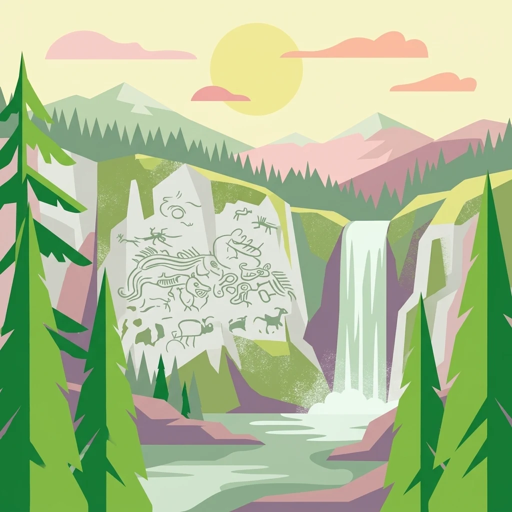
A colorful flat-design illustration of a mountainous landscape with a prominent cliff face covered in stylized petroglyphs; a waterfall descends into a stream in the foreground, framed by pine trees under a sunset sky.

Petroglyph Provincial Park

State or regional park

Park overview

Structured park overview, official facts, and landscape profile for Petroglyph Provincial Park

Petroglyph Provincial Park park facts, protected area profile, and essential visitor context

Review the core facts for Petroglyph Provincial Park, including designation, size, terrain, visitor scale, habitats, and operating context in one park-focused overview.

About Petroglyph Provincial Park

Petroglyph Provincial Park is a very small but exceptionally meaningful cultural preserve located on the southeastern edge of Nanaimo, on the traditional territory of the Snuneymuxw people. The park sits near the mouth of the Nanaimo River, where freshwater meets the saltwater of the Northumberland Channel. This coastal estuary setting, combined with the surrounding sandstone and basalt shoreline, creates exactly the kind of environment that has supported human settlement and cultural expression in the region for thousands of years.

The park's defining feature is its extraordinary density of ancient rock carvings, which are incised directly into the bedrock surfaces near the river. While many petroglyphs exist throughout the Pacific Northwest, the concentration here is unusually high, making the site one of the most important of its kind on Vancouver Island. The imagery ranges from abstract forms to clearly recognizable depictions of sea creatures, human figures, and animals, many of which carry symbolic weight in Coast Salish cosmology and oral tradition.

The site's protected status reflects long-standing recognition of its cultural value. Established as a Class A Provincial Park in 1948 and managed by BC Parks, Petroglyph Provincial Park is classified under the IUCN system as a natural monument or feature, underscoring that its importance is rooted in cultural heritage rather than ecological preservation. Despite its small footprint, the park serves as an outdoor cultural archive, preserving a tangible link between the Snuneymuxw and Coast Salish peoples and the coastal landscape that has shaped their history. For visitors, the park offers an unusually direct encounter with the deep human history of the Vancouver Island shoreline.

Quick facts and research context for Petroglyph Provincial Park

Petroglyph Provincial Park is a Class A provincial park managed by BC Parks, situated at the southern edge of Nanaimo on Vancouver Island. Covering only about 2 hectares around the Nanaimo River estuary, its protected purpose is entirely cultural rather than ecological: preserving a dense grouping of ancient rock carvings.

Designated a natural monument under IUCN Category III, the park safeguards petroglyphs that are believed to extend back at least to the 10th century. The site's importance lies in its connection to the spiritual and ancestral heritage of the Coast Salish and Snuneymuxw First Nations.

Protection and recognition

Documented terrestrial protection scope, designation framework, and conservation records.

Petroglyph Provincial Park Protection Status and International Recognition Data

Petroglyph Provincial Park maintains a documented terrestrial protection scope without supplementary international recognition sources or transboundary classifications on file. Structured records organize the designated conservation framework and administrative parameters for comprehensive geographic review.

Protection details

Protection scope
Terrestrial
Transboundary protection
No
Park context

Deeper park guide and search-rich context for Petroglyph Provincial Park

Petroglyph Provincial Park history, landscape, wildlife, and travel context

Explore Petroglyph Provincial Park through its history, landscape character, ecosystems, wildlife, conservation priorities, cultural context, and seasonal travel timing in a structured park guide built for atlas discovery and search intent.

Why Petroglyph Provincial Park stands out

Petroglyph Provincial Park is best known for housing one of the most concentrated groupings of Indigenous rock carvings on Vancouver Island. The petroglyphs here are recognized as a key expression of the cultural and spiritual traditions of the Coast Salish peoples, particularly the Snuneymuxw First Nation, whose ancestral territories include the Nanaimo River estuary. The site's significance is amplified by its setting. The carvings were not placed randomly: they were deliberately positioned near natural features such as waterfalls and distinct rock formations, places where Coast Salish belief held that natural forces were especially powerful. Together, the carvings and their location offer a rare glimpse into how Indigenous communities in the Pacific Northwest integrated landscape, spirituality, and cultural memory into enduring stone imagery.
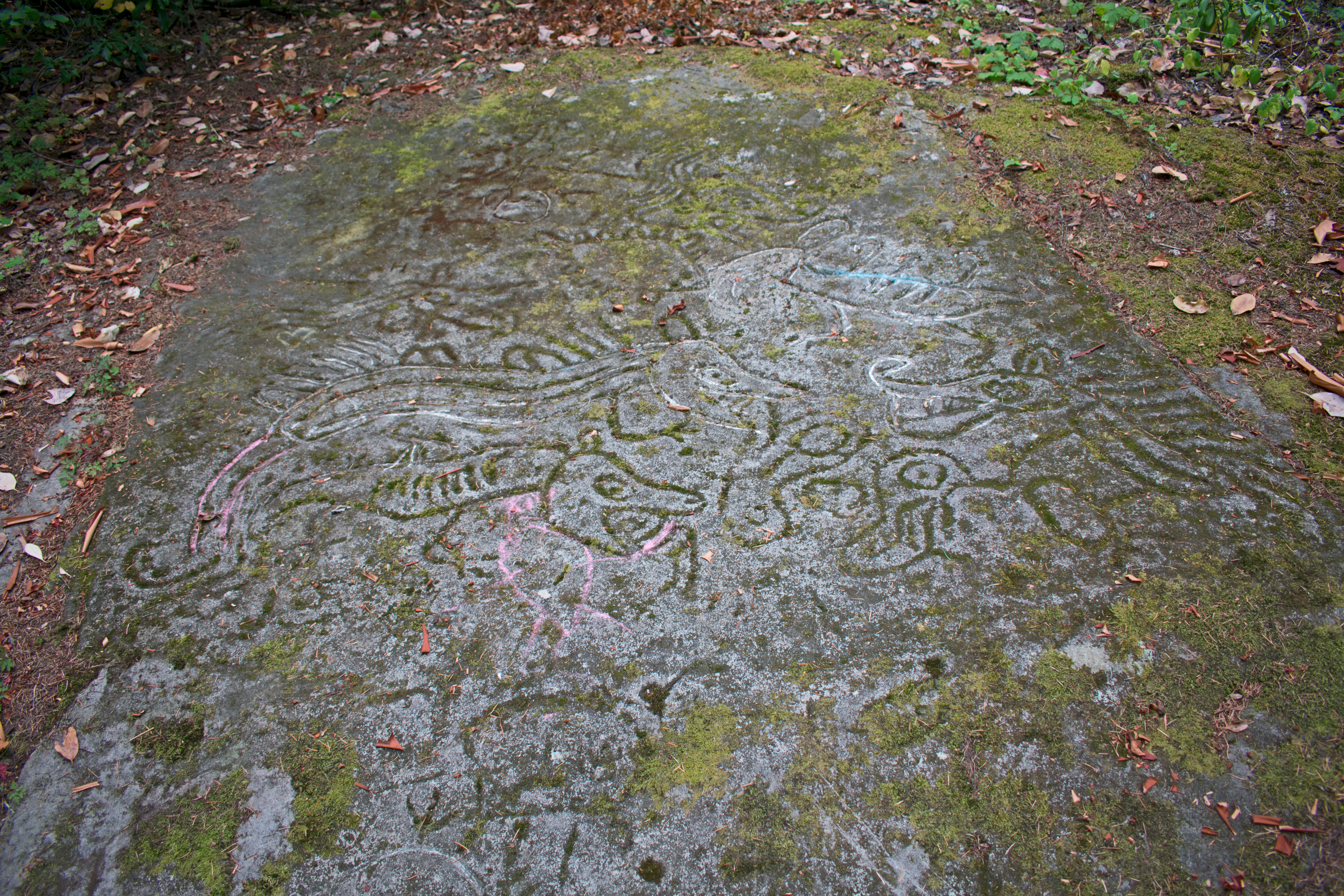
Ancient Indigenous petroglyphs carved into a mossy rock surface at Petroglyph Provincial Park.
Ancient rock carvings at Petroglyph Provincial Park.

Petroglyph Provincial Park history and protected-area timeline

Petroglyph Provincial Park was formally established on August 24, 1948, making it one of the older provincial park designations in British Columbia dedicated to the protection of Indigenous cultural heritage. From the moment of its creation, the park's purpose was clearly distinct from the province's many wilderness and recreation-focused parks: it was set aside to safeguard a specific collection of ancient rock carvings clustered near the mouth of the Nanaimo River.

The historical significance of the carvings themselves extends far deeper than the park's establishment date. The petroglyphs are believed to date back to at least the 10th century CE, and some researchers suggest certain elements may be even older. This places the site within a long continuum of Indigenous cultural expression along the eastern coast of Vancouver Island, a region that has been inhabited and shaped by Coast Salish peoples for millennia.

The carvings are closely associated with the Snuneymuxw First Nation, whose ancestral and contemporary territory encompasses the Nanaimo area. Within Coast Salish tradition, these carvings are not simply decorative; they are considered expressions of spiritual belief, ancestral memory, and connection to the landscape. The placement of the carvings near powerful natural features such as waterfalls and rock outcrops reflects an intentional relationship between people and place, one that the park's protected status now helps preserve for future generations.

Over the decades since 1948, the park has continued to be recognized as a culturally significant site, both for Indigenous communities and for the broader public interest in the heritage of the Pacific Northwest.

Petroglyph Provincial Park landscape and geographic character

The landscape of Petroglyph Provincial Park is shaped by its location at the edge of the Nanaimo River estuary, where the river meets the sheltered coastal waters of the Strait of Georgia. The terrain is low-lying and rocky, dominated by exposed sandstone and basalt bedrock that rises gently from the shoreline. This bedrock is not only the park's geological foundation but also the surface upon which its culturally significant carvings were etched.

Vegetation in the surrounding area reflects the coastal rainforest character of southeastern Vancouver Island, with mixed stands of coniferous trees, deciduous growth, and shoreline shrubs typical of the region. The estuary environment nearby contributes to a landscape defined by the interplay of land, freshwater, and sea, an interplay that has long supported both wildlife and human settlement.

What makes the park's landscape especially notable, however, is not its scale but the way natural features were woven into cultural use. The petroglyphs are concentrated in places where waterfalls, commanding rock formations, or other expressions of natural force occur. In Coast Salish belief, such locations were considered spiritually charged, and the carvings served to mark and engage with that power. The result is a landscape where geology and human history are layered together in a remarkably visible way.

Petroglyph Provincial Park ecosystems, habitats, and plant life

While Petroglyph Provincial Park is primarily valued for its cultural heritage rather than its ecological profile, the ecosystem in which it sits is characteristic of coastal British Columbia. The park lies within the eastern Vancouver Island lowland, where mild, wet winters and dry summers support a rich coastal forest environment. The nearby Nanaimo River estuary adds an important transitional zone between freshwater and marine ecosystems, supporting diverse plant communities and serving as a seasonal habitat for waterfowl and other wildlife.

The bedrock outcrops that host the petroglyphs themselves are weathered sandstone and basalt, materials that have shaped both the visual character of the site and its suitability for carving. Surrounding forests include typical Pacific Northwest species such as Douglas fir, western red cedar, and bigleaf maple, along with understory plants adapted to the moist coastal climate.

Although the park's footprint is very small and offers no developed facilities, the broader landscape it belongs to is ecologically productive. The estuary setting, in particular, supports a dynamic interplay of tidal, riparian, and woodland habitats that contribute to the biological richness of the Nanaimo area.

Petroglyph Provincial Park wildlife and species highlights

Given its small size and lack of developed facilities, Petroglyph Provincial Park is not a primary destination for wildlife viewing, but the surrounding estuary and coastal forest environments support a variety of species typical of the region. The brackish waters and tidal flats near the Nanaimo River attract shorebirds, waterfowl, and small coastal fish, while the forested edges offer habitat for songbirds, small mammals, and typical Pacific Northwest forest fauna.

Visitors to the park are likely to encounter common coastal species rather than charismatic large mammals, but the broader ecosystem reinforces the importance of protecting culturally significant shoreline areas in their natural state. Maintaining the integrity of the surrounding forest and estuary helps preserve both the visual context of the petroglyphs and the ecological health of the Nanaimo River mouth.

Petroglyph Provincial Park conservation status and protection priorities

The conservation significance of Petroglyph Provincial Park lies primarily in cultural preservation rather than ecological protection. As a Class A Provincial Park and an IUCN Category III natural monument, its central mandate is to safeguard an irreplaceable collection of Coast Salish rock carvings from disturbance, weathering, and loss. Each carving represents a tangible element of Indigenous heritage whose meaning and value cannot be replicated, making physical preservation a matter of regional and national cultural importance.

The park's protection also indirectly supports the conservation of the broader estuary landscape. By limiting development and maintaining natural shoreline conditions around a sensitive cultural site, the park contributes to the ecological health of the Nanaimo River estuary and the integrity of the surrounding coastal forest. In this way, the park serves a dual role: conserving an irreplaceable cultural record while helping to maintain the natural setting in which that record was created.

Recognition of the site's importance extends beyond local appreciation. The petroglyphs are considered among the most significant examples of Indigenous rock art in British Columbia, and their protected status reflects a broader awareness of the need to preserve Indigenous cultural landscapes alongside natural ecosystems.

Petroglyph Provincial Park cultural meaning and human context

Petroglyph Provincial Park sits within the ancestral and contemporary territory of the Snuneymuxw First Nation, part of the broader Coast Salish cultural region that extends across much of coastal British Columbia and the Pacific Northwest. For the Snuneymuxw and neighbouring Coast Salish communities, the carvings in the park are far more than historical curiosities; they are expressions of spiritual belief, ancestral memory, and the deep relationship between people and the coastal landscape.

The imagery carved into the rock includes mythological sea creatures, human figures, and animals that carry symbolic meaning within Coast Salish oral tradition. Their placement near natural features such as waterfalls and rock formations reflects a worldview in which concentrated natural forces are spiritually significant, and in which such places become appropriate sites for marking cultural memory in stone.

The site's establishment as a provincial park in 1948 marked an early recognition of this heritage value by the government of British Columbia. Today, the park continues to serve as a place where visitors can engage respectfully with one of the most vivid surviving records of Indigenous cultural expression on Vancouver Island's coast.

Top sights and standout views in Petroglyph Provincial Park

Petroglyph Provincial Park's standout feature is its extraordinary concentration of Indigenous rock carvings, a rare density of ancient petroglyphs set into the bedrock above the Nanaimo River estuary. The carvings, some believed to date back to the 10th century CE or earlier, depict mythological sea creatures, human figures, and animals with deep symbolic meaning in Coast Salish tradition.

Equally significant is the deliberate placement of the carvings in locations where natural forces, such as waterfalls and distinctive rock formations, were believed to be especially powerful. This combination of spiritual landscape and enduring stone imagery makes the park a uniquely concentrated intersection of cultural heritage and natural setting on Vancouver Island.

Best time to visit Petroglyph Provincial Park

Petroglyph Provincial Park is a year-round outdoor cultural site on the coast of Vancouver Island, where winters are mild and wet and summers are warm and generally drier. Spring and early summer tend to be especially pleasant for walking the shoreline paths and viewing the carvings in clear, comfortable conditions, while autumn offers quieter visits with softer light along the estuary.

Visitors should note that the park has no developed facilities, so planning around daylight hours and comfortable weather is advisable. The site's cultural significance also encourages quiet, respectful visits at any time of year, with lower visitation periods offering more solitary engagement with the carvings and the surrounding coastal landscape.
Monthly climate preview

Long-term temperature ranges and monthly precipitation averages for British Columbia

Petroglyph Provincial Park Climate Normals and Annual Weather Patterns

Representative coordinate records show measured monthly temperature variations alongside daily precipitation averages across the protected area. Reviewing complete multi-year baseline statistics provides clear context for annual thermal rhythms and moisture distribution.
Annual mean10 °C
4 °C18 °C
Jan
Feb
Mar
Apr
May12°
Jun15°
Jul18°
Aug18°
Sep15°
Oct10°
Nov
Dec
Warmest month
August

18.4 °C

Coolest month
December

3.5 °C

Wettest month
November

4.7 mm/day

Driest month
July

0.9 mm/day

Park location guide

Geography guide, regional context, and park location map for Petroglyph Provincial Park

Petroglyph Provincial Park park geography, regions, and map view in Canada

Understand where Petroglyph Provincial Park sits in Canada through a broader geographic reading of the surrounding landscape, nearby location context, and its mapped position within the national park landscape.

How Petroglyph Provincial Park fits into Canada

Canada is a federal parliamentary constitutional monarchy spanning North America from the Atlantic to the Pacific and Arctic Oceans. With a population of over 41 million, it is officially bilingual in English and French at the federal level. The country gained independence from the United Kingdom through a gradual process culminating in 1982.

Wider geography shaping Petroglyph Provincial Park in Canada

Canada occupies the northern portion of North America, sharing its longest international border with the United States. The country extends from the Atlantic Ocean to the Pacific Ocean and northward into the Arctic Ocean, giving it the longest coastline of any nation.

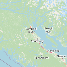
Map view of Petroglyph Provincial Park

Use this park location map to pinpoint Petroglyph Provincial Park in Canada, understand its exact geographic position, and read its mapped placement within the surrounding landscape more clearly.

Pigeon | © OpenStreetMap contributors

Location context for Petroglyph Provincial Park

British Columbia

Explore protected coastal terrain, sandstone bedrock formations, and ancient stone carvings.

Petroglyph Provincial Park Photos and Landscape Scenery Visual Guide

Visual documentation captures the unique terrain, exposed sandstone bedrock, and coastal rainforest setting of Petroglyph Provincial Park. Examining these photographs provides deeper insight into the protected landscape, ancient rock carvings, and estuarine environment along the Vancouver Island shoreline.

Ancient Indigenous petroglyphs carved into a mossy rock surface at Petroglyph Provincial Park.

Park atlas

Discover related coastal terrain and protected areas across Vancouver Island

Explore Parks Near Petroglyph Provincial Park and Surrounding Protected Landscapes

Browse other parks and protected areas near Petroglyph Provincial Park to compare regional coastal landscapes and bedrock formations. Expanding the geographic view helps trace connected conservation zones and adjacent natural heritage across the surrounding territory.
A watercolor painting showing a horizontal landscape with a green forest in the foreground and soft pink, layered rolling hills in the background.
State or regional parkBritish Columbia
About 6.3 km away#1 closest

Southeast

Morden Colliery Historic Provincial Park: Heritage Infrastructure and Regional Coal Mining History

Industrial landscape and historic rail corridor in British Columbia

Located near Nanaimo, this heritage site preserves the substantial concrete remains of the Morden Colliery. The park serves as a physical archive of southern Vancouver Island industrial life, contrasting engineering landmarks with local forest environments and interpretive trails along former coal railway alignments.

Area
0.04 km²
Established
1972
Relief
Lowland
Scope
Terrestrial
A pale, minimalist watercolor painting depicting a wide, sandy beach shoreline with a line of evergreen trees in the distance.
State or regional parkBritish Columbia
About 30 km away#2 closest

Northwest

Rathtrevor Beach Provincial Park: Coastal Geography and Protected Land Overview

Vancouver Island coastal terrain and forested landscapes

Spanning over 300 hectares, Rathtrevor Beach Provincial Park protects a rare combination of fine sandy beaches and ancient Douglas fir groves along the Strait of Georgia. This coastal sanctuary on Vancouver Island serves as a critical habitat for migrating birds and represents a preserved segment of regional geography amidst the surrounding developed shoreline.

Area
3.47 km²
Established
1967
IUCN
II
Visitors
836.2K annual
Watercolor painting of a waterfall surrounded by lush green trees and forest.
State or regional parkBritish Columbia
About 33 km away#3 closest

West

Englishman River Falls Provincial Park: Regional Geography and Protected Area Overview

Vancouver Island river canyon and coastal forest terrain

Englishman River Falls Provincial Park protects a concentrated area of canyon scenery and old-growth forest on the eastern side of Vancouver Island. The landscape is characterized by the dramatic steps of the Englishman River, deep plunge pools, and mature cedar and hemlock stands. This geography provides an essential look at the coastal rainforest ecosystems and river-fed topography that define the recreational corridors of British Columbia.

Area
0.97 km²
IUCN
II
Relief
Upland
Access
Easy access
Watercolor painting of a tranquil body of water with gentle hills in the background and a cluster of trees on the right shore.
State or regional parkBritish Columbia
About 42 km away#4 closest

Northwest

Jedediah Island Marine Provincial Park: Coastal Terrain and Regional Protected Area Map

Mapping island boundaries and sheltered maritime ecosystems

Jedediah Island Marine Provincial Park offers a unique study in coastal geography, featuring a complex shoreline of pebble beaches and indented bays. Located within the Strait of Georgia, the park serves as a protected landmass that blends maritime forest ecosystems with open water corridors. Its boat-only access ensures the landscape remains a quiet, preserved example of Gulf Islands terrain.

Area
6.03 km²
Established
1995
IUCN
II
Relief
Lowland
State or regional parkBritish Columbia
About 45 km away#5 closest

Northeast

Plumper Cove Marine Provincial Park: Protected Marine Geography and Coastal Landscapes in Howe Sound

Exploring the forested trails and sheltered marine anchorages of Keats Island.

Plumper Cove Marine Provincial Park represents a vital protected landscape on the coast of British Columbia, defined by its blend of upland coastal forest and intimate, boat-accessed marine anchorages. This geography-focused profile traces the park's terrain, including its rocky shorelines, forest-covered bluffs, and the trail networks that connect visitors to the broader Howe Sound maritime environment.

Area
0.66 km²
Established
1960
IUCN
II
Relief
Upland
A soft watercolor illustration depicting a winding river flowing through a lush green valley with coniferous forests on the hillsides and mountains in the background.
State or regional parkBritish Columbia
About 48 km away#6 closest

West

Little Qualicum Falls Provincial Park: Regional Protected Landscape and Atlas Geography

River canyon and mountain lake habitat in British Columbia

Explore the structured geography of Little Qualicum Falls Provincial Park, a protected area characterized by its sequence of dramatic river cascades and old-growth Douglas Fir stands. This entry maps the park's key natural features, including the Cameron Lake shoreline and the rugged canyon terrain of the Little Qualicum River.

Area
4.4 km²
Established
1940
IUCN
II
Relief
Mountain
National parkBritish Columbia
About 50 km away#7 closest

Southeast

Gulf Islands National Park Reserve: British Columbia National Park Protected Area

Mapped boundaries and regional geographic context.

Delve into the protected landscape of Gulf Islands National Park Reserve, a significant national park located in British Columbia. This entry provides detailed insights into its mapped boundaries, regional geographic setting, and its identity as a protected area. Understand the park's place within the natural terrain and atlas of Canada, offering a clear geographic overview for focused discovery and landscape context.

Area
36 km²
Established
2003
IUCN
VI
Visitors
28.4K annual
A horizontal watercolor illustration featuring a wooden boardwalk winding through a calm, light-filled landscape with soft green trees, grassy foreground, and rolling hills in the distance.
State or regional parkBritish Columbia
About 56 km away#8 closest

West

MacMillan Provincial Park: Mapped Geography and Protected Forest Landscapes

Vancouver Island, British Columbia

Examine the mapped footprint of MacMillan Provincial Park, home to iconic old-growth Douglas fir trees and the Cameron River delta. This protected area serves as a biogeoclimatic transition zone, showcasing the rich, moisture-retentive coastal forest environment that defines this specific section of Vancouver Island.

Area
3.01 km²
Established
1947
IUCN
III
Visitors
543.7K annual

Common questions about visiting, size, designation, and location context for Petroglyph Provincial Park

Petroglyph Provincial Park FAQs for park facts, access, geography, and protected area context

Find quick answers about Petroglyph Provincial Park, including protected-area facts, park geography, trail and visitor context, and how the park fits into its surrounding country and regional landscape.
MoriAtlas Explorer

Continue Your Protected Areas Search Across the Global Atlas

Deepen your exploration by continuing the structured search for national parks and protected areas worldwide. Utilize the comprehensive filtering capabilities to compare different conservation landscapes and refine your understanding of global park geography. Discover more about the distribution and characteristics of protected natural areas.

Global natural geography