Mori Atlas logo
Nearby park discovery

Map-based regional geography and proximity analysis for surrounding protected lands.

Protected Areas and Natural Landscapes Near Petroglyph Provincial Park in British Columbia

Examine the geographic distribution of parks and protected areas surrounding Petroglyph Provincial Park. This overview provides a structured atlas perspective on regional natural landscapes, mapping the proximity and spatial relationships between this culturally significant site and other preserved environments across coastal British Columbia.

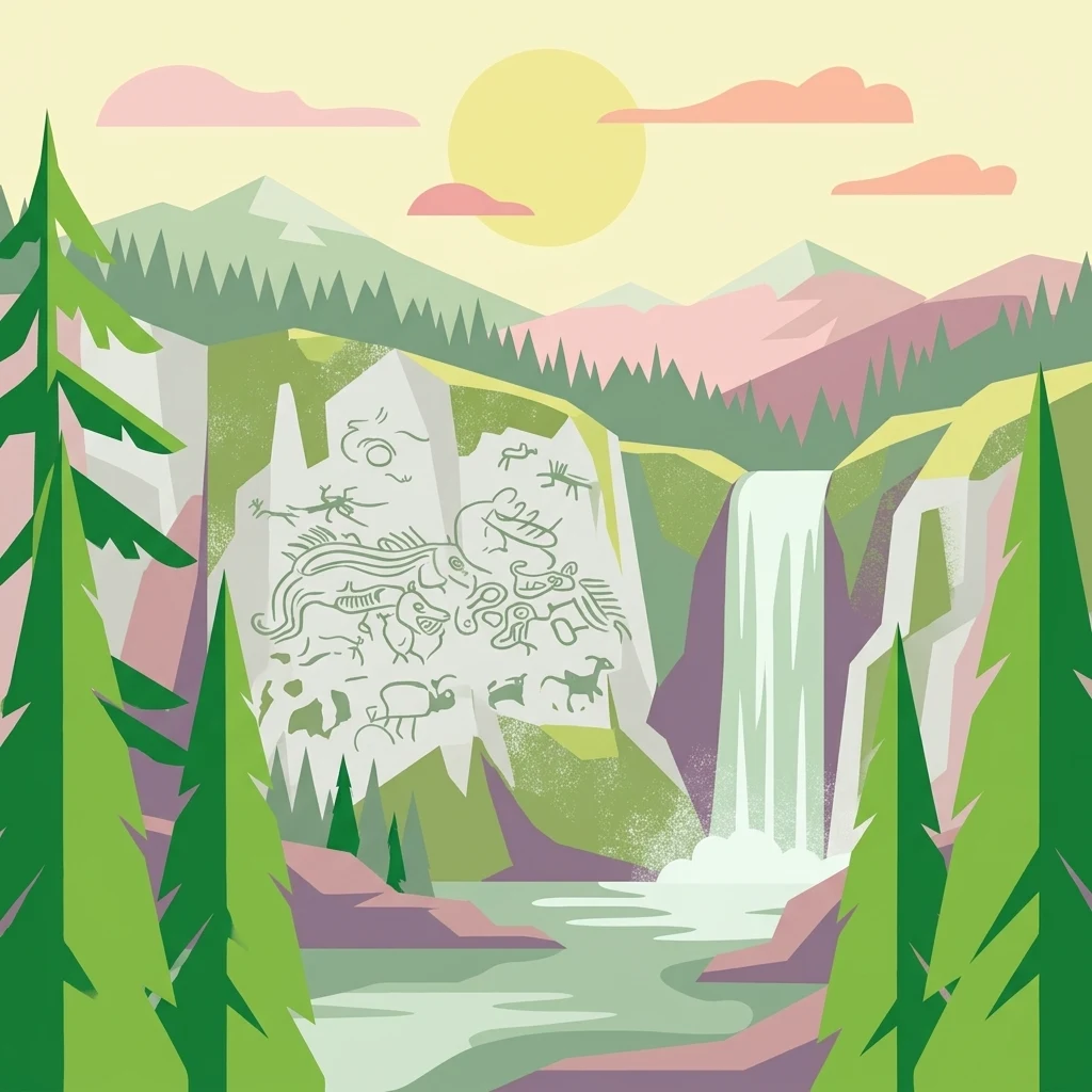
A colorful flat-design illustration of a mountainous landscape with a prominent cliff face covered in stylized petroglyphs; a waterfall descends into a stream in the foreground, framed by pine trees under a sunset sky.

A small coastal park protecting one of western Canada's most significant collections of Indigenous rock carvings near Nanaimo.

Petroglyph Provincial Park

Petroglyph Provincial Park is a small Class A provincial park located at the south end of Nanaimo, on the east coast of Vancouver Island in British Columbia, Canada. Established in 1948, the park exists specifically to protect a remarkable concentration of ancient stone carvings etched into the bedrock near the estuary of the Nanaimo River. The carvings, which date to at least the 10th century CE, include images of mythological sea creatures, human figures, and animals that carry deep cultural and spiritual meaning for the Coast Salish people, especially the Snuneymuxw First Nation. Their placement along the shoreline reflects a deliberate relationship between human symbolism and powerful natural features such as waterfalls and rock formations. Though tiny in size, the park holds outstanding significance as a protected outdoor archive of Indigenous coastal heritage in the Pacific Northwest, offering visitors a direct connection to one of the most concentrated petroglyph sites on Vancouver Island.

Location
Canada
Park type
State or regional park
Established
1948
Area
0 km²
Petroglyph Provincial Park Geography and Atlas
Regional park map

See the ranked park cluster in its geographic setting

Nearby parks around Petroglyph Provincial Park

This regional map shows the same 20 nearby parks ranked below around Petroglyph Provincial Park. Select a ranked marker to highlight that park’s boundary where boundary data is available.
Reference park: Petroglyph Provincial ParkRanked nearby park20 nearby parks shown
20 nearby parks

Distance ranked park collection and surrounding regional geography in British Columbia

Parks and Protected Areas Geographically Near Petroglyph Provincial Park

Geographic separation values and directional coordinates establish a structured ranking for protected areas surrounding Petroglyph Provincial Park. Country context and recorded environmental attributes provide reliable comparison signals across neighboring regional park geography.
A watercolor painting showing a horizontal landscape with a green forest in the foreground and soft pink, layered rolling hills in the background.
State or regional parkBritish Columbia
About 6.3 km away#1 closest

Southeast

Morden Colliery Historic Provincial Park: Heritage Infrastructure and Regional Coal Mining History

Industrial landscape and historic rail corridor in British Columbia

Located near Nanaimo, this heritage site preserves the substantial concrete remains of the Morden Colliery. The park serves as a physical archive of southern Vancouver Island industrial life, contrasting engineering landmarks with local forest environments and interpretive trails along former coal railway alignments.

Area
0.04 km²
Established
1972
Relief
Lowland
Scope
Terrestrial
A pale, minimalist watercolor painting depicting a wide, sandy beach shoreline with a line of evergreen trees in the distance.
State or regional parkBritish Columbia
About 30 km away#2 closest

Northwest

Rathtrevor Beach Provincial Park: Coastal Geography and Protected Land Overview

Vancouver Island coastal terrain and forested landscapes

Spanning over 300 hectares, Rathtrevor Beach Provincial Park protects a rare combination of fine sandy beaches and ancient Douglas fir groves along the Strait of Georgia. This coastal sanctuary on Vancouver Island serves as a critical habitat for migrating birds and represents a preserved segment of regional geography amidst the surrounding developed shoreline.

Area
3.47 km²
Established
1967
IUCN
II
Visitors
836.2K annual
Watercolor painting of a waterfall surrounded by lush green trees and forest.
State or regional parkBritish Columbia
About 33 km away#3 closest

West

Englishman River Falls Provincial Park: Regional Geography and Protected Area Overview

Vancouver Island river canyon and coastal forest terrain

Englishman River Falls Provincial Park protects a concentrated area of canyon scenery and old-growth forest on the eastern side of Vancouver Island. The landscape is characterized by the dramatic steps of the Englishman River, deep plunge pools, and mature cedar and hemlock stands. This geography provides an essential look at the coastal rainforest ecosystems and river-fed topography that define the recreational corridors of British Columbia.

Area
0.97 km²
IUCN
II
Relief
Upland
Access
Easy access
Watercolor painting of a tranquil body of water with gentle hills in the background and a cluster of trees on the right shore.
State or regional parkBritish Columbia
About 42 km away#4 closest

Northwest

Jedediah Island Marine Provincial Park: Coastal Terrain and Regional Protected Area Map

Mapping island boundaries and sheltered maritime ecosystems

Jedediah Island Marine Provincial Park offers a unique study in coastal geography, featuring a complex shoreline of pebble beaches and indented bays. Located within the Strait of Georgia, the park serves as a protected landmass that blends maritime forest ecosystems with open water corridors. Its boat-only access ensures the landscape remains a quiet, preserved example of Gulf Islands terrain.

Area
6.03 km²
Established
1995
IUCN
II
Relief
Lowland
State or regional parkBritish Columbia
About 45 km away#5 closest

Northeast

Plumper Cove Marine Provincial Park: Protected Marine Geography and Coastal Landscapes in Howe Sound

Exploring the forested trails and sheltered marine anchorages of Keats Island.

Plumper Cove Marine Provincial Park represents a vital protected landscape on the coast of British Columbia, defined by its blend of upland coastal forest and intimate, boat-accessed marine anchorages. This geography-focused profile traces the park's terrain, including its rocky shorelines, forest-covered bluffs, and the trail networks that connect visitors to the broader Howe Sound maritime environment.

Area
0.66 km²
Established
1960
IUCN
II
Relief
Upland
A soft watercolor illustration depicting a winding river flowing through a lush green valley with coniferous forests on the hillsides and mountains in the background.
State or regional parkBritish Columbia
About 48 km away#6 closest

West

Little Qualicum Falls Provincial Park: Regional Protected Landscape and Atlas Geography

River canyon and mountain lake habitat in British Columbia

Explore the structured geography of Little Qualicum Falls Provincial Park, a protected area characterized by its sequence of dramatic river cascades and old-growth Douglas Fir stands. This entry maps the park's key natural features, including the Cameron Lake shoreline and the rugged canyon terrain of the Little Qualicum River.

Area
4.4 km²
Established
1940
IUCN
II
Relief
Mountain
National parkBritish Columbia
About 50 km away#7 closest

Southeast

Gulf Islands National Park Reserve: British Columbia National Park Protected Area

Mapped boundaries and regional geographic context.

Delve into the protected landscape of Gulf Islands National Park Reserve, a significant national park located in British Columbia. This entry provides detailed insights into its mapped boundaries, regional geographic setting, and its identity as a protected area. Understand the park's place within the natural terrain and atlas of Canada, offering a clear geographic overview for focused discovery and landscape context.

Area
36 km²
Established
2003
IUCN
VI
Visitors
28.4K annual
A horizontal watercolor illustration featuring a wooden boardwalk winding through a calm, light-filled landscape with soft green trees, grassy foreground, and rolling hills in the distance.
State or regional parkBritish Columbia
About 56 km away#8 closest

West

MacMillan Provincial Park: Mapped Geography and Protected Forest Landscapes

Vancouver Island, British Columbia

Examine the mapped footprint of MacMillan Provincial Park, home to iconic old-growth Douglas fir trees and the Cameron River delta. This protected area serves as a biogeoclimatic transition zone, showcasing the rich, moisture-retentive coastal forest environment that defines this specific section of Vancouver Island.

Area
3.01 km²
Established
1947
IUCN
III
Visitors
543.7K annual
State or regional parkBritish Columbia
About 64 km away#9 closest

West

Horne Lake Caves Provincial Park: Mapped Protected Landscapes and Cave Networks

Vancouver Island protected area and karst geography

Horne Lake Caves Provincial Park protects a distinct array of limestone cave systems, including Main, Riverbend, and Euclataws caves. The area bridges underground geological formations with surface-level river recreation along the Qualicum River, providing a comprehensive look at the karst and forested terrain of central-eastern Vancouver Island.

Area
1.58 km²
Established
1971
IUCN
II
Relief
Upland
A horizontal watercolor illustration depicting soft green rolling hills and distant purple mountains above a flat shoreline with patches of marsh grasses.
State or regional parkBritish Columbia
About 67 km away#10 closest

Northeast

Porteau Cove Provincial Park: Mapping Coastal Protected Landscapes in British Columbia

Geography of Howe Sound shorelines and marine habitats

Porteau Cove Provincial Park offers a unique geographic vantage point at the meeting of granite-sloped mountains and the Pacific waters of Howe Sound. This park detail covers the coastal landscape, including protected intertidal zones, artificial reef structures, and the surrounding terrain that characterizes this segment of the British Columbia coastline.

Area
0.5 km²
Established
1981
IUCN
II
Visitors
611.8K annual
National parkBritish Columbia
About 71 km away#11 closest

Southwest

Pacific Rim National Park Reserve: National Park Protected Landscape & Map Atlas

Mapped boundaries and regional geographic context in British Columbia.

Pacific Rim National Park Reserve stands as a distinct protected natural landscape, serving as a critical component of Canada's national park inventory. This page facilitates an atlas-style exploration of its mapped boundaries and its position within the broader geography of British Columbia. Understanding the park's protected status and its integration with the surrounding natural terrain offers valuable insight into conservation landscapes.

Area
511 km²
Established
1970
IUCN
VI
Visitors
1.2M annual
A horizontal watercolor painting depicting a soft-toned landscape with green trees, rolling hills, a calm body of water, and distant pale mountains.
State or regional parkBritish Columbia
About 87 km away#12 closest

East

Peace Arch Park: Mapped Geography and Protected Landscapes of the Canada and US Border

Coastal binational protected area in British Columbia

Peace Arch Park is a notable protected landscape positioned directly on the international border. This site acts as a continuous green space between Canada and the United States, offering an unusual study of territorial boundaries and coastal geography. Spanning manicured terrain and historic monument grounds, the park provides an essential vantage point for understanding land-based connectivity in the Pacific Northwest region.

Area
0.17 km²
Established
1939
Visitors
500K annual
Access
Easy access
A watercolor illustration of a mountain landscape featuring soft rolling hills, evergreen trees, and low-lying vegetation on a white background.
State or regional parkBritish Columbia
About 87 km away#13 closest

Northeast

Pinecone Burke Provincial Park: Coast Mountain Wilderness and Protected Terrain Geography

Mapping a vast ecological corridor in British Columbia

Spanning over 38,000 hectares, Pinecone Burke Provincial Park represents a dramatic transition from the urban proximity of Coquitlam to the remote interiors of the southern Coast Mountains. The landscape is defined by its rugged relief, featuring subalpine meadows, deep freshwater systems, and historically significant forested slopes. This park provides a critical look at the complex topography of the Pacific Northwest, serving as a sanctuary for wildlife and a foundational piece of regional conservation.

Area
380 km²
Established
1995
IUCN
II
Relief
Mountain
A horizontal watercolor painting showing a panoramic view of a coastal landscape with green, tree-covered headlands, rocky sea stacks, and distant mountains under a pale sky.
Marine protected areaWashington
About 91 km away#14 closest

Southwest

Olympic Coast National Marine Sanctuary: Mapping the Washington Outer Coast Marine Protected Area

Pacific Ocean canyons, shelf ecosystems, and coastal wilderness

Defined by its proximity to the Olympic Peninsula, this marine protected area spans a rugged stretch of the Pacific Ocean. The sanctuary encompasses significant seafloor features including the Nitinat and Quinault canyons, alongside dynamic upwelling zones that support diverse marine life and complex tidal habitats.

Area
8,260 km²
Established
1994
IUCN
IV
Climate
Temperate
A horizontal watercolor painting depicting a light, airy landscape with distant snow-capped mountains, rolling green hills, and coniferous forest edges.
State or regional parkBritish Columbia
About 92 km away#15 closest

Northeast

Garibaldi Provincial Park: An Atlas of Volcanic and Glacial Terrain in British Columbia

Protected wilderness in the Garibaldi Volcanic Belt

Garibaldi Provincial Park preserves a massive expanse of mountainous wilderness, defined by iconic landmarks such as The Black Tusk and Garibaldi Lake. The park represents a crucial study in vertical zonation, transitioning from temperate coastal forests to vast alpine meadows, glaciers, and jagged volcanic summits. Analyze the geological history and mapped protected boundaries that shape this significant British Columbia conservation area.

Area
1,950 km²
Established
1920
IUCN
II
Visitors
136K annual
Nature reserveBritish Columbia
About 98 km away#16 closest

South

Race Rocks Ecological Reserve: Protected Marine Landscape and Island Geography

Nature reserve in the Strait of Juan de Fuca, British Columbia

Race Rocks Ecological Reserve is a geographically distinct protected area consisting of low-lying rocky islets and surrounding high-current marine waters. Located in the Strait of Juan de Fuca, the reserve is recognized for its intense tidal mixing, which supports productive food webs and diverse marine mammals. This site provides a vital window into the ecological dynamics of the Pacific coast through its role as a dedicated research and conservation zone.

Area
2.27 km²
Established
1980
IUCN
Ia
Relief
Lowland
A watercolor painting showing a soft-focus landscape with rolling green hills, distant mountains, and a central river or water feature.
State or regional parkBritish Columbia
About 101 km away#17 closest

East

Golden Ears Provincial Park: Geographic Atlas and Protected Landscape Overview

Coast Mountains terrain and protected wilderness boundaries

Golden Ears Provincial Park is a major protected wilderness in British Columbia, defined by the twin peaks of the Golden Ears massif and vast glacial lake systems like Alouette and Pitt. This site serves as a vital ecological corridor where lowland forests meet high subalpine ridges. Explore the park through its mapped boundaries and diverse ecological zones within the Pacific Northwest mountain landscape.

Area
609 km²
Established
1967
IUCN
II
Visitors
956.5K annual
National parkWashington
About 111 km away#18 closest

South

Olympic National Park National Park: Geographic Atlas and Protected Landscape Discovery

Explore its unique Washington landscape and mapped protected areas.

Olympic National Park serves as a key protected area within Washington, offering rich opportunities for geographic exploration. This detail page provides essential context on its designation as a national park, its mapped boundaries, and its contribution to the regional geography. Understand the park's specific landscape character and its role within the atlas of protected lands, facilitating a structured approach to discovering its natural terrain and geographic significance.

Area
3,733.8 km²
Established
1938
IUCN
II
Visitors
3.7M annual
A watercolor painting showing a panoramic view of rolling mountain ranges and dense evergreen forests with a soft, misty aesthetic.
Protected landscapeWashington
About 112 km away#19 closest

Southeast

Olympic National Forest: Atlas and Geographic Overview of Washington Protected Lands

Temperate rainforests, alpine ridges, and fjord shorelines

Olympic National Forest defines the outer reaches of the Olympic Mountains, featuring a massive expanse of old-growth conifers and high-precipitation temperate rainforests. This protected area connects diverse ecosystems ranging from the brackish waters of Hood Canal to rugged, snow-dusted subalpine ridges. Our detailed geographic mapping highlights the forest's role as a vital buffer and wilderness corridor within the broader Pacific Northwest landscape.

Area
2,541.89 km²
Established
1897
Relief
Mountain
Climate
Temperate
A soft watercolor painting of a landscape featuring a lake, low rolling hills in the background, and grassy vegetation along the foreground shoreline under a warm, pale yellow sky.
State or regional parkFraser Valley Regional District
About 113 km away#20 closest

East

Rolley Lake Provincial Park: An Atlas of Protected Landscapes and Regional Geography

Lakeshore forest terrain and protected park geography

Delve into the geographic identity of Rolley Lake Provincial Park, a state-protected landscape in the Fraser Valley Regional District. This documentation traces the park's internal map, including its central freshwater lake, loop trail connectivity, and surrounding second-growth forest topography, providing essential context for understanding this localized wilderness zone.

Area
1.15 km²
Established
1961
IUCN
II
Distance methodology

Geographic measurements, not driving distances

How nearby park distances are calculated

Distances use park boundaries whenever the available geometry allows it. When one or both boundaries are missing, the mapped park locations provide a clearly labelled estimate. Every value represents straight-line geographic separation and does not use roads or routing.

Boundary distance

Calculated between the nearest points of both park boundaries.

Location-to-boundary estimate

Estimated from one mapped park location to the nearest boundary of the other park.

Mapped-location estimate

Estimated between the mapped locations of both parks.

MoriAtlas Explorer

Explore the Cultural and Natural Mapping of Petroglyph Provincial Park

Continue your geographic exploration of British Columbia by investigating the protected landscape of Petroglyph Provincial Park. MoriAtlas provides detailed context on the relationship between these ancient rock carvings and the surrounding coastal terrain. Understand how the natural features of the Nanaimo River estuary define this protected cultural site.