


Mori Atlas logo
National parkPhong Nha–Kẻ Bàng National Park

Uncover the mapped boundaries and ancient geological formations of a world-renowned protected area.

Phong Nha–Kẻ Bàng National Park: Vietnam's UNESCO Karst Landscape and Cave Atlas

(Vườn quốc gia Phong Nha – Kẻ Bàng)

Phong Nha–Kẻ Bàng National Park in Vietnam stands as a monumental UNESCO World Heritage Site, celebrated for its extraordinary karst terrain and vast subterranean wonders. Spanning over 857 square kilometers of dramatic limestone mountains and deep gorges, this protected landscape offers a unique window into millions of years of geological history. Users can explore the park's mapped boundaries and understand its significance within Southeast Asia's natural atlas.

Karst landscapesCave systemsUNESCO World Heritage SiteTropical forestsEndangered primatesLimestone mountains
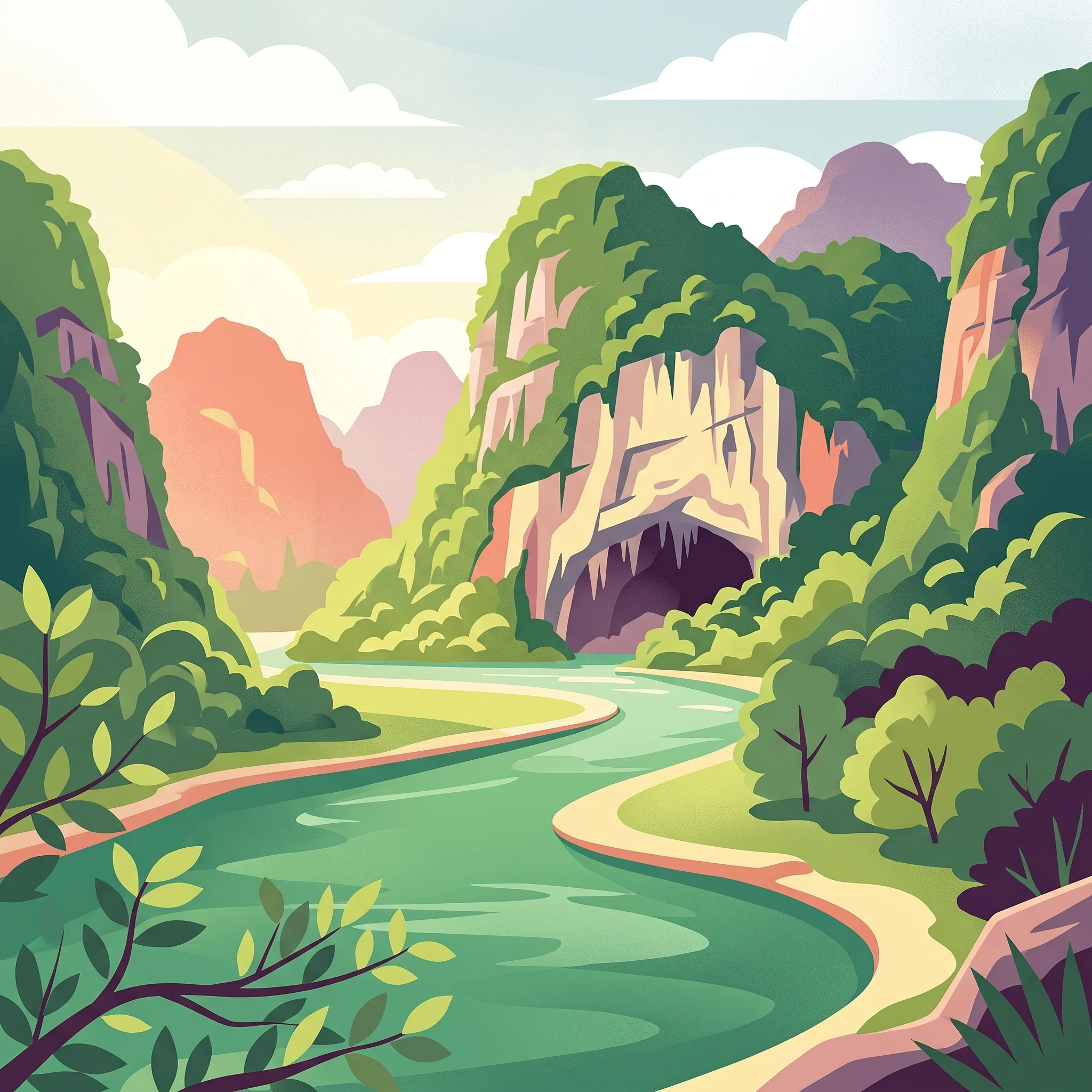
Illustration of boats on a river approaching a cave entrance with rocky cliffs and green vegetation

Phong Nha–Kẻ Bàng National Park

National park

Park overview

Structured park overview, official facts, and landscape profile for Phong Nha, Kẻ Bàng National Park

Phong Nha, Kẻ Bàng National Park park facts, protected area profile, and essential visitor context

Review the core facts for Phong Nha, Kẻ Bàng National Park, including designation, size, terrain, visitor scale, habitats, and operating context in one park-focused overview.

About Phong Nha, Kẻ Bàng National Park

Phong Nha–Kẻ Bàng National Park is a protected area of extraordinary global significance located in central Vietnam's North Central Coast region. The park occupies a complex karst landscape characterized by towering limestone peaks, deep valleys, and an extensive network of caves and underground rivers. The geological importance of the area is immense, with the karst formations representing some of the oldest in Asia, having evolved since the Paleozoic era approximately 400 million years ago. This long geological history has produced a landscape of remarkable complexity with multiple levels of cave development, sophisticated underground river systems, and diverse surface landforms including cone karst, tower karst, and karstic valleys. The park forms part of a larger transboundary karst region that extends into Laos, where the adjacent Hin Namno National Park creates a continuous protected landscape spanning approximately 317,000 hectares. The protection of this area recognizes both its geological significance, demonstrating Earth's history through its complex karst formations, and its biological importance as a center of biodiversity in Southeast Asia.

Quick facts and research context for Phong Nha, Kẻ Bàng National Park

Phong Nha–Kẻ Bàng National Park is situated in Quảng Trị Province, North Central Coast region of Vietnam, spanning approximately 857 square kilometers of core protected area. The park features one of Asia's oldest karst systems, with geological formations dating back 400 million years to the Paleozoic era. It contains over 300 documented caves including Sơn Đoòng, the world's largest cave with chambers measuring over 5 kilometers in length, 200 meters high, and 150 meters wide. The park was designated a UNESCO World Heritage Site in 2003 under criterion viii for its geological significance and received a second designation in 2015 under criteria ix and x for its biodiversity values. The area is managed by the People's Committee of Quảng Trị Province and is part of a larger transboundary karst region extending into neighboring Laos.

Protection and recognition

Documented biosphere reserve status, transboundary conservation reach, and official designations.

Phong Nha-Kẻ Bàng National Park Protected Area Designation and Global Heritage Recognition

Exploration of Phong Nha-Kẻ Bàng National Park requires understanding its established legal safeguards and international protection status established in 2003. Official records document its integration as a transboundary conservation landscape, featuring dual recognition as a UNESCO World Heritage site and a UNESCO Biosphere Reserve.

International recognition

Protection details

Protection scope
Mixed
Designated year
2003
Transboundary protection
Yes
Core area
857.54 km²
Buffer area
1,954 km²
Park context

Deeper park guide and search-rich context for Phong Nha, Kẻ Bàng National Park

Phong Nha, Kẻ Bàng National Park history, landscape, wildlife, and travel context

Explore Phong Nha, Kẻ Bàng National Park through its history, landscape character, ecosystems, wildlife, conservation priorities, cultural context, and seasonal travel timing in a structured park guide built for atlas discovery and search intent.

Why Phong Nha, Kẻ Bàng National Park stands out

Phong Nha, Kẻ Bàng is best known for its extraordinary cave systems and status as a UNESCO World Heritage Site. The park contains Sơn Đoòng Cave, the world's largest known cave by volume, with passages large enough to contain a 40-story skyscraper. Prior to this discovery, Phong Nha Cave held multiple world records including the longest underground river and largest combined cavern system. The park also protects one of the two largest karst regions in the world, with geological formations representing 400 million years of Earth's history. Additionally, the park is renowned for its significant primate populations, including the Hatinh langur and white-cheeked crested gibbon, and for the rare Calocedrus forests on limestone that represent the largest such forest in Vietnam.
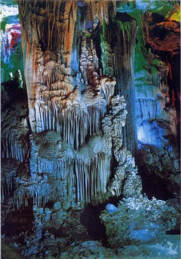
Interior of Tien Son Cave with hanging stalactites and formations on cave walls and floor, illuminated with blue and green lighting
Tien Son Cave interior featuring extensive stalactites and stalagmites

Phong Nha, Kẻ Bàng National Park history and protected-area timeline

The protected area history of Phong Nha–Kẻ Bàng traces back to 1986 when it was established as a nature reserve covering 50 square kilometers. This was expanded to 411 square kilometers by 1991, and on December 12, 2001, the Vietnamese Prime Minister issued Decision 189/2001/QĐ-TTG formally establishing the national park. Cave exploration in the region has a rich history dating to the 9th century, evidenced by Cham inscriptions on steles within Phong Nha Cave. The cave was first mentioned in literature in 1550 and received royal recognition from King Minh Mạng in 1824. Modern scientific exploration began in the late 19th century when French priest Léopold Michel Cadière discovered Champa scripts and proclaimed Phong Nha the "number one cave of Indochina." From 1990 onward, British-Vietnamese joint expeditions systematically explored the cave systems, with the British Cave Research Association conducting multiple surveys that mapped over 44 kilometers of passages. The landmark discovery came in April 2009 when a British expedition announced Sơn Đoòng as the world's largest cave. The park was nominated for UNESCO World Heritage status in 1998, received initial inscription in 2003, and was extended for biodiversity recognition in 2015.

Phong Nha, Kẻ Bàng National Park landscape and geographic character

The landscape of Phong Nha–Kẻ Bàng is dominated by a spectacular karst terrain characterized by massive limestone mountains, deep gorges, and extensive cave systems. The park contains over two dozen mountain peaks exceeding 1,000 meters, with the highest summits being Co Preu at 1,213 meters and Co Rilata at 1,128 meters. These peaks form a continuous range along the Vietnamese-Laotian border, creating a dramatic backdrop of towering limestone cliffs and karst towers. The non-karstic areas account for a small percentage, primarily in the northern and northeastern sections, where granite and other igneous rocks form lower mountainous terrain. The landscape is dissected by numerous valleys and gorges, with the Sơn River and Chay River being the principal waterways that have carved the extensive cave systems. The karst topography creates distinctive landforms including sinkholes, poljes, and disappearing streams where rivers vanish underground to reappear in cave passages.
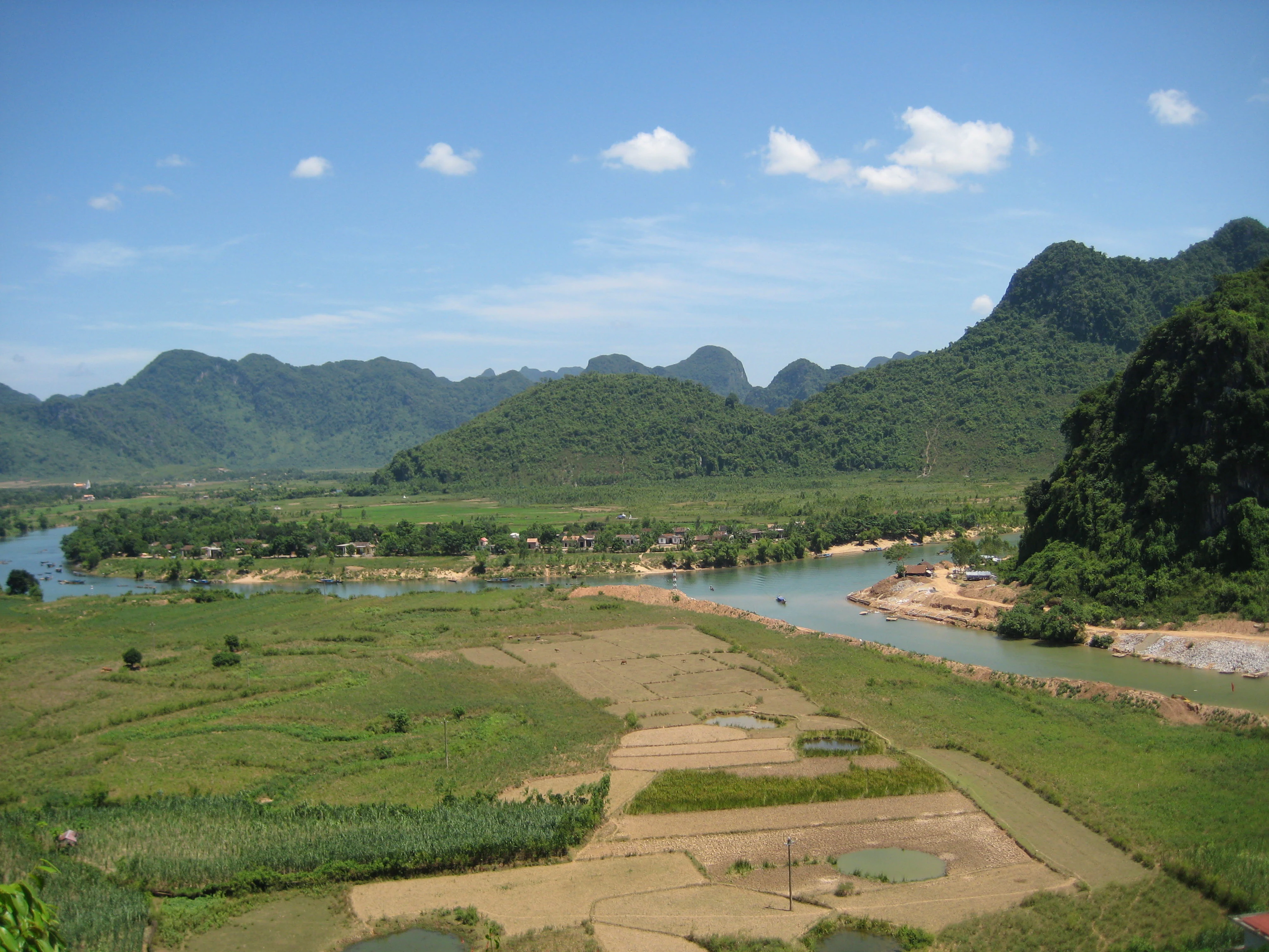
River flowing through rice paddies and fields with green karst mountains under a clear blue sky
River flowing through agricultural fields with karst mountains in the background

Phong Nha, Kẻ Bàng National Park ecosystems, habitats, and plant life

The park supports extensive tropical moist evergreen forest covering 96.2 percent of its area, with 92.2 percent classified as intact primary forest. The dominant forest type is tropical wet evergreen forest on limestone below 800 meters elevation, with smaller areas of forest at higher elevations and on non-karstic substrates. The forest vegetation is characterized by species from the Lauraceae, Fagaceae, Theaceae, and Rosaceae families, with scattered gymnosperms including Podocarpus species. A particularly significant feature is the 50 square kilometer forest of Calocedrus macrolepis on limestone, representing the largest such forest in Vietnam with trees estimated at 500 to 600 years old. The park contains remarkable botanical diversity with over 1,400 plant species documented, including 36 endangered species listed in Vietnam's Red Data Book. Rare orchids including Paphiopedilum malipoense, Paphiopedilum dianthum, and Paphiopedilum concolor have been recorded, all considered threatened with extinction.
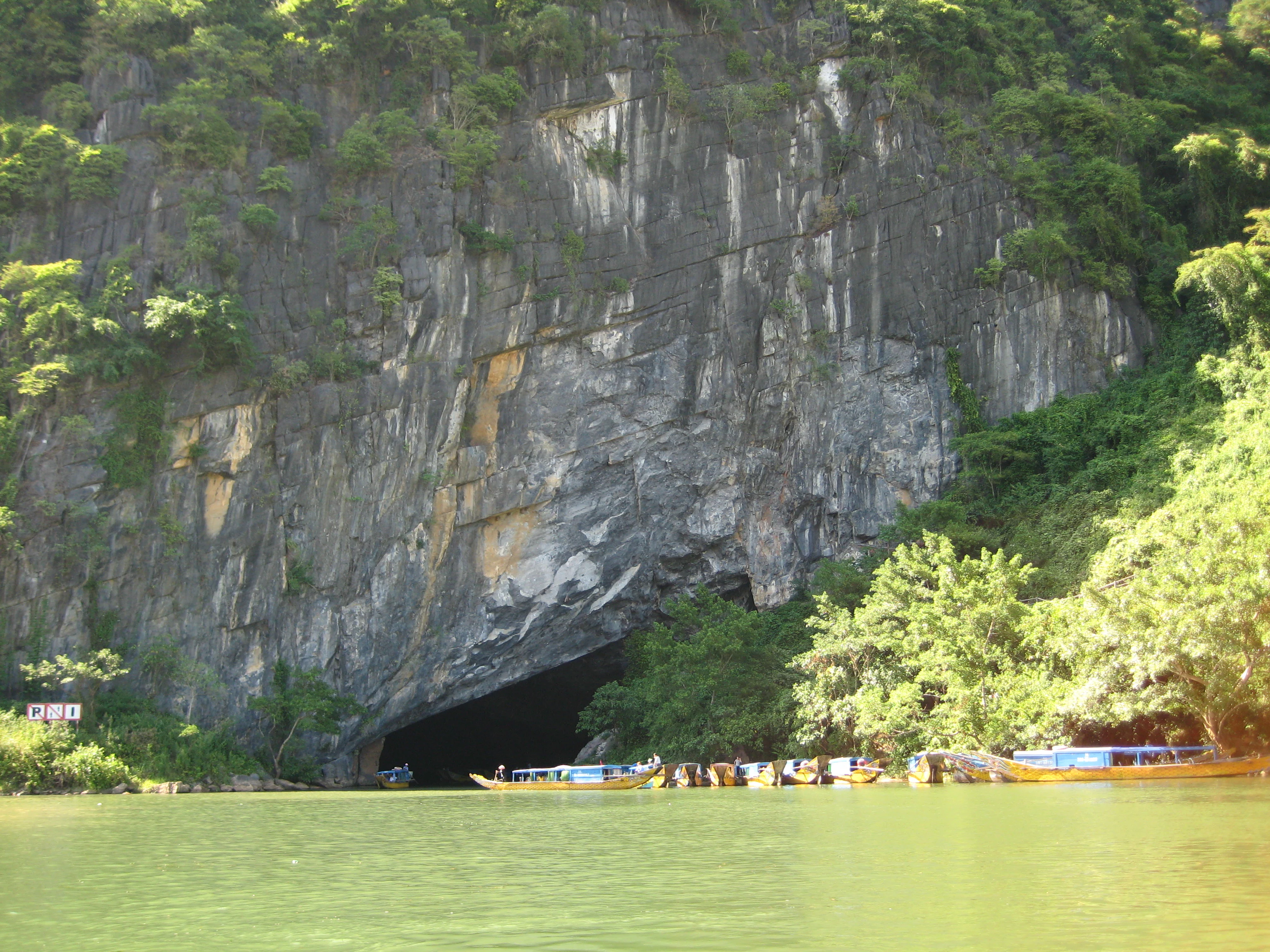
Rocky cliff face with large cave entrance, green river, and boats with people in the foreground
Cave entrance at Phong Nha, Kẻ Bàng National Park with boats on the river

Phong Nha, Kẻ Bàng National Park wildlife and species highlights

The wildlife of Phong Nha–Kẻ Bàng is exceptionally diverse, with the park supporting significant populations of endangered species. The area is particularly important for primates, hosting ten species and subspecies representing 50 percent of Vietnam's primate diversity. Notable species include the Hatinh langur, François' langur, white-cheeked crested gibbon, and potentially the critically endangered saola, one of the world's rarest large mammals. The park supports important populations of large mammals including gaur, mainland serow, giant muntjac, Asian black bear, and sun bear. Avian diversity is remarkable with over 200 bird species recorded, including rare species such as the chestnut-necklaced partridge, red-collared woodpecker, and short-tailed scimitar babbler. The park also contains significant herpetofauna with over 150 reptile and amphibian species, and 72 fish species including four endemic to the area. The caves support important bat populations with ten IUCN-listed species recorded.
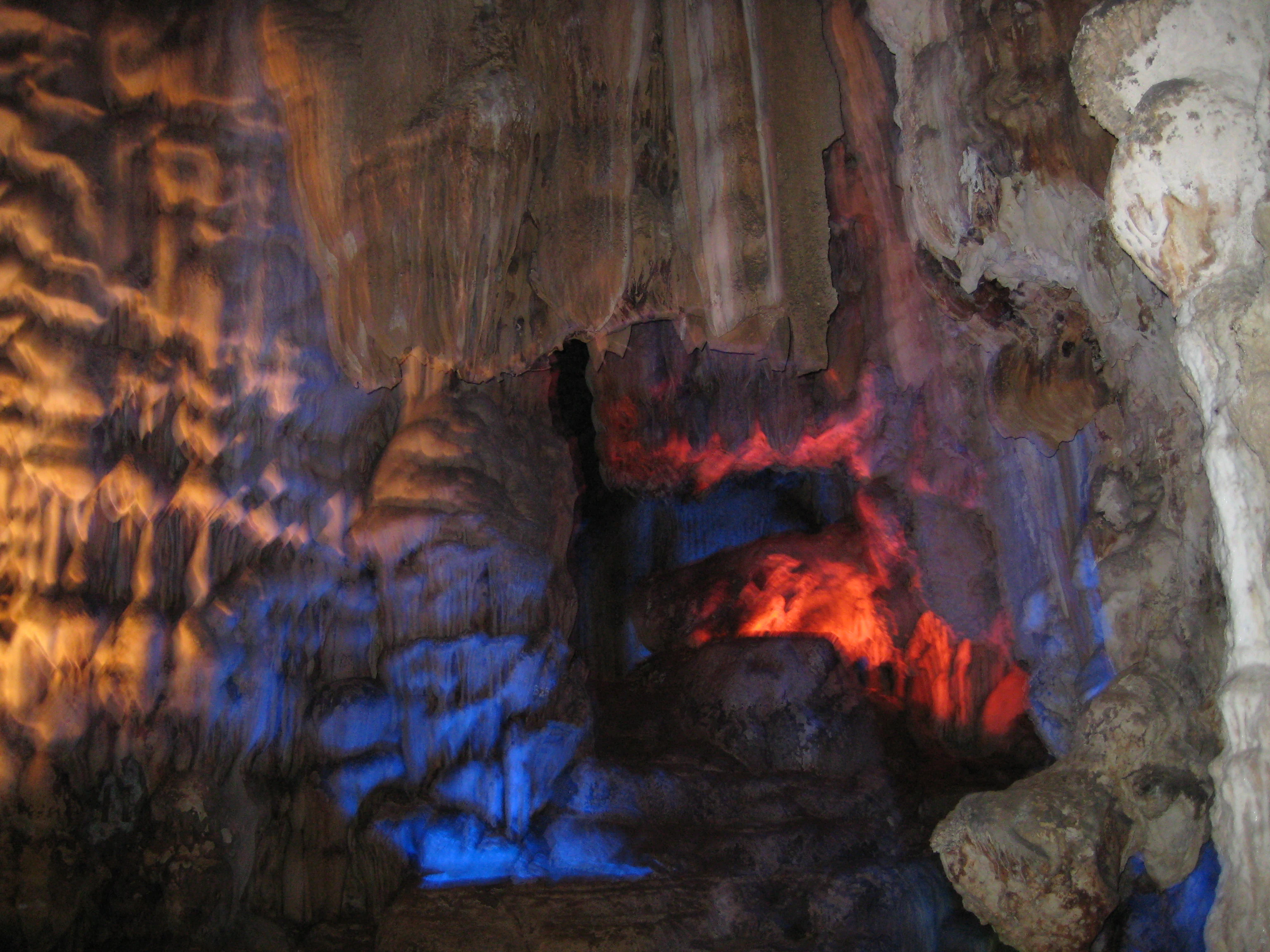
Cave interior showing illuminated stalactites and stalagmites with blue and red lighting
Cave interior with illuminated rock formations

Phong Nha, Kẻ Bàng National Park conservation status and protection priorities

Phong Nha–Kẻ Bàng holds dual UNESCO World Heritage status, recognized first in 2003 under criterion viii for its outstanding geological values and again in 2015 under criteria ix and x for its exceptional biodiversity and ecosystem importance. This makes it one of only three national parks in Asia to meet three UNESCO criteria. The park is one of the 200 global biodiversity centers identified by WWF and represents one of 60 significant sanctuaries in Vietnam. The protection framework divides the park into three zones: a strictly protected zone of 648.94 square kilometers, an ecological recovery zone of 174.49 square kilometers, and an administrative service zone of 34.11 square kilometers. International support has been substantial, with Germany providing 14.4 million euros for biodiversity conservation and Fauna and Flora International supporting primate protection programs. The park faces challenges including poaching, habitat degradation in buffer zones, and proposed development projects, but remains a critical conservation priority for Vietnam and Southeast Asia.

Phong Nha, Kẻ Bàng National Park cultural meaning and human context

The Phong Nha–Kẻ Bàng area has a rich human history extending back to the Neolithic period, evidenced by axe heads and artifacts found in caves. The region holds significant Cham heritage, with inscriptions dating to the 9th century found on steles and Buddhist altars within Phong Nha Cave, demonstrating the area's importance in the Champa Kingdom before Vietnamese expansion. The cave received royal recognition from multiple Nguyen dynasty kings and was depicted in the Nine Urns at the Imperial Citadel of Hue. During the French colonial period, the area served as a resistance base, with King Hàm Nghi using the caves as shelter during the Cần Vương movement against French colonization. The park currently contains two villages of Arem ethnic people living within its core zone, maintaining traditional lifestyles of hunting and natural product harvesting. The Ho Chi Minh Trail and Route 20 historically passed through the area, adding to its historical significance.
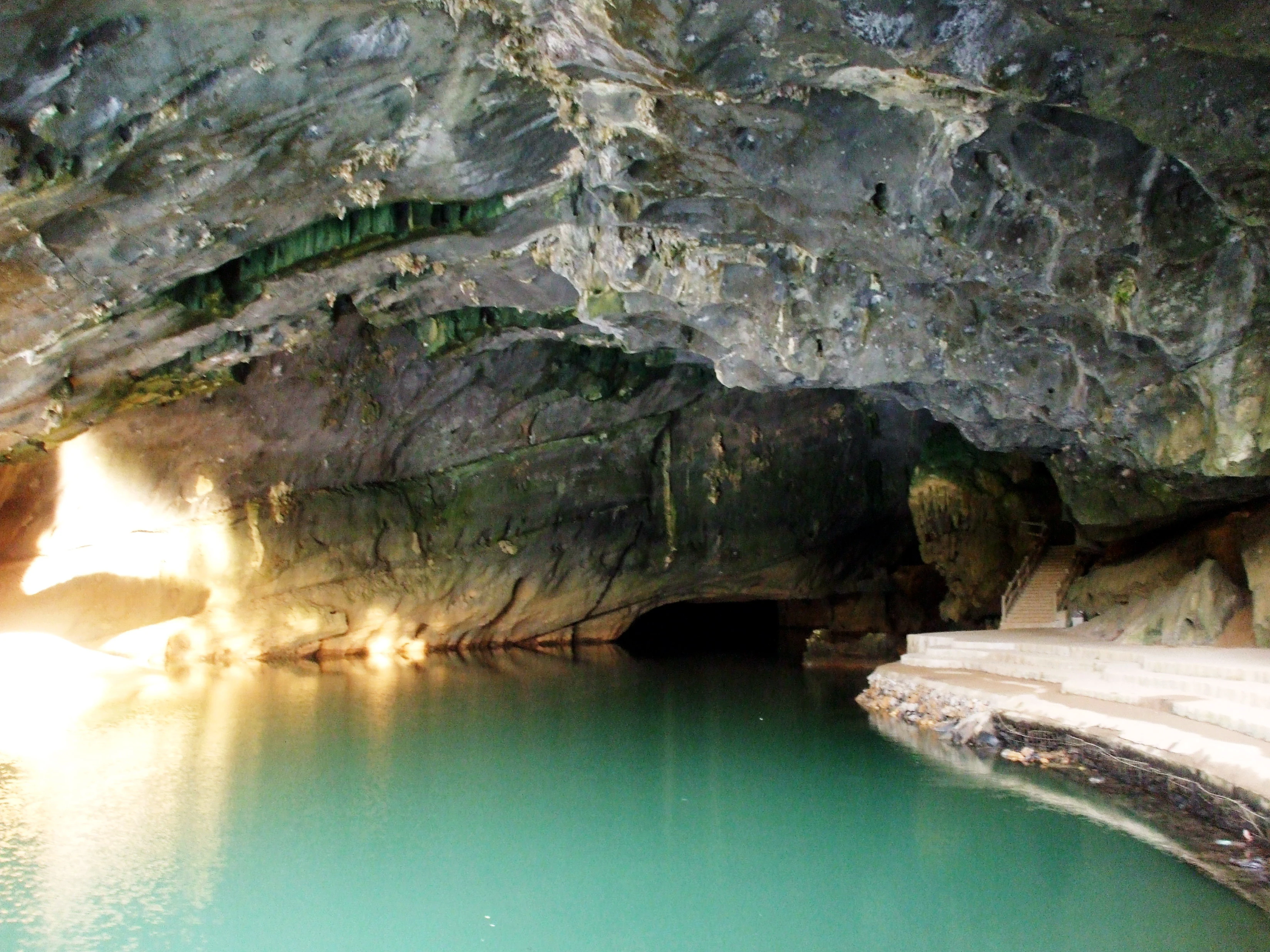
Interior of a cave with turquoise river water under rocky ceilings, illuminated by natural light from the left entrance.
Song Son River flowing through the interior of Phong Nha cave illuminated by natural light from the entrance.

Top sights and standout views in Phong Nha, Kẻ Bàng National Park

The outstanding highlights of Phong Nha–Kẻ Bàng include Sơn Đoòng Cave, the world's largest known cave passage, which can accommodate a 40-story skyscraper and contains its own jungle and river. The Phong Nha Cave system, with its 7,729 meters of passages and 14 kilometers of underground river, held multiple world records before Sơn Đoòng's discovery. Thiên Đường Cave, discovered in 2005, extends 31 kilometers and features spectacular stalactite formations. The ancient karst landscape, dating to 400 million years ago, represents the oldest major karst in Asia. The primate populations, particularly the Hatinh langur colonies, represent possibly the largest remaining populations of these species globally. The underground river systems, including the Sơn River flowing through cave passages for over 20 kilometers before emerging at Pu-Pha-Dam Mountain, represent extraordinary hydrological features.
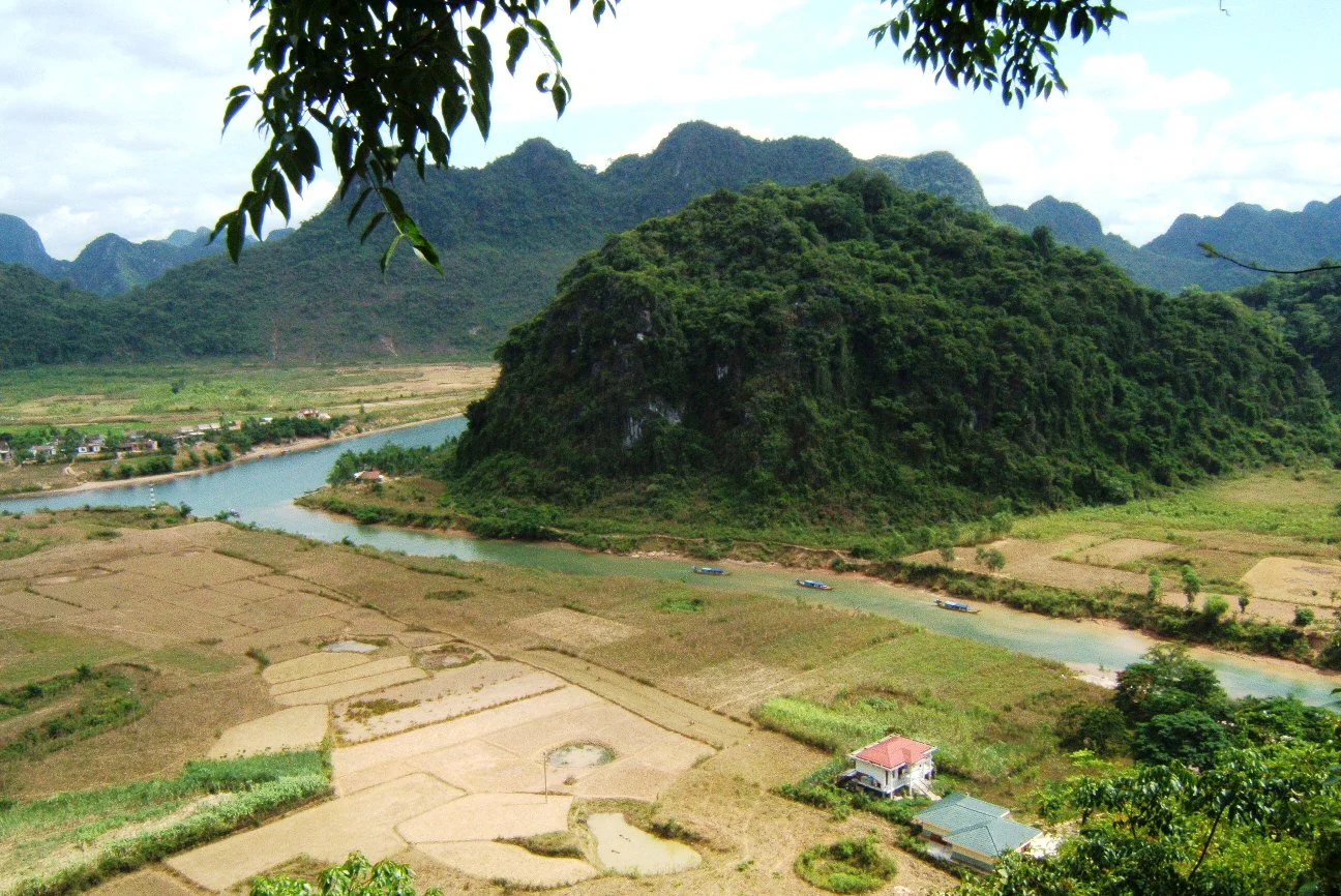
A river meandering through cultivated fields with lush green mountains and a small house with a red roof
River flowing through agricultural fields with forested mountains in the background

Best time to visit Phong Nha, Kẻ Bàng National Park

The optimal time to visit Phong Nha–Kẻ Bàng is during the dry season from February to May, when weather conditions are most favorable for exploring both cave systems and forest trails. During this period, water levels in the caves are lower, making boat trips through underground rivers safer and more accessible. The temperature inside the caves remains relatively constant year-round, but the dry season offers easier surface access and better conditions for trekking in the forest areas. The monsoon season from June to December brings heavy rainfall, with approximately 88 percent of the annual precipitation falling during this period. While the rainy season transforms the landscape with lush vegetation and spectacular waterfalls, some cave access may be restricted due to high water levels. The hottest months are June to August, with average temperatures around 28 degrees Celsius, while the coolest months from December to February average 18 degrees Celsius. Visitors interested in wildlife viewing may find the dry season more productive as animals concentrate near water sources.
Park guides

Targeted planning resources addressing seasonal timing across karst landscapes

Phong Nha–Kẻ Bàng National Park Published Guides and Focused Answers

Selected reference materials provide structured answers regarding optimal weather windows and cave exploration timing for the protected limestone terrain. Seasonal planning documentation examines dry periods and rainfall patterns to support informed geographic inquiry.
When to Visit Phong Nha-Ke Bang National Park: A Seasonal Guide
Seasonal Planning Guide

When to Visit Phong Nha-Ke Bang National Park: A Seasonal Guide

Determine the best time for your trip based on local climate patterns, cave accessibility, and seasonal tropical weather dynamics.

Planning a visit to Phong Nha-Ke Bang National Park requires careful consideration of its distinct tropical climate and the unique requirements of its world-class cave systems. This guide provides a detailed analysis of annual weather patterns, from the cooler, drier months of early spring to the intense precipitation seen in autumn. By interpreting long-term climate normals including temperature ranges, humidity, and rainfall intensity, the following sections help visitors align their travel priorities with the park's natural cycle. While the geological formations and karst environments remain a global attraction throughout the year, specific activities such as deep-cave trekking or river exploration are subject to varying environmental conditions that dictate seasonal feasibility. This guide emphasizes the importance of understanding these shifts to manage expectations regarding comfort, safety, and trail accessibility. Readers should note that while climate data offers reliable historical averages, operational statuses for specific caves, permits, and park facilities are subject to change. Always verify current weather forecasts and official park announcements with local authorities immediately before departure to ensure that intended activities remain accessible and safe during your planned dates.

When to Visit
Monthly climate preview

Analyze long-term temperature averages and monthly precipitation patterns across the year

Phong Nha-Kẻ Bàng National Park Climate and Weather by Month

Measured climate normals for the Vietnamese landscape show mean temperatures from 18 degrees Celsius to highs over 37 degrees, with rainfall peaking above 11 millimeters per day. Exploring the complete profile reveals detailed monthly fluctuations, historical precipitation trends, and long-term averages for comprehensive regional comparison.
Annual mean23 °C
18 °C27 °C
Jan18°
Feb20°
Mar23°
Apr26°
May27°
Jun27°
Jul26°
Aug26°
Sep25°
Oct24°
Nov21°
Dec19°
Warmest month
May

26.7 °C

Coolest month
January

18.3 °C

Wettest month
September

11.5 mm/day

Driest month
February

1 mm/day

Park location guide

Geography guide, regional context, and park location map for Phong Nha, Kẻ Bàng National Park

Phong Nha, Kẻ Bàng National Park park geography, regions, and map view in Vietnam

Understand where Phong Nha, Kẻ Bàng National Park sits in Vietnam through a broader geographic reading of the surrounding landscape, nearby location context, and its mapped position within the national park landscape.

How Phong Nha, Kẻ Bàng National Park fits into Vietnam

Vietnam, officially the Socialist Republic of Viet Nam, is a unitary communist state in Southeast Asia. It occupies roughly 331,000 square kilometres along the eastern edge of Mainland Southeast Asia, with a population exceeding 102 million. The country is bordered by China to the north, Laos and Cambodia to the west, and has maritime boundaries in the Gulf of Thailand and South China Sea.

Wider geography shaping Phong Nha, Kẻ Bàng National Park in Vietnam

Vietnam occupies the eastern edge of Mainland Southeast Asia, stretching along the Gulf of Thailand to the southwest and the South China Sea to the east. The country is bordered by China to the north, and Laos and Cambodia to the west. It has a diverse landscape ranging from the Red River Delta in the north to the Mekong Delta in the south.

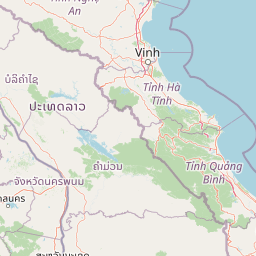
Map view of Phong Nha, Kẻ Bàng National Park

Use this park location map to pinpoint Phong Nha, Kẻ Bàng National Park in Vietnam, understand its exact geographic position, and read its mapped placement within the surrounding landscape more clearly.

Pigeon | © OpenStreetMap contributors

Location context for Phong Nha, Kẻ Bàng National Park

North Central CoastQuảng Bình Province
Natural feature types

Explore the Geological and Natural Landscapes of Phong Nha–Kẻ Bàng National Park

Deepen your understanding of the park geography by navigating through its diverse natural features. MoriAtlas provides a structured index of the mountains, cave networks, and riverine landscapes that define this UNESCO World Heritage Site in central Vietnam.

Visualizing the park's towering limestone mountains, ancient cave systems, and tropical forest habitats in central Vietnam.

Explore the Dramatic Karst Landscapes of Phong Nha–Kẻ Bàng National Park Through Captivating Imagery

Browse a curated collection of images showcasing Phong Nha–Kẻ Bàng National Park's unique karst topography, subterranean cave environments, and verdant tropical forest scenery. Gain a deeper understanding of this UNESCO World Heritage Site's exceptional geological formations, diverse habitats, and overall protected-area character through visual exploration.

Interior of Tien Son Cave with hanging stalactites and formations on cave walls and floor, illuminated with blue and green lighting

Cave interior with large limestone formations, stalactites, and stalagmites, illuminated by artificial lighting

River flowing through rice paddies and fields with green karst mountains under a clear blue sky

Rocky cliff face with large cave entrance, green river, and boats with people in the foreground

Cave interior showing illuminated stalactites and stalagmites with blue and red lighting

Blue-roofed tourist boats docked along a sandy riverbank with a large forested mountain in the background under a clear blue sky.

Interior of a cave with turquoise river water under rocky ceilings, illuminated by natural light from the left entrance.

A river meandering through cultivated fields with lush green mountains and a small house with a red roof

Cave interior with rocky walls, calm water, and a wooden boat entering a light-filled cave entrance

Wide shot of a river with forested shoreline and hills in the background under a clear blue sky

Brown and beige stalagmite formations in a cave, including a prominent linga-shaped structure with mineral deposits

Cave interior with colorful illuminated stalactites and stalagmites in Phong Nha-Kẻ Bàng National Park

Rock formations inside a cave with artificial lighting, showing layered textures and a passage leading deeper into the cave

Tall stalactite and stalagmite formations in a dark cave with a person holding a light source in the background

A gecko with dark and light striped patterns resting on a rock surface

Two individuals walking along a paved path toward the entrance of a cave with rocky walls and metal railings.

Park atlas

Compare regional conservation landscapes and trace the spread of protected terrain across Central Vietnam and its borders.

Discover Other National Parks and Protected Areas Near Phong Nha–Kẻ Bàng National Park

Continue your exploration from Phong Nha–Kẻ Bàng National Park by browsing other national parks and protected areas across Central Vietnam and its adjacent transboundary landscapes. Trace the regional distribution of conservation efforts and compare diverse protected terrain, from limestone mountains to vital forest reserves, for broader geographic understanding.
Protected areaSavannakhet Province
About 72 km away#1 closest

Southwest

Phou Xang He National Protected Area: Geographic Overview and Forest Landscape Mapping

Protected forest ecosystems in Savannakhet Province, Laos

Phou Xang He National Protected Area encompasses a vast, relatively undisturbed forest expanse in central Laos. This detailed look at the park's physical geography highlights its characteristic mix of deciduous and evergreen woodlands, serving as a vital habitat within the Annamite foothills region. Understand the spatial distribution of this protected landscape and its regional importance to conservation efforts across Savannakhet Province.

Area
1,180 km²
Established
1993
IUCN
VI
Access
Access unknown
National parkHà Tĩnh Province
About 75 km away#2 closest

Northwest

Vũ Quang National Park: Protected Landscape Identity and Geographic Context in Hà Tĩnh

National Park Discovery and Mapped Terrain Exploration

Investigate Vũ Quang National Park, a key protected area situated in Hà Tĩnh Province. This page provides detailed insight into the park's designation as a national park, focusing on its mapped boundaries, surrounding natural landscapes, and contribution to the regional geography. It serves as a vital resource for understanding the park's protected landscape characteristics and its place within Vietnam's atlas of conservation areas.

Area
550.28 km²
Established
2002
IUCN
II
Relief
Mountain
Wildlife reserveKhammouane Province
About 106 km away#3 closest

West

Phou Hin Poun National Biodiversity Conservation Area: Khammouane Province Landscapes

Tower karst geology and Annamite Range biodiversity

Delve into the geography of Phou Hin Poun National Biodiversity Conservation Area, where dramatic stone ridges and dense forest patches define a unique karst ecosystem. Located in Khammouane Province, this wildlife reserve stands as a major center for scientific discovery and protected habitat monitoring in central Laos.

Area
1,801.49 km²
Established
1993
IUCN
VI
Relief
Mountain
National parkMukdahan Province
About 175 km away#4 closest

Southwest

Phu Pha Thoep National Park: Mukdahan Province Protected National Park Geography

Explore its mapped protected landscape and regional context.

Phu Pha Thoep National Park is a designated national park in Thailand's Mukdahan Province, offering a distinct focus for geographic exploration. This resource provides detailed insights into its protected landscape, outlining mapped park boundaries and its integration within the regional geography. Understand the park's specific natural terrain and its value for structured atlas-style discovery, moving beyond simple location data to grasp its protected area significance.

Area
48 km²
IUCN
II
Visitors
47.6K annual
Relief
Upland
Protected areaBolikhamsai Province
About 181 km away#5 closest

Northwest

Nam Kading National Protected Area: An Atlas of Rugged Terrain in Bolikhamsai Province

River-carved mountain ranges and forest corridors

Nam Kading National Protected Area encompasses a vast, roadless wilderness in central Laos shaped by the Nam Kading river system. This protected landscape features deep valleys, dense evergreen forests, and dramatic relief that support a wide array of fauna and significant environmental research in the Bolikhamsai region.

Area
1,690 km²
Established
1993
IUCN
VI
Relief
Mountain
National parkNghệ An Province
About 184 km away#6 closest

Northwest

Pù Mát National Park: National Park Protected Landscape and Geographic Mapping

Explore Nghệ An Province's protected area context.

Pù Mát National Park is a key protected area situated in Nghệ An Province, Vietnam. This entry focuses on its role as a national park, detailing its mapped boundaries and geographic features. It serves as a vital point for understanding the distribution of protected lands and the natural landscape context within the broader regional atlas. Discover the specific geographic identity and atlas significance of Pù Mát National Park.

Area
911.13 km²
Established
2001
IUCN
II
Relief
Mountain
National parkAmnat Charoen Province
About 188 km away#7 closest

Southwest

Phu Sa Dok Bua National Park: National Park with Mapped Protected Boundaries

Explore protected landscapes in Amnat Charoen Province, Thailand.

Discover Phu Sa Dok Bua National Park, a designated national park situated within the geographic context of Amnat Charoen Province. This profile focuses on the park's protected area identity and its mapped boundaries, offering essential geographic information for atlas-based exploration and understanding its role within Thailand's conservation landscape.

Area
231 km²
Established
1992
IUCN
II
Visitors
1.8K annual
National parkVietnam
191 km away#8 closest

Southeast

Bach Ma National Park: Protected Area and Mountain Landscape in Vietnam

Explore the biodiversity and unique geography of this vital national park.

Bach Ma National Park in Vietnam is a protected area defined by its steep, granite-rich mountainous terrain within the Annamite Range. The park’s location at a significant biogeographical crossroads contributes to its exceptional biodiversity, particularly its documented birdlife and varied forest ecosystems. Understanding Bach Ma National Park through its mapped landscape provides critical insight into Vietnam's natural heritage and the ecological dynamics shaped by its unique regional geography.

Area
220 km²
Established
1986
IUCN
II
Relief
Mountain

Common questions about visiting, size, designation, and location context for Phong Nha, Kẻ Bàng National Park

Phong Nha, Kẻ Bàng National Park FAQs for park facts, access, geography, and protected area context

Find quick answers about Phong Nha, Kẻ Bàng National Park, including protected-area facts, park geography, trail and visitor context, and how the park fits into its surrounding country and regional landscape.
MoriAtlas Explorer

Continue Your Protected Areas Search Across the Global Atlas

Deepen your exploration by continuing the structured search for national parks and protected areas worldwide. Utilize the comprehensive filtering capabilities to compare different conservation landscapes and refine your understanding of global park geography. Discover more about the distribution and characteristics of protected natural areas.

Global natural geography

