
Rivers
Park geography
Analyzing the elevation, regional landscape, and natural terrain features
Structured Geographic Profile and Mapped Boundaries of Poás Volcano National Park
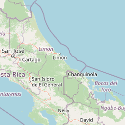
Poás Volcano National Park spans a 65 square kilometer area within the Alajuela Province of Costa Rica. This mountainous geography encompasses peaks, volcanic features, and diverse lacustrine systems including Laguna Caliente. The terrain profile details the high altitude landscape reaching 2700 meters and the network of rivers and streams defined by the park boundary.
Related tags
Volcanic landscapesActive volcanoCrater lakeCloud forestHighland ecosystems
Active volcanic crater park in Costa Rica's Central Highlands
Poás Volcano National Park
Poás Volcano National Park is a protected highland area in the Alajuela Province of Costa Rica, established in 1971 to preserve the dramatic volcanic landscape surrounding one of Central America's most active volcanoes. The park encompasses approximately 65 square kilometers of volcanic terrain at elevations reaching 2,700 meters, making it one of the most accessible active volcanic environments in the world. The centerpiece of the park is the Poás Volcano crater, a constantly active vent that regularly displays geyser-like eruptions and lava activity, offering visitors a rare opportunity to witness ongoing volcanic processes from a relatively safe viewing distance. The park occupies a strategic position within Costa Rica's Central Conservation Area, a region of exceptional biodiversity that bridges the country's volcanic mountain ranges with its Pacific-facing slopes. The landscape combines the raw, mineral-rich terrain of recent volcanic activity with older, dormant volcanic features that have developed stabilizing vegetation over millennia. Two additional volcanic craters, the extinct Von Frantzuis crater and the dormant Botos crater containing a striking cold-water lake, add geological diversity to the protected area and provide contrasting environments within the park's boundaries. Poás Volcano National Park holds particular significance both scientifically and educationally, as its ongoing volcanic activity provides researchers with continuous data about magmatic systems while offering visitors an unforgettable encounter with Earth's geological forces. The park's high-altitude cloud forest environment supports specialized flora and fauna adapted to the cool, moist conditions, creating an ecosystem that coexists with the volcanic activity in a dynamic equilibrium.
- Location
- Costa Rica
- Park type
- National park
- Established
- 1971
- Area
- 65 km²
- Highest point
- 2,700 m
Location overview
Factual regional positioning within Alajuela Province
Geographic Location of Poás Volcano National Park in Costa Rica
Poás Volcano National Park is situated within the Alajuela Province of Costa Rica. Database records confirm its status as an inland, non-coastal protected area managed entirely under a single national jurisdiction.
- Countries
- Costa Rica
- Regions
- Alajuela Province
- Primary location
- Alajuela Province
- Geographic setting
- Inland
Boundary and coordinates
Volcanic park outline with spatial context
Poás Volcano National Park mapped boundary and 65 km² area
Poás Volcano National Park has stored boundary geometry that places its 65 km² protected footprint in geographic context. The database contains a single overall area figure, with no land or marine subdivision and no perimeter measurement.
- Boundary area
- 65.6 km²
- Boundary perimeter
- 46 km
- Northernmost point
- 10.2766° N
- Southernmost point
- 10.1584° N
- Easternmost point
- 84.1945° W
- Westernmost point
- 84.2675° W
- Geographic centre
- 10.2097° N, 84.2284° W
- North–south span
- 13.1 km
- East–west span
- 8 km
Elevation and terrain
Explore recorded vertical ranges, craters, rivers, and peaks within the protected landscape
Poás Volcano National Park Elevation Profile and Mountain Terrain Mapping
Elevation summary metrics detail the high mountain terrain within Poás Volcano National Park. Individual feature cards list recorded natural formations, rivers, and viewpoints inside the protected area.
- Highest point
- 2,700 m
Selected named natural features
Rivers
Río La Paz Grande
Viewpoints
Vísta del Cráter del Volcán Poás
Rivers
Quebrada Pilas
Rivers
Río Mastate
Volcanoes
Poas
2,708 m
Environmental setting
Interpreting tropical mountain relief, volcanic terrain, and forest cover
Environmental Classifications and Physical Setting of Poás Volcano National Park
Recorded mountain relief, tropical climate zones, and forest cover classifications provide complementary frameworks for reading the physical setting of Poás Volcano National Park. Individual records connect these categories directly to relevant protected area classifications across the regional atlas.
- Relief
- Mountain
- Climate
- Tropical
- Water
- Major water bodies
- Forest cover
- Partial forest
- Seasonality
- Strongly seasonal
Landscape features
Mountains · Volcano · Lakes · Forest
Habitat types
Tropical forest · Montane forest · Lacustrine habitat
Park atlas
Browse the regional spread of protected areas, tracing connections across Costa Rica's diverse volcanic terrain.
Discover Other National Parks and Protected Areas Near Poás Volcano National Park
Browse a curated selection of national parks and protected areas geographically close to Poás Volcano National Park, allowing for detailed comparison of diverse conservation landscapes. Deepen your geographic understanding of Central America's highland ecosystems and volcanic regions by exploring how protected areas connect across the country's unique terrain.
National parkAlajuela Province
2.3 km away#1 closest
Northwest

Juan Castro Blanco National Park: National Park Boundaries and Alajuela Province Geography
Explore the protected landscape within north-central Costa Rica.
Juan Castro Blanco National Park offers a distinct protected landscape for geographic study within Alajuela Province. This national park serves as a key entity for exploring mapped boundaries, understanding local terrain, and situating its protected area within the broader atlas of Costa Rica. Delve into the specific geographic context and natural landscape features that define this important park.
- Area
- 145 km²
- Established
- 1992
- IUCN
- II
- Relief
- Mountain
National parkHeredia Province
7.2 km away#2 closest
East
Braulio Carrillo National Park: Costa Rica's Protected Landscape in Heredia Province
National Park Boundaries and Regional Geography Exploration
Braulio Carrillo National Park represents a vital protected area, offering deep insights into its geographic setting within Heredia Province. This entry provides a focused view on the park's mapped boundaries and its identity as a national park, contributing essential data for regional geography and landscape atlas exploration. Understand the character of its protected terrain and its place within the broader mapped context.
- Area
- 475.8 km²
- Established
- 1978
- IUCN
- II
- Relief
- Mountain
National parkCartago Province
40 km away#3 closest
Southeast
Irazú Volcano National Park: National Park Protected Area Atlas
Mapped Boundaries and Volcanic Terrain
Irazú Volcano National Park stands as a distinct protected area within the landscape of Cartago Province, Costa Rica. This page provides an atlas-centric view, detailing the park's mapped boundaries and its identity as a national park. Explore the volcanic geography and regional context, understanding its contribution to the protected lands of Central America.
- Area
- 20 km²
- Established
- 1955
- IUCN
- II
- Relief
- Mountain
National parkCosta Rica
48 km away#4 closest
East
Turrialba Volcano National Park: Mapped Geography and Protected Landscape Context in Costa Rica
Explore the protected area's natural terrain and regional atlas placement
Turrialba Volcano National Park is a key protected landscape in Costa Rica, offering distinct geographic features and environmental context for atlas exploration. This page details the park's mapped boundaries and its significance as a national park, providing a foundation for understanding its place within the country's diverse natural terrain. Discover the unique geographic identity of this protected area and its role in the regional landscape.
- Area
- 16 km²
- Established
- 1955
- IUCN
- II
- Relief
- Mountain
National parkSan José Province
48 km away#5 closest
South
La Cangreja National Park: Costa Rican National Park with Distinct Protected Landscape Identity
Explore its mapped boundaries and regional geographic context in San José Province.
La Cangreja National Park serves as a key protected area within the geography of San José Province, Costa Rica. This page facilitates a deeper understanding of its specific landscape character and mapped terrain, crucial for users interested in the structured discovery of national parks and their geographic significance. Examine the park's identity as a protected national park and its placement within the broader atlas of natural landscapes.
- Area
- 19 km²
- Established
- 1987
- IUCN
- II
- Relief
- Mountain
National parkCosta Rica
50 km away#6 closest
Northwest
Arenal Volcano National Park: Costa Rica National Park Atlas and Mapped Terrain
Detailed geography and protected landscape context for a Costa Rican national park.
Gain a structured understanding of Arenal Volcano National Park, a protected natural area situated in Costa Rica. This page provides detailed geographic information, focusing on its mapped boundaries and landscape characteristics. It serves as a key resource for exploring the park's specific regional context and its role within the country's network of protected lands.
- Area
- 121.24 km²
- Established
- 1991
- IUCN
- II
- Relief
- Mountain
National parkCosta Rica
57 km away#7 closest
Southeast
Tapantí National Park: Costa Rica National Park Atlas and Mapped Landscape Exploration
Explore protected boundaries and natural terrain within its geographic setting.
Tapantí National Park is a designated national park in Costa Rica, offering specific insights into the country's protected natural landscapes. This page provides an atlas-style view of its geographic placement, the extent of its protected area, and the character of its natural terrain. Users can investigate the park's mapped context and understand its significance within the broader geography of Costa Rica, facilitating focused exploration of protected lands and regional landscape features.
- Area
- 583.2 km²
- Established
- 1982
- IUCN
- II
- Relief
- Mountain
Nature reserveNicaragua
58 km away#8 closest
North

Indio Maíz Biological Reserve: Protected Landscape and Geographic Identity
Lowland rainforest and riverine systems of southeastern Nicaragua
Indio Maíz Biological Reserve stands as one of Central America's largest protected blocks of tropical forest. Characterized by dense, humid lowlands and extensive river systems like the San Juan, this reserve serves as a critical biodiversity stronghold and a significant example of indigenous-led land stewardship in the region.
- Area
- 2,639 km²
- Established
- 1990
- Relief
- Lowland
- Climate
- Tropical
MoriAtlas Explorer
Continue Exploring Poás Volcano National Park's Geographic and Protected Landscape Context
Deepen your understanding of Poás Volcano National Park by exploring its specific geographic features and protected landscape identity. Discover how its boundaries fit within the broader regional context of Alajuela Province. This detailed park information is essential for structured atlas exploration and appreciating the mapped natural terrain of Costa Rica's protected areas.
Browse next
Global natural geography
Explore related park routes
Explore MoriAtlas Global ParksBrowse All MoriAtlas ParksGlobal Park Map DiscoveryMoriAtlas: Browse All CountriesBrowse All MoriAtlas ContinentsNational Park Environment AtlasGrand Canyon National Park AtlasYellowstone National Park AtlasYosemite National Park Atlas and GeographySerengeti National Park AtlasGalápagos National Park Protected LandscapeBanff National Park Geography and AtlasKruger National Park Atlas EntryUluṟu-Kata Tjuṯa National Park AtlasExplore Uluru-Kata Tjuta National Park GeographyPlitvice Lakes National Park AtlasFiordland National Park Protected LandscapeGreat Smoky Mountains National Park AtlasAfghanistan National Parks and Protected AreasAlbania National Parks and Protected AreasAlgeria National Parks and Protected AreasAmerican Samoa National Parks and Protected AreasAndorra National Parks and Protected AreasAngola National Parks and Protected AreasAntarctica National Parks and Protected AreasAntigua and Barbuda Park List