
Why Punakaiki Marine Reserve stands out
Punakaiki Marine Reserve is best known for protecting the offshore waters around Punakaiki's Pancake Rocks and blowholes at Dolomite Point, one of New Zealand's most photographed natural landmarks. The reserve is closely associated with the dramatic karst-like coastal formations carved by the Tasman Sea over millions of years.
Punakaiki Marine Reserve history and protected-area timeline
The geological foundation of Punakaiki Marine Reserve stretches back around 30 million years. Lime-rich fragments of dead marine shells accumulated on the ancient sea floor and were layered with soft mud, clay, and plant sediments. Over time, earthquake activity raised these layers above sea level, and persistent wave action etched them into the distinctive layered formations now visible at Dolomite Point.
The reserve itself is a much more recent creation. In 2012 the West Coast Marine Protection Forum, a multi-stakeholder group that included representatives of Ngāi Tahu, commercial and recreational fishers, conservationists, tourism operators, and local councils, recommended the creation of five marine reserves along the West Coast. Punakaiki was among them. The Minister of Conservation, Nick Smith, approved the proposal in March 2013, and the reserve was gazetted later that year before officially coming into existence on 7 September 2014.
The reserve was designed to allow certain pre-existing activities to continue alongside its protected status, including limited gold mining in its existing footprint, traditional grazing practices involving driving stock with dogs on the foreshore, and continuing use of construction vehicles and non-motorised tools by landowners near Hibernia Creek. In 2015 the Ministry for Primary Industries moved to extend the protection further by proposing restrictions on commercial fishing methods inside the river mouths enclosed by the reserve.
Punakaiki Marine Reserve landscape and geographic character
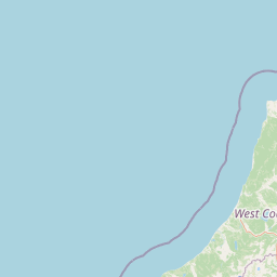
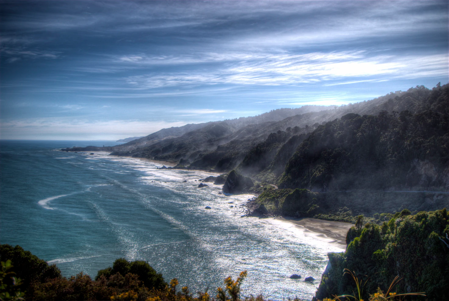
The reserve sits along a wild, surf-battered stretch of the Tasman Sea coast, where cliffs, rocky headlands, and eroded limestone terraces meet the open ocean. The Pancake Rocks at Dolomite Point are the reserve's most celebrated landform, their horizontally layered appearance the result of differential erosion between harder limestone and softer intervening sediments. Blowholes add drama to this setting, periodically venting spray as the surf forces seawater upward through vertical shafts in the rock.
Within the protected waters, the seafloor transitions quickly from hard reef and boulder fields near the cliffs into gravel and cobble shore habitats, eventually giving way to sandy seabed areas around the 20-metre depth contour. The combination of substrate types, varying exposure to wave energy, and proximity to river mouths like the Pororari and Punakaikai River creates a varied underwater topography that supports diverse marine communities.
Punakaiki Marine Reserve ecosystems, habitats, and plant life
Punakaiki Marine Reserve protects a representative cross-section of coastal and shallow marine habitats on the West Coast of the South Island. Within its boundaries, six natural habitat types are recognised, spanning rocky shore platforms, gravel shores, cobble beaches, and sandy seabed environments. These habitats form a gradient from the high-energy splash zone near Dolomite Point to calmer, sediment-rich seafloor areas further offshore.
The reserve's ecological significance is reinforced by its connection with Paparoa National Park on land. Together, the two protected areas safeguard a continuous corridor where coastal forest, freshwater streams, reef systems, and open ocean habitats are linked through shared catchments and shoreline interfaces. The marine component captures nutrient and sediment flows from inland waterways, supporting kelp beds and other productive nearshore communities.
Punakaiki Marine Reserve wildlife and species highlights
The varied habitats of Punakaiki Marine Reserve support a rich mix of marine and coastal fauna. Marine mammals recorded in or near the reserve include fur seals and the rare Hector's dolphin, while little blue penguins nest along parts of the coast. Forest and scrub birds from the adjacent Paparoa National Park, such as weka and the threatened tāiko, also inhabit the reserve's coastal fringe.
The coastline and offshore waters are important for seabirds, several of which face conservation concerns. White-fronted terns, Westland petrels, sooty shearwaters, fairy prions, banded dotterels, and red-billed gulls all occur in the area. Large kelp beds mapped offshore form the base of a productive food web that underpins much of this bird and marine mammal activity.
Punakaiki Marine Reserve conservation status and protection priorities
Punakaiki Marine Reserve adds a critical marine dimension to the broader Paparoa conservation landscape, creating a protected boundary where rainforest and reef exist under the same management umbrella. By prohibiting commercial fishing extraction, the taking of marine life, and the disturbance of seabed habitats, the reserve allows fish populations, kelp communities, and seafloor ecosystems to recover and stabilise.
The site also plays a research role. In 2020 the National Institute of Water and Atmospheric Research, the Department of Conservation, and the University of Canterbury jointly used drones to map marine plants and animals in the reserve, including extensive kelp beds offshore. The reserve's prohibition on feeding fish, careful anchoring practice, and restrictions on mobile bottom-impacting fishing methods all reflect a precautionary approach to conserving an exposed and ecologically productive coastal environment.
Punakaiki Marine Reserve cultural meaning and human context
The creation of Punakaiki Marine Reserve is closely tied to Ngāi Tahu involvement. Ngāi Tahu representatives participated in the West Coast Marine Protection Forum that recommended the reserve in 2012, ensuring that customary values were considered from the earliest stages of the process. Certain Ngāi Tahu members retain the right to collect pounamu, or greenstone, in accordance with tradition, acknowledging the cultural significance of the broader West Coast landscape.
Top sights and standout views in Punakaiki Marine Reserve
Punakaiki Marine Reserve is defined by the rare combination of geological spectacle, ecological productivity, and integrated land-sea protection. The Pancake Rocks and blowholes above the waterline are matched below by six distinct marine habitat types, large offshore kelp beds, and a coastline that supports fur seals, Hector's dolphins, little blue penguins, and a rich assemblage of seabirds.
What makes the reserve especially notable is its position at the seaward edge of Paparoa National Park. Together, the two reserves form a unified corridor of terrestrial and marine protection that is relatively rare in New Zealand, allowing conservation management to extend from forested ridgelines out into the Tasman Sea.
Best time to visit Punakaiki Marine Reserve
The West Coast's climate is characterised by frequent rainfall, strong swell, and rapidly changing weather at any time of year, and these conditions shape the experience of visiting Punakaiki Marine Reserve. The blowholes at Dolomite Point are most dramatic during periods of large ocean swell, which can occur throughout the year, while calmer seas tend to make wildlife viewing and exploration of nearshore reef life easier.
Spring and summer generally offer milder temperatures and longer daylight hours for exploring the coastline, though visitors should be prepared for sudden weather changes at any season. The Department of Conservation notes that large waves can arrive quickly along this coast, so checking forecasts and dressing for wet conditions is wise no matter when the visit takes place.