Mori Atlas logo
Nature reserveRace Rocks Ecological Reserve

Mapping the tidal habitats and marine ecosystems within a key Strait of Juan de Fuca nature reserve

Race Rocks Ecological Reserve: A Significant Protected Marine Landscape in British Columbia

Race Rocks Ecological Reserve stands as a compact, biologically vital protected landscape situated at a powerful tidal constriction within the Strait of Juan de Fuca. This nature reserve, located off the southern tip of Vancouver Island in British Columbia, protects a cluster of rocky islets and nutrient-rich marine waters. The area serves as a critical habitat for California and Steller sea lions, harbour seals, and elephant seals, functioning as a primary location for marine research and ecological observation.

marine reservecoastal islandstidal habitatsea lion haul-outharbour seal rookeryelephant seal colony

Race Rocks Ecological Reserve

Nature reserve

Park overview

Structured park overview, official facts, and landscape profile for Race Rocks Ecological Reserve

Race Rocks Ecological Reserve park facts, protected area profile, and essential visitor context

Review the core facts for Race Rocks Ecological Reserve, including designation, size, terrain, visitor scale, habitats, and operating context in one park-focused overview.

About Race Rocks Ecological Reserve

Race Rocks Ecological Reserve occupies a tiny but remarkably rich piece of the Pacific coastline, defined more by water than by land. Located roughly 1.5 kilometres off the southern tip of Vancouver Island, the reserve consists of eleven small islets and the surrounding high-current waters of the Strait of Juan de Fuca. Although the protected footprint is small, almost all of it is ocean, and the combination of strong tidal flow and rocky substrate creates a habitat mosaic that supports dense concentrations of marine species.

The ecological significance of Race Rocks is tied closely to its oceanographic setting. The Strait of Juan de Fuca narrows in this area, accelerating tidal currents and promoting the mixing and upwelling of nutrient-rich deeper water. These conditions fuel a productive food web, drawing seabirds, marine mammals, fish, invertebrates, and marine plants into a compact geographic arena. As a result, the reserve functions less like a traditional land-based park and more like a concentrated coastal marine sanctuary, where visitors and researchers can experience a wide range of Pacific marine life within a relatively small area.

Race Rocks has also become an important site for marine science education and research. The reserve was established following a marine science project by students at Pearson College UWC, and it continues to operate under a joint management arrangement between BC Parks and the college. This partnership has helped establish Race Rocks as a living classroom and long-term monitoring site for the region, reinforcing its identity as both a protected natural area and an educational resource on Canada's Pacific coast.

Quick facts and research context for Race Rocks Ecological Reserve

Race Rocks Ecological Reserve is a BC Parks ecological reserve located in the Juan de Fuca Electoral Area of the Capital Regional District, British Columbia, approximately 1.5 kilometres off the southern tip of Vancouver Island. Classified as an IUCN Category Ia strict nature reserve, it protects a small group of rocky islets and the dynamic tidal waters surrounding them, where strong currents concentrate nutrients and marine life. Established in 1980, it remains a benchmark site for Pacific marine biodiversity research and education on Canada's West Coast.

Protection and recognition

Examine the documented marine protection status and official designation history for Race Rocks Ecological Reserve.

Race Rocks Ecological Reserve Protection Status and Marine Conservation Scope

Marine protection status and management scope details establish the baseline for Race Rocks Ecological Reserve within global conservation data. Structured protection facts outline the documented designation history and regulatory framework governing the marine environment.

Protection details

Protection scope
Marine
Transboundary protection
No
Park context

Deeper park guide and search-rich context for Race Rocks Ecological Reserve

Race Rocks Ecological Reserve history, landscape, wildlife, and travel context

Explore Race Rocks Ecological Reserve through its history, landscape character, ecosystems, wildlife, conservation priorities, cultural context, and seasonal travel timing in a structured park guide built for atlas discovery and search intent.

Why Race Rocks Ecological Reserve stands out

Race Rocks is most widely recognized for its exceptional abundance of marine mammals in a tiny spatial footprint, situated at a high-current bottleneck of the Strait of Juan de Fuca. The reserve supports California and Steller sea lion haul-outs, a harbour seal birthing rookery, and the northernmost elephant seal breeding colony on the Pacific coast of North America. Its presence in a powerful tidal mixing zone creates an unusually productive marine environment, making it a focal point for both conservation and marine science education.
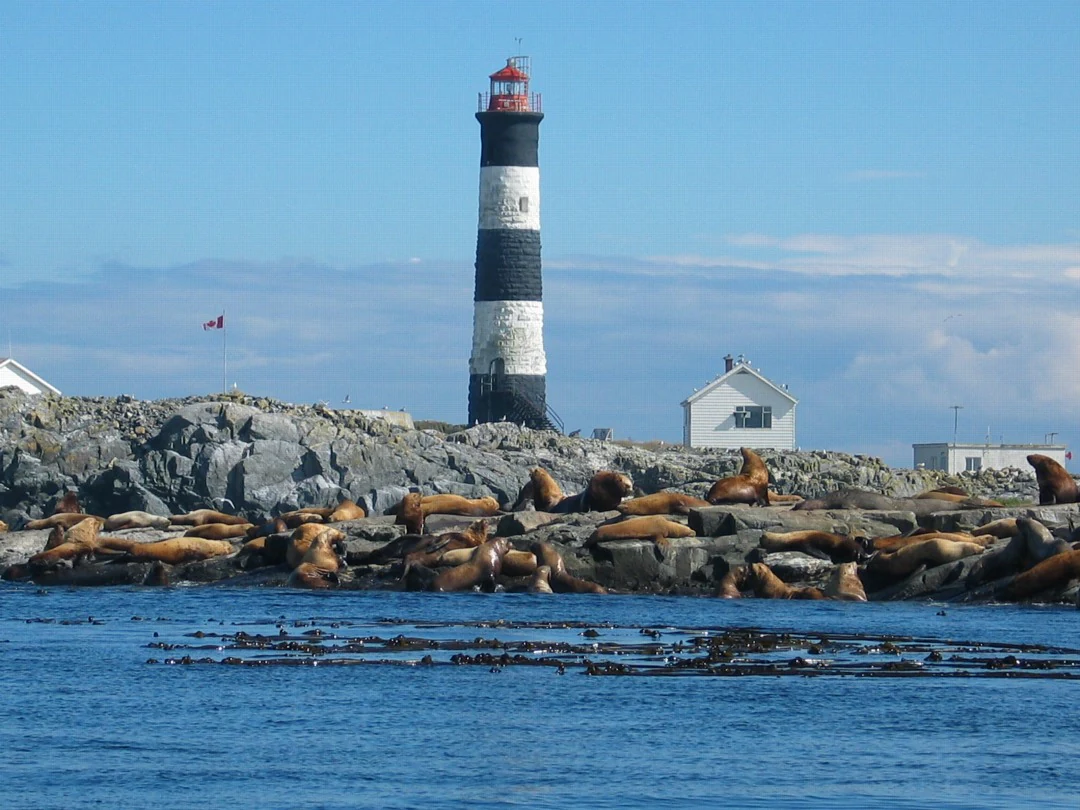
A large group of sea lions resting on rocky terrain at the base of the black and white striped Race Rocks lighthouse.
Sea lions resting on the rocky shores at Race Rocks Ecological Reserve, with the iconic lighthouse in the background.

Race Rocks Ecological Reserve history and protected-area timeline

The movement to protect Race Rocks began in 1978, when students at Pearson College UWC, led by teachers Garry Fletcher and Marks McAvity, undertook a marine science project documenting the area's rich biodiversity and ecological importance. Their work helped bring attention to the exceptional concentration of marine life at this narrow section of the Strait of Juan de Fuca and laid the foundation for formal protection.

In 1980, the islets and surrounding waters were designated as an ecological reserve under a joint management arrangement between BC Parks and Pearson College UWC, making Race Rocks one of the early marine-focused ecological reserves in British Columbia. In 2006 and 2007, the Race Rocks Tidal Power Demonstration Project was installed to study the feasibility of tidal energy generation in such a high-current environment. After six years of experimental research, the tidal energy generator was eventually removed, leaving the reserve managed as a protected natural area once again.

Race Rocks Ecological Reserve landscape and geographic character

The landscape of Race Rocks is unlike that of most terrestrial parks, defined primarily by water, rocks, and tidal motion. The reserve consists of eleven small, low-lying islets clustered along a narrow constriction of the Strait of Juan de Fuca, where the passage between Vancouver Island and the Olympic Peninsula narrows and accelerates tidal flow. Only a tiny fraction of the protected area is actually exposed land; the overwhelming majority is marine, shaped continuously by strong currents and exchange between the Salish Sea and the open Pacific.

The islets themselves are exposed rock, battered by weather and wave action, providing haul-out sites for marine mammals and nesting platforms for seabirds. The shoreline of each islet has likely been shaped over thousands of years by the same tidal forces that make the waters biologically rich. The lighthouse on Great Race Rock, though not part of the reserve itself, is a familiar landmark in this rugged seascape and underscores the long history of human presence in an otherwise remote marine environment.

Race Rocks Ecological Reserve ecosystems, habitats, and plant life

Race Rocks Ecological Reserve protects a small but extraordinarily productive marine ecosystem anchored by strong tidal currents and rocky substrate. The nutrient-rich waters support a wide variety of marine algae and seagrasses, which in turn sustain invertebrates, forage fish, and larger predators. The combination of moving water and varied bottom structure creates habitat depth in a tiny area, with each islet and submerged rock offering different conditions for marine organisms.

Because the reserve sits at a confluence of oceanographic conditions, the boundary between the Salish Sea, the Strait of Juan de Fuca, and the open Pacific Ocean, its ecological communities reflect influences from multiple marine environments. Upwelling and tidal mixing concentrate plankton and other foundational organisms near the surface, supporting the dense aggregations of fish and invertebrates that draw larger predators, including seabirds and marine mammals. This compact convergence of oceanographic conditions makes Race Rocks disproportionately rich in species and trophic interactions for its size.

Race Rocks Ecological Reserve wildlife and species highlights

The wildlife profile of Race Rocks is overwhelmingly marine. The reserve is best known for its populations of pinnipeds, including California sea lions and Steller sea lions that use the rocks as haul-out areas, hauling themselves onto the islets between feeding trips. Harbour seals also frequent the area in large numbers, and the islets function as a birthing rookery where pups are born and raised during the spring months.

Perhaps most notably, Race Rocks hosts one of the northernmost elephant seal breeding colonies on the Pacific coast of North America, giving the reserve a distinctive role in the regional population dynamics of this species. Beyond marine mammals, the surrounding waters host seabirds, schooling fish and forage species, and a diverse community of marine invertebrates that benefit from the area's nutrient-rich conditions. The result is an intense, visible food web compressed into a relatively small island-and-water setting, where multiple trophic levels can be observed interacting in a single view.

Race Rocks Ecological Reserve conservation status and protection priorities

Race Rocks Ecological Reserve is designated as an IUCN Category Ia strict nature reserve, the highest level of protection, focused on preserving ecological processes and biodiversity with minimal direct human interference. This designation reflects both the small, sensitive nature of the reserve and the exceptional ecological value concentrated within it. The combination of marine mammal breeding habitat, seabird nesting areas, and dense invertebrate communities makes the reserve a high-priority site for the long-term health of the Strait of Juan de Fuca.

The joint management partnership between BC Parks and Pearson College UWC has shaped the reserve's conservation approach, integrating formal protection with ongoing research, monitoring, and education. Experimental tidal energy infrastructure installed in 2006 and 2007 was eventually removed after a six-year research period, demonstrating the reserve's role as a place where new energy and conservation questions can be tested against long-standing ecological priorities. Today, the reserve stands as a model of how a small, high-value coastal area can be protected through cooperative stewardship.

Race Rocks Ecological Reserve cultural meaning and human context

Although Race Rocks is defined by its natural environment, it has a meaningful human story shaped by maritime navigation, lighthouse heritage, and education. The lighthouse on Great Race Rock, though not formally part of the reserve, has long marked this treacherous stretch of water and is leased by the Canadian Coast Guard. The reserve itself emerged from a marine science project by Pearson College UWC students in 1978, and the school's continued partnership in its management gives the area a strong educational and stewardship tradition tied to the broader Vancouver Island community.

Top sights and standout views in Race Rocks Ecological Reserve

Race Rocks Ecological Reserve concentrates an exceptional range of Pacific marine wildlife into a small, high-current group of islets at one of the busiest ocean passages in the Salish Sea. The reserve's most notable features are its California and Steller sea lion haul-outs, its harbour seal birthing rookery, and its role as one of the northernmost elephant seal breeding colonies on the Pacific coast of North America.

The reserve also stands out for its oceanographic setting, where strong tidal mixing and upwelling drive an unusually productive food web in a compact footprint. The long-standing partnership between BC Parks and Pearson College UWC gives Race Rocks a distinctive identity as both a strictly protected natural area and a working site for marine science education and research, making it one of the most studied small marine reserves on Canada's West Coast.

Best time to visit Race Rocks Ecological Reserve

As a marine environment in the Strait of Juan de Fuca, Race Rocks is most accessible to visitors during periods when weather and seas are calmer, generally in the late spring through early fall. Spring and early summer are particularly notable for harbour seal pupping and active seabird nesting on the islets, while summer and early fall tend to offer the most stable viewing conditions for marine mammals, including sea lions hauled out on the rocks. Winter months bring rougher seas and reduced visibility, but also highlight the power of the tidal currents that define the reserve. Because the area is governed as a strict ecological reserve, access is primarily through permitted and remote viewing rather than casual public tourism, and conditions on the water rather than on land shape the experience.

Monthly climate preview

Long-term representative monthly temperature and precipitation data for British Columbia

Race Rocks Ecological Reserve Climate Normals and Annual Weather Patterns

Long-term representative records outline the measured annual temperature range and monthly precipitation rhythm sampled at Race Rocks Ecological Reserve in British Columbia. Examining the complete twelve-month climatology profile reveals detailed variations in average minimum and maximum temperatures across the protected area.
Annual mean9 °C
4 °C16 °C
Jan
Feb
Mar
Apr
May11°
Jun13°
Jul16°
Aug16°
Sep14°
Oct10°
Nov
Dec
Warmest month
August

16.3 °C

Coolest month
December

4 °C

Wettest month
November

6.6 mm/day

Driest month
July

1 mm/day

Park location guide

Geography guide, regional context, and park location map for Race Rocks Ecological Reserve

Race Rocks Ecological Reserve park geography, regions, and map view in Canada

Understand where Race Rocks Ecological Reserve sits in Canada through a broader geographic reading of the surrounding landscape, nearby location context, and its mapped position within the national park landscape.

How Race Rocks Ecological Reserve fits into Canada

Canada is a federal parliamentary constitutional monarchy spanning North America from the Atlantic to the Pacific and Arctic Oceans. With a population of over 41 million, it is officially bilingual in English and French at the federal level. The country gained independence from the United Kingdom through a gradual process culminating in 1982.

Wider geography shaping Race Rocks Ecological Reserve in Canada

Canada occupies the northern portion of North America, sharing its longest international border with the United States. The country extends from the Atlantic Ocean to the Pacific Ocean and northward into the Arctic Ocean, giving it the longest coastline of any nation.

Map view of Race Rocks Ecological Reserve

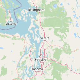
Use this park location map to pinpoint Race Rocks Ecological Reserve in Canada, understand its exact geographic position, and read its mapped placement within the surrounding landscape more clearly.

Pigeon | © OpenStreetMap contributors

Location context for Race Rocks Ecological Reserve

British Columbia

Visual exploration of rocky islets, tidal habitats, and coastal wildlife

Race Rocks Ecological Reserve Photos, Scenery, and Marine Landscape Views

Examine detailed Race Rocks Ecological Reserve photos that reveal the rugged rock formations, powerful tidal currents, and marine wildlife habitats of the Strait of Juan de Fuca. Visual documentation helps observers understand the distinctive coastal geography, sea lion haul-outs, and oceanographic character of this protected marine environment.

A large group of sea lions resting on rocky terrain at the base of the black and white striped Race Rocks lighthouse.

Park atlas

Discover surrounding marine reserves, coastal islands, and regional habitats across the Salish Sea.

Explore Parks Near Race Rocks Ecological Reserve and Related Coastal Protected Areas

Browse other parks near Race Rocks Ecological Reserve to compare coastal habitats and protected marine landscapes across the Pacific Northwest region. Expanding your geographic view helps place high-current tidal reserves and island sanctuaries within a broader regional conservation context.
National parkWashington
About 23 km away#1 closest

South

Olympic National Park National Park: Geographic Atlas and Protected Landscape Discovery

Explore its unique Washington landscape and mapped protected areas.

Olympic National Park serves as a key protected area within Washington, offering rich opportunities for geographic exploration. This detail page provides essential context on its designation as a national park, its mapped boundaries, and its contribution to the regional geography. Understand the park's specific landscape character and its role within the atlas of protected lands, facilitating a structured approach to discovering its natural terrain and geographic significance.

Area
3,733.8 km²
Established
1938
IUCN
II
Visitors
3.7M annual
A watercolor painting showing a panoramic view of rolling mountain ranges and dense evergreen forests with a soft, misty aesthetic.
Protected landscapeWashington
About 26 km away#2 closest

Southeast

Olympic National Forest: Atlas and Geographic Overview of Washington Protected Lands

Temperate rainforests, alpine ridges, and fjord shorelines

Olympic National Forest defines the outer reaches of the Olympic Mountains, featuring a massive expanse of old-growth conifers and high-precipitation temperate rainforests. This protected area connects diverse ecosystems ranging from the brackish waters of Hood Canal to rugged, snow-dusted subalpine ridges. Our detailed geographic mapping highlights the forest's role as a vital buffer and wilderness corridor within the broader Pacific Northwest landscape.

Area
2,541.89 km²
Established
1897
Relief
Mountain
Climate
Temperate
National parkBritish Columbia
About 35 km away#3 closest

North

Gulf Islands National Park Reserve: British Columbia National Park Protected Area

Mapped boundaries and regional geographic context.

Delve into the protected landscape of Gulf Islands National Park Reserve, a significant national park located in British Columbia. This entry provides detailed insights into its mapped boundaries, regional geographic setting, and its identity as a protected area. Understand the park's place within the natural terrain and atlas of Canada, offering a clear geographic overview for focused discovery and landscape context.

Area
36 km²
Established
2003
IUCN
VI
Visitors
28.4K annual
National parkBritish Columbia
About 70 km away#4 closest

Northwest

Pacific Rim National Park Reserve: National Park Protected Landscape & Map Atlas

Mapped boundaries and regional geographic context in British Columbia.

Pacific Rim National Park Reserve stands as a distinct protected natural landscape, serving as a critical component of Canada's national park inventory. This page facilitates an atlas-style exploration of its mapped boundaries and its position within the broader geography of British Columbia. Understanding the park's protected status and its integration with the surrounding natural terrain offers valuable insight into conservation landscapes.

Area
511 km²
Established
1970
IUCN
VI
Visitors
1.2M annual
A horizontal watercolor painting depicting a calm coastal inlet, surrounded by green hills, coniferous trees, and distant soft mountain silhouettes.
Marine protected areaUnited States of America
About 78 km away#5 closest

East

Padilla Bay National Estuarine Research Reserve: Coastal Protected Area Geography

A significant tidal estuary and marine protected landscape in Washington

This marine protected area encompasses large, shallow tidal mudflats and salt marshes within the Salish Sea. It serves as a essential hub for ecological research and conservation, framing a hybrid environment where historical diked farmlands meet protected coastal terrain. The reserve offers deep insight into the regional geography of Washington, detailing how tidal processes and human history have shaped this productive Pacific Northwest estuarine landscape.

Area
32 km²
Established
1980
Relief
Lowland
Access
Easy access
Wildlife reserveWashington
About 80 km away#6 closest

South

Mount Skokomish Wilderness: Ridge Systems and Alpine Geography in Washington State

Exploration of a protected Olympic Peninsula mountain landscape.

Mount Skokomish Wilderness protects a dramatic stretch of the eastern Olympic Mountains defined by steep ridges and glacial basins. The area serves as a critical headwaters region and offers a dense display of peaks and old-growth forest transitions across its varied elevation profile, providing essential landscape context for the region.

Area
53.79 km²
Established
1984
IUCN
Ib
Relief
Mountain
A horizontal watercolor painting showing a panoramic view of a coastal landscape with green, tree-covered headlands, rocky sea stacks, and distant mountains under a pale sky.
Marine protected areaWashington
About 83 km away#7 closest

West

Olympic Coast National Marine Sanctuary: Mapping the Washington Outer Coast Marine Protected Area

Pacific Ocean canyons, shelf ecosystems, and coastal wilderness

Defined by its proximity to the Olympic Peninsula, this marine protected area spans a rugged stretch of the Pacific Ocean. The sanctuary encompasses significant seafloor features including the Nitinat and Quinault canyons, alongside dynamic upwelling zones that support diverse marine life and complex tidal habitats.

Area
8,260 km²
Established
1994
IUCN
IV
Climate
Temperate
A watercolor painting showing a horizontal landscape with a green forest in the foreground and soft pink, layered rolling hills in the background.
State or regional parkBritish Columbia
About 92 km away#8 closest

North

Morden Colliery Historic Provincial Park: Heritage Infrastructure and Regional Coal Mining History

Industrial landscape and historic rail corridor in British Columbia

Located near Nanaimo, this heritage site preserves the substantial concrete remains of the Morden Colliery. The park serves as a physical archive of southern Vancouver Island industrial life, contrasting engineering landmarks with local forest environments and interpretive trails along former coal railway alignments.

Area
0.04 km²
Established
1972
Relief
Lowland
Scope
Terrestrial

Common questions about visiting, size, designation, and location context for Race Rocks Ecological Reserve

Race Rocks Ecological Reserve FAQs for park facts, access, geography, and protected area context

Find quick answers about Race Rocks Ecological Reserve, including protected-area facts, park geography, trail and visitor context, and how the park fits into its surrounding country and regional landscape.
MoriAtlas Explorer

Continue Your Protected Areas Search Across the Global Atlas

Deepen your exploration by continuing the structured search for national parks and protected areas worldwide. Utilize the comprehensive filtering capabilities to compare different conservation landscapes and refine your understanding of global park geography. Discover more about the distribution and characteristics of protected natural areas.

Global natural geography