
Mori Atlas logo
State or regional parkRathtrevor Beach Provincial Park

Examining the intersection of tidal sand flats, old-growth forests, and coastal terrain

Rathtrevor Beach Provincial Park: A Protected Coastal Landscape on Vancouver Island

Rathtrevor Beach Provincial Park stands as a significant protected area on the eastern coast of Vancouver Island, British Columbia. This coastal landscape features a two-kilometre sandy shoreline that extends into vast tidal flats at low tide, providing a unique vantage point across the Strait of Georgia. Behind the beach, a rare stand of old-growth Douglas fir provides a dense, forested contrast to the open maritime environment, serving as a vital natural corridor in the region.

coastal parksandy beachold-growth forestDouglas firVancouver IslandBritish Columbia
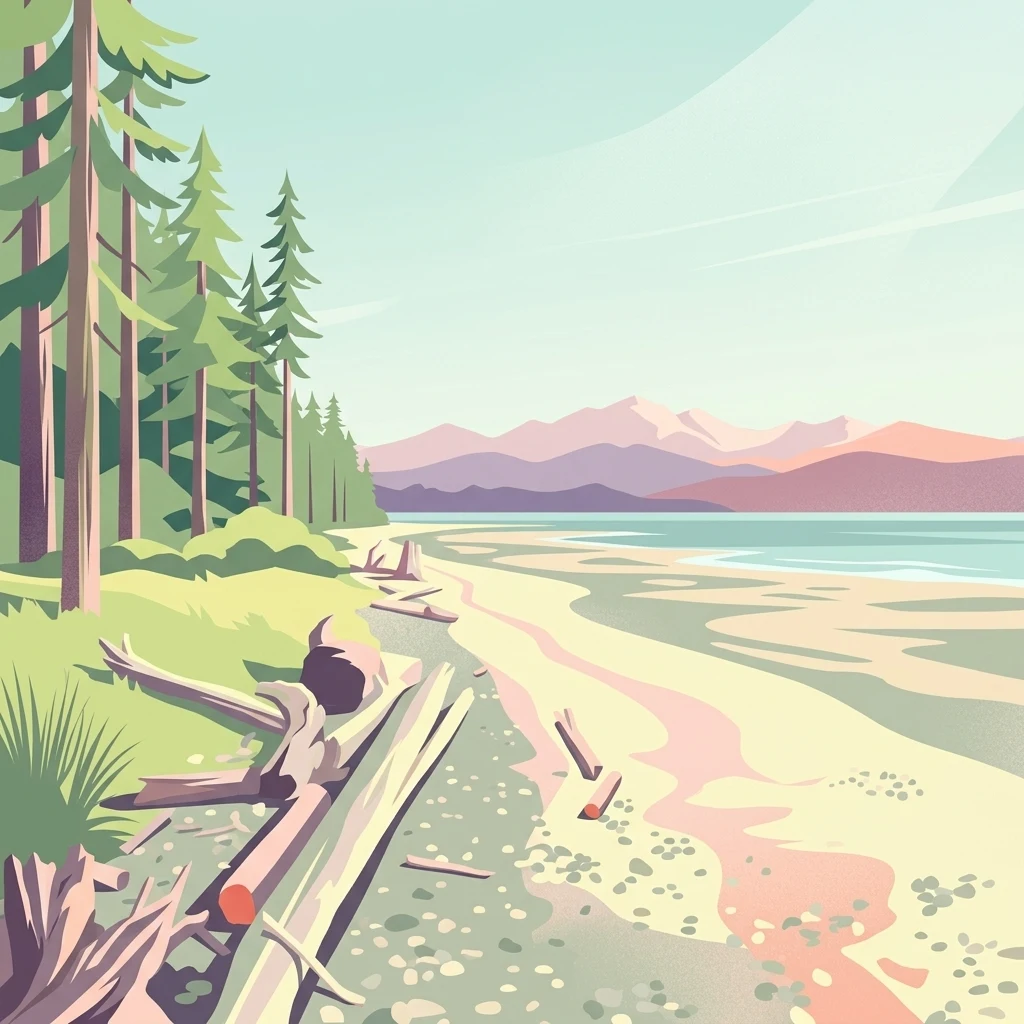
A stylized digital illustration of a sandy beach bordered by a coniferous forest, with driftwood in the foreground and mountains in the distance.

Rathtrevor Beach Provincial Park

State or regional park

Park overview

Structured park overview, official facts, and landscape profile for Rathtrevor Beach Provincial Park

Rathtrevor Beach Provincial Park park facts, protected area profile, and essential visitor context

Review the core facts for Rathtrevor Beach Provincial Park, including designation, size, terrain, visitor scale, habitats, and operating context in one park-focused overview.

About Rathtrevor Beach Provincial Park

Rathtrevor Beach Provincial Park sits at the eastern edge of Parksville, where the developed coastline of central Vancouver Island gives way to a long, curving sweep of sand and sheltered estuarine flat. The 347-hectare park wraps around a two-kilometre stretch of beach facing the Strait of Georgia, with views across the water toward Lasqueti Island and, on clearer days, the Coast Mountains of the British Columbia mainland. At low tide, the sand and mudflats stretch out almost a kilometre from the high water line, producing one of the broadest and most gently sloped intertidal areas in the region.

Behind the beach, the park climbs into a forested terrace of older coastal terrain. This inland portion holds a stand of old-growth Douglas fir trees, a notably rare feature on eastern Vancouver Island, where most of the original coastal forests were logged long ago for settlement, farming, and later suburban development. The contrast between sun-exposed sand and dark, towering conifers is a defining visual signature of the park and a major part of its appeal for visitors arriving from the nearby towns.

Rathtrevor Beach is far more than a place to swim and sunbathe. The intertidal zone attracts migratory birds, the forest shelters typical Vancouver Island mammals, and the park's interpretive program introduces visitors to the natural history of the area. Its accessibility from the Inland Island Highway and its location right beside Parksville make it a touchstone for residents and tourists alike, and helped establish it as one of the most visited parks in the BC Parks system.

Quick facts and research context for Rathtrevor Beach Provincial Park

Rathtrevor Beach Provincial Park lies within Parksville, on the east coast of Vancouver Island in British Columbia, and is administered by BC Parks. The park covers about 347 hectares, the great majority of which are forested land behind the shoreline.

The defining feature is a roughly two-kilometre sandy beach along the Strait of Georgia. Inland from the beach, the park contains a remnant stand of old-growth Douglas fir, unusual for an area where coastal development has long since replaced most such forests. The park is an important seasonal staging area for migrating brant geese in early spring, and supports a range of typical coastal Vancouver Island wildlife. Together, beach, forest, and wildlife make Rathtrevor Beach a compact but unusually varied coastal park.

Protection and recognition

Documented terrestrial protection scope and recognized conservation management history

Rathtrevor Beach Provincial Park Protection Status and Conservation Data

Rathtrevor Beach Provincial Park maintains a documented terrestrial protection scope within its regional conservation framework. Official records compile available management parameters and administrative designations for the protected area without external international recognition sources.

Protection details

Protection scope
Terrestrial
Transboundary protection
No
Park context

Deeper park guide and search-rich context for Rathtrevor Beach Provincial Park

Rathtrevor Beach Provincial Park history, landscape, wildlife, and travel context

Explore Rathtrevor Beach Provincial Park through its history, landscape character, ecosystems, wildlife, conservation priorities, cultural context, and seasonal travel timing in a structured park guide built for atlas discovery and search intent.

Why Rathtrevor Beach Provincial Park stands out

Rathtrevor Beach is best known for its long, gently sloping sandy beach on the Strait of Georgia, backed by a stand of old-growth Douglas fir that survives in a coastal setting otherwise dominated by suburban and resort development. The combination of a wild-looking beach backed by towering conifers, all within walking distance of a town centre, gives the park a distinctive character for Vancouver Island. The park is also recognized as a major spring staging area for brant geese, which gather on the exposed tidal flats each March and early April before continuing north. Add to that one of British Columbia's most heavily used provincial campgrounds, and Rathtrevor Beach is known primarily as a place where sandy shore, old-growth forest, bird migration, and accessible camping meet in a single compact park.
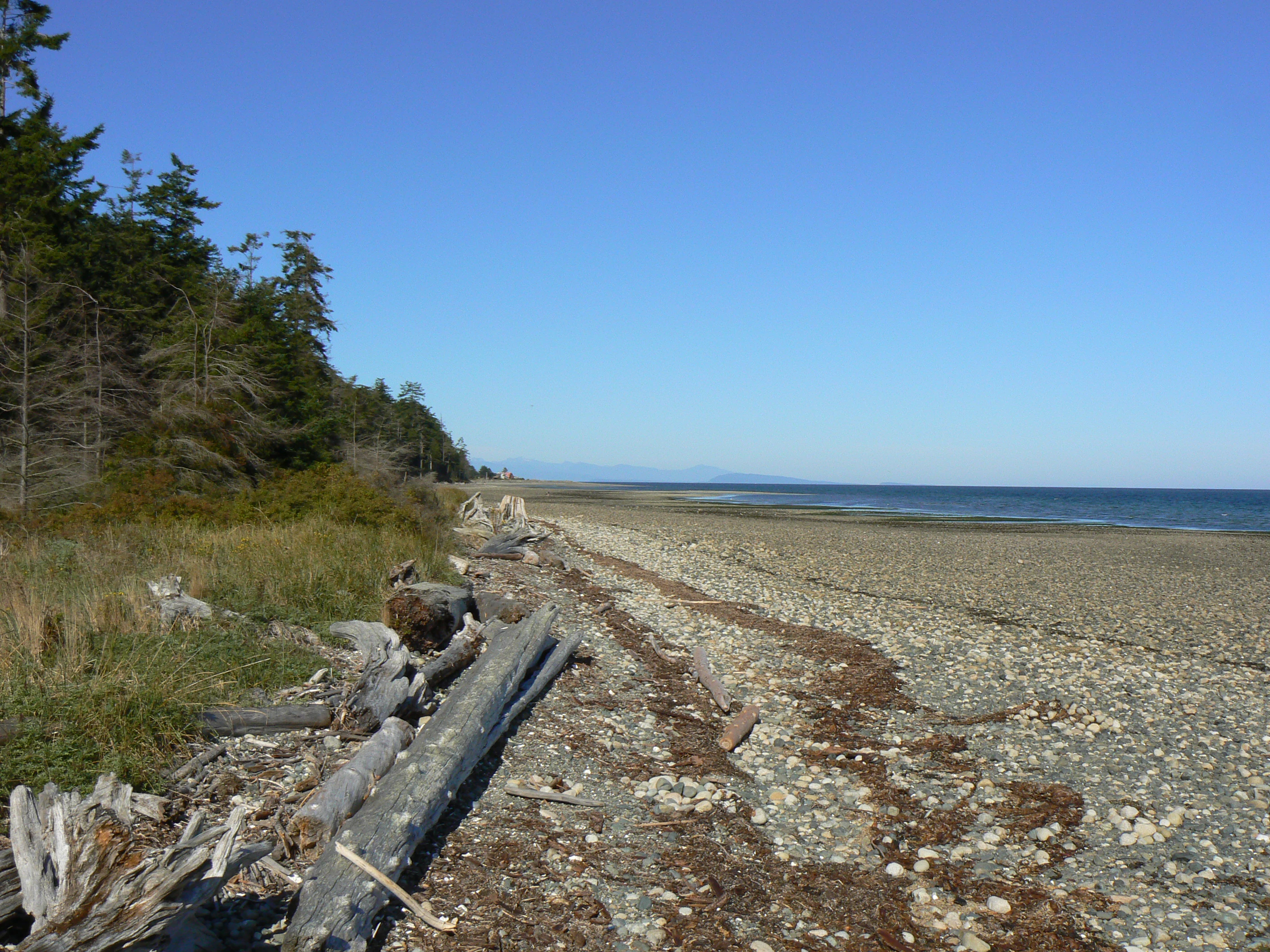
A wide angle view of a long, stony, and sandy beach on a sunny day. Driftwood logs lie along the shore in the foreground, with a dense forest line on the left and the calm ocean stretching toward a distant horizon on the right.
The expansive shoreline of Rathtrevor Beach at low tide, featuring driftwood and coastal forest.

Rathtrevor Beach Provincial Park history and protected-area timeline

The land that is now Rathtrevor Beach Provincial Park was homesteaded in the late nineteenth century by the Rath family, who gave the property its name. The family later operated a private campground on the site, choosing the more euphonious "trevor" addition to make the place sound romantic; this campground became the basis for the present park.

The park was formally established on 20 April 1967, but its creation came through one of the more controversial land deals in the history of British Columbia parks. In the early 1960s, Clearwater Timber Products, a major employer near Wells Gray Provincial Park in the central interior, was running short of timber for its mill. In October 1963, the Social Credit government of the day passed an order-in-council allowing Clearwater Timber to acquire timber rights to about 137 square kilometres inside the southwestern portion of Wells Gray Park, in exchange for roughly 47 hectares of Rathtrevor Beach land owned by the company. The exchange was valued at $186,000, but the stumpage fees paid to the government for the timber were set at an exceptionally low rate of $1.50 per 100 cubic feet for fir, compared to the standard industry rate of $16.90.

Subsequent investigations revealed that the Rath family had sold the beach property to Clearwater Timber only months earlier for $150,000, raising questions about the appraisal and the political pressure behind the deal. Critics, including Member of the Legislative Assembly Bob Williams, argued that the swap was a serious example of mismanagement, pointing out that the province would eventually receive far less in stumpage fees than it had effectively paid out, and that the arrangement opened a large part of Wells Gray Park to industrial logging. Former Kamloops MLA Phil Gaglardi was accused of using his position as Highways Minister to push the deal through.

By 1974, two years after the New Democratic Party took office, the arrangement with Clearwater Timber was cancelled. The logging road into the Flourmill Volcanoes area was permanently closed by the demolition of the bridge over the Mahood River, ending industrial access into that part of Wells Gray Park. In the decades since, Rathtrevor Beach itself has grown into one of the most visited and best loved campgrounds in the British Columbia park system, a quiet but telling contrast to the logging controversy that gave it its start.

Rathtrevor Beach Provincial Park landscape and geographic character

The landscape of Rathtrevor Beach Provincial Park is shaped by the meeting of Vancouver Island's coastal lowlands with the sheltered waters of the Strait of Georgia. The park's dominant feature is a curving, two-kilometre sandy beach, fine grained and unusually broad for the eastern coast of the island. At low tide the beach becomes a sweeping expanse of sand and shallow tidal flat that reaches almost a kilometre offshore, creating a gentle, walkable gradient that defines the visitor experience.

Behind the shoreline, the terrain rises into a forested bluff and terrace that supports the park's old-growth Douglas fir stand. These mature conifers rise above a mossy understorey, lending the inland portion of the park a darker, more enclosed feel that contrasts strongly with the open beach below. The transition from open sand to shaded, cathedral-like forest over a short walk is one of the park's most distinctive landscape features.

From the beach itself, views open to the west and northwest across the Strait of Georgia. Lasqueti Island sits on the horizon, with the silhouettes of the mainland Coast Mountains visible behind it on clear days. The combination of broad intertidal flats, sheltered marine water, forested terrace, and distant mountain skyline gives Rathtrevor Beach a layered and varied coastal landscape unusually rich for a park of its size.
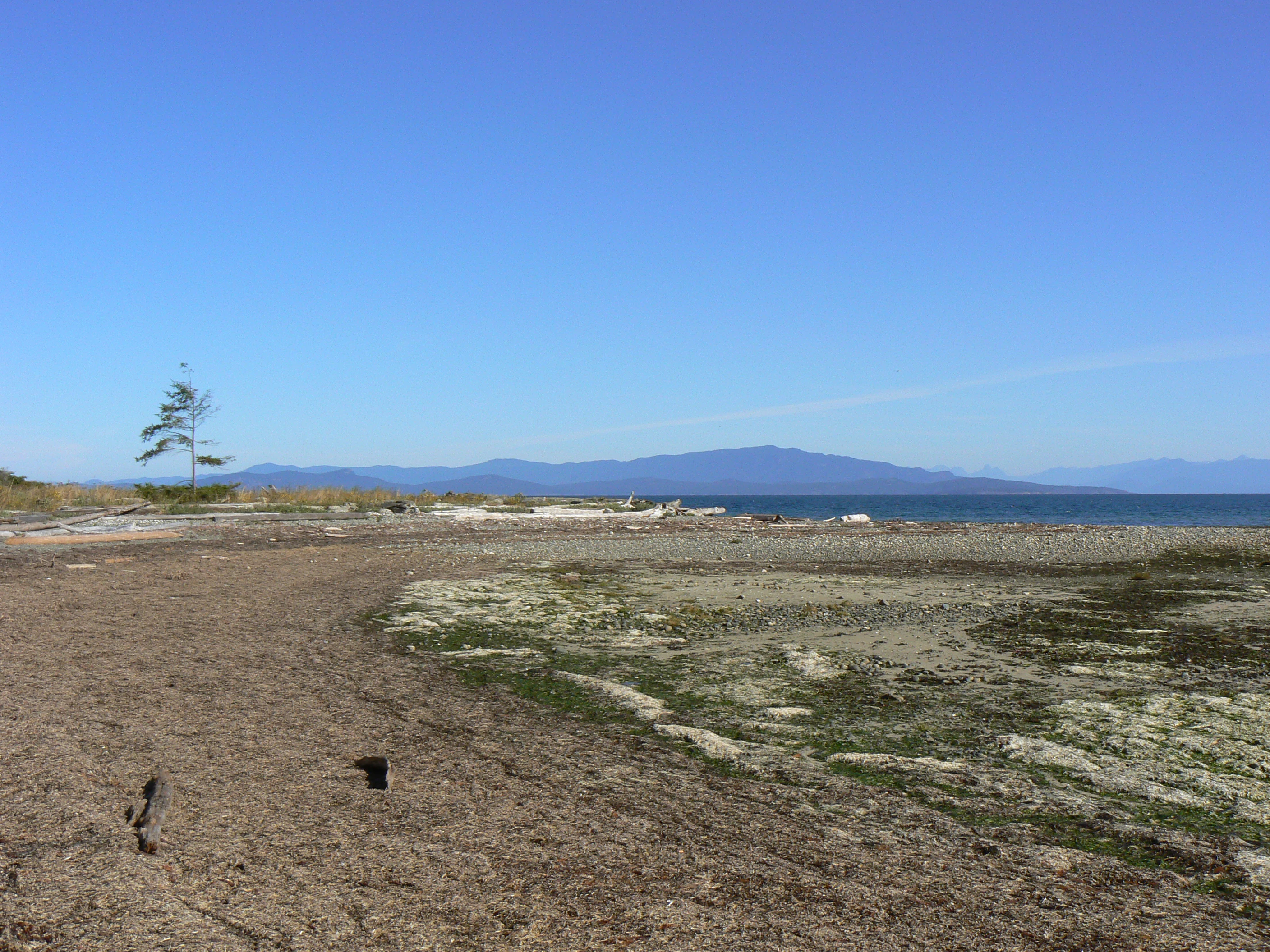
A wide angle view of a coastal beach at low tide, with exposed sandy and mossy terrain, a solitary tree on the left, and mountains visible across the water under a clear blue sky.
A wide view of the sandy and rocky beach at Rathtrevor Beach Provincial Park, featuring tide flats and coastal views across the water.

Rathtrevor Beach Provincial Park ecosystems, habitats, and plant life

Ecologically, Rathtrevor Beach sits at the interface between marine, intertidal, and coastal forest environments, all of which are represented within its modest 347-hectare area. The Strait of Georgia shoreline and the broad tidal flats form a productive feeding habitat for shorebirds and waterfowl, while the forested uplands support a typical coastal Douglas fir ecosystem.

The most distinctive ecological feature is the surviving stand of old-growth Douglas fir, which represents an increasingly rare fragment of the coastal forest that once ran along this part of Vancouver Island. Mature Douglas fir ecosystems on the island's east coast have been heavily reduced by logging and land conversion, which makes the trees at Rathtrevor Beach ecologically as well as visually significant. The understorey of the forest carries the mosses, shrubs, and shade-tolerant plants typical of older coastal conifer stands.

The intertidal and shoreline zones support a different ecological community, dominated by invertebrates living in the sand and mudflats and the seasonal visitors that feed on them. The combination of marine shoreline and coastal forest within a single compact park gives Rathtrevor Beach an unusually layered ecological character for a beach-oriented park.
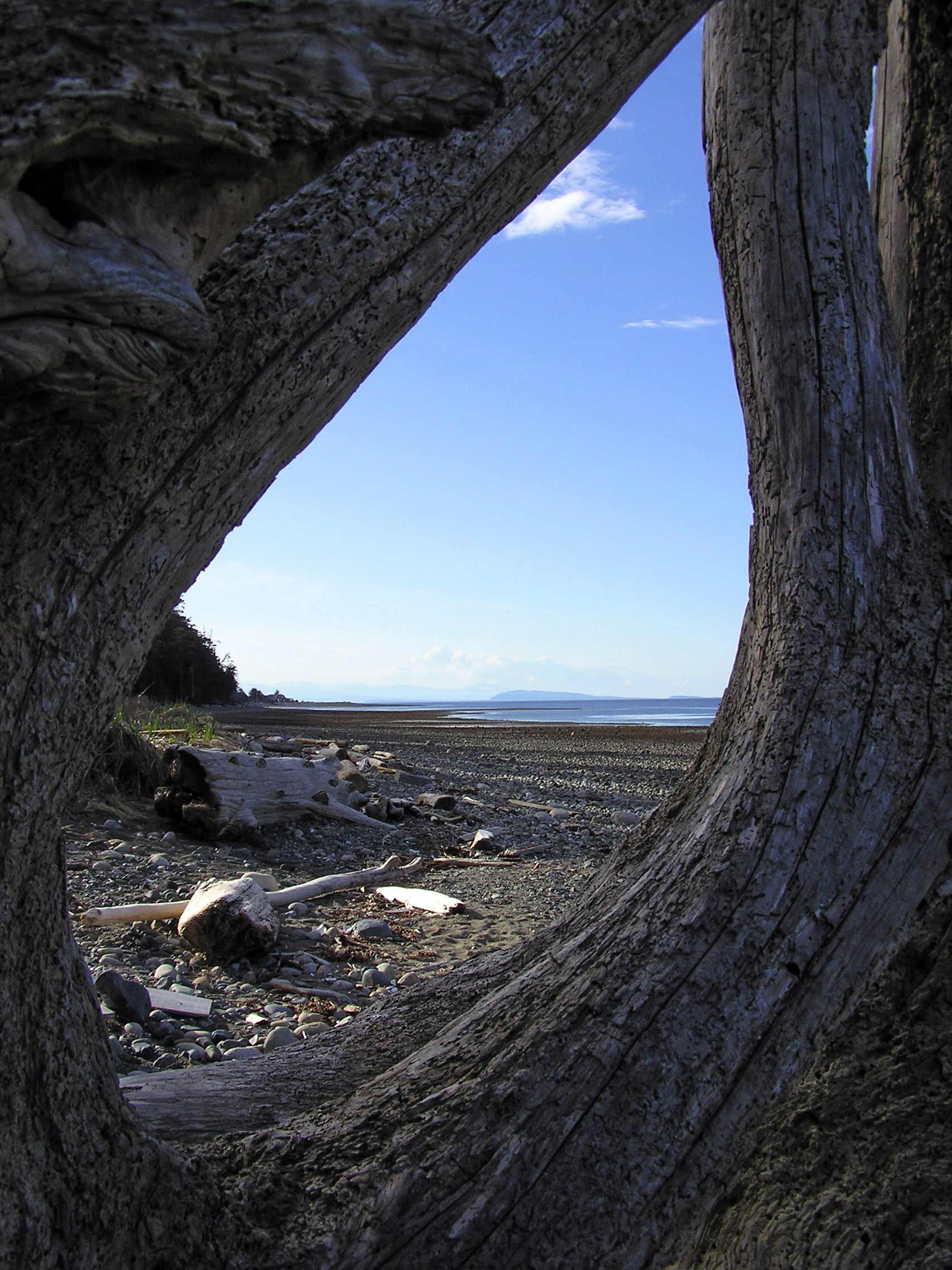
A view of a sandy and rocky beach shoreline on Vancouver Island, seen through the hollow trunk of a large piece of driftwood.
A framed view of the Rathtrevor Beach shoreline, characterized by expansive tidal flats and weathered driftwood.

Rathtrevor Beach Provincial Park wildlife and species highlights

The wildlife of Rathtrevor Beach reflects the park's position at the edge of the Strait of Georgia and within a coastal forest fragment. Most famously, the park is a major spring stopover for brant geese, which use the exposed sand and tidal flats as a staging area between roughly 1 March and 15 April each year. The geese feed on eelgrass and other intertidal resources before continuing their migration north, and their presence is one of the park's signature wildlife events.

During the same spring migration period, a wider variety of birds pass through and around the park, taking advantage of the shoreline habitat. The intertidal zone and adjacent forest edges attract typical shorebirds, waterfowl, and songbirds of the Georgia Strait coast. Wildlife viewing is a major reason visitors come to the park outside the main summer beach season.

The forested portions of the park host the mammals familiar from coastal Vancouver Island: black-tailed deer, raccoons, mink, and squirrels are regularly observed, with otters recorded along the waterfront. While the park is compact, the mix of beach, forest, and shoreline produces a noticeably varied animal presence for such a small protected area.
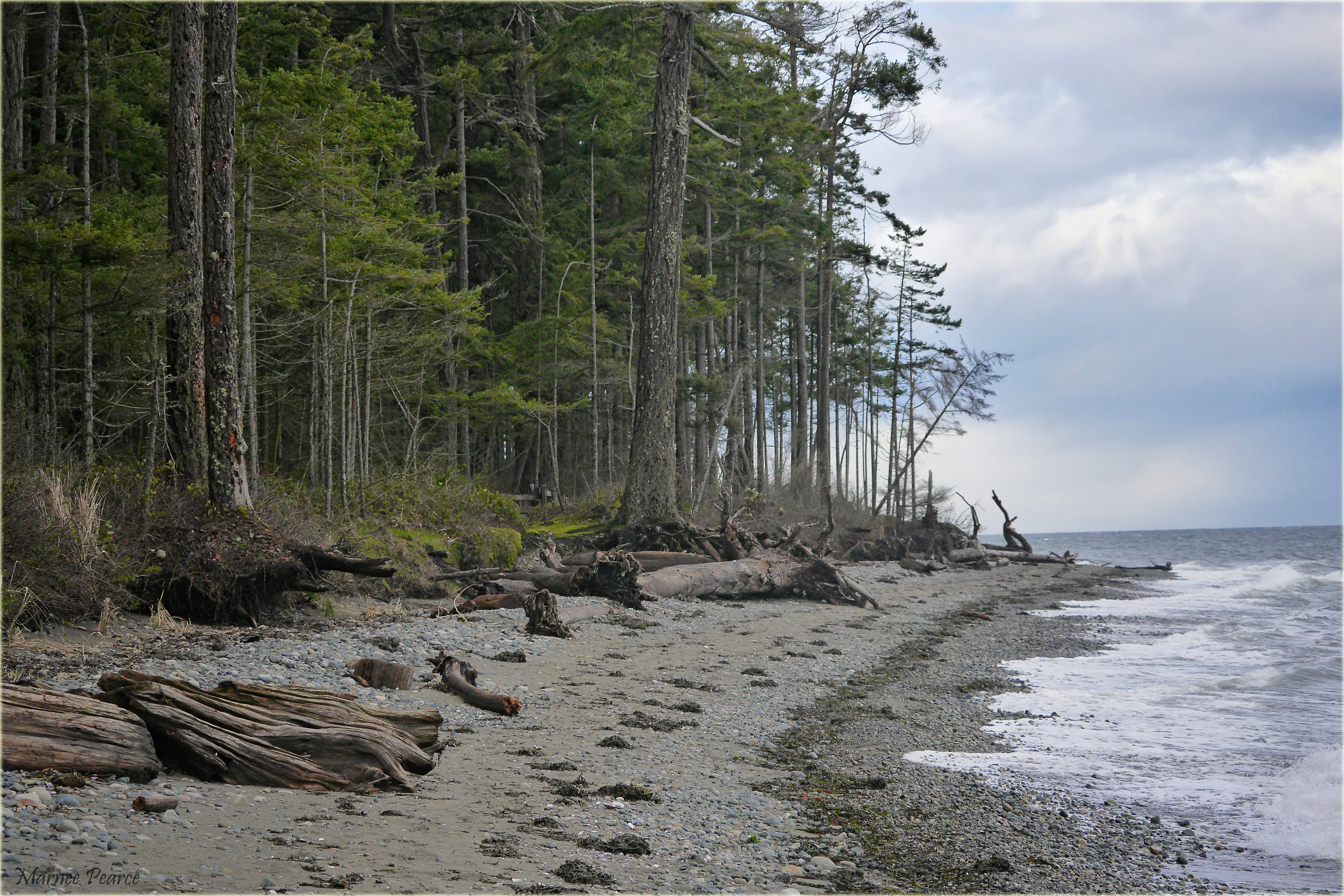
A shoreline with dark, pebbled sand and driftwood leading to a dense forest of tall, mature trees under a cloudy sky.
The forested coastline of Rathtrevor Beach Provincial Park, featuring a rocky beach and mature trees.

Rathtrevor Beach Provincial Park conservation status and protection priorities

As a Class II protected area within the BC Parks system, Rathtrevor Beach Provincial Park plays an outsize conservation role for the eastern coast of Vancouver Island. The most important contribution is the preservation of a stand of old-growth Douglas fir within an otherwise heavily developed coastal corridor. Such stands have become vanishingly rare in this region, and the Rathtrevor forest provides both a refuge for old-growth dependent species and a reference point for what the original coastal forest looked like.

The park also protects a substantial stretch of natural shoreline and intertidal habitat along the Strait of Georgia. Sandy beaches and tidal flats on this coast have been progressively altered by resort, residential, and marina development, and retaining an undeveloped two-kilometre reach with its associated flats is meaningful for migratory shorebirds and coastal waterfowl. The brant goose staging area is among the most significant seasonal wildlife values the park protects.

Beyond ecological values, Rathtrevor Beach contributes to public conservation education. The on-site nature house operates seasonal environmental programs for school groups and the general public, using the park's combination of beach, forest, and migratory wildlife as a teaching landscape. Together, old-growth forest, shoreline habitat, and interpretive programming make the park a small but conservation-rich protected area.

Rathtrevor Beach Provincial Park cultural meaning and human context

The cultural identity of Rathtrevor Beach is closely tied to Parksville and the broader Parksville Qualicum beach tourism tradition that has shaped Vancouver Island's east coast since the twentieth century. Long before the park existed, the area's broad sandy beach and gentle tide made it a popular summer destination, a role the provincial park has both inherited and formalized. The old private campground run by the Rath family, whose name still defines the park, was an early expression of that regional beach culture.

The park also carries an unusual place in British Columbia's conservation history because of the politically charged land swap that created it. The exchange of Rathtrevor Beach land for timber rights inside Wells Gray Provincial Park became a well-known case study in how park policy, industrial logging, and provincial politics intersected in the 1960s, and it is referenced in the broader narrative of the struggle to protect Wells Gray. That history gives the park a cultural weight beyond its size, linking a small coastal campground to one of the province's signature interior parks.
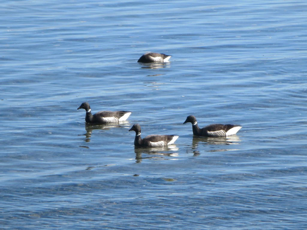
Four Brant geese floating on calm blue water.
A small group of Brant geese swimming in the water at Rathtrevor Beach.

Top sights and standout views in Rathtrevor Beach Provincial Park

Rathtrevor Beach Provincial Park's standout qualities are its long, sweeping sandy beach along the Strait of Georgia and the unexpected presence of old-growth Douglas fir forest directly behind it, a combination unusual on Vancouver Island's developed east coast. The tidal flats and shoreline host the park's other major highlight: a major spring staging area for migrating brant geese between early March and mid April.

Rounding out the park's profile are a heavily used BC Parks campground, easy access from Highway 19, and an on-site nature house that runs seasonal environmental education programs for visitors and school groups. Together these features make Rathtrevor Beach a compact park with an unusually rich mix of beach scenery, old-growth forest, migratory wildlife, and public programming.

Best time to visit Rathtrevor Beach Provincial Park

Rathtrevor Beach Provincial Park is genuinely a year-round destination, and the character of a visit shifts meaningfully with the seasons. The summer months of June, July, and August bring the warmest beach conditions and the busiest atmosphere, drawing large numbers of campers, swimmers, and families; this is also when the campground is at its liveliest and advance reservations are most important.

Spring, particularly from early March through mid April, is the prime time for visitors interested in wildlife rather than swimming. This is the window when brant geese stage on the tidal flats and a wide range of migratory birds move through the park, while the forest still carries the cool, fresh feel of the wet season. Autumn and winter visits are quieter, the beach is largely empty, and storms drive logs and driftwood high onto the sand, giving the park a more contemplative, storm-washed character for those who prefer solitude over crowds.
Monthly climate preview

Track monthly temperature variations and precipitation averages across the year.

Rathtrevor Beach Provincial Park Climate Normals and Temperature Rhythms

Long-term data records illustrate measured temperature and precipitation distributions across a representative coordinate at Rathtrevor Beach Provincial Park. Reviewing the complete twelve-month climatology profile provides deeper analytical context for annual environmental patterns.
Annual mean10 °C
4 °C18 °C
Jan
Feb
Mar
Apr
May13°
Jun15°
Jul18°
Aug18°
Sep15°
Oct10°
Nov
Dec
Warmest month
August

18.1 °C

Coolest month
December

4.2 °C

Wettest month
November

5.7 mm/day

Driest month
July

1 mm/day

Park location guide

Geography guide, regional context, and park location map for Rathtrevor Beach Provincial Park

Rathtrevor Beach Provincial Park park geography, regions, and map view in Canada

Understand where Rathtrevor Beach Provincial Park sits in Canada through a broader geographic reading of the surrounding landscape, nearby location context, and its mapped position within the national park landscape.

How Rathtrevor Beach Provincial Park fits into Canada

Canada is a federal parliamentary constitutional monarchy spanning North America from the Atlantic to the Pacific and Arctic Oceans. With a population of over 41 million, it is officially bilingual in English and French at the federal level. The country gained independence from the United Kingdom through a gradual process culminating in 1982.

Wider geography shaping Rathtrevor Beach Provincial Park in Canada

Canada occupies the northern portion of North America, sharing its longest international border with the United States. The country extends from the Atlantic Ocean to the Pacific Ocean and northward into the Arctic Ocean, giving it the longest coastline of any nation.

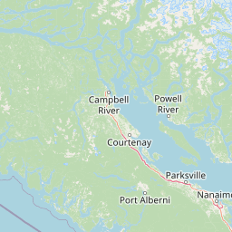
Map view of Rathtrevor Beach Provincial Park

Use this park location map to pinpoint Rathtrevor Beach Provincial Park in Canada, understand its exact geographic position, and read its mapped placement within the surrounding landscape more clearly.

Pigeon | © OpenStreetMap contributors

Location context for Rathtrevor Beach Provincial Park

British Columbia
Natural feature types

Browse the Natural Features and Geographic Landscape of Rathtrevor Beach Provincial Park

Dive into the specific landforms and natural environments defined within the boundaries of Rathtrevor Beach Provincial Park. MoriAtlas helps you map the transition from coastal tidal flats to mature forest stands through this curated geographic collection of regional landmarks.
Recorded earthquake history

Browse the Earthquake History for Rathtrevor Beach Provincial Park

Examine the historical catalogue of recorded seismic activity associated with the location of Rathtrevor Beach Provincial Park. This MoriAtlas collection offers clear access to event data, providing context for the seismic geography of this notable British Columbia coastal landscape.

Rathtrevor Beach Provincial Park Earthquake History

Catalogued events

9 events

Strongest magnitude

Magnitude 4.4

Most recent event

Dec 11, 2014

This history includes earthquakes recorded inside the park or within 50 km of its borders

Visual exploration of sandy shores, tidal flats, and old-growth forest habitats.

Rathtrevor Beach Provincial Park Photos and Coastal Landscape Scenery

Visual records capture the sweeping intertidal flats and mature Douglas fir forests defining Rathtrevor Beach Provincial Park. Detailed photography reveals the sharp ecological transition between open marine waters and protected coastal woodland.

A wide angle view of a long, stony, and sandy beach on a sunny day. Driftwood logs lie along the shore in the foreground, with a dense forest line on the left and the calm ocean stretching toward a distant horizon on the right.

A wide, high-angle view looking over a broad expanse of sandy tidal flats at low tide, with distant mountains across the water under a clear blue sky.

A wide angle view of a coastal beach at low tide, with exposed sandy and mossy terrain, a solitary tree on the left, and mountains visible across the water under a clear blue sky.

A view of a sandy and rocky beach shoreline on Vancouver Island, seen through the hollow trunk of a large piece of driftwood.

A shoreline with dark, pebbled sand and driftwood leading to a dense forest of tall, mature trees under a cloudy sky.

A close view of a pebbled beach shoreline meeting the edge of a coniferous forest, with a piece of driftwood resting in the grass.

Four Brant geese floating on calm blue water.

Park atlas

Compare surrounding coastal landscapes, marine shores, and old growth forest reserves.

Other Parks Near Rathtrevor Beach Provincial Park and Regional Protected Areas

Explore protected areas near Rathtrevor Beach Provincial Park to compare regional coastal terrain and forest reserves. Extending your geographic search helps connect individual shoreline habitats with broader provincial park networks.
Watercolor painting of a waterfall surrounded by lush green trees and forest.
State or regional parkBritish Columbia
8.6 km away#1 closest

Southwest

Englishman River Falls Provincial Park: Regional Geography and Protected Area Overview

Vancouver Island river canyon and coastal forest terrain

Englishman River Falls Provincial Park protects a concentrated area of canyon scenery and old-growth forest on the eastern side of Vancouver Island. The landscape is characterized by the dramatic steps of the Englishman River, deep plunge pools, and mature cedar and hemlock stands. This geography provides an essential look at the coastal rainforest ecosystems and river-fed topography that define the recreational corridors of British Columbia.

Area
0.97 km²
IUCN
II
Relief
Upland
Access
Easy access
Watercolor painting of a tranquil body of water with gentle hills in the background and a cluster of trees on the right shore.
State or regional parkBritish Columbia
18 km away#2 closest

North

Jedediah Island Marine Provincial Park: Coastal Terrain and Regional Protected Area Map

Mapping island boundaries and sheltered maritime ecosystems

Jedediah Island Marine Provincial Park offers a unique study in coastal geography, featuring a complex shoreline of pebble beaches and indented bays. Located within the Strait of Georgia, the park serves as a protected landmass that blends maritime forest ecosystems with open water corridors. Its boat-only access ensures the landscape remains a quiet, preserved example of Gulf Islands terrain.

Area
6.03 km²
Established
1995
IUCN
II
Relief
Lowland
A soft watercolor illustration depicting a winding river flowing through a lush green valley with coniferous forests on the hillsides and mountains in the background.
State or regional parkBritish Columbia
19 km away#3 closest

West

Little Qualicum Falls Provincial Park: Regional Protected Landscape and Atlas Geography

River canyon and mountain lake habitat in British Columbia

Explore the structured geography of Little Qualicum Falls Provincial Park, a protected area characterized by its sequence of dramatic river cascades and old-growth Douglas Fir stands. This entry maps the park's key natural features, including the Cameron Lake shoreline and the rugged canyon terrain of the Little Qualicum River.

Area
4.4 km²
Established
1940
IUCN
II
Relief
Mountain
A horizontal watercolor illustration featuring a wooden boardwalk winding through a calm, light-filled landscape with soft green trees, grassy foreground, and rolling hills in the distance.
State or regional parkBritish Columbia
About 28 km away#4 closest

West

MacMillan Provincial Park: Mapped Geography and Protected Forest Landscapes

Vancouver Island, British Columbia

Examine the mapped footprint of MacMillan Provincial Park, home to iconic old-growth Douglas fir trees and the Cameron River delta. This protected area serves as a biogeoclimatic transition zone, showcasing the rich, moisture-retentive coastal forest environment that defines this specific section of Vancouver Island.

Area
3.01 km²
Established
1947
IUCN
III
Visitors
543.7K annual
A minimalist watercolor illustration showing rolling hills in the background and soft foliage in the foreground on a white background.
State or regional parkBritish Columbia
About 30 km away#5 closest

Southeast

Petroglyph Provincial Park: Protected Indigenous Heritage and Coastal Geography

Cultural landscape and bedrock carvings in British Columbia

Petroglyph Provincial Park preserves a remarkable concentration of ancient carvings etched into the sandstone bedrock of the Nanaimo River estuary. This protected area on Vancouver Island provides a rare look at how Indigenous traditions integrated with powerful natural features, offering a unique geographic context for studying historical rock art in the Pacific Northwest.

Area
0.02 km²
Established
1948
IUCN
III
Relief
Lowland
State or regional parkBritish Columbia
About 35 km away#6 closest

West

Horne Lake Caves Provincial Park: Mapped Protected Landscapes and Cave Networks

Vancouver Island protected area and karst geography

Horne Lake Caves Provincial Park protects a distinct array of limestone cave systems, including Main, Riverbend, and Euclataws caves. The area bridges underground geological formations with surface-level river recreation along the Qualicum River, providing a comprehensive look at the karst and forested terrain of central-eastern Vancouver Island.

Area
1.58 km²
Established
1971
IUCN
II
Relief
Upland
A watercolor painting showing a horizontal landscape with a green forest in the foreground and soft pink, layered rolling hills in the background.
State or regional parkBritish Columbia
37 km away#7 closest

Southeast

Morden Colliery Historic Provincial Park: Heritage Infrastructure and Regional Coal Mining History

Industrial landscape and historic rail corridor in British Columbia

Located near Nanaimo, this heritage site preserves the substantial concrete remains of the Morden Colliery. The park serves as a physical archive of southern Vancouver Island industrial life, contrasting engineering landmarks with local forest environments and interpretive trails along former coal railway alignments.

Area
0.04 km²
Established
1972
Relief
Lowland
Scope
Terrestrial
State or regional parkBritish Columbia
About 58 km away#8 closest

East

Plumper Cove Marine Provincial Park: Protected Marine Geography and Coastal Landscapes in Howe Sound

Exploring the forested trails and sheltered marine anchorages of Keats Island.

Plumper Cove Marine Provincial Park represents a vital protected landscape on the coast of British Columbia, defined by its blend of upland coastal forest and intimate, boat-accessed marine anchorages. This geography-focused profile traces the park's terrain, including its rocky shorelines, forest-covered bluffs, and the trail networks that connect visitors to the broader Howe Sound maritime environment.

Area
0.66 km²
Established
1960
IUCN
II
Relief
Upland

Common questions about visiting, size, designation, and location context for Rathtrevor Beach Provincial Park

Rathtrevor Beach Provincial Park FAQs for park facts, access, geography, and protected area context

Find quick answers about Rathtrevor Beach Provincial Park, including protected-area facts, park geography, trail and visitor context, and how the park fits into its surrounding country and regional landscape.
MoriAtlas Explorer

Continue Your Protected Areas Search Across the Global Atlas

Deepen your exploration by continuing the structured search for national parks and protected areas worldwide. Utilize the comprehensive filtering capabilities to compare different conservation landscapes and refine your understanding of global park geography. Discover more about the distribution and characteristics of protected natural areas.

Global natural geography