
Mori Atlas logo
Nature reserveRéserve naturelle géologique de Haute-Provence

Mapping deep time across the limestone cliffs and fossil-bearing strata of the French Pre-Alps

Réserve naturelle géologique de Haute-Provence: A Comprehensive Geological Protected Area Atlas

(Réserve naturelle nationale géologique de Haute-Provence)

The Réserve naturelle géologique de Haute-Provence stands as a premier protected area in France, safeguarding extensive fossil-rich outcrops and dramatic tectonic formations across the Verdon and Durance valleys. Spanning 18 distinct sites, the protected territory reveals 300 million years of Earth history through tilted limestone layers, eroded badlands, and renowned fossil pavements. This atlas provides a detailed view of the terrain and scientific significance defining this unique geological preserve.

geological reservegeoparkfossil sitesammonite fossilsichthyosaurPre-Alps
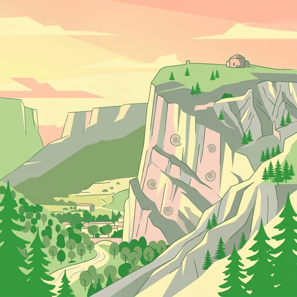
A stylized digital illustration of a mountainous valley with steep, light-colored limestone cliffs featuring large spiraled ammonite fossils embedded in the rock face, with a small structure on the plateau above and a forested valley floor below.

Réserve naturelle géologique de Haute-Provence

Nature reserve

Park overview

Structured park overview, official facts, and landscape profile for Haute-Provence Geological Nature Reserve

Haute-Provence Geological Nature Reserve park facts, protected area profile, and essential visitor context

Review the core facts for Haute-Provence Geological Nature Reserve, including designation, size, terrain, visitor scale, habitats, and operating context in one park-focused overview.

About Haute-Provence Geological Nature Reserve

The Haute-Provence Geological Nature Reserve is a decentralized network of protected sites rather than a single contiguous block. Its 18 component sites are distributed across mountainous terrain in the Alpes-de-Haute-Provence and Var, between the deep valleys of the Verdon and the Durance. Each site has been chosen because its rock record is exceptionally rich in fossils, mineral structures, or surface features that illustrate key stages of Alpine geological history, from ancient sea floors and tropical lagoons to more recent tectonic upheaval.

Geologically, the reserve lies in the Pre-Alps, where sedimentary layers from the Jurassic and later periods have been folded, fractured, and uplifted by the ongoing collision of Africa and Europe. This deformation has exposed long sequences of marine sediments at the surface, allowing visitors to walk directly through rock strata that were once buried beneath deep oceans. Landscapes shaped by this geology include dramatic badlands, jagged ridges, and tilted limestone pavements, particularly around Digne-les-Bains and Castellane.

The reserve's protection covers not only the core fossil sites but also a much larger surrounding perimeter across 59 communes, where fossil extraction and collection are strictly regulated. Together, the reserve and its perimeter form a regional geological laboratory that supports scientific research, educational programming, and geotourism. As a UNESCO Global Geopark and founding member of the European Geoparks Network, the reserve plays an international role in the conservation and promotion of geological heritage.

Through museums in Digne-les-Bains, Sisteron, and Castellane, along with marked discovery trails in the field, the reserve offers an unusually direct connection between public audiences and deep-time natural history, while maintaining strict protections against unauthorized fossil collection within its boundaries.

Quick facts and research context for Haute-Provence Geological Nature Reserve

The Haute-Provence Geological Nature Reserve was created by decree on 31 October 1984 and is classified as a national nature reserve with IUCN Category III protection. It is administered by the Conseil général des Alpes-de-Haute-Provence and covers 18 separate sites across the Alpes-de-Haute-Provence and Var departments, with a core area of approximately 269 hectares and a broader protection perimeter of more than 2,300 square kilometers spanning 59 communes.

The reserve is officially labeled as a UNESCO Geopark and is affiliated with both the Global Geoparks Network and the European Geoparks Network. Its territory lies between the Verdon and Durance rivers in the Pre-Alps, which makes it the largest geological reserve of its type in Europe.

Protection and recognition

Examining documented terrestrial protection parameters and official conservation records

Réserve naturelle géologique de Haute-Provence Protection Status and Designated Area Record

Réserve naturelle géologique de Haute-Provence maintains documented terrestrial protection metrics within global conservation registries. Certified database records organize the verified designation scope and associated administrative identifiers for this protected terrain.

Protection details

Protection scope
Terrestrial
Transboundary protection
No
WDPA ID
106715
Core area
2.69 km²
Park context

Deeper park guide and search-rich context for Haute-Provence Geological Nature Reserve

Haute-Provence Geological Nature Reserve history, landscape, wildlife, and travel context

Explore Haute-Provence Geological Nature Reserve through its history, landscape character, ecosystems, wildlife, conservation priorities, cultural context, and seasonal travel timing in a structured park guide built for atlas discovery and search intent.

Why Haute-Provence Geological Nature Reserve stands out

The reserve is best known worldwide for the Dalle aux Ammonites, a tilted rock surface near Digne-les-Bains that displays around 1,500 ammonites from the Early Jurassic Sinemurian stage, dominated by the species Coroniceras multicostatum. Some of the shells preserved there reach about 70 centimeters in diameter, making the slab one of the most iconic fossil exposures anywhere in the world. Beyond this landmark site, the reserve is recognized for a wide spectrum of fossil-rich outcrops, including a strikingly well-preserved Toarcian ichthyosaur from La Robine and a collection of Eocene sirenian, or sea cow, fossils housed at Castellane. Together these finds illustrate the deep marine past of what is now the French Pre-Alps.
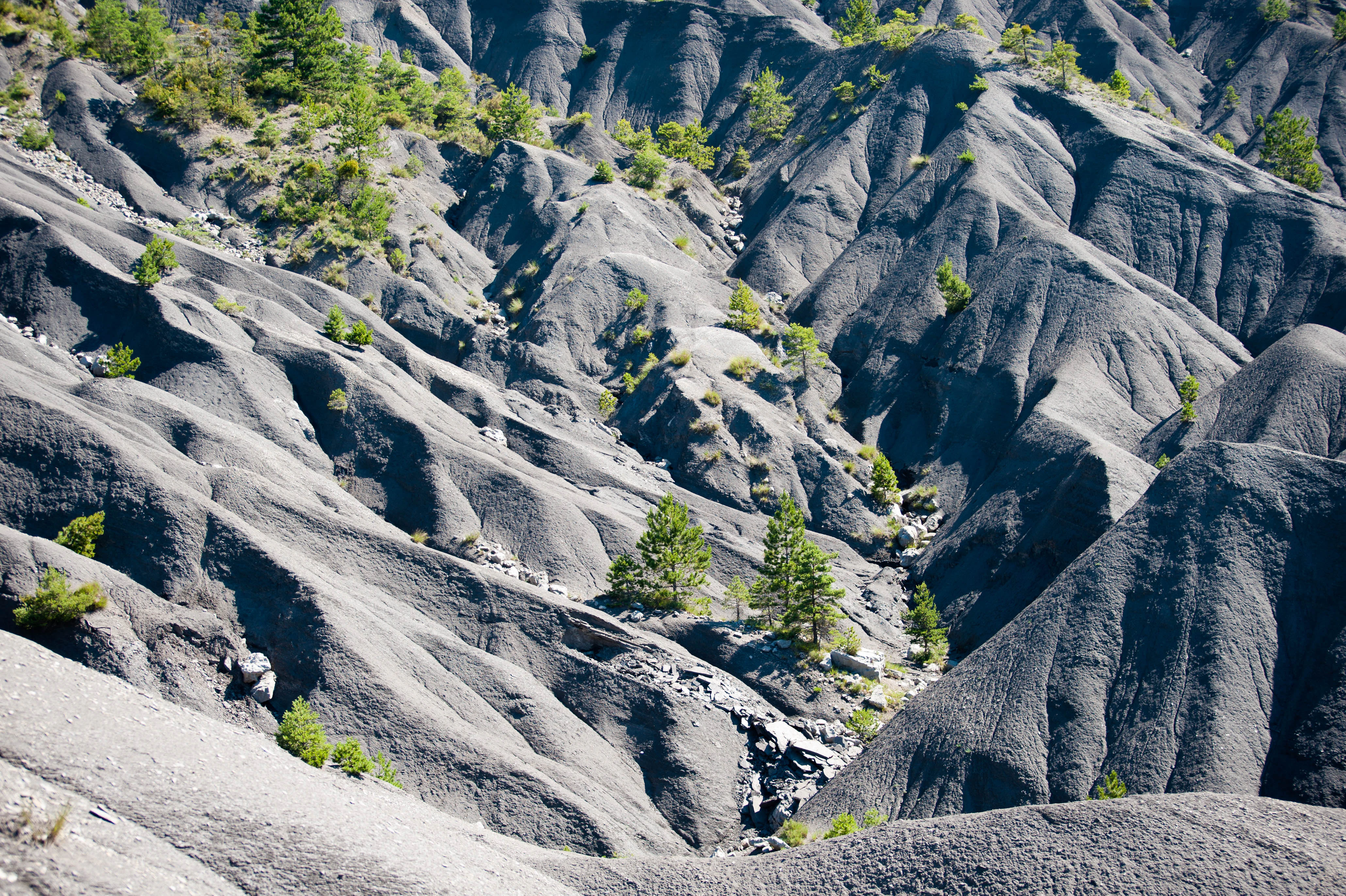
A wide angle view of steeply eroded dark gray slopes and badlands featuring sparse small green trees and shrubs.
The rugged badlands landscape of Adret de l'Escure within the Réserve naturelle géologique de Haute-Provence.

Haute-Provence Geological Nature Reserve history and protected-area timeline

The reserve was created by decree on 31 October 1984, formalizing decades of growing recognition that the fossil sites of Haute-Provence were of exceptional scientific and educational value. From its founding, it has been designed as a multi-site reserve, a structure that reflects the scattered but rich distribution of important geological exposures across the Pre-Alp landscape.

Initially, the reserve was managed by an association created under French law of 1901, the Association pour la gestion de la réserve géologique de Haute-Provence, which brought together local stakeholders around the protection and interpretation of the sites. Management has since been transferred to the Conseil général des Alpes-de-Haute-Provence, which oversees day-to-day operations, conservation measures, and public engagement.

The reserve's more recent history is closely tied to the international geopark movement. It earned the UNESCO Geopark label and became a founding member of the European Geoparks Network, integrating its local heritage protection into a broader global framework. Regulating fossil extraction, both within the core protected sites and across an extended protection perimeter, has remained a central part of its mission since the 1980s.

Haute-Provence Geological Nature Reserve landscape and geographic character

The landscape of the Haute-Provence Geological Nature Reserve reflects the structural geology of the southwestern Pre-Alps. Sedimentary layers have been compressed, folded, and broken by Alpine tectonics, producing steeply tilted strata, ridgelines, and deeply incised valleys. The reserve's territory lies between the Verdon and the Durance, two major rivers that have carved sharply contrasting valleys into the surrounding limestone and marl formations.

Around Digne-les-Bains, the terrain opens into badlands, as seen in the Adret de l'Escure, where soft, clay-rich sediments erode into gullies and bare slopes that expose underlying geological layers. At Castellane, towering limestone cliffs rise above the town, including the prominent Roc de Castellane, shaped by the same tectonic forces that lifted the ancient seafloor into mountain ridges. At Bargème, the Montagne du Brouis adds a further element of uplifted massif terrain to the reserve's topographic character.

These varied landforms are not isolated from the reserve's scientific purpose; they are themselves the object of protection. Exposed rock faces, folded pavements, and eroded slopes make geological processes visible at the surface, allowing folded and fractured layers, fossil beds, and ancient seabeds to be read directly from the surrounding terrain.
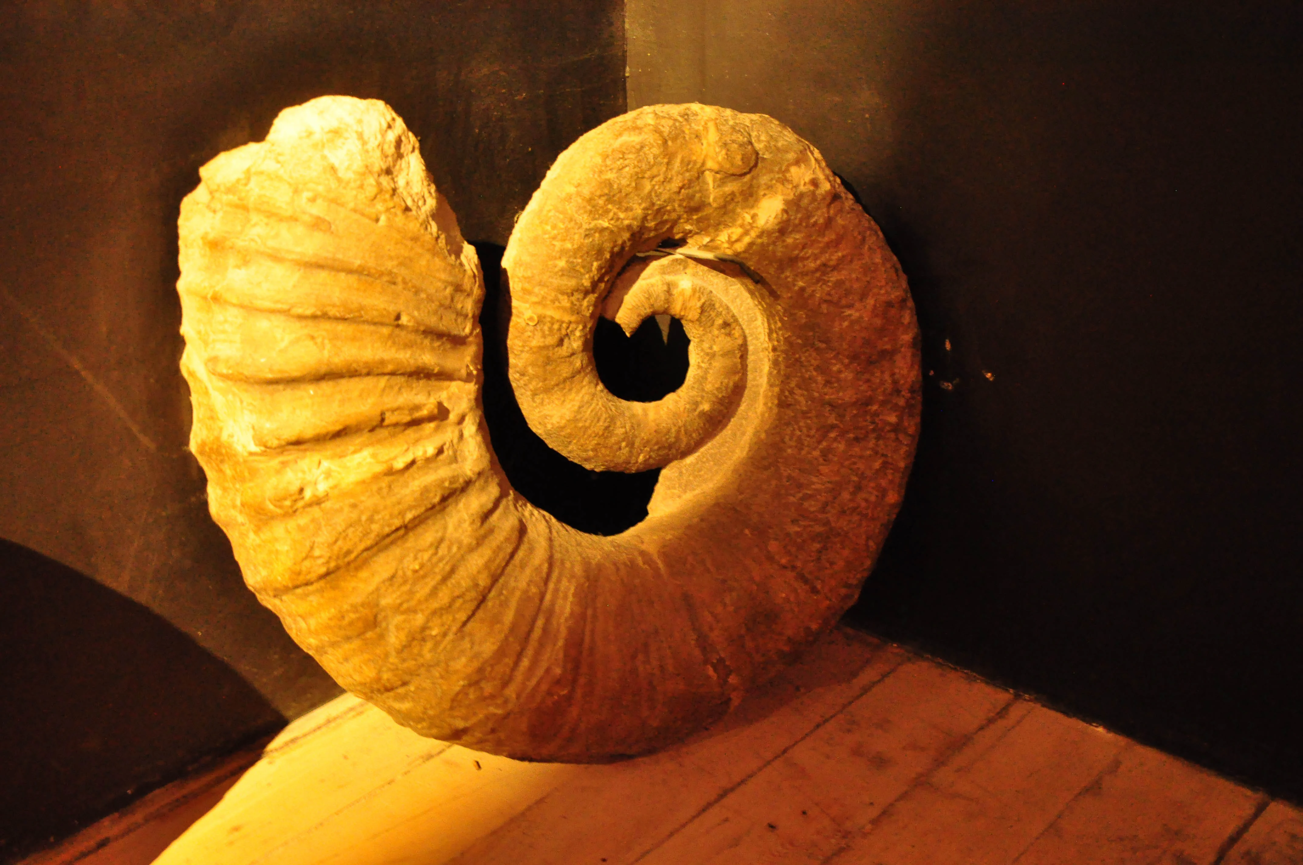
A large, spiraled ammonite fossil, labeled as Arietites bucklandi, resting on a wooden surface against a dark background.
A specimen of the ammonite Arietites bucklandi, a hallmark of the fossil collection at the Réserve naturelle géologique de Haute-Provence.

Haute-Provence Geological Nature Reserve ecosystems, habitats, and plant life

Because the Haute-Provence Geological Nature Reserve is established primarily around geological heritage rather than living ecosystems, its nature profile is dominated by abiotic features: rock outcrops, sedimentary strata, fossil deposits, and erosion patterns. The reserve documents habitats of the geological past, particularly warm shallow seas from the Jurassic and Eocene, whose faunas are preserved as fossils in sedimentary rocks that now form part of the Pre-Alpine landscape.

In ecological terms, the surrounding Pre-Alpine terrain includes Mediterranean and montane plant communities typical of the Provence hinterland, with garrigue and steppe-like vegetation on dry southern slopes and more forested cover on higher elevations. These living landscapes provide the visual backdrop for the reserve's geological sites, but the protected area itself is defined by fossil-bearing strata, structural geology, and erosional landforms rather than by biodiversity inventories.

The distinction between geological protection and ecological protection is central to the reserve's identity. Rather than managing habitats for rare species, the reserve manages rocks, exposures, and fossil localities as natural heritage in their own right, ensuring that key stages of Earth's history remain readable in the landscape for future research and education.
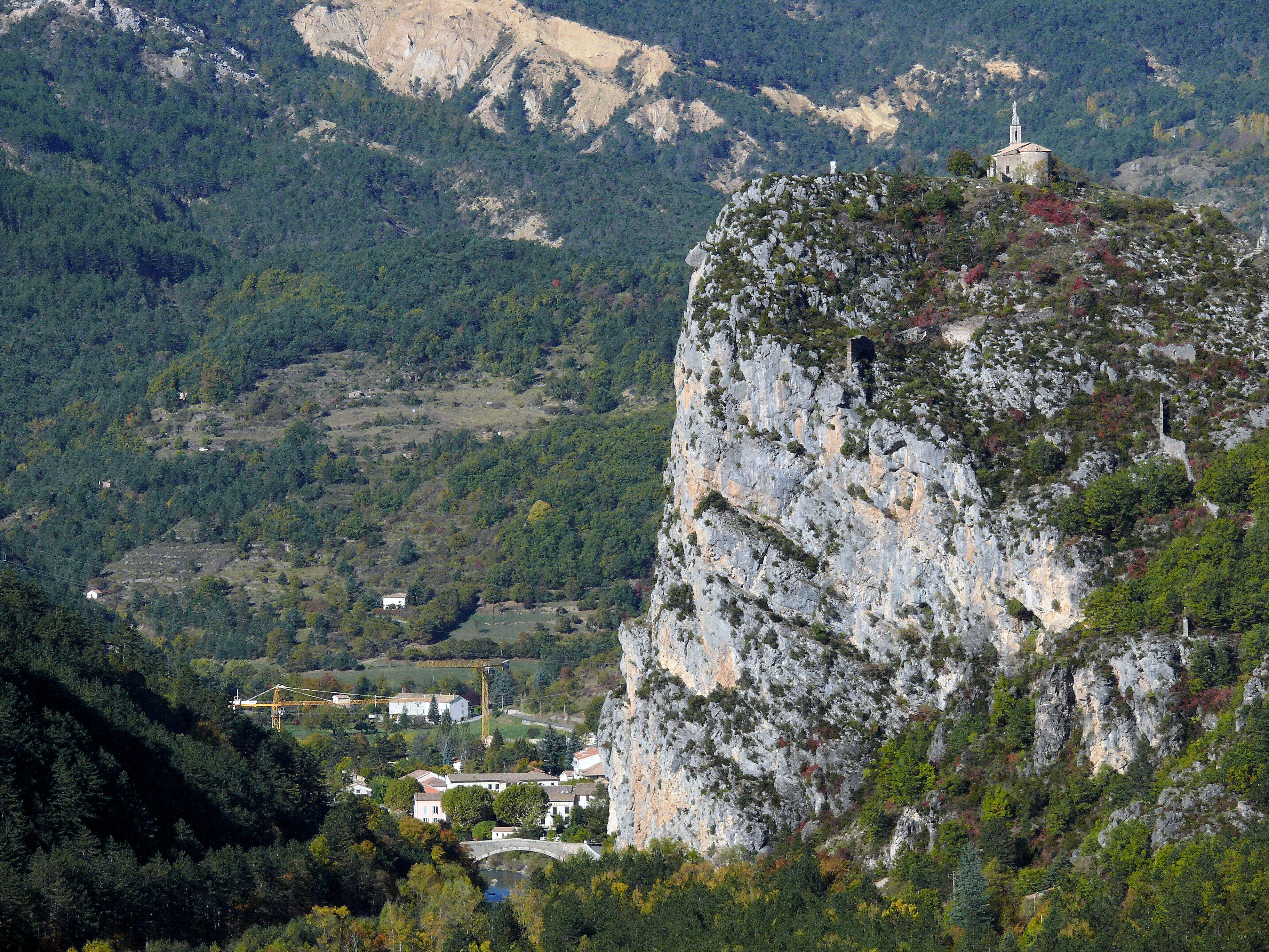
A large vertical limestone cliff, known as the Roc of Castellane, rises above a valley floor with dense green forest and a small cluster of buildings below.
The prominent limestone Roc of Castellane rising above the village and surrounding forests.

Haute-Provence Geological Nature Reserve wildlife and species highlights

The reserve is not focused on living wildlife, and its protected values are primarily paleontological and geological. Faunal interest centers on fossil species preserved in the sedimentary record, including ammonites, nautiluses, belemnites, bivalves such as pectens, the ichthyosaur of La Robine, and sirenian mammals found near Castellane. These fossils represent former marine ecosystems of the Pre-Alps rather than current fauna.

Because the reserve consists of multiple small geological sites scattered across inhabited rural and mountainous terrain, its living wildlife is essentially that of the surrounding Pre-Alpine environment. Visitors should not expect a sanctuary in the conventional sense; the reserve's 'wildlife' is overwhelmingly prehistoric, captured in stone across millions of years of marine and tectonic history.
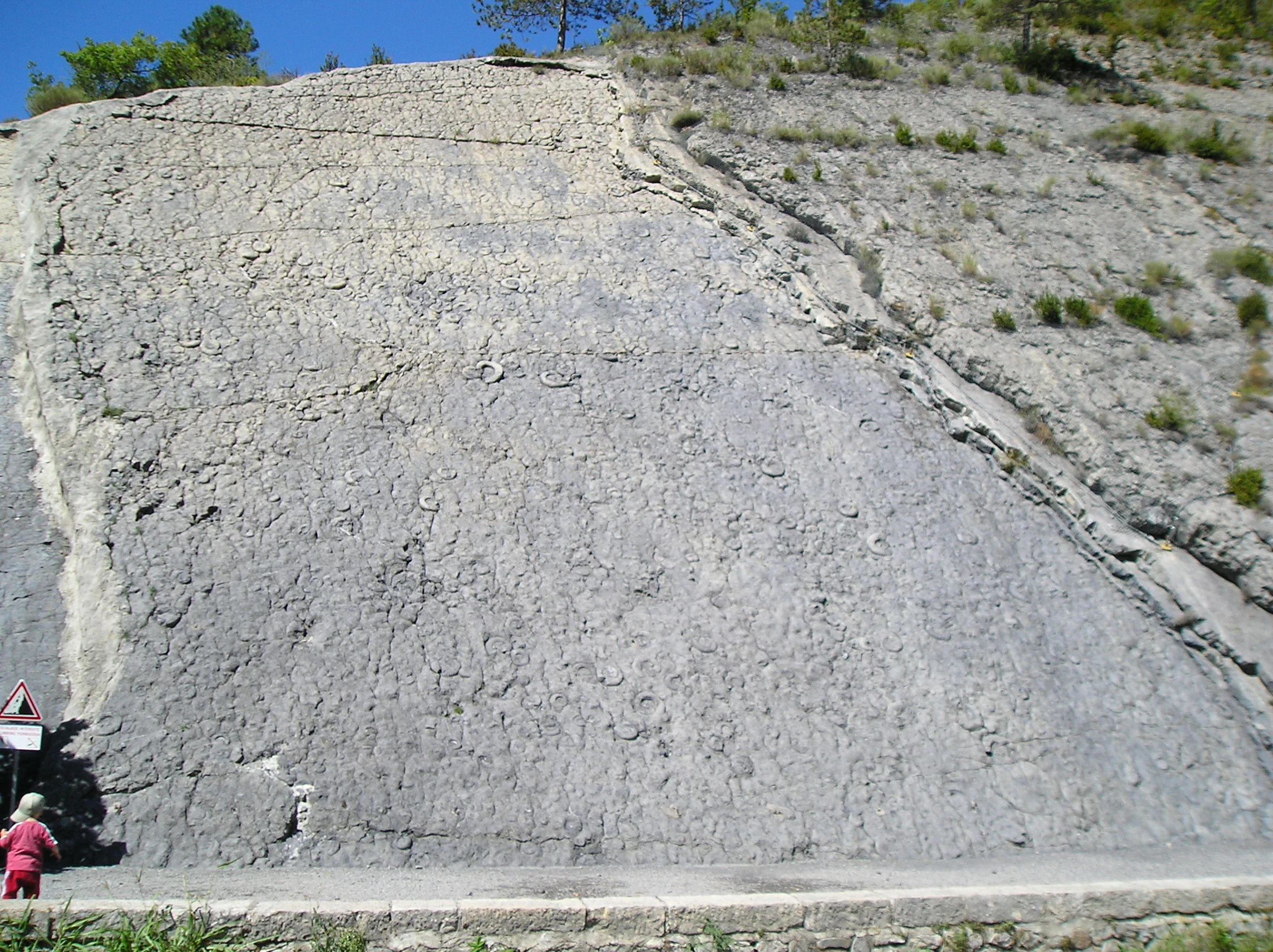
A massive, steeply tilted slab of gray limestone rock face covered in numerous fossilized ammonite imprints, with a small child standing at the bottom left for scale.
The famous Ammonite Slab, a massive limestone wall embedded with hundreds of ammonite fossils in the Haute-Provence Geological Nature Reserve.

Haute-Provence Geological Nature Reserve conservation status and protection priorities

The reserve's central conservation purpose is the protection of fossil deposits, geological outcrops, and structural features that together document major chapters of Earth history. By fragmenting its protections across 18 distinct sites rather than enclosing one continuous area, the reserve ensures that the most scientifically important exposures in the region are shielded from fossil extraction, degradation, and unauthorized collection.

A wider protection perimeter, extending across more than 2,300 square kilometers and 59 communes in the Alpes-de-Haute-Provence and Var, complements the core sites by regulating the removal of fossils across a large surrounding landscape. Within both the core reserve and the perimeter, the rules forbid digging out or collecting fossils except for very limited quantities of naturally loosened material.

Recognition as a UNESCO Global Geopark and membership in both the Global Geoparks Network and the European Geoparks Network gave the reserve an international framework for geological heritage conservation. This status positions the Haute-Provence reserve alongside other notable European geoparks and reinforces its role as a reference site for the protection, study, and public interpretation of geological heritage.

Haute-Provence Geological Nature Reserve cultural meaning and human context

The reserve is deeply tied to the cultural and scientific identity of its host region. Local museums in Digne-les-Bains, Sisteron, and Castellane have long presented the area's fossil heritage to the public, and the Maison Nature et Patrimoine in Castellane uses the sirenian fossils to link natural history with the ancient myth of the sirens, illustrating how prehistoric mammals once inspired classical storytelling.

Rural towns and villages across the reserve, including Barles, Barrême, Beynes, Clumanc, La Javie, Senez, and Tartonne, sit at the heart of traditional Provence, where generations of inhabitants have lived among striking geological exposures without always recognizing their scientific significance. The reserve has helped transform that local familiarity into a structured heritage resource.

The label of UNESCO Geopark also ties the reserve into the broader European cultural geography of geotourism, in which geological features are interpreted alongside local food, craft traditions, and rural landscapes. In this sense, the reserve is as much a cultural institution as a natural one, shaping how the Pre-Alps are presented and understood.
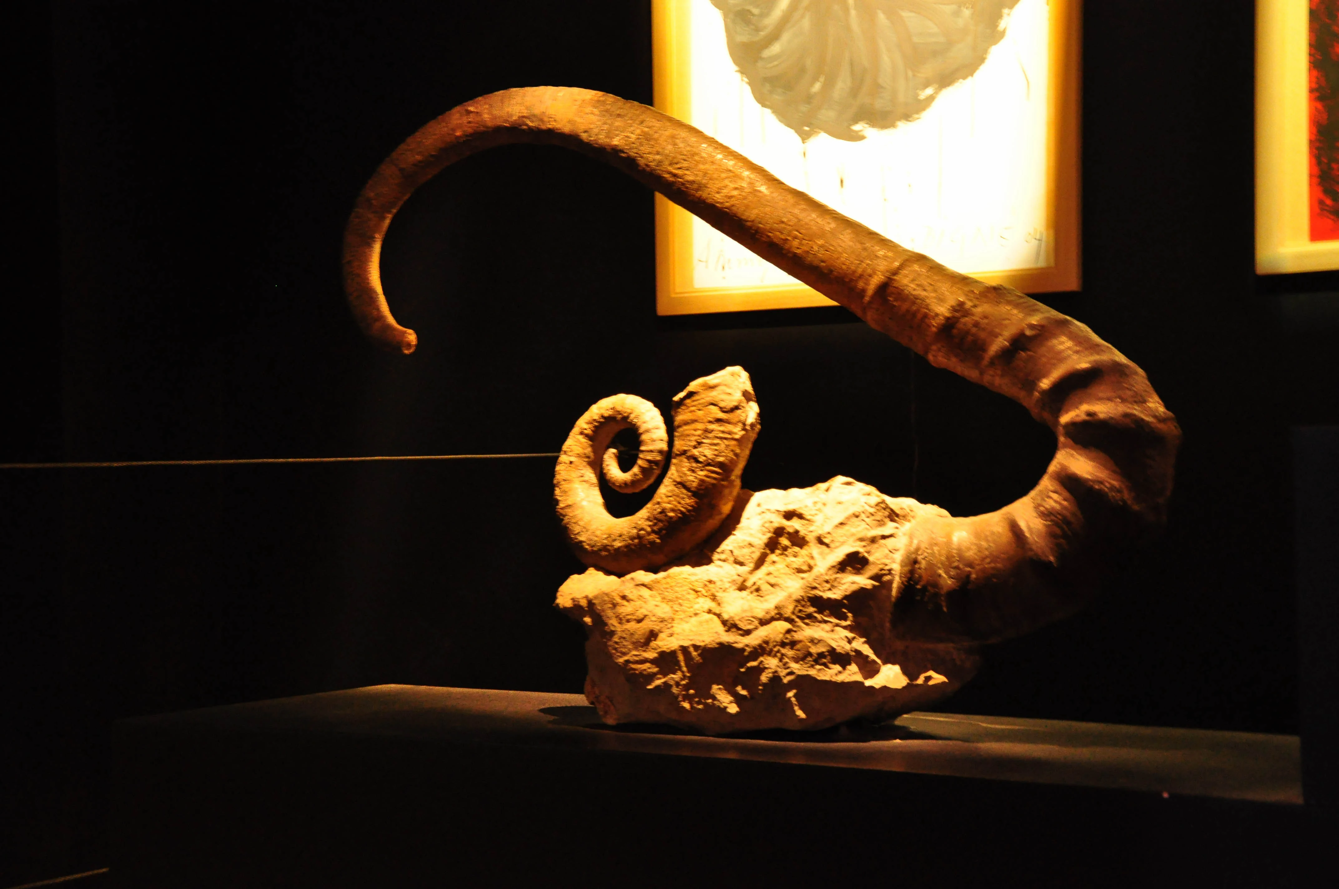
A fossilized ammonite with a coiled shell displayed on a pedestal against a dark background, lit from above.
An ammonite fossil, specifically Arietites bucklandi, on display at the Réserve naturelle géologique de Haute-Provence.

Top sights and standout views in Haute-Provence Geological Nature Reserve

The Dalle aux Ammonites near Digne-les-Bains is the single most iconic feature of the reserve: a sloping limestone pavement carrying around 1,500 Early Jurassic ammonites up to about 70 centimeters across. The La Robine ichthyosaur, preserved in exceptional detail from the Late Toarcian, offers a rare glimpse into marine reptile life in what is now the French Pre-Alps. In Castellane, the sirenian fossils connect local geology to a wider story about warm Eocene seas.

Landscapes such as the badlands of the Adret de l'Escure, the roc of Castellane, and the Montagne du Brouis at Bargème complement these fossil treasures with visually striking terrain shaped by folding, faulting, and erosion. Together, these sites form an unusually rich and varied museum of regional Earth history.
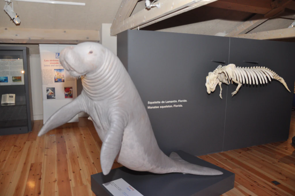
A life-sized model of a sirenian and a mounted skeleton display in a museum exhibit with light wood floors.
A sirenia model and skeleton on display at the Maison Nature et Patrimoine de Castellane, highlighting the geological heritage of Haute-Provence.

Best time to visit Haute-Provence Geological Nature Reserve

Spring and early autumn are the most comfortable times to explore the Pre-Alpine landscapes of the reserve, when temperatures are moderate and walking conditions on the marked geological trails are typically at their best. Summer can be hot in exposed sites such as the badlands around Digne-les-Bains, while higher elevations in the reserve may be difficult to access in deep winter.

Visitors interested primarily in museums and indoor fossil collections in Digne-les-Bains, Sisteron, and Castellane will find year-round access, with the field sites themselves best appreciated when weather and light allow clear views of the tilted rock surfaces and surrounding ridges. Seasonal programming by local geopark partners can further enrich any visit.


Monthly climate preview

Long-term representative temperature and monthly precipitation averages

Réserve naturelle géologique de Haute-Provence Annual Climate Normals

Representative coordinates document sustained thermal variation and monthly precipitation rhythms across the protected landscape over a thirty-year baseline period. Comprehensive monthly climate records provide deeper baseline comparisons for studying long-term environmental patterns within the protected terrain.
Annual mean10 °C
1 °C21 °C
Jan
Feb
Mar
Apr
May13°
Jun18°
Jul21°
Aug21°
Sep16°
Oct11°
Nov
Dec
Warmest month
July

21 °C

Coolest month
January

1.2 °C

Wettest month
November

3.2 mm/day

Driest month
July

0.8 mm/day

Park location guide

Geography guide, regional context, and park location map for Haute-Provence Geological Nature Reserve

Haute-Provence Geological Nature Reserve park geography, regions, and map view in France

Understand where Haute-Provence Geological Nature Reserve sits in France through a broader geographic reading of the surrounding landscape, nearby location context, and its mapped position within the national park landscape.

How Haute-Provence Geological Nature Reserve fits into France

France is a unitary semi-presidential republic and one of the world's largest economies. It borders Belgium, Luxembourg, Germany, Switzerland, Italy, Monaco, Andorra, and Spain, with a maritime border to the United Kingdom. The country is known for its cultural influence, art, cuisine, and political history spanning centuries.

Wider geography shaping Haute-Provence Geological Nature Reserve in France

France is located in Western Europe. Metropolitan France extends from the Rhine to the Atlantic Ocean and from the Mediterranean Sea to the English Channel and North Sea. The country borders Belgium, Luxembourg, Germany, Switzerland, Italy, Monaco, Andorra, Spain, and has a maritime border with the United Kingdom.

Map view of Haute-Provence Geological Nature Reserve

Use this park location map to pinpoint Haute-Provence Geological Nature Reserve in France, understand its exact geographic position, and read its mapped placement within the surrounding landscape more clearly.

Pigeon | © OpenStreetMap contributors

Location context for Haute-Provence Geological Nature Reserve

Provence-Alpes-Côte d'Azur

Visual reference of protected geological outcrops, badlands, and Pre-Alpine terrain

Réserve naturelle géologique de Haute-Provence Landscape and Scenery Photography

Examine high-resolution photography showcasing the rugged topography, limestone cliffs, and eroded badlands of Réserve naturelle géologique de Haute-Provence. Visual documentation reveals the distinct geomorphology, fossil-bearing rock exposures, and protected natural environment of the southwestern Alps.

A wide angle view of steeply eroded dark gray slopes and badlands featuring sparse small green trees and shrubs.

A close-up view of a large, spiral-shaped fossilized ammonite shell mounted on a small clear stand against a plain, light-colored wall.

A large, spiraled ammonite fossil, labeled as Arietites bucklandi, resting on a wooden surface against a dark background.

A large vertical limestone cliff, known as the Roc of Castellane, rises above a valley floor with dense green forest and a small cluster of buildings below.

A massive, steeply tilted slab of gray limestone rock face covered in numerous fossilized ammonite imprints, with a small child standing at the bottom left for scale.

A large Ichthyosaurus fossil mounted on a museum wall, with a black model of the marine reptile attached to the fossil, and two smaller ammonite fossils on pedestals nearby.

A fossilized ammonite with a coiled shell displayed on a pedestal against a dark background, lit from above.

A life-sized model of a sirenian and a mounted skeleton display in a museum exhibit with light wood floors.

A close up view of a tan, spiral-shaped fossilized ammonite shell mounted against a solid dark brown background.

Wide aerial view of the rugged, mountainous landscape of the Haute-Provence region, featuring the Montagne de Brouis with distant snow-capped peaks in the background.

Park atlas

Compare regional geography, protected landscapes, and neighboring Pre-Alpine terrain.

Other Parks and Protected Areas Near Réserve naturelle géologique de Haute-Provence

Browsing other protected areas near Réserve naturelle géologique de Haute-Provence reveals the wider geological context of the southwestern Pre-Alps. Comparing neighboring reserves helps trace regional topography, folded rock strata, and connected conservation landscapes across Provence.
Watercolor illustration of a mountainous landscape featuring a river, rolling hills, and green vegetation
National parkFrance
About 31 km away#1 closest

East

Mercantour National Park: Mapped Alpine Protected Landscape and Regional Geography

Explore France's dramatic Alps, park boundaries, and unique ecotones.

Mercantour National Park stands as a premier protected area within the French Alps, distinguished by its remarkable geographic diversity and ecological significance. This national park encompasses mountainous terrain featuring dramatic peaks, deep glacial valleys, and a unique ecotone where Mediterranean and Alpine ecosystems converge. MoriAtlas facilitates a detailed atlas-style exploration of Mercantour National Park, highlighting its mapped protected boundaries, varied natural landscapes, and its pivotal role in regional geography and conservation efforts.

Area
679 km²
Established
1979
IUCN
II
Visitors
800K annual
Nature reserveProvence-Alpes-Côte d'Azur
About 31 km away#2 closest

South

Réserve naturelle régionale de Saint-Maurin: Geological Heritage in the Verdon Gorge

Travertine formations and cave habitats in Provence

Covering 25 hectares at the mouth of the Gorges du Verdon, this regional nature reserve protects a rare set of travertine terraces and tufa caves. Its geography creates a micro-refuge for specific cave-dwelling species and cliff-nesting raptors, standing as a significant example of geological and biological preservation in the Alpes-de-Haute-Provence department.

Area
0.248 km²
Established
2009
IUCN
IV
Relief
Upland
A soft watercolor illustration depicting layered rolling hills, distant mountain silhouettes, and clusters of trees in a pale color palette.
Regional parkProvence-Alpes-Côte d'Azur
About 33 km away#3 closest

West

Parc naturel régional du Luberon: Regional Park Boundaries and Protected Landscape Atlas

Geology, mountain ridges, and Mediterranean ecosystems of Provence

Parc naturel régional du Luberon serves as a vital protected corridor in southeastern France. The park features three parallel limestone massifs, dramatic ochre formations, and fossil-rich plateaus. Its geography offers a case study in integrating sustainable land use with rich biodiversity across the Vaucluse and Alpes-de-Haute-Provence departments.

Area
1,747.26 km²
Established
1977
IUCN
V
Visitors
350K annual
A watercolor illustration showing a landscape with red rock formations, green vegetation, and a winding blue river.
Nature reserveProvence-Alpes-Côte d'Azur
About 43 km away#4 closest

East

Réserve naturelle régionale des gorges de Daluis: Red Rock Canyon and Geological Atlas

Protected canyon landscape in Provence-Alpes-Côte d'Azur

Defined by its vivid red pelite cliffs, Réserve naturelle régionale des gorges de Daluis functions as a significant protected canyon system. The terrain preserves rare mineralogy and diverse microhabitats, ranging from river-carved walls to upland slopes that support unique regional biodiversity in the Alpes-Maritimes.

Area
10.82 km²
Established
2012
IUCN
IV
Relief
Mountain
Watercolor illustration showing mountains, a winding river, and pine trees in a landscape
National parkFrance
About 60 km away#5 closest

North

Écrins National Park: Alpine Glaciated Terrain and Protected Landscape Details

Mapped boundaries and regional geography of a major French National Park.

Delve into Écrins National Park, a defining national park within the French Alps. This page provides a comprehensive overview of its protected landscape, focusing on its dramatic glaciated terrain, significant peaks such as the Barre des Écrins, and its position within the regional geographic context. Explore the mapped extent and understand the unique alpine environment of this protected area.

Area
925 km²
Established
1973
IUCN
II
Visitors
800K annual
State or regional parkAlpes-Maritimes
About 61 km away#6 closest

East

Parc naturel départemental de l'Estéron: Riverside Geography in Alpes-Maritimes

A departmental park focusing on the wild Estéron River corridor

Located in the hinterland of the Côte d'Azur, Parc naturel départemental de l'Estéron provides a protected environment focused on the Estéron river valley. Its geography encompasses sun-exposed Mediterranean hillsides and riparian zones, reflecting the intersection of mountain terrain and historic cross-border heritage in the Alpes-Maritimes department.

Area
0.2 km²
Established
2011
Scope
Terrestrial
Water
Major water bodies
Nature reserveProvence-Alpes-Côte d'Azur
About 70 km away#7 closest

West

Réserve naturelle nationale géologique du Luberon: Geological Atlas and Protected Park Sites

Mapping Cenozoic fossil sites and limestone terrains in Provence

This protected area consists of 28 scattered sites documenting life from the Cenozoic Era through fossil-rich limestone, marl basins, and ancient lake sediments. It serves as a vital reference for field research and earth sciences, featuring rare trace fossils and mammal trackways embedded within the wider Provençal countryside.

Area
3.12 km²
Established
1987
IUCN
III
A soft watercolor illustration depicting a panoramic view of rolling green hills under a pale, warm sky with distant mountains.
State or regional parkProvence-Alpes-Côte d'Azur
About 72 km away#8 closest

Southeast

Parc naturel départemental du Plan des Noves: Protected Landscapes and Regional Geography

Upland limestone plateau in the French Baous massif

Covering 904 hectares above the town of Vence, this park features a unique combination of Mediterranean woodlands, open pastoral mosaics, and historic agricultural terraces. The terrain serves as a vital ecological corridor, recognized for its birdlife and reptiles, while its elevation offers expansive vistas across the surrounding regional geography from the coast to the high mountain summits.

Area
9.04 km²
Established
1987
Relief
Upland
Scope
Terrestrial

Common questions about visiting, size, designation, and location context for Haute-Provence Geological Nature Reserve

Haute-Provence Geological Nature Reserve FAQs for park facts, access, geography, and protected area context

Find quick answers about Haute-Provence Geological Nature Reserve, including protected-area facts, park geography, trail and visitor context, and how the park fits into its surrounding country and regional landscape.
MoriAtlas Explorer

Continue Your Protected Areas Search Across the Global Atlas

Deepen your exploration by continuing the structured search for national parks and protected areas worldwide. Utilize the comprehensive filtering capabilities to compare different conservation landscapes and refine your understanding of global park geography. Discover more about the distribution and characteristics of protected natural areas.

Global natural geography