
Mori Atlas logo
Nature reserveRéserve naturelle nationale de la grotte de Hautecourt

Examining the vertical cavern systems and limestone terrain of the southern Jura Mountains.

Réserve naturelle nationale de la grotte de Hautecourt: A Protected Subterranean Landscape

The Réserve naturelle nationale de la grotte de Hautecourt represents a significant protected area within the Ain department of Auvergne-Rhône-Alpes, France. Established as the first national nature reserve in the country dedicated to cave protection, it preserves a vertical subterranean system that serves as a vital reference site for cavernicolous fauna and biological research. The surface landscape above the cave encompasses dry grasslands and limestone ridges, reflecting the distinct ecological character of the western Jura transition zone.

cave reservesubterranean faunacave biodiversitybiospeleologyJura mountainsAin department
A colorful, flat-style digital illustration showing a valley with towering mountains, a winding river, evergreen forests, and a prominent waterfall flowing down a cliff face during a soft sunset.

Réserve naturelle nationale de la grotte de Hautecourt

Nature reserve

Park overview

Structured park overview, official facts, and landscape profile for Réserve naturelle nationale de la grotte de Hautecourt

Réserve naturelle nationale de la grotte de Hautecourt park facts, protected area profile, and essential visitor context

Review the core facts for Réserve naturelle nationale de la grotte de Hautecourt, including designation, size, terrain, visitor scale, habitats, and operating context in one park-focused overview.

About Réserve naturelle nationale de la grotte de Hautecourt

The Réserve naturelle nationale de la grotte de Hautecourt occupies a distinctive place in the history of nature conservation in France. While most national nature reserves protect large tracts of terrestrial habitat, this reserve was created around a single geological and ecological feature: the Hautecourt cave, one of the underground cavities typical of the southern Jura. The site opened in 1962 as an underground biological laboratory run by the team from the University of Lyon 1, under the leadership of René Ginet, a founding figure in French biospeleology. The cave was used to study the invertebrates that have adapted their entire life cycles to the absolute darkness and stable conditions of subterranean environments.

The push for formal protection began in 1969, when the university initiated an administrative procedure to have the site classified. The process extended over more than a decade and culminated in the decree of 10 September 1980, which created the reserve as the first national nature reserve in France established specifically to protect a cave. This act set a precedent that has shaped the management of subterranean sites across the country, recognizing that cave ecosystems, despite their confined extent, host biodiversity and ecological processes of national significance.

Geographically, the reserve sits on the western flank of the southern Jura, in the commune of Hautecourt-Romanèche, in the department of Ain. The cave opens around 500 meters southwest of the summit of Mont Rosset, in a landscape shaped by limestone dissolution and by the broader configuration of the Ain river valley and its surrounding ridges. While the surface area of the reserve is compact, the cave is overwhelmingly vertical, descending to about 36 meters and extending roughly 150 meters in total development. This hidden dimension gives the site much more ecological substance than its modest surface footprint suggests.

Management of the reserve is entrusted to LPO Coordination Rhône-Alpes, an organization better known for bird conservation, whose involvement reflects the broader ecological value of the protected area beyond the cave itself. Public access to the interior of the cave is not permitted, in order to protect the fragile environment and the species that depend on it. Near the entrance, however, visitors can follow a discovery trail with interpretive panels that explain the significance of the cave, the surrounding dry grasslands, and the conservation work being carried out.

Quick facts and research context for Réserve naturelle nationale de la grotte de Hautecourt

The Réserve naturelle nationale de la grotte de Hautecourt was established on 10 September 1980 by national decree, making it the first French national nature reserve created for the protection of a cave. It lies in the western foothills of the southern Jura massif, on the commune of Hautecourt-Romanèche in the Ain department, about 80 kilometers from Lyon. The reserve covers a surface area of 10.22 hectares, which protects both the entrance of the Hautecourt cave and the surrounding landscape. Beneath this compact surface lies a vertical cave system with a total height of 36 meters and a total development of 150 meters. The site is classified under IUCN Category IV and is managed by LPO Coordination Rhône-Alpes.

Protection and recognition

Examine documented protected area records, management status, and database identifiers for this conservation landscape.

Protection Status and International Recognition for Réserve naturelle nationale de la grotte de Hautecourt

Examine verified conservation metrics, management frameworks, and official database registries associated with Réserve naturelle nationale de la grotte de Hautecourt. Reference records outline the established protection status and administrative identifiers cataloged within global protected area inventories.

Protection details

WDPA ID
15169
Park context

Deeper park guide and search-rich context for Réserve naturelle nationale de la grotte de Hautecourt

Réserve naturelle nationale de la grotte de Hautecourt history, landscape, wildlife, and travel context

Explore Réserve naturelle nationale de la grotte de Hautecourt through its history, landscape character, ecosystems, wildlife, conservation priorities, cultural context, and seasonal travel timing in a structured park guide built for atlas discovery and search intent.

Why Réserve naturelle nationale de la grotte de Hautecourt stands out

The reserve is best known as France's first national nature reserve dedicated to the protection of a cave, anchoring a broader scientific tradition of subterranean biology research that began at the site in the 1960s. Its defining feature is the Hautecourt cave itself, a predominantly vertical cavity whose modest surface footprint conceals a complex underground system hosting a rich cavernicolous fauna. The site is recognized as a type locality for the typical cave fauna association of the Jura, characterized by species such as Royerella villardi, Plusiocampa sollaudi, Trichoniscoïdes mixtus, and the springtail Pseudosinella vandeli.
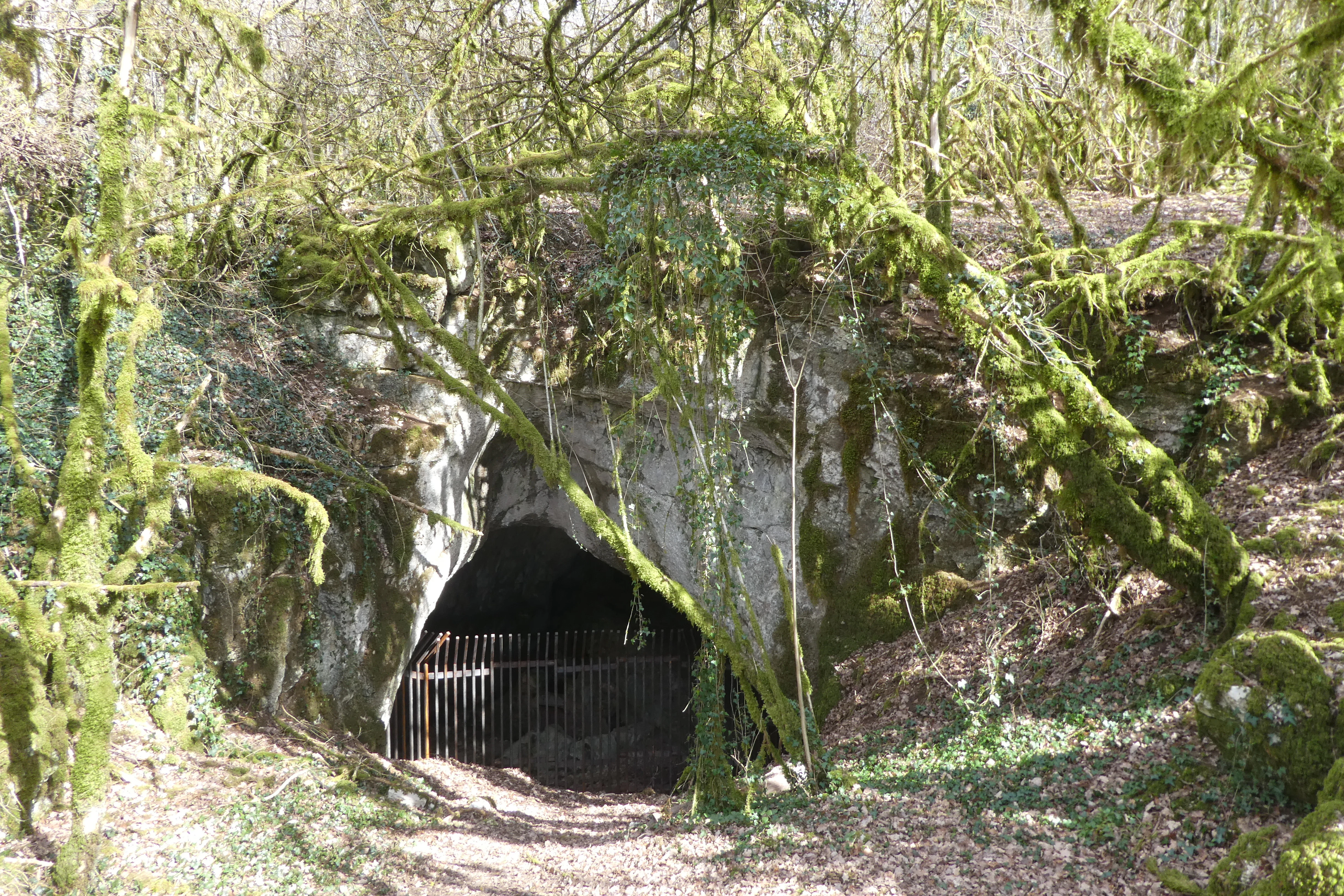
A gated cave entrance set into a limestone rock face, surrounded by trees covered in thick green moss in a woodland setting.
The entrance to the Grotte de Hautecourt nature reserve, featuring a gated cave opening surrounded by mossy forest.

Réserve naturelle nationale de la grotte de Hautecourt history and protected-area timeline

The modern history of the Hautecourt cave is closely tied to scientific research rather than to human settlement or traditional land use. In 1962, the subterranean biology team of the University of Lyon 1 established an underground laboratory inside the cave under the direction of René Ginet. At the time, the university acted as the tenant of the site and used it to study cavernicolous fauna, a field in which French researchers were then becoming international leaders.

The scientific value of the site quickly raised questions about its long-term protection. In 1969 the university began formal administrative efforts to obtain nature reserve status for the cave and its surroundings. The process proved long: it took more than a decade of procedure before the safeguard was finally achieved. On 10 September 1980, a national decree officially created the Réserve naturelle nationale de la grotte de Hautecourt, making it the first national nature reserve in France dedicated specifically to the protection of a cave. The decree remains the foundational legal instrument for the protected area, and the LPO Coordination Rhône-Alpes has since taken on its day-to-day management.

Réserve naturelle nationale de la grotte de Hautecourt landscape and geographic character

The landscape of the reserve reflects the transitional setting of the western edge of the southern Jura. The cave opens on the western flank of Mont Rosset, which separates the broad depression crossed by the commune of Hautecourt-Romanèche from the Suran valley. To the other side of this depression rise the rocky outcrops of the Crêt, which overlook the Ain river valley. The combination of limestone ridges, open depressions, and dry grasslands gives the surrounding terrain a typical southern Jura character, with abrupt relief framing expansive valley views.

Within this setting, the surface component of the reserve covers just 10.22 hectares. However, the true extent of the protected environment lies beneath the surface. The Hautecourt cave is predominantly vertical, dropping roughly 36 meters from entrance to deepest point, and stretching around 150 meters in total development. The narrow surface footprint thus masks a much more three-dimensional environment, where cave-adapted species occupy fissures, chambers, and passages that are not visible from the outside. Near the entrance, the surface includes dry grassland habitats, which form an additional ecological layer above the cave system.
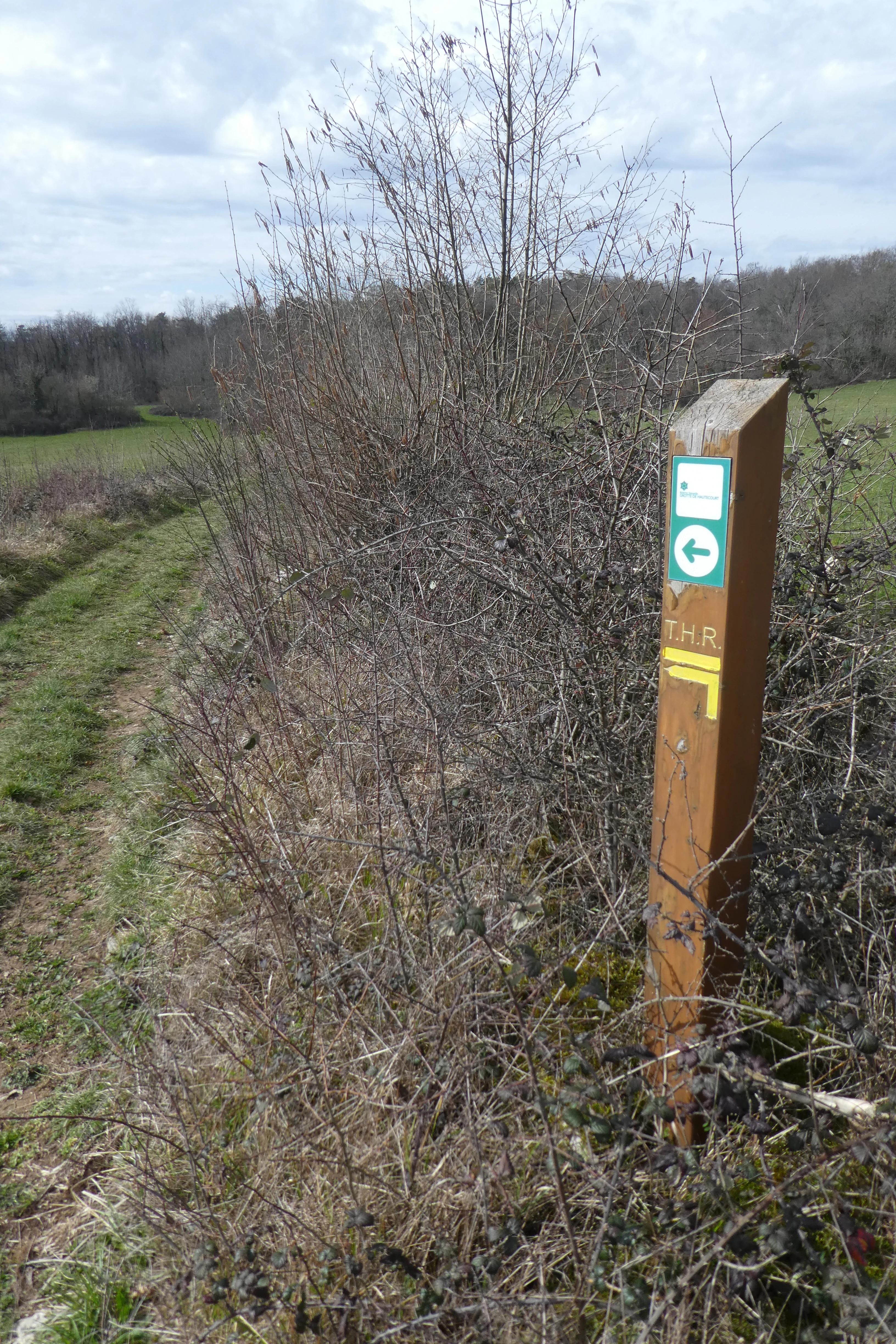
A weathered wooden trail marker post stands in a grassy field, displaying a green circular marker with a white arrow and a yellow trail marking.
A trail marker post at the Réserve naturelle nationale de la grotte de Hautecourt.

Réserve naturelle nationale de la grotte de Hautecourt ecosystems, habitats, and plant life

The nature of the reserve is dominated by the underground environment, which is the principal reason the site was protected. The cave and accompanying subterranean voids constitute the core of the protected area, with surrounding dry grasslands providing a complementary surface habitat. Together, they form a vertical mosaic of light and shade, with conditions above ground shaped by the Jura climate and conditions below characterized by the stable darkness, humidity, and temperature typical of subterranean systems.

The climate section of the source documentation is incomplete, and it is therefore difficult to describe the specific climatic profile of the reserve in detail. What is known is that cave conditions are buffered by the surrounding rock mass, producing the constant environment in which cavernicolous species complete their life cycles. The surface habitats, including the dry grasslands visible near the cave entrance, belong to the broader ecological patterns of the southern Jura and add an additional habitat dimension to the protected area.
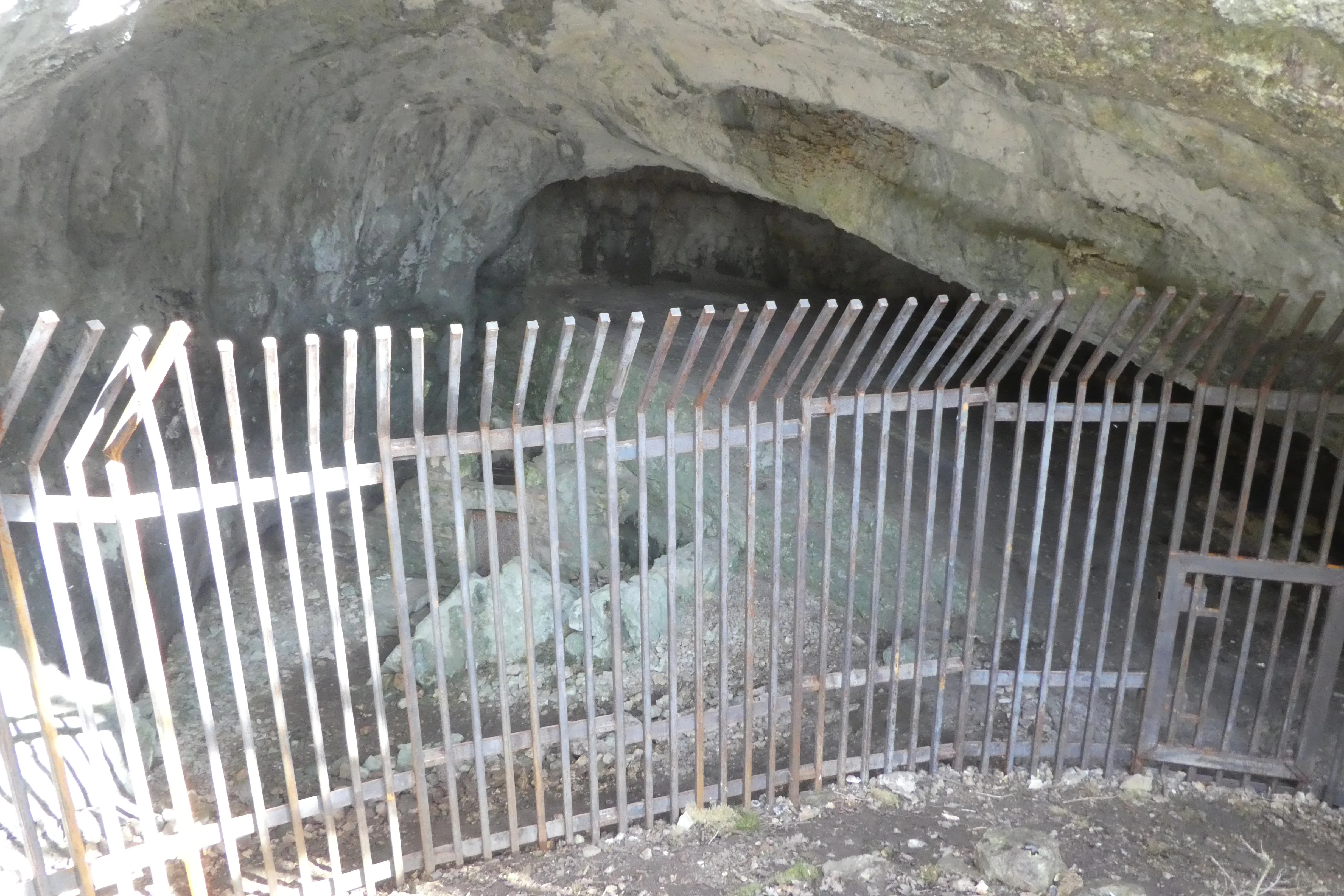
A metal security gate blocking the entrance to a cave opening in a rocky limestone hillside.
The gated entrance to the Grotte de Hautecourt nature reserve.

Réserve naturelle nationale de la grotte de Hautecourt wildlife and species highlights

Wildlife in the reserve is overwhelmingly subterranean, reflecting the site's identity as a protected cave system. The cavernicolous fauna is characterized by a set of typical adaptations to life in total darkness, including loss of pigmentation of the cuticle, atrophy or complete absence of eyes, and the disappearance of wings. These traits are diagnostic of species that spend their entire lives within cave systems and depend on the stability of these environments to survive.

The reserve's species inventory records 184 taxa, dominated by invertebrates, of which 21 species are formally protected. The documented fauna includes the cave-adapted species Royerella villardi, Plusiocampa sollaudi, Trichoniscoïdes mixtus, and the springtail Pseudosinella vandeli. Together, these species define the type of cavernicolous association characteristic of the Jura and give the site its particular scientific and conservation significance.
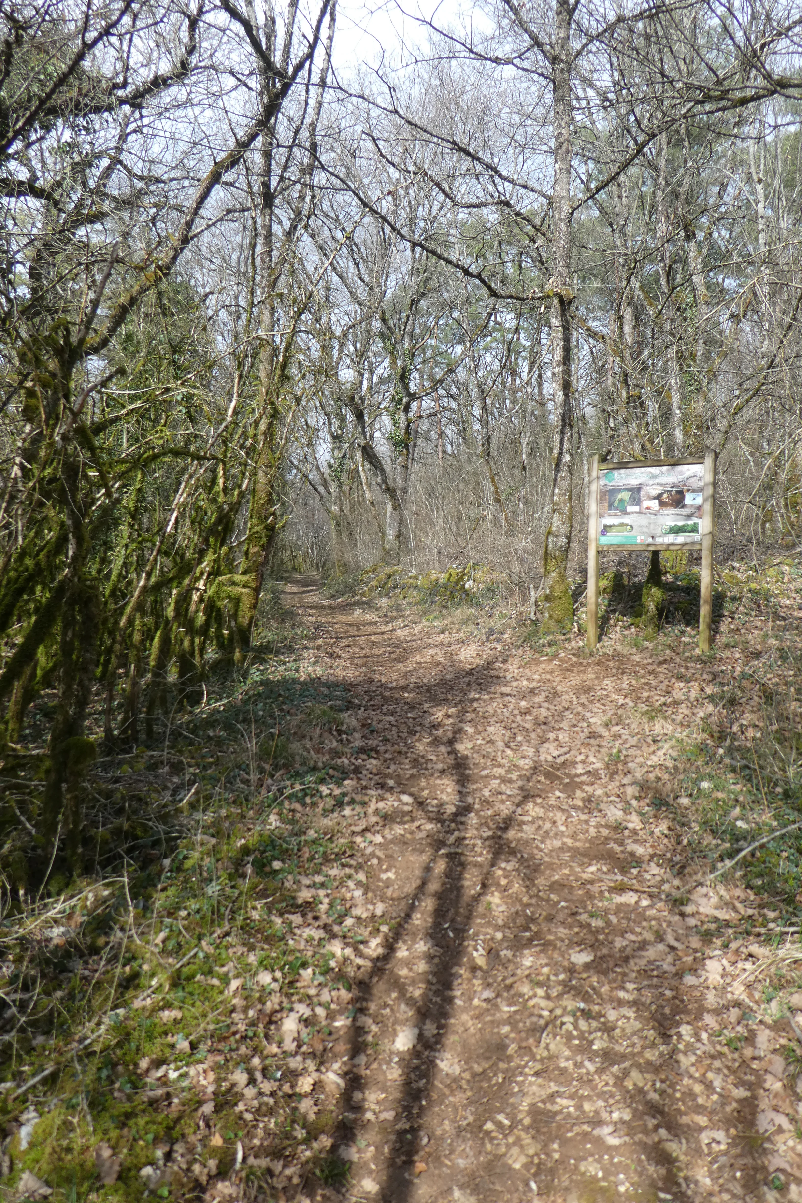
A dirt hiking trail winds through a forest of bare trees with leaf-covered ground; an informational signpost stands on the right side of the trail.
A trail leading into the forest at the Réserve naturelle nationale de la grotte de Hautecourt, featuring an informational nature reserve sign.

Réserve naturelle nationale de la grotte de Hautecourt conservation status and protection priorities

The Hautecourt reserve holds a special place in the history of conservation in France because it was established specifically to protect a cave and its associated fauna. Its creation by decree on 10 September 1980 was a milestone: it became the first national nature reserve in France created for the protection of a cave, setting a legal and institutional precedent for safeguarding subterranean ecosystems.

From a conservation perspective, the reserve protects not only the cave interior but also a small surrounding surface area, including dry grasslands and the immediate rocky terrain around the cave entrance. Restricting public access to the cave itself is a deliberate management measure designed to avoid disturbing the fragile underground environment, in which small changes in temperature, humidity, or human presence can have disproportionate effects on cave-adapted species. The fact that 21 of the 184 recorded taxa are formally protected underlines the site's relevance for biodiversity conservation, while the broader scientific history of the cave, dating back to the 1960s, gives it an additional role as a long-term reference site for biospeleology in the Jura.

Réserve naturelle nationale de la grotte de Hautecourt cultural meaning and human context

The cultural context of the reserve is closely tied to the scientific tradition of French biospeleology rather than to major human settlement or heritage sites near the cave itself. The site became significant in the 1960s when the University of Lyon 1 began using it as an underground biological laboratory and initiated the long administrative process that eventually led to its protected status. The figures associated with this work, including René Ginet, have shaped the way the cave is understood today as a place of scientific heritage as well as natural heritage.
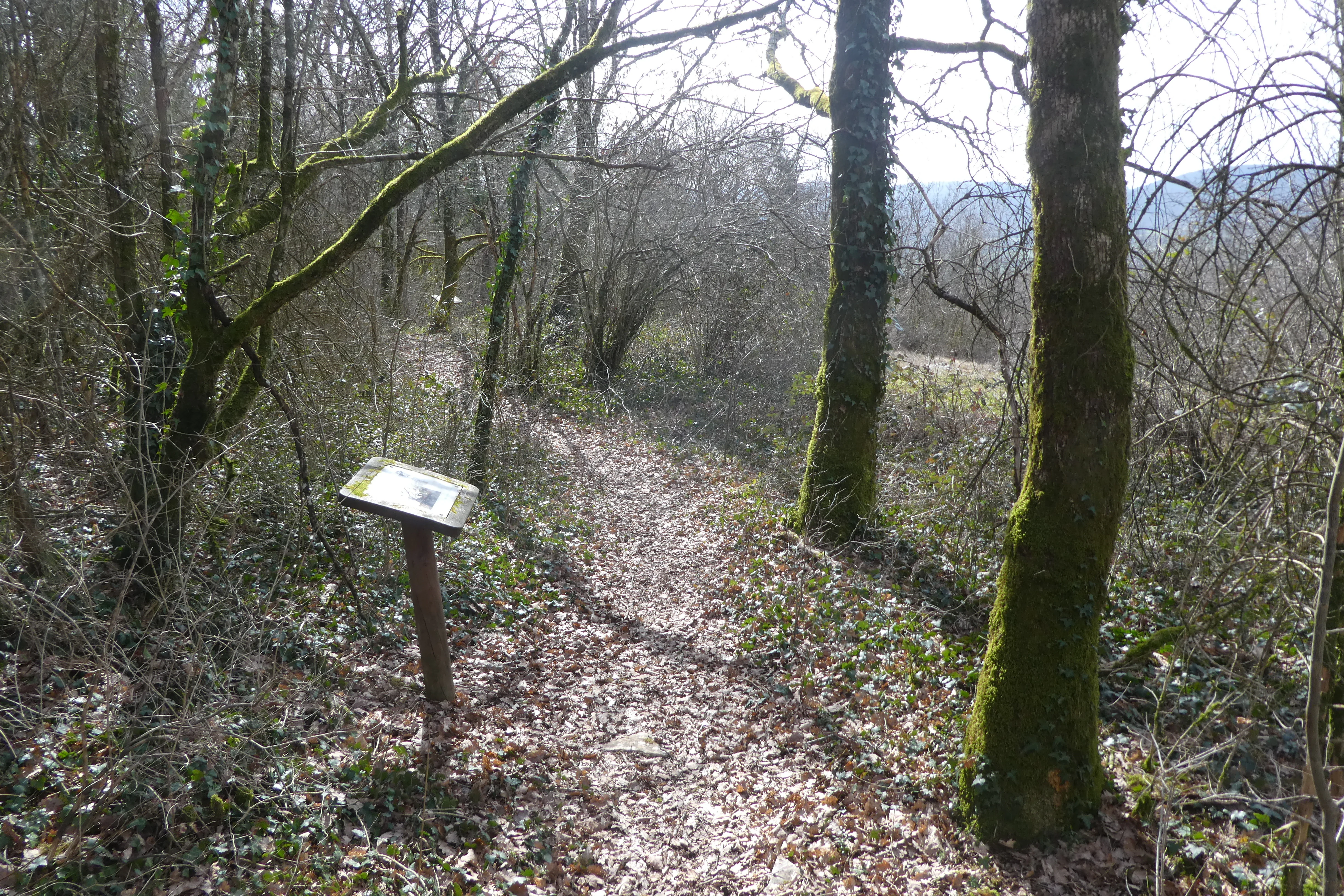
A narrow dirt trail leads through a deciduous forest with an informational sign post standing on the left side of the path.
An informational sign along a wooded trail in the Réserve naturelle nationale de la grotte de Hautecourt.

Top sights and standout views in Réserve naturelle nationale de la grotte de Hautecourt

The reserve's standout features are its role as France's first national nature reserve dedicated to a cave, the vertical character of the Hautecourt cave, and its importance as a reference site for the cave fauna of the Jura. Although the surface area is small, the protection of a complete underground system with 184 recorded taxa, including 21 protected species, gives the site an ecological weight far beyond its hectarage. The combination of dry grasslands above and a stable subterranean environment below, managed since 1980 by LPO Coordination Rhône-Alpes, makes the reserve a compact but scientifically dense protected area.
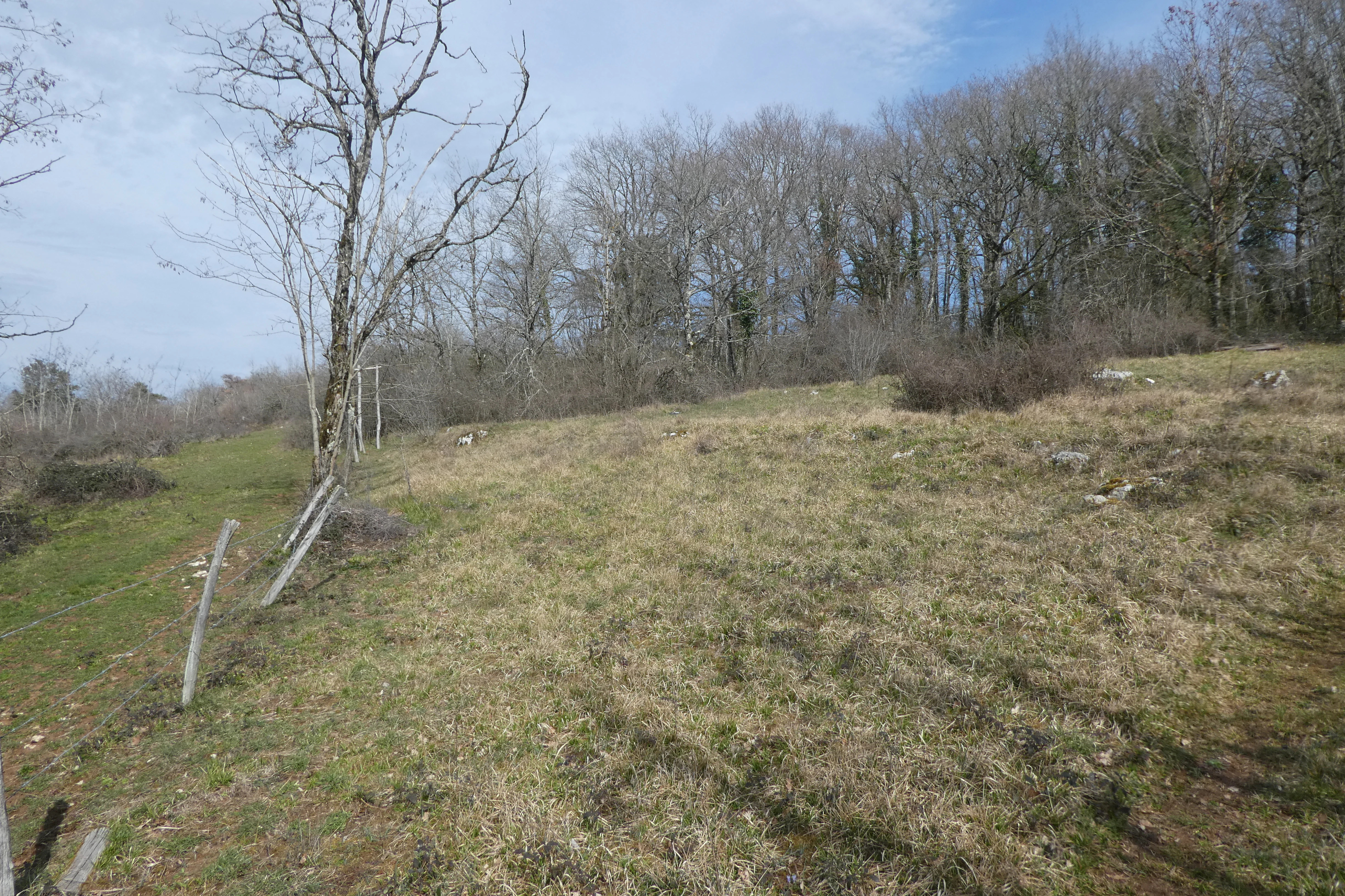
A grassy field with scattered rocks and a wire fence bordering a line of deciduous trees under a cloudy sky.
The landscape surface above the Grotte de Hautecourt nature reserve in France.

Best time to visit Réserve naturelle nationale de la grotte de Hautecourt

Because the cave itself is closed to the public to protect its fragile environment, any visit to the site is limited to the surface around the entrance. The dry grasslands and limestone terrain of the southern Jura are most pleasant in the warmer months, when conditions allow for walking the discovery trail and reading the interpretive panels without weather discomfort. Spring and early summer tend to favor richer surface vegetation and clearer views across the Ain valley, while autumn brings quieter conditions and softer light on the rocky outcrops.
Monthly climate preview

Long-term representative temperature and precipitation averages recorded at benchmark coordinates

Climate Normals and Annual Weather Patterns at Réserve naturelle nationale de la grotte de Hautecourt

Representative coordinate records show measured monthly temperature ranges and steady precipitation levels across the observation period. Examining the complete twelve-month climatology profile reveals detailed thermal rhythms and moisture distribution patterns for this protected location.
Annual mean9 °C
0 °C19 °C
Jan
Feb
Mar
Apr
May13°
Jun17°
Jul19°
Aug19°
Sep15°
Oct10°
Nov
Dec
Warmest month
July

18.8 °C

Coolest month
January

0.3 °C

Wettest month
November

3.9 mm/day

Driest month
March

2.8 mm/day

Park location guide

Geography guide, regional context, and park location map for Réserve naturelle nationale de la grotte de Hautecourt

Réserve naturelle nationale de la grotte de Hautecourt park geography, regions, and map view in France

Understand where Réserve naturelle nationale de la grotte de Hautecourt sits in France through a broader geographic reading of the surrounding landscape, nearby location context, and its mapped position within the national park landscape.

How Réserve naturelle nationale de la grotte de Hautecourt fits into France

France is a unitary semi-presidential republic and one of the world's largest economies. It borders Belgium, Luxembourg, Germany, Switzerland, Italy, Monaco, Andorra, and Spain, with a maritime border to the United Kingdom. The country is known for its cultural influence, art, cuisine, and political history spanning centuries.

Wider geography shaping Réserve naturelle nationale de la grotte de Hautecourt in France

France is located in Western Europe. Metropolitan France extends from the Rhine to the Atlantic Ocean and from the Mediterranean Sea to the English Channel and North Sea. The country borders Belgium, Luxembourg, Germany, Switzerland, Italy, Monaco, Andorra, Spain, and has a maritime border with the United Kingdom.

Map view of Réserve naturelle nationale de la grotte de Hautecourt

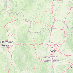
Use this park location map to pinpoint Réserve naturelle nationale de la grotte de Hautecourt in France, understand its exact geographic position, and read its mapped placement within the surrounding landscape more clearly.

Pigeon | © OpenStreetMap contributors

Location context for Réserve naturelle nationale de la grotte de Hautecourt

Auvergne-Rhône-Alpes

Visual exploration of southern Jura limestone landscapes and protected habitats

Réserve naturelle nationale de la grotte de Hautecourt Photos and Scenery

Photographic records reveal the rugged limestone terrain and dry grassland habitats surrounding the protected cave entrance. Visual documentation offers deeper insight into the unique topography and ecological character of this protected landscape.

A gated cave entrance set into a limestone rock face, surrounded by trees covered in thick green moss in a woodland setting.

A small, dark cave entrance set into a rocky hillside, surrounded by dense, moss-covered trees and a small dirt path in the foreground.

A weathered wooden trail marker post stands in a grassy field, displaying a green circular marker with a white arrow and a yellow trail marking.

A metal security gate blocking the entrance to a cave opening in a rocky limestone hillside.

A dirt hiking trail winds through a forest of bare trees with leaf-covered ground; an informational signpost stands on the right side of the trail.

A weathered wooden pedestal with an informational sign stands at the edge of a dirt path leading into a dense, leafless forest.

A narrow dirt trail leads through a deciduous forest with an informational sign post standing on the left side of the path.

A grassy field with scattered rocks and a wire fence bordering a line of deciduous trees under a cloudy sky.

Park atlas

Compare surrounding regional reserves and connected limestone landscapes across the Jura mountains

Other Parks and Protected Areas Near Réserve naturelle nationale de la grotte de Hautecourt

Browse protected areas and regional reserves situated near Réserve naturelle nationale de la grotte de Hautecourt to examine neighboring limestone terrain. Comparing adjacent subterranean and surface habitats provides broader geographic context for the surrounding region.
Nature reserveAuvergne-Rhône-Alpes
About 23 km away#1 closest

Northeast

Réserve naturelle régionale du récif fossile de Marchon - Christian Gourrat Geological Site

A protected Jurassic fossil reef in the Auvergne-Rhône-Alpes region

Located in the Ain department, this small nature reserve is scientifically renowned for its Kimmeridgian reef outcrop. The site protects a fossilized coral and rudist assemblage within the forêt de Marchon, offering a quiet, forested setting for studying France's ancient marine geological history.

Area
0.001 km²
Established
2015
IUCN
IV
Scope
Terrestrial
A soft, light watercolor painting of a winding river flowing through a gentle, rolling landscape with trees and distant hills against a pale, warm sky.
Nature reserveAuvergne-Rhône-Alpes
About 31 km away#2 closest

East

Réserve naturelle régionale de la galerie du Pont-des-Pierres Regional Nature Reserve

Protected gorge landscapes and underground habitats in France

An essential record of the Réserve naturelle régionale de la galerie du Pont-des-Pierres, detailing its critical role in safeguarding cliff and underground habitats within the Valserine gorges. This protected land in the Ain department represents a vital ecological intersection of geological features and specialized faunal refuges.

Area
0.093 km²
Established
2009
IUCN
IV
Relief
Mountain
Wildlife reserveBourgogne-Franche-Comté
About 45 km away#3 closest

Northeast

Tourbières et lacs de la montagne jurassienne: Mapping High-Altitude Wetlands and Glacial Landscapes

A vast protected wildlife reserve in the Bourgogne-Franche-Comté region

Covering more than 12,000 hectares, this wildlife reserve forms a crucial conservation benchmark for peatland and glacial lake systems in the Jura Massif. The landscape encompasses deep combes, broad plateaus, and clear-water basins like Lac de Saint-Point, providing a vital habitat mosaic for diverse flora and fauna across the French highlands.

Area
121.56 km²
Established
2021
Relief
Mountain
Climate
Temperate
A watercolor landscape painting showing green hills, trees, and marshy river banks.
Nature reserveGeneva
About 47 km away#4 closest

East

Naturschutzgebiet Moulin de Vert: Protected Wetland and Forest Geography in Geneva

Detailed nature reserve map and regional landscape context

The Naturschutzgebiet Moulin de Vert nature reserve protects a mosaic of riverside woodland, meadows, and managed pond systems along the Rhône in the Canton of Geneva. Spanning approximately 132 hectares, this conservation area is recognized for supporting extensive biodiversity, from nesting peregrine falcons to diverse amphibian populations. Access this detailed geographic perspective to visualize the park boundaries, internal terrain features, and its ecological connection to the broader Swiss river landscape.

Area
1.32 km²
Established
2001
IUCN
IV
Nature reserveAuvergne-Rhône-Alpes
About 48 km away#5 closest

South

Réserve naturelle régionale des étangs de Mépieu: Atlas and Geographic Protected Area Overview

Wetlands, peatlands, and dry grasslands in northern Isère

The Réserve naturelle régionale des étangs de Mépieu offers a striking study in ecological contrast. This protected landscape contains a dense mosaic of five ponds and marshy terrain set directly against sun-exposed dry grasslands and heathland slopes. The site serves as a vital corridor for migratory birds and rare flora within the rolling countryside of the Auvergne-Rhône-Alpes region.

Area
1.618 km²
Established
2008
IUCN
IV
Relief
Lowland
A horizontal watercolor painting depicting a soft, layered landscape with distant hills, gentle slopes, and clusters of evergreen trees in shades of green and purple.
Nature reserveBourgogne-Franche-Comté
About 51 km away#6 closest

Northeast

Réserve naturelle régionale des tourbières du bief du Nanchez: Protected Jura Mountain Peatlands

Mapping bog systems and wet grassland geography in Eastern France

Located in the Jura department, this regional nature reserve preserves forty-nine hectares of vital peatland, including diverse mire communities and forested slopes. The site provides a critical look at montane landscape restoration, documenting significant bog flora and complex hydrological patterns along the Combe du Nanchez valley floor.

Area
0.488 km²
Established
2021
IUCN
IV
Relief
Upland
Nature reserveBourgogne-Franche-Comté
About 52 km away#7 closest

North

Réserve naturelle nationale de la grotte de Gravelle: Underground Protected Nature Reserve

A limestone cave sanctuary in the Bourgogne-Franche-Comté region

This protected area represents a specialized subterranean habitat in the French Jura, preserving essential maternity and hibernation roosts for eleven bat species. The reserve, set within forested limestone cliffs, remains a key node in the regional network of protected underground sites, emphasizing the conservation of fragile environments.

Area
0.014 km²
Established
1992
IUCN
IV
Relief
Upland
A soft watercolor illustration depicting rolling green hills, gentle slopes, and small clusters of trees against a light, neutral background.
Nature reserveBourgogne-Franche-Comté
About 54 km away#8 closest

North

Réserve naturelle régionale de la côte de Mancy: Protected Landscapes and Geography

Limestone escarpments and calcareous grasslands in eastern France

Delve into the geography of Réserve naturelle régionale de la côte de Mancy, a 49-hectare nature reserve in the Jura department. This site features Jurassic limestone cliffs, thin calcareous soils, and scrubby woodlands, documenting a rich intersection of habitats that preserve rare reptiles and diverse butterfly populations within the Revermont.

Area
0.492 km²
Established
2010
IUCN
IV
Relief
Upland

Common questions about visiting, size, designation, and location context for Réserve naturelle nationale de la grotte de Hautecourt

Réserve naturelle nationale de la grotte de Hautecourt FAQs for park facts, access, geography, and protected area context

Find quick answers about Réserve naturelle nationale de la grotte de Hautecourt, including protected-area facts, park geography, trail and visitor context, and how the park fits into its surrounding country and regional landscape.
MoriAtlas Explorer

Continue Your Protected Areas Search Across the Global Atlas

Deepen your exploration by continuing the structured search for national parks and protected areas worldwide. Utilize the comprehensive filtering capabilities to compare different conservation landscapes and refine your understanding of global park geography. Discover more about the distribution and characteristics of protected natural areas.

Global natural geography