
Mori Atlas logo
Nature reserveRéserve naturelle régionale Confluence Garonne-Ariège

A diverse protected corridor at the meeting point of the Garonne and Ariège rivers within Occitanie

Réserve naturelle régionale Confluence Garonne-Ariège: Mapped Riverine Landscapes and Protected Geography

The Réserve naturelle régionale Confluence Garonne-Ariège spans 580 hectares of riverine landscape where the Garonne and Ariège rivers converge south of Toulouse. This protected territory features a dynamic mosaic of alluvial forests, oxbow channels, and dry molasse cliffs that support varied ecosystems within the Occitanie region. Its geography serves as a critical green corridor, blending Mediterranean and temperate natural influences into a singular, mapped floodplain environment.

regional nature reserveriver confluencefloodplainriparian forestalluvial forestwetlands
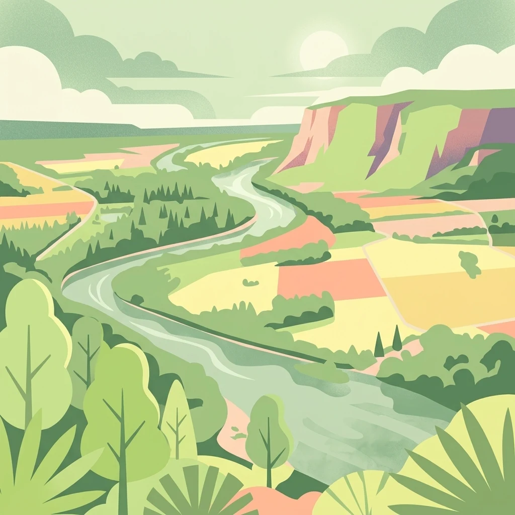
A flat-style digital illustration of a winding river flowing through a green valley with cliffs and agricultural fields.

Réserve naturelle régionale Confluence Garonne-Ariège

Nature reserve

Park overview

Structured park overview, official facts, and landscape profile for Réserve naturelle régionale Confluence Garonne-Ariège

Réserve naturelle régionale Confluence Garonne-Ariège park facts, protected area profile, and essential visitor context

Review the core facts for Réserve naturelle régionale Confluence Garonne-Ariège, including designation, size, terrain, visitor scale, habitats, and operating context in one park-focused overview.

About Réserve naturelle régionale Confluence Garonne-Ariège

The Confluence Garonne-Ariège regional nature reserve protects a strategically located river landscape in southwestern France, where two major rivers meet just before they flow through the Toulouse metropolitan area. Although the protected area is modest in size (around 579 hectares), it captures a remarkable diversity of habitats compressed into a narrow band of floodplain extending about fifteen kilometers along the Ariège and lower Garonne corridors.

The river environment dominates the reserve. Permanent and seasonal wetlands fringe both rivers, fed by surface runoff, floods, and rising alluvial groundwater. These wet habitats support aquatic insects, amphibians, and a rich aquatic flora, including rare species adapted to the calm backwaters and temporary pools left behind by shifting river channels. The riparian woodland along the banks is complemented by older alluvial forest formations, which together provide shade, stable microclimates, and critical refuge for fish and other aquatic species.

In sharp contrast, the right bank of the reserve rises into dry molasse hillsides carved by small wooded valleys. These slopes feature open grasslands, heaths, and downy oak woodlands, with patches of vegetation more typical of Mediterranean regions. The juxtaposition of these dry, sunny habitats with the cool, periodically flooded riverside gives the reserve its strong ecological character and supports a mix of plants, reptiles, birds, and insects that reflect both northern and southern influences.

Beyond ecology, the reserve is deeply integrated into the surrounding human landscape. It functions as a recreational green space and ecological corridor for the Toulouse agglomeration, while also preserving traces of long-standing human presence along the rivers, from prehistoric and historic settlement patterns to old mills, weirs, and riverside estates. Its proximity to a major urban population makes it as much an environmental education and public amenity space as a strict biodiversity reserve.

Quick facts and research context for Réserve naturelle régionale Confluence Garonne-Ariège

The Réserve naturelle régionale Confluence Garonne-Ariège lies in the Haute-Garonne department of the Occitanie region in southwestern France, immediately south of the Toulouse metropolitan area. It was officially classified on 4 June 2015 by the Regional Council, with a renewable term of ten years, and encompasses about 579 hectares of public fluvial domain, riparian habitats, and adjacent hillsides.

Its territory includes the public waterways of both the Garonne and the Ariège rivers upstream of their confluence, as well as molasse cliffs and wooded valleys on the right bank. The site overlaps with the ZNIEFF type I site known as the Confluence Garonne-Ariège or Ramiers de Portet, reinforcing its recognized ecological value. Day-to-day management is delegated to Nature en Occitanie, which oversees habitat protection, public outreach, and policing of the reserve's rules.

Protection and recognition

Documented terrestrial protection metrics and official registry data for the protected landscape

Réserve naturelle régionale Confluence Garonne-Ariège Protection Status and Regional Conservation Scope

Terrestrial protection records and baseline management designations outline the formal administrative scope for Réserve naturelle régionale Confluence Garonne-Ariège. Verified database registries track the documented conservation parameters and official territorial boundaries for the protected area.

Protection details

Protection scope
Terrestrial
Transboundary protection
No
WDPA ID
555597278
Park context

Deeper park guide and search-rich context for Réserve naturelle régionale Confluence Garonne-Ariège

Réserve naturelle régionale Confluence Garonne-Ariège history, landscape, wildlife, and travel context

Explore Réserve naturelle régionale Confluence Garonne-Ariège through its history, landscape character, ecosystems, wildlife, conservation priorities, cultural context, and seasonal travel timing in a structured park guide built for atlas discovery and search intent.

Why Réserve naturelle régionale Confluence Garonne-Ariège stands out

The reserve is best known for protecting one of the last large stretches of natural river landscape at the spectacular confluence of the Garonne and the Ariège, immediately south of Toulouse. It safeguards a rare mosaic of riparian forest (ripisylve), alluvial forest, oxbow arms, molasse cliffs, and seasonally flooded grasslands within a single protected perimeter. It is also notable as a refuge for species that mix Mediterranean and temperate influences, including thermophilic plants such as the Mastic tree and Holm oak alongside wetland species like the aquatic carnivorous plant Utricularia australis. The site functions both as a biodiversity stronghold and as a green corridor breathing space for the Toulouse urban area.
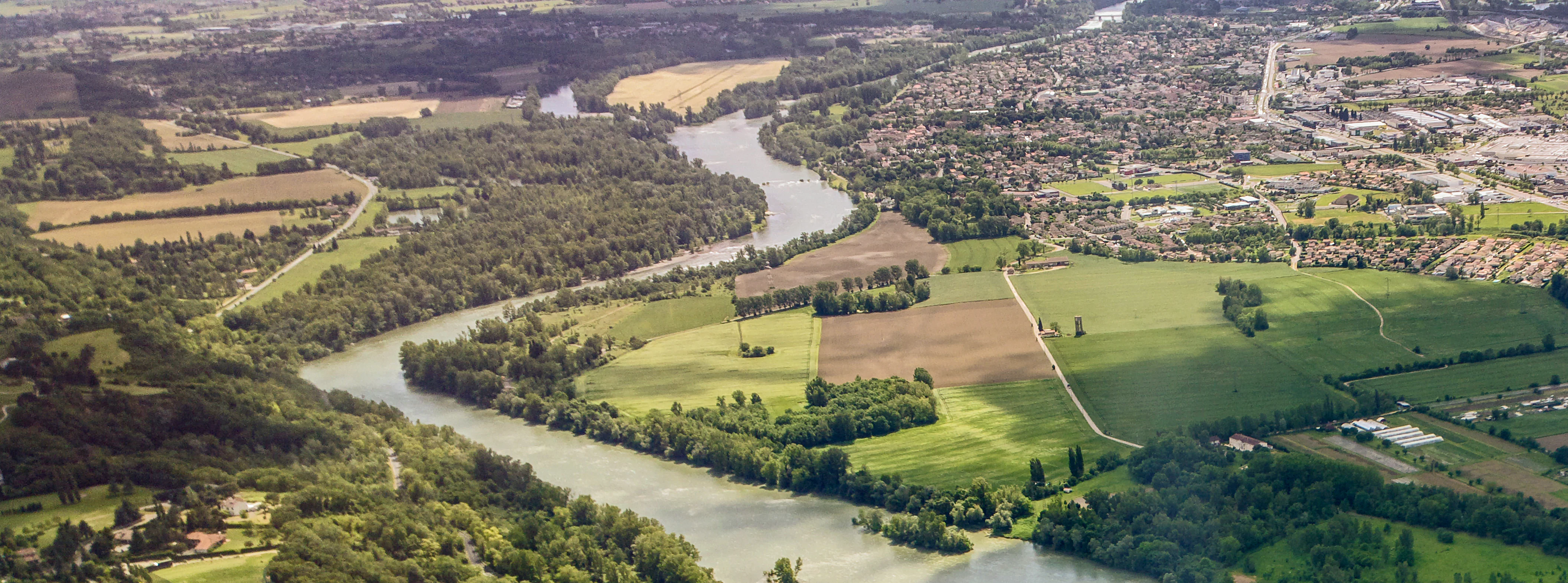
An aerial photograph looking down on the confluence of two winding rivers, with forested banks, agricultural fields, and a small town visible in the distance.
An aerial view of the meandering Garonne and Ariège rivers at their confluence in Haute-Garonne, France.

Réserve naturelle régionale Confluence Garonne-Ariège history and protected-area timeline

The two rivers that define the reserve have carried human activity for centuries, traditionally supporting barge transport and later gravel extraction through dredging at the confluence throughout the twentieth century. These interventions left a lasting imprint on the river morphology and land use around the meeting point of the Garonne and Ariège.

In 2001, local stakeholders began efforts to preserve and enhance the confluence area. The association ConfluenceS Garonne-Ariège was established, launching action programs and developing a territorial charter by 2007, followed by a formal feasibility study for a regional nature reserve in 2009. In the years that followed, consultations took place with both public and private property owners along the riverbanks.

The formal classification dossier was prepared in 2013 and reviewed by the CSRPN (Conseil scientifique régional du patrimoine naturel). The reserve was officially classified by the Occitanie Regional Council on 4 June 2015 for an initial renewable period of ten years, completing a process that tied together local initiative, scientific review, and regional governance.

Réserve naturelle régionale Confluence Garonne-Ariège landscape and geographic character

The reserve is defined above all by its river geography, shaped by the convergence of the Garonne and the Ariège just south of Toulouse. The two waterways divide and rejoin around gravel islands and shallows, with visible turbulence where their currents meet, creating a dynamic mosaic of flowing channels, quiet margins, and exposed sediment bars.

Along the banks, ripisylve woodland and alluvial forest form continuous green ribbons, broken by oxbow arms (bras morts), which act as quiet backwaters rich in biodiversity. These wooded fringes hold the soil, filter runoff, trap debris carried by floods, and produce localized cooling and windbreak effects, buffering the surrounding countryside from extremes of temperature and erosion.

On the right bank, the topography shifts abruptly to dry molasse hills and cliffs, cut by small wooded valleys and covered in downy oak woodland, open grassland, and Mediterranean-influenced heath. The Pech-David hill on the edge of Toulouse anchors the northern end of the reserve and offers commanding views over the entire river system.

Réserve naturelle régionale Confluence Garonne-Ariège ecosystems, habitats, and plant life

Ecologically, the reserve captures an unusually compressed range of habitats, anchored by the floodplain and flanked by contrasting dry slopes. The wetlands are fed by surface runoff, seasonal floods, and rising alluvial groundwater, producing a mosaic of permanent and temporary aquatic environments. These habitats host a dense community of aquatic insects, amphibians, and plants adapted to variable water levels.

Wooded areas include riparian willow and alder formations along the active channels, more mature alluvial forest in older meander belts, and dry downy oak woodland on the molasse slopes. Open habitats include sunny grasslands, scrub, and heath patches where thermophilic Mediterranean flora has established alongside more continental species.

The reserve partly overlaps with the ZNIEFF type I site Confluence Garonne-Ariège, also known as the Ramiers de Portet, reinforcing the recognised ecological importance of its wetland core. Altogether, the mosaic supports both stable resident communities and migratory or seasonal visitors, particularly along the river corridors.

Réserve naturelle régionale Confluence Garonne-Ariège wildlife and species highlights

The reserve records roughly 900 animal species, reflecting the richness of its wetland, woodland, and cliff habitats. The riverbanks and gravel islands are important for birds of prey and waterbirds, with regular sightings of Black Kite, Great Egret, Purple Heron, Night Heron, Booted Eagle, Eurasian Hobby, and European Bee-eater, alongside woodland and cliff-nesting species such as the Eurasian Eagle-Owl.

The rivers themselves support a notable community of migratory fish, including Allis shad, Twaite shad, European eel, and Atlantic salmon, reinforcing the value of connected river habitat. The European Otter is also documented along the watercourses, a strong indicator of healthy aquatic ecosystems.

Reptiles are particularly diverse thanks to the mix of warm dry slopes and damp valley bottoms, with species such as the Western green lizard, wall lizard, Western whip snake, grass snake, viperine snake, and the introduced or expanding Iberian lizard, alongside the European pond turtle in wetland margins. Amphibians include the Mediterranean tree frog, natterjack toad, common toad, agile frog, and both palmate and marbled newts. Invertebrate interest is also high, with notable species such as the Mercury bluet damselfly, the large blue butterfly, and the southern demoiselle dragonfly recorded within the site.

Réserve naturelle régionale Confluence Garonne-Ariège conservation status and protection priorities

The Confluence Garonne-Ariège reserve is a cornerstone of regional conservation strategy in the Toulouse area, functioning both as a protected habitat and as a critical link in the regional Trame verte et bleue (green and blue infrastructure network). Its riverine forests, alluvial woodlands, and oxbow channels create corridors for wildlife movement, quiet refuge zones for sensitive species, and habitat for endemic plants and animals that depend on these specific riparian conditions.

Beyond biodiversity, the reserve delivers important ecological functions at the landscape scale. Its wetlands and natural channels help regulate floods by buffering peak flows, retaining sediment, and slowing water movement downstream, while trees and dense vegetation stabilize the banks and reduce erosion. The wooded areas also act as local cool islands, windbreaks, and natural filters for runoff in an otherwise heavily urbanized area.

Management is led by the association Nature en Occitanie, which carries out targeted habitat preservation, public outreach, regulation enforcement, and efforts to control invasive species that would otherwise threaten fragile native flora and fauna. The site also partly overlaps with the ZNIEFF type I area Confluence Garonne-Ariège (Ramiers de Portet), reinforcing its official ecological recognition.

Réserve naturelle régionale Confluence Garonne-Ariège cultural meaning and human context

The reserve preserves a landscape shaped by long human presence along these waterways. The rivers historically supported barge traffic, gravel extraction, milling, and agriculture, leaving traces throughout the protected area. Several historic sites sit within or adjacent to the reserve, including a Celtic and Roman remnant area at Goyrans, the ancient oppidum at Vieille-Toulouse, and the motte castrale (fortified earthwork) at Clermont-le-Fort.

Riverside architecture and infrastructure also feature in the cultural layer of the site, with old mills and millraces preserved at several points along the Ariège and Garonne. The Château Bertier and its associated farm at Pinsaguel, listed as historic monuments since 1941, are tangible reminders of the seigneurial and agricultural history of the confluence area. Today, the reserve bridges these heritage elements with active urban life, offering Toulouse residents and visitors a place where natural ecology and centuries of human settlement coexist within a single protected territory.

Top sights and standout views in Réserve naturelle régionale Confluence Garonne-Ariège

The reserve offers a remarkable concentration of ecosystems within a small area south of Toulouse, anchored by the meeting point of the Garonne and the Ariège, where the collision of two distinct currents is visibly visible from the riverbanks. Its mix of riparian forest, alluvial woodland, oxbow channels, and dry molasse cliffs sets up a dramatic ecological contrast that supports an unusually diverse flora and fauna.

Visitors are drawn to the wooded river islands (ramiers), the calm backwaters of old channel arms, and the dry hillside woodlands with their southern-influenced plant communities. The reserve is equally valued for its cultural depth, encompassing prehistoric and Roman remnants, medieval earthworks, historic mills, and listed architecture, all within easy reach of the Toulouse urban area.

Best time to visit Réserve naturelle régionale Confluence Garonne-Ariège

Spring and early summer tend to be especially rewarding for visiting the reserve, when water levels are typically moderate, wetland vegetation is at its most expressive, and migratory and breeding birds are active around the rivers and gravel islands. These months offer strong chances of observing raptors, herons, and bee-eaters in suitable conditions.

Autumn brings lower water levels and active fish migration along the Garonne and Ariège, while the molasse slopes take on warm tones that highlight the contrast between dry hillside and riparian woodland. Winter offers quieter conditions and good chances to observe waterbirds and overwintering raptors, though some access areas may be restricted after major flood events. Visitors should note that swimming and motor vehicle access are prohibited across the public fluvial domain, and that hunting and fishing are regulated.
Monthly climate preview

Long-term temperature ranges and monthly precipitation patterns sampled at a representative coordinate

Réserve naturelle régionale Confluence Garonne-Ariège Climate Normals and Weather by Month

Representative coordinate measurements reveal marked annual temperature variations alongside consistent monthly precipitation across Réserve naturelle régionale Confluence Garonne-Ariège. Examining the complete twelve-month climatological record provides detailed context for local environmental patterns.
Annual mean13 °C
5 °C23 °C
Jan
Feb
Mar
Apr12°
May16°
Jun20°
Jul23°
Aug23°
Sep19°
Oct15°
Nov
Dec
Warmest month
August

23.2 °C

Coolest month
January

5.3 °C

Wettest month
November

2.7 mm/day

Driest month
July

1.6 mm/day

Park location guide

Geography guide, regional context, and park location map for Réserve naturelle régionale Confluence Garonne-Ariège

Réserve naturelle régionale Confluence Garonne-Ariège park geography, regions, and map view in France

Understand where Réserve naturelle régionale Confluence Garonne-Ariège sits in France through a broader geographic reading of the surrounding landscape, nearby location context, and its mapped position within the national park landscape.

How Réserve naturelle régionale Confluence Garonne-Ariège fits into France

France is a unitary semi-presidential republic and one of the world's largest economies. It borders Belgium, Luxembourg, Germany, Switzerland, Italy, Monaco, Andorra, and Spain, with a maritime border to the United Kingdom. The country is known for its cultural influence, art, cuisine, and political history spanning centuries.

Wider geography shaping Réserve naturelle régionale Confluence Garonne-Ariège in France

France is located in Western Europe. Metropolitan France extends from the Rhine to the Atlantic Ocean and from the Mediterranean Sea to the English Channel and North Sea. The country borders Belgium, Luxembourg, Germany, Switzerland, Italy, Monaco, Andorra, Spain, and has a maritime border with the United Kingdom.

Map view of Réserve naturelle régionale Confluence Garonne-Ariège

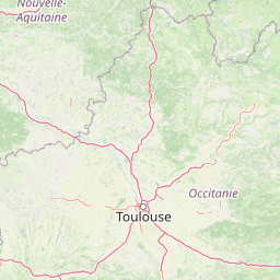
Use this park location map to pinpoint Réserve naturelle régionale Confluence Garonne-Ariège in France, understand its exact geographic position, and read its mapped placement within the surrounding landscape more clearly.

Pigeon | © OpenStreetMap contributors

Location context for Réserve naturelle régionale Confluence Garonne-Ariège

Occitanie

Explore detailed photographs of river confluences, alluvial forests, and dry molasse cliffs.

Visualizing Réserve naturelle régionale Confluence Garonne-Ariège Landscapes and Protected Scenery

Visual records capture the complex river geography, dense riparian woodland, and steep limestone hillsides that define the protected perimeter. Photographic documentation reveals the dynamic intersection of aquatic habitats and dry Mediterranean scrubland across the entire protected corridor.

An aerial photograph looking down on the confluence of two winding rivers, with forested banks, agricultural fields, and a small town visible in the distance.

A wide view of the confluence of two rivers with forested banks and gravel shores under a bright sky.

Park atlas

Compare surrounding river basins, floodplain wetlands, and protected natural landscapes across the region.

Parks Near Réserve naturelle régionale Confluence Garonne-Ariège and Regional Protected Areas

Browse other protected areas and river valley reserves located near Réserve naturelle régionale Confluence Garonne-Ariège. Expanding your search across adjacent regional terrain helps connect distinct watershed ecosystems and river corridor habitats.
Nature reserveOccitanie
About 59 km away#1 closest

East

Réserve naturelle régionale de Cambounet-sur-le-Sor: Protected Wetland Geography

Alluvial floodplain habitat in the Tarn, Occitanie

Situated in the Tarn department of Occitanie, this nature reserve guards a dense wetland habitat shaped by the confluence of the Sor and Agout rivers. The area stands as an ecological centerpiece, providing sheltered riparian woodland and marshy terrain for more than one hundred and seventy recorded bird species, making it a distinct study in French riverine conservation.

Area
0.309 km²
Established
1990
IUCN
IV
Relief
Lowland
A soft, horizontal watercolor painting depicting a gentle, rolling landscape with green hills, sparse trees, and a hazy background in pale green and pink tones.
Regional parkOccitanie
About 79 km away#2 closest

North

Parc naturel régional des Causses du Quercy: Protected Karst Plateaus and River Valleys

Geographic atlas of the Causses du Quercy karst landscapes

An essential look at the geography of Parc naturel régional des Causses du Quercy. This protected area in Occitanie features an expansive network of limestone plateaus and carved river gorges. Learn about the karst terrain, sedimentary history, and the natural boundaries that define this French regional park and internationally recognized geopark.

Area
1,855 km²
Established
1999
IUCN
V
A soft, painterly watercolor illustration of a river landscape with lush green trees on the banks and rolling hills in the background.
Nature reserveFrance
About 99 km away#3 closest

Northwest

Réserve naturelle nationale de la frayère d'Alose: Garonne River Protected Area Mapping

Analyzing aquatic terrain and migratory fish spawning grounds in France

Located in the Lot-et-Garonne department, the Réserve naturelle nationale de la frayère d'Alose comprises a unique, ecologically defined segment of the Garonne River. The reserve manages specific riverbed substrates and current patterns to maintain critical habitats for endangered anadromous species. Its role extends beyond simple protection, acting as a vital reference area for ecological research into the health of river-based migratory fish corridors across the region.

Area
0.478 km²
Established
1981
Relief
Lowland
Climate
Temperate
Nature reserveOccitanie
About 101 km away#4 closest

Southeast

Réserve naturelle nationale de la Grotte du T.M. 71: Geological Protected Area Map

Subterranean karst exploration in the Aude department of Occitanie

Located in the foothills bordering the Pyrenees, the Réserve naturelle nationale de la Grotte du T.M. 71 protects a sprawling network of limestone passages. This site represents a key protected area for the study of subterranean mineral formations and Pyrenean karst evolution, featuring kilometres of mapped galleries maintained under a strict integral conservation framework.

Area
0.96 km²
Established
1987
IUCN
III
Watercolor painting of a river winding through a valley with green fields, trees, and distant hills
Protected areaAndorra
About 101 km away#5 closest

South

Parc Natural Comunal de les Valls del Comapedrosa: Andorra's Highest Protected Alpine Landscape

Explore the Pyrenean terrain and mapped boundaries of Andorra's summit park.

Parc Natural Comunal de les Valls del Comapedrosa is the primary high-altitude protected area in Andorra, defined by its rugged alpine terrain and the presence of Coma Pedrosa, the country's highest peak. This protected landscape offers a significant geographic anchor for exploring the Pyrenees, highlighting the unique mountain conservation efforts. Its mapped boundaries encompass dramatic valleys and steep ridges, providing a clear context for understanding Andorra's mountainous geography through a structured atlas lens.

Area
15.43 km²
Established
2003
IUCN
IV
Relief
Mountain
Watercolor illustration of a mountainous landscape with a river, green vegetation, and distant peaks under a light sky
National parkProvince of Lleida
About 106 km away#6 closest

South

Aigüestortes i Estany de Sant Maurici National Park: Pyrenean High Mountain National Park Landscape

Explore glacial lakes and winding waterways in Catalonia.

Aigüestortes i Estany de Sant Maurici National Park is a premier national park in the Pyrenees, celebrated for its extensive network of almost 200 glacial lakes and the dramatic natural beauty of the Sant Maurici lake. Its landscape is defined by high mountain terrain, characterized by U-shaped valleys, sharp ridges, and unique hydrological features like the Aigüestortes plain's meandering streams. This protected area in the Province of Lleida offers a rich setting for understanding alpine environments and Pyrenean geography through detailed mapping and atlas exploration.

Area
141 km²
Established
1955
IUCN
II
Visitors
525K annual
A watercolor painting of a serene mountain landscape featuring gentle rolling hills, small clusters of trees, and soft, muted tones of green, pink, and purple, set against a light background.
Nature reserveOccitanie
About 107 km away#7 closest

Southwest

Réserve naturelle régionale du Massif du Montious: Regional Nature Reserve in Occitanie

Granitic massif geography and Pyrenean protected landscapes

Located in the heart of the Hautes-Pyrénées, this reserve captures the geological and biological essence of the Central Pyrenees. From the summit grasslands at 2,171 metres to the sheltered glacial basins, the terrain provides a comprehensive look at regional mountain ecosystems and Hercynian geological heritage.

Area
7.38 km²
Established
2020
IUCN
IV
Protected areaAndorra
About 113 km away#8 closest

South

Madriu-Perafita-Claror Valley: Geographic Overview of Andorra's Premier Protected Landscape

An examination of glacial landforms and historic mountain heritage.

Spanning nine percent of Andorra, the Madriu-Perafita-Claror Valley remains a rare example of a preserved Pyrenean cultural landscape. This protected area features granite cliffs, glacial cirques, and historic ironworking remnants, offering a deep look into the environmental legacy of mountain societies within a remote, foot-access-only basin.

Area
42.47 km²
Established
2004
Relief
Mountain
Climate
Alpine

Common questions about visiting, size, designation, and location context for Réserve naturelle régionale Confluence Garonne-Ariège

Réserve naturelle régionale Confluence Garonne-Ariège FAQs for park facts, access, geography, and protected area context

Find quick answers about Réserve naturelle régionale Confluence Garonne-Ariège, including protected-area facts, park geography, trail and visitor context, and how the park fits into its surrounding country and regional landscape.
MoriAtlas Explorer

Continue Your Protected Areas Search Across the Global Atlas

Deepen your exploration by continuing the structured search for national parks and protected areas worldwide. Utilize the comprehensive filtering capabilities to compare different conservation landscapes and refine your understanding of global park geography. Discover more about the distribution and characteristics of protected natural areas.

Global natural geography