
Mori Atlas logo
Nature reserveRéserve naturelle régionale de la pelouse de la côte de l'étang

A preserved mosaic of calcareous dry grasslands and thermophilic woodland in northeastern France

Réserve naturelle régionale de la pelouse de la côte de l'étang Protected Landscape and Regional Geography

(Réserve naturelle régionale de la pelouse de la côte de l'étang (RNR234))

The Réserve naturelle régionale de la pelouse de la côte de l'étang protects a rare fragment of dry calcareous grassland within the Aube department of the Grand Est region. This site preserves an ecologically rich mosaic of habitats, including sun-exposed slopes, shrubby fringes, and traditional orchards that host unique plant and invertebrate species. Its elongated, southwest-facing terrain serves as a vital refuge for biodiversity amidst the surrounding agricultural landscapes of the Barrois champenois.

dry grasslandcalcareous habitatprotected nature reserveChampagne regionAubeGrand Est
A flat-style digital illustration showing a winding river flowing through a green valley with small clusters of houses, surrounded by terraced hills under a pale sun.

Réserve naturelle régionale de la pelouse de la côte de l'étang

Nature reserve

Park overview

Structured park overview, official facts, and landscape profile for Réserve naturelle régionale de la pelouse de la côte de l'étang

Réserve naturelle régionale de la pelouse de la côte de l'étang park facts, protected area profile, and essential visitor context

Review the core facts for Réserve naturelle régionale de la pelouse de la côte de l'étang, including designation, size, terrain, visitor scale, habitats, and operating context in one park-focused overview.

About Réserve naturelle régionale de la pelouse de la côte de l'étang

The Réserve naturelle régionale de la pelouse de la côte de l'étang is a compact regional nature reserve in the Aube part of the Grand Est region. Although barely larger than ten hectares, it plays an outsized role in the conservation of the dry calcareous grassland heritage of the Barrois champenois, a rural area south of Bar-sur-Aube where centuries of agricultural expansion have erased most similar habitats.

The site occupies a southwest-facing slope in the Landion valley, an orientation that maximizes sun exposure and heat retention, two factors that determine the character of the ecosystems protected here. Its landscape is a mosaic: open calcicolous grassland dominates the steeper, sunnier surfaces, while shrubby fringes, a thermophilic oak woodland, a Scots pine stand, and old conservation orchards fill the more sheltered or marginal zones. Below and around the reserve, vineyards and arable fields form the agricultural backdrop of the village of Spoy.

The ecological value of the reserve lies in the combination of these habitats. Calcareous and marly grasslands are among the most species-rich habitat types in temperate Europe when measured per square meter, and they support highly specialized plants, pollinators, reptiles, and birds. The reserve protects a representative sample of these communities, contributing directly to regional biodiversity objectives and to the continuity of habitat networks linking the reserve to the nearby Forêt d'Orient regional park and the Forêt de Clairvaux.

The site is not equipped for tourists and is managed primarily for conservation. This minimal-intervention approach reflects the fragility of the dry grassland flora and fauna and the desire to maintain the ecological processes that have shaped the slope over centuries of low-intensity traditional land use.

Quick facts and research context for Réserve naturelle régionale de la pelouse de la côte de l'étang

The Réserve naturelle régionale de la pelouse de la côte de l'étang lies in the commune of Spoy in the Aube department, near the town of Bar-sur-Aube and just southeast of the Parc naturel régional de la forêt d'Orient. It was classified as a regional nature reserve in May 2010 and is managed by the Conservatoire d'espaces naturels de Champagne-Ardenne.

The reserve covers around 11 hectares shaped as an 800-meter-long band oriented toward the southwest, wedged between vineyards and cultivated fields in the Landion valley. It lies within an IUNC Category IV framework and is also recognized under several national ecological inventories, including ZNIEFF and a Special Protection Zone associated with the Barrois and the Forêt de Clairvaux.

Protection and recognition

Documented terrestrial protection scope and 2010 establishment timeline facts

Protection Status and Designation History for Réserve naturelle régionale de la pelouse de la côte de l'étang

Recorded protection status and designation history for Réserve naturelle régionale de la pelouse de la côte de l'étang highlight its established terrestrial framework dating to 2010. Structured metrics outline the official protected area parameters and foundational conservation context for this regional reserve.

Protection details

Protection scope
Terrestrial
Designated year
2010
Transboundary protection
No
WDPA ID
555514364
Park context

Deeper park guide and search-rich context for Réserve naturelle régionale de la pelouse de la côte de l'étang

Réserve naturelle régionale de la pelouse de la côte de l'étang history, landscape, wildlife, and travel context

Explore Réserve naturelle régionale de la pelouse de la côte de l'étang through its history, landscape character, ecosystems, wildlife, conservation priorities, cultural context, and seasonal travel timing in a structured park guide built for atlas discovery and search intent.

Why Réserve naturelle régionale de la pelouse de la côte de l'étang stands out

The reserve is best known for preserving a rare example of calcareous and marly dry grassland in the Champagne-Bar region. These open, sun-exposed slopes are among the most threatened habitats in this part of France because they have been progressively converted to cropland or conifer plantations. It is also recognized for the diversity of life concentrated on such a small site: over 150 vascular plant species, nationally protected orchids and gentians, breeding birds listed under the European Birds Directive, thermophilic reptiles, and a remarkable assemblage of butterflies, bush-crickets, and other invertebrates typical of warm dry grasslands.
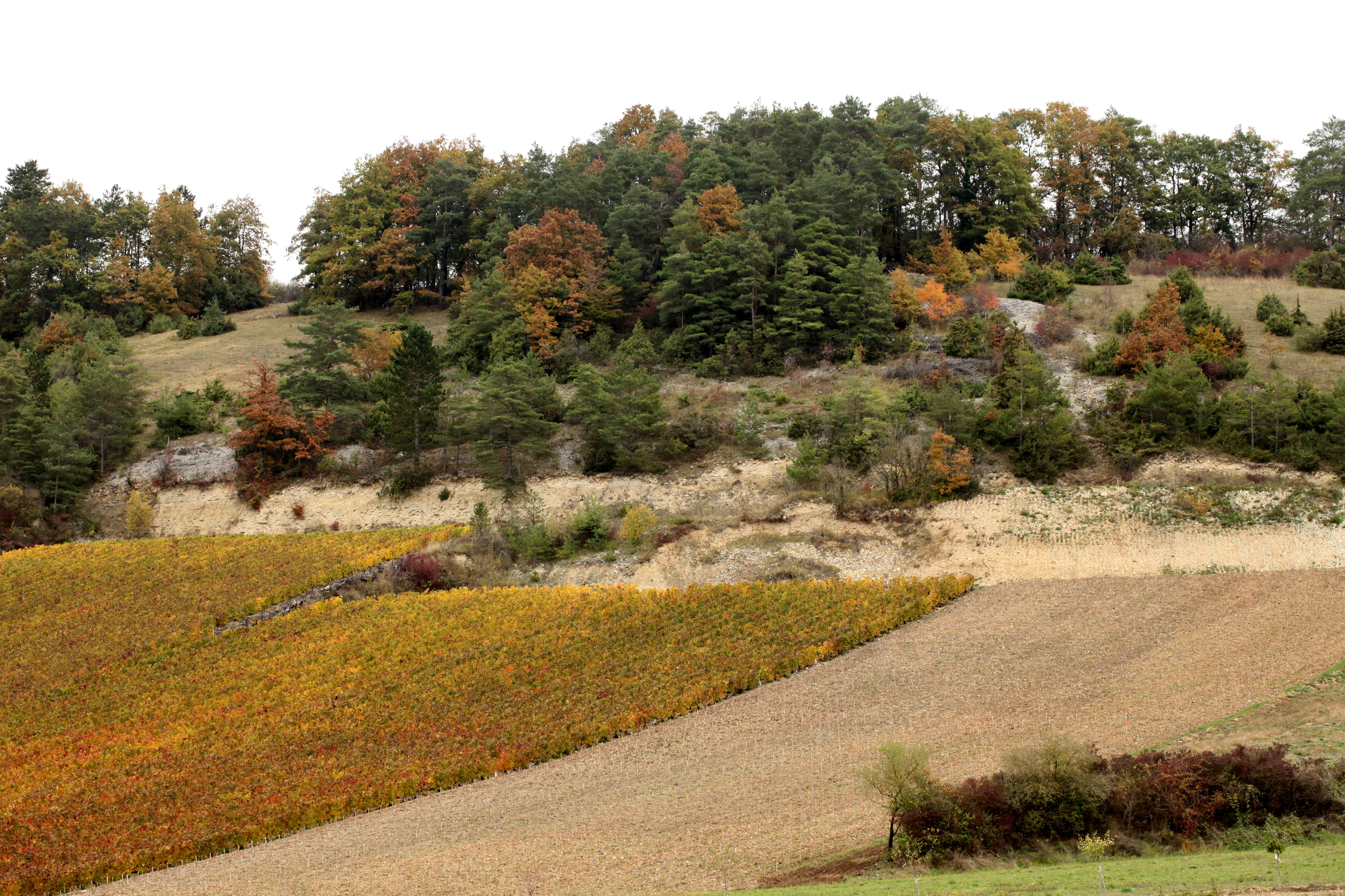
A wide landscape view of a hillside in autumn with a mix of light-colored rocky outcrops, dense forest, and terraced fields in yellow and brown shades.
Autumn landscape view of the Réserve naturelle régionale de la pelouse de la côte de l'étang.

Réserve naturelle régionale de la pelouse de la côte de l'étang history and protected-area timeline

The history of the Réserve naturelle régionale de la pelouse de la côte de l'étang is essentially a story of habitat loss and rescue. Across the Aube and the wider Barrois champenois, similar dry calcareous and marly grasslands were once common features of the agricultural countryside. Over the twentieth century, however, the majority of these open slopes were reclaimed for cultivation or planted with conifers, dramatically reducing the area of this habitat type across the region.

By the early twenty-first century, surviving examples had become scarce enough to warrant formal protection. The reserve was officially created by regional deliberation on May 17, 2010, and assigned the regional nature reserve reference RNR234. Conservation management was entrusted to the Conservatoire d'espaces naturels de Champagne-Ardenne, a regional body specialized in the protection of natural heritage sites through land agreements and tailored management plans.

The reserve's management history follows the standard planning cycle of French regional nature reserves. Earlier planning cycles covering 1996 to 2001 and 2002 to 2007 guided work on comparable sites, and the lessons from those plans informed the conservation approach adopted when the côte de l'étang was formally classified. The site is also integrated into a wider network of ecological designations, including a ZNIEFF type I area called 'Pelouse de Spoy et ses annexes,' a ZNIEFF type II area covering the wooded and grassy slopes of the Landion and Champignol valleys, and a Special Protection Zone extending across the Barrois and the Forêt de Clairvaux for bird species listed under Annex I of the European Birds Directive.

Réserve naturelle régionale de la pelouse de la côte de l'étang landscape and geographic character

The landscape of the reserve is defined by a single southwest-facing slope in the Landion valley. The protected area forms a long, narrow ribbon roughly 800 meters in length and 200 meters in width, pressed between rows of vines above and cultivated plots below. This elongated shape reflects the geology beneath: a band of calcareous and marly substrate that supports the distinctive dry grassland vegetation featured throughout much of the Barrois champenois.

From a distance, the site reads as a discontinuous patch of open, herb-rich vegetation between wooded horizons. Closer in, the terrain reveals subtle variation: steeper rocky exposures carry the most open grassland; mid-slope positions host shrubby fringes; while low and flatter areas include orchard terraces and a thin Scots pine stand. The southwesterly exposure gives the slope a warm, bright character that distinguishes it sharply from the surrounding agricultural matrix.

The broader visual context is dominated by the rolling agricultural countryside of southern Aube. To the south and west, the eye meets the vineyards of the Champagne fringe; to the north lies the wooded expanse of the Forêt de Clairvaux, and beyond it the lakes and forests of the Parc naturel régional de la forêt d'Orient. This connective position, between vineyards, forests, and protected natural areas, gives the small reserve an important landscape-role well beyond its footprint.
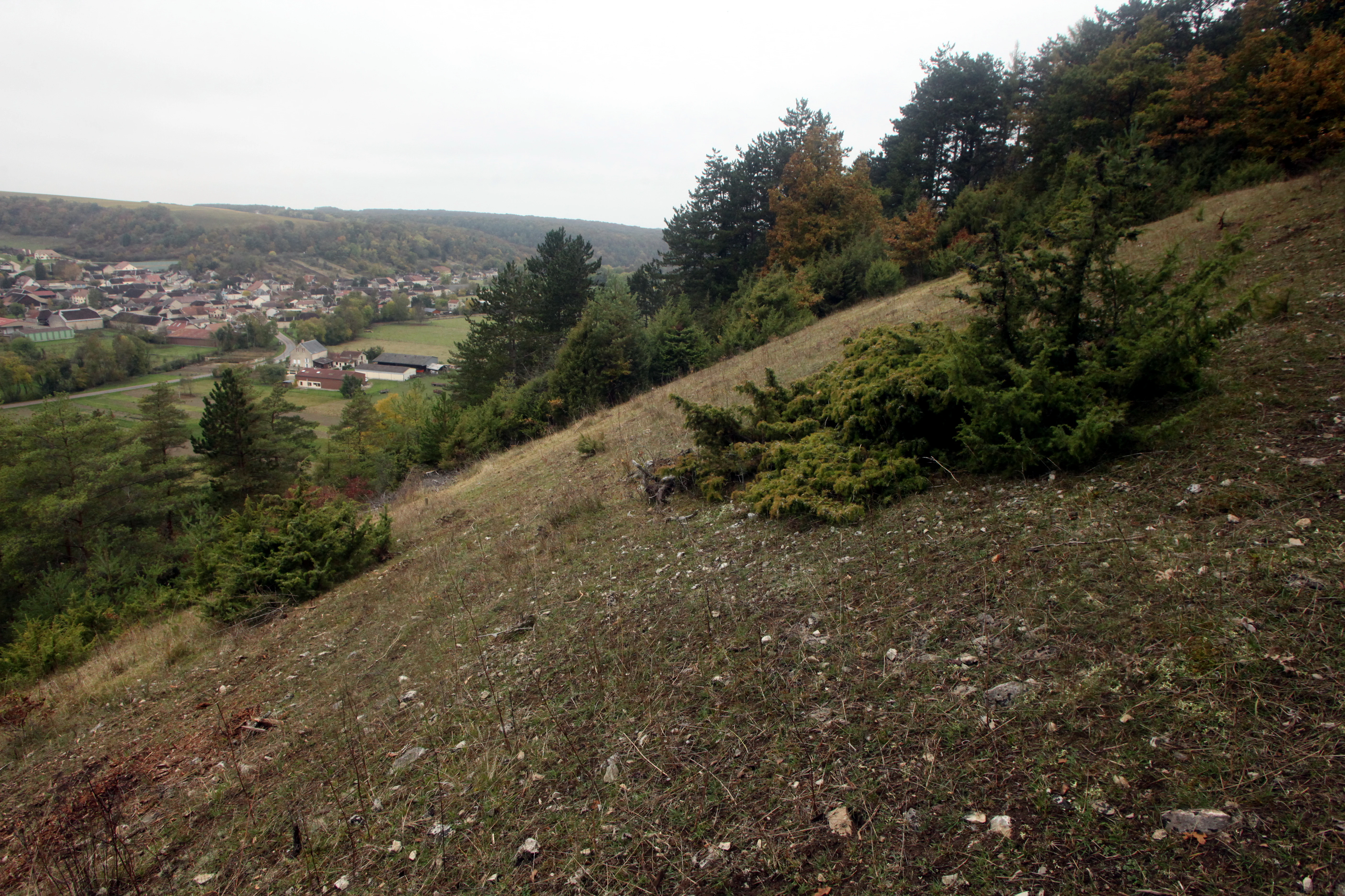
A downward-sloping grassy hill with scattered juniper bushes leads toward a valley containing a small village under a cloudy sky.
A view overlooking the dry grassland and forest edges of the Réserve naturelle régionale de la pelouse de la côte de l'étang.

Réserve naturelle régionale de la pelouse de la côte de l'étang ecosystems, habitats, and plant life

The nature of the reserve is centered on three main habitat types that together compose the protected area: a calcareous dry grassland covering the largest share of the site, shrubby fringes marking transitions toward woodland, and a thermophilic oak woodland representing the warmer, drier end of the regional forest spectrum. To these are added a small Scots pine stand and a network of traditional orchards managed as conservation features.

The dry grassland is the ecological heart of the reserve. Its shallow soils, calcareous and sometimes marly composition, and low nutrient status support a specialized flora of perennial herbs, sedges, and orchids that thrive under high light and summer drought. These conditions also create favorable microclimates for sun-loving invertebrates and reptiles, while offering open hunting and nesting habitat for a range of bird species.

The shrubby fringes and thermophilic oak woodland contribute structural diversity and habitat continuity. They connect the open grassland with the surrounding wooded landscape, allowing species to move between habitats as conditions change through the year. The orchards, often considered cultural rather than natural features, add yet another element of heterogeneity, supporting pollinators, cavity-nesting birds, and small mammals. Together, these habitats form a small but functioning ecological network rather than a single uniform vegetation cover.
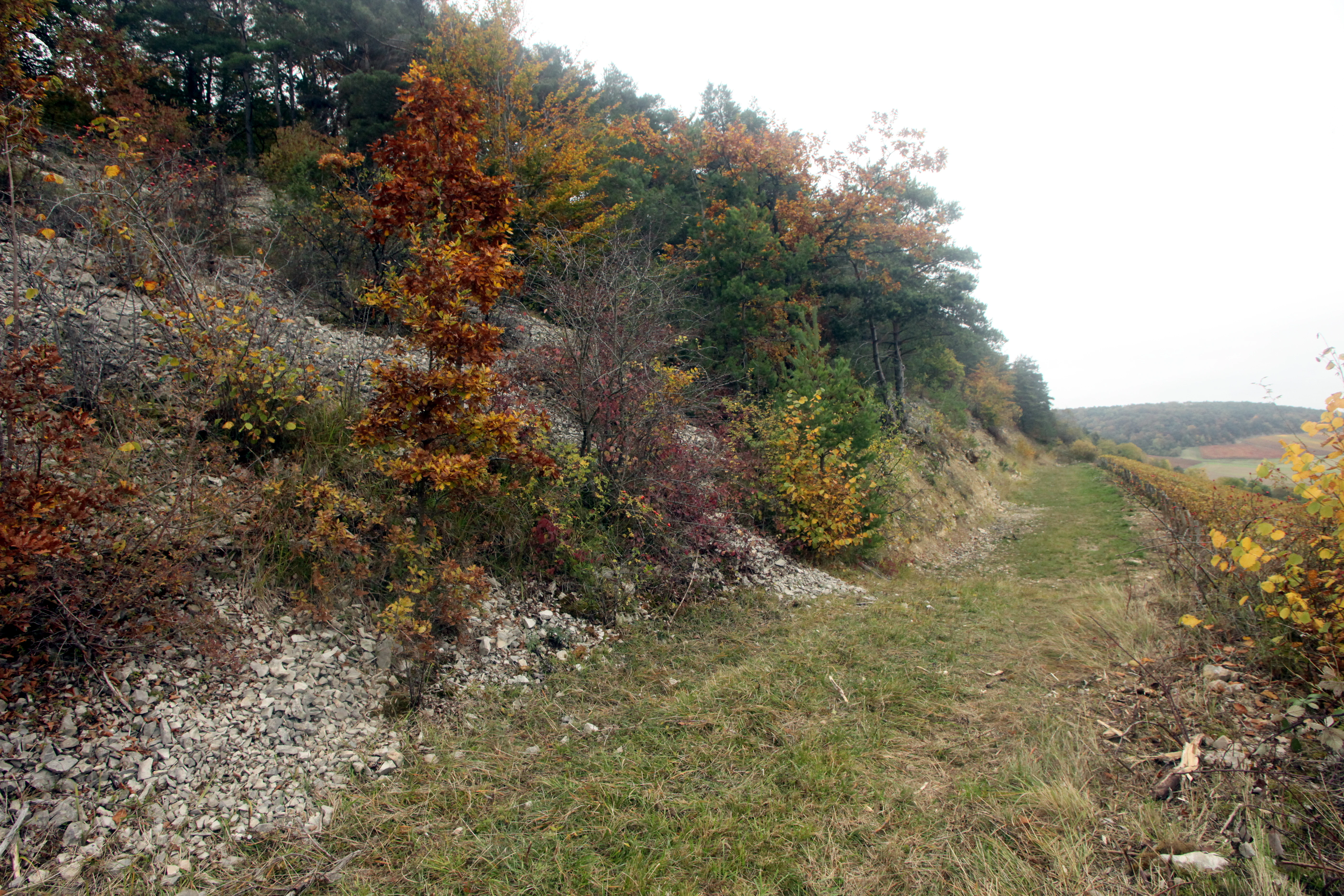
A sloped landscape features a grassy path alongside a rocky hillside covered in autumn-colored trees and shrubs under an overcast sky.
A view of the dry grassland and wooded slopes within the Regional Nature Reserve of the Etang Slope.

Réserve naturelle régionale de la pelouse de la côte de l'étang wildlife and species highlights

Wildlife in the reserve strongly reflects the warm, open character of its calcareous slopes. Birdlife is particularly notable: two species protected under Annex I of the European Birds Directive are present, the red-backed shrike, a breeding species that depends on open grassland dotted with thorny shrubs, and the hen harrier, a raptor of open country. Other breeding or regularly occurring species include the Bonelli's warbler and the common kestrel.

Reptiles and amphibians find especially favorable conditions on the dry, stony slopes. The agile frog, common frog, and common toad use the wetter pockets of the site for breeding, while reptiles such as the smooth snake, sand lizard, green lizard, and wall lizard inhabit the sunny dry-grassland and shrubby areas. This concentration of thermophilic reptiles is one of the reserve's defining ecological features.

Invertebrate diversity is equally striking for such a small site. The reserve supports a notable assemblage of butterflies typical of warm dry grasslands, including the scarce swallowtail, the lesser purple emperor, and the dryad, along with several characteristic grasshopper species such as the ochraceous grasshopper, the field grasshopper, the pine grasshopper, and the black-eared grasshopper. The sulphur-yellow ascalaphid, a striking neuropteran of dry open habitats, is also recorded. The combination of birds, reptiles, and a rich invertebrate community gives the reserve an unusually high biodiversity density.
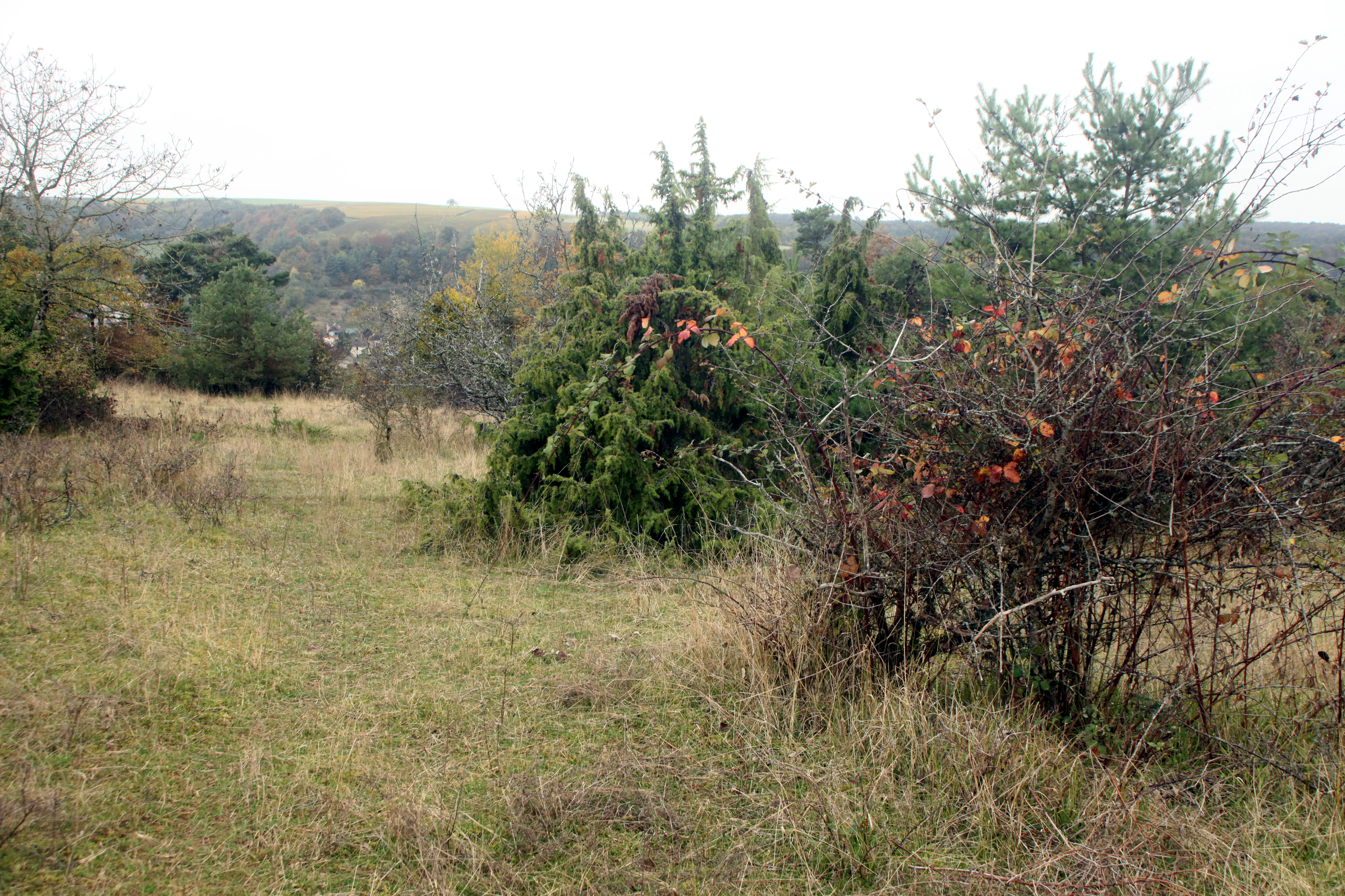
A wide, outdoor landscape shot featuring patches of dry grass, low shrubs, and evergreen bushes under an overcast sky.
A view of the open dry grassland habitat within the Réserve naturelle régionale de la pelouse de la côte de l'étang.

Réserve naturelle régionale de la pelouse de la côte de l'étang conservation status and protection priorities

The reserve's conservation importance rests on the rarity and ecological quality of its dry calcareous grassland. Across the Barrois champenois and large parts of northeastern France, this habitat type has been reduced to small, isolated fragments, making each surviving site disproportionately valuable for regional biodiversity. By protecting a representative example of this habitat, along with associated shrubby woodland and orchards, the reserve acts as a refuge and stepping stone within a much larger, degraded agricultural landscape.

The reserve contributes directly to several national and European nature protection frameworks. It lies within a Special Protection Zone designated for the conservation of birds listed under the European Birds Directive, and it overlaps with ZNIEFF type I and type II areas that document the exceptional ecological value of the Spoy slope and the surrounding Landion-Champignol valleys. These overlapping designations demonstrate that the reserve sits inside a recognized network of protected natural areas.

Management is carried out by the Conservatoire d'espaces naturels de Champagne-Ardenne, applying tailored plans adapted to the conservation needs of dry calcareous grasslands. The lack of public facilities is itself a conservation choice, designed to avoid trampling and visitor disturbance of fragile vegetation and ground-nesting fauna. By keeping the site quiet and focused on habitat quality, the reserve aims to preserve the ecological processes that sustain its exceptional flora and fauna over the long term.

Réserve naturelle régionale de la pelouse de la côte de l'étang cultural meaning and human context

The reserve is part of a cultural landscape shaped by centuries of mixed agricultural use in southern Champagne. The slope above Spoy has long sat at the interface between vineyards, cropland, orchards, and woodland, with each element reflecting different aspects of local rural life. The survival of open grassland here was historically dependent on extensive grazing, hay-making, and the manual removal of shrubs, all practices that gradually disappeared as agriculture intensified in the twentieth century.

The traditional orchards still present in the reserve are a tangible link to this period of low-intensity land use. Kept today as conservation features, they carry both a cultural and an ecological heritage, preserving old fruit varieties while providing habitat for pollinators and cavity-nesters. The wider cultural setting, between the Bar-sur-Aube vineyards and the forests to the north, reinforces the reserve's role as a small but characteristic element of the Champagne-Bar rural identity.
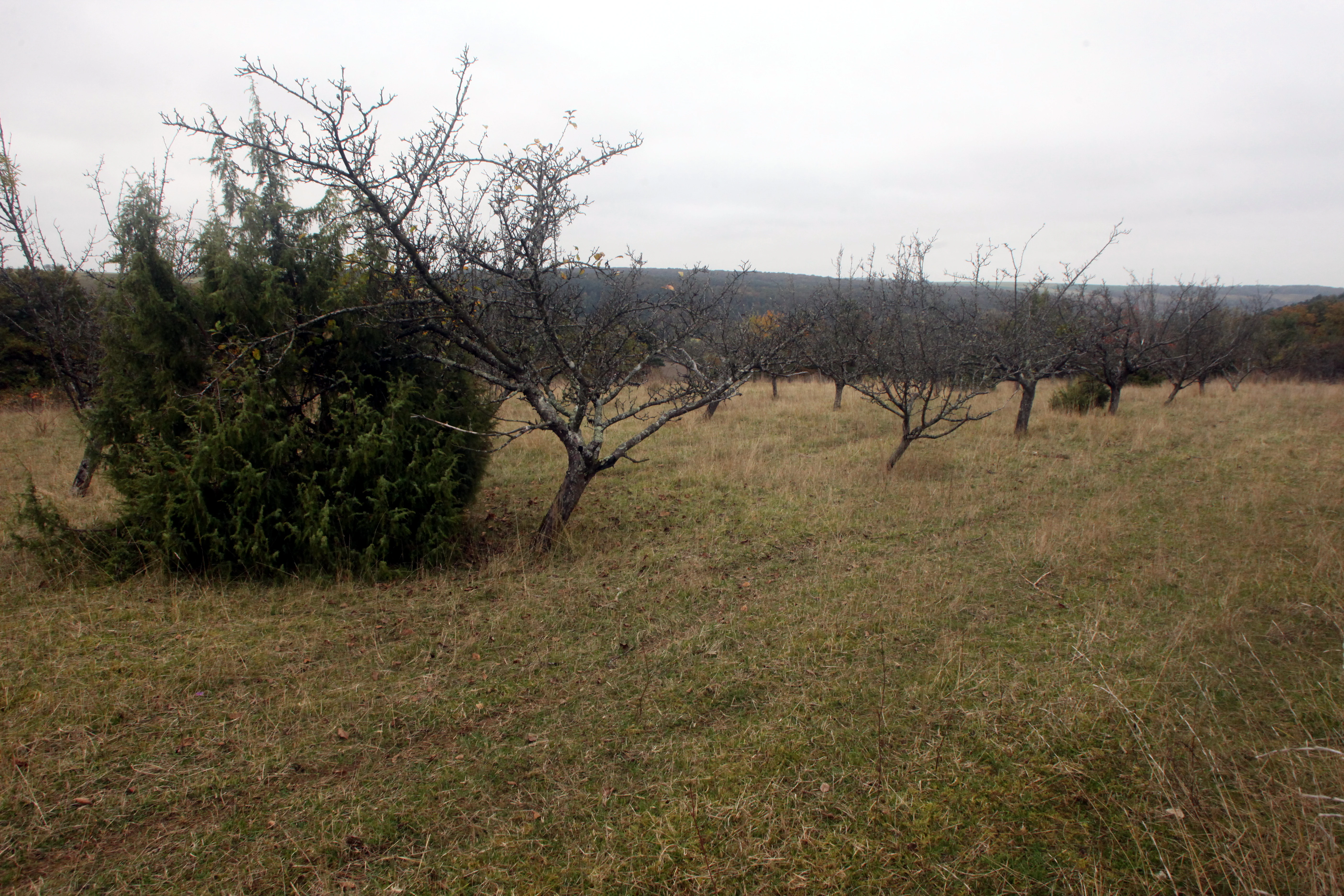
A wide view of a dormant, grassy hillside with sparse, leafless trees and a prominent evergreen shrub in the foreground under a cloudy sky.
A view of the dry grassland and scattered trees at the Réserve naturelle régionale de la pelouse de la côte de l'étang.

Top sights and standout views in Réserve naturelle régionale de la pelouse de la côte de l'étang

The reserve's standout features include its exceptionally dense biodiversity on a tiny footprint, the presence of nationally protected plants such as the yellow gentian and the vanilla-scented orchid, and the occurrence of European Directive bird species breeding on a slope just eleven hectares in size.

Equally distinctive is the mosaic of warm habitats: calcareous dry grassland, thermophilic oak woodland, Scots pine stand, shrubby fringes, and traditional conservation orchards arranged along a sun-facing slope. This combination of habitats is unusual in the Barrois champenois and gives the reserve its particular character.
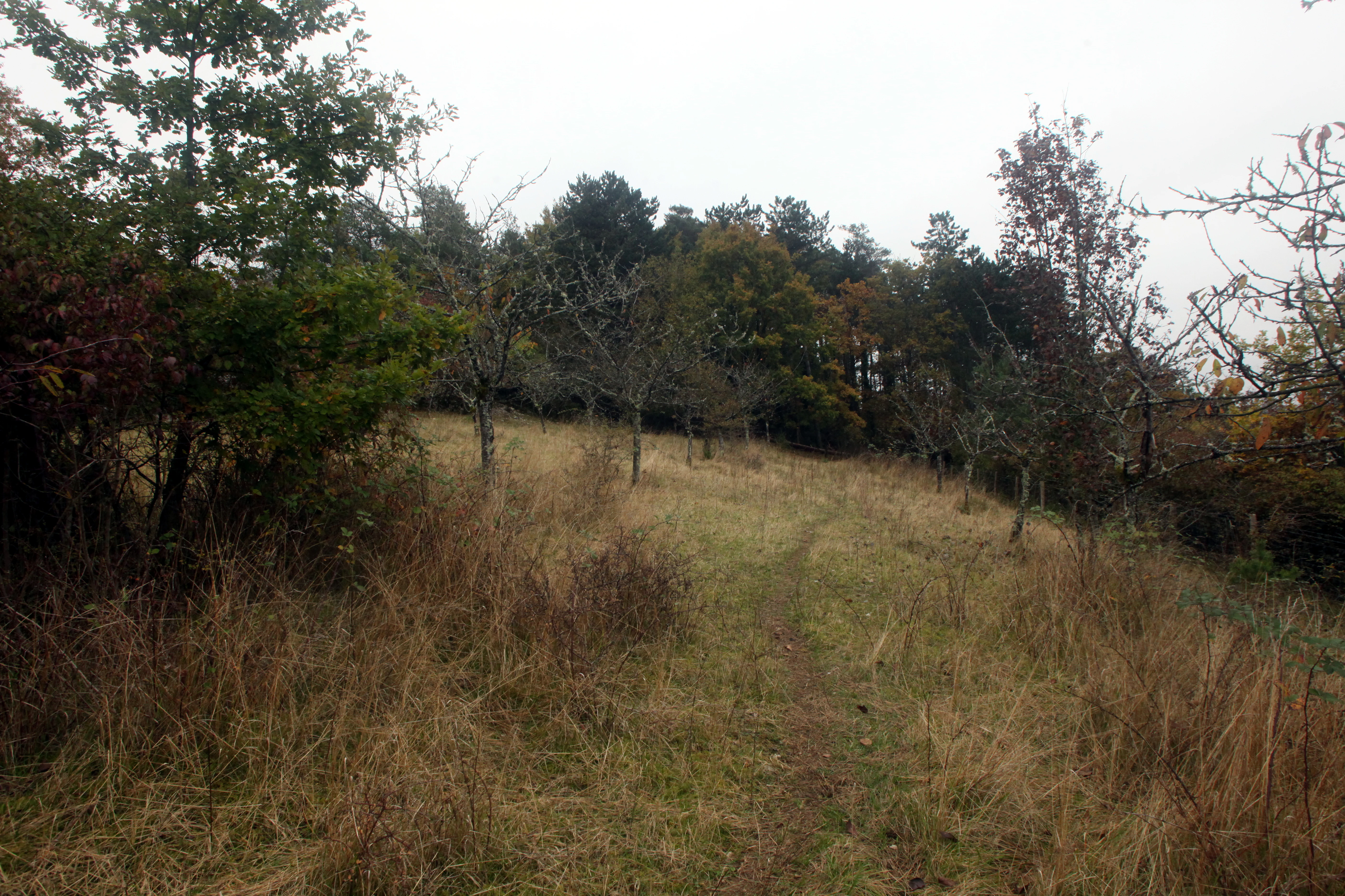
A narrow dirt trail leads through a dry grassy meadow towards a wooded hillside under a cloudy sky.
A view of the open, dry grassland habitat at the Réserve naturelle régionale de la pelouse de la côte de l'étang.

Best time to visit Réserve naturelle régionale de la pelouse de la côte de l'étang

As the site is not equipped for visitors and is managed primarily for conservation, any visit is best considered as quiet nature observation rather than a tourist outing. The most ecologically expressive period is late spring through early summer, when the dry grassland reaches its peak flowering, orchids come into bloom, and reptiles and grasshoppers become active on the warm slopes.

Bird activity is also most visible in spring and early summer, when breeding species such as the red-backed shrike and Bonelli's warbler are present on the site. As with most dry grassland habitats, visits during the hottest and driest weeks of midsummer can offer concentrated reptile and insect activity, while autumn brings quieter conditions and a different color palette across the slope. Visitors should always respect the reserve's conservation focus and any management directives of the Conservatoire d'espaces naturels.
Monthly climate preview

Long-term annual temperature and precipitation patterns from representative coordinates

Réserve naturelle régionale de la pelouse de la côte de l'étang Climate and Weather by Month

Historical climate data reveals a measured annual temperature and precipitation rhythm across representative coordinates in Réserve naturelle régionale de la pelouse de la côte de l'étang. Examining the full twelve-month profile provides complete insight into long-term averages for temperature swings and precipitation distribution.
Annual mean10 °C
2 °C20 °C
Jan
Feb
Mar
Apr
May14°
Jun17°
Jul20°
Aug19°
Sep15°
Oct11°
Nov
Dec
Warmest month
July

19.6 °C

Coolest month
January

1.9 °C

Wettest month
December

2.3 mm/day

Driest month
March

1.7 mm/day

Park location guide

Geography guide, regional context, and park location map for Réserve naturelle régionale de la pelouse de la côte de l'étang

Réserve naturelle régionale de la pelouse de la côte de l'étang park geography, regions, and map view in France

Understand where Réserve naturelle régionale de la pelouse de la côte de l'étang sits in France through a broader geographic reading of the surrounding landscape, nearby location context, and its mapped position within the national park landscape.

How Réserve naturelle régionale de la pelouse de la côte de l'étang fits into France

France is a unitary semi-presidential republic and one of the world's largest economies. It borders Belgium, Luxembourg, Germany, Switzerland, Italy, Monaco, Andorra, and Spain, with a maritime border to the United Kingdom. The country is known for its cultural influence, art, cuisine, and political history spanning centuries.

Wider geography shaping Réserve naturelle régionale de la pelouse de la côte de l'étang in France

France is located in Western Europe. Metropolitan France extends from the Rhine to the Atlantic Ocean and from the Mediterranean Sea to the English Channel and North Sea. The country borders Belgium, Luxembourg, Germany, Switzerland, Italy, Monaco, Andorra, Spain, and has a maritime border with the United Kingdom.

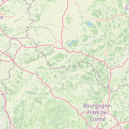
Map view of Réserve naturelle régionale de la pelouse de la côte de l'étang

Use this park location map to pinpoint Réserve naturelle régionale de la pelouse de la côte de l'étang in France, understand its exact geographic position, and read its mapped placement within the surrounding landscape more clearly.

Pigeon | © OpenStreetMap contributors

Location context for Réserve naturelle régionale de la pelouse de la côte de l'étang

Grand Est

Explore the calcareous dry grasslands, terrain features, and protected habitats of this reserve.

Visualizing Réserve naturelle régionale de la pelouse de la côte de l'étang Photos and Landscapes

Examine curated photography of Réserve naturelle régionale de la pelouse de la côte de l'étang to understand its unique southwest-facing limestone slope and warm vegetation mosaic. Visual documentation reveals the distinct topography and habitat structures defining this protected natural area.

A wide landscape view of a hillside in autumn with a mix of light-colored rocky outcrops, dense forest, and terraced fields in yellow and brown shades.

A landscape view of a hillside in the nature reserve showing dry grassland, shrubs, and a band of exposed limestone rock with a forest line at the top.

A downward-sloping grassy hill with scattered juniper bushes leads toward a valley containing a small village under a cloudy sky.

A sloped landscape features a grassy path alongside a rocky hillside covered in autumn-colored trees and shrubs under an overcast sky.

A wide, outdoor landscape shot featuring patches of dry grass, low shrubs, and evergreen bushes under an overcast sky.

A wide angle view looking down from a grassy hillside slope into a valley with farmland, scattered trees, and a small building in the distance.

A wide view of a dormant, grassy hillside with sparse, leafless trees and a prominent evergreen shrub in the foreground under a cloudy sky.

A narrow dirt trail leads through a dry grassy meadow towards a wooded hillside under a cloudy sky.

Park atlas

Compare regional protected areas and surrounding conservation landscapes

Other Parks Near Réserve naturelle régionale de la pelouse de la côte de l'étang

Browsing other protected areas near Réserve naturelle régionale de la pelouse de la côte de l'étang reveals the broader ecological context of the Grand Est region. Comparing these neighboring reserves helps trace connected wildlife habitats and regional terrain patterns.
A horizontal watercolor illustration showing a pond with green trees, reeds, and low hills in the background against a white backdrop.
Nature reserveGrand Est
About 12 km away#1 closest

North

Réserve naturelle régionale de l'étang de Ramerupt: Geography and Protected Wetland Atlas

Mapping the historic Champagne humide pond landscape in Grand Est

Examine the dense wetland mosaic of Réserve naturelle régionale de l'étang de Ramerupt, a 33-hectare sanctuary in the Aube department. This resource traces the pond edges, reedbed structures, and wet woodland terrain that comprise this essential regional nature reserve, highlighting the intersection of human water management and natural marshland succession in the French countryside.

Area
0.336 km²
Established
2010
IUCN
IV
Relief
Lowland
A soft watercolor painting of a calm lake scene featuring small grassy islands with trees, surrounded by marshy vegetation under a light, hazy sky.
Nature reserveGrand Est
About 20 km away#2 closest

Northwest

Réserve naturelle nationale de la forêt d'Orient: Protected Landscapes and Wetland Mapping

Key protected area in the Grand Est region of France

Investigate the geographic structure of Réserve naturelle nationale de la forêt d'Orient, a reserve shaped by reservoir-driven water cycles. This protected area features a diverse arrangement of lake-edge mudflats, expansive reedbeds, and temperate forest cover. Gain insight into the regional importance of these habitats as a node for migratory bird pathways and native terrestrial biodiversity in eastern France.

Area
15.6 km²
Established
2002
IUCN
IV
Relief
Lowland
Nature reserveGrand Est
About 30 km away#3 closest

West

Réserve naturelle régionale des prairies humides de Courteranges: Protected Landscape Map

Barse Valley wetlands and meadow mosaic in Grand Est

This protected area preserves an intricate network of humid grasslands and traditional hay meadows along the Barse river. Its geography showcases a rare mosaic of wetland vegetation and managed habitats that provide critical ecological continuity within the Grand Est natural network.

Area
0.277 km²
Established
2010
IUCN
IV
Relief
Lowland
Watercolor illustration of a forested landscape with rolling hills, distant mountains, and a sky with soft pastel colors
National parkFrance
About 32 km away#4 closest

South

Forêts National Park: A Protected Landscape of Lowland Deciduous Forests

Explore its unique geography and protected forest ecosystems.

Delve into Forêts National Park, a significant protected area in northeastern France dedicated to preserving lowland deciduous forests and their associated biodiversity. This park represents a unique atlas entry for understanding mapped protected lands, featuring extensive broad-leaved forest tracts, diverse wetlands, and limestone grasslands across the Grand Est and Bourgogne-Franche-Comté regions. Discover the geographic identity of this conservation landscape and its role within the Paris Basin's terrain.

Area
560 km²
Established
2019
IUCN
II
Relief
Lowland
A horizontal watercolor illustration featuring a soft green and yellow landscape of a pond and wetland area with shrubs and meadow grass.
Nature reserveGrand Est
About 46 km away#5 closest

North

Réserve naturelle régionale de l'étang et prairie humide des Paquis: Regional Nature Reserve Geography

Wetland habitat mapping in the Marne department of Grand Est, France

This regional nature reserve encompasses a compact 8.31 hectare wetland complex comprising an étang and a surrounding prairie humide. Its significance lies in its role as a concentrated biodiversity node amidst the open agricultural landscape of the Champagne region, managed primarily for habitat conservation and avian protection.

Area
0.083 km²
Established
2014
IUCN
IV
Nature reserveHaute-Marne
About 55 km away#6 closest

Tufière de Rolampont Nature Reserve: Travertine Cascades and Geological Heritage in Haute-Marne

A rare living limestone formation in the Grand Est region of France

Tufière de Rolampont offers a window into the evolution of calcareous wetland ecosystems within the Champagne plateau. Visitors observe a process of natural stone creation where mineral-rich water encrusts living mosses, resulting in the stepped terraces that define this protected landscape. This site serves as a vital laboratory for understanding the intersection of hydrological heritage and unique botanical habitats.

Area
0.126 km²
Established
1982
Relief
Lowland
Climate
Temperate
A watercolor painting of a rolling rural landscape with grassy hills, woodlands, and a winding stream, rendered in soft pastel greens, yellows, and pinks.
Nature reserveGrand Est
About 72 km away#7 closest

Southeast

Réserve naturelle régionale des pelouses et bois de Villemoron: Protected Area and Map

Regional nature reserve in the Grand Est, France

This protected area provides a rare glimpse into the limestone-based geography of the Haute-Marne department. Featuring a structured mix of oak forests and open calcareous grasslands, the reserve serves as an essential habitat refuge within the larger landscape of the Grand Est region. Use our mapped data to trace the boundaries and features of this uniquely managed natural environment.

Area
0.87 km²
Established
2015
IUCN
IV
Relief
Upland
A soft, horizontal watercolor painting depicting a calm wetland landscape with grassy banks, distant forested hills, and a pale, misty sky.
Nature reserveFrance
About 84 km away#8 closest

North

Réserve naturelle régionale des étangs de Belval-en-Argonne: Protected Area and Wetland Geography

Mapped pond systems in the Marne department of France.

This protected area features a unique mosaic of five historic pond basins set within a gentle plateau landscape. The site is a cornerstone of the Champagne humide wetland system, defined by its interconnected open water, reedbed margins, and wet woodland habitats that support diverse waterbird and amphibian populations across the Argonne region.

Area
2.037 km²
Established
2012
Relief
Lowland
Climate
Temperate

Common questions about visiting, size, designation, and location context for Réserve naturelle régionale de la pelouse de la côte de l'étang

Réserve naturelle régionale de la pelouse de la côte de l'étang FAQs for park facts, access, geography, and protected area context

Find quick answers about Réserve naturelle régionale de la pelouse de la côte de l'étang, including protected-area facts, park geography, trail and visitor context, and how the park fits into its surrounding country and regional landscape.
MoriAtlas Explorer

Continue Your Protected Areas Search Across the Global Atlas

Deepen your exploration by continuing the structured search for national parks and protected areas worldwide. Utilize the comprehensive filtering capabilities to compare different conservation landscapes and refine your understanding of global park geography. Discover more about the distribution and characteristics of protected natural areas.

Global natural geography