
Mori Atlas logo
Nature reserveRéserve naturelle régionale des étangs de Bonnelles

Analyzing the ecological role of pond habitats within the southern Yvelines regional geography.

Réserve naturelle régionale des étangs de Bonnelles: Mapping Freshwater Protected Landscapes

The Réserve naturelle régionale des étangs de Bonnelles is a significant protected area in the Île-de-France region, anchored by the Étang de Chartemps and the Étang des Trois Ducs. This compact 22-hectare wetland serves as an essential refuge for aquatic biodiversity, including rare dragonfly populations and diverse bird species. Its geography illustrates the importance of preserving small-scale pond ecosystems within an increasingly urbanized landscape.

regional nature reservewetlandpondsfreshwater habitatdragonfliesbirdwatching
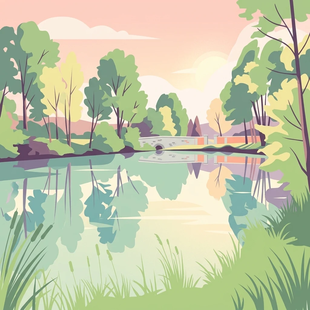
A stylized vector art illustration depicting a calm pond reflecting a stone bridge and surrounding trees at sunset.

Réserve naturelle régionale des étangs de Bonnelles

Nature reserve

Park overview

Structured park overview, official facts, and landscape profile for Réserve naturelle régionale des étangs de Bonnelles

Réserve naturelle régionale des étangs de Bonnelles park facts, protected area profile, and essential visitor context

Review the core facts for Réserve naturelle régionale des étangs de Bonnelles, including designation, size, terrain, visitor scale, habitats, and operating context in one park-focused overview.

About Réserve naturelle régionale des étangs de Bonnelles

The Réserve naturelle régionale des étangs de Bonnelles sits in the rural fringes of the Yvelines, on the commune of Bonnelles, where it occupies a small but ecologically significant landscape shaped by standing water and surrounding woodland. Although it covers only about 22 hectares, the reserve concentrates protection around two ponds that have become the focal point for biodiversity in this part of the Île-de-France region. The Étang de Chartemps has long been associated with angling, while the neighboring Étang des Trois Ducs adds to the wetland mosaic.

The site was first protected in 1990 as a Réserve Naturelle Volontaire, a status granted through a voluntary commitment of local landowners and managers to maintain ecologically friendly practices. In 2016, the Conseil régional d'Île-de-France reclassified the area as a Réserve naturelle régionale, elevating its level of protection and bringing it into the formal French regional nature reserve network. This reclassification marked a clear transition from a privately driven conservation effort to a regionally backed and legally anchored reserve.

Ecologically, the reserve functions as a refuge for freshwater and wetland-dependent wildlife in a region where ponds, marshes, and associated habitats have been heavily reduced over time. The combination of open water, shoreline vegetation, wet meadows, and surrounding woodland creates a gradient of microhabitats that supports a wide range of species. The site is also closely linked to the broader context of the Parc naturel régional de la Haute Vallée de Chevreuse, with relevant management and consultation processes connected to the park's authorities. Today, the Étangs de Bonnelles reserve stands as a small but well-documented example of how even modest wetland patches can carry meaningful conservation weight in highly populated regions of western Europe.

Quick facts and research context for Réserve naturelle régionale des étangs de Bonnelles

The Réserve naturelle régionale des étangs de Bonnelles is a regional nature reserve situated in the commune of Bonnelles, in the Yvelines department of the Île-de-France region. It encompasses about 22 hectares centered on two ponds, the Étang de Chartemps and the Étang des Trois Ducs. The site was first classified as a voluntary nature reserve in 1990 and was strengthened through reclassification as a regional nature reserve in 2016. Its IUCN category IV designation reflects its role in protecting specific habitats and species. The reserve is catalogued under the identifier RNR314 and is registered in the World Database on Protected Areas.

Protection and recognition

Documented terrestrial protection scope, designation year, and official recognition records

Réserve naturelle régionale des étangs de Bonnelles Protection Status and Designation History

Terrestrial protection status and designation history for Réserve naturelle régionale des étangs de Bonnelles establish a clear baseline for conservation geography. Official records detail the 2016 establishment framework and management scope across the protected landscape.

Protection details

Protection scope
Terrestrial
Designated year
2016
Transboundary protection
No
WDPA ID
555597219
Park context

Deeper park guide and search-rich context for Réserve naturelle régionale des étangs de Bonnelles

Réserve naturelle régionale des étangs de Bonnelles history, landscape, wildlife, and travel context

Explore Réserve naturelle régionale des étangs de Bonnelles through its history, landscape character, ecosystems, wildlife, conservation priorities, cultural context, and seasonal travel timing in a structured park guide built for atlas discovery and search intent.

Why Réserve naturelle régionale des étangs de Bonnelles stands out

The reserve is best known for its two artificial ponds that anchor a compact but ecologically rich wetland habitat in a predominantly urban region. It is particularly recognized for hosting a notable diversity of dragonflies, including several rare and protected species, as well as a substantial bird list reflecting the importance of open water and adjacent vegetation for waterbirds and woodland species. Within Île-de-France, it is valued as a stronghold of freshwater biodiversity and a representative example of small-scale pond conservation.
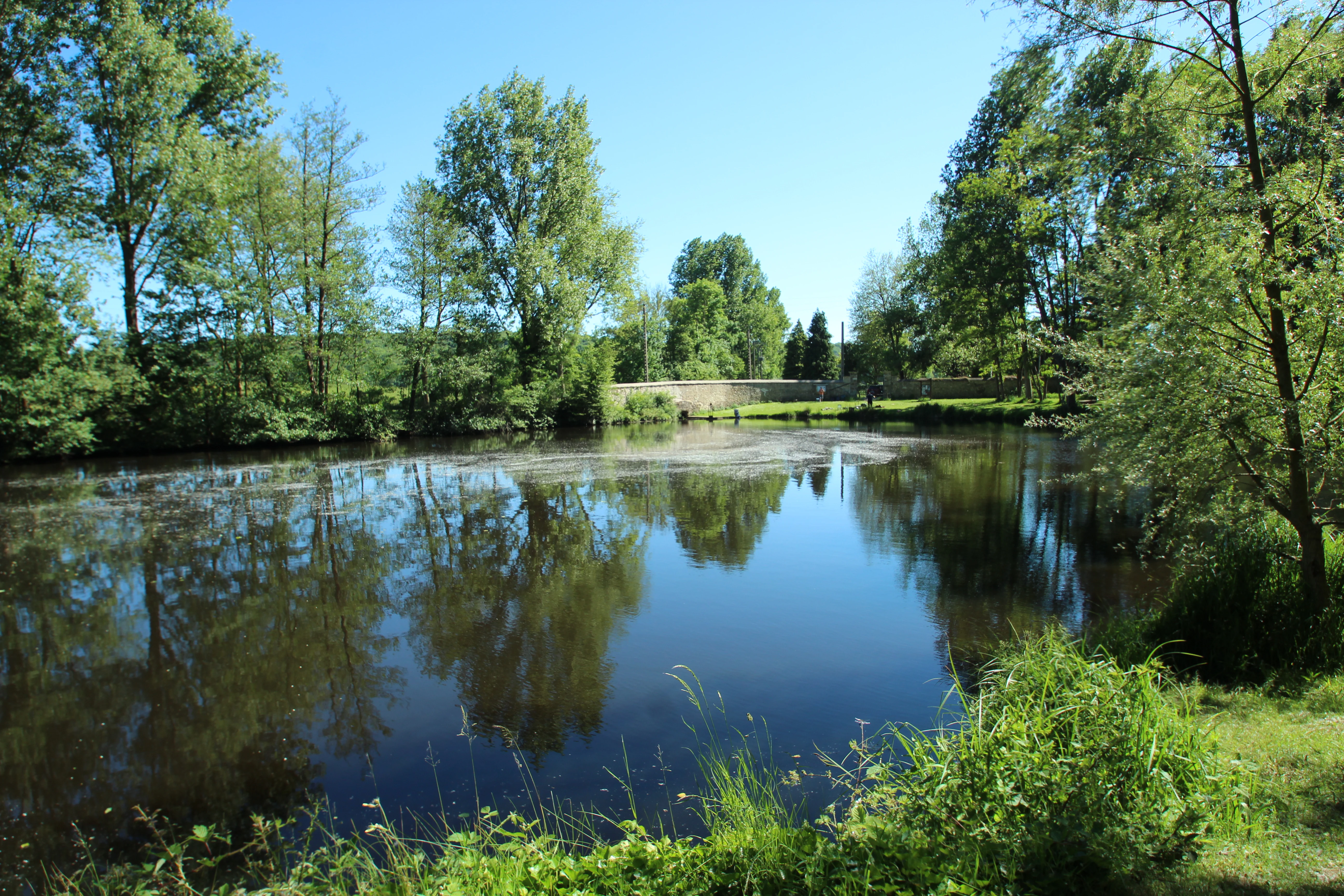
A calm, reflective pond surrounded by lush green trees and vegetation on a clear day.
A serene view of one of the ponds at the Réserve naturelle régionale des étangs de Bonnelles.

Réserve naturelle régionale des étangs de Bonnelles history and protected-area timeline

The history of the Étangs de Bonnelles reserve begins with its establishment on 24 August 1990, when it was originally classified as a Réserve Naturelle Volontaire. This initial designation reflected a voluntary approach to conservation, common in France during that period, in which landowners and local stakeholders committed to maintaining environmentally sensitive management practices on privately held land. The ponds of Bonnelles, including the Étang de Chartemps, were at the heart of this early protective effort.

In the decades that followed, the recognition that voluntary reserves could be strengthened through regional frameworks led the Conseil régional d'Île-de-France to reclassify the site. On 8 October 2016, a regional deliberation formalized its transition into a Réserve Naturelle Régionale, a stronger and more durable protected-area status within the French conservation system. This reclassification process included public consultation and input from bodies such as the Parc naturel régional de la Haute Vallée de Chevreuse, reflecting the site's integration into the wider regional conservation landscape of the Yvelines.

Réserve naturelle régionale des étangs de Bonnelles landscape and geographic character

The landscape of the Étangs de Bonnelles reserve is defined by its two ponds and the surrounding mosaic of wetland and woodland habitats. The Étang de Chartemps and the Étang des Trois Ducs are the dominant physical features, with their calm, open waters bordered by vegetated shorelines. These water bodies are set within a gently rolling terrain typical of the southern Yvelines, where rural land use, hedgerows, and patches of forest still characterize parts of the landscape.

Although the reserve itself is small in area, the ponds create a pronounced hydrological influence, sustaining wet margins, reed beds, and damp meadows that extend beyond the strict reserve perimeter. The surrounding woodland and hedge networks add further structural diversity, producing transitions between open water, marshy edges, and shaded forest habitats that are characteristic of the broader Chevreuse area.

Réserve naturelle régionale des étangs de Bonnelles ecosystems, habitats, and plant life

Ecologically, the reserve is centered on freshwater pond ecosystems, which are increasingly rare and fragmented in the wider Île-de-France region. The two ponds sustain a layered habitat structure: open water, floating and submerged vegetation, reed-dominated margins, wet meadows, and adjacent woodland. This gradient of conditions supports a wide range of aquatic, semi-aquatic, and terrestrial species, giving the reserve an ecological richness that belies its modest footprint.

The site is particularly significant for invertebrate life, especially dragonflies and damselflies, which depend heavily on healthy pond ecosystems. The mosaic of microhabitats also benefits amphibians, aquatic insects, and waterbirds, while the surrounding woodland adds habitat for songbirds, small mammals, and woodland invertebrates. As a result, the Étangs de Bonnelles function as a compact biodiversity reservoir in an otherwise heavily urbanized region.

Réserve naturelle régionale des étangs de Bonnelles wildlife and species highlights

The wildlife profile of the reserve is anchored by its freshwater biodiversity, with dragonflies being one of the most prominent groups. The site documents a notably rich odonat fauna, including multiple species that are rare or protected within the regional context. This makes the ponds an important reference site for dragonfly conservation in Île-de-France.

Birdlife is equally significant: the reserve records a substantial checklist of bird species reflecting the diversity of habitats present. Open water supports waterbirds and species associated with reed beds, while surrounding woodland contributes woodland and edge species. Together, these conditions create a varied bird community across a small area, reinforcing the reserve's value as a refuge for species that have lost much of their natural habitat in the broader region.

Réserve naturelle régionale des étangs de Bonnelles conservation status and protection priorities

From a conservation perspective, the Étangs de Bonnelles reserve addresses a critical challenge in Île-de-France: the protection of freshwater and wetland habitats in a region dominated by urbanization, infrastructure, and agriculture. The ponds represent a surviving example of a habitat type that has been heavily reduced historically, making their formal protection an important contribution to regional biodiversity policy.

The evolution from a voluntary reserve to a regional nature reserve marks a strengthening of the site's conservation framework. The regional status provides clearer legal protection, structured management, and integration into the broader French network of regional nature reserves. The reserve's IUCN Category IV designation emphasizes habitat and species protection, and its inclusion in international databases reflects its recognition as a formally protected wetland site of regional importance.

Top sights and standout views in Réserve naturelle régionale des étangs de Bonnelles

The reserve's strongest highlights are its two pond habitats, the Étang de Chartemps and the Étang des Trois Ducs, which together form a compact but ecologically dense wetland complex. It stands out for hosting a rich dragonfly community, including rare and protected species that depend on healthy pond environments. Its bird list further reinforces its identity as a significant small-scale refuge for aquatic and woodland species within the heavily populated Île-de-France region.

The site's reclassification in 2016 from a voluntary reserve to a formal regional nature reserve is itself a highlight, signaling a long-term regional commitment to protecting this small but valuable patch of freshwater habitat.

Best time to visit Réserve naturelle régionale des étangs de Bonnelles

The Étangs de Bonnelles reserve is best appreciated during the warmer months, when pond habitats are most active and species diversity is at its peak. Late spring and summer bring peak dragonfly activity along pond margins, vibrant wetland vegetation, and heightened bird song, making these seasons especially rewarding for naturalists and casual visitors interested in freshwater biodiversity. Autumn can offer quieter conditions and the chance to observe migratory bird activity around the ponds. Winter visits, while less lively biologically, can still provide peaceful views of the water bodies and surrounding woodland in the rural Yvelines setting.
Monthly climate preview

Long-term representative point measurements tracking annual temperature and precipitation rhythm

Réserve naturelle régionale des étangs de Bonnelles Climate Normals and Weather by Month

Representative coordinate records show average monthly temperatures ranging from 3.1 degrees Celsius to 19.22 degrees Celsius alongside steady precipitation distribution across the year. Complete monthly climate normals provide deeper analytical context for studying long-term meteorological patterns at this protected location.
Annual mean11 °C
3 °C19 °C
Jan
Feb
Mar
Apr10°
May14°
Jun17°
Jul19°
Aug19°
Sep15°
Oct11°
Nov
Dec
Warmest month
July

19.2 °C

Coolest month
January

3.1 °C

Wettest month
December

2.1 mm/day

Driest month
March

1.5 mm/day

Park location guide

Geography guide, regional context, and park location map for Réserve naturelle régionale des étangs de Bonnelles

Réserve naturelle régionale des étangs de Bonnelles park geography, regions, and map view in France

Understand where Réserve naturelle régionale des étangs de Bonnelles sits in France through a broader geographic reading of the surrounding landscape, nearby location context, and its mapped position within the national park landscape.

How Réserve naturelle régionale des étangs de Bonnelles fits into France

France is a unitary semi-presidential republic and one of the world's largest economies. It borders Belgium, Luxembourg, Germany, Switzerland, Italy, Monaco, Andorra, and Spain, with a maritime border to the United Kingdom. The country is known for its cultural influence, art, cuisine, and political history spanning centuries.

Wider geography shaping Réserve naturelle régionale des étangs de Bonnelles in France

France is located in Western Europe. Metropolitan France extends from the Rhine to the Atlantic Ocean and from the Mediterranean Sea to the English Channel and North Sea. The country borders Belgium, Luxembourg, Germany, Switzerland, Italy, Monaco, Andorra, Spain, and has a maritime border with the United Kingdom.

Map view of Réserve naturelle régionale des étangs de Bonnelles

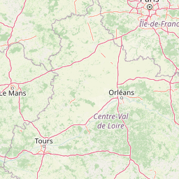
Use this park location map to pinpoint Réserve naturelle régionale des étangs de Bonnelles in France, understand its exact geographic position, and read its mapped placement within the surrounding landscape more clearly.

Pigeon | © OpenStreetMap contributors

Location context for Réserve naturelle régionale des étangs de Bonnelles

Île-de-France

Explore protected wetland habitats, pond environments, and regional nature reserve terrain.

Visualizing Réserve naturelle régionale des étangs de Bonnelles Photos and Landscape Scenery

Photographic collections reveal the distinctive wetland habitats, calm pond waters, and wooded margins that define the protected landscape. Visual reference records help researchers and visitors examine the terrain, aquatic ecosystems, and local biodiversity preserved across the reserve.

A calm, reflective pond surrounded by lush green trees and vegetation on a clear day.

Park atlas

Compare adjacent wetland habitats, regional reserves, and connected natural landscapes

Parks Near Réserve naturelle régionale des étangs de Bonnelles and Surrounding Protected Areas

Visitors exploring Réserve naturelle régionale des étangs de Bonnelles can browse nearby protected areas and adjacent wetland reserves across the surrounding regional terrain. Extending the geographic review allows comparison of similar freshwater habitats, regional park networks, and protected landscapes.
Nature reserveÎle-de-France
About 10 km away#1 closest

Northeast

Réserve naturelle régionale du val et coteau de Saint-Rémy: Regional Nature Reserve Geography

A protected river valley and coteau habitat in Île-de-France

Spanning eighty-three hectares across five distinct parcels, this protected area serves as a vital ecological corridor along the Yvette river. Analyze the site's unique habitat distribution, ranging from moist bottomlands to dry, calcareous slopes, and trace its role in preserving regional biological diversity near Saint-Rémy-lès-Chevreuse.

Area
0.83 km²
Established
2008
IUCN
IV
A soft, painterly watercolor illustration depicting a winding river flowing through a green basin with rolling hills, grasses, and scattered trees under a light sky.
Nature reserveÎle-de-France
About 24 km away#2 closest

Northeast

Réserve naturelle régionale du bassin de la Bièvre: Protected Wetland and Basin Geography

A vital urban nature reserve within the Île-de-France region

Located south of Paris, this six-hectare nature reserve demonstrates how an artificial stormwater basin can evolve into a functioning wetland. Its geography is defined by fluctuating water levels and reedbed habitats that provide sanctuary for migratory birds. Examine the protected boundaries and landscape terrain of this significant, compact ecological refuge in the Bièvre valley.

Area
0.06 km²
Established
2009
IUCN
IV
Relief
Lowland
A soft watercolor illustration depicting a serene landscape with rolling green fields, scattered deciduous trees, and a small meandering stream, set against a light, hazy background.
Nature reserveÎle-de-France
About 42 km away#3 closest

East

Réserve naturelle régionale des bruyères de Sainte-Assise: Heathland Conservation Geography

A protected sandy heathland within the Île-de-France region

This reserve protects rare lowland heathland habitat on acidic soils within the Seine-et-Marne department. Spanning approximately 87 hectares near the Seine valley, the landscape is defined by heather and open vegetation. The site provides a vital sanctuary for biodiversity in a peri-urban setting, balancing conservation with its unique integration of historical land use and local geography.

Area
0.872 km²
Established
2009
IUCN
IV
Relief
Lowland
Nature reserveÎle-de-France
About 48 km away#4 closest

Northwest

Réserve naturelle régionale du site géologique de Limay: Protected Landscapes and Geological Maps

A diverse nature reserve in the Yvelines department of Île-de-France.

Deeply rooted in the geological history of the Paris Basin, this former quarry site in Limay is now a thriving regional nature reserve. Its compact territory features a striking contrast between ancient limestone exposures and rich wetland pockets, providing a vital educational platform for studying biodiversity and land reclamation in north-central France.

Area
0.698 km²
Established
2009
IUCN
IV
Relief
Lowland
A watercolor illustration of a rural landscape with rolling green fields and distant trees, framed by delicate foliage in the foreground.
Nature reserveCentre-Val de Loire
About 48 km away#5 closest

Northwest

Réserve naturelle régionale de la Vallée des Cailles: Protected Area Map & Geography

Ecological landscape features in the Centre-Val de Loire

The Réserve naturelle régionale de la Vallée des Cailles encompasses forty-five hectares of calcareous chalk valley. This protected space preserves rare orchid species and diverse botanical communities shaped by a unique combination of flint geology, north-facing slopes, and long-running traditional land management practices.

Area
0.45 km²
Established
1999
IUCN
IV
Relief
Upland
A horizontal watercolor illustration showing a calm river winding around small tree-covered islands with low hills in the distance.
Nature reserveÎle-de-France
About 51 km away#6 closest

Northeast

Réserve naturelle régionale des îles de Chelles: Protected River Islands in Île-de-France

Wetland ecosystems and riparian landscape geography

Located on the Marne River, this protected regional nature reserve encompasses a series of river islands known for their rich wetland biodiversity. The site offers a unique geographic perspective on urban-adjacent conservation, featuring a mosaic of riparian thickets and hygrophilous flora that contrasts with the surrounding Seine-et-Marne landscape.

Area
0.05 km²
Established
2008
IUCN
IV
Relief
Lowland
Nature reserveÎle-de-France
About 51 km away#7 closest

North

Réserve naturelle régionale du site géologique de Vigny-Longuesse: A Geological Reference Site

Protected limestone landscape in the Vexin region of Île-de-France

Protecting a critical paleontological and stratigraphic record, this reserve showcases a unique Tertiary reef complex. The site combines artificial quarry cliffs with natural geomorphological features, including paleolandslides and fossil-bearing limestone plates, providing a comprehensive outdoor archive of the Paris Basin.

Area
0.219 km²
Established
2009
IUCN
IV
Relief
Upland
A pale, soft watercolor painting of a calm wetland or marsh, featuring muted green vegetation, light water reflection, and a gentle shoreline under a hazy sky.
Nature reserveÎle-de-France
About 54 km away#8 closest

North

Réserve naturelle régionale du marais de Stors: Atlas and Protected Landscape Overview

A rare wetland enclave in the Vallée de Chauvry

Focusing on the hydrological and ecological character of the Réserve naturelle régionale du marais de Stors, this overview examines its role as a protected nature reserve in the Paris region. Explore the marshland terrain and valley topography that define this unique pocket of conserved habitat in northern France.

Area
0.47 km²
Established
2009
IUCN
IV

Common questions about visiting, size, designation, and location context for Réserve naturelle régionale des étangs de Bonnelles

Réserve naturelle régionale des étangs de Bonnelles FAQs for park facts, access, geography, and protected area context

Find quick answers about Réserve naturelle régionale des étangs de Bonnelles, including protected-area facts, park geography, trail and visitor context, and how the park fits into its surrounding country and regional landscape.
MoriAtlas Explorer

Continue Your Protected Areas Search Across the Global Atlas

Deepen your exploration by continuing the structured search for national parks and protected areas worldwide. Utilize the comprehensive filtering capabilities to compare different conservation landscapes and refine your understanding of global park geography. Discover more about the distribution and characteristics of protected natural areas.

Global natural geography