Why Réserve naturelle régionale des Larris et tourbières de Saint-Pierre-es-Champs stands out
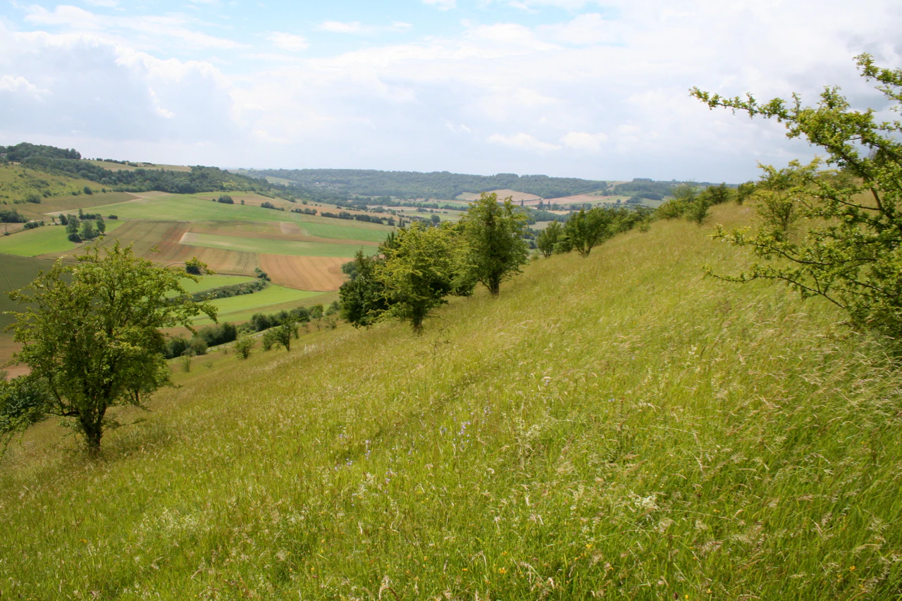
The reserve is best known for its chalk grasslands, called larris in local Picard speech, which cap the south-facing slopes of the Côte Sainte-Hélène. These nutrient-poor, drought-prone grasslands once stretched widely across northern France but have shrunk to a small fraction of their historic area. It is also recognised for the contrast between this dry, Mediterranean-flavoured slope and the cooler, damper northern flank, which supports peatland patches and sub-montagnard woodland species such as Herb Paris and Baneberry. The archaeological and historic fabric of the Côte Sainte-Hélène, combined with strong populations of orchids and butterflies, gives the site its distinctive identity.
Réserve naturelle régionale des Larris et tourbières de Saint-Pierre-es-Champs history and protected-area timeline
The Côte Sainte-Hélène has been occupied and used for millennia, thanks to its position as a commanding natural viewpoint. Archaeological excavations conducted in 1988 and 1989 revealed stone tools, pottery, and coins that confirm human presence from the Neolithic period through the Gallo-Roman era.
In addition to its defensive and settlement role, the Côte became a place of worship. Two chapels were built in succession, the later one dedicated to Saint Helena, after whom the promontory is named. Pilgrimages and processions were held there, and burials have been identified near the large ancient lime tree at the foot of the slope. Religious processions were revived on the site in 2001, reconnecting the landscape with its older cultural functions.
The south-facing slope was grazed by transhumant sheep moving along the chalk cuesta of the Pays de Bray until the late 1950s. As pastoral use faded, the open chalk grassland was progressively invaded by shrubs and woodland. Concerned by this loss, the commune of Saint-Pierre-es-Champs entrusted management of around fourteen hectares of communal land to the Conservatoire d'espaces naturels de Picardie in 1991. On 18 June 1992 the area was designated a Réserve Naturelle Volontaire, and in 1997 the partnership was extended to around twenty-five hectares of communal land. In 2010 a total of seventy-nine hectares were reclassified as a Régionale Naturelle Régionale, securing the site's long-term protection under regional authority.
Réserve naturelle régionale des Larris et tourbières de Saint-Pierre-es-Champs landscape and geographic character
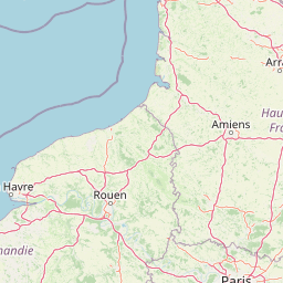
The reserve is built around the Côte Sainte-Hélène, a limestone promontory that rises to roughly 190 metres and dominates the surrounding countryside. From its summit, the land falls away on one side to the south-facing chalk slope and on the other to the shaded, damper north-facing flank where peat and woodland have developed.
The terrain belongs to the edge of the Pays de Bray boutonnière, where geological erosion has cut through the chalk plateau to expose older rocks beneath. The chalk itself, locally called larris in Picard speech, forms the characteristic open, stony grasslands that give the reserve part of its name. The combination of steep slopes, exposed rock, and thin soils creates the dry, sunlit conditions that shape the site's distinctive habitat.
A marked walking path leads to the summit of the Côte, where interpretation panels guide visitors through the landscape. The view from the top sweeps over the Epte valley and the broader Pays de Bray, providing a clear sense of how the promontory sits within the wider regional topography.
Réserve naturelle régionale des Larris et tourbières de Saint-Pierre-es-Champs ecosystems, habitats, and plant life
Ecologically, the reserve is defined by the meeting of two strongly contrasting environments on either side of the Côte Sainte-Hélène. On the south-facing slope, thin chalk soils, intense sunlight, and low moisture support a short turf rich in stress-tolerant herbs and grasses. Mediterranean-affinity species such as oregano, wild thyme, and lavender persist here, along with rare orchids adapted to calcareous grasslands.
The opposite slope, cooler and damper, supports a markedly different community of plants described as sub-montagnard because they are more typical of upland regions than of the surrounding lowlands. Species such as Herb Paris and Baneberry find refuges in this shaded habitat, alongside taller woodland and bog vegetation. The peatland fragments, referenced in the reserve's name, contribute additional habitat diversity and host moisture-loving plants.
Taken together, these contrasting flanks create a compact but ecologically rich mosaic. Chalk grassland specialists, woodland plants, and peatland species occur within a short distance of one another, an arrangement that greatly increases the ecological value of a relatively small reserve.
Réserve naturelle régionale des Larris et tourbières de Saint-Pierre-es-Champs wildlife and species highlights
The reserve is particularly notable for its invertebrate fauna, which benefits from the abundance and diversity of flowering plants on the chalk grassland. More than two hundred species of butterflies have been recorded on the site.
Among the insects of conservation interest, the Marsh Fritillary stands out as a species threatened with disappearance across much of its range, while the small cicada known as the Cigale des montagnes adds a Mediterranean-sounding element to the acoustic life of the south-facing slope. The variety of microhabitats supports a wide insect community, which in turn underpins the food web of the reserve.
Although the site's profile is dominated by plants and invertebrates, the mix of open grassland, scrub, woodland, and peat also provides habitat for a broader assemblage of fauna typical of the Picard countryside, including the small mammals, birds, and pollinators associated with traditional chalk landscapes.
Réserve naturelle régionale des Larris et tourbières de Saint-Pierre-es-Champs conservation status and protection priorities
The reserve's designation as a Réserve naturelle régionale under IUCN Category IV reflects its focus on active management of habitats and species. Its principal conservation significance is the safeguarding of the chalk grassland habitat, locally called larris, which has declined dramatically across northern Europe during the twentieth century. In Picardy alone, only a small percentage of the original chalk grassland area survives, making surviving sites of high regional and international importance.
The conservation approach combines restoration of traditional pastoral use with targeted scrub clearance to maintain open conditions. This management has reversed the post-1950s trend towards woodland encroachment and has helped recover both the structure and the species composition of the grassland. The site is managed by the Conservatoire d'espaces naturels de Picardie together with the commune of Saint-Pierre-es-Champs, with financial support from the Conseil Général de l'Oise, the Conseil Régional de Picardie, and the Direction Régionale de l'Environnement.
Beyond the direct protection of habitats, the reserve plays a role in maintaining rare orchids, threatened butterflies such as the Marsh Fritillary, and characteristic Mediterranean-affinity plant communities on the northern edge of their climatic range. It is therefore a key reference site for understanding the future of chalk grassland conservation in northern France.
Réserve naturelle régionale des Larris et tourbières de Saint-Pierre-es-Champs cultural meaning and human context
The Côte Sainte-Hélène carries a deep and layered human imprint that complements its natural importance. Prehistoric tools, Gallo-Roman coins, and pottery found during 1988 and 1989 excavations demonstrate continuous human presence at the site from the Neolithic period onwards, attracted by the promontory's strategic position overlooking the surrounding valleys.
The promontory also became a focus of devotion. Two successive chapels stood on the Côte, the later one dedicated to Saint Helena. Pilgrimages and religious processions were held there for centuries, and burials have been documented near the foot of the Grand Tilleul, the large ancient lime tree that is itself a cultural landmark. In 2001 these traditional processions were revived, restoring a living connection between the landscape and its older spiritual uses.
The historical grazing of transhumant sheep along the cuesta formed a traditional land-use pattern that shaped the open character of the chalk grasslands. The restoration of pastoral management by the Conservatoire is therefore as much an act of cultural landscape recovery as it is a conservation measure, reconnecting the modern reserve with centuries of rural practice.
Top sights and standout views in Réserve naturelle régionale des Larris et tourbières de Saint-Pierre-es-Champs
The reserve offers a rare compact example of contrasting chalk grassland and peatland habitats meeting on either side of a single limestone promontory. Its open south-facing slope supports Mediterranean-affinity plant communities, fourteen orchid species, and more than two hundred species of butterflies, while its shaded northern flank shelters sub-montagnard woodland plants and peat.
Cultural depth adds to the site's appeal, with Neolithic and Gallo-Roman archaeology, restored religious processions, and a landscape shaped by centuries of transhumant grazing now consciously revived. The short marked trail to the summit of the Côte Sainte-Hélène provides both panoramic views over the Epte valley and the Pays de Bray and an introduction to one of the most diverse small protected areas in the Oise.
Best time to visit Réserve naturelle régionale des Larris et tourbières de Saint-Pierre-es-Champs
The site is best experienced in late spring and summer, when the chalk grasslands of the south-facing slope come into flower, Mediterranean herbs release their scent, and orchids and butterflies are most abundant. Visitors during this season are likely to encounter both the richest displays of flora and the strongest insect activity, including conspicuous species such as the Marsh Fritillary.
The walking path up to and around the Côte Sainte-Hélène is most rewarding on clear days when the panoramic view across the Epte valley and the Pays de Bray is at its sharpest. Cooler months have their own appeal for those interested in woodland, peatland, and the broader landscape structure, when vegetation is less dense and archaeological and historic features become easier to read.