Mori Atlas logo
Nature reserveRéserve naturelle régionale des prairie et boisement humides des Bizeuls

A regional nature reserve focused on the preservation of wet meadow and wet woodland mosaics in the Mayenne department.

Réserve naturelle régionale des prairie et boisement humides des Bizeuls: Mapping Protected Wetland Landscapes in France

The Réserve naturelle régionale des prairie et boisement humides des Bizeuls stands as a focused conservation site within the Pays de la Loire region. This protected area preserves critical wet meadow and wet woodland habitats, which serve as essential ecological fragments within the broader Mayenne rural landscape. The reserve allows for the observation of specialized wetland terrain and the regional conservation efforts dedicated to maintaining these saturated, waterlogged soil ecosystems.

wetlandwet meadowwet woodlandregional nature reservePays de la LoireMayenne

Réserve naturelle régionale des prairie et boisement humides des Bizeuls

Nature reserve

Park overview

Structured park overview, official facts, and landscape profile for Bizeuls Wet Meadows and Woodland Regional Nature Reserve

Bizeuls Wet Meadows and Woodland Regional Nature Reserve park facts, protected area profile, and essential visitor context

Review the core facts for Bizeuls Wet Meadows and Woodland Regional Nature Reserve, including designation, size, terrain, visitor scale, habitats, and operating context in one park-focused overview.

About Bizeuls Wet Meadows and Woodland Regional Nature Reserve

The Bizeuls Wet Meadows and Woodland Regional Nature Reserve is one of the many regional nature reserves (réserves naturelles régionales) that together form an important tier of France's protected-area system. Unlike the better-known national parks or national nature reserves run at the state level, regional nature reserves are created and overseen by regional governments, allowing targeted protection of locally significant natural sites. The Bizeuls reserve exemplifies this approach, combining a small footprint with a clearly defined ecological mission.

The reserve lies in the commune of Ernée, in the northern Mayenne department, within the broader Pays de la Loire region. Mayenne sits in the historical agricultural heartland of western France, a region dominated historically by mixed farming, bocage hedgerow landscapes, and small valley wetlands. Within this setting, the Bizeuls site represents a fragment of the wet grassland and wet woodland mosaic that historically followed small streams, springs, and poorly drained lowlands, and which has been steadily reduced by drainage, ploughing, and land improvement over the past century.

Designated in February 2019 by the Regional Council of Pays de la Loire, the reserve protects approximately 4.43 hectares. Its very specific name, describing both wet meadows and wet woodland in a single designation, indicates that the site combines two complementary habitat types rather than a single vegetation community. This combination is ecologically meaningful, because wet meadows and wet woodland often support overlapping but distinct groups of species, and because the interface between open grassy wetland and adjacent wooded wetland can be disproportionately important for amphibians, invertebrates, and breeding birds.

As a regional classification equivalent to IUCN Category IV, the reserve's designation emphasizes active habitat and species management rather than strict wilderness preservation. In practice, this typically means that the site is managed to maintain the ecological conditions on which its characteristic species depend, while remaining accessible for educational, scientific, and low-impact public purposes within the rules defined by the management plan. The reserve thus serves not only as a refuge for wetland biodiversity but also as a reference site for understanding how small wet habitat fragments function within the modern Pays de la Loire countryside.

Quick facts and research context for Bizeuls Wet Meadows and Woodland Regional Nature Reserve

The Bizeuls reserve is a regional nature reserve (réserve naturelle régionale) in the Pays de la Loire region of western France, administratively attached to the Mayenne department and the commune of Ernée. It was formally created on 8 February 2019 by a deliberation of the Regional Council of Pays de la Loire, establishing legal protection over approximately 4.43 hectares of land.

The site is classified under IUCN Category IV, reflecting its role as a habitat and species management area. It is recorded in the World Database on Protected Areas under the identifier 555597293, and in France's national inventory of protected natural spaces as FR9300187. The reserve's identity, as indicated by its full name, centers on the protection of wet meadows (prairies humides) and humid woodland (boisement humides), two linked habitat types that share a reliance on consistently moist soil conditions.

Protection and recognition

Examine the official protection status, management scope, and conservation records for this protected landscape.

Réserve naturelle régionale des prairie et boisement humides des Bizeuls Protection Status

Consult documented protection status records and designation details for Réserve naturelle régionale des prairie et boisement humides des Bizeuls. Official records provide verified data regarding protected area management scope and administrative frameworks.

Protection details

WDPA ID
555597293
Park context

Deeper park guide and search-rich context for Bizeuls Wet Meadows and Woodland Regional Nature Reserve

Bizeuls Wet Meadows and Woodland Regional Nature Reserve history, landscape, wildlife, and travel context

Explore Bizeuls Wet Meadows and Woodland Regional Nature Reserve through its history, landscape character, ecosystems, wildlife, conservation priorities, cultural context, and seasonal travel timing in a structured park guide built for atlas discovery and search intent.

Why Bizeuls Wet Meadows and Woodland Regional Nature Reserve stands out

The reserve is known primarily for protecting a compact but representative example of wet meadow and wet woodland habitats in the Mayenne part of the Pays de la Loire region. Its name itself, mentioning both prairies humides and boisements humides, signals a deliberate focus on two intersecting wetland communities that depend on saturated or seasonally flooded soils. Within the wider French regional nature reserve network, the Bizeuls site is recognized as a small-scale but targeted conservation area. Rather than depending on scenic grandeur, its importance lies in its ecological specificity and its contribution to maintaining wetland-dependent biodiversity in a department where such habitats are under pressure from agricultural intensification and land conversion.

Bizeuls Wet Meadows and Woodland Regional Nature Reserve history and protected-area timeline

The Bizeuls reserve is a recent addition to France's regional nature reserve network, formally created on 8 February 2019 by a deliberation of the Regional Council of Pays de la Loire. Its creation places it within a generation of regional reserves that have been established to fill gaps in habitat protection at scales too small or too locally specific to be covered by national-level designations.

Although the reserve itself dates only from 2019, the habitats it protects, wet meadows and wet woodland on heavy or poorly drained Mayenne soils, are far older landscape features. Such wetlands have been part of the rural Mayenne environment for centuries, often forming in valley bottoms, along small tributaries, and in zones where groundwater emerges close to the surface. Over the twentieth century, however, many of these habitats were reclaimed for agriculture, drained, or otherwise simplified, making surviving fragments increasingly valuable for conservation.

Beyond these broader landscape dynamics, the deeper site-specific history of the Bizeuls reserve is not documented in available public sources. It is unclear from currently accessible information how the particular parcel was acquired, who manages it on a daily basis, how it was selected among other candidate wetland sites, or what specific conservation pressures motivated its classification. For that reason, the historical record for this profile is intentionally limited to what is well supported.

Bizeuls Wet Meadows and Woodland Regional Nature Reserve landscape and geographic character

The Bizeuls reserve sits within the gently rolling rural landscape typical of the Mayenne department in western France, a region characterized by modest elevations, mixed agricultural land use, and a traditional pattern of small fields enclosed by hedgerows and woodland patches. The terrain itself is shaped by the underlying geology and hydrology of the area, which produces zones of slow drainage that maintain the wet conditions essential to the reserve's defining habitats.

Within the reserve's boundaries, the landscape is defined less by dramatic landforms than by subtle transitions between wet meadow and wet woodland. Wet meadows are typically open, grassy areas where soil moisture remains high for much of the year, often appearing greener and lusher than surrounding drier pastures, especially in late spring and after rainfall. Wet woodland, by contrast, occupies the wooded counterpart of this moisture gradient, where trees tolerant of saturated or periodically flooded soils create a distinctive, often species-influenced forested environment.

The very small size of the reserve, only a few hectares, means that these landscape features are tightly compressed. Visitors and researchers encountering the site will find a compact mosaic rather than a sweeping panorama, with the wet meadow and woodland communities likely sitting close enough to one another to be perceived in a single continuous scene. The surrounding landscape outside the protected perimeter is, by all indications, predominantly agricultural, framing the reserve as an island of preserved wetland habitat within a working countryside.

Bizeuls Wet Meadows and Woodland Regional Nature Reserve ecosystems, habitats, and plant life

The defining ecological identity of the Bizeuls reserve is its combination of wet meadows and wet woodland, two habitat types united by their dependence on persistently high soil moisture. In the Pays de la Loire context, where much of the original wetland cover has been reduced by drainage and land conversion, this combination is itself a defining feature of the site's conservation value.

Wet meadows in this type of setting typically support a mix of moisture-loving grasses, sedges, and herbaceous plants adapted to soils that may be saturated seasonally or year-round. Such vegetation communities are often richer in plant species than adjacent improved agricultural pastures, and they can harbor specialized wetland flora that has retreated from the broader countryside as traditional management has declined.

Wet woodland adds a structurally different layer to this ecological mosaic. Trees growing on saturated or periodically flooded soils tend to form open, irregular canopies, sometimes accompanied by characteristic ground flora tolerant of waterlogged conditions. The juxtaposition of wet meadow and wet woodland creates ecotones, that is, transition zones where open and shaded conditions meet, and these transitions are often disproportionately rich in biodiversity compared with either habitat in isolation. Although the available source material does not provide a species inventory for the reserve, this habitat framework is a reasonable description of the ecological conditions implied by its official name and designation.

Bizeuls Wet Meadows and Woodland Regional Nature Reserve wildlife and species highlights

Wet meadows and wet woodland of the kind the Bizeuls reserve protects typically support a distinctive set of fauna associated with moist soils, shallow surface water, and the structural diversity of mixed habitat edges.

In western France, such sites are commonly used by amphibians, including frogs and newts that depend on damp ground and seasonal puddles or saturated depressions for breeding. Moist ground vegetation and the invertebrate communities it sustains also provide feeding habitat for a range of insects, including dragonflies and damselflies in areas with standing or slow-moving water. Small mammals, ground-nesting birds, and songbirds associated with hedgerows and woodland edges are likewise typical elements of this habitat mosaic.

Unfortunately, the public source material available for the reserve does not contain a documented fauna list, so this profile cannot confirm which specific species are present at Bizeuls. The ecological context, however, strongly suggests that the reserve's wildlife value rests on habitat sensitivity rather than on charismatic or rare megafauna, with importance concentrated in less conspicuous but ecologically significant groups tied to wetland conditions.

Bizeuls Wet Meadows and Woodland Regional Nature Reserve conservation status and protection priorities

From a conservation perspective, the Bizeuls reserve represents a small but targeted intervention with disproportionate ecological meaning. The principal value of small protected areas in intensively farmed regions is that they preserve ecological conditions that the surrounding landscape can no longer sustain. By maintaining just a few hectares of wet meadow and wet woodland, the reserve safeguards habitat, soil moisture, and associated species that have otherwise been lost across much of the Mayenne lowlands.

Its designation as a regional nature reserve under French law gives it formal protection against activities that would compromise its ecological character. Being classified as IUCN Category IV indicates that the site is managed primarily for habitat and species conservation, with active stewardship expected rather than passive non-intervention. This often includes controlling invasive species, maintaining appropriate hydrology, and managing vegetation to prevent succession away from the desired open or semi-open habitats.

Beyond its local contribution, the reserve also has educational and demonstration value: it illustrates how very small parcels can be effectively protected when their ecological functions are well understood, and it forms part of the growing network of regional nature reserves in Pays de la Loire that collectively preserve the environmental heritage of the region.

Top sights and standout views in Bizeuls Wet Meadows and Woodland Regional Nature Reserve

The reserve's defining highlights are tightly linked to what it chooses to protect: a compact mosaic of wet meadows and wet woodland on waterlogged Mayenne soils, formally secured in 2019 under regional nature reserve status. Its IUCN Category IV designation and modest scale together mark it as a habitat-focused, actively managed site rather than a wilderness or scenic-area designation.

Equally important is what this reserve represents in regional terms: a deliberate act of regional-level conservation in a department whose wetland heritage has been heavily reduced by modern agriculture. For visitors, researchers, or anyone interested in small-scale habitat preservation in western France, the site offers a focused example of how regional authorities can lock in protection for ecologically specific, fragmented habitats.

Best time to visit Bizeuls Wet Meadows and Woodland Regional Nature Reserve

Wet meadow and wet woodland habitats of the kind protected at Bizeuls are typically at their most expressive in late spring and early summer, when lush grass growth, flowering wetland plants, and active amphibian and invertebrate life are most visible. Late spring is also often the best season to appreciate the structural contrast between open wet meadow and shaded wet woodland.

Autumn can highlight the reserve in another light, as wet woodland displays seasonal change and wet meadows settle into a quieter, soil-saturated phase. Winter visits can show the hydrological character of the site most clearly, with saturated ground, surface water where present, and bare-branch woodland structure. As this is a small regional reserve with no widely documented visitor infrastructure, any visit is best understood in terms of natural history appreciation rather than as a tourism outing, and timing should be planned around the ecological season of greatest interest rather than around crowd or amenity considerations.

Monthly climate preview

Long term temperature ranges and monthly precipitation distributions across representative park coordinates

Climate Normals and Annual Weather Patterns at Réserve naturelle régionale des prairie et boisement humides des Bizeuls

Representative coordinate records show measured temperature variations and precipitation distributions across twelve months at Réserve naturelle régionale des prairie et boisement humides des Bizeuls. Detailed monthly climate normals provide full analytical context for long term averages and seasonal weather rhythms across the protected area.
Annual mean10 °C
4 °C18 °C
Jan
Feb
Mar
Apr
May13°
Jun16°
Jul18°
Aug18°
Sep15°
Oct11°
Nov
Dec
Warmest month
July

17.7 °C

Coolest month
January

3.9 °C

Wettest month
December

2.7 mm/day

Driest month
March

1.7 mm/day

Park location guide

Geography guide, regional context, and park location map for Bizeuls Wet Meadows and Woodland Regional Nature Reserve

Bizeuls Wet Meadows and Woodland Regional Nature Reserve park geography, regions, and map view in France

Understand where Bizeuls Wet Meadows and Woodland Regional Nature Reserve sits in France through a broader geographic reading of the surrounding landscape, nearby location context, and its mapped position within the national park landscape.

How Bizeuls Wet Meadows and Woodland Regional Nature Reserve fits into France

France is a unitary semi-presidential republic and one of the world's largest economies. It borders Belgium, Luxembourg, Germany, Switzerland, Italy, Monaco, Andorra, and Spain, with a maritime border to the United Kingdom. The country is known for its cultural influence, art, cuisine, and political history spanning centuries.

Wider geography shaping Bizeuls Wet Meadows and Woodland Regional Nature Reserve in France

France is located in Western Europe. Metropolitan France extends from the Rhine to the Atlantic Ocean and from the Mediterranean Sea to the English Channel and North Sea. The country borders Belgium, Luxembourg, Germany, Switzerland, Italy, Monaco, Andorra, Spain, and has a maritime border with the United Kingdom.

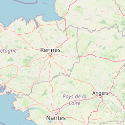
Map view of Bizeuls Wet Meadows and Woodland Regional Nature Reserve

Use this park location map to pinpoint Bizeuls Wet Meadows and Woodland Regional Nature Reserve in France, understand its exact geographic position, and read its mapped placement within the surrounding landscape more clearly.

Pigeon | © OpenStreetMap contributors

Location context for Bizeuls Wet Meadows and Woodland Regional Nature Reserve

Pays de la Loire
Park atlas

Compare adjacent protected landscapes and wetland reserves across the surrounding region

Parks Near Réserve naturelle régionale des prairie et boisement humides des Bizeuls

Browsing other protected areas near Réserve naturelle régionale des prairie et boisement humides des Bizeuls reveals broader ecological patterns across the agricultural lowlands of western France. Extending geographic comparison beyond a single wetland reserve helps connect localized habitat conservation with wider regional park networks.
A horizontal watercolor painting depicting a soft-toned landscape with a rocky scree slope in the foreground and rolling hills under a pastel sunset sky.
Nature reserveNormandie
About 46 km away#1 closest

Northeast

Réserve naturelle régionale des pierriers de Normandie: Geographic Scree Slope Atlas

Examining rocky protected terrain in Normandy, France

The Réserve naturelle régionale des pierriers de Normandie protects one of the most distinctive natural scree slopes in northwestern Europe. This site preserves fragile rocky debris fields that support specialized vegetation and invertebrate communities. Our atlas data offers a close look at the boundaries and geological character of this significant protected landscape in the Orne department.

Area
0.009 km²
Established
2018
IUCN
IV
Scope
Terrestrial
A soft watercolor illustration of a green wetland area with rolling hills and misty silhouettes in the background, set against a white background.
Nature reserveBretagne
About 49 km away#2 closest

Northwest

Réserve naturelle régionale du marais de Sougeal: Regional Wetland and Protected Landscape in Bretagne

A managed floodplain sanctuary near the Bay of Mont-Saint-Michel

Located in the Ille-et-Vilaine department, this regional nature reserve preserves a unique strip of wet grassland and flood-prone meadows. Use our mapping data to understand the park's specific terrain, from its narrow channel systems to its role as a key stopover for migratory waterbirds and a communal grazing area in the heart of Bretagne.

Area
1.74 km²
Established
2006
IUCN
IV
Relief
Lowland
A watercolor illustration of a soft, rolling landscape with green hills, a winding path or stream, and hints of pink flora in the foreground, set against a light background.
Nature reservePays de la Loire
About 50 km away#3 closest

East

Réserve naturelle régionale des landes et tourbière des Égoutelles Geographic Overview

Protected peat bog and wet heathland in Pays de la Loire

Located in Villepail, this nature reserve occupies a sheltered quarry depression in the Mayenne countryside. The site is a study in ecological resilience, featuring approximately one hundred plant species and a diverse fauna of dragonflies and amphibians that thrive in this compact, waterlogged habitat.

Area
0.013 km²
Established
2009
IUCN
IV
Relief
Lowland
A pale watercolor landscape painting showing rolling green hills and distant mountain ridgelines against a white background.
Nature reservePays de la Loire
About 59 km away#4 closest

East

Réserve naturelle régionale Mont des Avaloirs: Protected Landscape and Geographic Overview

Upland heath and summit geography of the Armorican Massif

Investigate the unique physical geography of Réserve naturelle régionale Mont des Avaloirs. This area acts as a biodiversity stronghold in northwestern France, defined by a dramatic interplay of stony blockfields, sheltered valley brooks, and protected peatland basins that create atypical ecological conditions across the Mayenne countryside.

Area
3.211 km²
Established
2020
IUCN
IV
Relief
Mountain
Watercolor painting of a river flowing through a valley with gentle green hills and trees on the banks.
Nature reserveCalvados
About 75 km away#5 closest

Northeast

Rochers des Parcs Nature Reserve: A Detailed Atlas and Protected Landscape Overview

Geographic boundaries and cliff terrain in Calvados, Normandy.

The Rochers des Parcs nature reserve features dramatic Cambrian conglomerate cliffs rising above the Orne river in the Calvados department. This site is defined by its steep wooded slopes, rare plant species, and established network of hiking paths. It represents a vital area of conservation, protected for its geological interest and ecological value, providing a clear window into the rugged terrain of the Suisse normande landscape.

Area
0.36 km²
Established
1977
Relief
Upland
Scope
Terrestrial
Nature reserveFrance
About 78 km away#6 closest

Northeast

Réserve naturelle régionale géologique de Normandie-Maine: Geological Nature Reserve

A protected Ordovician limestone site in the Armorican Massif

Located in northwestern France, this reserve focuses on the geological preservation of the Carrière des Vaux. It is an essential site for understanding Paleozoic biostratigraphy, featuring well-exposed limestone sequences and significant microfossil deposits that allow for precise dating of regional strata within the Normandie-Maine landscape.

Area
0.006 km²
Established
2009
Relief
Lowland
Climate
Temperate
Nature reservePays de la Loire
About 91 km away#7 closest

Southeast

Réserve naturelle régionale des marais de Cré-sur-Loir et La Flèche Protected Landscape

Wetland ecosystems in the Pays de la Loire region.

Spanning an old meander of the Loir river, this regional nature reserve preserves a complex network of marshes, canals, and alluvial forests. Learn about its unique floodplain geography and the protected wetland habitats that sustain regional biodiversity in the heart of the Sarthe department.

Area
0.531 km²
Established
2008
IUCN
IV
Relief
Lowland
A watercolor painting showing a soft, pastoral landscape with green rolling hills, light yellow grasslands, and a tranquil pond in the foreground against a light, hazy sky.
Nature reservePays de la Loire
About 93 km away#8 closest

East

Réserve naturelle régionale du coteau et plateau de Tessé: Protected Limestone Geography

Calcareous grassland landscapes in the Sarthe department

Examine the geography of this regional nature reserve in Pays de la Loire. The site preserves a compact parcel of limestone plateau and slopes, offering a concentrated look at dry calcareous habitat conservation and the distinct geology of the Rutin valley area.

Area
0.056 km²
Established
2009
IUCN
IV
Relief
Upland

Common questions about visiting, size, designation, and location context for Bizeuls Wet Meadows and Woodland Regional Nature Reserve

Bizeuls Wet Meadows and Woodland Regional Nature Reserve FAQs for park facts, access, geography, and protected area context

Find quick answers about Bizeuls Wet Meadows and Woodland Regional Nature Reserve, including protected-area facts, park geography, trail and visitor context, and how the park fits into its surrounding country and regional landscape.
MoriAtlas Explorer

Continue Your Protected Areas Search Across the Global Atlas

Deepen your exploration by continuing the structured search for national parks and protected areas worldwide. Utilize the comprehensive filtering capabilities to compare different conservation landscapes and refine your understanding of global park geography. Discover more about the distribution and characteristics of protected natural areas.

Global natural geography