
Mori Atlas logo
Nature reserveRéserve naturelle régionale des prairies du Schoubrouck

A preserved mosaic of traditional agricultural drainage channels and lowland grasslands in Hauts-de-France.

Réserve naturelle régionale des prairies du Schoubrouck: Exploring the Flemish Wet-Meadow Landscape

Réserve naturelle régionale des prairies du Schoubrouck represents a vital example of managed Flemish rural terrain within the Hauts-de-France region. This protected nature reserve focuses on the stewardship of wet meadows intersected by traditional watergang drainage networks. By mapping these specific geographic boundaries, the area offers insight into how centuries of farming and water management continue to define the ecological character of this low-lying department in northern France.

wet meadowregional nature reserveFlanders plainwatergangsagricultural landscapehabitat management
A minimalist flat illustration of a mountain valley with a waterfall, pine trees, and a river under a soft pink sky.

Réserve naturelle régionale des prairies du Schoubrouck

Nature reserve

Park overview

Structured park overview, official facts, and landscape profile for Prairies du Schoubrouck Regional Nature Reserve

Prairies du Schoubrouck Regional Nature Reserve park facts, protected area profile, and essential visitor context

Review the core facts for Prairies du Schoubrouck Regional Nature Reserve, including designation, size, terrain, visitor scale, habitats, and operating context in one park-focused overview.

About Prairies du Schoubrouck Regional Nature Reserve

The Prairies du Schoubrouck is a small regional nature reserve situated in the low-lying agricultural plains of northern France, in the historical region of French Flanders. It lies in the Nord department, within the commune of Noordpeene, northeast of Saint-Omer. Although the reserve covers only a modest surface area of roughly ten hectares, it is designed around a precise conservation purpose: protecting a remnant fragment of the traditional wet-meadow landscape that once characterized much of this part of the Hauts-de-France region.

The defining feature of the site is its network of watergangs, the small drainage channels typical of the Flemish countryside. These shallow watercourses crisscross the meadows and have long supported a distinctive rural habitat, marking the boundary between agricultural land and semi-natural wetland. By protecting both the meadows and the watergangs together, the reserve maintains the ecological relationships that depend on this finely balanced landscape pattern.

Designated as a regional nature reserve on 15 October 2012, the site is part of the broader French network of regional protected areas that emphasize habitat and species management, corresponding to IUCN Category IV. Its management is handled by the Conservatoire d'espaces naturels du Nord et du Pas-de-Calais, an organization that coordinates conservation efforts across the Nord and Pas-de-Calais departments. The reserve's location within a working agricultural landscape gives it an identity rooted as much in cultural heritage as in ecological preservation, reflecting centuries of human interaction with the flat, wetland-prone terrain of the Flanders plain.

Quick facts and research context for Prairies du Schoubrouck Regional Nature Reserve

The Prairies du Schoubrouck Regional Nature Reserve is located in the Nord department, within the Hauts-de-France region of northern France, near the commune of Noordpeene. It is administered under the French regional nature reserve designation and corresponds to IUCN Category IV, meaning it focuses on habitat and species management rather than strict wilderness protection.

Established on 15 October 2012, the reserve protects a small footprint of approximately 10 hectares of wet meadow habitat, including the network of watergang drainage channels that define the traditional Flemish landscape. The site is managed by the Conservatoire d'espaces naturels du Nord et du Pas-de-Calais, a regional conservation body responsible for protected natural areas across Nord and Pas-de-Calais.

Protection and recognition

Examine documented protected area designation records, management scope, and verified recognition sources.

Protection Status and International Recognition for Réserve naturelle régionale des prairies du Schoubrouck

Review verified protected area designation records, management context, and official recognition sources for Réserve naturelle régionale des prairies du Schoubrouck. Access structured conservation facts and administrative details to understand the documented legal framework governing this protected landscape.

Protection details

WDPA ID
555513704
Park context

Deeper park guide and search-rich context for Prairies du Schoubrouck Regional Nature Reserve

Prairies du Schoubrouck Regional Nature Reserve history, landscape, wildlife, and travel context

Explore Prairies du Schoubrouck Regional Nature Reserve through its history, landscape character, ecosystems, wildlife, conservation priorities, cultural context, and seasonal travel timing in a structured park guide built for atlas discovery and search intent.

Why Prairies du Schoubrouck Regional Nature Reserve stands out

The reserve is best known for protecting a small but representative example of the traditional wet-meadow landscapes of French Flanders, along with the historic watergang drainage network that shapes this lowland agricultural environment. Its identity is closely tied to the cultural landscape of the Hauts-de-France region rather than to spectacular scenery or charismatic megafauna. What distinguishes the site is its emphasis on conserving a rural habitat that depends on long-established farming and water management practices. The combination of managed grasslands, shallow drainage ditches, and regional conservation stewardship gives the reserve a focused ecological character centered on meadow biodiversity and cultural landscape preservation.
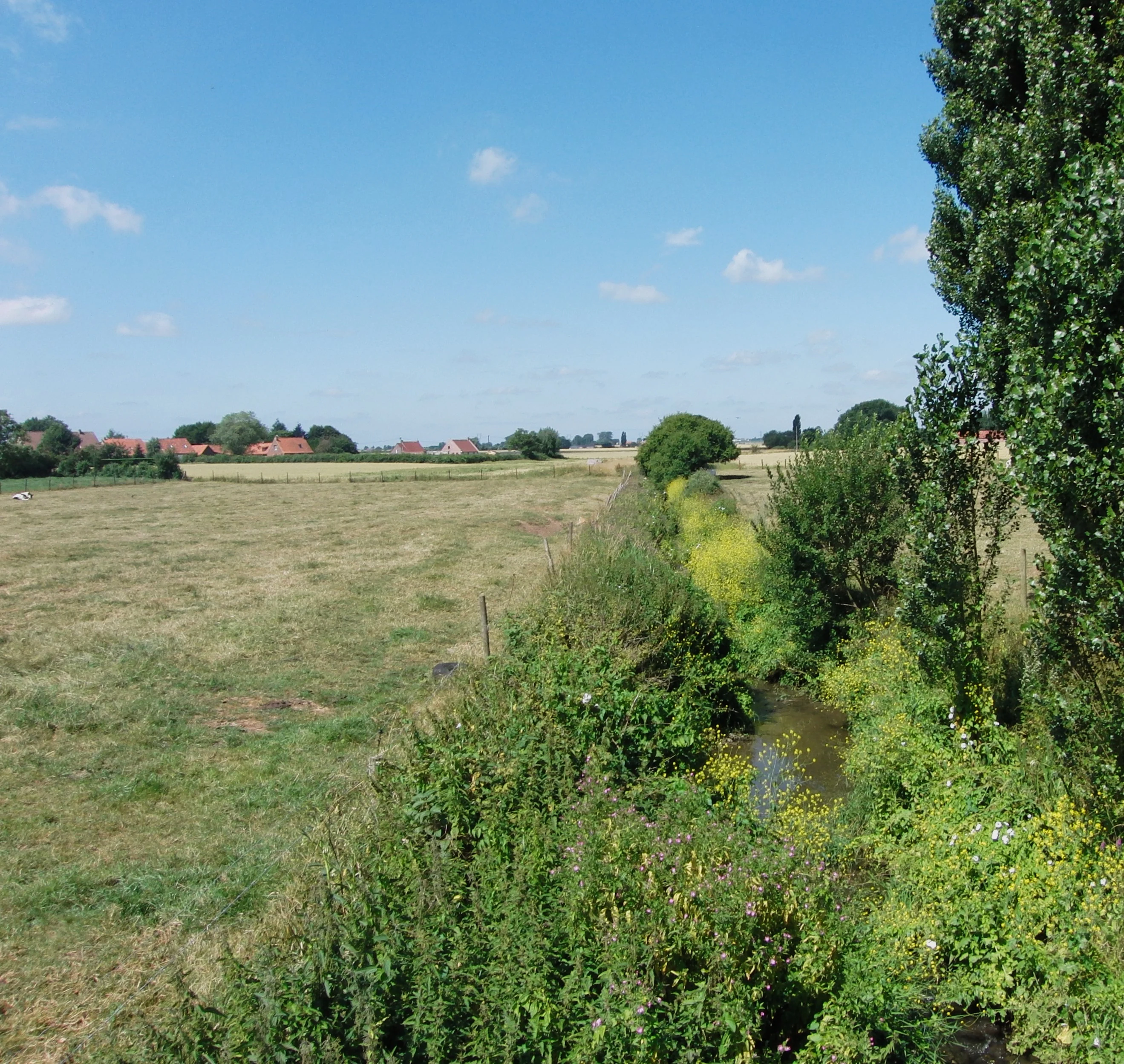
A wide, sunny landscape view of a green meadow bordering a narrow, plant-lined water channel; houses are visible in the distant horizon.
A view of the watringue water channel and surrounding humid meadows in the Réserve naturelle régionale des prairies du Schoubrouck.

Prairies du Schoubrouck Regional Nature Reserve history and protected-area timeline

The reserve was formally established on 15 October 2012, following a deliberation that created its protected status under the framework of France's regional nature reserve system. Its creation reflects a regional effort to safeguard the surviving examples of Flemish wet-meadow habitat in the Nord department, an environment shaped by long-standing agricultural traditions and water management practices.

The site has been managed since its designation by the Conservatoire d'espaces naturels du Nord et du Pas-de-Calais, an institution dedicated to preserving natural spaces across the northern French departments. The reserve's relatively recent establishment reflects the broader trend in French regional conservation policy toward protecting small but ecologically meaningful cultural landscapes, rather than focusing exclusively on larger wilderness areas.

Prairies du Schoubrouck Regional Nature Reserve landscape and geographic character

The landscape of the Prairies du Schoubrouck is characterized by the flat, low-lying terrain typical of the Flanders plain in northern France. The reserve sits within a gently graded agricultural environment, where meadows are intersected by a network of shallow drainage channels known locally as watergangs. These watergangs are an essential part of the landscape, defining field boundaries, regulating moisture levels, and supporting the wet-meadow vegetation that defines the reserve.

The visual character of the site is open and pastoral, with few trees and long sightlines across grassy fields. The combination of meadows and small waterways gives the area a distinctive mosaic texture that distinguishes it from more intensively farmed cropland, while still remaining clearly part of the broader Flemish countryside. The overall impression is of a quiet, working rural landscape shaped by centuries of human use.

Prairies du Schoubrouck Regional Nature Reserve ecosystems, habitats, and plant life

The reserve's ecological value lies primarily in its wet meadow habitat and the associated watergang network. These shallow drainage channels maintain the moisture conditions that support meadow vegetation adapted to periodically waterlogged soils, a habitat type that has become increasingly rare in the intensively farmed landscapes of the Hauts-de-France region.

By focusing protection on this combination of open grassland and shallow water features, the reserve contributes to the conservation of habitats that support a range of invertebrates, amphibians, and wetland-adapted plant species. The site's modest size limits its role, but its ecological significance is tied to the quality and continuity of the traditional management practices that maintain the meadow and water system together.

Prairies du Schoubrouck Regional Nature Reserve conservation status and protection priorities

The Prairies du Schoubrouck is classified as a regional nature reserve under IUCN Category IV, indicating that its primary conservation objective is the management of habitats and species rather than the preservation of untouched wilderness. This category reflects a focus on active stewardship of a cultural landscape shaped by long-standing agricultural and water management practices.

The reserve addresses the gradual loss of traditional wet-meadow habitats in the Nord department, where agricultural intensification has reduced the extent of these environments. By maintaining the meadows and their associated watergangs, the reserve helps preserve habitat connectivity, supports meadow-dependent biodiversity, and contributes to the broader regional network of protected sites managed by the Conservatoire d'espaces naturels du Nord et du Pas-de-Calais.

Prairies du Schoubrouck Regional Nature Reserve cultural meaning and human context

The reserve is embedded in the cultural landscape of French Flanders, an area with a long agricultural tradition shaped by Flemish land use practices. The presence of watergangs, the small drainage channels typical of the region, ties the site to centuries of engagement between local communities and the wet, low-lying terrain of the Flanders plain. The protection of the meadows thus carries both ecological and cultural significance, preserving a working rural environment rather than a purely natural one.

Top sights and standout views in Prairies du Schoubrouck Regional Nature Reserve

The reserve's standout features include its protected wet-meadow habitat, its network of traditional Flemish watergangs, and its role as a small but representative example of the rural landscapes of the Hauts-de-France region. Its modest size is offset by a focused conservation mission and a clear connection to regional land-use heritage.

Best time to visit Prairies du Schoubrouck Regional Nature Reserve

The meadows and watergangs of the reserve are most expressive during late spring and early summer, when grassland vegetation is at its peak and the water network is most visible across the landscape. Mild and dry conditions typically offer the most comfortable experience of walking across the flat, open terrain, while autumn and winter tend to emphasize the quiet, waterlogged character of the Flemish plain. As with any wet-meadow reserve, seasonal water levels and meadow growth shape the impression of the site throughout the year.
Monthly climate preview

Long term representative point measurements detailing average monthly temperatures and precipitation.

Climate Normals and Annual Temperature Rhythm for Réserve naturelle régionale des prairies du Schoubrouck

Historical data records a measured annual temperature range from negative winter minimums to warm summer maximums alongside consistent monthly precipitation rates at a representative coordinate. Reviewing complete monthly climate normals illuminates the broader environmental rhythms across the protected landscape.
Annual mean11 °C
4 °C18 °C
Jan
Feb
Mar
Apr
May13°
Jun15°
Jul17°
Aug18°
Sep15°
Oct12°
Nov
Dec
Warmest month
August

17.7 °C

Coolest month
January

4.3 °C

Wettest month
November

2.7 mm/day

Driest month
April

1.4 mm/day

Park location guide

Geography guide, regional context, and park location map for Prairies du Schoubrouck Regional Nature Reserve

Prairies du Schoubrouck Regional Nature Reserve park geography, regions, and map view in France

Understand where Prairies du Schoubrouck Regional Nature Reserve sits in France through a broader geographic reading of the surrounding landscape, nearby location context, and its mapped position within the national park landscape.

How Prairies du Schoubrouck Regional Nature Reserve fits into France

France is a unitary semi-presidential republic and one of the world's largest economies. It borders Belgium, Luxembourg, Germany, Switzerland, Italy, Monaco, Andorra, and Spain, with a maritime border to the United Kingdom. The country is known for its cultural influence, art, cuisine, and political history spanning centuries.

Wider geography shaping Prairies du Schoubrouck Regional Nature Reserve in France

France is located in Western Europe. Metropolitan France extends from the Rhine to the Atlantic Ocean and from the Mediterranean Sea to the English Channel and North Sea. The country borders Belgium, Luxembourg, Germany, Switzerland, Italy, Monaco, Andorra, Spain, and has a maritime border with the United Kingdom.

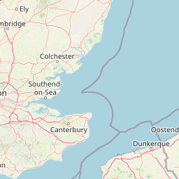
Map view of Prairies du Schoubrouck Regional Nature Reserve

Use this park location map to pinpoint Prairies du Schoubrouck Regional Nature Reserve in France, understand its exact geographic position, and read its mapped placement within the surrounding landscape more clearly.

Pigeon | © OpenStreetMap contributors

Location context for Prairies du Schoubrouck Regional Nature Reserve

Hauts-de-France

Visualizing the wet meadows, lowland terrain, and historic watergang networks of French Flanders.

Réserve naturelle régionale des prairies du Schoubrouck Photos and Landscape Scenery

Photographic records reveal the open pastoral terrain, traditional drainage channels, and flat agricultural mosaic defining this regional nature reserve. Visual exploration highlights the specialized habitats and conservation stewardship preserving northern France wet grasslands.

A wide, sunny landscape view of a green meadow bordering a narrow, plant-lined water channel; houses are visible in the distant horizon.

Park atlas

Compare adjacent lowland habitats and connected protected landscapes across the Flanders plain

Parks Near Réserve naturelle régionale des prairies du Schoubrouck and Regional Reserves

Browsing other protected areas near Réserve naturelle régionale des prairies du Schoubrouck reveals the wider network of wet meadows and lowland drainage networks shaping northern France. Comparing surrounding regional reserves provides valuable context on traditional agricultural land management and Flemish conservation stewardship.
Nature reserveHauts-de-France
About 9 km away#1 closest

South

Réserve naturelle régionale du plateau des landes: Regional Nature Reserve Landscape Profile

Protected heathland geography in the Pas-de-Calais corridor.

Understand the ecological structure of the Réserve naturelle régionale du plateau des landes. This protected area features a unique crescent shape and mosaic of heathland sectors spread across several communes, offering a focused study of low-elevation inland conservation management in the heart of northern France.

Area
1.811 km²
Established
2009
IUCN
IV
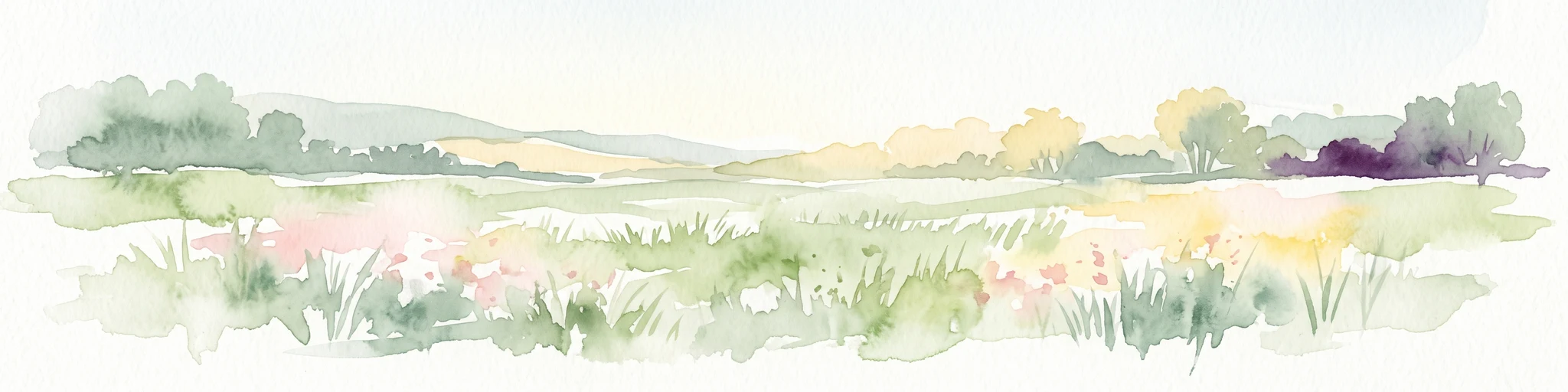
A horizontal watercolor illustration depicting a soft, impressionistic landscape of wetland meadows, grassy patches, and distant trees in pastel shades of green, yellow, and soft purple.
Nature reserveHauts-de-France
About 18 km away#2 closest

Northeast

Réserve naturelle régionale du vallon de la Petite Becque: Protected Area Map and Geography

Flemish Houtland wetland conservation and regional green infrastructure

This protected area in Hauts-de-France functions as a compact, high-value laboratory for habitat restoration within the modernized Flemish countryside. It provides essential sanctuary for relict marsh flora, orchid-rich meadows, and specialized invertebrate communities, effectively acting as an ecological island amidst a vast expanse of intensively cultivated arable farmland.

Area
0.009 km²
Established
2010
IUCN
IV
Relief
Lowland
A soft watercolor painting of a grassy landscape with exposed limestone rock faces and green vegetation.
Nature reserveHauts-de-France
About 19 km away#3 closest

Southwest

Réserve naturelle régionale des anciennes carrières de Cléty: Protected Geological Landscape

Regional nature reserve in the Hauts-de-France, France

A significant geological protected area in the Pas-de-Calais, this reserve features an exposed chalk quarry face that serves as a stratigraphic record for the Cretaceous period. The landscape hosts a rare intersection of geological heritage and diverse ecosystems, including orchids, butterflies, and bat colonies, within a compact footprint.

Area
0.02 km²
Established
2011
IUCN
IV
Nature reserveHauts-de-France
About 24 km away#4 closest

North

Réserve naturelle régionale de Grande-Synthe: Protected Geography and Regional Mapping

Nature reserve landscapes in the Hauts-de-France coastal plain

Spanning 174 hectares on the edge of the Dunkirk urban zone, this protected area serves as a model for ecological restoration. Examine the patchwork of sandy grasslands, wetlands, and mature hedgerows that define the reserve, and see its position as a link in the regional green and blue ecological corridor of northern France.

Area
1.74 km²
Established
2015
Relief
Lowland
Climate
Temperate
Nature reserveHauts-de-France
About 28 km away#5 closest

Northwest

Réserve naturelle régionale de Pont d'Ardres: Mapped Wetland Geography and Protected Lands

A restored industrial landscape in the Hauts-de-France coastal hinterland.

Situated southeast of Calais, this reserve represents a rare success in ecological restoration. The former sugar factory basins now provide vital habitats for shorebirds and nesting species, maintaining an essential wetland presence in an otherwise cultivated landscape of northern France.

Area
0.663 km²
Established
2012
IUCN
IV
Relief
Lowland
A horizontal watercolor painting showing a soft coastal scene with rolling dunes, sparse grasses, and a calm shoreline under a light sky.
Nature reservePas-de-Calais
About 30 km away#6 closest

Northwest

Réserve naturelle nationale du Platier d'Oye: Protected Coastal Landscape and Wetland Geography

Coastal dunes and migratory bird habitats in Pas-de-Calais

Located along the Opal Coast, the Réserve naturelle nationale du Platier d'Oye represents a complex mosaic of tidal flats, mobile sand dunes, and humid polder meadows. This protected area offers unique insight into the ecological intersection of maritime forces and terrestrial environments, functioning as a primary staging ground for diverse migratory species within the Hauts-de-France coastal region.

Area
3.91 km²
Established
1987
IUCN
IV
Relief
Lowland
A soft watercolor painting showing a panoramic landscape with light green trees and low hills in the background, set against a pale, washed-out sky.
Nature reserveHauts-de-France
About 33 km away#7 closest

Southeast

Réserve naturelle régionale des prés du Moulin Madame: Regional Protected Meadow Map

Riverine floodplain landscapes in the Hauts-de-France region

The Réserve naturelle régionale des prés du Moulin Madame protects an 8.52 hectare corridor along the Lys river. This site highlights the preservation of traditional flood meadows that are increasingly rare in northern France. Users can examine the park boundaries, understand the flat lowland terrain, and trace the riverine geography that defines this unique protected cultural landscape.

Area
0.085 km²
Established
2015
IUCN
IV
Watercolor painting showing layered rolling hills or dunes in shades of green, purple, and pale pink against a white background.
Nature reserveHauts-de-France
About 34 km away#8 closest

North

Réserve naturelle nationale de la dune Marchand: Protected Coastal Dune Landscapes

Coastal Flemish dunes and North Sea protected geography

Located in the Hauts-de-France region, the Réserve naturelle nationale de la dune Marchand is a protected area defined by its rare continuity of dune habitats. From wind-scoured slacks to established grey dunes and wetland pockets, the reserve provides a critical study of coastal topography and endemic species preservation within an active maritime border landscape.

Area
1.13 km²
Established
1974
IUCN
IV
Relief
Lowland

Common questions about visiting, size, designation, and location context for Prairies du Schoubrouck Regional Nature Reserve

Prairies du Schoubrouck Regional Nature Reserve FAQs for park facts, access, geography, and protected area context

Find quick answers about Prairies du Schoubrouck Regional Nature Reserve, including protected-area facts, park geography, trail and visitor context, and how the park fits into its surrounding country and regional landscape.
MoriAtlas Explorer

Continue Your Protected Areas Search Across the Global Atlas

Deepen your exploration by continuing the structured search for national parks and protected areas worldwide. Utilize the comprehensive filtering capabilities to compare different conservation landscapes and refine your understanding of global park geography. Discover more about the distribution and characteristics of protected natural areas.

Global natural geography