
Why Roosevelt Protected Landscape stands out
Roosevelt Protected Landscape is best known for its large open cogon grasslands set against the backdrop of the Zambales Mountain Range, an unusual landscape setting for a protected area near the heavily developed Subic Bay corridor. It is also notable for containing surviving patches of old-growth forest alongside mahogany and teak plantations, creating an interesting mosaic of grassland and woodland habitats. The area's wildlife profile, which includes pythons, monitor lizards, cloud rats, fruit bats, and a variety of forest and grassland birds, adds to its identity as a biologically meaningful refuge amid a densely populated and historically industrialized region of Luzon.
Roosevelt Protected Landscape history and protected-area timeline
Roosevelt Protected Landscape has origins that stretch back to the early years of American colonial administration in the Philippines. It was first established as Roosevelt National Park on March 30, 1933, through Proclamation No. 567, which was signed by Governor-General Theodore Roosevelt Jr. The original national park encompassed approximately 1,485 hectares of land at the foot of the Zambales Mountain Range in northern Bataan.
In 1965, the boundary of the national park was revised and its area was reduced to roughly 1,334 hectares. A more significant change came on April 23, 2000, when the area was reclassified from national park status to a protected landscape under Philippine protected area legislation, and its extent was further reduced to the present 786.04 hectares.
This shift from national park to protected landscape reflects a broader trend in Philippine conservation policy toward categorizing areas based on the balance between conservation and sustainable land use. Despite the reductions in size, the site retains its original identity as the Roosevelt area and continues to be managed by the Department of Environment and Natural Resources as a formally recognized protected area within the national system.
Roosevelt Protected Landscape landscape and geographic character
The physical setting of Roosevelt Protected Landscape is defined by its location in a narrow valley at the southern base of the Zambales Mountain Range. The protected area sits at the foot of Mount Santa Rita and Mount Malasimbo, two prominent peaks that frame the valley and provide a dramatic mountainous backdrop to the relatively flat terrain of the park itself.
The landscape is dominated by open grassland, which occupies roughly 87 percent of the protected area and gives the site its characteristically wide, savanna-like appearance. Cogon grass and talahib are the principal grass species shaping this open terrain, while the remaining 13 percent of the park consists of old-growth forest remnants as well as plantation stands of mahogany and teak, which add tree cover and vertical structure to parts of the valley.
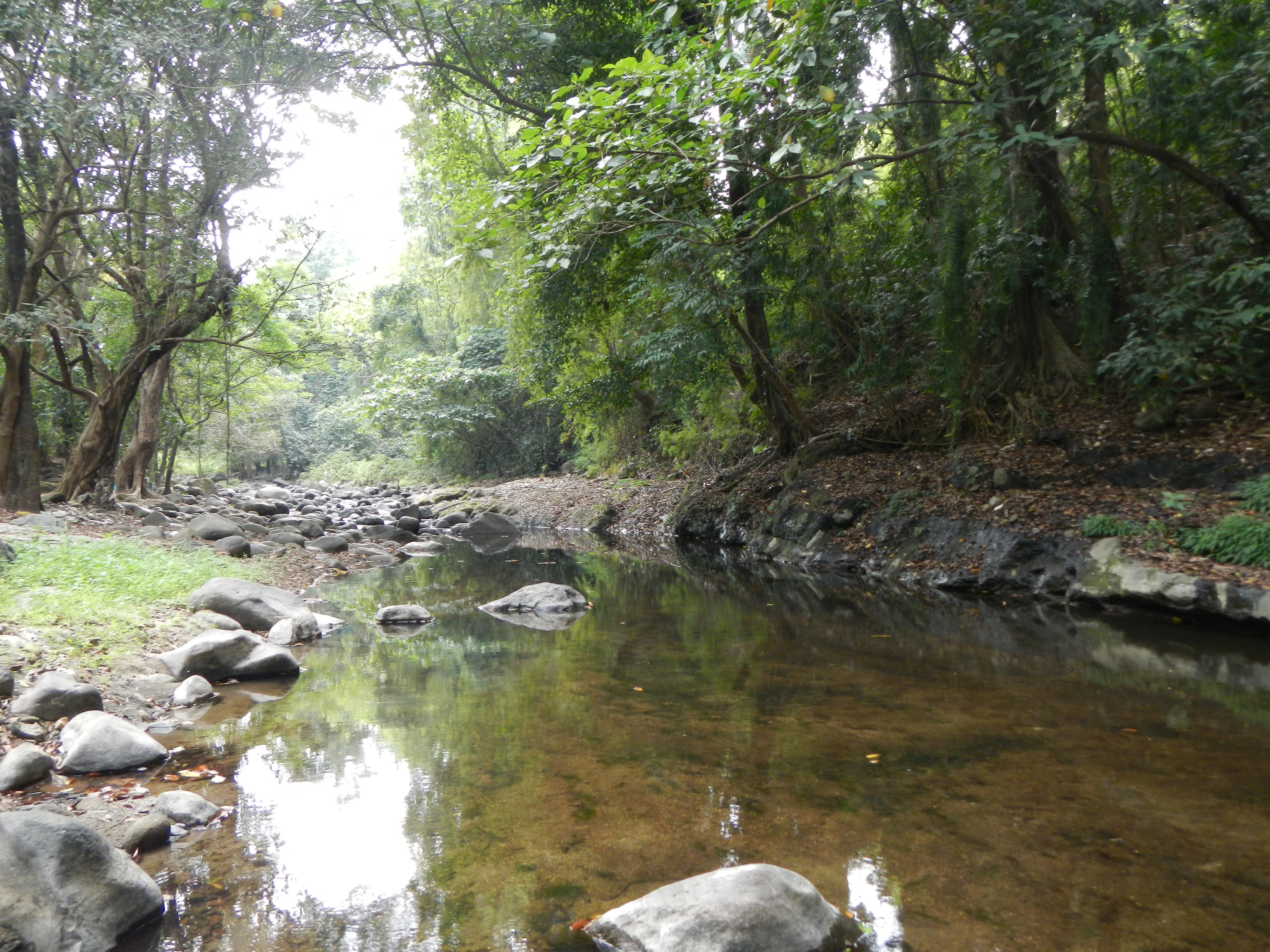
Several watercourses traverse the protected area, including the Cucubog and Olongi rivers, which bisect the landscape and create riparian corridors through the grasslands. Although the terrain itself is relatively gentle within the protected boundary, the surrounding mountains and the proximity to the Subic Bay lowlands give the area a distinctive sense of being enclosed by larger topographic features while still open within the park itself.
Roosevelt Protected Landscape ecosystems, habitats, and plant life
Ecologically, Roosevelt Protected Landscape is defined by its unusual combination of extensive tropical grassland and patches of lowland forest within a relatively small area. The dominance of cogon grass and talahib creates an open habitat type that contrasts with the heavily forested character of many other protected areas in the Philippines, giving Roosevelt a vegetation profile more reminiscent of a fire-maintained or disturbance-adapted landscape.
Within this grassland matrix, the remnants of old-growth forest are ecologically significant, representing surviving fragments of the original forest cover that once occupied the foothills of the Zambales Mountain Range. Planted stands of mahogany and teak add a layer of anthropogenic forest cover that nonetheless provides habitat structure and canopy continuity in parts of the protected area.
The riparian zones along the Cucubog and Olongi rivers add a third ecological dimension, creating linear strips of wetter habitats that contrast with both the dry open grasslands and the upland forest patches. Together these elements form a mosaic of grassland, forest, plantation, and riparian environments that supports a notable variety of wildlife in a region otherwise dominated by urban and industrial land use.
Roosevelt Protected Landscape wildlife and species highlights
Roosevelt Protected Landscape supports a community of native wildlife adapted to its mix of grassland and forest habitats. Among the more notable species recorded in the area are pythons and monitor lizards, both of which use the combination of open ground and vegetative cover provided by the park's mosaic landscape.
Mammals documented in the area include cloud rats, distinctive Philippine endemic rodents associated with forested habitats, as well as fruit bats that move between forest patches and surrounding agricultural areas. Quails are also present, taking advantage of the open grassland habitat.
The park's birdlife reflects both the grassland and forest environments of the site. Kingfishers are found along the park's streams and rivers, while various flycatcher species inhabit the forest patches and edges. The protected area is recognized as habitat for several endangered species alongside these more commonly encountered game animals and birds, giving it conservation significance that exceeds what might be expected from its relatively small size and proximity to major urban centers.
Roosevelt Protected Landscape conservation status and protection priorities
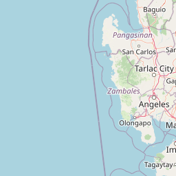
Roosevelt Protected Landscape holds a distinctive place in Philippine conservation as a formally recognized protected area within one of the most heavily developed regions of Luzon. Its location near Olongapo and the Subic Bay Freeport Zone places it adjacent to major transport corridors, including the Subic-Clark-Tarlac Expressway and Jose Abad Santos Avenue, making its preserved status particularly meaningful in a landscape otherwise shaped by urban expansion and industrial activity.
The protected landscape supports several endangered species, including pythons, monitor lizards, and cloud rats, alongside more common wildlife. The survival of old-growth forest fragments and the continued presence of these species indicate that, despite historical reductions in the protected area's extent, the site retains important habitat value.
From a conservation planning perspective, Roosevelt illustrates the role of IUCN Category V protected landscapes in the Philippine system. Its protected landscape designation reflects a recognition that conservation outcomes in such heavily modified regions may depend on maintaining a working landscape that combines habitat preservation with allowances for compatible land uses, rather than relying solely on strict nature reserve protection.
Top sights and standout views in Roosevelt Protected Landscape
Roosevelt Protected Landscape stands out for its unusual combination of extensive cogon and talahib grasslands, surviving patches of old-growth forest, and planted mahogany and teak stands, all set within a narrow valley at the foot of the Zambales Mountain Range. Its streams, including the Cucubog and Olongi rivers, add riparian diversity to this grassland-forest mosaic.
The area's proximity to Olongapo and the Subic Bay Freeport Zone gives it particular conservation significance as a natural refuge within an otherwise heavily urbanized and industrialized region of Luzon. Its long institutional history, dating back to a 1933 proclamation, also makes it one of the older formally protected natural areas in the Philippines.
Best time to visit Roosevelt Protected Landscape
The character of Roosevelt Protected Landscape shifts with the seasonal climate of Central Luzon. The dry season, generally running from late November through May, typically produces more open and golden grasslands under cogon and talahib, with clearer views across the valley toward the surrounding peaks of the Zambales Mountain Range. Wildlife observation in this period often focuses on species that remain active in the dry grasslands and along river corridors.
The rainy season, from roughly June through October, brings lusher green conditions to the grasslands and forest patches, and supports higher activity levels among many animal species. Rainfall also affects stream flow in the Cucubog and Olongi rivers, which can make some trails and low-lying areas more difficult to access. Visitors interested in the contrast between the park's dry golden landscape and its wetter green character may find value in experiencing the area in more than one season.