Mori Atlas logo
Nearby park discovery

Mapping regional natural monuments and protected terrain within the Vysočina landscape context.

Protected Areas and Surrounding Geographic Landscapes Near Rozštípená skála

Examine the distribution of protected areas and natural landmarks surrounding the Rozštípená skála gneiss formation. This geographic overview highlights the spatial relationship between local geological monuments and the broader protected landscapes across the Vysočina region, facilitating a clearer understanding of the area's natural topography.

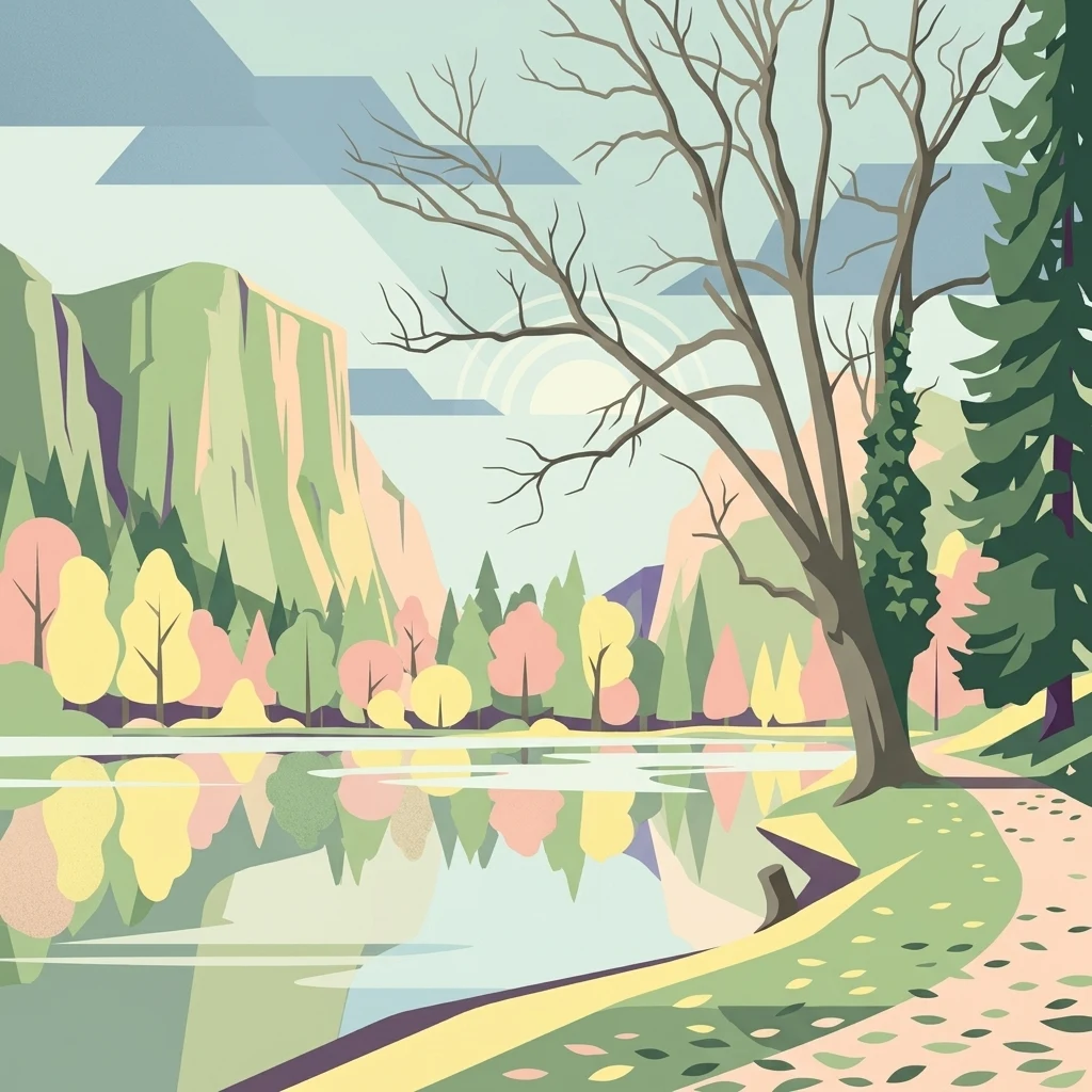
A flat vector-style illustration of a forested mountain valley with a prominent central rock formation shaped like a woolly mammoth.

A small gneiss rock monument split by a weathered fissure in the Žďárské vrchy hills.

Rozštípená skála

Rozštípená skála is a small protected natural monument in the Czech Republic, situated near Žďár nad Sázavou in the Vysočina Region. Its defining feature is a vertical rock face of metamorphic gneiss that has been split along a weathered fracture running roughly ten meters in length and about two meters wide. The protected area occupies only 0.76 hectares, yet it preserves a compact example of the rocky outcrops that characterize the broader Žďárské vrchy protected landscape. The site lies within the cadastral area of Najdek na Moravě, just a few kilometers west of the town of Žďár nad Sázavou. The Sázava River flows beneath the rock, and along the meadow at the base stands a sculptor Michal Olšiak's stone artwork titled Hlava mamuta, a roughly 2.5-meter depiction of a Pleistocene mammoth head emerging from the rock. Beyond its geological significance, the site is a popular local stop for hikers, who can reach it via marked trails. The rock also attracts climbers, making the small protected area a mix of geological monument, walking destination, and outdoor recreation point in the Bohemian-Moravian Highlands.

Location
Czechia
Park type
Natural monument
Established
1974
Area
0 km²
Highest point
560 m
Rozštípená skála Natural Monument Map
Regional park map

See the ranked park cluster in its geographic setting

Nearby parks around Rozštípená skála

This regional map shows the same 20 nearby parks ranked below around Rozštípená skála. Select a ranked marker to highlight that park’s boundary where boundary data is available.
Reference park: Rozštípená skálaRanked nearby park20 nearby parks shown
20 nearby parks

Distance separation and regional park geography for comparative environmental analysis

Ranked Parks and Protected Areas Geographically Near Rozštípená Skála

Spatial proximity measurements establish a structured ranking of protected areas surrounding Rozštípená skála based on direct geographic coordinates. Evaluating these nearby conservation zones reveals broader regional landscape patterns and habitat variations across the surrounding terrain.
A watercolor painting showing a soft landscape of rolling hills, grassy meadows, and patches of vegetation in a pastel color palette.
Natural monumentKraj Vysočina
About 9.8 km away#1 closest

Northeast

Sklenské louky Natural Monument: Wetland Landscapes in Kraj Vysočina

Highland geography and protected peatland habitats

Sklenské louky functions as a concentrated nature monument within the Kraj Vysočina region, preserving vital moisture-loving vegetation and peat-based ecosystems. The terrain features a characteristic mix of open meadows and spruce groupings, illustrating the diverse landscape character of the Bohemian-Moravian Highlands. This protected area provides a clear view into the region's unique upland hydrological and botanical patterns.

Area
0.063 km²
Established
1985
IUCN
IV
Relief
Upland
Watercolor painting of a rolling countryside scene featuring green hills, forest edges, and muted pastel tones on a white background.
Protected landscapeVysočina Region
About 10 km away#2 closest

South

Přírodní park Bohdalovsko: Protected Landscape and Wetland Geography in the Vysočina Region

Highland terrain, fishpond mosaics, and protected natural corridors.

Located in the Czech Republic, Přírodní park Bohdalovsko serves as a primary example of a cultural highland landscape. The area features a remarkable concentration of ponds and peatland pockets that anchor local biodiversity, including rare aquatic species and amphibian strongholds. Its geography is characterized by rolling uplands and varied forest-field mosaics that remain integral to the regional conservation framework of the Bohemian-Moravian Highlands.

Area
60.8 km²
Established
2001
Relief
Upland
Climate
Temperate
Natural monumentKraj Vysočina
About 16 km away#3 closest

East

Vávrova skála Natural Monument: Geological Exploration in the Kraj Vysočina Region

Metamorphic rock outcrops and highland protected habitats

Vávrova skála stands as a protected natural monument near Pohledec, showcasing a distinct orthogneiss formation shaped by Quaternary weathering. This site serves as a vital reference for the geological diversity of the Bohemian-Moravian highlands, protecting rare summit heath and dry grassland within the larger Žďárské vrchy protected landscape.

Area
0.001 km²
Established
1983
IUCN
III
Relief
Upland
A soft watercolor illustration of a landscape with rolling hills, a meandering stream, and wooded areas against a pale sky.
Natural monumentVysočina Region
About 17 km away#4 closest

Southeast

Rasuveň Natural Monument: Protected Forest Terrain in the Czech Vysočina Region

Mapping upland woodland and fir-beech conservation areas

Rasuveň protects a meaningful remnant of fir-beech forest in the Czech-Moravian Highlands. This natural monument, situated in the Vysočina Region, provides a quiet example of mature upland woodland conservation. Its geographic profile is defined by rolling ridges and crystalline bedrock, offering a dedicated space for observing natural forest structures within an increasingly managed agricultural landscape.

Area
0.207 km²
Established
1989
IUCN
IV
Relief
Upland
A horizontal watercolor painting depicting a soft, scenic view of hills with rocky outcrops in the foreground and a forested landscape in the distance.
Protected areaCzechia
About 17 km away#5 closest

Northeast

Malinská skála: Geomorphological Landmark and Viewpoint in the Czech-Moravian Highlands

Protected gneiss rock group and mountain ridge geography

Rising as a striking summit in the Žďárské vrchy, Malinská skála presents a concentrated group of named gneiss towers reaching 20 meters in height. The site functions as a geological monument, preserving classic examples of frost-shattered boulder streams and high-elevation landforms. With its panoramic vantage points, it serves as a central point for mapping the topography of the surrounding Czech upland ridges.

Area
0.058 km²
Established
1987
Relief
Mountain
Climate
Temperate
A soft watercolor painting showing a quiet pond landscape with grassy banks, reeds, and distant trees against a pale background.
Nature reservePardubický kraj
About 23 km away#6 closest

North

Ratajské rybníky Protected Nature Reserve: Highland Wetland Geography and Mapped Boundaries

A core wetland refuge for rare flora and fauna in the Pardubický kraj region

The Ratajské rybníky reserve represents a vital highland wetland ecosystem characterized by its three connected fishponds and surrounding quaking bogs. This mapped protected area provides an essential habitat for endangered butterfly populations, the rare moss Hamatocaulis vernicosus, and dense amphibian breeding grounds, set against the backdrop of the forested Železné hory mountain ridge.

Established
1990
IUCN
IV
Relief
Upland
Climate
Temperate
A soft watercolor illustration featuring rolling hills in pink and green tones with stylized coniferous trees, set against a white background.
Natural monumentPardubický kraj
About 23 km away#7 closest

Northeast

Rybenské Perničky: Natural Monument and Geological Landmark of the Bohemian-Moravian Highlands

Geological rock outcrops and protected upland terrain in the Pardubice Region

Investigate the geological structure of Rybenské Perničky, a protected natural monument featuring unique orthogneiss outcrops and characteristic bowl-shaped weathering basins. Situated in the Pardubice Region, this site offers a focused look at the crystalline rock formations and undulating plateau terrain of the Bohemian-Moravian Highlands, providing essential geographic context for this noteworthy natural landmark.

Area
0.141 km²
Established
1980
Relief
Upland
Climate
Temperate
A soft, horizontal watercolor painting showing a green meadow in the foreground leading to a line of trees and distant rolling hills.
Natural monumentKraj Vysočina
About 29 km away#8 closest

East

Na Ostrážné Natural Monument: Geographic Boundaries and Protected Meadow Landscapes

A vital Natura 2000 site in the Bohemian-Moravian Highlands

The Na Ostrážné natural monument encompasses a compact meadow ecosystem situated on an ecologically expressive slope. This area serves as a critical refuge for rare invertebrate species, maintaining traditional grassland characteristics within the Svratecká hornatina. Its status as both a national monument and a European site makes it a key focus for understanding habitat preservation in the Vysočina Region.

Area
0.014 km²
Established
2015
IUCN
IV
Relief
Upland
Nature reserveKraj Vysočina
About 33 km away#9 closest

East

Pyšolec Nature Reserve: Protected Forest Geography and Mapped Terrain in Kraj Vysočina

Biodiverse woodland and historic castle ruin protected area

Pyšolec is a significant nature reserve characterized by mature broadleaf forests and steep, rocky terrain in the Czech Vysočina Region. The site provides a critical habitat for specialized invertebrates and rare species within its unique forest-castle mosaic, mapped here for geographic context and ecological study.

Area
0.342 km²
Established
2021
IUCN
IV
Relief
Upland
Watercolor illustration of a peaceful landscape featuring soft-colored hills, green trees, and an open foreground on a white background.
Natural monumentKraj Vysočina
About 34 km away#10 closest

South

Na Kopaninách Natural Monument and Protected Meadow Geography in the Vysočina Region

A vital habitat for rare Bohemian-Moravian grassland flora.

Situated at an elevation of 550 to 570 meters, Na Kopaninách represents a critical fragment of traditional rural landscape. The area consists of a small mosaic of hay meadows and communal pasture, playing a central role in national rescue programs for rare gentian populations. Its north-facing terrain and nutrient-poor soils support a specialized botanical community that highlights the importance of small-scale habitat protection.

Area
0.01 km²
Established
1986
IUCN
IV
Relief
Lowland
Natural monumentKraj Vysočina
About 35 km away#11 closest

South

Urbánkův palouk Natural Monument: Protected Highland Landscape and Meadow Geography

Preserved peat meadow terrain in the Czech Republic.

Urbánkův palouk serves as a critical natural monument in Kraj Vysočina, protecting a rare fragment of wet and peat-influenced meadow habitat. Positioned on a highland plateau at 622 meters, this site functions as an ecologically dense refuge for threatened plant species within the traditional Czech-Moravian Highland landscape.

Area
0.01 km²
Established
1990
IUCN
IV
Relief
Lowland
A watercolor painting of a soft, rolling landscape with green hills, patches of trees, and a pale sky.
Natural monumentPardubický kraj
About 38 km away#12 closest

Northeast

Sněženky ve Vysokém lese: Exploring the Protected Natural Monument and Forest Geography

A small-scale Bohemian botanical reserve and valley landscape

Located in the Svitavy district of Pardubický kraj, Sněženky ve Vysokém lese is a natural monument dedicated to preserving a dense, naturally occurring population of wild snowdrops. The protected hollow, carved into the broader Vysoký les spruce woodland, illustrates how specific moisture conditions and soil patterns create essential habitats for rare local wildflowers within the Czech landscape.

Area
0.022 km²
Established
1994
IUCN
IV
Relief
Upland
Nature reserveCzechia
About 39 km away#13 closest

Southwest

Prameniště Jankovského potoka: Protected Wetland Landscapes in the Czech Vysočina Region

An atlas exploration of highland spring-fed meadow ecosystems and conservation corridors.

Prameniště Jankovského potoka acts as a cornerstone for wetland conservation in the Vysočina Region. The site features a mosaic of nutrient-poor peat meadows and spring-fed stream corridors, providing stable habitats for endangered freshwater pearl mussels and unique highland flora. This protected area offers a clear look at the intersection of traditional meadow management and hydrological restoration in the Czech landscape.

Area
0.658 km²
Established
2018
IUCN
IV
Relief
Upland
Watercolor painting of a forested hillside with evergreen trees and distant rolling purple mountains.
Protected landscapeJihlava District
About 39 km away#14 closest

Southwest

Přírodní park Čeřínek: Map and Protected Landscape Geography of the Jihlava District

Highland forests, granite outcrops, and peatland ecosystems

Located in the Jihlava District, Přírodní park Čeřínek offers a detailed look at the highland terrain of the Křemešnická vrchovina. The area features a mix of dense spruce woodland, prominent rocky outcrops including Přední skála, and the significant Hojkovské rašeliniště peat bog. This protected landscape serves as a regional anchor for understanding the ecological and topographical character of the Czech-Moravian Highlands.

Area
23 km²
Established
1985
Relief
Upland
Climate
Temperate
A soft watercolor painting of a river landscape with rolling hills, grassy riverbanks, and light green vegetation under a pale sky.
Protected landscapePardubický kraj
About 39 km away#15 closest

Northwest

Přírodní park Doubrava Protected Landscape and River Valley Geography

A detailed map-based overview of the Doubrava River protected corridor in the Czech Republic.

Navigate the linear terrain of Přírodní park Doubrava, where natural riverine habitats meet industrial heritage in the Pardubický kraj. The area features a significant water tunnel, rocky banks, and a historic quarry-stone dam, creating an ecologically rich corridor that bridges the gap between the Bohemian-Moravian Highlands and the Iron Mountains.

Area
0.65 km²
Established
1998
Relief
Upland
Climate
Temperate
Natural monumentJihomoravský kraj
About 41 km away#16 closest

Southeast

Veselský chlum Natural Monument: Protected Highland Landscape and Regional Geography

A diverse habitat mosaic in the South Moravian Highlands

Veselský chlum functions as a compact natural monument, preserving an unusual blend of vegetation formations including dry grasslands and shrublands. Located in the South Moravian region, this protected area offers significant value for understanding how historical land use creates rich habitat mosaics on low-elevation summits. The site provides a valuable geographic reference point for highland conservation patterns.

Area
0.124 km²
Established
1991
IUCN
IV
Relief
Mountain
An illustrative style digital painting of a tranquil park scene with a lake in the foreground, a path along the bank, and mountains in the distance, depicted with a muted, pastel-toned color palette.
Protected landscapeChrudim District
About 44 km away#17 closest

North

Přírodní park Heřmanův Městec: Geographic Profile and Protected Landscape Boundaries

Tracing the elevation transitions of the Chrudim District foothills

This protected landscape in the Chrudim District merges man-made baroque vistas with natural oak woodlands. The park terrain rises over 100 metres from water-side flats to forested ridges, providing a distinct study in regional geology and calcareous soil habitats that support rare beetle and bat populations.

Area
3.41 km²
Established
1996
Relief
Mixed relief
Climate
Temperate
A watercolor painting showing a wide view of soft, green rolling hills against a pale, warm-toned sky.
Protected landscapeBlansko District
About 46 km away#18 closest

East

Halasovo Kunštátsko Nature Park: Protected Highland Landscapes and Regional Geography

A detailed geographic study of the Blansko District highland interior.

Covering the eastern flank of the Czech-Moravian Highlands, Halasovo Kunštátsko Nature Park provides a diverse inland environment of ridges, valleys, and forest mosaics. From the high summit of Kulíšek to the transitional zones of the Boskovická brázda, this protected landscape integrates geological, botanical, and regional environmental values into a single, cohesive geographic area.

Area
68.3 km²
Established
1980
Relief
Upland
Climate
Temperate
Protected landscapeBrno-venkov District
About 50 km away#19 closest

Southeast

Přírodní park Údolí Bílého potoka: Protected Landscape in the South Moravian Region

Forested stream valley geography and upland terrain mapping

This protected area centers on the deep, forested valley of the Bílý potok stream. It features a rich mosaic of beech-fir and oak-pine forests on rocky slopes, representing a significant ecological corridor in the agricultural landscape northwest of Brno within the Brno-venkov District.

Area
40.46 km²
Established
1978
Relief
Upland
Climate
Temperate
A soft watercolor illustration showing a landscape with a calm body of water in the foreground, rolling green hills, and distant hazy mountains under a pale sky.
Nature reservePardubický kraj
About 50 km away#20 closest

Northeast

Psí kuchyně Nature Reserve: Geographic Overview of Protected Woodland Habitats

Mapping the forest biodiversity of the Pardubický kraj region

Psí kuchyně offers a protected look at Central European woodland landscapes, integrating mature beech stands with moisture-rich ash-alder floodplains. The reserve serves as a critical habitat for specialized insect life and forest-interior bird species, all set within the geologically diverse terrain of the Svitavy and Ústí nad Orlicí districts.

Area
2.74 km²
Established
1994
IUCN
IV
Relief
Upland
Distance methodology

Geographic measurements, not driving distances

How nearby park distances are calculated

Distances use park boundaries whenever the available geometry allows it. When one or both boundaries are missing, the mapped park locations provide a clearly labelled estimate. Every value represents straight-line geographic separation and does not use roads or routing.

Boundary distance

Calculated between the nearest points of both park boundaries.

Location-to-boundary estimate

Estimated from one mapped park location to the nearest boundary of the other park.

Mapped-location estimate

Estimated between the mapped locations of both parks.

MoriAtlas Explorer

Explore the Geological Boundaries of Rozštípená skála in the Vysočina Region

Trace the map boundaries and terrain features of this significant natural monument. Through the MoriAtlas database, discover how these specific geological formations contribute to the broader landscape character of the Bohemian-Moravian Highlands and the surrounding Vysočina protected areas.