Why Rubondo Island National Park stands out
Rubondo Island is uniquely known for its introduced chimpanzee population, one of the few successful chimpanzee introduction programs in Africa. The park also features extensive papyrus swamps along its western shore, rocky and sandy beaches on the eastern lakeshore, and a landscape of volcanic hills rising from Lake Victoria. Its status as an uninhabited island with near-pristine forest makes it distinctive among Tanzania's protected areas.
Rubondo Island National Park history and protected-area timeline
Rubondo Island became a game reserve in 1965, established specifically to provide a sanctuary for animals. The decision to create the reserve coincided with a broader government initiative to relocate the island's human population. The approximately 400 Zinza tribe members who had lived on Rubondo, maintaining banana plantations and fishing, were resettled to neighboring islands and the mainland in the late 1960s. The island was officially gazetted as a national park in 1977. A significant conservation initiative occurred between 1966 and 1969 when Professor Bernhard Grzimek of the Frankfurt Zoological Society coordinated the introduction of seventeen chimpanzees to the island. These animals, sourced from European zoos and circuses, were released in four cohorts without pre-release rehabilitation. The program has proven successful, with the population growing from sixteen founders to approximately forty individuals today.
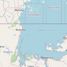
Rubondo Island National Park landscape and geographic character
Rubondo Island rises from Lake Victoria's surface at 1,134 meters elevation, with the Masa Hills in the far south reaching 1,486 meters, about 350 meters above the lake level. The island essentially consists of a partially submerged ridge of four volcanically formed hills connected by three flatter isthmuses. The terrain supports mixed evergreen and semideciduous forest covering approximately 80% of the island, characterized by species such as Croton sylvaticus, Drypetes gerrardii, and Lecaniodiscus fraxinifolius, with a dense understory of lianas. The forest is interspersed with patches of open grassland and, restricted primarily to the Lukaya area, acacia woodland. The eastern lakeshore features rocky areas and sandy beaches, while the western shore supports extensive papyrus swamps lined with date palms. The island has no rivers and its soils are volcanic in origin.
Rubondo Island National Park ecosystems, habitats, and plant life
The park's ecological character is defined by its extensive forest cover and the diversity of habitats created by its island setting and volcanic topography. The mixed evergreen and semideciduous forest represents the dominant habitat, with a canopy dominated by species adapted to the tropical lake environment. The understory features dense liana growth, creating the classic appearance of an African forest. Grassland patches break the forest continuity, while acacia woodland occurs in specific areas, particularly around Lukaya. The transition from forest to lakeshore produces distinct habitat zones, with papyrus swamps dominating the western shoreline and more open rocky and sandy shores characterizing the eastern side. This habitat diversity supports both forest-dependent species and those associated with wetland and aquatic environments.
Rubondo Island National Park wildlife and species highlights
Rubondo Island supports a unique combination of introduced and native wildlife. The chimpanzee population, descended from sixteen individuals introduced between 1966 and 1969, has grown to approximately forty individuals and now lives in an unhabituated wild state, building nests and foraging independently. Other introduced species include roan antelope and black rhinoceros, though both are now extinct on the island. Surviving introduced species include suni, African bush elephants, giraffes, mantled guereza, and grey parrots. Native fauna includes vervet monkeys, sitatunga (a wetland-dwelling antelope), hippopotamus, genets, and harnessed bushbuck. The island's position in Lake Victoria also connects it to the broader lake ecosystem.
Rubondo Island National Park conservation status and protection priorities
Rubondo Island National Park represents an important conservation model as an island sanctuary within Africa's largest lake. The relocation of human populations in the late 1960s enabled the preservation of approximately 80% of the island in forest cover, creating a rare example of a relatively unmodified tropical forest ecosystem in a populated region. The chimpanzee introduction program, while unconventional, has resulted in a self-sustaining population that has successfully adapted to wild conditions. The park's isolated island status provides natural boundaries that facilitate protection, with legal penalties for unauthorized landing and attempted poaching. Conservation challenges include managing the introduced species population and maintaining the forest ecosystem against potential invasive species or disease threats.
Rubondo Island National Park cultural meaning and human context
Prior to its designation as a protected area, Rubondo Island was home to the Zinza people, a tribe of approximately 400 individuals who practiced fishing and maintained banana plantations on the island. The Zinza have historical connections to the Lake Victoria region and their presence on Rubondo represents traditional land use patterns in the area. The government's decision to relocate these communities in the late 1960s was part of the establishment of the game reserve, reflecting a conservation approach that prioritized wildlife protection over ongoing human habitation. This displacement represents an important historical context for understanding the park's creation and the tension between conservation objectives and human settlement rights.
Top sights and standout views in Rubondo Island National Park
Rubondo Island offers visitors a distinctive African island wilderness experience. The chimpanzee population provides a unique wildlife viewing opportunity, one of the few places where these primates can be observed in a semi-wild island setting. The island's extensive forest trails allow exploration of volcanic hillsides, while the lakeshore environments offer different scenery including papyrus swamps and sandy beaches. The absence of permanent human settlement means the island retains a wilder character than most mainland parks, with the forest ecosystem largely unmodified by agriculture or development. The combination of lake-based access and island isolation creates a specialized safari experience.
Best time to visit Rubondo Island National Park
The park experiences a bimodal rainfall pattern with peaks in December and April to May during the October to May rainy season. Annual temperatures range from 19 to 26 degrees Celsius. The dry seasons between the rainy periods typically offer better conditions for forest walks and wildlife viewing, though the island's forest environment remains green year-round. Visitors should consider that access is by boat across Lake Victoria, making weather conditions an important factor in planning.