Mori Atlas logo
National parkSaltfjellet–Svartisen National Park

Discover Scandinavia's second-largest glacier, diverse alpine terrain, and rich flora in Northern Norway.

Saltfjellet–Svartisen National Park: Protected Landscape & Glacial Geography

Saltfjellet–Svartisen National Park in Nordland county, Norway, presents over 2,100 square kilometers of dramatic mountain and valley landscapes. This protected wilderness showcases a pronounced west-east geographic gradient, from coastal influences to high alpine plateaux, supporting exceptional plant biodiversity due to its unique calcareous bedrock. At its core lies Svartisen, Scandinavia's second-largest glacier, a significant feature shaping the region's meltwater rivers and glacial valleys. Explore this vast protected area's distinct terrain and rich natural context through MoriAtlas's detailed geographic and map-based discovery tools.

National ParksGlaciersAlpine EnvironmentsBirch ForestsSami CultureArctic Wilderness
Illustration of a river valley with green hills, trees, and distant mountains under a partly cloudy sky.

Saltfjellet–Svartisen National Park

National park

Park overview

Structured park overview, official facts, and landscape profile for Saltfjellet, Svartisen National Park

Saltfjellet, Svartisen National Park park facts, protected area profile, and essential visitor context
Review the core facts for Saltfjellet, Svartisen National Park, including designation, size, terrain, visitor scale, habitats, and operating context in one park-focused overview.

About Saltfjellet, Svartisen National Park

Saltfjellet–Svartisen National Park represents one of Norway's most significant protected wilderness areas, a vast expanse of mountain, valley, and glacial terrain that showcases the ecological diversity possible within Arctic conditions. The park's establishment in 1989 reflected growing recognition that this region contained irreplaceable natural values—most notably the Svartisen glacier system and the unusual calcium-rich geology that supports exceptional plant life. The park sits within a broader network of protected lands, with adjacent Gåsvatnan and Saltfjellet landscape protection areas and four small nature reserves creating a contiguous protected zone of nearly 2,840 square kilometres. This interconnected protection strategy acknowledges that wilderness ecosystems function as integrated systems rather than isolated fragments. The park's position spanning multiple municipalities reflects both the natural geography of the region and the need for coordinated management across administrative boundaries. Visitors approaching from the south and east encounter the park along the European route E6 corridor and Nordland Line railway, though the park itself remains a remote and undeveloped wilderness where the sounds of traffic fade quickly into mountain silence.

Quick facts and research context for Saltfjellet, Svartisen National Park

Saltfjellet–Svartisen National Park was established in 1989 and covers approximately 2,192 square kilometres across six municipalities: Beiarn, Meløy, Rana, Rødøy, Saltdal, and Bodø. The park is classified as IUCN Category II (national park) and is managed by the Norwegian Directorate for Nature Management. The defining geological characteristic is the extensive calcareous bedrock rich in calcium carbonate, which supports exceptional plant diversity. The park is bordered to the south and east by the European route E6 highway and the Nordland Line railway, which provide access points for visitors while the park itself remains a remote wilderness experience. Svartisen glacier represents one of the last great ice masses in mainland Scandinavia, making the park significant for understanding glacial processes and climate dynamics in northern Europe.

Park context

Deeper park guide and search-rich context for Saltfjellet, Svartisen National Park

Saltfjellet, Svartisen National Park history, landscape, wildlife, and travel context
Explore Saltfjellet, Svartisen National Park through its history, landscape character, ecosystems, wildlife, conservation priorities, cultural context, and seasonal travel timing in a structured park guide built for atlas discovery and search intent.

Why Saltfjellet, Svartisen National Park stands out

Saltfjellet, Svartisen is best known for the Svartisen glacier, Scandinavia's second-largest ice cap, which dominates the southwestern corner of the park and creates a dramatic backdrop of ice, meltwater rivers, and glacial valleys. The park is also renowned for its exceptional plant biodiversity supported by calcareous soils, something relatively rare in northern Norway's typically acid granite and gneiss terrain. The combination of coastal proximity, alpine elevation, and calcium-rich bedrock creates unusual ecological conditions that support species more typical of continental Europe far to the south. The living Sami reindeer husbandry tradition adds cultural depth, with seasonal grazing still practiced within the park boundaries and three Swedish Sami "samebyer" utilizing summer pastures in July and August.

Panoramic view of a turquoise glacial lake surrounded by rocky mountains with snow patches under a partly cloudy sky
Panoramic view of glacial lake and snow-capped mountains in Saltfjellet-Svartisen National Park

Saltfjellet, Svartisen National Park history and protected-area timeline

Saltfjellet–Svartisen National Park was designated by royal decree in 1989, representing the culmination of decades of conservation advocacy and scientific assessment of the region's natural values. The establishment came during a period when Norway was expanding its national park system to better protect representative examples of the country's diverse landscapes and ecosystems. Prior to national park designation, parts of the area had been protected through various mechanisms, but the 1989 decree created the comprehensive framework necessary to manage the region as a unified wilderness unit. The park's creation also acknowledged the importance of maintaining traditional Sami land use practices within a protected area framework—a recognition that cultural landscapes and natural values could coexist when properly managed. Since establishment, management has balanced wilderness preservation with sustainable recreation use, with visitor surveys and research studies informing adaptive management strategies.

Saltfjellet, Svartisen National Park landscape and geographic character

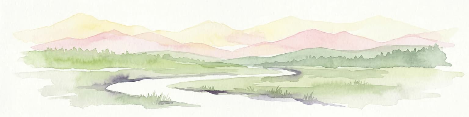
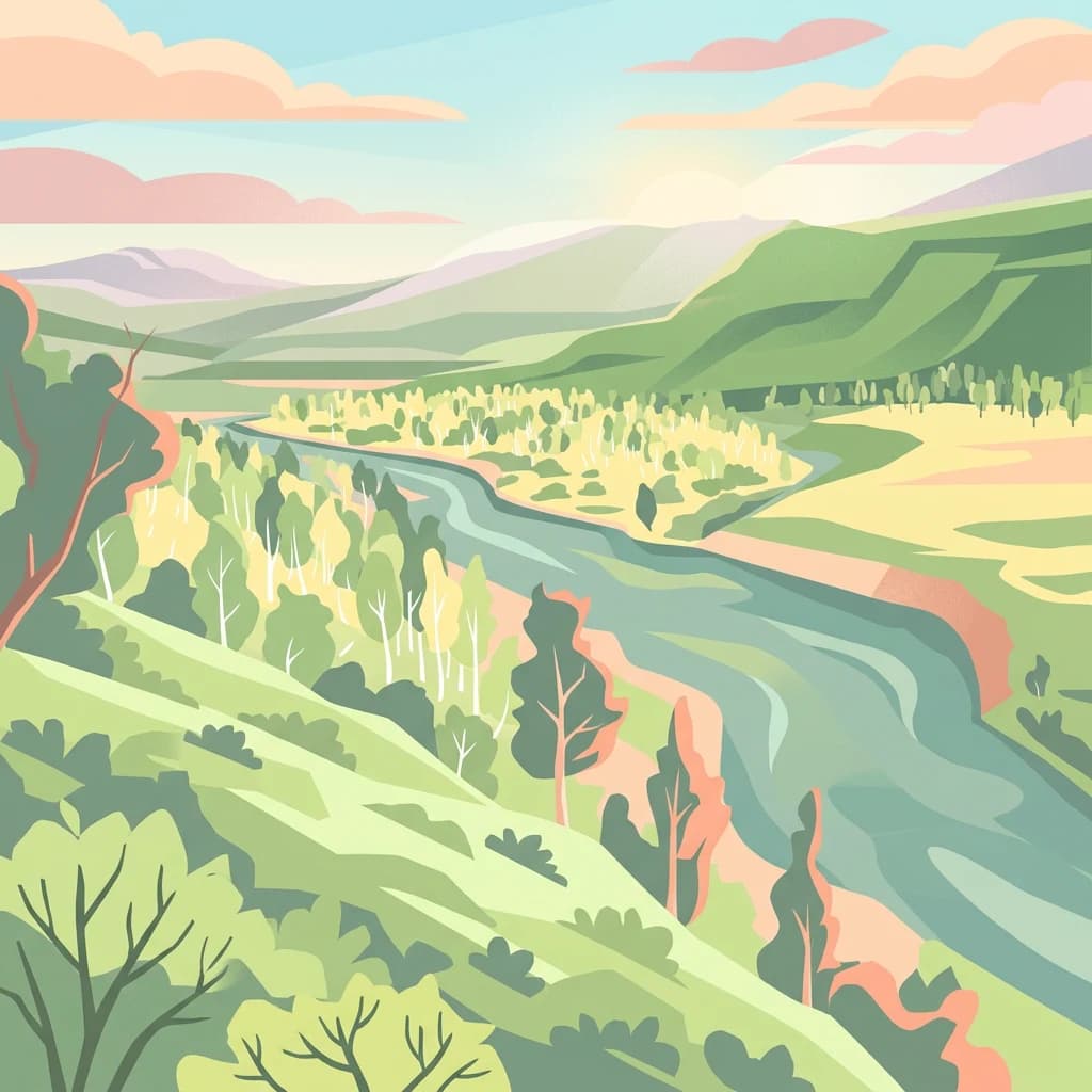
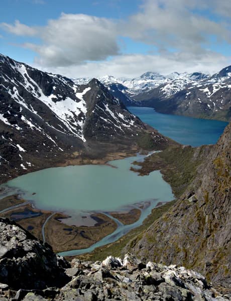
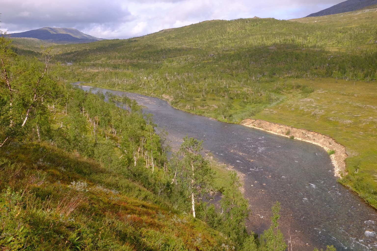
The landscape of Saltfjellet–Svartisen spans a remarkable topographic range, from the marine-influenced coastal zones near Nordfjorden to the high alpine plateau terrain that reaches elevations where only the hardiest vegetation survives. The western portions of the park receive moisture-laden air from the North Atlantic, creating conditions quite different from the more continental eastern zones. The birch-covered valleys represent a characteristic Norwegian mountain landscape, where birch forest transitions into alpine meadows and eventually into treeless tundra at higher elevations. The Svartisen glacier occupies a major valley system in the southwest, its ice mass visible from considerable distances as a gleaming white presence against dark mountain ridges. Meltwater rivers cascade from the glacier's snout, carving channels through glacial moraines before flowing into lakes that dot the landscape. The underlying calcareous bedrock creates distinctive terrain—limestone and marble outcrops break through the surface in places, contrasting with the more common granitic and gneissic rocks that dominate much of northern Norway.

A river flows through a valley surrounded by green hills and trees under a partly cloudy sky
Bjøllåga river flowing through Bjøllådalen valley in Saltfjellet National Park, Norway

Saltfjellet, Svartisen National Park ecosystems, habitats, and plant life

The ecological character of Saltfjellet–Svartisen is defined by the interaction between the calcareous bedrock and the climatic gradient from coast to interior. This calcium-rich geology creates soil conditions that support a flora significantly more diverse than typical Arctic-alpine terrain, including species that reach their northern distribution limits here or that are otherwise confined to specialized calcareous habitats. The presence of these plant communities makes the park botanically significant at a European scale. The landscape creates multiple habitat types within close proximity—coastal heaths, birch woodlands, alpine meadows, exposed rock slopes, and glacial forelands each support different ecological communities. The meltwater systems flowing from Svartisen create riparian corridors that serve as movement routes for wildlife and provide productive fishing habitat. The combination of protected status and minimal infrastructure means that natural processes continue largely uninterrupted, allowing ecological dynamics to unfold as they would in the absence of human management.

Saltfjellet, Svartisen National Park wildlife and species highlights

While the source material focuses more on geological and botanical values, the park's position within the Arctic ecosystem supports populations of species typical of northern Norwegian mountain and forest environments. The birch forests provide habitat for various bird species, and the alpine zones offer breeding grounds for species adapted to open tundra conditions. The meltwater rivers and lakes support fish populations, and the traditional hunting and fishing activities documented in visitor studies indicate that these resources remain locally significant. The presence of Sami reindeer husbandry (with approximately 4,783 animals counted in 2014) creates a cultural landscape where domestic reindeer move through territories that also support wildlife, creating complex interactions between wild and domestic ungulate populations. The park's remote character and minimal development mean that wildlife experiences remain a primary draw for visitors seeking encounters with northern nature.

Saltfjellet, Svartisen National Park conservation status and protection priorities

Saltfjellet–Svartisen holds significant conservation value at multiple levels. The Svartisen glacier represents one of the last substantial ice masses in mainland Scandinavia, making the park important for understanding glacier dynamics and climate change impacts on Arctic environments. The calcareous flora represents a conservation priority at the European scale, as these specialized plant communities are limited in distribution and vulnerable to disturbance. The park's inclusion within a larger network of connected protected areas—spanning nearly 2,840 square kilometres when adjacent landscape protection areas and nature reserves are included—reflects a conservation strategy that maintains ecological connectivity rather than creating isolated fragments. The traditional Sami reindeer husbandry, while a cultural practice, also maintains open landscape character that benefits biodiversity, creating a conservation model that integrates human cultural traditions with natural values rather than separating them.

Saltfjellet, Svartisen National Park cultural meaning and human context

The living presence of Sami reindeer husbandry gives Saltfjellet–Svartisen cultural depth beyond its natural values. The Saltfjellet and Hestmannen/Strandtindene grazing districts maintain traditional rights to graze reindeer within the park, with the 2014 count recording 4,783 animals utilizing these pastures. Additionally, three Swedish Sami "samebyer" (Sami communities) exercise seasonal grazing rights, bringing herds into the park during July and August. This integration of traditional land use within a national park reflects Norway's approach to recognizing indigenous cultural practices as compatible with wilderness protection when properly managed. Visitor studies have shown that Sami cultural identity and traditional resource use (hunting, fishing, gathering) are significantly over-represented as values among park users compared to other Norwegian national parks, indicating that visitors themselves perceive this cultural dimension as integral to the park's character.

Top sights and standout views in Saltfjellet, Svartisen National Park

Saltfjellet–Svartisen stands out as a wilderness destination combining dramatic glacial scenery with botanical richness uncommon in Arctic environments. The Svartisen glacier offers one of mainland Scandinavia's most accessible major ice experiences, with meltwater rivers and glacial lakes creating scenic variety throughout the southwestern sector. The calcareous bedrock creates surprising floral diversity, with rare plant species rewarding observant visitors who explore the birch valleys and alpine zones. The park's scale—over 2,100 square kilometres—ensures a wilderness experience even during the summer season when visitor numbers are moderate. The integration of Sami cultural practices, particularly visible during the summer grazing season, adds dimension to the landscape that distinguishes this park from purely natural reserves.

Best time to visit Saltfjellet, Svartisen National Park

The park can be visited year-round, though the summer months of June through August offer the most accessible conditions for hiking and wilderness exploration. During this period, the high alpine zones are snow-free, Sami reindeer herds move through their summer pastures, and the midnight sun provides extended daylight for exploration. The shoulder seasons of spring and autumn offer different experiences—autumn often brings clear weather and opportunities to witness the birch forests turning golden, while spring sees the snowmelt create dramatic glacial runoff in the rivers. Winter access is more limited but possible for those with appropriate experience and equipment; the cross-country skiing potential on the plateau terrain attracts backcountry enthusiasts. The park's northern latitude means that winter darkness returns from late November through January, while summer brings the phenomenon of the midnight sun above the Arctic Circle.

Park location guide

Geography guide, regional context, and park location map for Saltfjellet, Svartisen National Park

Saltfjellet, Svartisen National Park park geography, regions, and map view in Norway
Understand where Saltfjellet, Svartisen National Park sits in Norway through a broader geographic reading of the surrounding landscape, nearby location context, and its mapped position within the national park landscape.

How Saltfjellet, Svartisen National Park fits into Norway

Norway, officially the Kingdom of Norway, is a Nordic country in Northern Europe located on the Scandinavian Peninsula. It encompasses mainland Norway, the Arctic islands of Svalbard and Jan Mayen, and maintains dependencies including Bouvet Island and Antarctic claims. The country has a population of about 5.6 million and is bordered by Sweden, Finland, and Russia. Norway is a unitary parliamentary constitutional monarchy with Oslo as its capital and largest city.

Wider geography shaping Saltfjellet, Svartisen National Park in Norway

Norway occupies the western and northern portions of the Scandinavian Peninsula in Northern Europe. The country shares a long eastern border with Sweden, and borders Finland and Russia to the northeast. Norway has an extensive coastline facing the Skagerrak, North Sea, Norwegian Sea, and Barents Sea. The terrain is predominantly mountainous with numerous fjords along the coastline.

Map view of Saltfjellet, Svartisen National Park

Use this park location map to pinpoint Saltfjellet, Svartisen National Park in Norway, understand its exact geographic position, and read its mapped placement within the surrounding landscape more clearly.

Pigeon | © OpenStreetMap contributors

Location context for Saltfjellet, Svartisen National Park

Nordland

Explore the dramatic scale of Norway's second-largest glacier and the unique alpine ecosystems through detailed park imagery.

Saltfjellet–Svartisen National Park Photos: Visual Guide to Glacial Landscapes and Arctic Scenery
Browse a comprehensive visual gallery showcasing the diverse landscapes and habitats of Saltfjellet–Svartisen National Park, from the iconic Svartisen glacier to its distinct calcareous bedrock environments. These curated park images offer essential insight into the vast scale, ecological richness, and protected-wilderness character of this significant Norwegian protected area.

Panoramic view of a turquoise glacial lake surrounded by rocky mountains with snow patches under a partly cloudy sky

Three small mountain huts on a rocky hillside overlooking a turquoise lake with snow-covered mountains

A river flows through a valley surrounded by green hills and trees under a partly cloudy sky

Park atlas

Compare the diverse protected landscapes of northern Norway, from glacial features to unique alpine environments.

Explore Nearby National Parks and Protected Areas Surrounding Saltfjellet–Svartisen National Park
Continue your discovery of Norway's protected wilderness by exploring additional national parks and conservation areas across the Nordland county region and wider northern landscapes. Compare their varied terrain, including glaciers, alpine plateaux, and birch forests, to gain regional geographic context for protected lands in northern Norway.
National park

Láhko National Park: Northern Norway's Protected Arctic Landscape and Geographic Atlas Entry

Mapped boundaries and terrain of a key Finnmark national park.

Láhko National Park is a significant protected area within Norway's Finnmark region, representing a vast expanse of sub-Arctic wilderness and characteristic tundra ecosystems. This park serves as a crucial element in the atlas of northern European protected lands, offering insights into the geographic features and ecological integrity of high-latitude environments. Explore Láhko National Park through MoriAtlas to understand its landscape context, mapped terrain, and its role in preserving Nordic wilderness.

Watercolor illustration of a landscape with rolling hills, a river, and trees
National parkNordland

Junkerdal National Park: Protected Arctic-Alpine Landscape in Nordland, Norway

Explore mapped boundaries and unique geographic context.

Delve into Junkerdal National Park, a significant protected area within Nordland county, Norway. This national park is celebrated for its rich arctic-alpine flora, including rare plant species that thrive at their southernmost European range. The varied landscape, shaped by glacial activity, features dramatic mountain valleys and alpine plateaus, offering a distinct geographic profile. Understand its protected status and mapped terrain, providing a critical point of discovery for regional landscape context.

Area
682 km²
Established
2004
IUCN
II
Relief
Mountain
National parkNordland

Sjunkhatten National Park: Norway's Protected National Park Identity and Geographic Atlas

Mapped landscape context and regional geography details.

Explore the structured geographic data and protected landscape context for Sjunkhatten National Park, a significant national park in Nordland, Norway. This page provides detailed insights into its mapped boundaries and regional setting, offering an atlas-driven view of its natural terrain. Understand how this protected area contributes to the broader geography of Norway through factual, map-oriented discovery.

Area
417.5 km²
Established
2010
IUCN
II
Relief
Mountain
National parkNorrbotten County

Pieljekaise National Park: Ancient Birch Woodland and Glacial Terrain in Norrbotten

Explore Sweden's protected landscape and mapped geography.

Pieljekaise National Park, a historic protected area in Norrbotten County, showcases one of Scandinavia's most intact boreal birch woodlands. Its landscape is shaped by ancient glacial activity, featuring a U-shaped valley, rolling hills covered in primeval-like birch forests, and distinctive twin peaks. Positioned along the renowned Kungsleden trail, this national park serves as a vital point for understanding the mapped geography and protected natural heritage of Sweden's Lapland region.

Area
153.4 km²
Established
1909
IUCN
II
Relief
Upland
Watercolor illustration showing mountains, a river, and forests in a landscape
National parkNordland

Rago National Park: Northern Norway's Protected Mountain Wilderness and Transboundary Atlas

Explore the mapped terrain and unique landscape context of this significant protected area.

Rago National Park is a protected national park in Nordland, Norway, recognized for its challenging mountainous terrain and its crucial role as part of a vast transboundary protected area complex spanning into Sweden. The park's landscape features alpine lakes and glaciers, offering a stark representation of northern Scandinavian mountain wilderness. Understanding Rago National Park provides insight into regional conservation efforts and the geographic significance of large-scale protected lands in Europe.

Area
171 km²
Established
1971
IUCN
II
Relief
Mountain
Watercolor painting of mountains, a river, and trees under a pink and yellow sky
National parkNordland

Lomsdal, Visten National Park: Mapped Protected Landscape and Karst Geology in Nordland

Explore the protected geography of northern Norway's unique terrain.

Delve into the protected world of Lomsdal, Visten National Park, a key national park within Norway's Nordland county. This area is celebrated for its extraordinary geological formations, including significant karst features like caves, subterranean rivers, and natural arches, set against a backdrop of dramatic fjords and rugged mountain landscapes. The park’s diverse ecosystems, from valley woodlands to alpine environments, offer rich context for understanding regional geography and the mapped distribution of protected natural areas in Scandinavia. Discover the unique characteristics that define this significant conservation landscape.

Area
1,102 km²
Established
2009
IUCN
II
Watercolor illustration of a winding river through a green landscape with distant mountains
National parkNorrbotten County

Padjelanta National Park: Sweden's Largest National Park Protected Plateau Landscape

Explore subarctic terrain, large lakes, and Laponia World Heritage Site geography.

Padjelanta National Park, situated in Norrbotten County, is Sweden's largest national park. It features a distinctive subarctic plateau ecosystem centered around two vast lakes, offering a starkly open landscape compared to adjacent alpine areas. This protected area is renowned for its exceptional botanical and lichen diversity, a vital part of the Laponia World Heritage Site. Users can explore its mapped geography, unique terrain, and the cultural significance of this expansive arctic wilderness.

Area
1,984 km²
Established
1963
IUCN
II
Relief
Highland
National parkNordland

Børgefjell National Park: Explore Norway's Extensive Undeveloped Wilderness and Alpine Terrain

Mapped protected landscape in Nordland, known for granite peaks and arctic fox.

Børgefjell National Park offers a rare glimpse into Norway's most secluded and undeveloped mountain wilderness, spanning dramatic granite peaks and expansive marshlands. This protected landscape in Nordland provides a rich subject for atlas-based discovery, highlighting its unique geological formations, vital habitats for species like the arctic fox and wolverine, and extensive network of lakes and rivers. Navigate its geographic context and understand the protected boundaries of this significant natural area.

Area
1,447 km²
Established
1963
IUCN
II
Relief
Mountain

Common questions about visiting, size, designation, and location context for Saltfjellet, Svartisen National Park

Saltfjellet, Svartisen National Park FAQs for park facts, access, geography, and protected area context
Find quick answers about Saltfjellet, Svartisen National Park, including protected-area facts, park geography, trail and visitor context, and how the park fits into its surrounding country and regional landscape.
MoriAtlas Explorer

Continue Your Protected Areas Search Across the Global Atlas

Deepen your exploration by continuing the structured search for national parks and protected areas worldwide. Utilize the comprehensive filtering capabilities to compare different conservation landscapes and refine your understanding of global park geography. Discover more about the distribution and characteristics of protected natural areas.

Global natural geography