Why Santubong National Park stands out
Santubong National Park is best known for its dramatic rainforest-covered mountain backdrop and its role as a nature recreation area near Kuching. The park protects important dipterocarp forest ecosystems and serves as habitat for the rhinoceros hornbill, Sarawak's state bird. The prominent peak of Mount Santubong provides a distinctive visual landmark that defines the peninsula and can be seen from Kuching, making the park a recognizable feature of the regional landscape. The combination of coastal scenery, accessible rainforest trails, and cultural heritage sites nearby makes it a popular destination for visitors to the Kuching area.
Santubong National Park history and protected-area timeline
The scientific significance of the Santubong region was first recognized during the mid-19th century when Alfred Russel Wallace conducted his pioneering voyage to Sarawak between November 1854 and January 1856. Wallace carried out extensive biological sampling during his stay, focusing particularly on the slopes of Mount Santubong and the Sarawak River valley. His research in the area contributed substantially to the early scientific understanding of biodiversity in coastal ecosystems of northern Borneo and helped establish the region's reputation as an area of significant ecological interest. Mount Santubong was officially gazetted as a national park in 2007, formalizing protection for the area's natural values. Since its establishment, the park has developed as a destination for nature tourism, attracting visitors to experience its rainforest trails, wildlife viewing opportunities, and the distinctive landscape defined by the mountain peak.
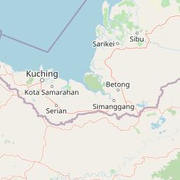
Santubong National Park landscape and geographic character
The park is situated on the Santubong Peninsula, a coastal landform where the slopes of Mount Santubong meet the surrounding marine and wetland environments. The terrain is dominated by the steep, forested slopes of Mount Santubong, which rises to 810 metres and forms the peninsula's highest point. The mountain's prominent peak creates a distinctive silhouette that is visible from Kuching and serves as a navigational landmark for the region. The park's land area of 14.1 square kilometres encompasses the lower and mid elevations of the mountain, with the terrain transitioning from coastal beach areas through lower slopes to the higher rainforest-covered ridges. The park is partially bordered by privately owned forest, creating a mosaic of protected and managed landscapes within the broader peninsula area.
Santubong National Park ecosystems, habitats, and plant life
The vegetation of Santubong National Park is characterized primarily by mixed dipterocarp forest, which covers the majority of the park's area and represents the dominant forest type of lowland Borneo. Smaller patches of kerangas forest, also known as heath forest, occur in areas with more acidic, nutrient-poor soils, adding ecological diversity to the park's plant communities. Beach forest is found along the coastal margins where salt-tolerant species adapted to sandy substrates and maritime conditions contribute to the park's botanical variety. This combination of forest types creates a heterogeneous landscape that supports different ecological communities across the elevation gradient from coast to mountain peak.
Santubong National Park wildlife and species highlights
Santubong National Park provides habitat for diverse wildlife, including several notable species of conservation concern. The rhinoceros hornbill, once widely distributed across southern Thailand, Peninsular Malaysia, Sumatra, Java, and Borneo but now believed to be extinct in Singapore, has been recorded within the park. This species inhabits various forest types including tall secondary forests, mixed dipterocarp forests, and swamp forests. Despite being recognized as Sarawak's state bird and having threatened status, detailed information about its current population distribution and ecology within the park remains limited. The broader wildlife community includes species typical of Bornean dipterocarp forests, though comprehensive species inventories for the park are not extensively documented in available sources.
Santubong National Park conservation status and protection priorities
The establishment of Santubong National Park in 2007 formalised protection for an area of ecological significance within Sarawak's coastal zone. The park's designation as an IUCN Category II protected area reflects its primary objective of conserving natural ecosystems while allowing for sustainable nature-based recreation. The protected area serves important watershed functions as a catchment zone, supporting hydrological processes that benefit the broader peninsula environment. The forest ecosystems, particularly the dipterocarp forest that dominates the park, store carbon and provide habitat for wildlife including threatened species such as the rhinoceros hornbill. The park's location adjacent to populated fishing villages and tourism facilities also creates opportunities for demonstrating compatible land use and promoting conservation awareness among local communities and visitors.
Santubong National Park cultural meaning and human context
The Santubong Peninsula has been home to traditional fishing communities for generations, with villages such as Kampung Santubong, Kampung Buntal, and Kampung Pasir Pandak located in the surrounding area. These communities maintain livelihoods linked to marine resources and contribute to the cultural character of the landscape. The proximity of the Sarawak Cultural Village, a heritage complex showcasing the traditions of Sarawak's diverse ethnic groups, provides additional cultural context for visitors to the area. The blend of natural landscapes with cultural attractions has helped establish the Santubong region as a destination that offers both outdoor recreation and insight into local heritage.
Top sights and standout views in Santubong National Park
The most distinctive highlight of Santubong National Park is the iconic silhouette of Mount Santubong, a 810-metre rainforest-covered peak that dominates the peninsula and can be seen from Kuching. The park offers accessible rainforest exploration through its trail network, allowing visitors to experience Bornean dipterocarp forest ecosystems within a relatively short distance from the state capital. The presence of the rhinoceros hornbill, Sarawak's state bird, provides wildlife viewing opportunities for interested visitors, though observations require patience and运气. The combination of mountain, forest, and coastal settings creates a varied landscape that supports different recreational activities and ecological experiences within a compact protected area.
Best time to visit Santubong National Park
The park can be visited throughout the year as it lies in a tropical climate where rainfall occurs in all seasons. The dry period typically falls between March and October, when visitor numbers tend to be higher and outdoor activities are more comfortable. The southwest monsoon season from November to February brings increased rainfall, which can affect trail conditions and visibility but also creates a greener, more lush landscape. Visitors interested in wildlife viewing may find that different seasons offer varying opportunities, though the rhinoceros hornbill and other forest species can be encountered year-round. The proximity to Kuching makes Santubong suitable for both day trips and longer stays at nearby resorts.