
Mori Atlas logo
National parkSemenawi Bahri National Park

Discover the dramatic mountain terrain and wildlife diversity of this unique Eritrean national park.

Semenawi Bahri National Park: Eritrea's Premier Highland Protected Landscape

Semenawi Bahri National Park stands as a significant protected area within Eritrea, distinguished by its dramatic highland geography. Situated between 900 and 2400 meters, the park encompasses massive mountains and deep valleys, offering a unique cooler climate and ecological contrast to Eritrea's coastal regions. This national park is a focal point for exploring its mapped boundaries, understanding its regional landscape context within the Horn of Africa, and discovering the diverse wildlife adapted to its mountainous terrain.

mountain parkshighland ecosystemswildlife viewingbirdwatchingEast Africaprotected areas

Semenawi Bahri National Park

National park

Park overview

Structured park overview, official facts, and landscape profile for Semenawi Bahri National Park

Semenawi Bahri National Park park facts, protected area profile, and essential visitor context

Review the core facts for Semenawi Bahri National Park, including designation, size, terrain, visitor scale, habitats, and operating context in one park-focused overview.

About Semenawi Bahri National Park

Semenawi Bahri National Park represents one of Eritrea's most important protected areas, established to preserve the unique highland ecosystems found in the central highlands of the country. The park's elevation range of 900 to 2400 meters creates a montane environment that contrasts strongly with the hot, arid lowlands and coastal plains that characterize much of Eritrea. This altitudinal gradient supports varied habitats from rocky mountain slopes and cliffs to forested valleys and grassy clearings. The park's location in the Eritrean highlands places it in a biogeographically significant zone where Afrotropical fauna meets highland-adapted species. Despite its ecological importance and proximity to the capital city of Asmara, the park has not yet developed into a major tourist destination, leaving much of its natural character relatively undisturbed. The presence of a single asphalted road traversing the park facilitates visitor access while the recreation centers at Meguo, Medhanit, and Sabur provide basic visitor facilities.

Quick facts and research context for Semenawi Bahri National Park

Semenawi Bahri National Park is situated in the Eritrean highlands at elevations ranging from 900 to 2400 meters. The protected area features mountainous terrain with interspersed valleys, creating diverse habitats within a relatively compact area. Wildlife includes several antelope species, large mammals, and a growing catalog of bird species. A single asphalted road traverses the park, providing access to recreation centers at Meguo, Medhanit, and Sabur. The park's proximity to the capital Asmara and its elevation make it a distinctive destination within Eritrea's natural landscape portfolio.

Protection and recognition

Tracking documented conservation frameworks and terrestrial management boundaries in Eritrea

Semenawi Bahri National Park Protection Status and Designated Terrestrial Boundaries

Geographers can review the terrestrial protection scope and documented conservation status established for Semenawi Bahri National Park. Verifying official boundaries and designated frameworks helps researchers compare African forest reserves within the global dataset.

Protection details

Protection scope
Terrestrial
Park context

Deeper park guide and search-rich context for Semenawi Bahri National Park

Semenawi Bahri National Park history, landscape, wildlife, and travel context

Explore Semenawi Bahri National Park through its history, landscape character, ecosystems, wildlife, conservation priorities, cultural context, and seasonal travel timing in a structured park guide built for atlas discovery and search intent.

Why Semenawi Bahri National Park stands out

Semenawi Bahri National Park is best known for its highland mountain environment, which supports a surprising diversity of wildlife despite the park's relatively compact size. The presence of duiker, klipspringer, warthog, leopard, and bushbuck represents a noteworthy assembly of African savanna and woodland species adapted to highland conditions. The park has also gained recognition for bird-watching, with numerous bird species documented in recent years. Its status as one of Eritrea's primary protected areas, combined with its accessibility from Asmara via a paved road, makes it a significant destination for nature enthusiasts interested in exploring the country's highland ecosystems.

Semenawi Bahri National Park landscape and geographic character

The landscape of Semenawi Bahri National Park is defined by its mountainous terrain, characterized by massive peaks and intervening valleys that create a visually striking highland environment. The elevation range spanning from 900 to 2400 meters produces varied terrain including rocky ridgelines, steep slopes, and more gentle valley bottoms. The interplay between exposed mountain rock and vegetated valleys gives the park a diverse visual character within a relatively contained area. This highland setting provides panoramic views and the sense of remoteness that distinguishes the park from Eritrea's more accessible coastal and lowland areas.

Semenawi Bahri National Park ecosystems, habitats, and plant life

The nature of Semenawi Bahri National Park centers on its highland ecological character, which supports species assemblages distinct from Eritrea's lowland protected areas. The montane environment creates conditions suitable for both forest-dwelling and open-country species, contributing to the park's biodiversity value. Recent bird surveys have documented numerous species within the park, enhancing understanding of its ornithological significance. The diversity of habitats created by the mountainous terrain and varying elevations supports the wildlife populations that have been recorded, including several species of antelope and larger mammals.

Semenawi Bahri National Park wildlife and species highlights

Wildlife in Semenawi Bahri National Park includes a notable assemblage of African mammal species adapted to highland environments. Duiker and bushbuck represent the park's antelope species, while klipspringer occupies the rocky outcrops and steeper terrain. Warthog populations inhabit the valley areas and grassy zones, while leopard presence indicates the park supports predator species requiring substantial territory. This combination of species reflects the park's role in conserving Eritrea's highland faunal heritage, though the full extent of wildlife diversity in the park remains a subject of ongoing documentation, particularly for smaller mammals, reptiles, and insects.

Semenawi Bahri National Park conservation status and protection priorities

Semenawi Bahri National Park serves as a key protected area within Eritrea's national park system, preserving the country's highland ecosystems and the species they support. The protected status provides legal framework for maintaining habitat integrity across the park's elevation gradient. Conservation of this area is particularly significant given Eritrea's limited network of protected lands and the ecological distinctiveness of highland environments in the Horn of Africa. The park's protected status helps ensure that its wildlife populations and ecological processes can continue functioning without the pressures that would accompany unregulated land use.

Semenawi Bahri National Park cultural meaning and human context

The park's location in the Eritrean highlands places it within a region of historical and cultural significance to Eritrea's highland communities. The surrounding areas have traditionally supported agricultural and pastoral activities, and the park's establishment reflects a balance between conservation objectives and local land use patterns. The recreation centers at Meguo, Medhanit, and Sabur provide visitor access points that connect to local communities.

Top sights and standout views in Semenawi Bahri National Park

Semenawi Bahri National Park offers visitors the opportunity to explore Eritrea's highland wilderness with its combination of mountain scenery, diverse wildlife, and bird-watching possibilities. The park's elevation provides a pleasant climate for outdoor activities, while the single access road makes it achievable for visitors without specialized vehicles. The relative lack of international tourism infrastructure contributes to a wilderness experience, and the documented presence of leopard, various antelope species, and numerous birds makes the park compelling for nature-focused travelers.

Best time to visit Semenawi Bahri National Park

The best time to visit Semenawi Bahri National Park coincides with Eritrea's dry season, typically from October through April, when conditions are most favorable for wildlife viewing and outdoor exploration. During this period, vegetation is less dense and animals tend to congregate more visibly around water sources. The cooler highland temperatures make outdoor activities more comfortable compared to Eritrea's hot lowlands, though visitors should be prepared for variable mountain weather conditions.

Monthly climate preview

Long term temperature ranges and monthly precipitation recorded at the representative coordinate

Semenawi Bahri National Park Climate Normals and Annual Weather Patterns

Historical data recorded between 1991 and 2000 reveals how average monthly temperatures and precipitation levels fluctuate throughout the year at this protected elevation. Analyzing the complete twelve month profile provides deeper insight into measured long term climate variations across the terrain.
Annual mean23 °C
19 °C26 °C
Jan19°
Feb21°
Mar22°
Apr25°
May26°
Jun26°
Jul23°
Aug23°
Sep24°
Oct22°
Nov21°
Dec19°
Warmest month
June

26.3 °C

Coolest month
January

19.3 °C

Wettest month
August

5.3 mm/day

Driest month
December

0.1 mm/day

Park location guide

Geography guide, regional context, and park location map for Semenawi Bahri National Park

Semenawi Bahri National Park park geography, regions, and map view in Eritrea

Understand where Semenawi Bahri National Park sits in Eritrea through a broader geographic reading of the surrounding landscape, nearby location context, and its mapped position within the national park landscape.

How Semenawi Bahri National Park fits into Eritrea

Eritrea is a sovereign nation in the Horn of Africa, gaining independence from Ethiopia in 1993 after a prolonged war of independence. The country features a diverse population of nine recognized ethnic groups, with Tigrinya being the most widely spoken language. Its geography includes highlands, coastal lowlands along the Red Sea, and islands such as the Dahlak Archipelago.

Wider geography shaping Semenawi Bahri National Park in Eritrea

Eritrea is located in the Horn of Africa in East Africa. The country shares borders with Ethiopia to the south, Sudan to the west, and Djibouti to the southeast. The northeastern and eastern regions have an extensive coastline along the Red Sea. The territory includes the Dahlak Archipelago and several of the Hanish Islands. The central highlands are historically known as Mereb Melash, serving as the northern frontier of Ethiopian kingdoms.

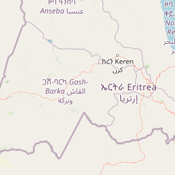
Map view of Semenawi Bahri National Park

Use this park location map to pinpoint Semenawi Bahri National Park in Eritrea, understand its exact geographic position, and read its mapped placement within the surrounding landscape more clearly.

Pigeon | © OpenStreetMap contributors
Park atlas

Compare Highland Ecosystems and Regional Protected Landscapes Around Eritrea

Explore Other National Parks and Protected Areas Near Semenawi Bahri National Park

Continue your discovery of Semenawi Bahri National Park by exploring other protected areas and national parks within Eritrea's diverse highland and surrounding regions. Trace the geographic spread of East African conservation efforts, map unique mountain ecosystems, and compare their distinct natural features across the Horn of Africa.
National parkEritrea
About 131 km away#1 closest

East

Dahlak Marine National Park: Eritrea National Park Mapping and Protected Marine Landscape

Explore its Red Sea geography, coral ecosystems, and marine wildlife.

Delve into Dahlak Marine National Park, a premier protected marine area located off the coast of Eritrea. This national park preserves extensive coral reef formations, critical seabird nesting islands, and important mangrove zones within the Red Sea. It is renowned for supporting over 325 species of fish, providing sanctuary for nesting sea turtles, and being one of the few Red Sea locations where dugongs are found. The park's unique geography and marine biodiversity offer a compelling atlas-style exploration of protected landscapes in the Horn of Africa.

IUCN
II
Relief
Lowland
Access
Highly restricted
Scope
Marine
National parkAmhara Region
About 259 km away#2 closest

South

Simien Mountains National Park: National Park Protected Landscape and Regional Geography

Explore Amhara Region's distinct mountain terrain and park boundaries.

Simien Mountains National Park serves as a key protected landscape within the Amhara Region of Ethiopia. This national park offers a distinct geographic identity, characterized by its unique terrain and mapped natural boundaries. Understanding this park provides valuable context for regional geography and the broader atlas of protected areas in northern Ethiopia.

Area
412 km²
Established
1969
IUCN
II
Visitors
26K annual
National parkSudan
About 343 km away#3 closest

North

Suakin Archipelago National Park: Sudan's Red Sea Marine Protected Area and Seabird Sanctuary

Explore the geography and mapped boundaries of this vital island ecosystem.

Suakin Archipelago National Park is a crucial protected area located in the Red Sea off Sudan's coast. This national park comprises a significant cluster of islets recognized for their abundant seabird nesting sites and as a critical habitat for marine fauna including sea turtles and dugongs. Its designation as an Important Bird Area underscores its international importance for coastal conservation, offering a distinct perspective on Sudan's natural geography and protected landscapes.

Area
1,500 km²
IUCN
II
Relief
Lowland
Climate
Arid
National parkNorth Gondar Zone
About 496 km away#4 closest

Southwest

Alitash National Park: Protected Lowland Woodland & Savanna Landscape

Explore the geographic context of this Ethiopian National Park.

Alitash National Park serves as a vital protected area within Ethiopia's North Gondar Zone, encompassing 2,665.7 square kilometers of distinct lowland woodland and savanna ecosystems. The park's landscape is characterized by gently undulating terrain, seasonal river valleys, and the prominent Twin Mountains of Amadog. Its mapped boundaries delineate an area rich in biodiversity, highlighting its significance as a national park for conservation efforts. Understanding Alitash National Park's geographic setting is key to appreciating its role in regional ecological preservation and atlas exploration.

Area
2,665.7 km²
Established
2006
IUCN
II
Relief
Upland
National parkSudan
About 524 km away#5 closest

Southwest

Dinder National Park: Sudan National Park Exploration and Protected Area Mapping

Mapped landscape context and protected area geography for this Sudanese national park.

This entry details Dinder National Park, a designated national park in Sudan, offering a comprehensive view for geographic exploration. Understand its specific location within Sudan's terrain and its significance as a protected landscape. The information provided is geared towards atlas-based research and understanding the park's mapped boundaries and regional geographic importance, facilitating structured discovery of conservation areas.

Area
10,000 km²
Established
1935
IUCN
II
Relief
Lowland
National parkAfar Region
About 534 km away#6 closest

South

Yangudi Rassa National Park: Protected Semi-Desert National Park in Afar Region

Mapped landscape and dryland ecosystems.

Yangudi Rassa National Park represents a critical protected area within Ethiopia's Afar Region, covering extensive semi-desert and grassland terrains. The park's geography is marked by Mount Yangudi and the broad Rassa Plains, with the Awash River shaping its riverine forests and marshes. This national park offers a unique insight into dryland ecosystems and their conservation, providing a distinct mapped landscape for geographic study and exploration.

Area
4,731 km²
Established
1969
IUCN
II
Relief
Mixed relief
National parkDjibouti
About 577 km away#7 closest

Southeast

Yoboki National Park: Djibouti National Park Geographic Atlas Explorer

Discover its mapped boundaries and regional terrain.

Yoboki National Park is a key protected area within Djibouti, offering a distinct focus for geographic exploration. This entry provides structured information to understand the park's mapped landscape and its position within the Horn of Africa's regional geography. Delve into the park's protected land identity and terrain context, essential for atlas-based discovery and appreciating its natural features.

IUCN
II
Relief
Mixed relief
Climate
Arid
Scope
Terrestrial
National parkTadjourah Region
About 593 km away#8 closest

Southeast

Day Forest National Park: Ancient Juniper Woodland and Protected Landscape in Djibouti

Discover a rare East African forest refuge with unique endemic species.

Day Forest National Park represents a critical ecological island within Djibouti's predominantly semi-desert geography. As the nation's oldest national park, it protects the largest remaining East African juniper forest, a vital sanctuary for species found nowhere else on Earth. Located in the Goda Mountains of the Tadjourah Region, its existence relies on rare localized rainfall, creating a distinctive mountainous forest environment that offers profound insights into protected landscape dynamics and regional biodiversity.

Area
15 km²
Established
1939
IUCN
II
Relief
Mountain

Common questions about visiting, size, designation, and location context for Semenawi Bahri National Park

Semenawi Bahri National Park FAQs for park facts, access, geography, and protected area context

Find quick answers about Semenawi Bahri National Park, including protected-area facts, park geography, trail and visitor context, and how the park fits into its surrounding country and regional landscape.
MoriAtlas Explorer

Continue Your Protected Areas Search Across the Global Atlas

Deepen your exploration by continuing the structured search for national parks and protected areas worldwide. Utilize the comprehensive filtering capabilities to compare different conservation landscapes and refine your understanding of global park geography. Discover more about the distribution and characteristics of protected natural areas.

Global natural geography

