
Mori Atlas logo
Protected landscapeShoshone National Forest

Mapping the vast mountain ranges and wilderness expanses of northwestern Wyoming

Shoshone National Forest: Examining the Geography and Protected Landscape of America's First National Forest

Spanning nearly 2.5 million acres in northwestern Wyoming, Shoshone National Forest anchors the Greater Yellowstone Ecosystem with a diverse, high-elevation terrain. This expansive protected landscape bridges the volcanic Absaroka Range, the ancient Precambrian granites of the Wind River Range, and the windswept plateaus of the Beartooth Mountains. As the first federally protected land of its kind, the forest serves as a vital wilderness corridor from the sagebrush lowlands to the glacier-clad summit of Gannett Peak.

first national forestnational forestRocky MountainsGreater Yellowstone EcosystemAbsaroka RangeBeartooth Mountains
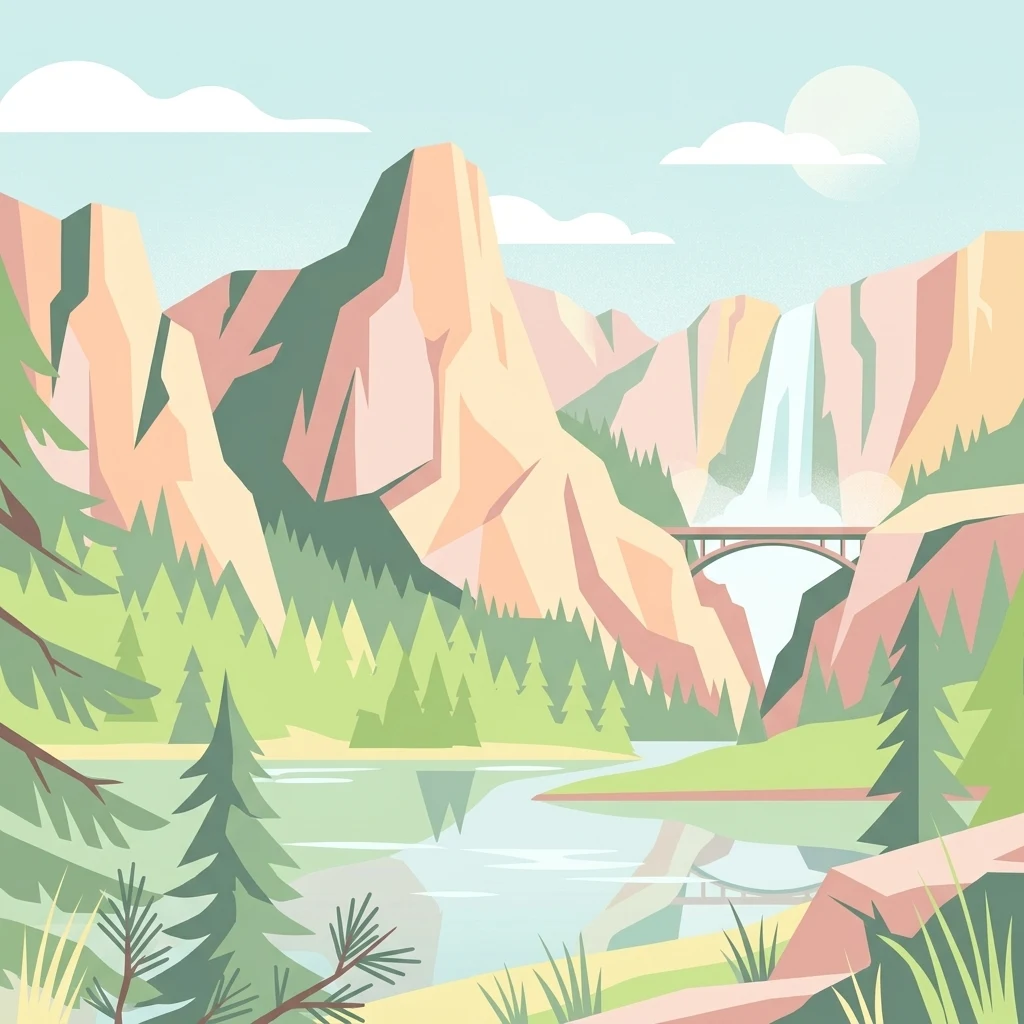
A flat-style digital illustration of a mountain range, a tall waterfall, an arched bridge, a forest of pine trees, and a river reflecting the scene.

Shoshone National Forest

Protected landscape

Park overview

Structured park overview, official facts, and landscape profile for Shoshone National Forest

Shoshone National Forest park facts, protected area profile, and essential visitor context

Review the core facts for Shoshone National Forest, including designation, size, terrain, visitor scale, habitats, and operating context in one park-focused overview.

About Shoshone National Forest

Shoshone National Forest occupies a vast and varied span of northwestern Wyoming, sitting at the intersection of the Absaroka, Beartooth, and Wind River mountain ranges and forming the eastern gateway country for Yellowstone National Park. It was established in 1891 when President Benjamin Harrison signed the Yellowstone Timberland Reserve into existence under the newly created Forest Reserve Act. That act allowed the federal government for the first time to set aside public domain land as forest reserves rather than transferring it into private hands, and Shoshone is therefore both the first national forest and one of the first major federal conservation land designations in American history.

Today the forest is managed by the U.S. Forest Service and is divided into five ranger districts. It covers nearly 2.5 million acres ranging from about 4,600 feet near Cody to 13,804 feet at the summit of Gannett Peak, allowing an extraordinary diversity of vegetation zones, from sagebrush grasslands to alpine tundra. More than half of the forest, about 1.4 million acres, is designated wilderness under the Wilderness Act of 1964, including the Fitzpatrick, North Absaroka, Washakie, Popo Agie, and portions of the Absaroka-Beartooth Wildernesses. Within these wilderness zones, motorized access is prohibited, and visitors travel on foot or horseback, preserving the forest's remote and undeveloped character.

The forest is a core element of the Greater Yellowstone Ecosystem, a nearly unbroken landscape of federally protected land that supports one of the most complete native wildlife communities remaining in the contiguous United States. All of the mammal species historically present still inhabit the forest, and the Greater Yellowstone ecosystem is internationally known as one of the last strongholds of the grizzly bear in the lower 48 states. Shoshone's rivers, including the Clarks Fork of the Yellowstone, are recognized for their recreational, scenic, and ecological importance, and its alpine terrain continues to define both the identity and the conservation significance of the region.

Quick facts and research context for Shoshone National Forest

Shoshone National Forest spans roughly 2.5 million acres across Park, Fremont, Hot Springs, Sublette, and Teton counties in Wyoming, with its headquarters in Cody. It was created from the Yellowstone Timberland Reserve in 1891 under the Forest Reserve Act of 1891, making it the first national forest in the United States and one of the earliest nationally protected land areas in the world.

The forest is part of the Greater Yellowstone Ecosystem, which preserves an estimated 20 million acres of contiguous protected land. About 56 percent of the forest is designated wilderness across areas including the Fitzpatrick, North Absaroka, Washakie, and Popo Agie Wildernesses. The Beartooth Highway across its northern edge is a National Scenic Byway, and the forest contains Gannett Peak, the highest mountain in Wyoming.

Protection and recognition

Documented protection history, management scope, and international recognition records

Shoshone National Forest Protection Status and Terrestrial Conservation Scope

Shoshone National Forest maintains a documented terrestrial protection scope and structured conservation framework within public land records. Official records compile designated status, management parameters, and international recognition details for geographic analysis.

Protection details

Protection scope
Terrestrial
Transboundary protection
No
Park context

Deeper park guide and search-rich context for Shoshone National Forest

Shoshone National Forest history, landscape, wildlife, and travel context

Explore Shoshone National Forest through its history, landscape character, ecosystems, wildlife, conservation priorities, cultural context, and seasonal travel timing in a structured park guide built for atlas discovery and search intent.

Why Shoshone National Forest stands out

Shoshone National Forest is best known as America's first national forest, a distinction it has held since 1891 and which gives it foundational significance in the history of U.S. conservation policy. The forest is also known for encompassing some of the most rugged and ecologically intact mountain terrain in the Greater Yellowstone Ecosystem, from the volcanic Absaroka Range to the ancient Precambrian granites of the Wind River and Beartooth Mountains. Its wildlife profile is another defining feature, with thriving populations of grizzly bears, gray wolves, bighorn sheep, elk, and mule deer, all sharing a landscape of designated wilderness, glacial cirques, alpine lakes, and the headwaters of major Rocky Mountain rivers. The forest's proximity to Yellowstone National Park and its dramatic scenic byways, especially the Beartooth Highway, further reinforce its identity as one of the crown-jewel landscapes of the American West.
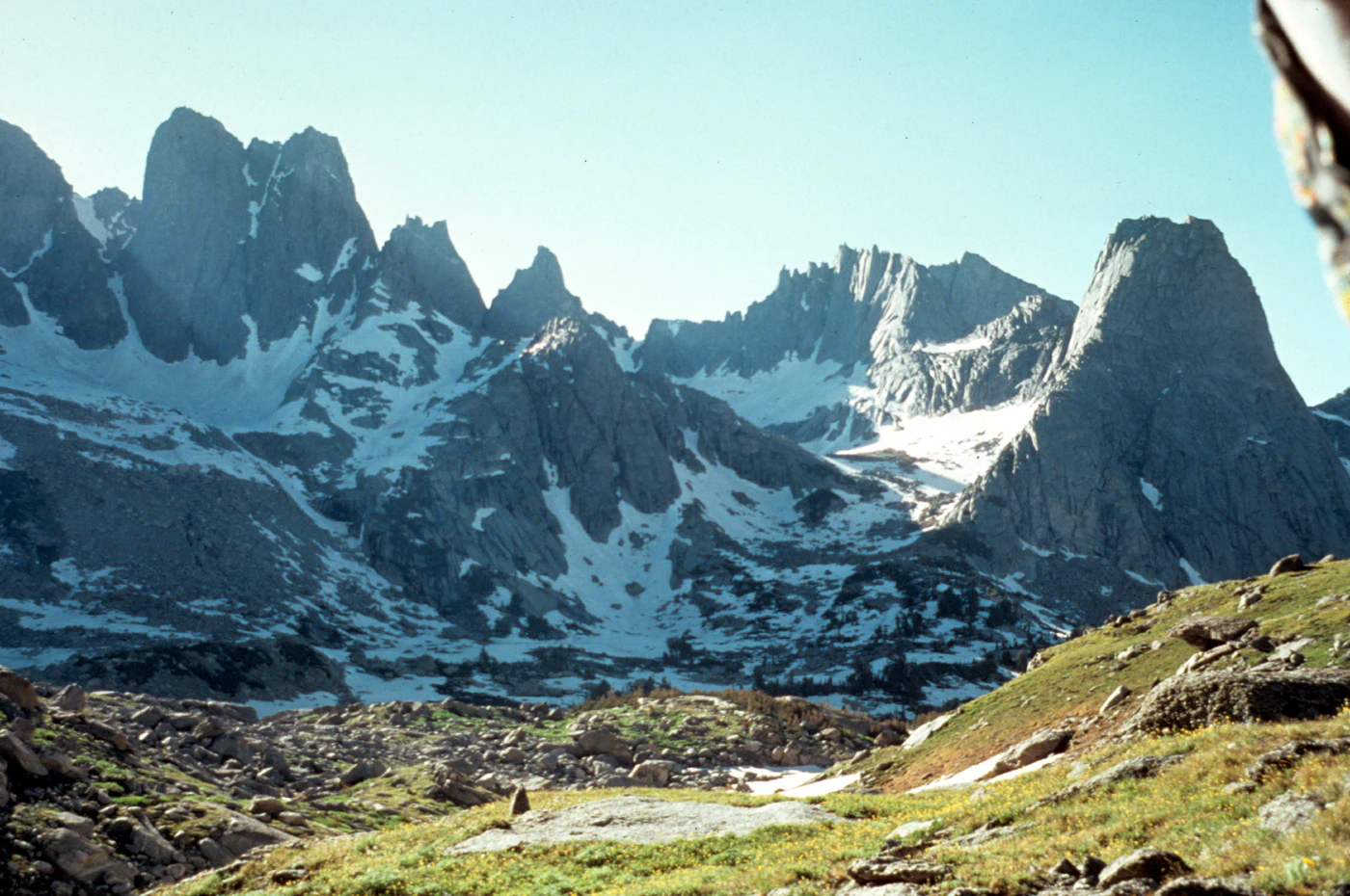
A wide landscape view of jagged granite mountain peaks with patches of snow, overlooking a rocky valley with green meadow and sparse vegetation.
The granite peaks of the Cirque of the Towers in Shoshone National Forest.

Shoshone National Forest history and protected-area timeline

The human history of Shoshone National Forest extends back at least 10,000 years, when paleoindian peoples inhabited the caves and river valleys of what is now northwestern Wyoming. Archaeological sites such as Mummy Cave, rediscovered in 1957 and subsequently excavated through the 1960s, document continuous occupation from around 7280 BC through the late pre-contact period and reveal a finely preserved paleoindian cultural assemblage placed on the National Register of Historic Places in 1981. In more recent centuries, the forest was home to Shoshone, Lakota, Crow, and Northern Cheyenne peoples, who used the high country for hunting, shelter, and spiritual practice. In the 1840s and 1860s, Chief Washakie of the Eastern Shoshone negotiated with the U.S. government, ultimately resulting in the establishment of the Wind River Indian Reservation, which still borders the forest today.

The first European exploration of the area occurred in the early nineteenth century by mountain men including John Colter, Jim Bridger, and Manuel Lisa, who traversed the Absaroka Range, Jackson Hole, and the headwaters of major rivers. Later scientific and military expeditions, notably the Raynolds Expedition of 1860 led by Captain William F. Raynolds and guided by Jim Bridger, completed much of the geographic understanding of the region. Ferdinand V. Hayden, geologist and naturalist on that expedition, returned in 1871 and helped build the public case that the Greater Yellowstone country deserved federal protection.

The defining moment in the forest's institutional history came in 1891 with the Forest Reserve Act, which authorized the President to set aside public land as forest reserves. President Benjamin Harrison immediately designated the Yellowstone Timberland Reserve, the nation's first. In 1902 President Theodore Roosevelt expanded the reserve and divided it into four units, of which Shoshone was the largest. With the creation of the U.S. Forest Service in 1905, the reserve was redesignated as a national forest, and its present title was formally adopted in 1945. The surviving Wapiti Ranger Station, built in 1903, is the oldest ranger station in any U.S. national forest and is recognized as a National Historic Landmark. Following World War II, visitation rose sharply with improved road access, and in the mid-twentieth century Civilian Conservation Corps camps built during the Great Depression left a lasting legacy of roads, trails, and campgrounds throughout the forest.

Shoshone National Forest landscape and geographic character

Shoshone National Forest contains some of the most dramatic and varied mountain scenery in the Greater Yellowstone Ecosystem, with elevations ranging from roughly 4,600 feet near Cody to 13,804 feet at Gannett Peak, the highest point in Wyoming. The forest encompasses three geologically distinct mountain ranges, each contributing a different character to the overall landscape. In the northern and central portions of the forest, the Absaroka Range rises in volcanic ridges of andesite and breccia laid down during Eocene volcanic activity around 50 million years ago, with Francs Peak, at 13,158 feet, marking the highest summit. Major passes through the Absarokas include Sylvan Pass, the route to Yellowstone's east entrance, and Togwotee Pass, the gateway to Jackson Hole and Grand Teton National Park.

At the far north of the forest, a small portion of the Beartooth Mountains rises in windswept plateaus and sheer cliffs of ancient Precambrian granite. Uplifted during the Laramide orogeny around 70 million years ago, the Beartooths are among the oldest exposed rocks in North America and host Beartooth Lake, dramatic cliff-walled glacial valleys, and some of the most popular alpine scenery in Wyoming. The Beartooth Highway, an All-American Road National Scenic Byway, crosses 10,974-foot Beartooth Pass and links the forest with Yellowstone's northeast entrance.

The southern section of the forest is dominated by the Wind River Range, a vast spine of Precambrian granite containing eight summits above 13,500 feet and 119 peaks over 12,000 feet. The Cirque of the Towers, located in the Popo Agie Wilderness, is one of the most famous alpine climbing areas in the country, surrounded by sheer granite walls and more than 200 climbing routes. The forest is also home to more than 500 lakes and about 1,000 miles of streams and rivers, including the Clarks Fork of the Yellowstone, which is federally designated as a Wild and Scenic River for 22 miles through a dramatic canyon walled by cliffs rising up to 2,000 feet.
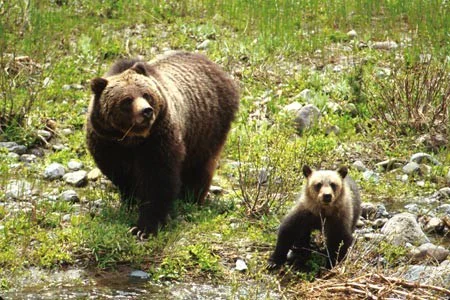
An adult grizzly bear and a smaller bear cub standing on a grassy, rocky slope near a stream.
A grizzly bear sow and her cub foraging in Shoshone National Forest.

Shoshone National Forest ecosystems, habitats, and plant life

Because the forest stretches across more than 9,000 vertical feet, it contains an unusually wide spectrum of Rocky Mountain ecosystems within a single protected area. Lower-elevation sites near Cody support sagebrush steppe and grassland communities, while mid-elevation forests are dominated by lodgepole pine, Rocky Mountain juniper, and quaking aspen. Higher montane and subalpine forests give way to stands of subalpine fir, Engelmann spruce, whitebark pine, and limber pine, and these in turn yield to alpine tundra and ultimately to rock, ice, and barren alpine terrain, which together account for roughly a quarter of the forest's total acreage. Along lower-elevation streams, cottonwoods and willows create distinct riparian corridors. Endemic plant species such as the shoshonea, fremont bladderpod, north fork Easter daisy, and a whitlow grass contribute to the region's botanical distinctiveness, while invasive exotics such as Canada thistle, spotted knapweed, and leafy spurge pose ongoing management challenges.

The forest lies within the Greater Yellowstone Ecosystem, which supports approximately 1,700 documented plant species. The complex elevation gradient, combined with the wide variation in moisture availability, creates a landscape of striking ecological transitions, from dry sage flats to high cirques holding snow well into summer. Tree distribution is strongly governed by water availability, with denser forests on higher slopes where longer-lasting snowpack keeps soils moist into the growing season. Mountain pine beetle and related bark beetle outbreaks have impacted more than a million acres of timberland, and have triggered intensive forest management efforts including controlled burns, salvage harvest, and targeted spraying to reduce wildfire risk and recover dead wood.

Shoshone National Forest contains 16 named and more than 140 unnamed glaciers, all located in the Wind River Range, making it the most glacier-rich national forest in the Rocky Mountains. Forty-four of these glaciers cluster in the Fitzpatrick Wilderness around the range's highest peaks. Like mid-latitude glaciers worldwide, they have been retreating significantly since the end of the Little Ice Age, with substantial volume loss documented across the twentieth and early twenty-first centuries. Gannett Glacier, on the northeast flank of Gannett Peak, is the largest single glacier in the U.S. Rocky Mountains.

Where the climate is generally arid, with most precipitation falling in winter and spring, higher elevations receive dramatically more moisture and snow, sustaining the glaciers and the cold-water habitats that many native fish species depend on.
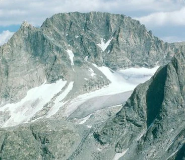
A wide, eye level shot of the craggy, grey, snow-dusted peak of Gannett Peak with a glacier nestled in the mountain cirque.
Gannett Peak in the Wind River Range, featuring prominent rugged slopes and glacial ice.

Shoshone National Forest wildlife and species highlights

Shoshone National Forest harbors one of the most complete native wildlife communities in the contiguous United States. All 70 mammal species historically present in the region still occur there, and at least 335 wildlife species overall have been documented. The forest supports roughly 125 grizzly bears within an estimated Greater Yellowstone population of about 700, making it one of the last major strongholds of the species in the lower 48. American black bears are also present and managed through cooperative programs with neighboring national forests and Yellowstone. Management of human-bear conflict includes trapping, ear-tagging, and relocation, and in serious cases, removal of chronically nuisance animals, along with food storage requirements for visitors in both frontcountry and backcountry areas.

Gray wolves, originally absent from the region after aggressive early eradication programs, were reintroduced in nearby Yellowstone in the mid-1990s and have since established permanent packs in Shoshone National Forest. By 2012, about a dozen packs and roughly 70 wolves were documented in the forest, and managed hunting seasons were later introduced. Other large carnivores include cougars, which are nocturnal and rarely seen, and rare wolverines, which are usually documented only by tracks. Coyotes, bobcats, weasels, martens, ferrets, and badgers round out the carnivore community. Omnivores such as raccoons and skunks are common, along with smaller mammals like porcupines and American pikas.

Ungulates are abundant. Elk number more than 20,000 and mule deer about 40,000, while bison and pronghorn antelope maintain sustainable populations as well. Bighorn sheep are particularly associated with the forest's rocky terrain; the herd that winters near Dubois is one of the largest in the lower 48 states, though disease transmission from domestic sheep and goats has reduced numbers since the 1990s. About 5,000 bighorn sheep live across the forest, and a small, stable population of roughly 200 mountain goats inhabits the northernmost portions. Moose, though declining in recent decades, are still found near lowland waterways, with around 739 estimated in 2006. Beavers are especially valued for their role in maintaining wetland and riparian habitat that benefits moose, waterfowl, amphibians, and other species.

The forest supports approximately 300 species of birds, including bald eagles, peregrine falcons, Swainson's hawks, and prairie falcons. Waterfowl such as western grebes, northern pintails, great blue herons, and Barrow's goldeneyes have stable populations along forest rivers and lakes, and rare trumpeter swans are sometimes observed. Sage-country upland species like pheasants, ruffed grouse, and wild turkeys are common, while sensitive species such as harlequin ducks and northern goshawks receive targeted habitat protection. Fish communities include rainbow, brook, brown, and Yellowstone cutthroat trout, with the Shoshone River being a particularly important stronghold of the native Yellowstone cutthroat. Reptiles include prairie rattlesnakes at lower elevations and various lizards and turtles, while amphibians such as the Columbia spotted frog and boreal toad are considered species of concern due to disease and habitat change.
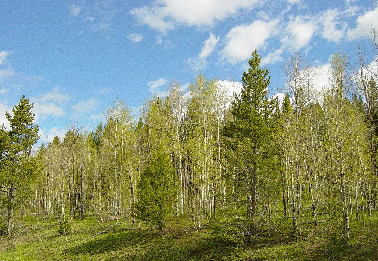
A grove of mixed aspen and pine trees under a blue sky with white clouds.
A grove of quaking aspen and pine trees in Shoshone National Forest.

Shoshone National Forest conservation status and protection priorities

Shoshone National Forest is a landmark in the history of American conservation, beginning with the Forest Reserve Act of 1891, which fundamentally changed the federal government's relationship to public land by allowing the President to set aside forest reserves rather than disposing of them through private transfer. The forest is a key component of the Greater Yellowstone Ecosystem, one of the largest nearly intact natural ecosystems in the temperate world, and the protection of its wilderness, rivers, wildlife, and headwaters has been a defining element of regional conservation policy for more than a century.

Roughly 56 percent of the forest is officially designated wilderness within the meaning of the Wilderness Act of 1964, providing the highest level of land protection available under U.S. law. Within these wilderness areas, all forms of mechanized transport, road construction, building, logging, and mineral extraction are prohibited, allowing ecosystems to function without major human alteration. The Clarks Fork of the Yellowstone is federally designated as a Wild and Scenic River for 22 miles through the forest. The forest's extensive roadless and wilderness lands make it a critical refuge for wide-ranging species such as grizzly bears, gray wolves, and wolverines, and the entire forest is considered critical habitat for Canada lynx recovery under the Endangered Species Act.

Conservation management within the forest continues to confront several large-scale pressures. Mountain pine beetles and related bark beetle outbreaks have killed trees across more than a million acres, accelerating fuel accumulation and increasing wildfire risk. Forest managers respond with controlled burns, fuel reduction projects, salvage logging, and targeted treatment of high-value stands. Invasive species also threaten the forest's native plant communities, and managers maintain a precautionary aquatic invasive species program focused on zebra mussels, quagga mussels, and the New Zealand mud snail, which have already been detected nearby. Finally, the retreat of the forest's glaciers is reducing late-summer cold-water runoff, with downstream consequences for native trout and other cold-water species, and illustrates how climate change is now a central driver of long-term conservation planning in the region.

Shoshone National Forest cultural meaning and human context

Shoshone National Forest takes its name from the Shoshone people and lies adjacent to the Wind River Indian Reservation, home to the Eastern Shoshone and Northern Arapaho. The forest's indigenous heritage extends back at least 10,000 years, as documented by archaeological sites such as Mummy Cave, and the dramatic mountain landscapes of the Absaroka and Wind River ranges were used by the Shoshone, Lakota, Crow, and Northern Cheyenne for hunting, shelter, and spiritual practice, including vision quests in the high country. Chief Washakie's mid-nineteenth-century negotiations with the U.S. government led to the establishment of the Wind River Indian Reservation, which today still borders the forest to the east.

The forest also sits at the heart of nineteenth-century American westward movement. The Oregon Trail, the South Pass route used by covered wagon migrants heading west, passes just south of the forest and gives a cultural context to the rugged landscape the pioneers encountered. The Chief Joseph Scenic Byway, running through the forest, follows the trail along which the Nez Perce and their leader Chief Joseph attempted to flee the U.S. Cavalry in 1877. Fort Washakie, built on the reservation lands east of the forest, was a U.S. Cavalry post staffed in part by African-American Buffalo Soldiers, including the second African-American graduate of West Point. The forest's natural setting also made it a cultural touchstone in modern media, serving as the setting for the 2016 video game Firewatch.
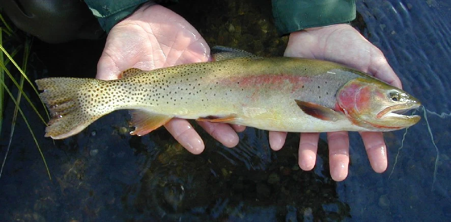
A pair of human hands holding a Yellowstone cutthroat trout over dark water, displaying its spotted body and distinct red gill patch.
A Yellowstone cutthroat trout held by an angler in the Shoshone National Forest.

Top sights and standout views in Shoshone National Forest

Shoshone National Forest stands out as the first federally protected national forest in the United States, set aside by President Benjamin Harrison in 1891 and still recognized as a foundational landmark of American conservation. Its landscape sweeps from the sagebrush lowlands near Cody to the glacier-clad summit of Gannett Peak, the highest point in Wyoming, encompassing the ancient Precambrian granites of the Wind River and Beartooth ranges and the volcanic Absaroka Range in a single contiguous protected area.

With more than half of its land designated wilderness, the forest preserves some of the most ecologically intact habitat in the Greater Yellowstone Ecosystem, supporting thriving populations of grizzly bears, gray wolves, elk, mule deer, bighorn sheep, and mountain goats. Together with the Beartooth Highway, the Chief Joseph Scenic Byway, the Buffalo Bill Cody Scenic Byway, and the Wyoming Centennial Scenic Byway, the forest offers access to Yellowstone, Grand Teton, and the heart of the American Rocky Mountain West.
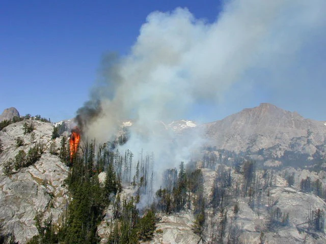
A forest fire burning in a mountainous area with flames visible among scattered trees and rocky slopes, with a plume of white smoke rising into a clear blue sky.
A spot fire burning in the rocky terrain of Shoshone National Forest in 2001.

Best time to visit Shoshone National Forest

Because the forest covers such a wide range of elevations, the best time to visit depends largely on the type of experience desired. Summer, from roughly June through early September, is the most versatile season: trails in the subalpine and alpine zones are largely free of snow, wildflowers including endemic species such as shoshonea and the fremont bladderpod are at their peak, and the forest's many rivers, lakes, and campgrounds are most accessible. Late summer, particularly August and September, brings the warmest and driest conditions at lower elevations, but it is also the period with the highest natural wildfire activity, since lightning is the dominant ignition source across the forest.

Winter transforms the forest into a different kind of destination, with extensive snowmobile trails and cross-country skiing routes opening in the Togwotee Pass area, where snowpack regularly reaches 6 to 10 feet at higher elevations. Spring and autumn tend to be quieter seasons marked by strong temperature swings, lingering snow at high elevations, and rapidly changing conditions. Across all seasons, large daily temperature variations are the rule, and visitors should expect cool to cold nights even during summer, especially at higher altitudes.
Monthly climate preview

Long-term representative point measurements tracking annual temperature and precipitation cycles

Shoshone National Forest Climate Normals and Monthly Temperature Patterns

Historical climate data for Shoshone National Forest records substantial monthly temperature shifts alongside measured precipitation variations across the representative coordinate. Detailed monthly climate profiles provide complete temperature minimums and maximums for comprehensive regional analysis.
Annual mean3 °C
-9 °C17 °C
Jan-8°
Feb-8°
Mar-4°
Apr
May
Jun12°
Jul17°
Aug16°
Sep11°
Oct
Nov-4°
Dec-9°
Warmest month
July

17.4 °C

Coolest month
December

-8.6 °C

Wettest month
May

2.5 mm/day

Driest month
August

1.1 mm/day

Park location guide

Geography guide, regional context, and park location map for Shoshone National Forest

Shoshone National Forest park geography, regions, and map view in United States of America

Understand where Shoshone National Forest sits in United States of America through a broader geographic reading of the surrounding landscape, nearby location context, and its mapped position within the national park landscape.

How Shoshone National Forest fits into United States of America

The United States of America is a federal presidential republic and one of the world's largest countries by area and population. It consists of 50 states across a vast territory spanning multiple time zones, with its capital in Washington, D.C. and largest city in New York City. The nation has a diverse economy, influential political system, and significant cultural and military presence globally.

Wider geography shaping Shoshone National Forest in United States of America

The United States occupies a vast territory in North America, bordered by Canada to the north and Mexico to the south. The 48 contiguous states stretch from the Atlantic to the Pacific Ocean, while Alaska occupies the northwestern region and Hawaii is an archipelago in the Pacific. The country encompasses diverse terrain including the Rocky Mountains, Appalachian Mountains, Great Plains, and extensive river systems.

Map view of Shoshone National Forest

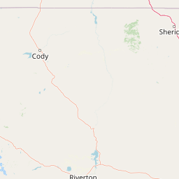
Use this park location map to pinpoint Shoshone National Forest in United States of America, understand its exact geographic position, and read its mapped placement within the surrounding landscape more clearly.

Pigeon | © OpenStreetMap contributors

Location context for Shoshone National Forest

Wyoming
Natural feature types

Explore the Geographic Features and Mountain Landscape of Shoshone National Forest

Investigate the diverse natural landmarks and topographic features of Shoshone National Forest through the MoriAtlas collection. Discover how geological formations and river systems define this expansive wilderness area, providing a deeper understanding of its regional geography and protected status.
Recorded earthquake history

Explore Historical Earthquake Records Associated with Shoshone National Forest

Review documented seismic events near the forest boundaries through our organized data catalogue. These records provide insight into historical activity across the region, allowing for easy comparison of event metrics such as magnitude and depth via the MoriAtlas geographic database.

Shoshone National Forest Earthquake History

Catalogued events

207 events

Strongest magnitude

Magnitude 5.9

Most recent event

Sep 7, 2026

This history includes earthquakes recorded inside the park or within 50 km of its borders

Visualizing mountain terrain, glacial peaks, and protected wilderness habitats

Shoshone National Forest Photos and Landscape Scenery

Visual documentation of Shoshone National Forest reveals the rugged topography of the Absaroka, Beartooth, and Wind River mountain ranges. Examining these protected landscapes helps observers understand the environmental character and remote elevation profile of America's first national forest.

A wide landscape view of jagged granite mountain peaks with patches of snow, overlooking a rocky valley with green meadow and sparse vegetation.

A towering granite mountain peak reflected in the calm waters of a high alpine lake, with coniferous forest on the right shoreline.

An adult grizzly bear and a smaller bear cub standing on a grassy, rocky slope near a stream.

A wide, eye level shot of the craggy, grey, snow-dusted peak of Gannett Peak with a glacier nestled in the mountain cirque.

A grove of mixed aspen and pine trees under a blue sky with white clouds.

A group of people riding horses across a grassy, open landscape with a forest and snow-dusted, jagged mountain peaks in the background.

A pair of human hands holding a Yellowstone cutthroat trout over dark water, displaying its spotted body and distinct red gill patch.

A forest fire burning in a mountainous area with flames visible among scattered trees and rocky slopes, with a plume of white smoke rising into a clear blue sky.

A long, single-story dark brown log cabin building stands on a flat clearing, backed by tall, craggy, light-brown cliffs and leafless trees.

A jagged, dark mountain peak rises above a vast, expansive snow and ice field under a cloudy sky.

A wide view of a calm lake mirroring a rocky mountain peak and dense evergreen forest under a clear blue sky.

A wide view of a large, snow-dusted mountain rising above rolling green slopes and patches of pine forest in the Shoshone National Forest.

A weathered, dark wooden historic mining structure nestled in a dense evergreen forest, situated above a patch of light-colored rocky tailings.

A wide shot of a high alpine meadow with a winding stream leading into a small lake, framed by rocky mountains and conifer trees.

A steel girder bridge spans a deep, rugged canyon with vertical rocky walls, surrounded by mountain slopes with scattered coniferous trees.

Two bighorn sheep standing on a snowy hillside with dry grass and a treeline in the background.

Park atlas

Compare surrounding mountain ranges and connected regional wilderness areas

Parks Near Shoshone National Forest and Related Protected Landscapes

Continue browsing national parks and protected areas near Shoshone National Forest across the Greater Yellowstone Ecosystem. Expanding the geographic scope reveals related mountain landscapes, alpine wildlife habitats, and connected conservation regions.
A soft, minimalist watercolor painting of a serene lake nestled among rolling hills under a gentle, pastel-toned sky.
Protected landscapeWyoming
Park boundaries overlap#1 closest

South

Fitzpatrick Wilderness: Exploring the Rugged Protected Landscapes of Western Wyoming

A core alpine environment within the Wind River Range.

Fitzpatrick Wilderness represents one of the most uncompromisingly wild segments of the Wind River Range, featuring persistent glaciers, dramatic U-shaped valleys, and high granite spires. This protected landscape offers a deep look into the alpine geography of Wyoming, preserved under the Wilderness Act to maintain its rugged character, remote glacial cirques, and intricate mountain ecosystems.

Area
803.4 km²
Established
1976
IUCN
Ib
Relief
Mountain
A pale, wide watercolor landscape illustration depicting mountain peaks above a line of evergreen trees and a flat foreground.
Protected areaWyoming
Park boundaries overlap#2 closest

South

Popo Agie Wilderness: Protected Landscapes in the Wyoming Wind River Range

High-altitude alpine terrain and glacial basins

The Popo Agie Wilderness in Wyoming encompasses a dramatic vertical landscape, ranging from forested valleys to alpine summits above 13,000 feet. This protected area features the iconic Cirque of the Towers, dense hydrological networks of glacial tarns, and expansive granite formations that anchor its identity within the Greater Yellowstone Ecosystem.

Area
412.3 km²
Established
1984
IUCN
Ib
Relief
Mountain
National parkWyoming
Park boundaries overlap#3 closest

West

Yellowstone National Park: US National Park Protected Landscape & Geographic Atlas

Explore mapped boundaries and regional natural landscape context.

Yellowstone National Park represents a significant protected landscape within Wyoming, designated as a US national park. This entry offers detailed insight into its geographic scope, mapped boundaries, and the unique natural terrain that defines it. Understand its role in regional geography and discover its protected-area identity through a structured atlas exploration, providing context for its conservation landscape.

Area
8,983.18 km²
Established
1872
IUCN
II
Visitors
4.7M annual
National parkUnited States of America
28 km away#4 closest

Southwest

Grand Teton National Park: Protected Landscape and Geographic Atlas Exploration

Explore the mapped terrain and regional park geography.

Grand Teton National Park is a protected landscape offering rich geographic discovery opportunities within the United States of America. This detailed entry facilitates an atlas-style exploration of its mapped boundaries, the surrounding regional geography, and its identity as a significant national park. Understand the specific landscape context and discover its placement within the broader natural terrain of North America.

Area
1,300 km²
Established
1929
IUCN
II
Visitors
2.8M annual
Wildlife reserveWyoming
60 km away#5 closest

Southwest

Jedediah Smith Wilderness: Protected Alpine Terrain and Teton Range Geography

Glacially sculpted high-country basins in western Wyoming

Spanning the western face of the Teton Range, the Jedediah Smith Wilderness serves as a federally protected buffer for iconic mountain landscapes. The region features dramatic cirques, hanging valleys, and dense subalpine forest habitats, forming an essential, roadless link within the broader Greater Yellowstone Ecosystem. Explore the terrain features and structural geography that define this remote high-country wilderness area.

Area
499.59 km²
Established
1984
IUCN
Ib
Relief
Mountain
Protected landscapeMontana
76 km away#6 closest

Northeast

Bighorn Canyon National Recreation Area: Maps and Protected Landscape Geography

A reservoir-anchored protected area in the Montana high desert

Defined by its striking contrast between deep blue reservoir water and sheer canyon walls, Bighorn Canyon National Recreation Area protects an essential arid landscape in the Mountain West. This region encompasses portions of the Pryor Mountains and the historic Bad Pass Trail, offering a window into the intersection of vast high-desert plains and rugged mountain terrain.

Area
486.82 km²
Established
1966
Visitors
217.7K annual
Relief
Upland
Wildlife reserveMontana
83 km away#7 closest

Northwest

Lee Metcalf Wilderness: Geographic Profile and Protected Landscape Boundaries in Montana

Mapping rugged alpine terrain across four distinct mountainous units

Located in southwestern Montana, the Lee Metcalf Wilderness serves as a cornerstone of ecological connectivity within the Greater Yellowstone Ecosystem. Spanning over 250,000 acres, this protected area features a unique fragmented geography consisting of the Bear Trap Canyon, Spanish Peaks, Taylor-Hilgard, and Monument Mountains units. The landscape is defined by its roadless mountain ridges, forested slopes, and deep river corridors, providing essential sanctuary for large mammal populations.

Area
1,029.07 km²
Established
1983
IUCN
Ib
Relief
Mountain
A watercolor painting showing a stylized landscape with a light blue lake, soft green rolling hills, and hints of red rock cliffs against a white background.
Protected areaWyoming
117 km away#8 closest

South

Flaming Gorge National Recreation Area: Protected Reservoir and Canyon Landscape Atlas

High desert geography and canyon terrain on the Wyoming and Utah border.

Flaming Gorge National Recreation Area features a complex geography where the Green River carves through vivid red sandstone cliffs. This protected area integrates large-scale reservoir management with mountain forest slopes and diverse river corridors, creating a unique mapped landscape that reflects the geologic character of the intermountain West.

Area
839.17 km²
Established
1968
Relief
Upland
Climate
Arid

Common questions about visiting, size, designation, and location context for Shoshone National Forest

Shoshone National Forest FAQs for park facts, access, geography, and protected area context

Find quick answers about Shoshone National Forest, including protected-area facts, park geography, trail and visitor context, and how the park fits into its surrounding country and regional landscape.
MoriAtlas Explorer

Continue Your Protected Areas Search Across the Global Atlas

Deepen your exploration by continuing the structured search for national parks and protected areas worldwide. Utilize the comprehensive filtering capabilities to compare different conservation landscapes and refine your understanding of global park geography. Discover more about the distribution and characteristics of protected natural areas.

Global natural geography