

Mori Atlas logo
National parkSidi Toui National Park

Discover the mapped boundaries and atlas significance of this Tunisian national park.

Sidi Toui National Park: Tunisia's Protected Landscape and Geographic Context

Sidi Toui National Park stands as a significant protected area within Tunisia, offering a unique focal point for exploring North African geography. As a designated national park, its mapped boundaries contribute to the regional atlas, providing valuable context for understanding the distribution of protected lands. This park serves as a key entity for those seeking detailed geographic insights and a deeper appreciation of Tunisia's natural landscapes.

National ParkGrassland EcosystemScimitar OryxSemi-Arid EnvironmentSahara RegionTunisia Protected Areas

Sidi Toui National Park

National park

Park overview

Structured park overview, official facts, and landscape profile for Sidi Toui National Park

Sidi Toui National Park park facts, protected area profile, and essential visitor context
Review the core facts for Sidi Toui National Park, including designation, size, terrain, visitor scale, habitats, and operating context in one park-focused overview.

About Sidi Toui National Park

Sidi Toui National Park represents Tunisia's effort to preserve one of the country's most distinctive ecological environments. The park was established in 1993 as part of Tunisia's national park network, designated specifically to protect the grassland ecosystems found in the country's southern region near the border with Libya. Unlike the vast desert expanses that characterize much of southern Tunisia, the area within Sidi Toui supports a grassland habitat with vegetation adapted to semi-arid conditions. This grassland environment, while seemingly sparse compared to more lush ecosystems, forms the foundation of a unique food web supporting specialized species that have evolved to survive in these dry conditions. The park's location places it in a transitional zone between the Sahara Desert to the south and the more varied landscapes of central Tunisia, creating an environment that supports species from both desert and grassland ecological communities.

Quick facts and research context for Sidi Toui National Park

Sidi Toui National Park is a protected grassland reserve in southern Tunisia established in 1993. The park lies in the country's arid southern region near the Libyan border, with the nearest town of Ben Gardane located approximately 54 kilometers to the south. The protected area encompasses a semi-arid grassland ecosystem that is relatively uncommon among Tunisia's national parks, which more typically feature desert, mountain, or forest environments. The park serves as a critical refuge for the scimitar oryx, an endangered antelope species that has been introduced into the reserve as part of conservation and reintroduction programs.

Park context

Deeper park guide and search-rich context for Sidi Toui National Park

Sidi Toui National Park history, landscape, wildlife, and travel context
Explore Sidi Toui National Park through its history, landscape character, ecosystems, wildlife, conservation priorities, cultural context, and seasonal travel timing in a structured park guide built for atlas discovery and search intent.

Why Sidi Toui National Park stands out

Sidi Toui National Park is distinguished primarily by its grassland ecosystem, which sets it apart from most other protected areas in Tunisia that feature desert, mountain, or forest habitats. The park's most notable conservation achievement is its population of scimitar oryx, an endangered antelope species that was reintroduced into the reserve after being nearly eliminated from the wild. These elegant desert antelopes, recognizable by their long, curved horns, now thrive within the park's boundaries, making Sidi Toui an important site for this species' survival. The combination of grassland habitat and successful large mammal conservation gives the park a unique identity within Tunisia's protected area system.

Sidi Toui National Park history and protected-area timeline

Sidi Toui National Park was established in 1993, making it one of Tunisia's more recently designated protected areas. The park's creation reflected a growing recognition within Tunisia of the need to protect unique ecological environments beyond the country's better-known desert and mountain landscapes. The establishment of Sidi Toui as a national park marked an important expansion of Tunisia's conservation framework to include grassland ecosystems, which had previously received less formal protection than other habitat types. The decision to create the park also aligned with broader regional conservation efforts to protect endangered species, particularly the scimitar oryx, which was targeted for reintroduction programs in suitable protected habitats.

Sidi Toui National Park landscape and geographic character

The landscape of Sidi Toui National Park consists primarily of semi-arid grassland stretching across the Tunisian desert frontier. The terrain is characterized by relatively flat terrain with sparse vegetation adapted to low rainfall conditions. Grasses and other drought-resistant plants form the dominant vegetation, creating a landscape that differs markedly from the true desert found immediately to the south and east. The park's grassland environment represents a transitional habitat zone where moisture levels are sufficient to support continuous plant cover, albeit at lower densities than more temperate grasslands. This landscape type, while not dramatic in appearance, plays an important ecological role as one of the few protected grassland areas in Tunisia.

Sidi Toui National Park ecosystems, habitats, and plant life

The ecological character of Sidi Toui National Park centers on its grassland ecosystem, a relatively rare habitat type within Tunisia's protected area network. The park supports a community of plants and animals adapted to semi-arid conditions with limited annual rainfall. Grassland ecosystems of this type are ecologically significant because they represent a transition between true desert environments and more productive habitats, supporting a mix of species with different moisture requirements. The park's protected status ensures that this distinctive ecosystem remains intact and continues to provide habitat for species dependent on grassland environments, including the scimitar oryx and other arid-adapted fauna.

Sidi Toui National Park wildlife and species highlights

The wildlife of Sidi Toui National Park is centered on the scimitar oryx, an endangered antelope species that has been introduced and successfully maintained within the reserve. The scimitar oryx is recognizable by its distinctive long, curved horns and pale coat, adaptations that serve the species well in the park's arid environment. These antelopes were reintroduced into the park as part of conservation efforts to restore viable populations of this species, which was driven to near extinction in the wild by uncontrolled hunting during the twentieth century. The park's grassland habitat provides suitable foraging grounds for these desert antelopes, allowing them to maintain healthy populations. Beyond the scimitar oryx, the park supports other wildlife adapted to semi-arid grassland environments.

Sidi Toui National Park conservation status and protection priorities

Sidi Toui National Park serves an important conservation function by protecting one of Tunisia's remaining grassland ecosystems and providing a sanctuary for endangered wildlife. The park's establishment in 1993 created formal protection for an ecosystem type that had previously received little recognition in Tunisia's protected area system. The successful introduction and maintenance of scimitar oryx populations demonstrates the park's value as a conservation site for endangered species. This reintroduction program represents a significant achievement in Saharan biodiversity preservation, as the scimitar oryx was once on the brink of complete extinction in the wild. By protecting both the grassland habitat and the species it supports, Sidi Toui contributes to Tunisia's broader conservation objectives and helps preserve biodiversity in the Saharan region.

Sidi Toui National Park cultural meaning and human context

Sidi Toui National Park is located in southern Tunisia near the border region with Libya, an area historically inhabited by communities with connections to trans-Saharan trade routes and pastoral traditions. The park's name derives from a local landmark, with "Sidi" indicating a saint or religious figure in Tunisian Arabic naming conventions. The surrounding region has historically supported semi-nomadic populations whose livelihoods were adapted to the arid conditions of the desert frontier. While the park itself does not contain significant archaeological sites or monuments, its establishment reflects a modern approach to conservation that acknowledges both the ecological value of grassland habitats and the cultural importance of the broader southern Tunisian landscape.

Top sights and standout views in Sidi Toui National Park

Sidi Toui National Park stands out within Tunisia's protected area network for its combination of grassland habitat and endangered species conservation. The reintroduced scimitar oryx population represents the park's most celebrated conservation achievement, offering visitors the opportunity to observe these magnificent antelopes in a natural grassland setting. The park's location in southern Tunisia near the Libyan border provides access to a distinctive landscape that differs from the desert environments more commonly associated with the region. For visitors interested in Saharan wildlife and conservation, Sidi Toui offers a focused experience centered on grassland ecosystems and the successful recovery of an endangered species.

Best time to visit Sidi Toui National Park

The most favorable time to visit Sidi Toui National Park is during the cooler months from October through April, when average temperatures are more comfortable for outdoor exploration. The winter period in particular offers pleasant conditions for observing wildlife, though rainfall in this season is minimal. Summer months in southern Tunisia bring extremely high temperatures that can make daytime activities uncomfortable and limit the practical hours for park visits. The grassland landscape maintains its character throughout the year, but the cooler seasons provide more agreeable conditions for experiencing the park's natural environment.

Park location guide

Geography guide, regional context, and park location map for Sidi Toui National Park

Sidi Toui National Park park geography, regions, and map view in Tunisia
Understand where Sidi Toui National Park sits in Tunisia through a broader geographic reading of the surrounding landscape, nearby location context, and its mapped position within the national park landscape.

How Sidi Toui National Park fits into Tunisia

Tunisia is a Maghreb country in North Africa with a Mediterranean coastline, bordered by Algeria and Libya. The country features the ancient ruins of Carthage, the Great Mosque of Kairouan, and portions of the Atlas Mountains and Sahara Desert. With a population of approximately 12 million, Tunisia operates as a unitary presidential republic with Arabic as the official language.

Wider geography shaping Sidi Toui National Park in Tunisia

Tunisia occupies 163,610 km² in North Africa, bordering Algeria to the west and southwest, Libya to the southeast, and the Mediterranean Sea to the north and east. The country features the eastern end of the Atlas Mountains in the north and extends into the northern Sahara Desert in the south. Its 1,300 km of coastline runs along the Mediterranean Basin. Africa's northernmost point, Cape Angela, is located in Tunisia.

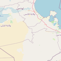
Map view of Sidi Toui National Park

Use this park location map to pinpoint Sidi Toui National Park in Tunisia, understand its exact geographic position, and read its mapped placement within the surrounding landscape more clearly.

Pigeon | © OpenStreetMap contributors
Park atlas

Browse the regional geography of protected landscapes surrounding Tunisia's unique grassland park.

Continue Your Discovery: Explore National Parks and Protected Areas Near Sidi Toui National Park
After exploring Sidi Toui National Park's unique grassland ecosystem, broaden your atlas view by comparing other protected areas across Tunisia's southern region. Trace the geographic spread of diverse conservation landscapes, understanding their regional context and varied habitats, from semi-arid grasslands to neighboring desert frontiers.
National parkLibya

Abughilan National Park: National Park Protected Landscape and Geographic Context

Explore Libya's protected area and mapped landscape.

Abughilan National Park stands as a designated national park, offering significant value for geographic discovery and understanding protected landscapes. This entry provides context on its mapped boundaries and its role within the regional geography of Libya, Northern Africa. It serves as a detailed point of reference for anyone exploring national parks and protected areas through an atlas-driven lens, focusing on the park's unique environmental context and its position in the landscape.

Area
40 km²
Established
1992
IUCN
II
Scope
Terrestrial
National parkKébili Governorate

Jebil National Park: Protected Area Details in Kébili Governorate

Explore its mapped boundaries and regional geographic context.

Jebil National Park is a key protected area within the Kébili Governorate, designated as a national park. This focus provides essential geographic context for understanding the region's natural landscapes and conservation efforts. Users can delve into its mapped extent and position within Tunisia's atlas, offering structured discovery of its protected land identity.

Area
1,500 km²
Established
1994
Relief
Lowland
Climate
Arid
National parkGafsa Governorate

Bou-Hedma National Park: Mapped Protected Area and Conservation Sanctuary in Gafsa Governorate

Discover Saharan wildlife, Roman ruins, and unique semi-arid landscapes.

Bou-Hedma National Park serves as a crucial conservation hub in Tunisia's Gafsa Governorate, renowned for its success in reintroducing endangered Saharan large mammals like the scimitar oryx and addax. The park's geography spans arid plains and seasonal wadis, encompassing the Ramsar-listed Sebkhet Noual wetland. Its unique landscape also preserves significant Roman-era archaeological sites, offering a rich context for exploring protected-area identity, conservation achievements, and ancient human history within a North African setting.

Established
1980
IUCN
II
Access
Access unknown
Scope
Terrestrial
National parkLibya

El Naggaza National Park: A Protected Landscape in Libya's Geographic Atlas

Mapped boundaries and regional terrain of a Libyan national park.

Delve into the specifics of El Naggaza National Park, a designated national park in Libya. This entry focuses on its geographic setting, providing details relevant to atlas exploration and understanding protected land distribution in North Africa. Examine its mapped features and its place within the broader landscape context of the region.

Area
40 km²
Established
1993
IUCN
II
Scope
Terrestrial
National parkKasserine Governorate

Chambi National Park: Tunisia's Highest Mountain Protected Area and Biosphere Reserve

Explore its mountainous terrain and conservation significance.

Chambi National Park is a protected national park in Tunisia's Kasserine Governorate, safeguarding the country's highest mountain, Djebel Chambi. This park is renowned for its mountainous terrain, semi-arid vegetation, and its role as a critical habitat for endangered species like the Cuvier's gazelle and Barbary sheep. As a UNESCO biosphere reserve, it offers significant insights into North African mountain ecosystems and landscape conservation.

Area
67.23 km²
Established
1980
IUCN
II
Relief
Mountain
National parkTunisia

Boukornine National Park: A Protected Mediterranean Mountain Landscape in Tunisia

Explore its mapped terrain and unique protected ecosystem.

Boukornine National Park in Tunisia represents a significant protected landscape, notable for its central granite peak, Jebel Boukornine, which rises sharply above the surrounding coastal plains. This national park, covering approximately 1,939 hectares, preserves a distinctive Mediterranean mountain ecosystem. Its rugged terrain, rocky slopes, and the presence of Aïn Zargua spring support a unique concentration of species, including notable flora and fauna. Understanding Boukornine National Park provides insight into the regional geography and the importance of conserving these mountainous protected areas within Tunisia.

Area
19.39 km²
Established
1987
IUCN
II
Relief
Mountain
Watercolor painting of a landscape with rolling hills, pink wildflowers, and scattered trees
National park

Pantelleria National Park: A Protected Landscape within Italy's Atlas

Mapped boundaries and regional geographic context.

Pantelleria National Park is a designated national park in Italy offering a distinct protected landscape for exploration. This page provides essential geographic context, highlighting the park's mapped boundaries and its significance within the regional atlas. Understand the terrain and protected land features that define this important natural area.

Area
66.4 km²
Established
2016
IUCN
II
Relief
Highland
National park

Ta' Qali National Park: Malta's Largest Urban Protected Landscape and Recreation Hub

Mapped Gardens, Event Venues, and Recreational Zones

Ta' Qali National Park serves as a vital green lung in central Malta, showcasing a landscape transformed from a wartime airfield into a modern urban protected area. This national park is recognized for its extensive recreational zones, meticulously designed formal gardens, and a prominent open-air concert venue that hosts major cultural events. Its relatively flat terrain and planned infrastructure offer a distinct map-based perspective on urban parkland, highlighting its significance as a major public amenity and a key feature of Malta's landscape.

Area
0.35 km²
IUCN
V
Relief
Lowland
Climate
Mediterranean

Common questions about visiting, size, designation, and location context for Sidi Toui National Park

Sidi Toui National Park FAQs for park facts, access, geography, and protected area context
Find quick answers about Sidi Toui National Park, including protected-area facts, park geography, trail and visitor context, and how the park fits into its surrounding country and regional landscape.
MoriAtlas Explorer

Continue Your Protected Areas Search Across the Global Atlas

Deepen your exploration by continuing the structured search for national parks and protected areas worldwide. Utilize the comprehensive filtering capabilities to compare different conservation landscapes and refine your understanding of global park geography. Discover more about the distribution and characteristics of protected natural areas.

Global natural geography