

Mori Atlas logo
Protected areaSierra de Tamaulipas

A comprehensive look at the vertical landscape, forest gradients, and karst formations shaping this unique sky island.

Sierra de Tamaulipas Protected Area: Mapping the Geographic and Ecological Identity of an Isolated Mexican Mountain Massif

(Sierra de Tamaulipas Protected Natural Area)

The Sierra de Tamaulipas stands as a distinctive mountain massif in northeastern Mexico, rising as an isolated sky island from the surrounding semi-arid lowlands. This protected landscape encompasses a significant ecological gradient, transitioning from Tamaulipan thorn scrub at its base to dense pine-oak forests at higher elevations. Beyond its varied terrain, the range is characterized by karst topography and extensive archaeological heritage, representing the northernmost frontier of ancient Mesoamerican agriculture.

sky islandmountain rangepine-oak foresttropical deciduous forestthorn scrubkarst landscape
A colorful digital illustration depicting a mountain landscape with green hills, rocky cliffs, pine trees in the foreground, and a waterfall in the distance under a sky with pink and blue clouds.

Sierra de Tamaulipas

Protected area

Park overview

Structured park overview, official facts, and landscape profile for Sierra de Tamaulipas

Sierra de Tamaulipas park facts, protected area profile, and essential visitor context

Review the core facts for Sierra de Tamaulipas, including designation, size, terrain, visitor scale, habitats, and operating context in one park-focused overview.

About Sierra de Tamaulipas

Sierra de Tamaulipas is an isolated mountain range in the northeastern Mexican state of Tamaulipas, set apart from the Sierra Madre Oriental and functioning as a distinct biogeographic island within the broader arid landscape of northeastern Mexico. Its roughly 110-kilometre length and 64-kilometre width enclose an area of about 3,340 square kilometres, with terrain that climbs from around 300 metres near its base to 1,260 metres at its highest summit. Because of this vertical relief, the Sierra captures more rainfall and experiences cooler temperatures than the surrounding plains, supporting a sequence of forest types that would otherwise be found much farther south.

The ecological zonation of the Sierra is one of its most striking features. The lowlands around the range, below 300 metres in elevation, are dominated by tropical thorn forest known as Tamaulipan mezquital, an arid shrubland typical of the region. As elevation increases inside the Sierra, this brushland gives way, between about 300 and 700 metres, to a closed-canopy tropical deciduous forest of the Veracruz moist forests type. Further up, between roughly 600 and 900 metres, drier slopes support montane scrub, low thickets, and savanna-like vegetation with huisache as a characteristic shrub. Above about 800 metres, the landscape changes again into luxuriant pine-oak forest, an isolated patch of temperate woodland belonging to the Sierra Madre Oriental pine-oak forests ecoregion. Where agriculture and logging have not disturbed the upper slopes, ferns grow in abundance among the oaks and pines.

Human presence in the Sierra has been shaped by both its natural richness and its relative isolation. No major highways cross the range, no large rivers traverse it, and no cities lie within it; the small population is largely rural and agricultural. Streams flow outward from the highest points in all directions, and precipitation, concentrated between May and October, supports this scattered agricultural activity. Archaeological evidence indicates that the Sierra was perhaps the northernmost area of eastern Mexico where maize cultivation was practiced in pre-Hispanic times, with documented cultivation around 2,500 BCE and the establishment of Mesoamerican Huastec villages from roughly 300 to 550 CE. Sites such as El Sabinito in the north of the range attest to this agricultural frontier, featuring central plazas and small pyramids suggestive of a centralized society.

In recognition of these overlapping natural and cultural values, the Mexican government declared the Sierra de Tamaulipas a Protected Natural Area on 5 December 2016, organizing the region around a core zone of roughly 38,285 hectares and a buffer zone of approximately 269,992 hectares. Today the Sierra stands as a combination of ecological refuge, cultural frontier, and protected landscape, distinguished by the way that a single small mountain range condenses so many different ecosystems and layers of human history into one compact region.

Quick facts and research context for Sierra de Tamaulipas

Sierra de Tamaulipas lies in the central part of the Mexican state of Tamaulipas, between roughly 23 and 24 degrees north latitude and 98 and 99 degrees west longitude, forming an isolated range of about 110 kilometres in length and around 64 kilometres at its widest.

The range rises from about 300 metres to 1,260 metres at its highest point, producing a clear elevation zonation from Tamaulipan thorn scrub at the base, through tropical deciduous forest and montane scrub, to pine-oak forests on the upper slopes. On 5 December 2016, the federal government declared the Sierra de Tamaulipas a Protected Natural Area, with a core zone of approximately 38,285 hectares and a buffer zone of about 269,992 hectares. The Sierra is also notable for containing El Zacatón, the world’s deepest known water-filled sinkhole, at 339 metres deep, situated in the karst terrain to the southeast of the range.

Protection and recognition

Terrestrial protected area designation records and official management scope

Sierra de Tamaulipas Protection Status and Designated Conservation History

Sierra de Tamaulipas maintains documented terrestrial protection status established in the year 2016. Structured conservation records outline the official designation history and management framework associated with the natural landscape.

Protection details

Protection scope
Terrestrial
Designated year
2016
Transboundary protection
No
Core area
382.85 km²
Buffer area
2,699.2 km²
Park context

Deeper park guide and search-rich context for Sierra de Tamaulipas

Sierra de Tamaulipas history, landscape, wildlife, and travel context

Explore Sierra de Tamaulipas through its history, landscape character, ecosystems, wildlife, conservation priorities, cultural context, and seasonal travel timing in a structured park guide built for atlas discovery and search intent.

Why Sierra de Tamaulipas stands out

Sierra de Tamaulipas is best known as a semi-tropical sky island, an isolated massif whose height supports oak and pine forests that contrast sharply with the semi-arid Tamaulipan thorn scrub of the surrounding lowlands. This dramatic ecological transition within a relatively small geographic area is one of its defining natural features. The range is also recognized for its karst landscapes to the southeast, especially in the municipality of Aldama, where limestone terrain gives rise to caves and cenotes, including El Zacatón, recognized as the deepest water-filled sinkhole in the world. Beyond its natural character, the Sierra is celebrated as the northern frontier of Mesoamerican agriculture in eastern Mexico, with evidence of early maize cultivation and the northernmost Huastec settlements located within its confines.
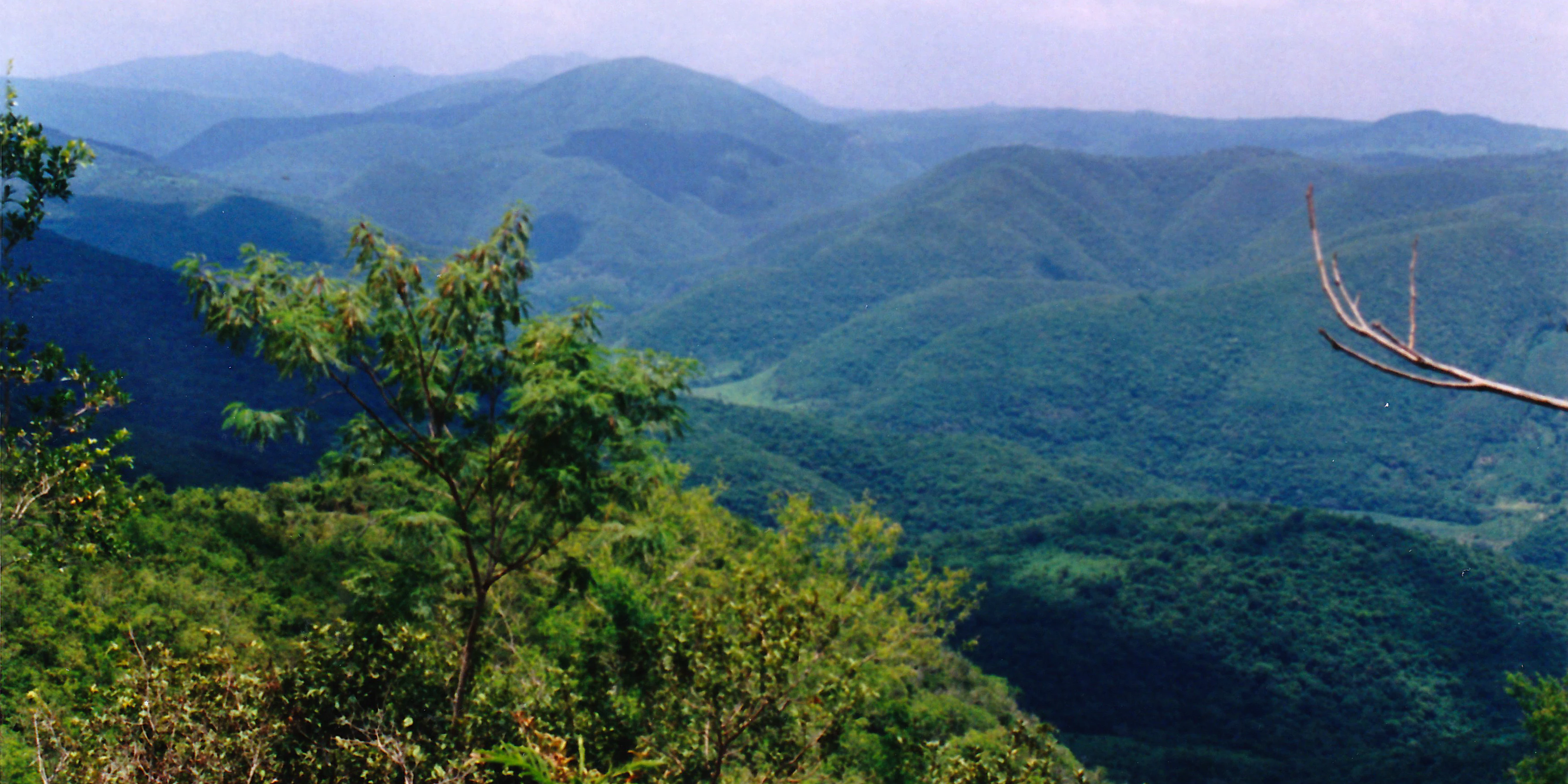
A wide landscape view of dense green forested mountains rolling into the distance under a hazy sky, with trees in the foreground.
Rolling green mountains of the Sierra de Tamaulipas near Aldama, Mexico.

Sierra de Tamaulipas history and protected-area timeline

The recognized protection history of Sierra de Tamaulipas begins with the Mexican government’s declaration of the range as a Protected Natural Area on 5 December 2016, formally placing its forests, karst landscapes, and cultural heritage under a structured conservation regime. The protected designation established a core area of about 38,285 hectares surrounded by a buffer zone of roughly 269,992 hectares, framing the Sierra as both an ecological refuge and a landscape of archaeological importance.

Long before this modern legal status, however, the Sierra held deep human history. Archaeologist Richard MacNeish documented evidence of maize cultivation in the range dating to around 2,500 BCE, indicating that the Sierra hosted one of the earliest transitions from nomadic hunting and gathering to a more settled, agricultural lifeway in eastern Mexico. Between roughly 300 and 550 CE, the northern part of the range was occupied by Huastec-speaking peoples, the northernmost extension of Mesoamerican civilization into eastern Mexico. Their villages, organized around public squares and small pyramids, suggest the presence of a centralized and possibly theocratic political structure.

The archaeological site of El Sabinito, located near the northern edge of the Sierra southwest of Soto la Marina, illustrates this history at scale; at its height it may have contained around 600 houses and a population of about 1,500. It was abandoned around 1100 to 1300 CE, with archaeologists suggesting that climatic shifts undermined agriculture and pushed inhabitants back toward hunting and gathering. When the explorer Francisco de Garay reached the coast adjacent to the Sierra in 1523, he found maize cultivation extending up to about the Tropic of Cancer, with non-agricultural, nomadic peoples living to the north in the semi-arid brushlands of what is now Southeast Texas.

Sierra de Tamaulipas landscape and geographic character

Sierra de Tamaulipas is a compact, north-south oriented mountain massif that stands out clearly against the flat Tamaulipan plains surrounding it. It stretches approximately 110 kilometres from north to south and reaches about 64 kilometres in width at its broadest southern extent. Elevations climb from around 300 metres at the lower slopes to a high point of 1,260 metres, creating a vertical relief that, while modest compared to the great sierras of Mexico, is enough to generate a sharp ecological contrast with the lowlands.

The morphology of the range creates a layered landscape. Foothills and lower slopes transition through tropical deciduous forest into more open montane scrub, where low thickets and savanna-like patches interrupt denser woodland. Higher elevations rise into a temperate zone of pine-oak forest, where undisturbed slopes remain green and humid with abundant fern growth, an almost unexpected sight in this otherwise semi-arid part of Mexico.

To the southeast, in the municipality of Aldama, the Sierra meets an extensive karst landscape, where limestone bedrock has been shaped into caves, sinkholes, and water-filled cenotes. The most famous of these is El Zacatón, recognized as the world’s deepest water-filled sinkhole, descending 339 metres below the surface. The Sierra itself contains no large rivers and no major roads, and abundant small, clear streams drain outward from the highest elevations in every direction, defining the quiet, unsettled character of the interior terrain.

Sierra de Tamaulipas ecosystems, habitats, and plant life

Sierra de Tamaulipas functions ecologically as a sky island, an isolated highland where cooler, wetter conditions have allowed vegetation communities typical of more temperate or more southerly regions to persist amid an otherwise semi-arid matrix. This compact mosaic of habitats is one of the defining ecological features of the range.

At the base of the Sierra, below 300 metres, the landscape blends into the Tamaulipan mezquital, a tropical thorn forest dominated by drought-adapted shrubs and small trees adapted to the dry climate of northeastern Mexico. As elevation rises into the Sierra proper, between approximately 300 and 700 metres, the vegetation shifts into tropical deciduous forest of the Veracruz moist forests type, a closed-canopy woodland averaging around 7.5 metres in height. Between about 600 and 900 metres, drier slopes support montane scrub, low thickets, and savanna-like communities, with huisache as a characteristic shrub.

Above roughly 800 metres, the vegetation enters its most distinctive form: pine-oak forest, an isolated patch of temperate woodland belonging to the larger Sierra Madre Oriental pine-oak forests ecoregion. Where agriculture and logging have not encroached, these upper forests are dense and humid, with luxuriant fern growth covering the understory. The precipitation gradient that drives these vegetation zones ranges from about 710 millimetres at the lowest elevations to more than 1,000 millimetres higher up, with most rain falling between May and October.

Sierra de Tamaulipas wildlife and species highlights

While the protected designation of the Sierra de Tamaulipas emphasizes its forest ecosystems and archaeological heritage, the ecological gradient across the range creates habitat for a mix of species typical of both the semi-arid Tamaulipan lowlands and the more humid, temperate uplands of northeastern Mexico. The thorn scrub of the surrounding mezquital supports drought-adapted wildlife, while the upper pine-oak forests and tropical deciduous slopes offer cooler, moister refuges for species associated with more temperate woodland.

The karst landscapes around the southeastern edge of the Sierra, particularly near the cenotes of the Aldama municipality, sustain distinctive aquatic and cave-adapted environments. El Zacatón, the world’s deepest known water-filled sinkhole, is a focal point for speleological and cave-diving research, and the broader network of caves and cenotes found in the area contributes to the region’s overall biological interest. The Sierra’s isolation and limited human infrastructure have helped preserve these habitats in a relatively undisturbed state.

Sierra de Tamaulipas conservation status and protection priorities

The principal conservation status of Sierra de Tamaulipas is its designation as a Protected Natural Area by the Mexican federal government on 5 December 2016. This declaration formalized protection for an area whose ecological value arises from its unusual role as a sky island: a relatively small mountain range that supports temperate pine-oak forests amid a vast surrounding matrix of thorn scrub and semi-arid plains.

Under the protected designation, the area is organized into a core zone of about 38,285 hectares and a buffer zone of approximately 269,992 hectares, with the buffer zone framing the core and providing a transition toward the surrounding landscapes. The protection recognizes both the ecological importance of the range and its archaeological heritage, including evidence of early maize cultivation and the northernmost Huastec settlements of Mesoamerica.

From a broader perspective, the range’s conservation significance lies in its compact but layered representation of multiple ecosystem types: Tamaulipan thorn scrub at the base, tropical deciduous forest on the lower slopes, montane scrub in the mid-elevations, and pine-oak forest at the highest altitudes. The karst landscapes of southeastern Sierra, with their caves and cenotes including El Zacatón, add a further dimension of geological and hydrological importance. Together, these features make the Sierra a concentrated refuge of ecological and cultural value within northeastern Mexico.

Sierra de Tamaulipas cultural meaning and human context

Sierra de Tamaulipas occupies a striking place in the cultural geography of eastern Mexico as the northernmost expression of Mesoamerican agricultural civilization in the region. Its higher rainfall compared to the surrounding plains made it one of the most northerly areas of eastern Mexico where maize cultivation was feasible during pre-Hispanic times, and archaeological work has traced evidence of this practice back to around 2,500 BCE.

From roughly 300 to 550 CE, communities of the Huastec culture inhabited the Sierra, establishing villages built around public squares and small pyramids, a layout that suggests centralized governance and possibly a theocratic organization. The site of El Sabinito, located near the northern edge of the range, may have supported as many as 600 houses and around 1,500 inhabitants at its peak before being abandoned around 1100 to 1300 CE. Archaeologists have linked this abandonment to climatic shifts that undermined agriculture, with the population possibly reverting to hunting and gathering.

Beyond the Sierra itself, the surrounding lowlands were home to non-agricultural nomadic peoples collectively known as the Coahuiltecans, whose presence delineated a sharp cultural frontier between the agricultural Sierra and the semi-arid brushlands extending into southern Texas. The Spanish explorer Francisco de Garay documented this transition along the coast in 1523, finding maize cultivation extending up to roughly the Tropic of Cancer. The modern population within the Sierra remains sparse, rural, and largely agricultural, reflecting a continuity of low-intensity land use that has helped preserve the range’s ecological character alongside its archaeological legacy.

Top sights and standout views in Sierra de Tamaulipas

Sierra de Tamaulipas is distinguished by how much it packs into a relatively small geographic area: a semi-tropical sky island whose elevation produces four distinct vegetation zones, from Tamaulipan thorn scrub at the base through tropical deciduous forest and montane scrub up to pine-oak forest on the summits. No major roads cross it and no cities lie within it, leaving the Sierra in a largely rural and lightly developed state. The range also marks the northern frontier of Mesoamerican agriculture and Huastec settlement in eastern Mexico, with evidence of maize cultivation extending back to 2,500 BCE. The karst landscapes of its southeastern flank add another layer of significance, encompassing the cenotes and caves around El Zacatón, the world’s deepest known water-filled sinkhole.

Best time to visit Sierra de Tamaulipas

The seasonal character of Sierra de Tamaulipas is shaped by a precipitation pattern in which most rainfall arrives between May and October, with higher elevations receiving upwards of 1,000 millimetres annually compared to about 710 millimetres at the base. Summers are warm and humid, particularly at higher elevations such as around Santa María de los Nogales, where warm summer temperatures and dry but mild winters define a subtropical climate. Winters are not as dry as in much of Mexico, though freezes are rare in the lower thorn scrub and more common in the upper pine-oak forests.

For visitors oriented toward landscape and ecology, the rainy summer months bring the Sierra’s forests into their lushest, greenest state, especially in the upper pine-oak zones where ferns and other understory plants flourish in undisturbed areas. Cooler and drier months offer clearer conditions for viewing the broader structure of the range and its stark contrast with the surrounding semi-arid lowlands.

Monthly climate preview

Long-term monthly temperature and precipitation patterns across the representative point

Sierra de Tamaulipas Climate Normals and Annual Temperature Rhythm

Measured historical records outline the annual temperature and precipitation rhythm across a representative point in Sierra de Tamaulipas from 1991 to 2020. Examining the complete twelve-month dataset provides deeper insight into long-term averages and regional climate trends.
Annual mean23 °C
17 °C28 °C
Jan17°
Feb19°
Mar22°
Apr25°
May27°
Jun28°
Jul27°
Aug27°
Sep26°
Oct23°
Nov20°
Dec18°
Warmest month
June

27.8 °C

Coolest month
January

16.9 °C

Wettest month
September

5.8 mm/day

Driest month
December

0.6 mm/day

Park location guide

Geography guide, regional context, and park location map for Sierra de Tamaulipas

Sierra de Tamaulipas park geography, regions, and map view in Mexico

Understand where Sierra de Tamaulipas sits in Mexico through a broader geographic reading of the surrounding landscape, nearby location context, and its mapped position within the national park landscape.

How Sierra de Tamaulipas fits into Mexico

Mexico, officially the United Mexican States, is a country in North America spanning the Sierra Madre mountain ranges, coastal plains, and tropical regions. It borders the United States to the north, Guatemala and Belize to the southeast, and has coastlines along the Pacific Ocean, Gulf of Mexico, and Caribbean Sea. With a population exceeding 130 million, Mexico is home to one of the world's most significant concentrations of Indigenous languages alongside Spanish.

Wider geography shaping Sierra de Tamaulipas in Mexico

Mexico occupies a land area of 1,972,550 km2, making it the thirteenth-largest country in the world. The terrain is highly diverse, featuring the Sierra Madre Occidental and Sierra Madre Oriental mountain ranges, the Mexican Plateau, coastal lowlands along the Pacific and Gulf/Caribbean margins, and the Yucatan Peninsula. The country spans multiple climate zones from desert in the north to tropical rainforest in the south.

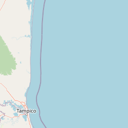
Map view of Sierra de Tamaulipas

Use this park location map to pinpoint Sierra de Tamaulipas in Mexico, understand its exact geographic position, and read its mapped placement within the surrounding landscape more clearly.

Pigeon | © OpenStreetMap contributors

Location context for Sierra de Tamaulipas

Tamaulipas

Visual reference guide for mountain habitats, karst terrain, and sky island vegetation zones.

Sierra de Tamaulipas Photos and Protected Landscape Scenery

Visual documentation captures the dramatic ecological gradient of Sierra de Tamaulipas, moving from semi-arid thorn scrub up to dense pine-oak forests. Field imagery reveals the rugged terrain, limestone karst formations, and distinct protected habitats defining this isolated mountain massif.

A wide landscape view of dense green forested mountains rolling into the distance under a hazy sky, with trees in the foreground.

Wide landscape view of karstic rock formations emerging from a dense green forest under a partly cloudy sky.

Park atlas

Compare regional mountain ranges, forest reserves, and conservation landscapes

Parks Near Sierra de Tamaulipas and Surrounding Protected Natural Areas

Browsing parks near Sierra de Tamaulipas reveals connected ecological gradients across the surrounding regional terrain. Expanding the geographic comparison connects isolated highland reserves with broader protected landscapes in northeastern Mexico.
Biosphere reserveSan Luis Potosí
About 124 km away#1 closest

Southwest

Sierra del Abra-Tanchipa Biosphere Reserve: Geography and Protected Area Map Context

Rugged sierra terrain in the Huasteca Potosina region of Mexico

Sierra del Abra-Tanchipa forms a continuous block of protected natural territory in eastern San Luis Potosí, featuring steep ridges and limestone-influenced karst topography. As an established biosphere reserve, this area serves as a primary example of conservation within the Huasteca Potosina, preserving an important transition zone of tropical vegetation and complex mountain landforms.

Area
214.64 km²
Established
1994
Scope
Terrestrial
Wildlife reserveTamaulipas
About 234 km away#2 closest

North

Laguna Madre Wildlife Reserve: Geography and Protected Coastal Landscapes of Tamaulipas

Mapping the hypersaline lagoons and barrier island chains of Mexico

Laguna Madre represents a singular coastal ecosystem characterized by its extreme salinity, expansive seagrass meadows, and sheltered barrier island configuration. As a vital protected wetland, the area serves as a primary migratory flyway and habitat for diverse shorebirds and sea turtles, revealing a distinct arid coastal landscape along the Tamaulipas shore.

Area
5,728.08 km²
Established
2005
IUCN
VI
Relief
Lowland
National parkSan Luis Potosí
About 249 km away#3 closest

Southwest

El Potosí National Park: Detailed Protected Area Geography and Landscape Context

Explore its mapped boundaries within San Luis Potosí.

Uncover the protected landscape of El Potosí National Park, a designated national park situated in San Luis Potosí, Mexico. This entry offers a detailed perspective on its geographic significance, providing insights into its mapped boundaries and regional natural terrain. Understand how this protected area contributes to the broader atlas of natural landscapes in Mexico, ideal for geographic discovery.

Area
20 km²
Established
1936
IUCN
II
Relief
Mountain
Watercolor painting of a coastal reef landscape with muted green and yellow tones against a white background, showing a distant island or reef structure with a lighthouse or tower silhouette.
Marine protected areaVeracruz
About 267 km away#4 closest

Southeast

Sistema Arrecifal Lobos-Tuxpan: Protected Marine Landscape and Regional Reef Geography

Mapping the northernmost coral reef system of the Mexican Gulf Coast.

The Sistema Arrecifal Lobos-Tuxpan marine protected area spans roughly 30,000 hectares of diverse underwater terrain off the coast of Veracruz. This complex includes the Lobos and Tuxpan polygons, which host extensive reef formations and a rare sandy cay habitat that supports significant nesting activity for marine turtles. The system remains a key focal point for understanding the limits of coral growth in the Gulf of Mexico and the broader ecological structure of the Mexican coastline.

Area
305.71 km²
Established
2009
Relief
Lowland
Climate
Tropical
National parkMexico
About 277 km away#5 closest

South

Los Mármoles National Park: Detailed Protected Landscape within Mexico's National Park Atlas

Explore the mapped boundaries and regional geography of this unique protected area.

Understand Los Mármoles National Park as a distinct protected landscape, integral to Mexico's atlas of natural areas. This park offers a unique geographic context, with its mapped boundaries providing a clear reference for its protected status. Delve into the regional landscape and discover the importance of this national park for conservation and geographic study.

IUCN
II
National parkMexico
About 304 km away#6 closest

Southwest

El Gogorrón National Park: National Park Protected Landscape and Geography

Mapped boundaries and regional atlas context in Mexico

El Gogorrón National Park is a protected natural area designated as a National Park within Mexico. This entry provides essential details for understanding its geographic significance, mapped boundaries, and its role in the country's conservation landscape. Discover the park's contribution to regional geography and its structured representation within the MoriAtlas exploration platform.

Area
250 km²
Established
1936
IUCN
II
Relief
Mountain
National parkMexico
About 310 km away#7 closest

Northwest

Cumbres de Monterrey National Park: National Park Protected Landscape Discovery

Explore Mexico's Mapped Terrain and Regional Geography

Understand Cumbres de Monterrey National Park as a distinct protected landscape within Mexico. This page provides detailed atlas-oriented information focused on its geographic boundaries, mapped terrain, and its role in regional conservation. It serves as a valuable entry point for exploring the park's natural context and understanding its place in the national geography.

Area
1,773.96 km²
Established
1939
IUCN
II
Relief
Mountain
Protected areaCoahuila
About 317 km away#8 closest

Northwest

Cuenca Alimentadora del Distrito Nacional de Riego 026 Bajo Rio San Juan Protected Landscape

Mountain watershed and forest habitat in Coahuila

An expansive protected area encompassing the upper catchments of the San Juan River. The terrain features a significant altitudinal gradient, ranging from semi-arid matorral shrublands to rare high-altitude conifer groves including Mexican Douglas-fir, defining the regional water supply landscape.

Area
1,971.57 km²
Established
1949
IUCN
VI
Relief
Mountain

Common questions about visiting, size, designation, and location context for Sierra de Tamaulipas

Sierra de Tamaulipas FAQs for park facts, access, geography, and protected area context

Find quick answers about Sierra de Tamaulipas, including protected-area facts, park geography, trail and visitor context, and how the park fits into its surrounding country and regional landscape.
MoriAtlas Explorer

Continue Your Protected Areas Search Across the Global Atlas

Deepen your exploration by continuing the structured search for national parks and protected areas worldwide. Utilize the comprehensive filtering capabilities to compare different conservation landscapes and refine your understanding of global park geography. Discover more about the distribution and characteristics of protected natural areas.

Global natural geography