
Mori Atlas logo
Natural monumentSinging Dune (Поющий бархан)

Geographic analysis of the stationary sand barchan situated between the Bolshoy and Maly Kalkhan mountain ridges.

Singing Dune (Поющий бархан) Natural Monument and Protected Landscapes in Almaty Region, Kazakhstan

Singing Dune (Поющий бархан) represents a distinct natural monument within the Altyn-Emel National Park in the Almaty Region of southeastern Kazakhstan. This stationary barchan formation, rising 150 meters between the Bolshoy and Maly Kalkhan ridges, provides a rare example of sand accumulation in a mountain foothill corridor. The site offers expansive views toward the Ili River valley, the Sogety mountains, and the distant snow-capped peaks of the Ketmen range.

singing sandbarchandesert dunesound phenomenonIli River valleyAltyn-Emel National Park
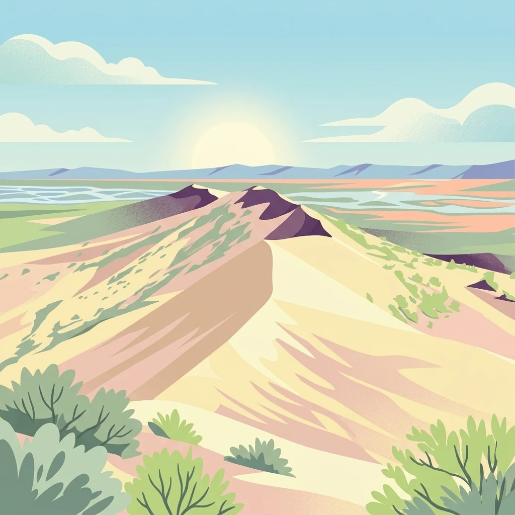
A flat vector-style illustration of a large sand dune under a sunlit sky, with sparse desert vegetation in the foreground and a river valley in the distance.

Singing Dune (Поющий бархан)

Natural monument

Park overview

Structured park overview, official facts, and landscape profile for Singing Dune

Singing Dune park facts, protected area profile, and essential visitor context

Review the core facts for Singing Dune, including designation, size, terrain, visitor scale, habitats, and operating context in one park-focused overview.

About Singing Dune

The Singing Dune is one of the most striking natural landmarks of southeastern Kazakhstan. Set in the Ili River valley between the Bolshoy Kalkhan to the west and the Maly Kalkhan to the east, this long pale ridge of fine sand rises dramatically against a backdrop of rugged mountain ranges. It lies within the Altyn-Emel National Park, where it is protected as a natural monument and draws visitors from across the country and beyond.

What sets the Singing Dune apart from ordinary sand formations is the way it sounds. In dry weather, the movements of wind across its surface, or the simple act of walking on its slopes, cause the sand grains to rub together and resonate, producing clear musical tones. The phenomenon is highly sensitive to moisture: only completely dry sand sings, and the louder and more sustained the sound, the larger the moving mass of sand involved.

Geologically, the dune is the product of long-term wind action along the Ili River. Persistent winds in this corridor pick up sand from the river's sandy banks and carry it inland, where the two Kalkhan ridges, positioned at a slight angle to each other, act as a natural windbreak. As the airflow slows, it drops its sand load, and over thousands of years these deposits have built up into the massive stationary ridge we see today. Despite the apparent fragility of its material, the Singing Dune has held its position for millennia.

The site holds strong cultural resonance as well. Travelers along the ancient Silk Road are believed to have deliberately detoured to hear the sound of the sand, and the dune gave rise to multiple local legends that attributed the music to buried cities, restless spirits, or supernatural beings. Today, it stands as both a natural curiosity and a symbol of Kazakhstan's striking desert-mountain landscapes.

Quick facts and research context for Singing Dune

The Singing Dune is a large pale sand ridge located in the Almaty Region of Kazakhstan, within the Altyn-Emel National Park, roughly 183 kilometers northeast of Almaty. It sits in the corridor between the Bolshoy and Maly Kalkhan foothills of the western Dzungarian Alatau. The formation rises about 150 meters, extends several kilometers in length, and has remained in place for thousands of years despite constant wind. It is classified as a natural monument under IUCN Category III protection and is one of the national park's signature geographic features.

Protection and recognition

Documented conservation parameters and management framework for Singing Dune (Поющий бархан)

Singing Dune (Поющий бархан) Protection Status and Terrestrial Area Scope

Singing Dune (Поющий бархан) maintains a documented terrestrial protection scope within its designated natural landscape. Official records outline management parameters and recognized conservation status without additional international designations.

Protection details

Protection scope
Terrestrial
Transboundary protection
No
Park context

Deeper park guide and search-rich context for Singing Dune

Singing Dune history, landscape, wildlife, and travel context

Explore Singing Dune through its history, landscape character, ecosystems, wildlife, conservation priorities, cultural context, and seasonal travel timing in a structured park guide built for atlas discovery and search intent.

Why Singing Dune stands out

The Singing Dune is best known for its acoustic phenomenon: under dry conditions, the friction of its fine sand grains produces sustained tones resembling organ music, ranging from high-pitched squeaks at small scale to deep rumbling when larger volumes of sand are set in motion. It is also well known for its dramatic visual setting, framed by the Ili River valley, the violet Boguty and Sogety ranges, and the distant snowy peaks of the Ketmen and Dzungarian Alatau.
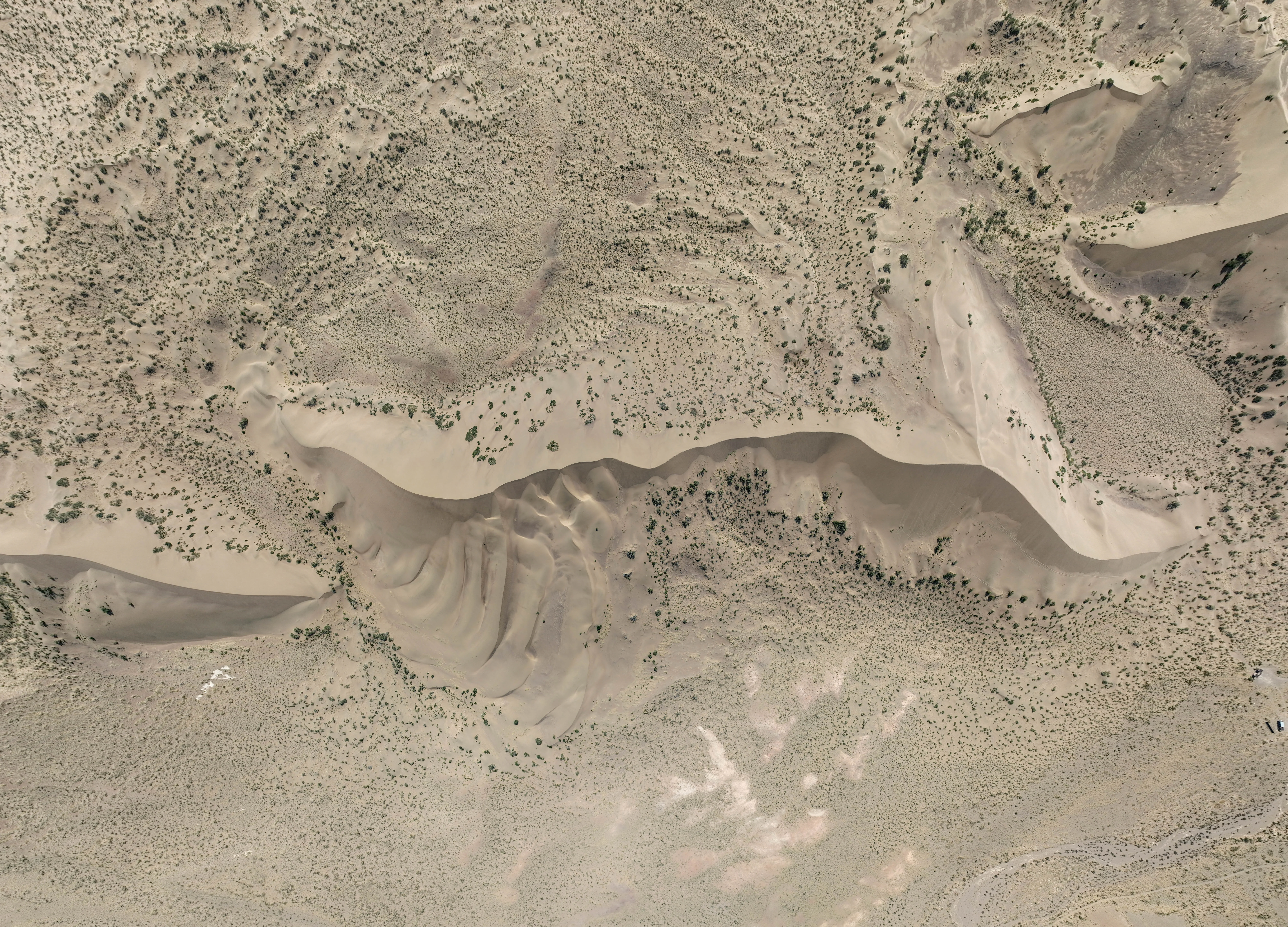
Top-down aerial view of a large, crescent-shaped sand dune surrounded by arid desert terrain.
Aerial perspective of the Singing Dune, highlighting its distinct sandy formation in the Altyn-Emel region.

Singing Dune history and protected-area timeline

The Singing Dune itself formed over thousands of years through natural wind-driven deposition from the Ili River floodplain, with the two Kalkhan ridges serving as an obstacle that caused sand to accumulate in place. While there is no single founding date for the landform itself, its cultural and scientific awareness developed gradually.

Modern scientific study of the acoustic phenomenon began in 1962, when the Leningrad physicist V. Arabadzhi conducted a series of observations and explained the sound as the product of friction between moving sand grains. This shifted understanding of the dune from a place of folklore to an object of legitimate physical research.

The dune's modern protected status came as part of the broader establishment of the Altyn-Emel National Park, created in 1996 within the Almaty Region. Already recognized as a natural monument before the park's formal foundation, the Singing Dune was included within the national park's boundaries and given IUCN Category III natural monument protection. It has also been nominated as a candidate for the Seven New Wonders of Nature, highlighting its recognition on an international scale.

Long before this modern scientific and conservation recognition, the Singing Dune already had a deep cultural history. Silk Road travelers passing through the Ili valley reportedly made deliberate detours to experience the dune's unusual sound, and local oral tradition wove the site into legends involving desert spirits, a slumbering shaitan on a mountaintop, the ghost of Genghis Khan recounting his deeds through the sand, and other supernatural explanations for the mysterious music.

Singing Dune landscape and geographic character

The Singing Dune occupies a striking transitional zone where the river plains of the Ili meet the rugged foothills of the Dzungarian Alatau. To the west rises the steep, cliff-like face of the Bolshoy Kalkhan, while to the east stands the Maly Kalkhan, the two ridges converging at a slight angle to create the natural corridor in which the dune has accumulated. To the south, the view opens toward a thin ribbon of the Ili River and the violet slopes of the Sogety and Boguty mountains, beyond which the white snowy crests of the Ketmen range can be glimpsed.

North of the dune lies the broader foothill landscape, marked by the lilac-blue ridges of the Dzungarian Alatau, including the Chulak, Mantai, and Altyn-Emel ranges. At the base of these mountains stretches a gently sloping piedmont valley, finely scored by the dry beds of seasonal rain runoff. The ridge itself measures roughly 150 meters in height and extends several kilometers in length, with a smooth southwestern face and a more sculpted northeastern flank broken by several ridges with gentler inclines.

This combination of soft, pale sand against deep mountain silhouettes gives the area a rare visual contrast: an ocean-like desert feature wedged between stony uplands, all under the same bright continental sky. The vantage from the top of the dune is widely noted for offering one of the most expansive panoramic views in the Altyn-Emel National Park.
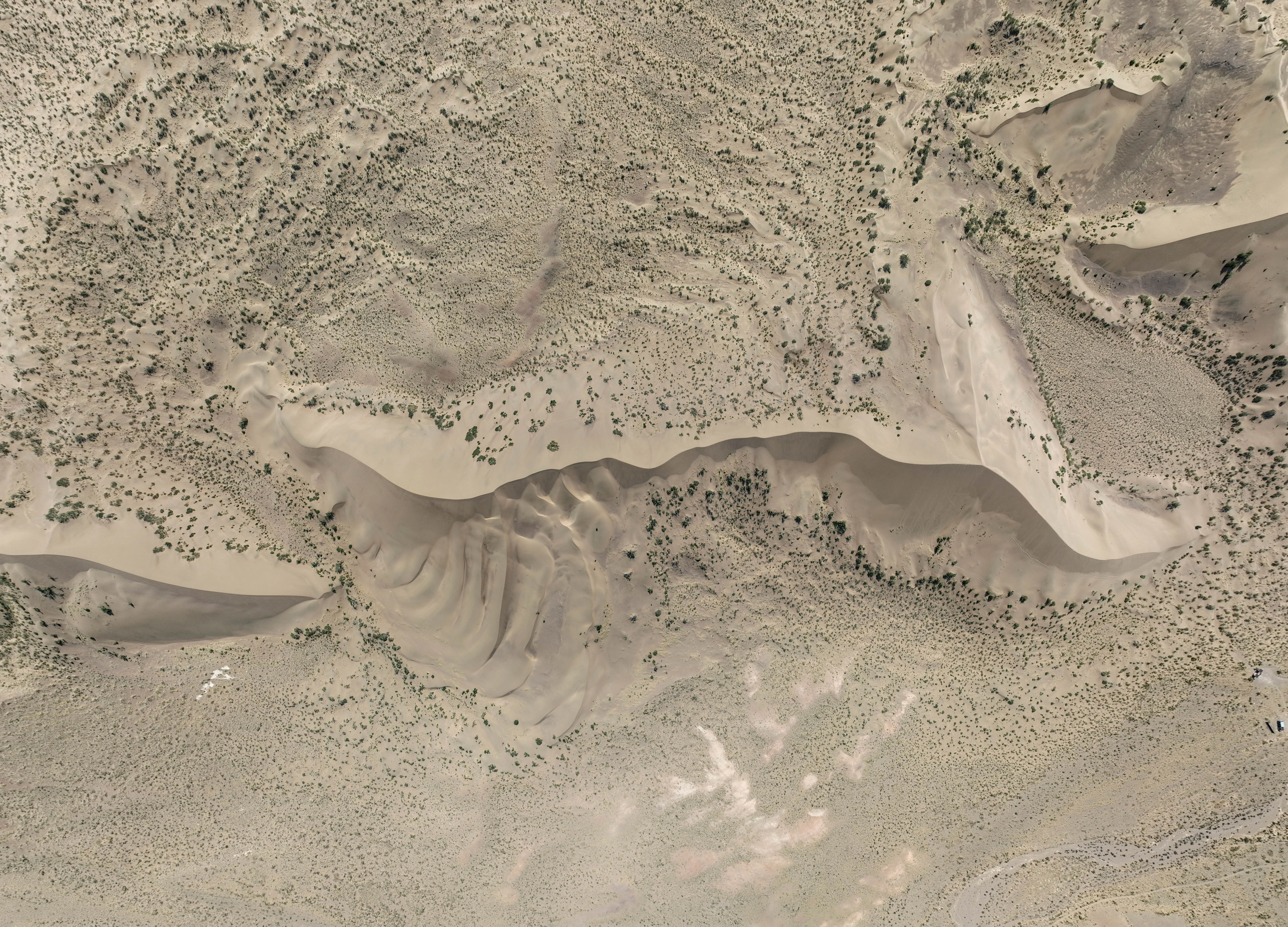
A top-down aerial view of a large, pale sand dune set against a dry, textured desert landscape with sparse vegetation.
An aerial view of the Singing Dune, showcasing the physical structure and surrounding arid terrain of the Altyn-Emel region.

Singing Dune ecosystems, habitats, and plant life

The natural setting around the Singing Dune reflects the broader ecological character of the Altyn-Emel National Park, where river valley, sand dune, and mountain steppe ecosystems meet in close proximity. The dune itself is composed of fine, well-sorted light-colored sand, shaped by persistent winds into a classic elongated barchan form rather than a wandering dune. The sand is unusually uniform in grain size, a quality often associated with singing sand phenomena worldwide.

Surrounding habitats include arid foothill plains, sparse desert vegetation, and the dry beds of seasonal watercourses that funnel rainwater down from the Dzungarian Alatau. The Ili River itself runs nearby, providing a critical water source that shapes local vegetation patterns. Although the Singing Dune does not host forest or wetland ecosystems, its immediate context combines desert, steppe, and riverine influences within a relatively compact area.

The region is also part of a wider landscape where moisture, wind, and sediment interact dynamically. The same winds that shape and sustain the dune's singing also shape the broader Altyn-Emel terrain, making it a notable focal point within a larger geological and ecological system of the southeastern Kazakh steppe.
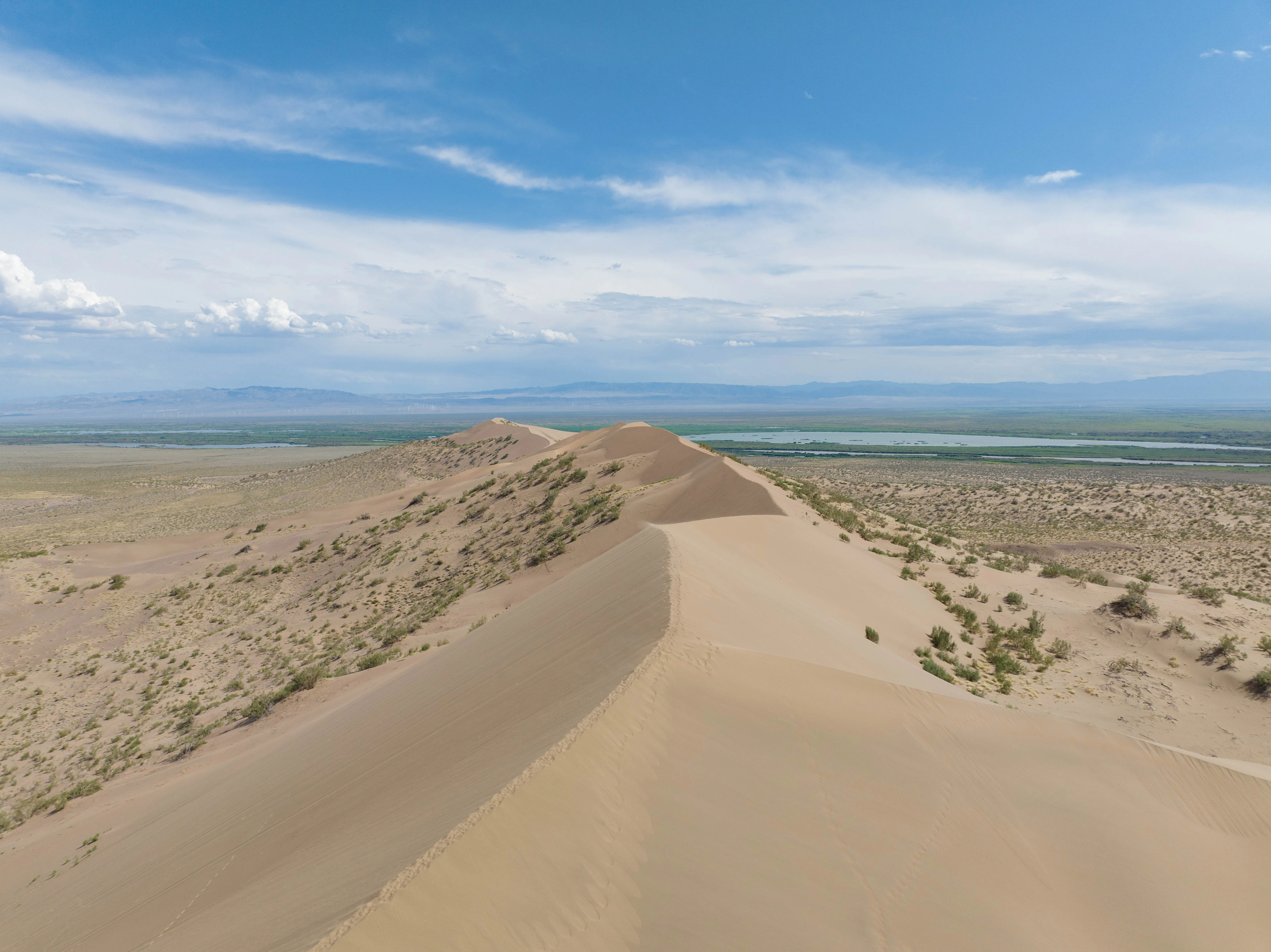
An aerial view looking along the sharp ridge of a large sand dune, with arid vegetation and a distant horizon under a cloudy blue sky.
An aerial view of the Singing Dune, a massive natural sand formation in Altyn-Emel.

Singing Dune conservation status and protection priorities

The Singing Dune is formally protected as a natural monument under IUCN Category III, with its management tied to the broader framework of the Altyn-Emel National Park. National park status, granted in 1996, places the dune within a system of regulated conservation that limits extractive activity and helps preserve the geological and acoustic integrity of the site.

Conservation attention around the Singing Dune is driven not by biodiversity richness in the conventional sense but by the rarity and fragility of its geomicrophysical phenomenon. The sand only sings when it is completely dry, making the site sensitive to changes in moisture patterns, surface disturbance, and any alterations that would change grain size uniformity. Protecting the dune therefore involves preserving both the landform itself and the precise sedimentary conditions that allow it to produce sound.

Its recognition as a candidate for the Seven New Wonders of Nature reflects international awareness of the site as a globally significant natural landmark, and its presence within a national park helps ensure that scientific study, public education, and tourism can continue around it without compromising its defining qualities.

Singing Dune cultural meaning and human context

The Singing Dune has long held a place in the imagination of the peoples of the Ili valley and beyond. Travelers along the Silk Road are reported to have diverted from their routes specifically to listen to the mysterious sound of the sand, treating the site as one of the natural curiosities of the journey between Central Asia and China.

Local oral tradition generated a rich body of folklore around the phenomenon, since the music of the sand could not easily be explained by pre-scientific worldviews. Some legends attribute the sound to a slumbering shaitan resting on the mountaintop, occasionally groaning when disturbed; others imagine the spirit of Genghis Khan buried beneath the dune, recounting his deeds through the sand. Earlier traditions explained the noise through desert spirits, mythical beasts, the ringing of bells from buried cities, or the roar of unseen underground rivers.

While these legends have been displaced by modern geophysical explanations, they remain part of how the Singing Dune is understood regionally. The site today functions simultaneously as a protected geological landmark, a tourist attraction, and a continuing thread in the intangible cultural heritage of the Ili valley communities.

Top sights and standout views in Singing Dune

The Singing Dune's profile combines an unusual acoustic phenomenon with a striking physical setting inside the Altyn-Emel National Park. It is one of the clearest examples of a stationary singing sand formation in Central Asia, producing sustained organ-like tones in dry conditions. Its location between the Bolshoy and Maly Kalkhan ridges, with views toward the Ili River and the snowy Dzungarian Alatau, makes the climb a memorable visual experience as well. Long-standing Silk Road lore, local legend, and international recognition through the Seven New Wonders of Nature nomination reinforce its cultural and symbolic weight as one of Kazakhstan's signature natural landmarks.

Best time to visit Singing Dune

Because the acoustic phenomenon requires completely dry sand, the Singing Dune is best experienced in the warm, rain-free months of late spring, summer, and early autumn, when conditions most reliably produce the characteristic sound. The surrounding Altyn-Emel landscape is also most accessible and visually vivid during this period, with clear mountain vistas and reduced risk of muddy or impassable tracks in the foothill valley.
Monthly climate preview

Long-term representative point measurements tracking monthly temperature variations and precipitation totals

Singing Dune (Поющий бархан) Climate Normals, Annual Temperature and Precipitation Rhythms

Representative point records for Singing Dune (Поющий бархан) outline measured long-term annual temperature swings and monthly precipitation distributions from NASA climatology data. Reviewing the complete twelve-month meteorological record provides deeper baseline comparison value for structured park geography research.
Annual mean11 °C
-5 °C25 °C
Jan-5°
Feb-2°
Mar
Apr12°
May18°
Jun23°
Jul25°
Aug24°
Sep18°
Oct10°
Nov
Dec-3°
Warmest month
July

25.5 °C

Coolest month
January

-4.8 °C

Wettest month
April

1.2 mm/day

Driest month
September

0.5 mm/day

Park location guide

Geography guide, regional context, and park location map for Singing Dune

Singing Dune park geography, regions, and map view in Kazakhstan

Understand where Singing Dune sits in Kazakhstan through a broader geographic reading of the surrounding landscape, nearby location context, and its mapped position within the national park landscape.

How Singing Dune fits into Kazakhstan

Kazakhstan is a Central Asian country spanning vast steppes and plains, bordered by Russia, China, Kyrgyzstan, Uzbekistan, and Turkmenistan, with a coastline along the Caspian Sea. It gained independence from the Soviet Union in 1991 and has a population of approximately 20.5 million people. The country is officially secular but predominantly Muslim, with Kazakh and Russian as official languages.

Wider geography shaping Singing Dune in Kazakhstan

Kazakhstan occupies a vast territory in Central Asia, extending into Eastern Europe. Its terrain consists largely of hilly plateaus and plains, with lowlands covering about a third of the area. The southern and eastern regions are mountainous. The country borders Russia to the north and west, China to the east, Kyrgyzstan to the southeast, Uzbekistan to the south, and Turkmenistan to the southwest. It has a coastline along the Caspian Sea.

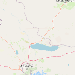
Map view of Singing Dune

Use this park location map to pinpoint Singing Dune in Kazakhstan, understand its exact geographic position, and read its mapped placement within the surrounding landscape more clearly.

Pigeon | © OpenStreetMap contributors

Location context for Singing Dune

Almaty Region

Visual reference of desert terrain, mountain ridges, and protected valley habitats.

Singing Dune (Поющий бархан) Photos and Landscape Scenery

Visual records capture the distinctive sandy relief and surrounding mountain terrain of Singing Dune (Поющий бархан). Detailed field photography reveals the protected desert ecosystem and expansive river valley vistas.

Top-down aerial view of a large, crescent-shaped sand dune surrounded by arid desert terrain.

A wide aerial view of the Singing Dune in Kazakhstan, showing its sharp, sand-covered ridgeline extending into the distance under a bright sky, surrounded by arid plains and distant mountains.

A top-down aerial view of a large, pale sand dune set against a dry, textured desert landscape with sparse vegetation.

An aerial view looking along the sharp ridge of a large sand dune, with arid vegetation and a distant horizon under a cloudy blue sky.

Park atlas

Compare regional landscapes and connected mountain sanctuaries in southeastern Kazakhstan

Explore Protected Areas and Parks Near Singing Dune (Поющий бархан)

Browsing other protected areas near Singing Dune (Поющий бархан) reveals diverse regional terrain across the Dzungarian Alatau foothills. Examining adjacent desert formations and mountain reserves provides a broader geographic comparison of Central Asian natural landscapes.
Watercolor illustration showing rolling hills, distant mountains, and sparse vegetation
National parkAlmaty Region
Mapped location lies within the park boundary#1 closest

North

Altyn-Emel National Park: A Protected Landscape of Singing Dunes and Lunar Mountains

Explore unique geological wonders and ancient Saka history.

Discover Altyn-Emel National Park, a prominent national park located in Kazakhstan's Almaty Region. This protected area showcases an extraordinary diversity of landscapes, from the echoing Singing Dunes to the otherworldly Aktau mountains, often referred to as the 'lunar mountains' due to their vivid mineral hues. As a vital conservation zone, it safeguards Central Asian steppe ecosystems and significant Iron Age archaeological sites, offering a rich tapestry of natural beauty and historical depth for atlas exploration.

Area
4,600 km²
Established
1996
IUCN
II
Relief
Mixed relief
Watercolor painting of a river landscape with green mountains, grasses, and a stream
National parkAlmaty Region
About 39 km away#2 closest

Southeast

Charyn National Park: Protected Landscape Atlas and Mapped Terrain in Almaty Region

Explore its dramatic canyons and ancient Sogdian ash groves.

Charyn National Park offers a compelling exploration of Central Asia's dramatic natural heritage, centered around its spectacular canyon system. This protected area, situated in Kazakhstan's Almaty Region, features towering red rock walls and unique geological formations carved by the Charyn River. The park is also notable for preserving one of the world's northernmost stands of ancient Sogdian ash trees, a vital link to prehistoric ecosystems. Users can discover the park's mapped boundaries, diverse terrain, and distinct landscape features, making it a key destination for geographic and atlas-based discovery.

Area
1,250 km²
Established
2004
IUCN
II
Relief
Mountain
A horizontal watercolor illustration showing soft green grassy foregrounds, a midground of low vegetation, and distant purple and green mountain silhouettes on a white background.
Natural monumentAlmaty Region
About 69 km away#3 closest

Southeast

Charyn Ash Grove Natural Monument and Riparian Forest Landscape in Almaty Region

Protected botanical relic in the Kazakhstan steppe

Charyn Ash Grove preserves a rare population of river-loving Sogdian ash trees within the arid landscape of southeastern Kazakhstan. This protected natural monument traces the moisture-rich corridors of the Charyn and Temirlik rivers, creating a vivid riparian ribbon surrounded by rugged semi-desert terrain and ancient archaeological features that define the regional geography.

Area
48.55 km²
Established
1964
IUCN
III
Relief
Lowland
Watercolor illustration of a mountain lake with forests, distant mountains, and calm water reflecting the scenery
National parkAlmaty Region
About 88 km away#4 closest

South

Kolsay Lakes National Park: Discover Protected Alpine Lakes in Almaty Region

Mapped Tian Shan mountain geography and glacial lake context.

Kolsay Lakes National Park is a significant protected area within the Almaty Region, celebrated for its breathtaking chain of three alpine lakes, often referred to as the 'Pearls of Tien Shan.' This national park showcases the rugged beauty of the Tian Shan mountains, with dramatic valleys, dense spruce forests, and pristine glacial waters. Understanding its geographic setting and mapped boundaries reveals the unique ecological and landscape value of this protected natural area.

Area
1,619 km²
Established
2007
IUCN
II
Relief
Mountain
Watercolor painting of a river, hills, and trees with pink and yellow sky tones
National parkAlmaty Region
About 148 km away#5 closest

Southwest

Ile-Alatau National Park: Protected Landscape Atlas and Almaty Region Geography

Mapped boundaries, diverse ecosystems, and mountain wilderness.

Ile-Alatau National Park is a key protected area in the Almaty Region of Kazakhstan, preserving a vast expanse of the Tian Shan mountain system. This national park showcases a dramatic vertical landscape, encompassing everything from lowland woodlands and relict spruce forests to expansive alpine meadows and glacial terrains. Its mapped boundaries define critical habitat for diverse wildlife and offer a profound insight into the complex ecological dynamics of high-altitude environments, making it an essential destination for atlas-based geographic discovery.

Area
2,000 km²
Established
1996
IUCN
II
Relief
Mixed relief
Watercolor painting depicting a mountain range, lake, and grassy foreground under a pale sky
National parkAlmaty Region
About 170 km away#6 closest

Northeast

Zhongar-Alatau National Park: Protected Mountain Landscape and Genetic Heritage Atlas

Almaty Region's critical wild apple forest and glaciated terrain.

Zhongar-Alatau National Park in Kazakhstan's Almaty Region is a significant protected landscape renowned for its role in conserving the genetic origins of cultivated apples. The park encompasses dramatic glaciated mountain ranges, deep canyons, and diverse ecosystems within the Dzungarian Alatau. Its mapped boundaries define an area vital for protecting unique wild fruit tree species, including the Sievers apple, and preserving the distinctive alpine terrain of southeastern Kazakhstan, offering rich context for geographic exploration.

Area
36 km²
Established
2010
IUCN
II
Relief
Mountain
National parkKyrgyzstan
About 172 km away#7 closest

South

Karakol State Nature Park: Kyrgyzstan National Park Atlas and Mapped Protected Landscape

Explore the geographic context and mapped boundaries of this Kyrgyz national park.

Delve into Karakol State Nature Park, a designated national park contributing to Kyrgyzstan's rich protected lands catalog. This entry provides essential details for understanding its protected landscape identity, its geographic setting within the Central Asian mountains, and its mapped presence within a broader atlas of natural areas. Discover the park's unique role as a mapped conservation zone and its contribution to regional geographic context.

Area
380.95 km²
Established
1997
Relief
Mountain
Scope
Terrestrial
State or regional parkKyrgyzstan
About 188 km away#8 closest

Southwest

Chong-Kemin Nature Park: Mapped Protected Landscape in Kyrgyzstan's Tian Shan Mountains

State or Regional Park with Alpine Valleys and Glacial Lakes

Chong-Kemin Nature Park offers a rich geographic exploration of Kyrgyzstan's Tian Shan mountain region. This state or regional park encompasses approximately 123,564 hectares, defined by the extensive Chong-Kemin River valley and seven glacial lakes. Its landscape provides crucial habitat within a protected area, showcasing alpine terrain and river ecosystems. Users interested in mapped protected areas and regional park geography will find Chong-Kemin Nature Park a key point for understanding Kyrgyzstan's natural heritage.

Area
1,235.64 km²
Established
1997
Relief
Mountain
Climate
Alpine

Common questions about visiting, size, designation, and location context for Singing Dune

Singing Dune FAQs for park facts, access, geography, and protected area context

Find quick answers about Singing Dune, including protected-area facts, park geography, trail and visitor context, and how the park fits into its surrounding country and regional landscape.
MoriAtlas Explorer

Continue Your Protected Areas Search Across the Global Atlas

Deepen your exploration by continuing the structured search for national parks and protected areas worldwide. Utilize the comprehensive filtering capabilities to compare different conservation landscapes and refine your understanding of global park geography. Discover more about the distribution and characteristics of protected natural areas.

Global natural geography