
Mori Atlas logo
Nature reserveSkabyer Torfgraben

Tracing the mapped boundaries of this protected lowland stream corridor and peatland mosaic

Skabyer Torfgraben Nature Reserve: A Detailed Geographic Atlas of Brandenburg Wetland Landscapes

(Naturschutzgebiet Skabyer Torfgraben)

Skabyer Torfgraben represents a significant protected nature reserve within the Dahme-Spreewald district of Brandenburg. This area encompasses a complex network of small flowing streams, wet grasslands, and alder swamp woodlands that create an uncommon floodplain mosaic in the regional landscape. Through this atlas entry, observe the geographic distribution of its mire remnants and sandy oak woodlands, which together form a vital protected corridor linked to the broader Dahme river system and European Natura 2000 network.

lowland wetlandNatura 2000 sitepeatland remnantFFH habitatflowing water systemwet meadows
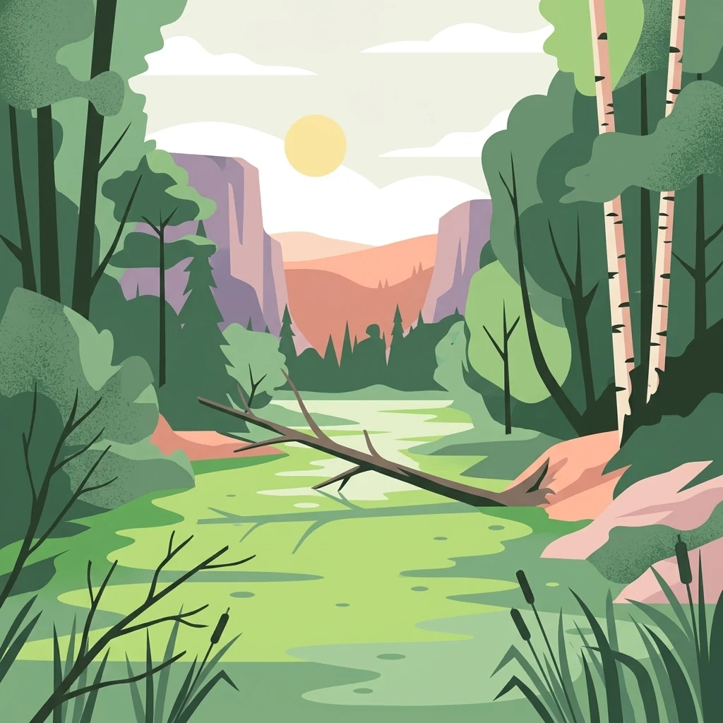
A flat-style digital illustration of a marshy waterway surrounded by birch trees and forest, featuring a fallen log in the water under a soft sunset sky with distant hills.

Skabyer Torfgraben

Nature reserve

Park overview

Structured park overview, official facts, and landscape profile for Skabyer Torfgraben

Skabyer Torfgraben park facts, protected area profile, and essential visitor context

Review the core facts for Skabyer Torfgraben, including designation, size, terrain, visitor scale, habitats, and operating context in one park-focused overview.

About Skabyer Torfgraben

Skabyer Torfgraben is a nature reserve located in the Dahme-Spreewald district of Brandenburg, within the municipalities of Heidesee and Königs Wusterhausen. It lies southeast of Berlin in a transitional zone between the glacial lake plateaus of the Dahme-Heideseen region and the broader lowland forests and wetlands of eastern Brandenburg. The reserve, of roughly 300 hectares, follows a corridor along the small Skabyer Torfgraben stream from around Friedrichshof in the north to where it flows into the Dahme river in the south.

The area lies alongside the Naturpark Dahme-Heideseen, which extends the network of protected lowland landscapes that characterize this part of Brandenburg. Within the reserve, the landscape shifts between open wet meadows, sedge-dominated marshy depressions, alder swamp fragments, and drier birch-oak woodland on sandy rises. Streams and small water channels meander through the terrain, and the elevation varies modestly between about 34 meters near the Dahme and roughly 53 meters at the eastern Limberg hill.

The protected area was designated on 21 July 1998 under the Brandenburg Nature Conservation Ordinance and is administered by the Brandenburg State Office for the Environment. It carries national designation number 1192 and has been integrated into the European Natura 2000 network as a Fauna-Flora-Habitat site under code DE 3748-305. The reserve is crossed by the Grunow–Königs Wusterhausen railway and the Dahme cycle route, while the Bundesautobahn 12 passes to the north, placing the site within a landscape where ecological protection sits in close proximity to infrastructure and recreational pathways.

Quick facts and research context for Skabyer Torfgraben

Established on 21 July 1998 under Brandenburg conservation law, Skabyer Torfgraben covers roughly 300 hectares and extends approximately 4.5 kilometers in length. The reserve sits within the Landkreis Dahme-Spreewald and adjoins the Naturpark Dahme-Heideseen to the south, placing it within the wider network of protected lowland landscapes southeast of Berlin.

In addition to its national nature reserve status, the site is registered as a European Fauna-Flora-Habitat (FFH) area within the Natura 2000 network, identified under the code DE 3748-305. It is administered by the Brandenburg State Office for the Environment. The reserve's elevation ranges from about 34 meters to roughly 53 meters above sea level, a modest rise that includes the Limberg hill at its eastern edge.

Protection and recognition

Documented terrestrial protection scope and Natura 2000 designation records

Skabyer Torfgraben Protection Status and International Recognition Data

Terrestrial protection status for Skabyer Torfgraben includes documented Natura 2000 network designations and verified administrative records. Official designation frameworks outline the conservation scope, management boundaries, and international recognition sources associated with the protected area.

International recognition

Protection details

Protection scope
Terrestrial
Transboundary protection
No
WDPA ID
319115
Park context

Deeper park guide and search-rich context for Skabyer Torfgraben

Skabyer Torfgraben history, landscape, wildlife, and travel context

Explore Skabyer Torfgraben through its history, landscape character, ecosystems, wildlife, conservation priorities, cultural context, and seasonal travel timing in a structured park guide built for atlas discovery and search intent.

Why Skabyer Torfgraben stands out

Skabyer Torfgraben is best known for its largely intact lowland flowing-water system, where a network of small streams winds through wet meadows, sedge communities, and remaining patches of through-flow peatland. The reserve preserves ecological features that have largely disappeared elsewhere in the region, including percolation mires with characteristic sundews and cotton grasses, sedge- and rush-dominated wet grasslands, and moist tall-herb vegetation along the watercourses. The site is also valued for its combination of distinctive vegetation types, such as old acidophilous birch-oak woodlands on sandy soils and alder swamp forests, with open wetland habitats that support threatened bird species. This tightly interwoven mosaic of mire, meadow, woodland, and flowing water is the defining character of the reserve and the basis for its national and European protection.
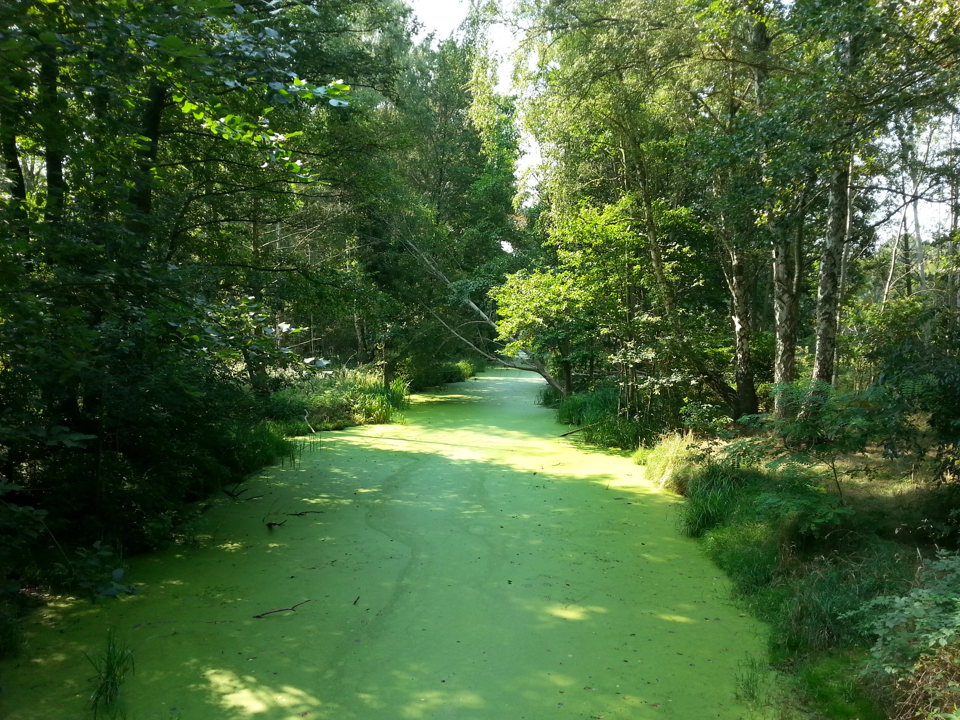
A narrow, tranquil canal covered in bright green duckweed or algae, flowing through a lush, dense forest.
The Skabyer Torfgraben waterway, flanked by dense forest foliage.

Skabyer Torfgraben history and protected-area timeline

The Skabyer Torfgraben nature reserve was formally established on 21 July 1998 through a state ordinance under Brandenburg conservation law, receiving the official designation number 1192. The site has been administered since its creation by the Brandenburg State Office for the Environment, particularly its division for ecology, nature protection, and water management.

The reserve's name reflects a longer local history of peat extraction in the Skaby area to the south of the Swatzke and Skaby hills, located in the neighboring Oder-Spree district. The drainage features associated with that historical peat-cutting legacy contributed to the place name that the modern reserve carries today. The site had long functioned as a working lowland landscape shaped by drainage, peat use, and traditional grassland management before its formal recognition as a protected area.

Following its national designation, the reserve was incorporated into the European Natura 2000 habitat network as a Fauna-Flora-Habitat site. A formal management plan was developed to guide habitat conservation across the core reserve and an adjoining extension area, framing the site as a recognized component of the coherent European ecological network of protected areas.

Skabyer Torfgraben landscape and geographic character

Skabyer Torfgraben occupies part of a gently undulating glacial lowland landscape typical of southern Brandenburg, where modest relief combines with extensive wetlands to create a network-like terrain. The reserve stretches roughly 4.5 kilometers along the small Skabyer Torfgraben stream, which flows from north to south before releasing its water into the Dahme river. This long, narrow arrangement shapes much of the visual character of the reserve.

The elevation spans from around 34 meters at the southern end near the Dahme to approximately 53.2 meters at the Limberg hill on the eastern edge. Much of the ground lies near the lower end of this range, giving the area its flat, marshy character. Sandy rises support drier woodland, while lower-lying corridors follow the course of the stream and its branches, lined by wet grasslands and tall-herb vegetation. The interplay between these slightly elevated sandy areas and the flatter wet zones creates the mosaic that defines the reserve's scenery.

Skabyer Torfgraben ecosystems, habitats, and plant life

Ecologically, Skabyer Torfgraben is defined by a lowland floodplain system in which flowing water, peatland remnants, wet meadows, and swamp woodland all interact. The protected area preserves a moderately nutrient-rich through-flow peatland, a habitat type of significant conservation interest, together with transitional and quaking bog communities and fragments of acidophilous birch-oak woodland on sandy soils. Alder swamp forests add a wooded wetland element along parts of the stream system.

The vegetation includes large and small sedge-dominated communities, moist tall-herb fringes along the streams, and drier grassland patches such as the small calcareous or dry grassland areas mentioned in the reserve's ordinance. Notable plant communities recognized for conservation include sedge and rush marshlands, tall herb floodplain fringes, and a mix of mire and wet woodland associations. The flowing watercourses themselves support submerged aquatic vegetation, an important structural element of the aquatic ecosystem.

In broader ecological terms, the reserve contributes to a regional biotope network, providing continuity between different habitat types across the southern Brandenburg lake and river landscape. Its combination of stream, mire, wet meadow, and woodland within a relatively compact area gives it a particular ecological coherence that distinguishes it from many of the surrounding protected sites.

Skabyer Torfgraben wildlife and species highlights

The reserve provides breeding and feeding habitat for a notable range of bird species associated with marshland and wet grassland environments. Among the species highlighted in conservation assessments are the great reed warbler, lapwing, common kingfisher, common crane, great grey shrike, and marsh harrier. These reflect the importance of reed beds, open wet meadows, and watercourses for birdlife in the Dahme-Spreewald region.

Mammal presence is anchored by the Eurasian otter, a species reliant on clean flowing waters and listed under Annex II of the EU Habitats Directive. The reserve's landscape also supports small mammals such as the European hare, which uses the mosaic of grassland and woodland transitions. Reptiles such as the grass snake and sand lizard are recorded in the drier and warmer microhabitats, while amphibians thrive in the wetter zones.

Among fish, the European weatherfish is noted as a species of conservation interest, reflecting the role of the reserve's flowing waters in supporting uncommon freshwater fauna. Insects include the large copper butterfly, an Annex II species tied to wetland habitats. Together, these species paint a picture of a lowland reserve whose value lies as much in its invertebrate and fish fauna as in its more visible birds and mammals.

Skabyer Torfgraben conservation status and protection priorities

Skabyer Torfgraben holds dual conservation status, recognized nationally as a nature reserve under Brandenburg law and at European level as a Fauna-Flora-Habitat area within the Natura 2000 network. Its designation reflects the site's importance for preserving a combination of threatened habitats, including through-flow peatland remnants, sedge and rush communities, wet woodland, and dry grassland fragments, as well as for protecting species listed under the EU Habitats Directive, such as the Eurasian otter, the European weatherfish, and the large copper butterfly.

The legal protection order for the reserve defines a series of explicit conservation goals. These include safeguarding rare plant communities, particularly large and small sedge wetlands, alder swamp forests, alternating-moisture meadows, and dry grasslands, as well as preserving the remaining portions of a moderately nutrient-rich through-flow peatland. The reserve also protects the populations of threatened animal species, serving as a breeding and feeding area for wetland birds and a refuge for threatened insects, amphibians, reptiles, and semi-aquatic mammals.

In addition to habitat and species protection, the reserve plays a role in maintaining the self-purification capacity of its largely intact flowing-water system with its submersed flora and fauna. It also contributes to regional biotope connectivity, linking different habitat types across the broader Dahme-Spreewald landscape and supporting the coherence of the European ecological network.

Top sights and standout views in Skabyer Torfgraben

Among the most distinctive features of Skabyer Torfgraben are its network of small flowing streams, which retain largely natural water quality and support a noteworthy underwater flora and fauna. The site is unusual in preserving fragments of moderately nutrient-rich through-flow peatland, a habitat type that has become rare in the surrounding agricultural lowlands.

The compact mosaic of mire, wet meadow, swamp woodland, and dry sandy woodland within a single elongated corridor creates a structural diversity that supports an unusually broad range of species. The reserve's inclusion in both the Brandenburg nature conservation system and the European Natura 2000 network underscores its ecological significance beyond the regional scale.

Best time to visit Skabyer Torfgraben

Spring and early summer bring active birdlife and fresh growth in the wet meadows, sedge communities, and tall-herb fringes along the streams, making this a rewarding period for visitors interested in wetland bird species and flowering wetland vegetation. Late spring is particularly favorable for observing breeding marshland birds among the reeds and meadows.

For those interested in bog and peatland botany, late spring to early summer is also when characteristic species such as cotton grasses and sundews are most visible. In late summer and autumn, the open landscapes of the Dahme-Heideseen region take on a quieter, more atmospheric mood, and the changing colors of wet meadows and derelict peatland edges can provide a different perspective on the reserve's textures and forms.


Monthly climate preview

Long-term temperature ranges and precipitation patterns across representative coordinates

Skabyer Torfgraben Climate Normals and Monthly Weather Records

Historical climate normals trace the measured annual temperature and precipitation rhythm across representative coordinates in Skabyer Torfgraben. Reviewing the complete twelve-month meteorological profile provides detailed long-term averages for detailed environmental analysis.
Annual mean9 °C
-1 °C20 °C
Jan-1°
Feb
Mar
Apr
May14°
Jun18°
Jul20°
Aug20°
Sep15°
Oct
Nov
Dec
Warmest month
July

20.3 °C

Coolest month
January

-0.9 °C

Wettest month
July

2.4 mm/day

Driest month
April

1.1 mm/day

Park location guide

Geography guide, regional context, and park location map for Skabyer Torfgraben

Skabyer Torfgraben park geography, regions, and map view in Germany

Understand where Skabyer Torfgraben sits in Germany through a broader geographic reading of the surrounding landscape, nearby location context, and its mapped position within the national park landscape.

How Skabyer Torfgraben fits into Germany

Germany is a federal republic in Western and Central Europe with a population of over 83 million across sixteen constituent states. It is Europe's largest economy by nominal GDP and a major global exporter and importer. The capital is Berlin, and the country borders Denmark, Poland, Czech Republic, Austria, Switzerland, France, Luxembourg, Belgium, and the Netherlands.

Wider geography shaping Skabyer Torfgraben in Germany

Germany is located in Western and Central Europe, spanning 357,022 km². It borders Denmark to the north, Poland and the Czech Republic to the east, Austria and Switzerland to the south, and France, Luxembourg, Belgium, and the Netherlands to the west. The country has coastlines on the Baltic Sea and North Sea to the north, with the Alps located in the southern region.

Map view of Skabyer Torfgraben

Use this park location map to pinpoint Skabyer Torfgraben in Germany, understand its exact geographic position, and read its mapped placement within the surrounding landscape more clearly.

Pigeon | © OpenStreetMap contributors

Location context for Skabyer Torfgraben

Brandenburg

Visual exploration of lowland habitats, flowing streams, and peatland terrain

Skabyer Torfgraben Photos and Landscape Scenery: Protected Wetland Views

Examine detailed photographs capturing the unique wetland landscapes, winding watercourses, and diverse natural habitats of Skabyer Torfgraben. Visual records reveal the intricate terrain of wet meadows and swamp woodlands that define this protected Brandenburg nature reserve.

A narrow, tranquil canal covered in bright green duckweed or algae, flowing through a lush, dense forest.

Park atlas

Discover related lowland reserves and connected wetland ecosystems across the surrounding regional landscape.

Parks Near Skabyer Torfgraben: Compare Other Protected Areas in Brandenburg

Browsing other parks near Skabyer Torfgraben reveals a broader network of protected lowland terrain and river valleys throughout Brandenburg. Comparing these neighboring nature reserves provides essential geographic context for regional wetland conservation and habitat distribution.
Nature reserveBrandenburg
3.1 km away#1 closest

South

Dolgensee Nature Reserve: Mapped Protected Landscapes and Wetland Geography in Brandenburg, Germany

Protected lake basin, reedbeds, and inland dune grassland

Located in the Brandenburg state of Germany, Dolgensee Nature Reserve offers a rare mosaic of wetland and dry grassland habitats. The site centers on a nutrient-rich lake basin featuring extensive reedbeds and alder swamp, which transitions into open inland dune ecosystems. This protected area represents a significant example of natural lake basin preservation within the larger Dahme-Heideseen landscape, providing a crucial habitat for various waterbird and aquatic wildlife species.

Area
3.085 km²
Established
1995
IUCN
IV
Relief
Lowland
Nature reserveBrandenburg
3.2 km away#2 closest

Northeast

Swatzke- und Skabyberge Nature Reserve and Protected Inland Dune Geography in Brandenburg

Mapping the sand heaths and forest ecosystems of northeastern Germany

Swatzke- und Skabyberge is a designated nature reserve in Brandenburg that preserves a rare inland dune complex. Originally shaped by long term military usage, this protected land now functions as a vital habitat for dry acid grasslands, lichen-rich pine forests, and wetland woodland fringes. It provides a unique study in how sand, fire, and moisture processes maintain biodiversity within the lowland German landscape.

Area
5.2 km²
Established
1999
IUCN
IV
Nature reserveBrandenburg
3.9 km away#3 closest

West

Tiergarten Nature Reserve: Geography and Protected Habitat Mapping in Brandenburg, Germany

Ancient oak woodland, riparian wetlands, and historic forest trails.

Spanning 158 hectares, the Tiergarten nature reserve serves as an ecologically rich sanctuary of oak-hornbeam forests and wet meadows. This area, formerly a royal hunting ground, offers a dense mosaic of riparian zones along the Staabe river, protecting essential habitats within the broader Brandenburg landscape.

Area
1.58 km²
Established
1995
IUCN
IV
A wide watercolor illustration showing a calm lake with small tree-covered islands, bordered by green forests and distant hills under a pale sky.
Protected areaBrandenburg
7.2 km away#4 closest

North

Wernsdorfer See Protected Area: Geographic Mapping and Landscape Context in Brandenburg

Glacial wetland mosaic featuring dunes and reedbeds

Wernsdorfer See is an essential nature reserve in Brandenburg that showcases a rare mix of habitats, from open sandy dunes and grasslands to shallow marshland and reedbeds. Managed as part of the Natura 2000 network, the site serves as a vital refuge for bird species and rare wetland flora. This overview traces the geography and terrain of the Spree valley lowland, offering a structured perspective on its conservation landscape.

Area
1.387 km²
Established
1967
Relief
Lowland
Climate
Temperate
Nature reserveBrandenburg
9.1 km away#5 closest

South

Katzenberge Nature Reserve: An Atlas of Glacial Moraine Woodlands in Brandenburg Germany

Protected oak forest habitats within the Dahme-Spreewald landscape

Katzenberge offers a focused look at the conservation of mature deciduous forest environments on sandy moraine soils. As a designated nature reserve within the Brandenburg region, the area serves as a primary reference point for studying habitat continuity and the unique glacial terrain that defines the south-eastern lowlands near the Dahme river.

Area
1.44 km²
Established
2004
IUCN
IV
Relief
Upland
Nature reserveBrandenburg
11 km away#6 closest

Southeast

Groß Schauener Seenkette Nature Reserve: Mapped Wetlands and Brandenburg Lake Geography

An undisturbed chain of shallow lakes and protected fen landscapes

This protected nature reserve in Brandenburg preserves a vital chain of six interconnected lakes. The geography is defined by extensive reedbeds, sedge stands, and rare inland saline meadows, providing a crucial habitat mosaic. Learn how these wetlands connect to the surrounding Dahme-Heideseen region through a network of terrain-focused conservation areas and historic trails.

Area
21.249 km²
Established
2000
Relief
Lowland
Climate
Temperate
A horizontal watercolor painting of a calm river or wetland area with trees, shoreline grasses, and rolling hills in the background, executed in a soft, muted style.
Nature reserveBerlin
About 11 km away#7 closest

North

EU-Vogelschutzgebiet Müggelspree: Protected Nature Reserve and Spree Valley Geography

Bird sanctuary and wetland landscape in southeastern Berlin

As a protected bird sanctuary within the European Natura 2000 network, the EU-Vogelschutzgebiet Müggelspree features an intricate mix of river corridors, fens, and pine forests. This reserve maintains significant ecological connectivity through the Spree lowlands, providing stable breeding and passage environments for numerous avian species. Its unique landscape architecture offers a clear view into the intersection of glacial sand formations and active floodplain ecosystems on the outskirts of Berlin.

Area
8.002 km²
Established
1997
Nature reserveBrandenburg
About 12 km away#8 closest

South

Streganzsee-Dahme Nature Reserve: Mapping Brandenburg Protected River Landscapes and Dunes

An ecological mosaic in the Dahme-Spreewald river corridor

Streganzsee-Dahme represents an intact Brandenburg riverine corridor characterized by sharply varied topography. The reserve encompasses water bodies, floodplain forests, fens, and dry sandland heaths. Its protected boundaries connect various biotopes, offering an essential look at the region's diverse lowland ecology and the structured geography of the local conservation network.

Area
4.36 km²
Established
1999
IUCN
IV
Relief
Lowland

Common questions about visiting, size, designation, and location context for Skabyer Torfgraben

Skabyer Torfgraben FAQs for park facts, access, geography, and protected area context

Find quick answers about Skabyer Torfgraben, including protected-area facts, park geography, trail and visitor context, and how the park fits into its surrounding country and regional landscape.
MoriAtlas Explorer

Continue Your Protected Areas Search Across the Global Atlas

Deepen your exploration by continuing the structured search for national parks and protected areas worldwide. Utilize the comprehensive filtering capabilities to compare different conservation landscapes and refine your understanding of global park geography. Discover more about the distribution and characteristics of protected natural areas.

Global natural geography